
 GPS & GNSS
 Lidar scanning
 Total Station
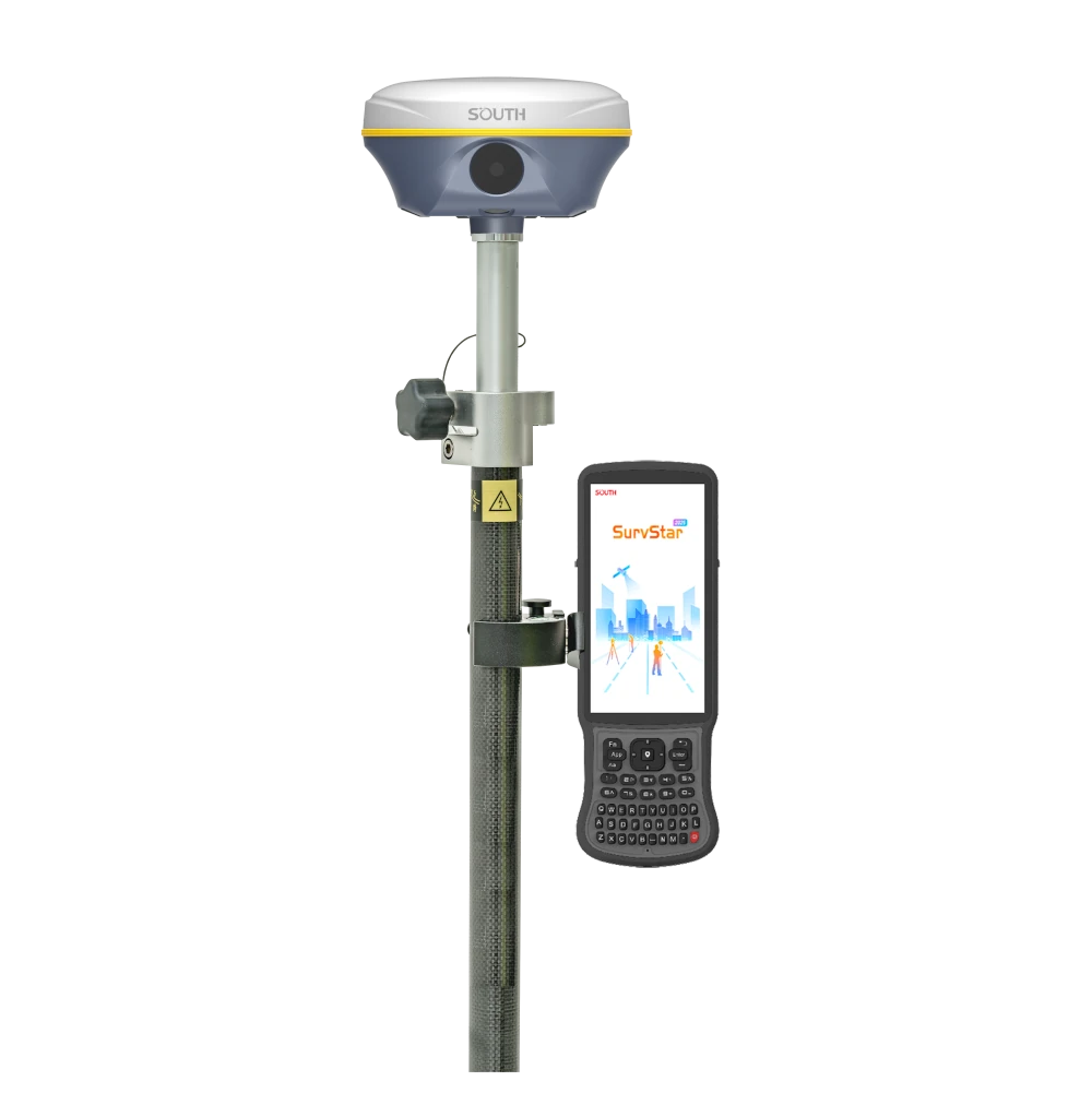


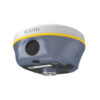
SOUTH Insight V3 Visual IMU RTK GNSS Rover Set
This product is available
Get the best price for your setup
Contact our experts for the best possible price and configuration.
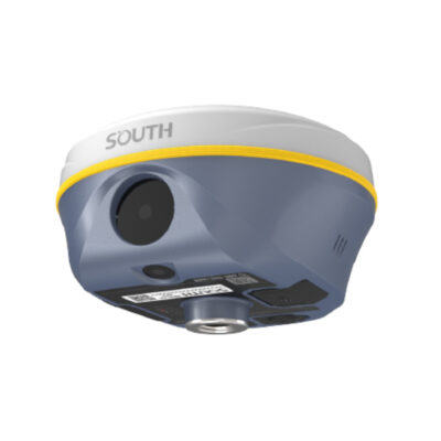
The SOUTH Insight V3 Rover Set is a professional RTK GNSS surveying solution with dual-camera AR stakeout, visual positioning and calibration-free IMU tilt compensation up to 60°. Its 1698-channel S805 GNSS engine tracks multiple satellite constellations and frequencies, helping construction teams, land surveyors, GIS professionals and engineering crews obtain reliable centimetre-level positioning across varied job sites.
The camera-guided stakeout workflow shows the direction to points, lines and curves on the controller screen, making site layout easier to follow and reducing time spent interpreting conventional directional indicators. Measurements can also be collected with the pole tilted, which is useful beside walls, beneath vegetation, near building corners and in other places where holding the pole perfectly vertical is difficult.
The rover supports network RTK through 4G and NTRIP as well as UHF corrections through its integrated Farlink 2.0 radio. Supplied as a field-ready set with a SOUTH H9 data collector, SurvStar field software, telescopic pole and controller bracket, it provides a practical setup for topographic surveying, construction stakeout, utility mapping, GIS data collection and general site measurement.
SOUTH Insight V3 Highlights
| GNSS technology | 1698-channel multi-constellation and multi-frequency receiver |
|---|---|
| Visual stakeout | Dual-camera AR guidance for points, lines and curves |
| IMU tilt surveying | Calibration-free compensation up to 60° |
| RTK accuracy | 8 mm + 0.5 ppm horizontal and 15 mm + 0.5 ppm vertical with NTRIP |
| Correction links | 4G NTRIP and integrated 410–470 MHz Farlink 2.0 UHF radio |
| Radio range | Up to 10–12 km under ideal operating conditions |
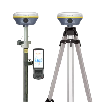
| Set configuration | Receiver, SOUTH H9 controller, SurvStar software, pole and controller bracket |
Valued customers:










Find RTK Networks
Search NTRIP providers and connect to reliable RTK correction services.
Description
Visual RTK GNSS Surveying for Faster Fieldwork
The SOUTH Insight V3 Rover Set combines centimetre-level RTK positioning with camera-assisted stakeout and modern IMU tilt measurement. It is designed for professionals who need to measure existing features, set out design points and collect dependable coordinates without slowing down for complicated receiver handling.
This makes the system suitable for land and topographic surveying, construction layout, road and infrastructure projects, utility mapping, earthworks, GIS asset collection and other jobs that require accurate GNSS positioning. The complete rover configuration includes the receiver, a SOUTH H9 data collector, SurvStar field software, a telescopic survey pole and a controller bracket.
Dual-Camera AR Stakeout
Traditional GNSS stakeout requires the operator to follow distance values, arrows or a compass-style display while moving towards the target. The Insight V3 adds front and downward-facing cameras that place visual guidance over the live view in SurvStar. The operator can see which direction to walk and where the target lies in relation to the pole.
This visual workflow is especially useful when setting out foundations, grid points, kerbs, utilities, boundaries, road alignments and other construction features. It can make stakeout easier for experienced surveyors while also helping site personnel understand the route to a point more quickly. Points, lines and curves can all be handled through the camera-guided workflow.
Measure with the Pole Tilted
The integrated fifth-generation IMU compensates for pole tilt up to 60° without requiring routine field calibration. Instead of carefully levelling the pole for every observation, the operator can place the pole tip on the required point and take the measurement while the receiver remains tilted.
In practical fieldwork, this helps when measuring beside walls, underneath tree branches, near parked machinery, at building corners or along trenches where a vertical pole position is inconvenient. It also supports a smoother working pace during regular point collection and visual stakeout.
Multi-Constellation GNSS Tracking
The SOUTH S805 GNSS engine provides 1698 channels for tracking signals from GPS, GLONASS, Galileo, BeiDou and other supported regional systems. Access to multiple constellations and frequencies gives the receiver more satellite observations to work with and can improve positioning availability where part of the sky is obstructed.
No GNSS rover can remove the effects of heavy obstruction or multipath completely, but the Insight V3 is built to maintain a productive workflow in the mixed conditions commonly found around buildings, roadside vegetation and partially covered sites. Actual accuracy and fixing performance remain dependent on satellite geometry, corrections, atmospheric conditions and the surrounding environment.
Dual-Engine Positioning
The receiver incorporates two GNSS positioning algorithms. When unusual ionospheric activity affects a VRS network solution, the operator can select the enhanced positioning mode in SurvStar so the alternative engine can help address positioning errors in real time. This gives survey crews an additional tool when normal network RTK conditions become less stable.
Network RTK and UHF Corrections
For network RTK work, the built-in 4G modem supports NTRIP corrections from compatible CORS and VRS services. This allows the Insight V3 to operate as a single rover without a local base station wherever suitable mobile coverage and correction access are available.
The integrated 410–470 MHz UHF radio also supports rover operation with a compatible GNSS base. SOUTH Farlink 2.0 is designed for stable correction transmission and can reach approximately 10–12 km in ideal open conditions. Real working range varies with radio settings, antennas, terrain, interference and physical obstructions. A lock-base function helps the rover remain connected to the intended base when several transmitters use the same frequency.
Field Data and Visual Workflows
In addition to normal RTK point collection and stakeout, the receiver supports visual positioning and image-based field workflows. These functions can assist with measuring locations that are difficult to occupy directly and with collecting visual information for supported 3D processing tasks. They are useful for surveyors and engineers who want more context than a coordinate alone can provide.
The receiver supports common survey data formats and correction standards, including RINEX, RTCM, NMEA and NTRIP-compatible network models. Internal storage and USB data transfer support straightforward movement of field files between the receiver and office systems.
Built for Daily Site Use
The Insight V3 uses a rugged housing suited to outdoor surveying and construction environments. Its internal battery is intended for extended rover operation, while the web interface allows authorised users to check receiver status, configure communication settings, manage recorded data and perform firmware-related tasks through Wi-Fi or USB.
Voice guidance and status indicators provide immediate feedback during setup and measurement. The electronic bubble can also be displayed in the controller software when a conventional level pole is preferred.
Who Is the SOUTH Insight V3 For?
This rover set is a strong match for surveyors who regularly perform topographic work and construction stakeout, contractors who need to position design points on site, engineering teams recording infrastructure, and GIS crews mapping utilities or physical assets. It can also support drone and photogrammetry teams that require accurate ground control or check points.
The visual guidance and tilt measurement functions are particularly valuable where speed and straightforward operation matter. Experienced operators gain a quicker route through repetitive field tasks, while less specialised site workers receive clearer guidance when navigating towards a stakeout point.
A Complete Rover Set from Global GPS Systems
Global GPS Systems supplies the SOUTH Insight V3 as a complete rover set rather than a receiver alone. The included H9 controller and SurvStar software provide the interface for project setup, coordinate systems, point collection, stakeout and data export, while the pole and controller bracket complete the field configuration.
Our product specialists can help confirm the correct correction service, radio configuration, coordinate workflow and accessories for your region and application. This is important when choosing an RTK GNSS system because network compatibility, local frequencies and field software requirements can vary between countries and projects.
Datasheets & Manuals
Datasheets and manuals
Datasheet
User Manual
Specifications
South Insight V3 Rover Set Specifications
Product Overview
| Product type | Multi-constellation RTK GNSS rover set with visual positioning, dual-camera AR stakeout and IMU tilt compensation |
|---|---|
| Receiver model | SOUTH Insight V3 |
| GNSS board | S805 GNSS engine |
| Primary applications | Land surveying, construction layout, topographic surveying, control surveys, road surveying, CORS operation, utility surveying, stakeout, photogrammetry and 3D modelling |
| Operating modes | Rover, base and static |
| Key technologies | 1698-channel GNSS tracking, dual-engine positioning, Farlink 2.0 UHF radio, calibration-free IMU, visual positioning, dual-camera AR stakeout and video-based 3D modelling |
GNSS Tracking
| GNSS channels | 1698 |
|---|---|
| GPS signals | L1, L1C, L2C, L2P and L5 |
| GLONASS signals | G1, G2 and G3 |
| BeiDou BDS-2 signals | B1I, B2I and B3I |
| BeiDou BDS-3 signals | B1I, B3I, B1C, B2a and B2b* |
| Galileo signals | E1, E5a, E5b, E6C and AltBOC* |
| SBAS signals | L1* |
| NavIC/IRNSS signals | L5* |
| QZSS signals | L1, L2C and L5* |
| MSS | L-Band reserved* |
| PPP support | BeiDou B2b PPP and Galileo HAS support for supported regions and services |
Positioning Performance
| Positioning Mode | Horizontal Accuracy | Vertical Accuracy |
|---|---|---|
| Code differential positioning | 0.25 m + 1 ppm RMS | 0.50 m + 1 ppm RMS |
| GNSS static | 2.5 mm + 0.5 ppm RMS | 5 mm + 0.5 ppm RMS |
| Long-observation static | 2.5 mm + 0.1 ppm RMS | 3 mm + 0.4 ppm RMS |
| Rapid static | 2.5 mm + 0.5 ppm RMS | 5 mm + 0.5 ppm RMS |
| PPK | 3 mm + 1 ppm RMS | 5 mm + 1 ppm RMS |
| RTK using UHF | 8 mm + 1 ppm RMS | 15 mm + 1 ppm RMS |
| RTK using NTRIP | 8 mm + 0.5 ppm RMS | 15 mm + 0.5 ppm RMS |
| SBAS positioning | Typically less than 5 m 3DRMS | |
| PPP/HAS positioning | Approximately 10–20 cm after convergence in an open environment | Approximately 20–40 cm after convergence in an open environment |
Initialization and Data Output
| Position output rate | 1 Hz to 20 Hz |
|---|---|
| General initialization time | Less than 10 seconds |
| RTK initialization time | Typically 2–8 seconds |
| Initialization reliability | Greater than 99.99% |
| Dual-engine positioning | Two positioning algorithms with an enhanced positioning mode for correcting errors in challenging ionospheric or VRS conditions |
IMU Tilt Measurement
| IMU type | Built-in fourth-generation calibration-free IMU module |
|---|---|
| Maximum tilt angle | 60° |
| IMU initialization | Approximately 2–5 seconds of movement or walking |
| Magnetic interference resistance | Designed to operate without dependence on a magnetic compass |
| Stationary tilt retention | Can retain the tilt solution for approximately 40 seconds while stationary, subject to operating conditions |
| Electronic bubble | Real-time pole levelling status displayed in the controller software |
Cameras and Visual Positioning
| Camera configuration | Dual-camera system with front-facing visual-positioning camera and downward-facing AR stakeout camera |
|---|---|
| Visual-positioning camera | 8 megapixels |
| AR stakeout camera | 2 megapixels |
| AR stakeout support | Visual guidance for point, line and curve stakeout using front and bottom cameras |
| Visual positioning | Captures and processes photographs or video to calculate coordinates for remotely observed points |
| Typical remote measurement range | Up to approximately 10 m or more under ideal conditions |
| Visual measurement applications | Measurements beneath roofs, around obstacles, across hazardous areas and at locations that cannot be safely or directly occupied with the survey pole |
| 3D modelling | Supports image- and video-based point collection for generating coordinates, areas, volumes and three-dimensional models |
| UAV data integration | Ground imagery can supplement UAV survey data and fill gaps in aerial photogrammetry models |
UHF Radio
| Internal UHF radio | Integrated transmitter and receiver |
|---|---|
| Frequency range | 410–470 MHz |
| Radio technology | Farlink 2.0 |
| Supported radio protocols | Farlink, TrimTalk, SOUTH, HUACE, Hi-Target and Satel |
| Typical communication range | Approximately 8 km using Farlink protocol |
| Maximum stated radio range | Approximately 10–12 km under ideal conditions |
| Lock-base function | Allows the rover to remain connected to a selected base when multiple bases transmit on the same frequency |
| External UHF antenna connection | Dedicated UHF antenna interface |
Cellular and Wireless Communications
| Cellular modem | Integrated 4G mobile network support |
|---|---|
| SIM card | Micro-SIM slot |
| Wi-Fi | IEEE 802.11 b/g/n |
| Wi-Fi operating functions | Internet datalink, receiver hotspot and access to the internal Web UI |
| Bluetooth | Bluetooth 3.0/4.1 and Bluetooth 2.1 + EDR |
| NFC | Supported for simplified pairing with compatible controllers |
| Network RTK | Supports NTRIP and VRS, FKP and MAC network models |
| Available datalink modes | Internal UHF, cellular network, external radio, Bluetooth/controller network, Wi-Fi or no datalink |
Ports and Interfaces
| USB interface | USB Type-C for charging, static-data transfer, USB OTG and Ethernet/Web UI access |
|---|---|
| LEMO interface | 5-pin LEMO port for external power and RS-232 communication |
| UHF antenna port | Dedicated external radio antenna connection |
| SIM interface | Micro-SIM card slot |
| USB Ethernet | Supported for internal Web UI access through a connected computer |
Data Storage and Transfer
| Internal storage | 16 GB SSD |
|---|---|
| Automatic storage management | Automatic cyclic storage |
| External storage | USB storage supported through OTG |
| Maximum recording rate | Configurable up to 20 Hz |
| USB data transfer | Plug-and-play USB data transmission |
| Network data download | FTP and HTTP |
Supported Data Formats
| Static observation formats | STH, RINEX 2.01, RINEX 3.02 and related supported formats |
|---|---|
| Differential correction formats | RTCM 2.1, RTCM 2.3, RTCM 3.0, RTCM 3.1 and RTCM 3.2 |
| GNSS output formats | NMEA 0183, PJK plane coordinates, binary output and Trimble GSOF |
| Network correction protocol | NTRIP |
| Network models | VRS, FKP and MAC |
| Developer data access | OpenSIC observation-data format and interaction-interface definitions available through the secondary development package |
User Interface and Operation
| Operating system | Embedded Linux |
|---|---|
| Display | 1.14-inch colour display |
| Display resolution | 135 × 240 pixels |
| Physical controls | Dual-button operation |
| Status indicators | Satellite, data and power indicators |
| Battery indication | Four-stage indication, with each illuminated segment representing approximately 25% charge |
| Web UI access | Available through Wi-Fi or USB connection for receiver monitoring and configuration |
| Voice guidance languages | Chinese, English, Korean, Spanish, Portuguese, Russian, Turkish, French and Italian |
| Cloud services | Supports remote management, firmware updates, online registration and related online services |
Sensors
| IMU sensor | Built-in calibration-free inertial measurement unit |
|---|---|
| Electronic bubble | Software-displayed electronic level for monitoring pole orientation |
| Temperature sensor | Built-in thermometer with intelligent temperature monitoring and control |
| Imaging sensors | 8 MP front visual-positioning camera and 2 MP downward AR stakeout camera |
Power
| Internal battery | Built-in 6800 mAh rechargeable lithium-ion battery |
|---|---|
| Typical rover operating time | Up to approximately 18 hours |
| External power input | 6–28 V DC |
| Power protection | Overvoltage protection |
| Charging interface | USB Type-C |
Physical Specifications
| Dimensions | 134 mm diameter × 79.1 mm height |
|---|---|
| Weight | Approximately 860 g including battery |
| Housing material | Magnesium-aluminium alloy shell |
| Mounting configuration | Survey-pole-mounted GNSS receiver |
Environmental Specifications
| Ingress protection | IP68 |
|---|---|
| Water protection | Protected against prolonged immersion at a depth of up to 1 m under specified test conditions |
| Dust protection | Fully protected against blowing dust |
| Operating temperature | -45°C to +75°C |
| Storage temperature | -55°C to +85°C |
| Humidity | 100% non-condensing |
| Drop resistance | Designed to withstand a natural 2 m pole drop onto concrete |
Survey and Processing Functions
| Control surveying | Supports high-precision static observation, deformation monitoring and photo-control point measurement |
|---|---|
| Road surveying | Supports control-point densification, topographic mapping, cross-sections and profile measurements |
| Stakeout | Point, line, curve, plane and CAD-assisted stakeout through compatible field software |
| CORS compatibility | Compatible with network RTK services using supported NTRIP correction streams |
| Photogrammetry | Processes photographs or video to obtain coordinates for multiple points |
| 3D outputs | Supports the creation and export of coordinate, area, volume and model data through compatible processing workflows |
| Image processing options | Compatible desktop-software and cloud-server processing workflows |
| Field software | SOUTH SurvStar Android surveying software |
| Office software compatibility | Compatible with SOUTH processing software and supported third-party modelling applications |
Rover Set Package Contents
| Item | Quantity | Notes |
|---|---|---|
| SOUTH Insight V3 GNSS receiver | 1 | 1698-channel visual-positioning RTK receiver with internal UHF, 4G, IMU and dual cameras |
| SOUTH H9 data collector | 1 | Rugged field controller for operating the receiver and survey software |
| SurvStar software | 1 licence | Android field-surveying software; licence terms and activated modules may depend on configuration |
| Telescopic survey pole | 1 | For rover mounting and field measurements |
| Controller bracket | 1 | For mounting the data collector to the survey pole |
| Receiver transport case | 1 | Protective carrying and storage case |
| Charger and power adapter | 1 set | For charging and powering the supplied equipment |
| USB Type-C cable | 1 | For charging, data transfer and receiver connection |
| UHF antenna | 1 | For internal-radio rover or base communication |
Configuration Notes
| Optional signal support | Signals marked with an asterisk may depend on firmware, licensing, regional availability or satellite-service status |
|---|---|
| Accuracy conditions | Published accuracy figures assume suitable satellite geometry, multipath conditions, correction quality, baseline length and atmospheric conditions |
| Radio range conditions | Actual UHF range depends on antenna height, terrain, interference, radio settings, environmental conditions and line of sight |
| Battery-life conditions | Operating time varies with radio transmission, cellular and Wi-Fi use, temperature, display use, battery condition and receiver configuration |
| Visual-positioning conditions | Measurement range and accuracy depend on lighting, image quality, target visibility, camera calibration, GNSS status and processing workflow |
Specifications and package contents may vary by configuration, region or manufacturer update. Always check the current configuration before ordering.
FAQ
South Insight V3 Rover Set FAQ
Product Overview and Applications
What is the South Insight V3 Rover Set?
The South Insight V3 Rover Set is a professional multi-constellation RTK GNSS surveying system. It combines the Insight V3 receiver with a South H9 data collector, SurvStar field software, a telescopic survey pole and a controller bracket for centimetre-level positioning, data collection and stakeout work.
Who is the South Insight V3 designed for?
The system is designed for land surveyors, construction professionals, civil engineers, utility contractors, GIS teams, mapping specialists and other users who require accurate field coordinates. It can support cadastral surveying, topographic mapping, construction layout, road surveys, utility measurement and infrastructure projects.
What surveying tasks can be completed with the Insight V3?
The receiver can be used for point collection, topographic surveys, control surveys, point, line and curve stakeout, cross-section and profile measurements, static observations, RTK measurements, PPK workflows, visual positioning and photogrammetric data collection.
Can the South Insight V3 be used for construction stakeout?
Yes. The Insight V3 is suitable for setting out construction points, lines, curves and other design geometry. Its dual-camera AR stakeout system displays visual guidance in the controller software, helping the operator move toward the target efficiently.
Is the Insight V3 suitable for road and infrastructure surveys?
Yes. Typical applications include road topographic mapping, control-point densification, profiles, cross-sections, excavation measurement, utility mapping and construction layout. The integrated radio and network RTK options also make it suitable for projects covering large working areas.
Can one person operate the South Insight V3 Rover Set?
Yes. The rover, H9 controller and SurvStar software are designed for single-operator fieldwork. IMU tilt compensation, camera-assisted stakeout, visual guidance and onboard data communications reduce the need for a second person during many measurement and layout tasks.
GNSS Accuracy and RTK Corrections
What accuracy can the South Insight V3 achieve?
According to the manufacturer specifications, RTK horizontal accuracy is 8 mm plus 1 ppm when using UHF corrections and 8 mm plus 0.5 ppm when using NTRIP. Specified RTK vertical accuracy is 15 mm plus 1 ppm with UHF and 15 mm plus 0.5 ppm with NTRIP. Actual results depend on satellite visibility, correction quality, baseline length, multipath, atmosphere and field procedures.
Does the Insight V3 require an RTK correction service?
Centimetre-level real-time measurements require corrections from a compatible GNSS base station or an NTRIP or CORS correction network. The rover can receive network corrections through its 4G connection or radio corrections through its integrated UHF modem.
Can the Insight V3 connect to an NTRIP or CORS network?
Yes. The receiver supports the NTRIP protocol and network models including VRS, FKP and MAC. A compatible correction-service account, mobile-data connection, mountpoint and the correct coordinate-system settings are required.
Can the Insight V3 work with a local GNSS base station?
Yes. Its integrated 410–470 MHz UHF radio can receive corrections from a compatible base station. Supported radio protocols include Farlink, TrimTalk, SOUTH, HUACE, Hi-Target and Satel, although the base and rover must use matching frequencies, protocols and correction settings.
What is the UHF radio range of the South Insight V3?
The specified range is typically around 8 km, while Farlink 2.0 can reach approximately 10–12 km under ideal conditions. Terrain, buildings, vegetation, antenna height, interference, radio power and local frequency regulations can significantly affect the practical range.
How quickly does the Insight V3 obtain an RTK fixed solution?
The specified RTK initialization time is approximately 2–8 seconds under suitable conditions, with general initialization stated as under 10 seconds. Obstructions, weak satellite geometry, radio or mobile-data interruptions and difficult atmospheric conditions may increase the time required.
Vision, IMU and Field Functions
What is dual-camera AR stakeout?
Dual-camera AR stakeout uses the receiver’s front and downward-facing cameras to display directional guidance over a live field view. In SurvStar, the operator can use this guidance to navigate toward points, lines and curves from a distance and then position the pole accurately at the target.
What is visual positioning on the South Insight V3?
Visual positioning combines RTK coordinates, camera imagery, photogrammetry and IMU data to calculate coordinates for features visible in photographs or video. It can help measure corners, façades, points beneath roof edges, locations behind obstacles and other targets that are difficult or unsafe to reach directly with the pole.
How far away can the Insight V3 measure a point with visual positioning?
The manufacturer states that visual positioning can measure points from approximately 10 metres or more in ideal conditions. Achievable distance and accuracy depend on image quality, lighting, target visibility, camera geometry, GNSS status and the data-processing workflow.
What does the 60-degree IMU tilt compensation do?
The integrated IMU compensates for a pole tilted by up to 60 degrees, allowing the operator to measure without keeping the pole perfectly vertical. This can improve speed when working beside walls, around obstacles, on slopes or at points where conventional pole levelling is inconvenient.
Does the Insight V3 IMU require manual calibration?
The IMU is described as calibration-free during normal operation. It typically initializes after a few seconds of movement or walking. Good satellite tracking and an RTK fixed solution are still important for reliable tilt-compensated measurements.
Can the South Insight V3 collect data for 3D models?
Yes. The receiver can collect photographs or video for photogrammetric processing and generate coordinates for multiple visible points. Ground imagery can also help supplement incomplete UAV models, document excavation or accident scenes and support calculations such as distances, areas and volumes when used with suitable processing software.
Hardware, Software and Data
Which satellite constellations and frequencies does the Insight V3 track?
The 1,698-channel receiver tracks multiple frequencies from GPS, GLONASS, Galileo and BeiDou. It also supports selected QZSS, SBAS, IRNSS and other signals where available, improving satellite availability and positioning performance in demanding environments.
What is included in the South Insight V3 Rover Set?
The set includes the South Insight V3 GNSS receiver, a South H9 data collector, SurvStar field software, a telescopic survey pole and a controller bracket. The exact case contents, chargers, cables, antennas and selected accessories should be confirmed in the final set configuration.
What software is used with the Insight V3 Rover Set?
The set is supplied for use with South SurvStar field software on the H9 Android controller. SurvStar supports receiver configuration, coordinate systems, point collection, coding, stakeout, road workflows, data import and export, and other surveying functions.
Which data formats does the Insight V3 support?
The receiver supports static data formats including STH and RINEX 2.01 and 3.02, RTCM correction formats from RTCM 2.1 through RTCM 3.2, and output formats including NMEA 0183, plane-coordinate data, binary data and Trimble GSOF. Available project import and export formats also depend on the SurvStar workflow.
How is survey data stored and transferred?
The receiver has 16 GB of internal storage, automatic cycling storage and support for external USB storage through OTG. Data can be transferred by USB and may also be downloaded through supported FTP or HTTP functions. Receiver status and settings can be accessed through the internal web interface over Wi-Fi or USB.
How long does the South Insight V3 battery last?
The built-in 6,800 mAh rechargeable lithium-ion battery is specified for up to approximately 18 hours in rover mode. Operating time varies with radio transmission, mobile-data use, temperature, display use, camera functions and battery condition.
Is the South Insight V3 suitable for harsh field conditions?
Yes. The receiver has an IP68 dust and water-resistance rating, a magnesium-aluminium alloy housing and a specified operating-temperature range of -45°C to +75°C. It is also designed to withstand a natural two-metre pole drop onto concrete, although protective handling is always recommended.
Reviews (1)
1 review for SOUTH Insight V3 Visual IMU RTK GNSS Rover Set
| 5 star | 0% | |
| 4 star | 100% | |
| 3 star | 0% | |
| 2 star | 0% | |
| 1 star | 0% |
Only logged in customers who have purchased this product may leave a review.
 GPS & GNSS
 Total Stations
 Data collectors
 Software
 Correction services
 Machine control
 External radio
 Lasers & levellers
 Marine
 Accessories
Klemen Simončič (verified owner) –
Most of functionalities work as expected. Precision in demanding environment is a litle bit below expectations.