


Aplitop TcpImage
This product is Available
Contact our experts for the best possible price and configuration.
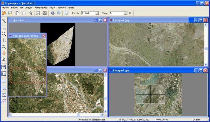
This application allows you to perform all types of operations on digital images, georeferenced or not, in a wide variety of formats. It is specially designed for the needs of Topography, Civil Engineering, Architecture, Archeology, etc. In which it seems frequent to work with aerial photographs, ortho photographs and scanned maps in combination with vector drawings. Its powerful user interface allows to open several documents on which can be applied from various visualisation controls, being the handling easy and intuitive. Detailed information about the images can be obtained as well as printing them with various controls.
You may also like…
Data collection
3D scanning and lidar software
CAD software


Accessories
Software
Valued customers:


Find RTK Networks
Search NTRIP providers and connect to reliable RTK correction services.
Description
Management and Transformation of Images
This application allows you to perform all kinds of operations on digital images, georeferenced or not, in a wide variety of formats. It is designed especially for the needs of Surveying, Civil Engineering, Architecture or Archaeology projects, in which it is common to work with aerial photographs, orthoimages and scanned maps in combination with vector drawings.
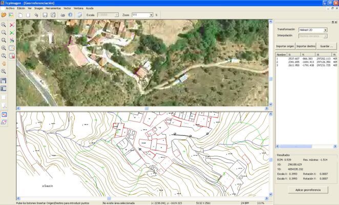
With TcpImage it is very easy to georeference and distort images using control points, from their coordinates or using cartography as a reference.
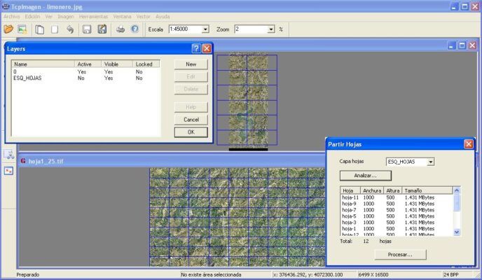
Its powerful user interface allows you to open multiple documents and apply adjustment and conversion processes, as well as joining and splitting images, etc.
Adjusting images or regions
There are controls for adjusting brightness, contrast, intensity, saturation, gamma adjustment and colour balance. These can be applied to whole images or regions. All adjustments are applied in an interactive way with pre-visualisation, where the parameters are displayed graphically or numerically. We can also change the image mode: greyscale or colour depth: 8, 24, 16 or 32 bits, using a fixed, an optimised or a user-specified palette. The histogram of the image can also be displayed.
Image processing
Operations include applying a 90º, 180º, 270º turn, or any angle. The images can also be rotated over the horizontal or vertical alignment.We can change the size of the image by specifying the width and height, resolution or percentages relative to the original, and specify the method of interpolation (normal, sampling or bicubic). Georeferencing An image can be georeferenced from coordinate points or using a vectorial drawing as reference. The transformation is calculated with 2D Helmert or affine methods. The mean square error and the maximum error obtained are also displayed. Georeferencing can be suppressed or recalculated by the user at any time.
Georeferencing
An image can be georeferenced using coordinate points or using a vectorial drawing as a reference. The transformation is calculated using the 2D Helmert or Affine method. The mean square error and the maximum error achieved are also displayed. Georeferencing can be suppressed or recalculated by the user at any time.
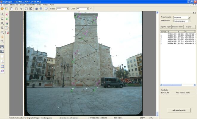
Distortions
This tool distorts an image in two ways: projective transformation or Rubber-Sheeting. The Projective Transformation adjusts four points independently of the number of points used for the calculation. The Rubber-Sheeting technique is a bilinear transformation of each of the cells of the generated grid of pairs of origin and destination points, with this technique all points involved in the calculation will be adjusted.The diagram below shows an example of image transformation with the Rubber-Sheeting technique The resulting images are created with one interpolation method: next neighbors, bilinear, bicubic or Lagrange. As a result, the mean squared error is shown, as well as the maximum residual, etc.
Datasheets & Manuals
Datasheets and manuals
Datasheet
Additional information
| Brand | Aplitop |
|---|
Reviews (0)
Only logged in customers who have purchased this product may leave a review.

Reviews
There are no reviews yet