a-GEO SurPro

(5 customer reviews)

💬
Need a tailored quote?
Get personal pricing and advice from one of our product specialists.
🎁 Limited-time offer
Free RTK license included
Included with every LiDAR or GNSS purchase.
Why choose Global GPS Systems?
European support & worldwide delivery
Worldwide shipping from the Netherlands
100% insured shipping against loss or damage
Import, export, tax and duties support
Expert support from product specialists
Buyer protection and warranty included
Speak with a specialist +31 035 205 7939
Global GPS Systems
Independently verified
4.73 store rating (567 reviews) | 4.68 product rating
Visa
MasterCard
American Express
IDeal
Invoice
Bancontact
Bank Transfer
Belfius
Eps
PayPal

Find RTK Networks

Search NTRIP providers and connect to reliable RTK correction services.

Search providers

a-GEO SurPro is a leading surveying software designed for professionals seeking effortless data collection and high-performance field calculations. This user-friendly a-GEO SurPro Software offers advanced road design, construction stake functions, and CAD drawing tools, making it ideal for both surveying and construction projects. This top-tier data collecting software and field software for construction enhances accuracy and efficiency on-site.

Datasheets and manuals

Valued customers: 

a-GEO SurPro

(5 customer reviews)

💬
Need a tailored quote?
Get personal pricing and advice from one of our product specialists.
🎁
Limited-time offer Free 1-year RTK license included with every LiDAR or GNSS purchase.

a-GEO SurPro is a leading surveying software designed for professionals seeking effortless data collection and high-performance field calculations. This user-friendly a-GEO SurPro Software offers advanced road design, construction stake functions, and CAD drawing tools, making it ideal for both surveying and construction projects. This top-tier data collecting software and field software for construction enhances accuracy and efficiency on-site.

Datasheets and manuals

Valued customers: 

Find RTK Networks

Search NTRIP providers and connect to reliable RTK correction services.

Search providers

💬
Need a tailored quote?
Get personal pricing and advice from one of our product specialists.
🎁 Limited-time offer
Free RTK license included
Included with every LiDAR or GNSS purchase.
Why choose Global GPS Systems?
European support & worldwide delivery
Worldwide shipping from the Netherlands
100% insured shipping against loss or damage
Import, export, tax and duties support
Expert support from product specialists
Buyer protection and warranty included
Speak with a specialist +31 035 205 7939
Global GPS Systems
Independently verified
4.73 store rating (567 reviews) | 4.68 product rating
Visa
MasterCard
American Express
IDeal
Invoice
Bancontact
Bank Transfer
Belfius
Eps
Klarna
Description

a-GEO SurPro Product Review

Experience Precision and Efficiency with a-GEO SurPro

a-GEO SurPro is a cutting-edge solution designed to provide surveying professionals with unmatched ease in data collection and high-performance field calculations. This advanced a-GEO SurPro Software streamlines surveying tasks with a user-friendly interface that allows users to construct drawings while taking measurements. This ensures immediate visual confirmation, guaranteeing accurate data collection and survey calculations.

a-GEO SurPro surveying software

Key Features of a-GEO SurPro Software

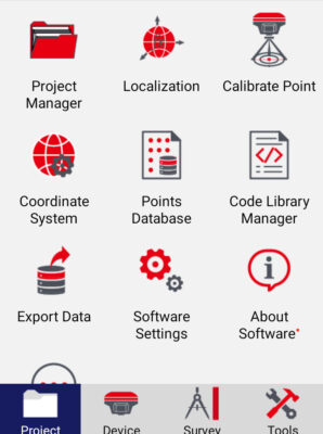
User-Friendly Interface

The intuitive design of this data collecting software makes it easy for users to navigate and operate, significantly reducing the learning curve. Surveying professionals can seamlessly collect data and perform real-time field calculations without interruption.

Powerful Road Design and Construction Stake Functions

Designed for efficiency, the construction field software includes robust road design tools and construction stake functions, enabling precise layout and project execution. Whether managing complex road projects or standard construction tasks, the software delivers superior performance.

Data collecting software

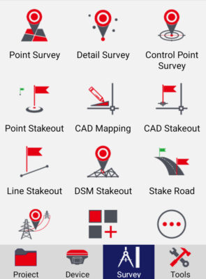
Advanced CAD Drawing Stake Function

The integrated CAD drawing stake functionality ensures precision in mapping and planning. This feature enhances the capabilities of this land surveying field software, allowing users to create, adjust, and finalize designs on-site.

Customizable Functional Menu Display

With a convenient and functional menu display, users can easily customize the design and workflow. This adaptability makes field software for construction ideal for various project needs and preferences.

Reviews (5)

5 reviews for a-GEO SurPro

5.0
Based on 5 reviews
5 star
100
100%
4 star
0%
3 star
0%
2 star
0%
1 star
0%
  1. Tomasz (verified owner)

    Verified reviewVerified review - view originalExternal link

    Very happy with this software

    (0) (1)
  2. Dillon (verified owner)

    Verified reviewVerified review - view originalExternal link

    Good software

    (0) (0)
  3. Marco Fischer (verified owner)

    Verified reviewVerified review - view originalExternal link

    easy to use

    (0) (0)
  4. Adeline Hogan (verified owner)

    Verified reviewVerified review - view originalExternal link

    Great software solution

    (0) (0)
  5. Atreus T. (verified owner)

    Verified reviewVerified review - view originalExternal link

    Stil lot to learn but so far good softwere

    (0) (0)

Only logged in customers who have purchased this product may leave a review.

Find RTK Networks

Search NTRIP providers and connect to reliable RTK correction services.

Search providers

RTK GNSS With 60° tilt:

GPS & GNSS

South INNO7

GPS & GNSS

Carlson BRX7

GPS & GNSS

EFIX F7

GPS & GNSS

South Galaxy G7

RTK GNSS With internet:

GPS & GNSS

South INNO7

GPS & GNSS

Carlson BRX7

Independently verified
567 reviews