GNSS
Understanding RTK VRS Networks
Real-time kinematic (RTK) virtual reference station (VRS) networks are becoming increasingly popular in the world of surveying and mapping. These networks are designed to provide highly accurate and precise real-time positioning data for a wide range of applications, including agriculture, construction, and land surveying. In this article, we will take a closer look at what RTK VRS networks are, how they work, and why they are so important.
What is an RTK VRS Network?
An RTK VRS network is a system of reference stations that are used to provide real-time corrections to GPS data. These reference stations are typically placed in strategic locations, such as on top of tall buildings or on mountaintops, to ensure maximum coverage and accuracy. The reference stations are connected to a central processing unit, which is responsible for collecting and analyzing the data from the reference stations and providing real-time corrections to GPS data.
How Does an RTK VRS Network Work?
An RTK VRS network works by using a combination of GPS and other technologies to provide highly accurate and precise real-time positioning data. The process begins with the use of GPS receivers that are placed at the reference stations. These receivers collect GPS data, including satellite signals and other information, which is then transmitted to the central processing unit.
The central processing unit then uses this data to calculate real-time corrections to the GPS data. These corrections are based on the difference between the GPS data collected by the reference station and the true position of the reference station. The corrected data is then transmitted back to the GPS receivers at the reference stations, which then use this data to provide highly accurate and precise real-time positioning data to users.
Why are RTK VRS Networks Important?
RTK VRS networks are incredibly important for a wide range of applications, including agriculture, construction, and land surveying. The high accuracy and precision of the data provided by these networks allows users to make more informed decisions and to work more efficiently. For example, in agriculture, RTK VRS networks can be used to provide highly accurate and precise data on crop yields and soil conditions, which can help farmers make more informed decisions about planting and fertilizing.
In construction, RTK VRS networks can be used to provide highly accurate and precise data on the location and elevation of construction sites, which can help builders and engineers to work more efficiently and to avoid costly mistakes. And in land surveying, RTK VRS networks can be used to provide highly accurate and precise data on property boundaries and topography, which can help surveyors to work more efficiently and to avoid costly errors.
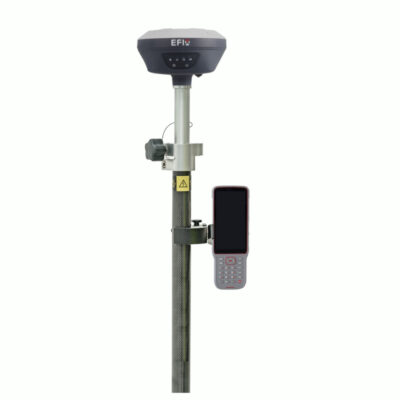
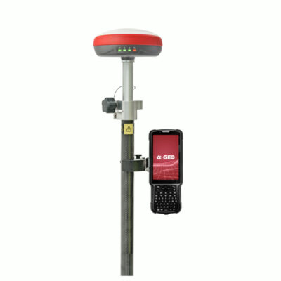
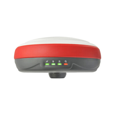
some popular rtk gps receivers


GPS & GNSS
What are Important aspects of RTK VRS?
Another important aspect of RTK VRS networks is their ability to provide real-time data even in areas with poor satellite visibility. This is made possible by the use of base stations, which are positioned in areas with good satellite visibility and are used to provide real-time corrections to GPS data for nearby users. This allows for accurate positioning even in areas with poor satellite coverage, such as in urban areas or under heavy tree cover.
RTK VRS networks can also be used in conjunction with other technologies, such as lidar, to provide even more accurate and precise data. Lidar, or light detection and ranging, is a technology that uses lasers to measure the distance between a sensor and an object. When combined with RTK VRS data, lidar can provide highly detailed and accurate 3D models of the earth’s surface. This can be used for a wide range of applications, such as mapping and surveying, environmental monitoring, and emergency response.
What are other advantages of RTK VRS networks?
Another advantage of RTK VRS networks is their ease of use. These networks can be accessed by any user with a GPS receiver that is compatible with the network. This means that users do not need to have specialized equipment or knowledge to take advantage of the benefits of RTK VRS networks. This makes it easy for anyone to access accurate and precise real-time positioning data, regardless of their level of expertise.
One of the most significant benefits of RTK VRS networks is their ability to provide real-time data. This is important for applications where time is critical, such as emergency response, navigation, and construction. With real-time data, users can make decisions and take action immediately, which can save time and money. In emergency response, for example, having real-time data on the location of emergency vehicles or the extent of damage can help first responders to respond more quickly and effectively.
Another advantage of RTK VRS networks is their scalability. These networks can be used in small-scale applications, such as surveying a single parcel of land, or in large-scale applications, such as mapping an entire city or region. This scalability makes RTK VRS networks suitable for a wide range of applications, from small-scale surveys to large-scale mapping projects.
RTK VRS networks are also cost-effective. Unlike traditional surveying methods, which can be time-consuming and labor-intensive, RTK VRS networks can be used to survey and map large areas quickly and efficiently. This can save time and money for users, making RTK VRS networks an affordable solution for a wide range of applications.
In addition, RTK VRS networks can be used to provide data that is not possible to obtain with traditional surveying methods. For example, RTK VRS networks can be used to provide data on the motion of vehicles and the position of moving objects. This can be used for applications such as traffic management, transportation planning, and logistics.
In conclusion, RTK VRS networks are a powerful and versatile tool that can be used to provide highly accurate and precise real-time positioning data for a wide range of applications. These networks are easy to use, can be accessed by anyone with a compatible GPS receiver, and can be used in conjunction with other technologies, such as lidar, to provide even more accurate and detailed data. They are also scalable, cost-effective, and can provide real-time data that is not possible to obtain with traditional surveying methods. If you need accurate positioning data for your business or project, an RTK VRS network is a great solution to consider.