GNSS
How to Survey Your Own Property with GPS: A Step-by-Step Guide
If you own a piece of property, you may be interested in surveying it yourself using GPS technology. This can be a cost-effective and efficient way to get a detailed map of your property, which can be useful for a variety of purposes such as construction, farming, or land management. In this article, we will provide a step-by-step guide on how to survey your own property with GPS. We will cover the basic principles of GPS, the equipment you will need, and the steps to take to get accurate and reliable data.
What is GPS?
GPS, or Global Positioning System, is a satellite-based navigation system that provides location and time information anywhere on Earth. GPS devices receive signals from a network of satellites orbiting the Earth and use those signals to calculate the user’s precise location.
GPS technology has a variety of uses, from navigation to mapping and surveying. It has become increasingly popular for property owners to use GPS to survey their own land, as it provides accurate and detailed information about the terrain and boundaries of the property.

Equipment Needed for Your Own Property GPS Survey
To survey your own property with GPS, you will need some specialized equipment. Here are the basic items you will need:
-
GPS receiver: This is the device that receives signals from the GPS satellites and calculates your location. You can choose from handheld GPS receivers or larger, more advanced models.
-
Surveying software: This is the software that allows you to collect points with the GPS receiver on your property. There are many options available, some are more extensive than others.
-
Data collector: You’ll need a device to run the surveying software. these are most of the time special tablets or controllers made for surveying. They are more rugged than normal tablets and can be easily connected with the GPS receiver.
-
RTK correction network: GPS receivers on their own aren’t that accurate. With an RTK correction network you’ll be able to achieve an accuracy of 1-2 centimeters.
If you combine all these items together we call it a ‘rover set’. A rover set is simply a set of items needed for a surveying job.
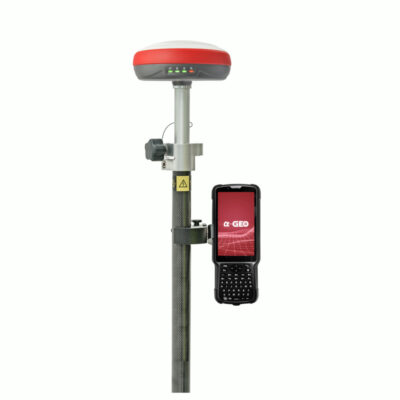
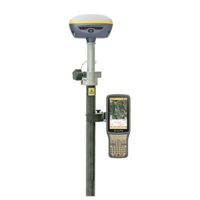
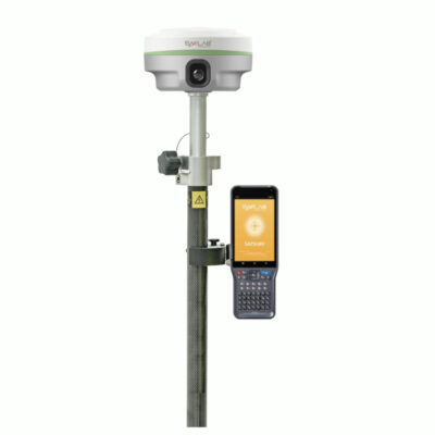
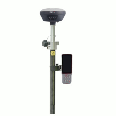
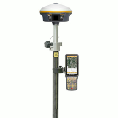
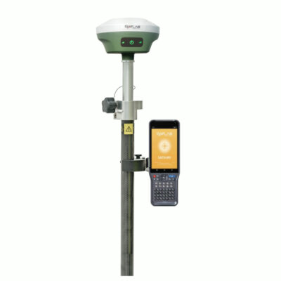
Some popular gps rover sets
Steps to Survey Your Property with GPS
Now that you have the equipment you need, it’s time to get started with the surveying process. Here are the steps to follow:
Step 1: Plan Your Survey
Before you start surveying, it’s important to have a clear plan in place. This includes determining the boundaries of your property, identifying any existing features on the land (such as trees, buildings, or water sources), and deciding on the level of detail you want to capture.
Step 2: Set Up Your GPS Receiver
Next, you’ll need to set up your GPS receiver. This involves turning it on, setting the date and time, and configuring any necessary settings such as the accuracy level and the type of data you want to capture.
Step 3: Collect Data
With your GPS receiver set up, you can now start collecting data. Walk around your property with the GPS receiver, making sure to cover all areas you want to include in your survey.
Step 4: Transfer Data to Mapping Software
Once you have collected all the necessary data, it’s time to transfer it to your mapping software. This software will use the GPS data to create a detailed map of your property, including boundaries, features, and any other information you have collected.
Step 5: Analyze and Interpret the Data
With your map created, it’s time to analyze and interpret the data. This may involve measuring distances, calculating areas, or identifying potential problem areas on your property.
Step 6: Use Your Survey Data
Finally, you can use the data collected during your survey for a variety of purposes. This may include planning construction projects, designing landscaping, or managing the land for farming or wildlife conservation.
Some popular data collectors
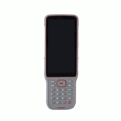
Data collectors
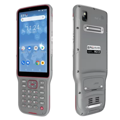
EFIX FC2 Data Collector for GNSS Surveying and Field Mapping


Conclusion
Surveying your own property with GPS can be a cost-effective and efficient way to get a detailed map of your property. By following the steps outlined in this guide, you can collect accurate and reliable data using GPS technology, and use that data for a variety of purposes.
It’s important to note that while surveying your own property with GPS can be a useful tool, it may not be appropriate for all situations. In some cases, you may need to hire a professional surveyor to ensure that your survey is accurate and legally binding.