

GNSS
GNSS Constellations: How They Work and How They Improve GPS
Global Navigation Satellite Systems (GNSS) are systems that use satellites in order to provide location and time information to users around the world. One of the most well-known GNSS systems is the Global Positioning System (GPS), which is operated by the United States government. However, there are other GNSS systems in operation, such as the Russian GLONASS system and the European Union’s Galileo system. Global Navigation Satellite Systems (GNSS) are becoming increasingly important for a variety of applications, from GPS navigation in smartphones to precision farming and self-driving cars. In this article, we will explore the history and development of GNSS, the technology behind it, and its various applications.
What are GNSS constellations?
A GNSS constellation refers to the group of satellites that make up a particular GNSS system. Each satellite in the constellation is in a specific orbit at a specific altitude, and they all work together to provide location and time information to users on the ground.
How Does GNSS Work?
GNSS systems rely on a network of satellites orbiting the Earth. Each satellite transmits a signal that can be picked up by a receiver on the ground. By measuring the time delay between the transmission and reception of the signal, the receiver can calculate its distance from the satellite. By measuring the distances from multiple satellites, the receiver can determine its precise location.
The signals transmitted by GNSS satellites are also used to provide precise timing information. By measuring the time delay between the transmission and reception of the signal, the receiver can determine the precise time. This is useful for a wide range of applications, including financial transactions, power grid management, and scientific research.
How do GNSS constellations work?
When a user on the ground wants to determine their location, they use a device called a receiver. The receiver communicates with the satellites in the GNSS constellation and uses the time delay of signals from multiple satellites to calculate the user’s position.
The receiver compares the time a signal was transmitted by a satellite to the time it was received by the receiver. Because the speed of light is constant, the time delay between transmission and reception can be used to calculate the distance between the satellite and the receiver. By measuring the distance to multiple satellites, the receiver can triangulate its position.
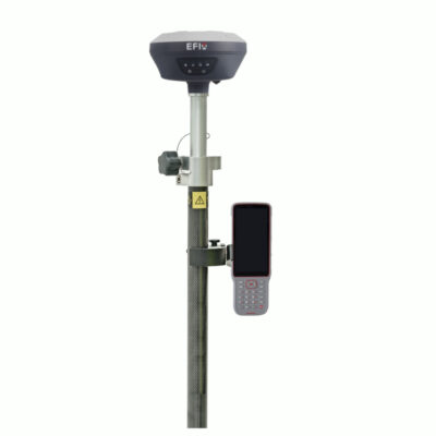
some popular gnss receivers


History of GNSS
The history of GNSS began in the 1960s, when the US Department of Defense developed the Global Positioning System (GPS) for military use. The system, which consisted of a network of satellites orbiting the Earth, was designed to provide precise location and timing information to military personnel and equipment. In the 1980s, the system was made available for civilian use, and it quickly became one of the most widely used GNSS systems in the world.
Other countries soon developed their own GNSS systems, including Russia’s GLONASS, Europe’s Galileo, and China’s BeiDou. These systems, along with GPS, are now considered to be the “big four” GNSS systems in operation.
How do GNSS constellations improve GPS?
One of the main advantages of GNSS constellations over GPS is that they increase the number of satellites available for positioning. This means that a user can receive signals from more satellites at any given time, which improves the accuracy and reliability of the positioning information.
Another advantage of GNSS constellations is that they are operated by different entities, which can provide redundancy in case one system goes down. For example, if the GPS system were to malfunction, users could still access location and time information from the GLONASS or Galileo systems.
Differences between GNSS and GPS
While GPS is a specific type of GNSS, there are some key differences between the two.
The main difference is that GPS is operated by the United States government and is primarily used for military and civilian purposes, while other GNSS systems, such as GLONASS and Galileo, are operated by other countries and organizations.
Another difference is that GPS only has 31 operational satellites while other GNSS systems like GLONASS, Galileo and BeiDou has more operational satellites which makes them more accurate and reliable.
In conclusion, GNSS constellations are groups of satellites that work together to provide location and time information to users around the world. They improve upon traditional GPS systems by increasing the number of satellites available for positioning and by providing redundancy in case one system goes down. As we can see, GNSS is a broader term that includes GPS and other satellite navigation systems around the world.
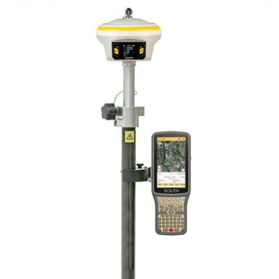
some popular gnss rover sets

GPS & GNSS
GPS Rover Sets
Advancements in GNSS technology
Recent advancements in GNSS technology have led to the development of new features and capabilities. One of the most significant advancements is the introduction of multi-frequency signals, which allow for more accurate and reliable positioning.
Multi-frequency signals refer to the use of multiple frequencies to transmit signals from the satellites. By using multiple frequencies, the receiver can better distinguish between signals that are reflected off of buildings and other obstacles, and signals that are coming directly from the satellites. This improves the accuracy and reliability of the positioning information.
Another advancement in GNSS technology is the use of precise point positioning (PPP) algorithms. PPP algorithms allow for highly precise positioning by taking into account various factors such as atmospheric conditions, satellite orbits, and clock errors.
Applications of GNSS
GNSS technology has a wide range of applications, including:
Navigation
Perhaps the most well-known application of GNSS is navigation. GPS is widely used in smartphones, cars, and other devices to provide turn-by-turn directions and location information. This makes it easy for people to find their way around and get to their destination quickly and easily.
Agriculture
GNSS technology is also used in precision agriculture. Farmers use GNSS-enabled tractors, combine harvesters, and other equipment to plant and harvest crops with precision. This not only increases crop yields but also reduces the amount of fuel and other inputs needed.
Surveying
Surveyors use GNSS technology to determine the precise location of points on the ground. This is used for a wide range of applications, including construction, land management, and mapping.
Transportation
GNSS technology is used to track the location of vehicles, including trucks, buses, and trains. This allows for efficient fleet management and can help reduce traffic congestion.
Timing
GNSS technology is used to provide precise timing information for a wide range of applications, including financial transactions, power grid management, and scientific research.
Search and Rescue
GNSS technology is used in search and rescue operations to locate people who are lost or in distress. This includes hikers, boaters, and other outdoor enthusiasts.
In conclusion, GNSS technology has revolutionized many aspects of our lives, from navigation to precision agriculture, and it has a wide range of applications that can improve efficiency and safety in various industries. As technology continues to advance, it is likely that we will see even more innovative uses for GNSS in the future.
Future of GNSS
The future of GNSS looks promising with the advancements and new developments in the field. Here are a few areas where we can expect to see advancements in the future:
- Increased number of satellites: With the launch of more satellites, the coverage and accuracy of GNSS will improve. This will lead to better reception in urban and remote areas and will reduce the dependence on terrestrial-based systems.
- Interoperability: As more countries and organizations launch their own GNSS systems, there will be a need for interoperability between these systems. This will allow for seamless navigation and positioning regardless of which system the user is accessing.
- Increased precision: With advancements in technology, the precision of GNSS will continue to improve. This will have significant implications for applications such as autonomous vehicles, drones, and precision agriculture.
- 5G integration: With the roll-out of 5G networks, GNSS will be able to integrate with these networks to provide enhanced services. This will allow for real-time location tracking, improved accuracy and reliability, and support for a larger number of connected devices.
- Quantum-based GNSS: With the advancement of quantum technology, it is expected that a quantum-based GNSS will be developed in the future. This would provide a higher level of security and accuracy, making it less vulnerable to jamming and spoofing.
In conclusion, GNSS technology has come a long way since its inception and is continuously evolving. The future of GNSS looks bright with many new developments and advancements in the pipeline. These advancements will not only improve the performance of GNSS but also open up new possibilities and applications.
Challenges facing GNSS
While GNSS technology has many benefits, there are also challenges that must be addressed. Here are a few of the main challenges facing GNSS:
- Interference: One of the main challenges facing GNSS is interference from other sources. This can include radio frequency interference (RFI) from other electronic devices, as well as jamming and spoofing. These types of interference can disrupt or falsify the signals from the satellites, leading to inaccurate or unreliable positioning information.
- Reliance on external infrastructure: GNSS relies on a network of satellites and ground-based infrastructure. This infrastructure can be vulnerable to natural disasters, cyber attacks, or other types of disruptions. If the infrastructure is damaged or compromised, it can affect the performance of the GNSS system.
- Limited coverage in certain areas: GNSS signals can be weakened or blocked by certain types of terrain or buildings. This can result in poor reception or no reception in certain areas. This can be a particular problem in urban areas or in areas with a high density of tall buildings.
- Lack of standardization: As more countries and organizations launch their own GNSS systems, there is a lack of standardization in terms of signal structure, frequencies, and data formats. This can make it difficult for receivers to process signals from multiple systems, and can also make it difficult for users to switch between different systems.
- Security and privacy concerns: As GNSS is used for a wide range of applications, there are concerns about the security and privacy of the data being transmitted and received. This includes concerns about unauthorized access to location data and the potential for malicious actors to disrupt or falsify the signals.
To address these challenges, research is being conducted on various fronts such as developing more robust and secure signals, developing new technologies to mitigate interference, and creating new infrastructure to improve coverage in certain areas. Additionally, international cooperation and standardization will be crucial in addressing these challenges and ensuring the continued growth and success of GNSS technology.
In conclusion, GNSS technology has the potential to revolutionize many industries and change the way we live our lives. However, with the increasing reliance on GNSS, it’s important to address the challenges that come with it, such as interference, infrastructure dependence, limited coverage, lack of standardization and security/privacy concerns. By addressing these challenges, we can ensure that GNSS technology continues to provide reliable and accurate location and time information in the future.
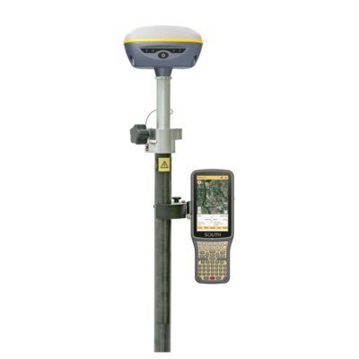
some more popular gnss rover sets
GPS & GNSS
Conclusion
In conclusion, Global Navigation Satellite Systems (GNSS) are systems that use satellites in order to provide location and time information to users around the world. GNSS constellations are the group of satellites that make up a particular GNSS system, and they work by transmitting signals to a receiver on the ground, which then uses the time delay of signals from multiple satellites to calculate the user’s position.
The most well-known GNSS system is the Global Positioning System (GPS), which is operated by the United States government. However, there are other GNSS systems in operation, such as the Russian GLONASS system and the European Union’s Galileo system. These systems have greatly improved our ability to determine location and time information with high accuracy.
Recent advancements in GNSS technology have led to the development of new features and capabilities, such as multi-frequency signals and precise point positioning algorithms, that have improved the performance and accuracy of GNSS. GNSS technology is used in a wide range of applications including navigation, surveying, agriculture, emergency services and timing.
The future of GNSS looks promising with the advancements and new developments in the field, including the launch of more satellites, interoperability between systems, increased precision and integration with 5G networks. However, there are also challenges that must be addressed such as interference, reliance on external infrastructure, limited coverage in certain areas, lack of standardization and security and privacy concerns.
Overall, GNSS technology has come a long way since its inception and is continuously evolving. With new developments and advancements in the pipeline, GNSS will continue to provide reliable and accurate location and time information, opening up new possibilities and applications.