
Construction, GNSS
Top 5 RTK GNSS Receivers for Construction and Infrastructure
Finding a good GPS antenna for your infrastructure and construction projects can be difficult and time consuming. With more and more brands entering the market won’t make it any easier.
Normally you would have gone to your local dealer and he would tell you he has the best receiver for you, but is this really true? Most local dealers only have 1 to 2 brands and probably just offer you what they want to sell you, not which receiver is best and most cost-effective for you.
Active users of RTK GPS equipment in the infrastructure and construction business need good performing, strong and reliable equipment. Your GNSS receiver needs to be able to measure points in sometimes harsh conditions where everything can happen and where the signal can be blocked by anything. So having a good, strong and reliable RTK GNSS receiver is a must.
The RTK GNSS receiver sets are pretty similar to the GPS sets used by land surveyors, both need strong GPS receivers.

Dense areas of (high) buildings can interfere alot with the satellite signals your RTK GNSS receiver tries to collect, so a GPS receiver with great performance is necessary in the infrastructure and construction business.
Performance and price are 2 of the key ingredients of finding a good GPS receiver. Of course there are more components that play a role which we take in consideration as well.
Here is our review process in detail:
- Performance
- Price
- Connectivity
- Compatibility
- Features
Top 5 Best RTK GNSS Receivers For Infrastructure and Construction in 2024
Below is a list of the top 5 best RTK GNSS receivers for the infrastructure and construction business that we think are cost effective and work well in the environments common in the infrastructure and construction industry.
Please note: As you probably know, a GPS surveying set is not complete without a good surveying software solution. Where the GNSS antenna determines the location its the software that allows you to determine what to do with this location. Wether this is uploading your DTM (digital terrain model) for staking out, or for point collection. In this review we focus on the GNSS antenna only because this is responsible for the performance. Please read the article below for a good software solution:
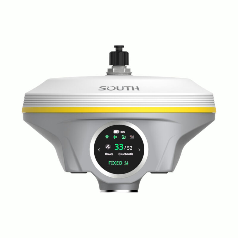
1. South Galaxy G3 – Best Overall
South Galaxy G3 Pros
✅ 1598/1760 Channels
✅ Fast FIX (CM accurate in 5 sec)
✅ 15 hours working time with 6800mAh battery
✅ Connect via IP, Bluetooth, Cable
✅ 60° IMU tilt sensor
✅ 8 km “Farlink” radio solution
✅ Robust aluminum housing

The South Galaxy G3 RTK GNSS receiver is the receiver we recommend for the infrastructure and construction business. It’s a very strong and reliable GPS receiver that gets the job done.
The South Galaxy G3 is very sharp priced for its performance capabalities. With its 1598 channels and 60° IMU tilt sensor you just know that whatever obstacles you encounter, with this RTK GNSS receiver they won’t be a problem. With the new function ‘RTK Keep’ the South Galaxy G3 GNSS antenna is able to keep centimeter-level accuracy for a few minutes when the RTK correction is missing.
The South Galaxy G3 GPS receiver doesn’t have an internet modem, but that won’t be necessary because your data collector probably does have one. So you’re able to connect with an RTK VRS correction network to get centimeter accurate.
With a weight of only 790 grams the South Galaxy G3 is a very light GNSS receiver. So you won’t have to carry a heavy device the whole time when you’re measuring on the construction site. The receiver is still packaged with a magnesium alloy shell which makes it a very strong device that can take a beating. It also has an IP68 rating which makes it fully protected against blowing dust.
The South Galaxy G3 RTK GNSS receiver uses the new Farlink protocol. The Farlink protocol let’s your South Galaxy G3 GPS receiver have a radio with a maximum range of 15 kilometers. Also the power consumption of your GNSS receiver is reduced by 60% with this protocol. This allows you to set up another GNSS receiver as a base station and be able to connect the two receivers with eachother for a distance of 15 kilometers.
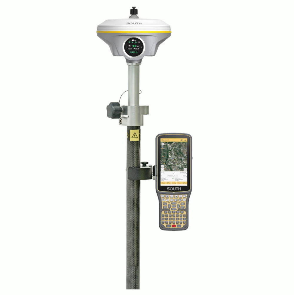
Here are some possible South Galaxy G3 setups
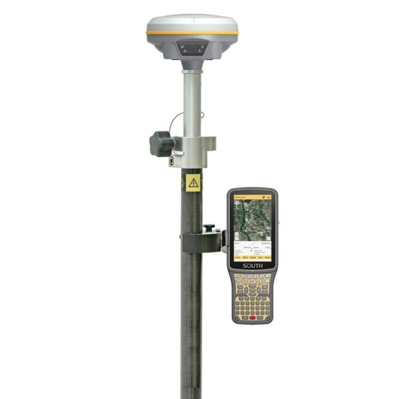
South Galaxy G3 Rover set
A standard RTK GPS set for mapping your terrain, staking out or collecting points.
Check options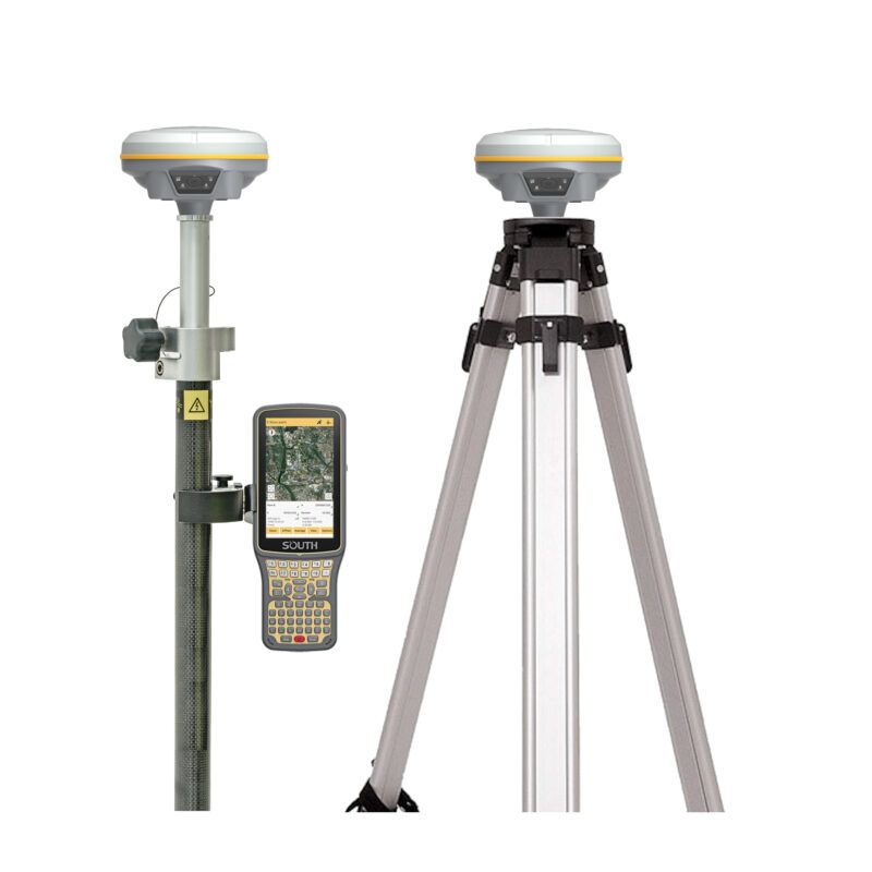
South Galaxy G3 Rover and Base set
When you live in a remote area a second GPS receiver is needed to act as a base station for correction data.
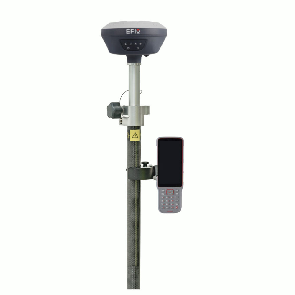
Check options2. EFIX F7 – Easy-To-Use Software
EFIX F7 Pros
✅ 1608 Channels
✅ Fast FIX (CM accurate in 5 sec)
✅ Connect via IP, Bluetooth, Cable
✅ IMU tilt sensor up to 60°
✅ Smart battery management
✅ 15 hours of continuous operation
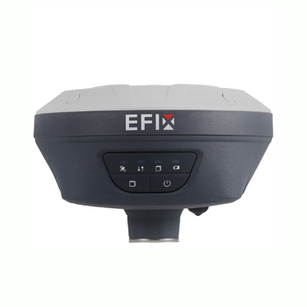
The EFIX F7 RTK GNSS receiver is a great receiver for construction and infrastructure and for a very sharp price. It has 1608 channels and an IMU tilt sensor that can tilt up to 60°. It doesn’t have an internet modem but most of the time your data collector has an internet modem in it so it isn’t per se necessary.
This RTK GPS receiver has an optimized power consumption which allows it to work for 12 hours in RTK mode and 15 hours in static mode. The EFIX F7 GNSS receiver supports charging from a mobile power bank allowing it to be recharged anytime and anywhere.
It has an IP67 rating which makes it waterproof and dustproof and protected from temporary immersion to a depth of 1 meter. The nagnesium alloy housing makes the EFIX F7 RTK GNSS receiver lighter and stronger, it weighs only 770 grams.
The LED lights on the front of the GPS receiver show you exactly the power and communication information you need.

Here are some possible EFIX F7 setups
EFIX F7 Rover set
A standard RTK GPS set for mapping your terrain, staking out or collecting points.
Check options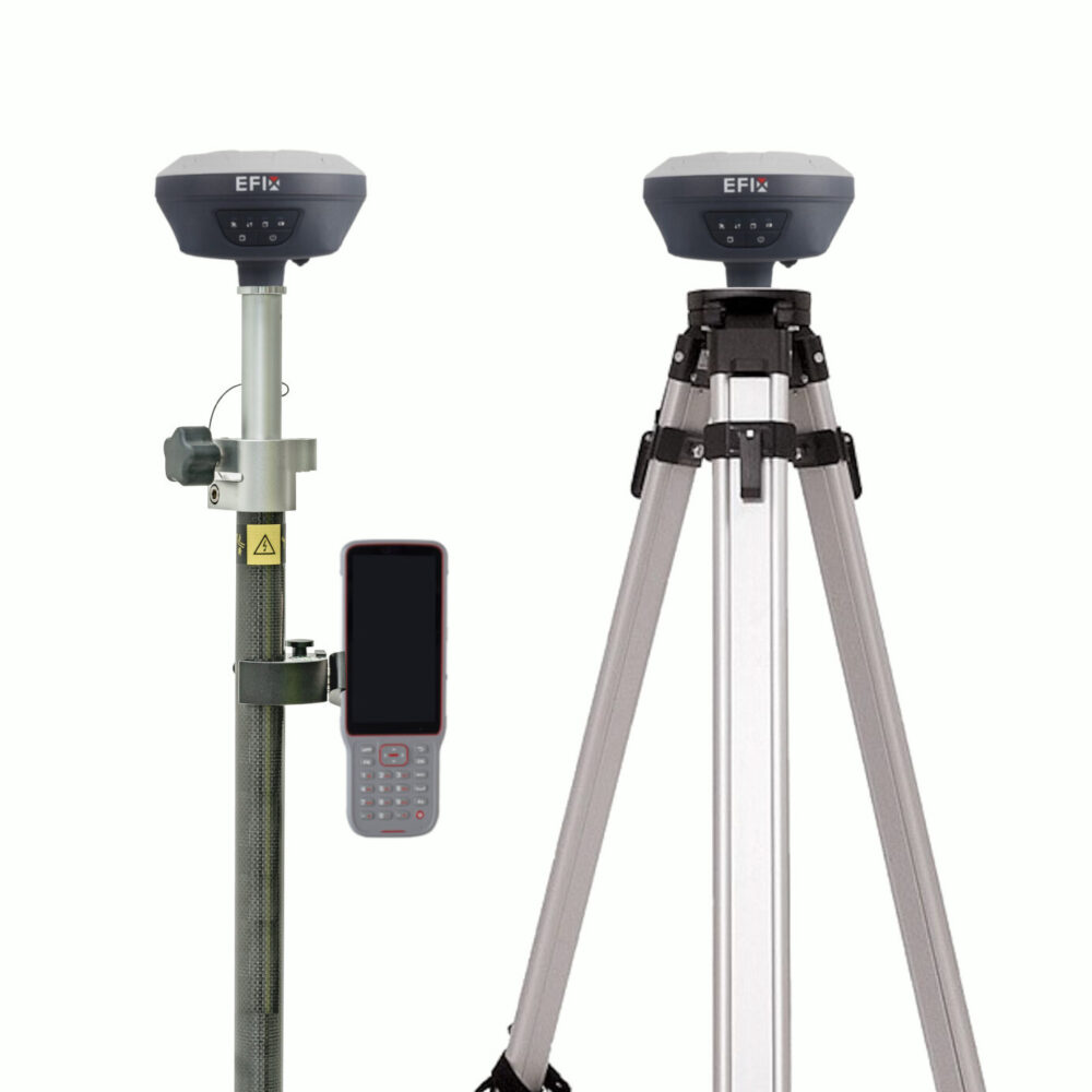
EFIX F7 Rover and Base set
When you live in a remote area a second GPS receiver is needed to act as a base station for correction data.
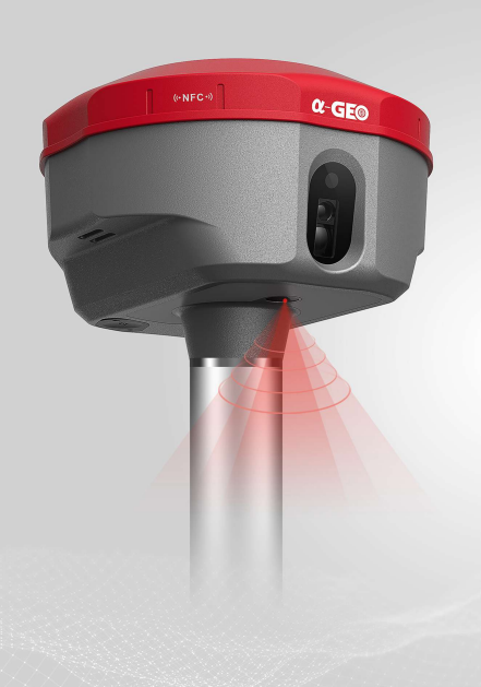
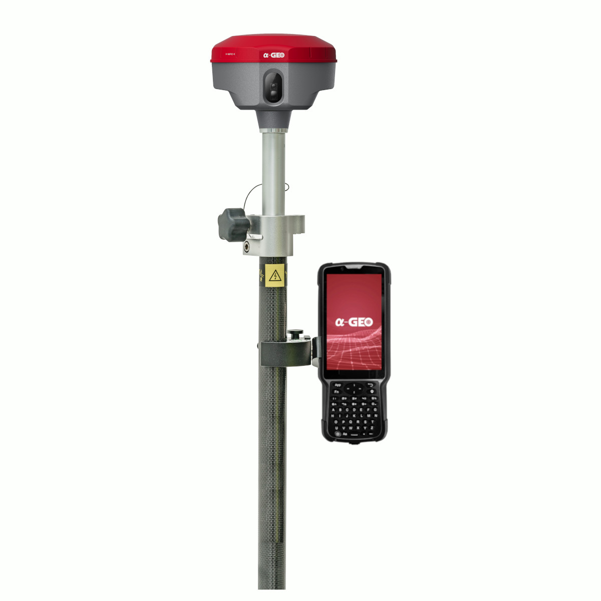
Check options3. a-GEO Matrix 2 – Camera + Laser Receiver
South Galaxy G7 Pros
✅ 1408 Channels
✅ Fast FIX (CM accurate in 5 sec)
✅ Connect via Bluetooth, Cable
✅ IMU Tilt Sensor (up to 60° angle)
✅ 4G Internet Modem
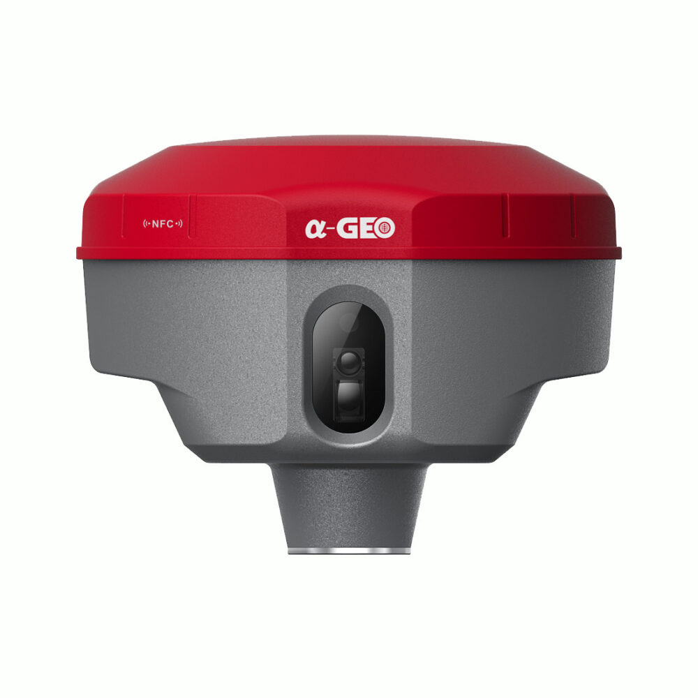
The a-GEO MATRIX II is a compact, next-generation smart laser AR RTK designed for any surveying project using the latest GNSS technology. This receiver boasts modern connectivity modules, including Bluetooth, an internal radio, WiFi, and a 4G modem. Additionally, it features a 7000mAh built-in battery, IMU tilt technology, and WebUI, showcasing the latest advancements in the field.
When stakeout points are marked directly on the ground, surveyors can easily locate the exact positions. By following the arrows on the real-life map, users can stake out points in one go without having to move the pole back and forth, enhancing the accuracy and efficiency of the stakeout process.
MATRIX II incorporates a patented laser coordinate measurement quick calibration technology, achieving centimeter-level measurement accuracy. This feature, along with a specialized camera that overcomes the difficulty of aiming under sunlight, makes field measurement operations faster and more efficient. Additionally, its fast-initialization IMU is calibration-free and immune to magnetic interference, allowing users to collect or stakeout topo points up to 120°. The device’s 1408-channel GNSS chipset supports multiple satellite constellations, including GPS, GLONASS, BEIDOU, GALILEO, QZSS, SBAS, and IRNSS, providing precise spatial data for users worldwide.
Here are some possible a-GEO Matrix 2 setups
a-GEO Matrix 2 Rover set
A standard RTK GPS set for mapping your terrain, staking out or collecting points.
Check options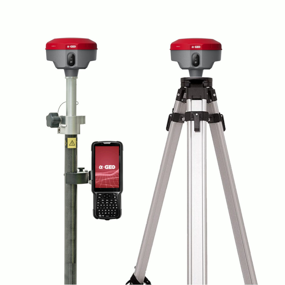
a-GEO Matrix 2 Rover and Base set
When you live in a remote area a second GPS receiver is needed to act as a base station for correction data.
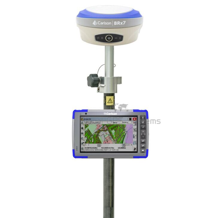
Check options4. Carlson BRx7 – High-End Receiver
Carlson BRx7 Pros
✅ 4G internet
✅ Fast FIX (CM accurate in 5 sec)
✅ With removable dual battery, for single
battery parameter: 7.2 V, 3400 mAh, 24.48 Wh
✅ E-bubble and IMU tilt sensor (up to 60° angle)
✅ 800+ Channels
✅ Hemisphere board with full constellation support
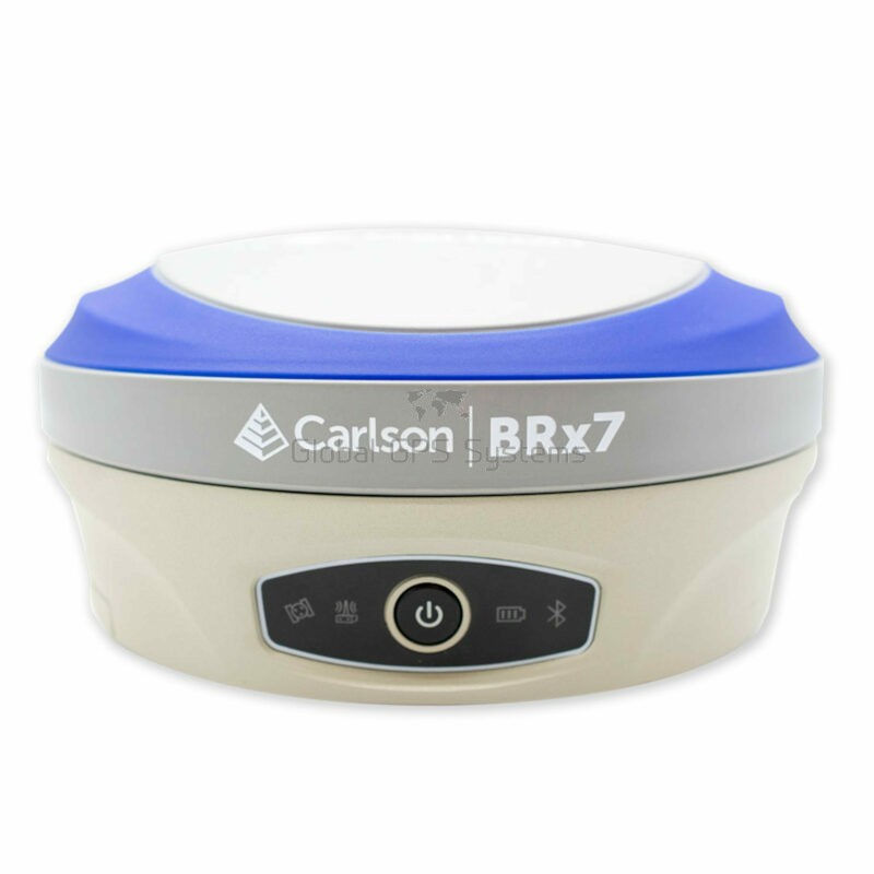
Founded in 1983 in America, Carlson specializes in field data collection, machine control products, and CAD design software for surveying markets worldwide.
The Carlson BRx7 RTK GNSS receiver stands out as their flagship hardware product. With over 800 channels, this RTK GNSS receiver ensures reliable performance. Although its price is higher than many RTK GPS receivers, it provides the confidence to survey almost anywhere.
The Carlson BRx7 GNSS receiver is equipped with an IMU tilt sensor that can tilt up to 60° with a compensation accuracy of 5 cm, making it suitable for surveying in challenging environments. If you are unable to connect to a local RTK or CORS solution and prefer not to set up a base station, you can use the Atlas L-Band correction data for seamless operation anywhere.
Featuring a removable dual battery with a 12-hour working time, the BRx7 allows you to swap out batteries when they run dry, ensuring uninterrupted surveying. Additionally, if you plan to use the Carlson BRx7 GNSS receiver in a rover and base setup, you can leverage Carlson’s Listen-Listen, an industry-leading cloud-based service that eliminates the baseline length restriction of UHF radios. This service provides RTK baselines up to 50 km with fast acquisition times.
Here are some possible Carlson BRx7 setups
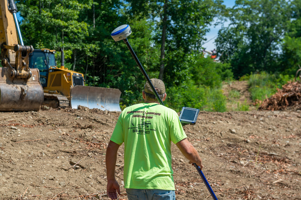
Carlson BRx7 Rover set
A standard RTK GPS set for mapping your terrain, staking out or collecting points.
Check options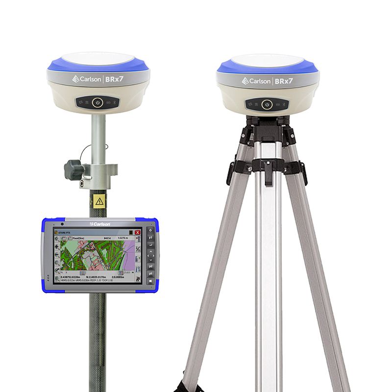
Carlson BRx7 Rover and Base set
When you live in a remote area a second GPS receiver is needed to act as a base station for correction data.
Check options5. South INNO8 – Dual Camera Receiver
South INNO8 Pros
✅ 1598/1698/1760 Channels Options
✅ Fast FIX (CM accurate in 5 sec)
✅ Connect via IP, Bluetooth, Cable
✅ IMU tilt sensor up to 60°
✅ Dual Camera for Vision Positioning and Stakeout
✅ Touch Screen Enhances User-Friendliness
Introducing the South INNO8 GNSS receiver, a cutting-edge geospatial solution that redefines precision and efficiency in positioning technology. Equipped with Visual Positioning & Stakeout capabilities, this receiver ensures unparalleled accuracy for surveying and mapping tasks. With models featuring up to 1760 channels, the INNO8 offers swift and reliable signal acquisition, ensuring high performance in various conditions.
The INNO8 elevates the user experience with advanced features such as 3D Modeling, providing comprehensive spatial representation. The integration of Farlink 2.0 ensures seamless communication and data transfer, enhancing operational efficiency. Additionally, the 4th generation IMU enhances motion sensing, delivering improved accuracy in dynamic environments.
Experience the pinnacle of GNSS technology with the South INNO8, setting new standards in geospatial innovation and offering a superior solution for all your positioning needs.

Here are some possible South INNO8 setups
South INNO8 Rover set
A standard RTK GPS set for mapping your terrain, staking out or collecting points.
Check Options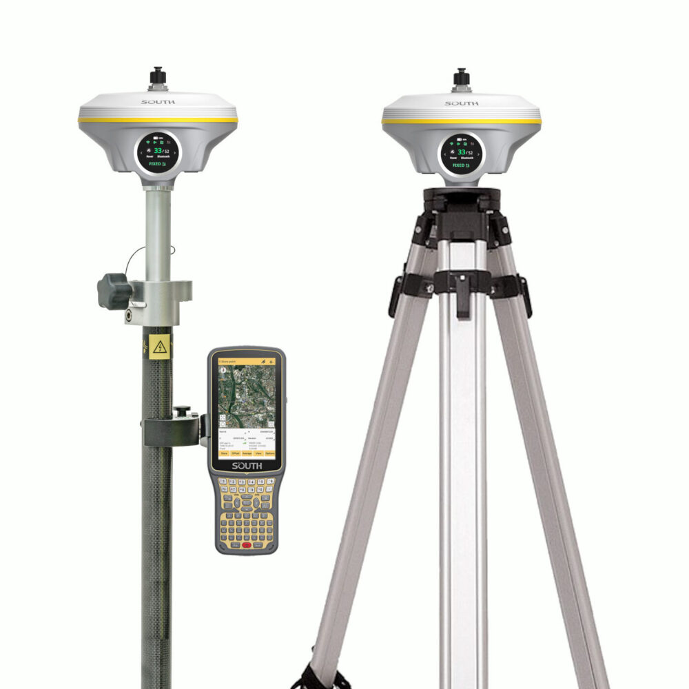
South INNO8 Rover and Base set
When you live in a remote area a second GPS receiver is needed to act as a base station for correction data.
Check OptionsThings to consider when choosing an RTK GPS receiver for Infrastructure and Construction purposes
1. Besides The GPS Antenna You Will Need Surveying Software As Well
With just a GNSS receiver you are not going to get far. Yes the GPS antenna provides you with the positioning data and the accuracy that you need but you’ll still need a place to process all of this.
This is what land surveying software is for. Within the software you can attach data to your GPS positioning data. By uploading DTM (Digital Terrain Models) into your software you can stake out these points based on the positioning data your GPS system provides.
The receivers listed above are all compatible with most of the GPS survey software packages so connecting should not be an issue. Now the questions remains, Which software package do I need? You can read the article below to find a good solution:
2. Choose a Strong GNSS Receiver
In the infrastructure and construction business the environments can be very harsh, because of that it is important to have a strong and rugged GNSS receiver. That’s why we always recommend a GPS receiver with an IP67 rating or higher. If something may happen it will be strong enough to survive it. This is ofcourse for minor things, not if a truck or something like that runs over it.