

 GPS & GNSS
 Lidar scanning
 Total Station
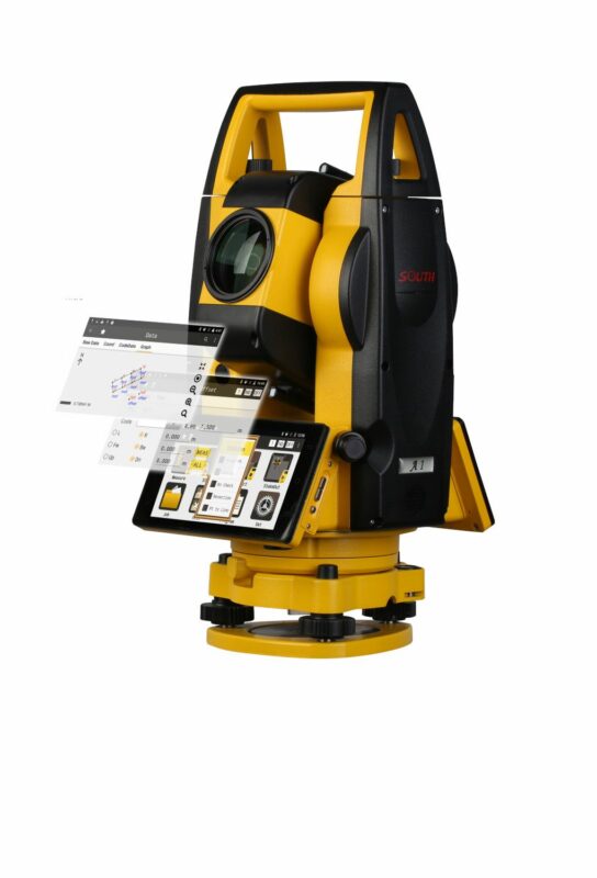
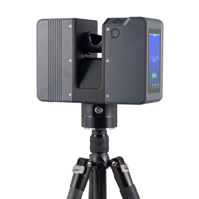
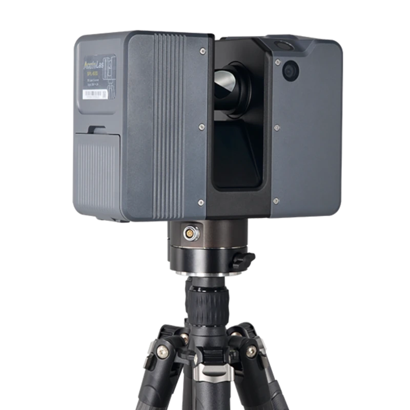
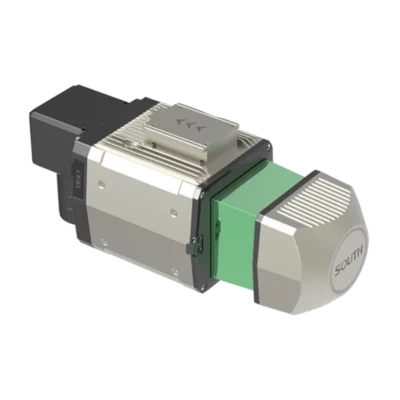
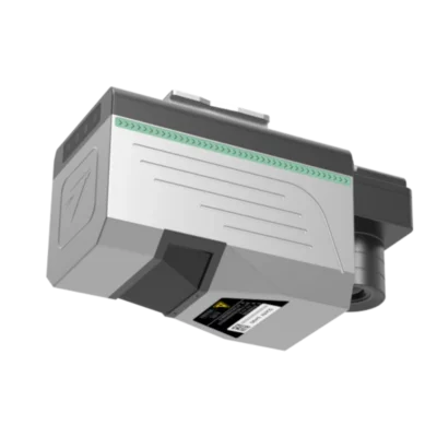
SOUTH SPL 135 AcuteLas Terrestrial 3D Laser Scanner
Get the best price for your setup
Contact our experts for the best possible price and configuration.
- Fast response
- Expert configuration advice
- No overpaying for features you do not need
The SOUTH SPL 135 AcuteLas Series is a terrestrial 3D laser scanning solution for professional surveying, building measurement, construction documentation and infrastructure mapping. Designed for capturing detailed spatial information from a stationary scanning position, it helps surveyors and engineers create 3D point clouds of structures and surrounding environments.
As part of SOUTH’s AcuteLas scanning family, the SPL 135 is aimed at workflows involving measured building documentation, as-built surveying, architectural recording and industrial inspection. The AcuteLas technology platform combines laser measurements, imaging and point cloud processing to support practical 3D documentation. Exact scanning performance and supplied functions depend on confirmation of the SPL 135 configuration.
SOUTH SPL 135 Highlights
| Scanning technology | Terrestrial 3D laser scanning |
|---|---|
| Product family | SOUTH AcuteLas Series |
| Scanning workflow | Station-based 3D point cloud acquisition |
| Typical applications | Building surveys, as-built documentation, construction and infrastructure |
| Processing ecosystem | SOUTH AcuteLas point cloud software |
| Exact scan range and accuracy | Model-specific confirmation required |
Valued customers:







Find RTK Networks
Search NTRIP providers and connect to reliable RTK correction services.
Description
SOUTH SPL 135 AcuteLas Terrestrial 3D Laser Scanner
The SOUTH SPL 135 AcuteLas Series is a terrestrial 3D laser scanning solution intended for professional surveying, building documentation, construction and infrastructure mapping. By collecting laser measurements from stationary scanning positions, the system supports the creation of detailed three-dimensional point clouds representing buildings, structures and other existing environments.
Terrestrial LiDAR scanning is particularly useful when a project requires more spatial information than can be collected efficiently with individual distance measurements. Instead of measuring every wall, column or structural feature separately, surveyors can capture large numbers of 3D points and use the resulting dataset to analyse the surveyed area.
The SOUTH AcuteLas family combines laser scanning technology with software for point cloud processing, allowing surveyors, engineers and construction professionals to develop digital representations of existing conditions.
Detailed 3D Measurements for Surveying and Engineering
Terrestrial laser scanning uses laser distance measurements and angular information to calculate the three-dimensional position of visible surfaces. As the scanner measures its surroundings, it builds a point cloud containing spatial information about walls, floors, ceilings, equipment, terrain and other objects.
For building and construction surveys, these point clouds provide a useful reference for understanding the dimensions and geometry of existing structures. Surveyors can inspect the data, measure distances between visible features and extract information for plans, elevations and cross-sections.
This is particularly valuable during renovation, refurbishment and infrastructure projects where accurate knowledge of existing conditions is needed before design or construction work begins.
Terrestrial Laser Scanning for Complex Environments
One of the main benefits of a terrestrial 3D scanner is its ability to capture irregular shapes and complicated geometry. Traditional surveying methods are often focused on individual measured points, while laser scanning records a much more complete representation of the visible environment.
In industrial facilities, this can include pipes, machinery, structural steelwork and other equipment. In buildings, it can include walls, door openings, columns, staircases and architectural details.
By collecting measurements from several positions, operators can document spaces that cannot be fully captured from a single location. Overlapping scans can subsequently be aligned to create a combined point cloud representing a larger area.
Reflective surfaces, glass, restricted lines of sight and moving objects can affect the quality or completeness of collected data. Suitable scan positioning and additional measurements may therefore be necessary.
Point Cloud Registration and Processing
The SOUTH AcuteLas software ecosystem provides tools for working with terrestrial laser scanning data. Point cloud registration is an important part of this workflow because measurements collected from different scanner positions must be combined into a consistent coordinate system.
After registration, surveyors can review the combined dataset, examine overlapping areas and prepare information for downstream surveying and engineering applications.
The AcuteLas software family includes tools for point cloud registration, viewing and further processing. Depending on the selected scanner and software configuration, workflows may include target-based registration, alignment adjustment, spatial measurements and the extraction of drawing information from point clouds.
For projects requiring georeferenced coordinates, appropriate survey control and coordinate transformation methods should be used. Internal positioning sensors alone should not be treated as a substitute for survey-grade control measurements.
Applications in Construction and Building Surveying
As-Built Building Surveys
Architects, surveyors and construction engineers can use terrestrial scanning to document the existing geometry of buildings before renovation or extension work begins. Point clouds can provide the dimensional information needed to prepare floor plans, elevations and sectional drawings.
This is especially useful in older buildings where the actual structure may differ from the available drawings.
Construction Site Documentation
Construction professionals can use 3D laser scanning to document completed work and compare existing conditions with design information. Point cloud data helps identify the location of structural components and provides a record of site geometry at the time of scanning.
When repeated surveys are performed using consistent control and processing methods, the collected datasets can also support comparisons between different project stages.
Industrial Plants and Facilities
Industrial engineers can use terrestrial LiDAR to capture the layout of machinery, pipework, steel structures and equipment within factories and processing facilities. This information can assist with refurbishment planning, equipment replacement and spatial coordination.
Infrastructure and Civil Engineering
Terrestrial scanning is useful for documenting bridges, retaining walls, road structures and other infrastructure elements. Engineers can use the collected measurements to inspect geometry, prepare cross-sections and support maintenance or reconstruction planning.
Architecture and Heritage Documentation
Architects and heritage specialists can use point clouds to document complex architectural forms, decorative features and existing structures. The resulting 3D information provides a detailed geometric record that can support restoration, conservation and design work.
Tunnel and Underground Surveys
Terrestrial LiDAR is also relevant to tunnel and underground infrastructure surveys. Multiple scanning positions can be used to capture tunnel profiles, walls and structural elements. With suitable processing, the data can support cross-section analysis and geometric documentation.
Working with 3D Point Clouds in CAD and BIM Projects
One of the practical advantages of terrestrial scanning is the ability to collect detailed information for subsequent design and modelling work. Processed point clouds can serve as geometric references when preparing CAD drawings or developing building information models.
For renovation and engineering projects, this reduces the need to rely entirely on original construction drawings that may no longer match the actual building.
The point cloud itself is a collection of measured coordinates rather than a finished CAD or BIM model. Converting scan data into drawings, surfaces or model elements requires appropriate processing software and, in many cases, additional modelling work.
Before starting a project, users should confirm the available export formats and compatibility between their AcuteLas software configuration and their intended CAD, BIM or GIS applications.
Planning an Efficient Terrestrial Scanning Survey
Successful terrestrial scanning depends on selecting suitable instrument positions and providing sufficient overlap between individual scans. A scanner can only measure surfaces that are visible from its current position, so additional setups are often needed to capture areas hidden behind walls, columns, furniture or equipment.
For indoor surveys, operators should consider room layout, access restrictions and the level of detail required. For infrastructure or outdoor work, factors such as measurement distance, surface reflectivity and environmental conditions must also be considered.
Survey control points or registration targets can be used where necessary to strengthen alignment and connect the scan data to an established coordinate system. Independent checks are recommended whenever the results will be used for engineering measurements.
SOUTH SPL 135 at Global GPS Systems
The SOUTH SPL 135 AcuteLas Series is intended for surveying companies, construction professionals, architects and engineers looking to incorporate terrestrial 3D scanning into their measurement workflow. Point cloud technology is particularly valuable for projects involving complex geometry, existing buildings and detailed documentation of structures.
At Global GPS Systems, we help customers select professional surveying and LiDAR equipment suited to their applications. Contact our team to confirm the SPL 135 hardware configuration, scanning specifications, compatible software and accessories required for your surveying projects.
Specifications
SOUTH SPL AcuteLas Series 3D Laser Scanner Specifications
Product Identification and Documentation
| Manufacturer | SOUTH Surveying & Mapping Technology Co., Ltd. |
|---|---|
| Product Listing | SOUTH SPL 135 AcuteLas Series |
| Product Type | Professional terrestrial 3D laser scanning system |
| Product Series | AcuteLas |
| Model Identification Status | The linked manufacturer brochure does not identify an SPL-135 model. It documents the SPL-1500 Pro, SPL-620 Pro, SPL-370 Pro and SPL-180. The exact model represented by the SPL-135 product listing requires confirmation. |
| Manufacturer Brochure Version | V.202609 |
| Manufacturer Brochure Models | SPL-1500 Pro / SPL-620 Pro / SPL-370 Pro / SPL-180 |
| Measurement Technology | Pulsed laser scanning |
| Measurement Principle | Time of Flight (ToF) |
| Primary Applications | Topographic surveying, building documentation, construction verification, architectural surveying, infrastructure inspection, tunnel surveying, industrial measurement, forestry and heritage documentation |
AcuteLas Model Comparison
| Specification | SPL-1500 Pro | SPL-620 Pro | SPL-370 Pro | SPL-180 |
|---|---|---|---|---|
| Measurement Range | 0.6–1,500 m | 0.6–620 m | 0.6–370 m | 0.6–180 m |
| Relative Accuracy at 100 m | 3 mm | 5 mm | 5 mm | 5 mm |
| Maximum Point Acquisition Rate | 2,000,000 points/s | 2,000,000 points/s | 2,000,000 points/s | 2,000,000 points/s |
| Horizontal Field of View | 360° | 360° | 360° | 360° |
| Vertical Field of View | 300° | 300° | 300° | 300° |
| Angular Accuracy | 0.001° | 0.001° | 0.001° | 0.001° |
| Maximum Scan Speed | 80 Hz | 80 Hz | 80 Hz | 80 Hz |
| Laser Wavelength | 1,550 nm | 1,550 nm | 1,550 nm | 1,550 nm |
| Laser Safety Class | Class 1 | Class 1 | Class 1 | Class 1 |
| Real-Time On-Site Registration | Available | Available | Available | Not available according to the brochure |
| Integrated Camera | Dual camera | Dual camera | Dual camera | Dual camera |
| Integrated GNSS | GPS L1 / BeiDou B1 | GPS L1 / BeiDou B1 | GPS L1 / BeiDou B1 | GPS L1 / BeiDou B1 |
| Ingress Protection | IP64 | IP64 | IP64 | IP64 |
Laser Scanner Performance
| Scanning Technology | High-speed pulsed laser scanning |
|---|---|
| Maximum Scanning Range | Up to 1,500 m, depending on model |
| Minimum Scanning Distance | 0.6 m |
| Maximum Point Measurement Rate | 2,000,000 points/second |
| Maximum Scan Speed | 80 Hz |
| Horizontal Scanning Coverage | 360° |
| Vertical Scanning Coverage | 300° |
| Angular Accuracy | 0.001° horizontal / 0.001° vertical |
| Angular Step Size | 0.018° |
| Angular Sampling Reference | 20,480 points per 360° revolution at the specified angular step |
| Laser Wavelength | 1,550 nm, infrared |
| Laser Beam Divergence | 0.5 mrad |
| Initial Laser Beam Diameter | 3.6 mm |
| Laser Safety Classification | Class 1 |
| Laser Safety Standard | IEC 60825-1:2014 |
| Multi-Target Detection | Supported according to manufacturer product literature |
| Scan Data Type | 3D point cloud data |
| Colourised Point Clouds | Supported using integrated RGB imagery and compatible processing software |
| Measurement Conditions | Performance depends on target reflectivity, illumination, atmospheric conditions and environmental factors |
Measurement Accuracy
| SPL-1500 Pro Relative Accuracy | 3 mm at 100 m |
|---|---|
| SPL-620 Pro Relative Accuracy | 5 mm at 100 m |
| SPL-370 Pro Relative Accuracy | 5 mm at 100 m |
| SPL-180 Relative Accuracy | 5 mm at 100 m |
| Horizontal Angular Accuracy | 0.001° |
| Vertical Angular Accuracy | 0.001° |
| Dual-Axis Compensation Range | ±15° |
| Dual-Axis Compensation Accuracy | ±0.008° |
| Automatic Levelling Compensation | Supported |
| Registration Accuracy | Dependent on scan geometry, control points, target configuration and registration methodology; no universal value specified |
| Field Accuracy Qualification | Published relative accuracy values are referenced to 100 m under manufacturer measurement conditions |
Scanning Speed and Fieldwork Performance
| Maximum Point Rate | 2,000,000 points/second |
|---|---|
| Maximum Scan Speed | 80 Hz |
| Fastest Scan-Only Reference Time | Approximately 16 seconds per station |
| Fastest Scan and Image Reference Time | Approximately 41 seconds per station |
| Scan Coverage | 360° horizontal × 300° vertical |
| Remote Scanning Control | Supported via tablet or smartphone, according to the available software configuration |
| Onboard Scanning Control | Integrated touchscreen |
| On-Site Scan Registration | Available on SPL-1500 Pro, SPL-620 Pro and SPL-370 Pro |
| Scan Station Registration | Automatic and manual registration workflows available through compatible software |
| Registration Result Visualisation | Supported through compatible field processing software |
| Fastest Scan Time Qualification | Manufacturer reference time; actual duration depends on acquisition settings and imaging requirements |
Integrated RGB Camera Specifications
| Camera Configuration | Two integrated cameras |
|---|---|
| Camera Arrangement | Forward-facing and upward-facing at approximately 45° |
| Resolution per Camera | 12.3 megapixels |
| Combined Resolution per Capture | 24.6 megapixels |
| Panoramic Imaging Directions | 8 directions |
| Imaging Interval | 45° between imaging directions |
| Total Image Resolution per Complete Imaging Round | 196.8 megapixels, calculated as 12.3 MP × 8 directions × 2 cameras |
| RGB Image Acquisition | Integrated colour image acquisition |
| Point Cloud Colourisation | Supported |
| True-Colour 3D Documentation | Supported through image and laser data processing |
Integrated Sensors and Positioning
| Dual-Axis Compensator | Integrated |
|---|---|
| Compensation Range | ±15° |
| Compensation Accuracy | ±0.008° |
| GNSS Receiver | Integrated |
| GPS Signal | L1 |
| BeiDou Signal | B1 |
| Electronic Compass | Integrated |
| Height Sensor | Integrated barometric sensor |
| Temperature Sensor | Integrated |
| GNSS Function | Records positioning information for scan station reference and associated workflows |
| Compass Function | Records directional information during scanning |
| Height Sensor Function | Records barometric information for relative height calculations |
| Temperature Monitoring | Internal temperature monitoring |
| Survey-Grade GNSS Accuracy | Not specified in the manufacturer brochure; integrated GNSS should not be assumed to provide RTK centimetre-level positioning |
Display and User Interface
| Integrated Display | 5-inch touchscreen |
|---|---|
| Display Resolution | 720 × 1280 pixels |
| Onboard Control | Supported |
| Remote Tablet Operation | Supported through compatible software |
| Smartphone Operation | Supported through compatible mobile software |
| Wireless Communication | Integrated WLAN |
| Wireless Standard | IEEE 802.11 b/g/n |
| Scan Data Visualisation | Supported through compatible field and office software |
| Scan Parameter Configuration | Available through the scanner interface and compatible software |
Data Storage and Connectivity
| Storage Type | USB flash drive |
|---|---|
| Standard Storage Capacity | 256 GB |
| Storage Expansion | Upgradeable, subject to supported storage media |
| USB Interface | USB 3.0 |
| USB Interface Location | Inside battery compartment |
| WLAN Interface | Integrated IEEE 802.11 b/g/n |
| Wireless Remote Control | Supported |
| Point Cloud Data Storage | Supported |
| Camera Image Data Storage | Supported |
| Scan Metadata | Includes data from applicable integrated sensors |
| SDK Availability | Optional, according to project requirements and manufacturer agreement |
Power and Battery Specifications
| Power Supply | Detachable battery unit or external power supply |
|---|---|
| Battery Type | Rechargeable lithium-ion |
| Battery Voltage | 28.8 V |
| Battery Capacity | 3,400 mAh |
| Battery Energy | 98 Wh |
| Typical Battery Endurance | Approximately 4–4.5 hours per battery unit |
| Typical Scanning Power Consumption | 40 W |
| External Supply Voltage | 18–24 V DC |
| External Power Connection | Bottom ring of scanner |
| Battery Installation | Detachable battery unit inside battery compartment |
| Battery Endurance Qualification | Operating duration depends on battery condition, temperature, scanning settings and operating conditions |
Physical and Mechanical Specifications
| Scanner Dimensions | 247 × 107 × 202 mm |
|---|---|
| Scanner Weight Without Battery | 4.85 kg |
| Scanner Weight With Battery | 5.3 kg |
| Housing Colour | Purple-grey |
| Housing Finish | Solid, uncoated finish according to manufacturer brochure |
| Mounting System | Lightweight elevating camera tripod with quick-release mounting |
| Tripod Type | Three-section elevating tripod |
| Inverse Mounting | Supported |
| Maximum Downward Inverse Mounting Adjustment | 0.505 m using the compatible elevating tripod |
| Scanner Display | Integrated 5-inch touchscreen |
| Battery Compartment | Integrated removable battery compartment |
| Weight Qualification | Published weights refer to the scanner with or without battery; tripod and accessories are not included in these weight figures |
Environmental Specifications
| Operating Temperature | -20°C to +60°C |
|---|---|
| Storage Temperature | -35°C to +70°C |
| Ingress Protection | IP64 |
| Dust Protection | IP6X — dust-tight |
| Water Protection | IPX4 — protection against splashing water |
| Humidity Resistance | Non-condensing conditions |
| Laser Safety Classification | Class 1 |
| Laser Safety Standard | IEC 60825-1:2014 |
| Laser Wavelength | 1,550 nm |
| Environmental Measurement Conditions | Accuracy and range depend on surface reflectivity, light conditions, temperature, humidity and other environmental factors |
Software and Processing
| Mobile Remote Control Software | AcuteLas Mobile |
|---|---|
| Tablet Remote Control Software | AcuteLas Onsite |
| Office Preprocessing Software | AcuteLas Studio |
| Field Registration Software | AcuteLasField, where supported by model and configuration |
| Real-Time Point Cloud Visualisation | Supported with applicable field software |
| Real-Time Scan Registration | Supported for SPL-1500 Pro, SPL-620 Pro and SPL-370 Pro |
| Automatic Scan Registration | Supported |
| Manual Registration Adjustment | Supported |
| Sphere Target Registration | Supported |
| Automatic Sphere Target Recognition | Supported by applicable software workflows |
| Point Cloud Fine Registration | Supported |
| Station Correction Using Survey Control | Supported |
| Tunnel Backsight Orientation Processing | Supported |
| Registration Reports | Supported for applicable workflows |
| Point Cloud Registration Optimisation | Supported |
| Colour Point Cloud Processing | Supported |
| Point Cloud Data Management | Supported through AcuteLas Studio |
| Software Feature Availability | Depends on scanner model, software version and licence configuration |
Specialised Surveying and Analysis Functions
| Building Mapping | Point cloud extraction, vector drawing, component insertion and dimensioning |
|---|---|
| Floor Plan Generation | Supported through compatible processing modules |
| Elevation Drawing Generation | Supported |
| Cross-Section Generation | Supported |
| Point Cloud Slice Extraction | Supported |
| Vector Drawing and Editing | Supported |
| Tunnel Overbreak and Underbreak Analysis | Supported through compatible software modules |
| Tunnel Centreline Analysis | Supported |
| Tunnel Cross-Section Analysis | Supported |
| Tunnel Ovality Analysis | Supported |
| Two-Epoch Point Cloud Monitoring | Supported through applicable analysis workflows |
| Room Wall Segmentation | Supported |
| Wall and Ceiling Extraction | Supported |
| Wall Merging Calculations | Supported |
| Room Squareness Analysis | Supported through the relevant as-built surveying module |
| As-Built Reporting | Supported through compatible software functions |
Surveying Applications
| Architectural Surveying | 3D building measurement and spatial documentation |
|---|---|
| Building Facade Surveying | Exterior geometry capture and elevation documentation |
| Heritage Documentation | Detailed 3D recording of historic buildings and structures |
| Construction Surveying | Site documentation and as-built verification |
| Tunnel Surveying | Tunnel profiling, section measurement and deformation monitoring workflows |
| Industrial Facility Mapping | Measurement of industrial equipment, plant layouts and structures |
| Steel Structure Surveying | 3D measurement and structural documentation |
| Power Transmission Structures | Power tower geometry measurement and documentation |
| Forestry Surveying | Forest structure and terrestrial vegetation measurement |
| Topographic Surveying | Ground surface and terrain feature documentation |
| Infrastructure Inspection | 3D mapping of infrastructure and civil engineering structures |
| Interior Mapping | Room geometry and interior building documentation |
| As-Built Verification | Comparison and analysis of measured structures |
| Engineering Surveying | High-density 3D spatial data collection for engineering workflows |
Package Contents and Accessories
| Item | Quantity | Notes |
|---|---|---|
| SOUTH AcuteLas SPL Laser Scanner | 1 system | Exact model must be confirmed; the linked brochure lists SPL-1500 Pro, SPL-620 Pro, SPL-370 Pro and SPL-180 |
| Integrated RGB Cameras | 2 | Documented as integrated into the brochure models |
| Integrated Touchscreen | 1 | 5-inch, 720 × 1280 pixel display |
| Rechargeable Lithium-Ion Battery | Configuration-dependent | 28.8 V, 3,400 mAh, 98 Wh battery unit specified |
| USB Storage | Configuration-dependent | 256 GB published standard capacity |
| Elevating Tripod | Configuration-dependent | Compatible three-section quick-release tripod described in the brochure |
| Battery Charging Equipment | Configuration-dependent | Confirm charger and power accessories supplied |
| AcuteLas Studio Software | Software package | Manufacturer documentation specifies standard software availability; confirm licence and delivery |
| AcuteLas Onsite / AcuteLasField | Configuration-dependent | Field control and registration software; model compatibility varies |
| External Power Accessories | Configuration-dependent | Compatible 18–24 V DC external supply accessories |
| Transport Case | Not confirmed | Verify supplied case and protective packaging |
| User Manual | Configuration-dependent | Use documentation corresponding to the exact scanner model and revision |
Manufacturer Documentation and Model Verification
| Product Listing | Global GPS Systems – SOUTH SPL 135 AcuteLas Series |
|---|---|
| Linked Manufacturer Datasheet | SOUTH AcuteLas Series 3D Laser Scanner Brochure (PDF) |
| Brochure Version | V.202609 |
| Models in Brochure | SPL-1500 Pro, SPL-620 Pro, SPL-370 Pro and SPL-180 |
| Linked User Manual | SOUTH SPL 3D Laser Scanner User Manual (PDF) |
| User Manual Model Note | The linked manual contains SPL-500 and SPL-1500 references and describes an earlier scanner generation. Its hardware-specific values should not automatically be applied to the SPL Pro models or to a product labelled SPL-135. |
| SPL-135 Verification Status | No SPL-135-specific technical datasheet or model designation was confirmed in the linked manufacturer documents. |
| Specification Scope | The tables above describe the verified AcuteLas scanner models identified in the linked V.202609 brochure, not an independently verified SPL-135 configuration. |
Specifications and package contents may vary by configuration, region or manufacturer update. Always check the current configuration before ordering.
Reviews (0)
Only logged in customers who have purchased this product may leave a review.
FAQ
SOUTH SPL-135 AcuteLas Series 3D Laser Scanner FAQ
General Information and Key Features
What is the SOUTH SPL-135 AcuteLas Series 3D laser scanner?
The SOUTH SPL-135 AcuteLas Series is a professional terrestrial laser scanning solution designed for high-precision 3D measurement, reality capture and point cloud generation. It uses laser scanning technology to capture detailed three-dimensional information about buildings, structures, terrain and industrial environments. The associated SOUTH AcuteLas scanner range supports surveying, construction, architecture, engineering, heritage documentation and infrastructure inspection. The manufacturer's current AcuteLas documentation identifies several scanner configurations with different measurement ranges and capabilities.
What are the main features of the SOUTH SPL-135 AcuteLas Series?
The SOUTH AcuteLas terrestrial laser scanner range combines high-speed 3D measurement, 360-degree horizontal scanning, integrated imaging, automatic leveling assistance and professional point cloud processing software. The current AcuteLas series documentation specifies up to 2 million points per second, a 300-degree vertical field of view, dual integrated cameras, wireless remote operation and Class 1 laser technology. Available functions, measurement ranges and real-time registration capabilities depend on the selected scanner configuration.
What is the maximum scanning range of the SOUTH AcuteLas Series?
The SOUTH AcuteLas Series is available in multiple measurement-range configurations. The current manufacturer documentation identifies the SPL-1500 Pro with a range of 0.6 to 1,500 meters, the SPL-620 Pro with a range of 0.6 to 620 meters, the SPL-370 Pro with a range of 0.6 to 370 meters and the SPL-180 with a range of 0.6 to 180 meters. These are specified measuring ranges under reference conditions. The exact range of a supplied SPL-135 configuration should be confirmed against its model-specific datasheet. Actual performance depends on target reflectivity, atmospheric conditions and scanning geometry.
How accurate is the SOUTH AcuteLas 3D laser scanner?
The current SOUTH AcuteLas manufacturer documentation specifies a relative measurement accuracy of 3 mm at 100 meters for the SPL-1500 Pro and 5 mm at 100 meters for the SPL-620 Pro, SPL-370 Pro and SPL-180. The series also specifies angular accuracy of 0.001 degrees in both horizontal and vertical directions. These figures describe reference measurement performance and should not be confused with the absolute accuracy of a complete registered survey. Final accuracy depends on the scanner model, station setup, registration quality, survey control and environmental conditions.
How many points per second can the SOUTH AcuteLas scanner capture?
The current SOUTH AcuteLas Series documentation specifies a maximum scanning rate of 2,000,000 points per second. This high measurement speed allows the scanner to capture dense 3D point clouds of complex structures, buildings, industrial facilities and terrain. The actual number of points collected depends on the selected scanner model, scan resolution, measurement settings and scanning duration. Higher point density can improve the representation of fine geometric details but also increases data storage and processing requirements.
Does the SOUTH AcuteLas scanner provide 360-degree scanning?
Yes. The current SOUTH AcuteLas terrestrial scanner range offers a 360-degree horizontal and 300-degree vertical scanning field of view. This enables the scanner to capture almost the entire surrounding environment from a single stationary position. The remaining vertical area is limited by the scanner's physical design and mounting arrangement. For complete coverage of complex structures, multiple scanner positions are normally required to capture surfaces hidden behind walls, columns, machinery or other obstacles.
Applications and Professional Surveying
What industries use the SOUTH SPL-135 AcuteLas Series?
The SOUTH AcuteLas Series is intended for professional users in land surveying, architecture, construction, civil engineering, industrial measurement, infrastructure inspection, mining, heritage conservation and geospatial mapping. Surveyors, engineers, BIM specialists, architects, construction managers and facility operators can use terrestrial LiDAR data to create accurate 3D representations of existing structures and environments. These datasets support measurement, documentation, design, quality control and asset management workflows.
Can the SOUTH AcuteLas scanner be used for building surveying and BIM?
Yes. The SOUTH AcuteLas scanner can capture detailed 3D measurements of building interiors, exterior facades, floors, walls, ceilings and structural elements. The resulting point clouds can be used as references for as-built documentation, renovation planning, architectural drawings and Building Information Modeling (BIM). With compatible CAD or BIM software, professionals can develop floor plans, elevations, sections and digital building models from the measured geometry. Model creation and element recognition may require additional processing and modeling steps.
Is the SOUTH AcuteLas Series suitable for construction and as-built surveys?
Yes. The SOUTH AcuteLas Series is suitable for construction documentation, dimensional verification, renovation surveys and as-built measurement. Its high-density point clouds can capture the existing geometry of walls, floors, ceilings, columns and structural components. Survey teams can compare measured conditions with design information to identify geometric differences, support installation planning and document construction progress. The associated software includes point cloud processing and building measurement workflows.
Can the SOUTH AcuteLas scanner be used for tunnels and underground infrastructure?
Yes. The SOUTH AcuteLas Series can be used for tunnel surveying, underground infrastructure documentation and geometric inspection. Its scanning coverage allows detailed measurements of tunnel walls, ceilings, cross-sections and structural features. SOUTH's software documentation identifies specialized tunnel analysis functions, including cross-section generation, centerline visualization, overbreak and underbreak analysis, and comparison of point clouds collected at different times. These workflows help engineers assess tunnel geometry and changes in structural dimensions.
Can the SOUTH AcuteLas scanner be used for heritage buildings and archaeological documentation?
Yes. The SOUTH AcuteLas Series is suitable for recording historical buildings, monuments, archaeological structures and architectural details. Non-contact laser measurement allows surveyors to capture complex geometry without physically touching fragile surfaces. The resulting 3D point clouds can support conservation planning, digital archiving, restoration documentation and geometric analysis. Integrated camera imagery can add visual context to measured surfaces, helping preserve both structural and appearance-related information.
Is the SOUTH AcuteLas Series suitable for industrial plants and steel structures?
Yes. The SOUTH AcuteLas Series can be used to document factories, industrial equipment, steel structures, processing facilities and other complex installations. Its high-density 3D measurements can support dimensional inspection, equipment layout documentation, retrofit planning and engineering design. By scanning from multiple positions, operators can create a combined point cloud of machinery, structural members, pipework and surrounding infrastructure. The accuracy and completeness of the final dataset depend on scan coverage and registration quality.
Technical Specifications and Hardware
What laser technology does the SOUTH AcuteLas Series use?
The SOUTH AcuteLas terrestrial scanner range uses pulsed laser measurement technology to determine distances to surrounding surfaces. The current manufacturer brochure specifies an invisible 1,550 nm laser wavelength and Class 1 laser safety classification according to IEC 60825-1:2014. The scanner measures distances and scanning angles to calculate three-dimensional point coordinates. This technology is suitable for capturing detailed geometric information across indoor and outdoor survey environments.
Does the SOUTH AcuteLas scanner include cameras for colorized point clouds?
Yes. The current SOUTH AcuteLas Series documentation specifies two integrated 12.3 MP cameras, providing a combined imaging resolution of 24.6 MP per capture. The cameras acquire color information that can be associated with the laser measurements to produce colorized 3D point clouds. Multi-direction image acquisition provides additional visual coverage of the surrounding scene. Colorized point clouds are particularly useful for building documentation, heritage recording, infrastructure visualization and digital reality capture.
Does the SOUTH AcuteLas scanner have automatic leveling?
Yes. The SOUTH AcuteLas Series includes an integrated dual-axis compensator with a specified compensation range of ±15 degrees. The manufacturer describes a compensation accuracy of approximately ±0.008 degrees. This system helps account for scanner tilt during measurement and simplifies instrument setup. Automatic compensation reduces the need for precise manual leveling, although a secure tripod, stable setup and appropriate survey procedures remain essential for reliable results.
How much does the SOUTH AcuteLas scanner weigh?
The current SOUTH AcuteLas Series brochure specifies a main instrument weight of approximately 4.85 kg without the battery and 5.3 kg with the battery installed. Its listed dimensions are 247 × 107 × 202 mm. These specifications apply to the current AcuteLas terrestrial scanner range described in the manufacturer documentation. The exact weight of a particular SPL-135 package may vary with its hardware configuration, tripod, battery and accessories.
Does the SOUTH AcuteLas scanner include GNSS and an electronic compass?
Yes. The current SOUTH AcuteLas Series documentation identifies integrated GPS L1 and BeiDou B1 positioning, an electronic compass, a height sensor and a temperature sensor. These components provide supplementary information about scanner position, orientation and operating conditions. The integrated GNSS function should not be treated as a replacement for survey-grade RTK GNSS or total station control when centimeter-level absolute positioning is required. Professional georeferencing may require measured control points or independently surveyed scanner positions.
What are the battery life and power requirements of the SOUTH AcuteLas scanner?
The current SOUTH AcuteLas scanner range uses a rechargeable 28.8 V, 3,400 mAh lithium-ion battery with a specified capacity of 98 Wh. Manufacturer documentation indicates approximately 4 to 4.5 hours of operating time per battery under reference conditions. The scanner also supports an external 18 to 24 V DC power supply and has a typical scanning power consumption of approximately 40 W. Actual battery endurance depends on scanning activity, environmental temperature, imaging functions and operating settings.
Is the SOUTH AcuteLas scanner suitable for outdoor use?
Yes. The current SOUTH AcuteLas Series has an IP64 ingress protection rating and a specified operating temperature range of -20°C to +60°C. IP64 provides protection against dust ingress and water splashes, but does not mean the instrument is waterproof or suitable for immersion. The scanner can be used for outdoor terrestrial surveying when environmental conditions remain within the manufacturer's limitations. Operators should avoid prolonged exposure to heavy rain, condensation and conditions that could affect measurement quality or instrument safety.
Software, Point Cloud Processing and Operation
Which software is used with the SOUTH SPL-135 AcuteLas Series?
SOUTH provides AcuteLas software solutions for controlling terrestrial scanning and processing the resulting point clouds. The current manufacturer documentation identifies AcuteLas Mobile for mobile-device control, AcuteLas Onsite for tablet-based operation and AcuteLas Studio for desktop data processing. The broader software workflow supports scan registration, point cloud visualization, geometric measurement and project data management. Specific software availability and licensing depend on the selected scanner model and configuration.
Does the SOUTH AcuteLas Series support automatic point cloud registration?
Yes. The current SOUTH AcuteLas software workflow supports automatic registration of scans collected from multiple instrument positions. The manufacturer also documents target-based registration, sphere target recognition, manual registration adjustment and registration optimization. Compatible configurations support real-time on-site registration, allowing operators to review aligned point clouds during fieldwork. The current series documentation lists on-site registration for the SPL-1500 Pro, SPL-620 Pro and SPL-370 Pro, but not the SPL-180. Reliable registration requires sufficient overlap and suitable common geometry or control targets.
How long does it take to complete a scan with the SOUTH AcuteLas scanner?
The current SOUTH AcuteLas Series brochure specifies a fastest reference scanning time of approximately 16 seconds per station for laser scanning only, or approximately 41 seconds when scanning and image acquisition are combined. These figures represent the fastest operating modes under reference conditions. Actual scanning duration depends on the selected resolution, imaging requirements, scanner configuration and survey workflow. Higher-resolution scanning and additional imaging can increase the time required at each station.
Can the SOUTH AcuteLas scanner generate floor plans, elevations and cross-sections?
Yes. Point clouds collected with the SOUTH AcuteLas Series can be processed to create floor plans, building elevations, sections and other measured drawings. The manufacturer's software documentation identifies point cloud slicing, vector extraction, drawing and editing functions, and building mapping tools. These capabilities support architectural surveys, as-built documentation, renovation planning and engineering workflows. Final CAD drawings or BIM deliverables may require additional interpretation, modeling and quality control.
Can the SOUTH AcuteLas scanner be controlled remotely?
Yes. The SOUTH AcuteLas terrestrial scanner range supports wireless remote operation through compatible mobile devices and tablets. The manufacturer identifies AcuteLas Mobile and AcuteLas Onsite as available control solutions, while the scanner also includes an onboard 5-inch touchscreen for direct operation. Remote control can simplify fieldwork when the instrument is positioned in locations that are difficult to access during a scan. Wireless operation depends on the supported software, network connection and scanner configuration.
Can the SOUTH AcuteLas scanner be used without internet or mobile network coverage?
Yes. Terrestrial LiDAR distance measurement does not inherently require an internet connection or mobile network. The SOUTH AcuteLas scanner can perform local data acquisition using its onboard controls and storage system. Supported Wi-Fi communication can also allow a compatible device to control the scanner over a local wireless connection. Certain software licensing, online services or data-sharing functions may require internet access, depending on the configuration.
How is scanning data stored and transferred from the SOUTH AcuteLas scanner?
The current SOUTH AcuteLas Series documentation specifies a USB 3.0 flash storage system with 256 GB capacity and upgrade options. Scan data can be transferred for registration, visualization and processing using compatible computer software. The manufacturer's documentation also identifies integrated Wi-Fi communication for remote operation. Storage requirements depend on scan resolution, project size, color imagery and the number of scanning stations. Regular data backups are recommended for larger projects.
 GPS & GNSS
 Total Stations
 Data collectors
 Software
 Correction services
 Machine control
 External radio
 Marine
 Accessories
Reviews
There are no reviews yet