

 GPS & GNSS
 Lidar scanning
 Total Station
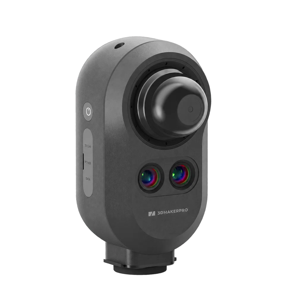
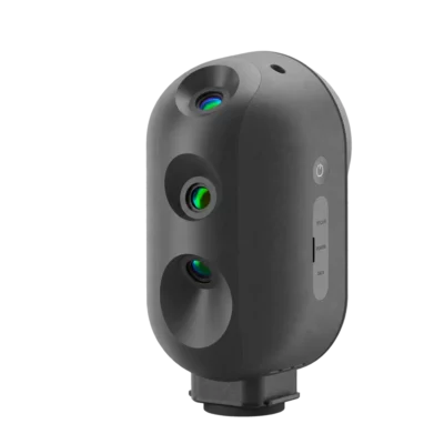
3DMakerpro Owl Max Premium LiDAR 3D Scanner with Handheld Mode
Get the best price for your setup
Contact our experts for the best possible price and configuration.
- Fast response
- Expert configuration advice
- No overpaying for features you do not need
The 3DMakerpro Owl Max Premium is a versatile LiDAR 3D scanner that combines stationary tripod scanning and handheld 3D mapping in one system. Featuring five cameras and binocular visual tracking, it allows surveyors, architects, engineers and construction professionals to capture detailed point clouds of rooms, buildings, industrial facilities and connected spaces. With 5 mm ranging accuracy at 10 metres in stationary mode and 2 cm specified accuracy in handheld mode, it supports different measurement workflows without requiring two separate scanners.
With a scanning radius of up to 60 metres at 20% reflectivity, a 360° horizontal and 280° vertical field of view, and a capture rate of up to 192,000 points per second, the Owl Max Premium records detailed spatial information for building measurement, renovation planning and 3D documentation. The Premium package includes stationary and handheld tripods, external power accessories, a carrying case and a 360° camera mounting kit. RayStudio software supports point cloud processing and export, while compatible imaging accessories enable realistic 3D Gaussian Splatting workflows.
3DMakerpro Owl Max Premium Highlights
| Scanning technology | LiDAR with stationary and handheld scanning modes |
|---|---|
| Stationary accuracy | 5 mm ranging accuracy at 10 m |
| Handheld accuracy | 2 cm specified accuracy |
| Visual tracking | Binocular visual tracking for handheld scanning |
| Camera configuration | Five-camera system with 3 × 48 MP panoramic cameras and 2 additional tracking cameras |
| Scanning radius | 0.5–60 m at 20% target reflectivity |
| Field of view | 360° horizontal and 280° vertical |
| Point cloud capture | Up to 192,000 points per second |
| Panoramic imaging | Up to 16K HDR panoramic images |
| Battery | Approximately 2 hours; external USB-C PD 65 W power supported |
| Scanner weight | Approximately 1.6 kg |
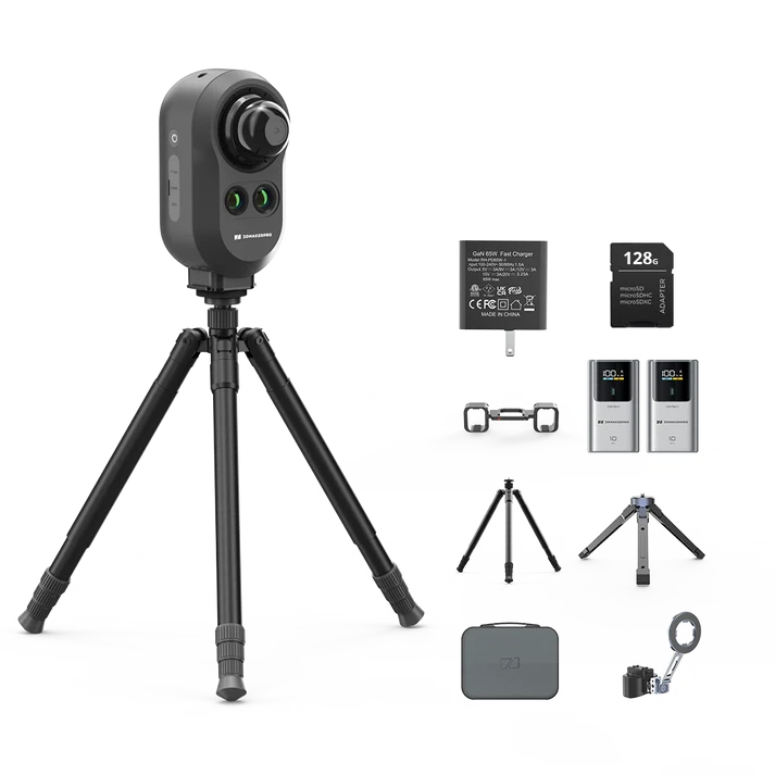
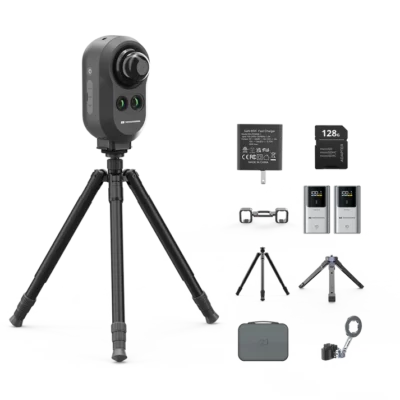
| Premium accessories | Stationary tripod, handheld tripod, power kit, 2 × 10,000 mAh power banks, carrying case and 360° camera/phone mounting kit |
| Data output | PLY and E57 point clouds, OBJ models and PNG panoramas |
You may also like…
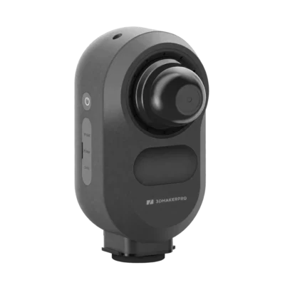
Slam Lidar scanner
3DMakerpro Owl Stationary LiDAR 3D Scanner with Triple 48MP Cameras
Lidar & 3D scanning
3DMakerpro Owl Premium Stationary LiDAR 3D Scanner with Field Kit
Valued customers:





Find RTK Networks
Search NTRIP providers and connect to reliable RTK correction services.
Description
3DMakerpro Owl Max Premium LiDAR 3D Scanner
The 3DMakerpro Owl Max Premium is a professional LiDAR 3D scanner that combines stationary tripod scanning with handheld spatial mapping. Designed for building surveyors, architects, engineers and construction professionals, it provides a flexible way to capture detailed 3D measurements, colour point clouds and panoramic images of buildings, industrial facilities and other real-world environments.
Unlike the standard Owl models, which operate only from fixed scanning positions, the Owl Max Premium also supports handheld data collection using binocular visual tracking. This allows professionals to choose the most suitable scanning method for each project: stationary scanning for detailed room measurements or handheld scanning when moving through connected spaces, corridors and complex environments.
With five cameras, a scanning radius of up to 60 metres at 20% reflectivity and a measurement rate of up to 192,000 points per second, the Owl Max Premium combines detailed spatial capture with practical field mobility. The complete Premium package includes stationary and handheld mounting accessories, external power equipment and a carrying case.
Stationary and Handheld LiDAR Scanning in One System
The main advantage of the 3DMakerpro Owl Max Premium is its ability to work in two different scanning modes. In stationary mode, the scanner is mounted on a tripod and records the surrounding environment from a fixed position. This provides a controlled workflow for documenting individual rooms, building interiors and detailed architectural features.
In handheld mode, the operator can carry the scanner through an environment while collecting spatial information. The integrated binocular visual tracking system helps estimate movement and connect measurements as the scanner changes position.
For building surveyors, this flexibility is particularly useful when a project includes both open rooms and connecting corridors. Stationary scans can be used where detailed fixed-position measurements are preferred, while handheld scanning is practical for capturing connected spaces without repeatedly setting up a tripod.
Construction teams can use the system to record existing site conditions, document renovation areas and capture visible installations. Architects and engineers can collect spatial information for reference drawings, 3D modelling and existing-condition documentation.
5 mm Stationary Ranging Accuracy and 2 cm Handheld Accuracy
The Owl Max Premium provides a specified 5 mm ranging accuracy at 10 metres in stationary mode. This makes it suitable for capturing detailed geometry of walls, floors, ceilings, columns, openings and other visible building elements.
In handheld mode, the manufacturer specifies an accuracy of 2 cm. This mode is intended for mobile spatial mapping where efficient coverage and movement through the environment are important.
These two accuracy specifications describe different measurement conditions and should not be interpreted as interchangeable. The stationary figure refers to ranging performance at a defined distance, while the handheld figure relates to the mobile scanning mode. The accuracy of a complete point cloud also depends on scanning technique, alignment, environmental conditions and processing.
For renovation planning and building documentation, this distinction allows professionals to select the appropriate scanning method according to the work. Projects requiring independently verified engineering tolerances should include suitable survey control and quality checks.
Five-Camera System with Binocular Visual Tracking
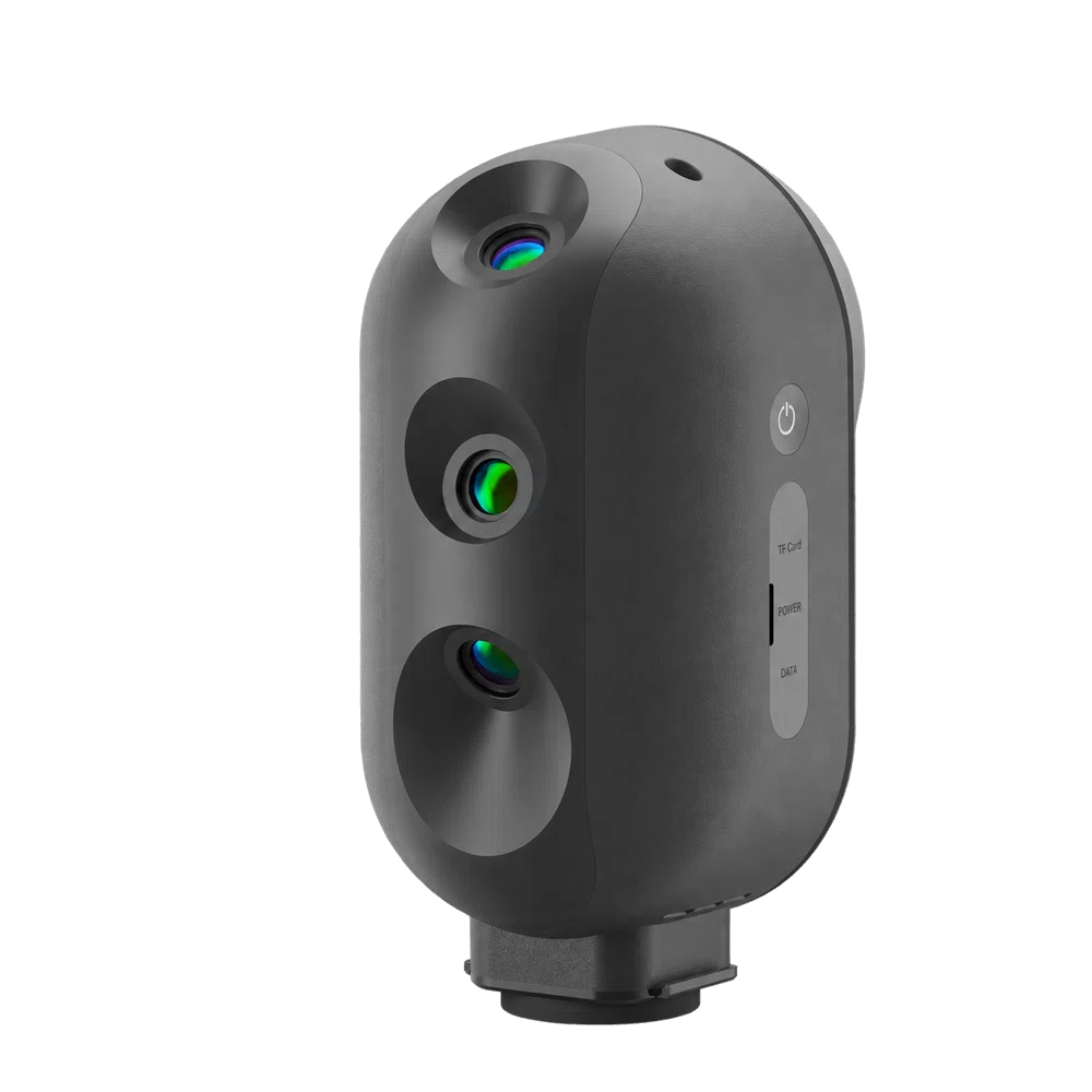
The Owl Max Premium uses a five-camera configuration, consisting of three 48 MP colour cameras and two additional cameras for binocular visual tracking. This is one of the main technical differences between the Max Premium and the standard three-camera Owl models.
The three high-resolution cameras capture colour information and visual details for panoramic images and colourised 3D data. The additional visual tracking cameras support the scanner’s ability to estimate movement during handheld operation.
For professionals documenting buildings, colour information makes the point cloud easier to interpret. Walls, doors, windows, materials and installations are more recognisable when spatial measurements are combined with photography. This is useful when reviewing a site after the measurement work has been completed.
Binocular visual tracking is particularly important during handheld scanning because the scanner must continuously estimate changes in its position. Capturing sufficient surrounding geometry and recognisable visual features helps support reliable tracking. Difficult lighting, repetitive surfaces and feature-poor environments may affect the quality of the resulting scan.
360° Horizontal and 280° Vertical Scanning Coverage
With a 360-degree horizontal and 280-degree vertical field of view, the Owl Max Premium can record a wide area around the scanner. In stationary mode, this helps capture surrounding walls together with substantial portions of floors and ceilings from a single position.
For building measurement, the wide coverage reduces the need to reposition the scanner frequently in open rooms. Large halls, offices and industrial interiors can often be documented using a smaller number of carefully selected scanning positions.
In handheld mode, the operator can move through the environment to capture additional geometry and areas that are difficult to reach from a stationary position. This is valuable for connected rooms, passageways and complex layouts containing numerous obstacles.
As with all laser scanning systems, surfaces hidden behind walls, furniture or equipment cannot be measured directly. Additional scanning positions or passes may be needed to capture these areas.
Up to 60 Metres Scanning Radius
The Owl Max Premium offers a specified scanning radius of 0.5 to 60 metres at 20% target reflectivity. This allows the scanner to capture both smaller interior spaces and larger environments such as warehouses, commercial buildings, industrial halls and covered infrastructure.
In practical fieldwork, this range helps users document structural features and distant surfaces without approaching every object individually. For example, an operator can capture the geometry of a large room from a suitable position and move the scanner only when additional coverage is required.
The effective measuring distance depends on the reflectivity of the surface, the viewing angle and environmental conditions. Dark or low-reflectivity materials may produce shorter usable distances than brighter surfaces.
High-Density Point Clouds at 192,000 Points per Second
The Owl Max Premium captures up to 192,000 LiDAR points per second, producing detailed three-dimensional data of the surrounding environment. The point cloud represents visible surfaces and can be used to examine dimensions, spatial relationships and structural geometry after the scan.
This is useful for projects where the overall shape of a building or installation needs to be documented. Instead of relying entirely on individual measurements, surveyors and engineers can collect a substantial amount of spatial information during a scanning session.
For construction and renovation projects, the point cloud can provide reference data for existing-condition drawings. In industrial facilities, it can support the documentation of machinery layouts and technical installations. Architectural teams can use the geometry as a starting point for subsequent 3D modelling.
High-Resolution HDR Panoramas and Colour 3D Models
The three 48 MP colour cameras support high-resolution panoramic imaging, including up to 16K HDR panoramas. These images provide a visual record of the scanned environment alongside the LiDAR measurements.
High-resolution colour imagery is useful for recognising materials, fixtures and visible site conditions. Building surveyors can review the appearance of a room after leaving the site, while architects and facility managers can use the images to understand the existing environment.
The combination of spatial data and panoramic images also supports digital documentation and property visualisation. For projects that need realistic 3D presentation, the Owl Max Premium supports Gaussian Splatting workflows with compatible external Insta360 camera equipment and the required processing software.
Gaussian Splatting is particularly useful for visually realistic representations of buildings and interiors. For technical measurement and engineering analysis, the processed LiDAR point cloud remains the primary geometric reference.
Complete Premium Kit for Stationary and Handheld Fieldwork
The Owl Max Premium package includes accessories for both scanning methods, allowing operators to adapt their equipment to different project environments.
The package contains the five-camera Owl scanner, power adapter, 128 GB microSD card, stationary tripod, handheld tripod, dedicated power kit, two 10,000 mAh power banks, carrying case and a 360° camera/phone mounting kit.
The stationary tripod provides a stable position for detailed room and building scans. The handheld tripod provides a practical way to carry and operate the scanner during mobile scanning sessions. External power accessories help support fieldwork where access to mains electricity is limited.
The included 360° camera mounting kit provides compatibility options for additional visual capture. A separate compatible panoramic camera may be required for workflows involving external camera footage.
Portable Design and Flexible Power Options
The Owl Max Premium uses a compact scanner body measuring approximately 199 × 139 × 100 mm and weighing around 1.6 kg. This makes it practical to transport between project sites and use in different areas of a building.
The scanner provides approximately two hours of battery operation under specified conditions and supports external power through USB-C Power Delivery at up to 65 W. The two included 10,000 mAh power banks offer additional power options during longer field sessions.
Wi-Fi connectivity allows the scanner to be controlled using compatible mobile devices. Operators can manage scanning sessions and review captured data without constantly connecting a separate laptop in the field.
The scanner uses a 905 nm Class 1 laser system classified according to IEC 60825-1:2014.
RayStudio Software for Point Cloud Processing
Captured scanning data can be processed using RayStudio, the companion software for 3DMakerpro LiDAR scanners. The software supports scan processing, point cloud alignment, colour processing and export for further use.
For stationary scanning projects, multiple overlapping scanning stations can be combined into a connected dataset. Handheld scans can also be processed for subsequent inspection and 3D visualisation, subject to the supported workflow.
Supported output formats include PLY and E57 point clouds, OBJ 3D models and PNG panoramic images. These formats allow users to work with compatible point cloud, CAD, 3D modelling and visualisation applications.
For building projects, the point cloud provides geometric reference information for floor plans, renovation drawings and scan-to-BIM workflows. Creating finished construction drawings or detailed BIM models generally requires additional interpretation, modelling and verification.
Floor Plans and Building Documentation
The Owl Max Premium can be used with compatible tools in the 3DMakerpro software ecosystem to support floor plan preparation. RayCraft and JIMUMETA provide functionality for extracting wall information and developing floor plan layouts from scanned building geometry.
This can simplify the early stages of renovation planning and architectural documentation. Instead of beginning with a completely blank drawing, users can start with spatial information recorded from the actual building.
Automated floor plans are not a replacement for verified construction drawings. Wall positions, openings, dimensions and other features should be checked and edited before using the results for engineering or construction decisions. Some advanced export and online services may require separate software access.
Applications in Surveying, Construction and 3D Mapping
The combined stationary and handheld functionality makes the Owl Max Premium suitable for professionals who need flexibility when documenting different types of spaces.
- Building surveying: Measure rooms, corridors, floors and structural features using stationary scanning or handheld capture.
- Construction and renovation: Record existing conditions, document building layouts and collect reference data before refurbishment or installation work.
- Architecture and scan-to-BIM: Capture building geometry and colour information for floor plans, existing-condition models and design workflows.
- Industrial inspection: Document machinery areas, technical installations, warehouses and production facilities.
- Facility management: Create spatial records of buildings and equipment layouts for maintenance planning and asset documentation.
- Digital twins and visualisation: Produce colour point clouds, panoramic images and realistic 3D representations of physical environments.
Using Owl Max Premium with Survey Control and GNSS
The Owl Max Premium captures three-dimensional geometry relative to its scanning positions and estimated movement. It does not include an integrated RTK GNSS receiver for directly establishing survey-grade geographical coordinates.
When a project requires alignment with a national coordinate system, an engineering reference frame or existing GIS data, suitable survey control and registration methods must be used. Control points can be measured separately with GNSS equipment or a total station and used to help position the processed point cloud.
This is particularly important for civil engineering and surveying projects where absolute coordinates and measurement tolerances need to be independently verified.
Owl Max Premium Compared with Owl Standard and Owl Premium
The 3DMakerpro Owl range includes three configurations. The Owl Standard is a three-camera stationary scanner intended for tripod-based LiDAR capture. The Owl Premium uses the same three-camera scanner but adds a tripod, power accessories and carrying case.
The Owl Max Premium adds two cameras for binocular visual tracking and enables handheld scanning alongside stationary scanning. Its accessory package supports both methods, making it the most flexible configuration for users who regularly work with different building layouts and scanning requirements.
All three models share the same stated stationary ranging accuracy, LiDAR scanning radius and point capture rate. The main reasons to choose the Max Premium are its additional handheld mode, visual tracking system and expanded imaging workflow rather than a higher LiDAR point capture rate.
3DMakerpro Owl Max Premium at Global GPS Systems
At Global GPS Systems, we help surveyors, architects, construction professionals and engineers select equipment that fits their measurement and mapping requirements. The 3DMakerpro Owl Max Premium is particularly suitable for teams that want detailed stationary LiDAR scanning and the flexibility to capture connected spaces using handheld scanning.
Whether you are documenting existing buildings, planning renovations or preparing 3D information for engineering and facility management, our team can help you understand the scanning workflow, compatible accessories and software requirements. We can also advise on GNSS receivers, total stations and survey control solutions when projects require georeferenced point clouds or independently verified coordinate accuracy.
Datasheets & Manuals
Specifications
3DMakerpro Owl Premium Max LiDAR 3D Scanner Specifications
General Specifications
| Manufacturer | 3DMakerpro |
|---|---|
| Product Name | 3DMakerpro Owl Max Premium |
| Product Series | Owl |
| Model / Edition | Owl Max Premium (Owl Premium Max) |
| Product Type | Hybrid stationary and handheld LiDAR 3D scanner |
| Scanning Technology | 3D LiDAR with binocular visual tracking and integrated RGB panoramic imaging |
| Scanning Modes | Stationary tripod-mounted scanning and handheld scanning |
| Camera Configuration | 5 integrated cameras, including 3 × 48 MP panoramic RGB cameras and 2 additional cameras |
| Visual Tracking | Binocular visual tracking |
| Stationary Ranging Accuracy | 5 mm at 10 m |
| Handheld Scanning Accuracy | 2 cm |
| Scanning Radius | 0.5–60 m at 20% target reflectivity |
| Scanning Field of View | 360° horizontal × 280° vertical |
| Point Cloud Acquisition Rate | 192,000 points/second |
| Panoramic Imaging | 16K HDR panoramas |
| 3D Gaussian Splatting | Supported with compatible Insta360 camera accessories and software |
| Colorized Point Cloud Generation | Supported |
| Multi-Station Scanning | Supported |
| Wireless Control | Wi-Fi 5 with compatible smartphone or tablet |
| Processing Software | 3DMakerpro RayStudio |
| Primary Applications | Architecture, construction, building surveying, scan-to-BIM, mobile spatial mapping, facility management, real estate, industrial documentation, digital twins, cultural heritage and 3D visualization |
LiDAR Scanning Performance
| LiDAR Technology | Laser-based 3D spatial measurement |
|---|---|
| Stationary Scanning | Supported |
| Handheld Scanning | Supported |
| Minimum Scanning Distance | 0.5 m |
| Maximum Scanning Radius | 60 m at 20% reflectivity |
| Maximum Scanning Span | 120 m across the full scanning diameter |
| Horizontal Field of View | 360° |
| Vertical Field of View | 280° |
| Combined Field of View | 360° × 280° |
| Point Cloud Acquisition Rate | 192,000 points/second |
| Point Cloud Rate | 192 kpts/s |
| Laser Wavelength | 905 nm |
| Laser Safety Class | Class 1 |
| Laser Safety Standard | IEC 60825-1:2014 |
| Full-Circle Horizontal Scanning | Supported |
| Wide-Angle Vertical Scanning | 280° coverage |
| Stationary Panoramic Scanning | Supported |
| Mobile Spatial Scanning | Supported through handheld mode |
| Continuous Handheld Capture | Supported |
| Colorized Point Cloud Acquisition | Supported |
| Multi-Station Data Acquisition | Supported |
| Real-Time Scan Preview | Supported on compatible control devices |
| Indoor Scanning | Supported |
| Outdoor Scanning | Supported under suitable environmental conditions |
| Scanning Range Conditions | Maximum working range depends on target reflectivity, surface properties, environmental conditions and scanner positioning |
Measurement Accuracy
| Specification | Stationary Mode | Handheld Mode |
|---|---|---|
| Specified Accuracy | 5 mm | 2 cm |
| Accuracy in Millimeters | 5 mm | 20 mm |
| Reference Distance | 10 m | Not separately specified |
| Capture Method | Stationary laser scanning | Mobile handheld scanning |
| Tracking Method | Stationary scan acquisition and registration | Binocular visual tracking-assisted capture |
| Typical Use | Detailed building and interior surveys | Mobile spatial documentation |
The 5 mm accuracy specification applies to stationary laser ranging at 10 m and must not be interpreted as guaranteed accuracy across an entire building or registered project. Handheld accuracy is separately specified at 2 cm. Final measurement accuracy depends on capture conditions, alignment, tracking quality and data processing.
Stationary Scanning Modes
| Scanning Mode | Approximate Duration per Station | Purpose |
|---|---|---|
| Fast | 1 minute | Rapid spatial acquisition and preliminary site documentation |
| Standard | 1 minute 30 seconds | General-purpose room and building scanning |
| High Resolution | 3 minutes | Higher-density point cloud acquisition for detailed measurement and reconstruction |
Handheld Scanning and Visual Tracking
| Handheld Scanning Support | Yes |
|---|---|
| Handheld Scanning Accuracy | 2 cm |
| Handheld Tracking Technology | Binocular visual tracking |
| Additional Tracking Cameras | 2 integrated cameras beyond the three 48 MP panoramic cameras |
| Binocular Tracking Function | Visual tracking to support scanner movement and spatial alignment |
| Movement-Based Scanning | Supported |
| Continuous Mobile Spatial Capture | Supported |
| Station Alignment Assistance | Binocular visual tracking helps register scan stations |
| Handheld Support Accessory | Included handheld tripod |
| Handheld Point Cloud Acquisition | Supported |
| Handheld Color Scanning | Supported through the integrated imaging and point cloud processing workflow |
| Indoor Mobile Scanning | Supported |
| Outdoor Mobile Scanning | Supported under suitable conditions |
| Tracking Limitations | Tracking performance may be affected by insufficient visual features, poor lighting, motion and environmental conditions |
| GNSS / RTK Georeferencing | No integrated GNSS or RTK accuracy specification published for Owl Max Premium |
Optical Camera and Imaging System
| Total Integrated Cameras | 5 |
|---|---|
| Panoramic RGB Cameras | 3 |
| Resolution per Panoramic Camera | 48 megapixels |
| Panoramic Camera Configuration | 3 × 48 MP |
| Additional Cameras | 2 for the additional visual tracking configuration |
| Additional Camera Resolution | Not separately specified by manufacturer |
| Camera System Function | RGB panoramic acquisition, point cloud colorization and visual tracking |
| Panoramic Photography | Supported |
| Maximum Panorama Resolution | 16K |
| Panorama Pixel Dimensions | 16,000 × 8,000 pixels |
| HDR Imaging | Supported |
| HDR Panorama Capture | Supported |
| RAW Imaging | 10-bit RAW supported |
| Colorized Point Cloud Mapping | Supported |
| Surface Color Capture | Supported |
| Panorama Processing | Supported through RayStudio |
| Panoramic Image Export | Supported |
| External 360° Camera Support | Supported with included camera mounting kit and compatible camera |
| 3D Gaussian Splatting Imaging | Supported with compatible Insta360 camera accessory and software |
3D Reconstruction and Processing Capabilities
| 3D Point Cloud Generation | Supported |
|---|---|
| RGB Colorized Point Clouds | Supported |
| Height-Colored Point Cloud Visualization | Supported through compatible software |
| Multi-Station Registration | Supported |
| Visual Tracking-Assisted Registration | Supported |
| Point Cloud Alignment | Supported |
| Point Cloud Denoising | Supported through RayStudio |
| Colorized 3D Reconstruction | Supported |
| Polygonal 3D Model Generation | Supported through compatible processing workflows |
| 3D Gaussian Splatting | Supported with compatible Insta360 accessory and software |
| HDR Panorama Generation | Supported |
| Panorama-Based Visualization | Supported |
| AI-Assisted Wall Extraction | Supported through RayCraft |
| AI-Assisted Floor Plan Creation | Supported through compatible RayCraft and JIMUMETA workflows |
| Floor Plan Editing | Supported |
| Floor Plan Export | PDF through supported JIMUMETA workflows |
| CAD Data Export | Available through supported JIMUMETA services |
| Digital Twin Data Acquisition | Supported |
| Virtual Tour Creation | Supported through compatible panoramic and online visualization workflows |
| Online Project Sharing | Supported through JIMUMETA |
3D Gaussian Splatting
| Gaussian Splatting Support | Yes, with compatible external camera accessory and processing software |
|---|---|
| Compatible Camera Ecosystem | Insta360 |
| Camera Mounting | Included 360° Camera / Phone Mount Kit |
| External Camera Included | No |
| Additional Software Requirement | Compatible processing software is required |
| Supported Reconstruction Workflow | Image-based 3D Gaussian Splatting using compatible external panoramic capture equipment |
| Onboard Gaussian Splatting Processing | Not specified as an onboard function |
| Output Compatibility | Depends on the selected Gaussian Splatting processing software |
| Camera Compatibility Limitation | Confirm support for the specific Insta360 model and software version |
Integrated Processing and Storage
| Integrated Processor | 8-core processor |
|---|---|
| Processor Clock Speed | 2.4 GHz |
| System RAM | 4 GB |
| Internal Storage | 32 GB |
| Expandable Storage | Supported |
| Storage Expansion Interface | TF card (microSD) |
| Included Memory Card | 128 GB microSD |
| Project Storage | Removable microSD card |
| Onboard Data Acquisition | Supported |
| Onboard Scanner Processing | Supported |
| External Computer Required During Capture | No desktop connection required for normal mobile-controlled acquisition |
| Desktop Processing | Supported through RayStudio |
Connectivity and Data Interfaces
| Wireless Connectivity | Wi-Fi |
|---|---|
| Wi-Fi Standard | Wi-Fi 5 (IEEE 802.11ac) |
| Wireless Scanner Control | Supported |
| Wireless Point Cloud Preview | Supported through compatible control devices |
| USB Data Interface | 1 × USB Type-C |
| Power Interface | USB Type-C |
| USB Power Delivery | 65 W PD |
| Removable Storage Interface | microSD / TF card |
| USB Drive Export | Supported |
| Supported USB Drive File Systems | exFAT and NTFS |
| Computer Transfer over Wi-Fi | Supported through RayStudio |
| Memory Card Transfer | Supported through compatible microSD card reader |
| External Power Bank Operation | Supported |
Mobile Device Control
| Control Method | Compatible smartphone or tablet |
|---|---|
| Supported Mobile Platforms | Android, iPadOS and iOS, subject to current application compatibility |
| Wireless Device Connection | Wi-Fi |
| Scanner Control | Supported through compatible mobile interface |
| On-Site Scan Coverage Review | Supported |
| Unprocessed Point Cloud Preview | Supported |
| Multi-Station Coverage Review | Supported |
| Panoramic Image Processing | Completed through RayStudio post-processing |
| Mobile Device Included | No |
Battery and Power Supply
| Battery Type | Integrated rechargeable battery |
|---|---|
| Internal Battery Capacity | 10,000 mAh according to the current manufacturer specification |
| Maximum Operating Time | Approximately 2 hours |
| Maximum Operating Time in Minutes | Approximately 120 minutes |
| Internal Battery Replacement | Built-in, not user-swappable |
| External Power Supply | Supported |
| External Power Connection | USB Type-C |
| USB Power Delivery | 65 W PD |
| Included Power Adapter | 65 W |
| Power Bank Operation | Supported |
| Included External Power Banks | 2 |
| External Power Bank Capacity | 10,000 mAh each according to the Owl Max Premium package listing |
| Power Bank Mounting | Included Power Kit |
| Operation with External Power | Supported |
| Extended Field Operation | Supported with compatible external power equipment |
| Operating Time Conditions | Actual runtime depends on scanning mode, environmental conditions and external accessories |
Physical Specifications
| Scanner Dimensions | 199 × 139 × 100 mm |
|---|---|
| Scanner Dimensions in Centimeters | 19.9 × 13.9 × 10 cm |
| Scanner Weight | 1.6 kg |
| Scanner Weight in Grams | 1,600 g |
| Form Factor | Portable hybrid stationary and handheld LiDAR scanner |
| Integrated Cameras | 5 |
| Stationary Mounting | Tripod-mounted |
| Handheld Mounting | Compatible with included handheld tripod |
| Integrated Battery | Yes |
| External Power Connection | USB Type-C |
| Transport Case | Included |
| Portable Field Deployment | Supported |
| Complete Kit Weight | Not specified; depends on transported accessories and power banks |
Environmental Conditions and Laser Safety
| Operating Temperature | -10°C to +40°C |
|---|---|
| Operating Temperature (Fahrenheit) | 14°F to 104°F |
| Indoor Operation | Supported |
| Outdoor Operation | Supported under suitable weather and environmental conditions |
| Laser Wavelength | 905 nm |
| Laser Safety Class | Class 1 |
| Laser Safety Standard | IEC 60825-1:2014 |
| Waterproof Protection | Not waterproof |
| Ingress Protection Rating | No numerical IP rating published |
| Dark or Low-Reflectivity Surfaces | May reduce scanning range and measurement quality |
| Glass and Mirror Surfaces | May affect LiDAR measurements and create missing or incorrect data |
| Moving Objects | May introduce artifacts into point cloud data |
| Environmental Limitations | Rain, moisture, dust, occlusion and changing environmental conditions may affect operation and measurement quality |
| Handheld Tracking Conditions | Requires suitable visual tracking conditions and controlled scanner movement |
Supported Export Formats
| File Format | Data Type | Application |
|---|---|---|
| PLY | 3D point cloud | Point cloud visualization and 3D processing |
| E57 | 3D point cloud exchange | Laser scanning, building surveying and BIM workflows |
| LAS | LiDAR point cloud | Surveying, GIS and point cloud processing |
| PCD | Point cloud data | 3D point cloud processing and analysis |
| XYZ | 3D coordinate data | Spatial analysis and coordinate-based data exchange |
| OBJ | 3D model / mesh | 3D modeling, visualization and compatible design software |
| PNG | Panoramic image | HDR panorama documentation and virtual tours |
| 2D floor plan | Floor plan export through JIMUMETA | |
| DXF | CAD drawing | Available through supported JIMUMETA export workflows |
| GLB | 3D model / scene | Available through supported JIMUMETA export workflows |
File format availability depends on the processing application, software version and selected export workflow. Point cloud export, image export and cloud-platform outputs are separate functions.
Software and Data Processing
| Official Desktop Software | 3DMakerpro RayStudio |
|---|---|
| RayStudio Platform | Microsoft Windows |
| Point Cloud Processing | Supported |
| Multi-Station Point Cloud Registration | Supported |
| Point Cloud Alignment | Supported |
| Point Cloud Denoising | Supported |
| Point Cloud Visualization | Supported |
| Point Cloud Export | Supported |
| HDR Panorama Processing | Supported |
| Local Panorama Export | Supported |
| Additional Processing Software | 3DMakerpro RayCraft |
| AI-Assisted Wall Extraction | Supported through RayCraft |
| Floor Plan Platform | JIMUMETA |
| AI-Assisted Floor Plan Creation | Supported |
| Floor Plan Editing | Supported |
| Floor Plan PDF Export | Supported |
| CAD and GLB Export | Available through applicable JIMUMETA services |
| Online Project Hosting | Supported through JIMUMETA |
| Online Project Sharing | Supported |
| Website Project Embedding | Supported for compatible hosted projects |
| Offline Point Cloud Processing | Supported through RayStudio |
| Mandatory Cloud Upload | Not required for standard local point cloud processing |
Third-Party Software Compatibility
| CloudCompare | Compatible through supported point cloud formats |
|---|---|
| Autodesk ReCap | Compatible through supported point cloud exchange workflows |
| Autodesk AutoCAD | Compatible through suitable CAD exports and conversion workflows |
| Autodesk Revit | Compatible through suitable point cloud conversion and scan-to-BIM workflows |
| Blender | Compatible through supported 3D model formats |
| BIM Software | Compatible applications supporting E57 or converted point cloud formats |
| 3D Modeling Software | Compatible applications supporting relevant mesh and point cloud formats |
| GIS Software | Compatible applications supporting suitable point cloud exports |
| Panoramic Image Viewers | Compatible applications supporting exported panorama imagery |
| Third-Party Integration | Depends on software version, supported import formats and workflow requirements |
Stationary Tripod Specifications
| Tripod Type | Stationary scanner tripod |
|---|---|
| Included | Yes |
| Tripod Weight | 1,530 g |
| Tripod Weight in Kilograms | 1.53 kg |
| Folded Length | 430 mm |
| Extended Length | 1,590 mm |
| Folded Length in Centimeters | 43 cm |
| Extended Length in Centimeters | 159 cm |
| Purpose | Stable stationary LiDAR scanning |
| Design | Foldable and portable |
| Compatibility | Owl scanner series |
Handheld Tripod and Mounting
| Handheld Tripod Included | Yes |
|---|---|
| Handheld Compatibility | Owl Max Premium |
| Primary Function | Support for handheld scanning |
| Handheld Scanner Accuracy | 2 cm |
| Visual Tracking | Binocular visual tracking-assisted scanning |
| Handheld Tripod Weight | Not specified by manufacturer |
| Handheld Tripod Dimensions | Not specified by manufacturer |
| Additional 360° Camera / Phone Mount | Included separately in the package |
Premium Power Kit Specifications
| Power Kit Included | Yes |
|---|---|
| Accessory Type | External power bank holder and mounting assembly |
| Dimensions | 201 × 63 × 56 mm |
| Dimensions in Centimeters | 20.1 × 6.3 × 5.6 cm |
| Weight | 261 g |
| Function | Mounts external power banks to support extended scanner operation |
| Included Power Banks | 2 × 10,000 mAh according to the Owl Max Premium package listing |
| Compatibility | Owl Premium and Owl Max Premium configurations |
360° Camera and Phone Mount Kit
| Accessory Included | Yes |
|---|---|
| Accessory Name | 360° Camera / Phone Mount Kit |
| Primary Function | Mounts compatible 360° imaging equipment or phone to the scanner configuration |
| Scanner Compatibility | Owl Max Premium |
| External 360° Camera Mounting | Supported |
| Phone Mounting | Supported |
| Insta360 Camera Support | Supported with compatible camera models and accessories |
| 3D Gaussian Splatting Application | Supports compatible external image acquisition workflows |
| External Camera Included | No |
| Smartphone Included | No |
| Compatibility Limitation | Phone mounting is specific to the Owl Max Premium configuration |
Professional Applications
| Architectural Surveying | 3D capture of building geometry, interiors and existing conditions |
|---|---|
| Building Measurement | Spatial data acquisition and dimensional documentation |
| Scan-to-BIM | Point cloud acquisition for building information modeling workflows |
| Construction | Construction site capture and as-built reference documentation |
| Renovation Planning | Existing building surveys and spatial reconstruction |
| Interior Design | Room geometry capture and spatial layout planning |
| Floor Plan Creation | AI-assisted wall extraction and floor plan generation |
| Facility Management | Digital documentation of buildings and technical facilities |
| Real Estate | Property scanning, virtual tours and panoramic documentation |
| Industrial Facilities | Scanning of factories, warehouses and production spaces |
| Infrastructure Documentation | Spatial capture of accessible structures and infrastructure facilities |
| Digital Twins | Capture of 3D spatial data for digital twin workflows |
| Cultural Heritage | Digital preservation of historic structures and sites |
| Museums and Exhibitions | Spatial documentation and panoramic capture of exhibition environments |
| Underground Facilities | 3D capture of parking garages, basements and accessible underground spaces |
| Event Venues | 3D spatial documentation and layout reference data |
| 3D Visualization | Point clouds, panoramic imagery and reconstructed models |
| Virtual Tours | Interactive spatial and panoramic visualization |
| Media Production | 3D scene reference capture and digital environment creation |
| Gaussian Splatting | Image-based 3D scene reconstruction with compatible Insta360 equipment |
Owl Max Premium Package Contents
| Item | Quantity | Notes |
|---|---|---|
| 3DMakerpro Owl Max LiDAR Scanner | 1 | 5-camera scanner with stationary and handheld modes |
| Power Adapter | 1 | 65 W power adapter |
| MicroSD Card | 1 | 128 GB removable storage |
| Stationary Tripod | 1 | For stationary scanning |
| Handheld Tripod | 1 | For handheld scanning |
| Power Kit | 1 | External power bank mounting assembly |
| External Power Banks | 2 | 10,000 mAh each according to the package listing |
| Carrying Case | 1 | Transport and storage case |
| 360° Camera / Phone Mount Kit | 1 | Mounting accessory for compatible external imaging equipment |
Optional Accessories
| Tripod Quick-Release Plate | Available separately |
|---|---|
| Quick-Release Plate Dimensions | 120 × 70 × 25 mm |
| Quick-Release Plate Weight | 112 g |
| Quick-Release Plate Compatibility | All Owl editions |
| Additional External Power Banks | Compatible power banks with suitable USB-C power delivery |
| Replacement Stationary Tripod | Compatible Owl stationary tripod |
| Replacement Power Kit | Compatible Owl power bank mounting assembly |
| Replacement Carry Case | Compatible Owl carrying case |
| Additional MicroSD Storage | Supported |
| Compatible Insta360 Camera | Optional external equipment for applicable 360° imaging and Gaussian Splatting workflows |
Technical Documentation and Product References
| Official Manufacturer Specifications | 3DMakerpro Owl Series Technical Specifications and Edition Comparison |
|---|---|
| Manufacturer Accessories | 3DMakerpro Owl Accessories and Mounting Equipment |
| Product Reference | 3DMakerpro Owl Premium Max – Global GPS Systems |
| Specification Revision Note | The current manufacturer specification lists a 10,000 mAh integrated battery, while some earlier Owl documentation lists 12,000 mAh. The Owl Max Premium package listing specifies two 10,000 mAh external power banks. Verify the exact hardware revision and supplied accessories against the current package. |
| Scanning Accuracy Qualification | Stationary ranging accuracy and handheld scanning accuracy are separate measurements and must not be treated as interchangeable. |
| Camera Configuration Qualification | Owl Max Premium has five integrated cameras, including three 48 MP panoramic cameras. The additional two cameras are not specified as 48 MP cameras. |
| Gaussian Splatting Qualification | 3D Gaussian Splatting requires compatible Insta360 external camera equipment and applicable processing software; the camera is not included. |
Specifications and package contents may vary by configuration, region or manufacturer update. Always check the current configuration before ordering.
Reviews (0)
Only logged in customers who have purchased this product may leave a review.
FAQ
3DMakerpro Owl Premium Max LiDAR 3D Scanner FAQ
General Information, Applications and Premium Max Package
What is the 3DMakerpro Owl Premium Max LiDAR 3D Scanner?
The 3DMakerpro Owl Premium Max, also known as the Owl Max Premium, is a professional 3D LiDAR scanner designed for both stationary tripod-mounted scanning and handheld 3D mapping. It combines a five-camera imaging system, LiDAR distance measurement and binocular visual tracking to capture detailed 3D point clouds, architectural environments and color information. The scanner offers a manufacturer-specified stationary ranging accuracy of 5 mm at 10 meters, handheld scanning accuracy of approximately 2 cm, a scanning radius of up to 60 meters and a point acquisition rate of 192,000 points per second. It is suitable for architectural surveys, construction documentation, building measurements, renovation planning, scan-to-BIM workflows and digital twin creation.
What is the 3DMakerpro Owl Premium Max used for?
The 3DMakerpro Owl Premium Max is used for architectural surveying, existing-building documentation, construction planning, renovation projects, interior measurements, infrastructure inspection, facility management and digital twin creation. Its stationary scanning mode is particularly useful for detailed room measurements, floor plans, building sections and as-built documentation. The handheld mode enables operators to capture spatial data while moving through an environment, making it suitable for scanning connected rooms, corridors and complex spaces. The resulting point clouds can support CAD, BIM, 3D visualization and immersive digital environments.
What is included in the 3DMakerpro Owl Premium Max package?
The 3DMakerpro Owl Premium Max package includes the five-camera Owl LiDAR scanner, power adapter, 128 GB microSD card, stationary tripod, handheld tripod, power kit, two 10,000 mAh power banks, carrying case and a 360-degree camera and smartphone mounting kit. The stationary tripod supports fixed-position scanning, while the handheld tripod provides a suitable grip for mobile scanning. The camera mounting kit enables compatible external imaging configurations. An external Insta360 camera, smartphone, tablet and processing computer are not included unless explicitly specified in the selected package.
What is the difference between the Owl Standard, Owl Premium and Owl Premium Max?
The 3DMakerpro Owl Standard and Owl Premium use the same three-camera scanner and support stationary tripod-mounted scanning. The Premium version adds field accessories, including a tripod, power equipment and carrying case. The Owl Premium Max features five cameras and adds handheld scanning with binocular visual tracking. It also supports compatible Gaussian Splatting workflows using an external Insta360 camera. All three models share the core LiDAR specifications, including 5 mm stationary ranging accuracy at 10 meters, a scanning radius of up to 60 meters and a capture rate of 192,000 points per second. The Owl Premium Max is the most versatile configuration for users requiring both stationary and handheld scanning.
Which industries benefit from the 3DMakerpro Owl Premium Max?
The Owl Premium Max is suitable for architecture, engineering, construction (AEC), building surveying, real estate, interior design, industrial manufacturing, infrastructure management, facility management and cultural heritage preservation. Architects can use it for existing-building surveys, construction professionals for site documentation and renovation specialists for accurate floor plans. Facility managers can capture building geometry for maintenance planning, while visualization professionals can use its high-resolution imaging capabilities for digital twins, virtual tours and immersive 3D environments.
Can the 3DMakerpro Owl Premium Max scan both indoor and outdoor environments?
Yes. The 3DMakerpro Owl Premium Max supports indoor and outdoor 3D scanning in both stationary and handheld modes. It can capture homes, offices, warehouses, industrial facilities, construction sites, building facades, historical structures and outdoor architectural environments. Its LiDAR sensor actively measures distances, while the five-camera system provides visual information and tracking functionality. Scanning performance depends on surface reflectivity, lighting, environmental conditions and the selected capture mode. Handheld visual tracking may be more challenging in environments with poor visibility or limited recognizable features.
Stationary Scanning, Handheld Mode and LiDAR Accuracy
How accurate is the 3DMakerpro Owl Premium Max LiDAR Scanner?
The 3DMakerpro Owl Premium Max has a manufacturer-specified stationary LiDAR ranging accuracy of 5 mm at a distance of 10 meters. In handheld scanning mode, the manufacturer specifies an accuracy of approximately 2 cm. These figures describe different measurement modes and should not be treated as interchangeable. The accuracy of a complete point cloud, building model or architectural drawing also depends on scanning geometry, alignment, tracking stability, environmental conditions and processing methods. Projects requiring certified survey accuracy should include appropriate control measurements and independent verification.
What is the difference between stationary and handheld scanning on the Owl Premium Max?
The Owl Premium Max offers two scanning methods. In stationary mode, the scanner is mounted on a tripod and captures its surroundings from fixed positions, providing stable measurements and high-resolution spatial documentation. In handheld mode, the operator moves with the scanner while binocular visual tracking estimates its position and movement. Stationary scanning has a specified ranging accuracy of 5 mm at 10 meters, while handheld mode has a specified accuracy of approximately 2 cm. Stationary scanning is particularly suitable for detailed architectural measurements, while handheld scanning is useful for capturing interconnected rooms, corridors and larger environments efficiently.
How does binocular visual tracking work on the 3DMakerpro Owl Premium Max?
The 3DMakerpro Owl Premium Max uses two additional cameras for binocular visual tracking. These cameras help the scanner identify visual features in the surrounding environment and estimate its position and movement during handheld scanning. This allows spatial data to be collected while the operator walks through a building or other environment. Binocular visual tracking can also assist with the alignment of different scanning positions. Reliable tracking depends on sufficient visual features, suitable lighting and appropriate scanner movement. Smooth scanning paths and overlapping coverage help improve the quality of the resulting 3D point cloud.
What is the maximum scanning range of the 3DMakerpro Owl Premium Max?
The 3DMakerpro Owl Premium Max has a manufacturer-specified scanning radius of 0.5 to 60 meters for targets with approximately 20% reflectivity. This corresponds to a maximum scanning diameter of up to 120 meters across the measurement area. The effective scanning distance depends on target reflectivity, atmospheric conditions, visibility and scanning geometry. Its long-range LiDAR system is suitable for capturing large rooms, warehouses, industrial halls, building facades and architectural structures. For consistent measurement quality, scanning positions should be planned according to the effective range rather than the maximum detection distance alone.
How fast does the 3DMakerpro Owl Premium Max capture 3D data?
The Owl Premium Max captures up to 192,000 LiDAR points per second. In stationary mode, the manufacturer offers several scanning settings, including Fast, Standard and High Resolution modes. Individual stationary scans typically take approximately one to five minutes depending on the selected mode and software configuration. Higher-resolution settings provide denser spatial data for detailed measurements. The total time required to scan a complete building depends on the number of scanning positions, project size, accessibility and subsequent processing. Handheld mode allows continuous data capture while moving through an environment.
What is the field of view of the 3DMakerpro Owl Premium Max?
The 3DMakerpro Owl Premium Max provides a 360-degree horizontal field of view and a 280-degree vertical field of view. This wide coverage allows the LiDAR scanner to capture surrounding floors, walls, ceilings and architectural structures from a stationary position. The extensive vertical scanning angle is especially useful for documenting building interiors and complex spaces. However, furniture, walls, columns and other objects may create hidden areas that require additional scanning positions. In handheld mode, scanner orientation and movement also affect the coverage of individual surfaces.
Five-Camera System, Accessories and Field Operation
What is the advantage of the five-camera system on the Owl Premium Max?
The 3DMakerpro Owl Premium Max features five cameras, consisting of three 48MP cameras for high-resolution color imaging and two additional cameras for binocular visual tracking. The three primary cameras capture visual information for HDR panoramas and colored 3D point clouds, while the tracking cameras support scanner positioning during handheld operation. This combination allows the Owl Premium Max to capture detailed spatial geometry and realistic visual information using either stationary or handheld scanning methods. The five-camera configuration is the main hardware difference between the Owl Premium Max and the three-camera Owl Standard and Premium models.
Does the 3DMakerpro Owl Premium Max capture 16K HDR panoramic images?
Yes. The 3DMakerpro Owl Premium Max supports high-resolution panoramic imaging using its three integrated 48MP cameras. The imaging system can generate 16K panoramas with a resolution of approximately 16,000 x 8,000 pixels. HDR capture and 10-bit RAW image data help preserve visual details in environments with bright windows, artificial lighting and dark interior areas. The resulting panoramas can be used for architectural documentation, property visualization, digital twins and virtual building presentations. Panorama quality depends on camera exposure, lighting conditions and image processing.
Can the 3DMakerpro Owl Premium Max be used with an Insta360 camera?
Yes. The Owl Premium Max supports compatible external Insta360 cameras through the appropriate 360-degree camera mounting accessory and processing workflow. The Premium Max package includes a 360-degree camera and smartphone mounting kit, but the external Insta360 camera itself is not included unless explicitly stated. Compatible panoramic cameras can provide additional imagery for realistic 3D reconstruction and Gaussian Splatting applications. Camera compatibility, synchronization requirements and supported software functions should be verified for the specific Insta360 model.
How long does the 3DMakerpro Owl Premium Max battery last?
The 3DMakerpro Owl Premium Max features a built-in 12,000 mAh battery with a manufacturer-specified operating time of approximately two hours. The scanner also supports an external power supply through USB-C Power Delivery at 65W. The Premium Max package includes a power kit and two additional 10,000 mAh power banks, allowing suitable external power arrangements during longer field operations. Actual battery life depends on scanning mode, operating conditions, connected accessories and device settings. The scanner can be powered externally while operating when a compatible power source is used.
Can the Owl Premium Max be controlled using a smartphone or iPad?
Yes. The 3DMakerpro Owl Premium Max supports wireless control using compatible smartphones and tablets. The manufacturer's dedicated iPad capture application supports compatible iPads with an M1 chip or newer. Supported smartphones can connect to the scanner's Wi-Fi network and access scanning controls through a web browser without installing a separate phone application. The scanner uses Wi-Fi 5 connectivity for supported control and data transfer workflows. Users should verify the latest device compatibility and software requirements before selecting a mobile control device.
How portable is the 3DMakerpro Owl Premium Max and what storage options does it offer?
The 3DMakerpro Owl Premium Max measures approximately 199 x 139 x 100 mm and weighs 1.6 kg, excluding tripods and additional accessories. Its compact design makes it suitable for transporting between buildings, construction sites and surveying locations. The scanner includes an eight-core 2.4 GHz processor, 4 GB RAM, 32 GB internal storage and a 128 GB microSD card. The Premium Max package also includes a carrying case, stationary tripod and handheld tripod, providing flexible transport and deployment options for different scanning environments.
Software, AI Floor Plans, Data Export and Professional Workflows
What software is used with the 3DMakerpro Owl Premium Max?
The 3DMakerpro Owl Premium Max works with RayStudio, RayCraft and compatible JIMUMETA workflows. RayStudio processes captured scanning data, aligns scanning positions and generates point clouds and panoramic images. RayCraft provides additional architectural processing capabilities, including AI-assisted wall extraction from point clouds. JIMUMETA supports compatible floor plan refinement, online visualization, project sharing and digital presentation workflows. Software features and available export options depend on the application and version. The manufacturer supports local point cloud processing and export through RayStudio on Windows computers.
Which file formats can the 3DMakerpro Owl Premium Max export?
The 3DMakerpro Owl Premium Max supports point cloud export in PLY and E57 formats, polygonal 3D model export in OBJ format and panoramic image export in PNG format. E57 is commonly used for exchanging laser scanning data between surveying, engineering and point cloud processing applications. PLY is suitable for colored point cloud visualization, while OBJ supports compatible 3D modeling workflows. PNG panoramas can be used for visual documentation and virtual presentations. Additional file conversion may be necessary for software requiring other formats. Available exports depend on the processing workflow and software functions.
Can the Owl Premium Max automatically generate 2D and 3D floor plans using AI?
Yes. The 3DMakerpro Owl Premium Max supports AI-assisted architectural workflows using RayCraft and JIMUMETA. RayCraft can identify and extract wall geometry from captured 3D point clouds, while JIMUMETA can generate a basic floor plan for review and refinement. Users can compare the extracted layout against the original point cloud, adjust walls, add doors and windows, and verify dimensions before exporting supported drawings. This is useful for building surveys, renovations, property documentation and interior planning. AI-generated floor plans require human verification and should not be treated as finished construction drawings without appropriate checks.
Can Owl Premium Max point clouds be used in AutoCAD, Revit, CloudCompare and BIM software?
Yes. The Owl Premium Max produces point cloud data that can be transferred into compatible CAD, BIM and 3D processing applications. CloudCompare supports common point cloud formats such as E57 and PLY. Autodesk AutoCAD and Revit workflows may require additional conversion or indexing through software such as Autodesk ReCap. Architects and engineers can use processed point clouds as reference information for creating floor plans, building sections, elevation drawings, as-built models and scan-to-BIM deliverables. Users should verify coordinate systems, file compatibility and project-specific measurement accuracy before using the data for engineering decisions.
Does the 3DMakerpro Owl Premium Max support Gaussian Splatting?
Yes. The Owl Premium Max supports compatible 3D Gaussian Splatting workflows when used with a suitable external Insta360 camera accessory and the required processing software. Gaussian Splatting is a 3D reconstruction technique that creates realistic visual representations of physical environments using captured imagery and spatial information. It is particularly useful for virtual property tours, architectural visualization, immersive experiences, cultural heritage documentation and digital twin applications. The required camera and software configuration should be verified before beginning a project. Gaussian Splatting visualizations should not replace validated LiDAR point clouds when precise geometric measurements are required.
Can the 3DMakerpro Owl Premium Max create digital twins and virtual building tours?
Yes. The 3DMakerpro Owl Premium Max captures spatial geometry, colored point clouds and HDR panoramic imagery that can support digital twin development and virtual building visualization. Its stationary scanning mode provides detailed architectural measurements, while handheld scanning helps capture connected environments efficiently. Processed data can be used for facility documentation, interactive property presentations, renovation planning and immersive 3D environments. JIMUMETA supports compatible online visualization and project sharing. Additional software or development may be required to create fully interactive digital twins or integrate scanned data with facility management systems.
Does the 3DMakerpro Owl Premium Max support RTK GNSS positioning and georeferenced point clouds?
The 3DMakerpro Owl Premium Max does not include an integrated RTK GNSS receiver. Both its stationary and handheld scanning modes primarily capture spatial data relative to a local coordinate system. For projects requiring geographic coordinates, the resulting point clouds may be georeferenced using externally measured survey control points and compatible processing software. Surveyors can establish these control points using GNSS RTK receivers or total stations. The manufacturer's 5 mm stationary ranging accuracy and 2 cm handheld accuracy are not absolute georeferencing accuracy specifications. Projects requiring survey-grade coordinates should include appropriate control and validation procedures.
Videos
 GPS & GNSS
 Total Stations
 Data collectors
 Software
 Correction services
 Machine control
 External radio
 Marine
 Accessories
Reviews
There are no reviews yet