


 GPS & GNSS
 Lidar scanning
 Total Station


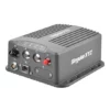
SingularXYZ SV100 Dual GNSS Receiver Dual Antenna RTK
Get the best price for your setup
Contact our experts for the best possible price and configuration.
- Fast response
- Expert configuration advice
- No overpaying for features you do not need
The SingularXYZ SV100 Dual GNSS Receiver is a rugged dual-antenna RTK GNSS solution for vehicle navigation, machine guidance, construction equipment, agriculture, GIS and industrial automation. It provides centimeter-level positioning and heading information from a single integrated unit, helping operators guide machinery, monitor assets and connect accurate GNSS data to onboard control systems. The receiver tracks multiple satellite constellations and supports RTK corrections through 4G or optional UHF. Bluetooth, Wi-Fi, Ethernet, RS232 and USB connectivity make setup and system integration practical for field teams, surveyors, engineers and equipment manufacturers. Its IP67 aluminum housing, loop recording and wide operating temperature range support demanding outdoor and in-vehicle applications.
SingularXYZ SV100 Dual GNSS Receiver Highlights
| Positioning Accuracy | RTK: 8 mm + 1 ppm horizontal; 15 mm + 1 ppm vertical |
|---|---|
| Heading Accuracy | (0.2/R)° based on antenna baseline length |
| Satellite Tracking | 1,408 channels; GPS, BDS, GLONASS, Galileo, QZSS and NavIC |
| Communication | 4G, optional UHF, Bluetooth, Wi-Fi, Ethernet, RS232 and USB |
| Rugged Design | IP67 aluminum housing; 162 × 142 × 65 mm; 1.05 kg without battery |
Valued customers:










Find RTK Networks
Search NTRIP providers and connect to reliable RTK correction services.
Description
SingularXYZ SV100 Dual for Precision Vehicle Navigation and Machine Guidance
The SingularXYZ SV100 Dual is a rugged dual-antenna GNSS receiver designed for applications that require both accurate positioning and dependable heading information. It is built for vehicle navigation, machine guidance, agricultural equipment, construction machinery, autonomous platforms, industrial vehicles, marine systems and other equipment that needs reliable satellite-based positioning in the field.
Unlike a standard single-antenna GNSS receiver, the SV100 Dual uses two GNSS antenna connections to calculate heading from the distance and direction between the antennas. This allows a vehicle or machine control system to determine not only where it is, but also which direction it is facing. When combined with RTK corrections, the receiver can provide centimeter-level positioning suitable for precision guidance, automated steering, construction equipment positioning and other high-accuracy workflows.
Accurate Positioning with Dual-Antenna Heading
The dual-antenna design is one of the main advantages of the SV100 Dual. A conventional GNSS receiver may provide an accurate position while stationary or moving, but heading can be less reliable when the vehicle is moving slowly or stopped. By using two separated antennas, the SV100 Dual can calculate orientation from the antenna baseline, making it useful for machine guidance, vehicle navigation and industrial automation where the direction of travel must remain stable and available.
With RTK corrections, the receiver is specified to provide horizontal positioning accuracy of 8 mm plus 1 ppm and vertical accuracy of 15 mm plus 1 ppm under suitable operating conditions. In practical fieldwork, this level of precision can help equipment operators follow planned lines, position machinery accurately, monitor vehicle movement and maintain repeatable passes across a work area. Actual results depend on correction quality, antenna installation, satellite visibility, multipath, machine vibration and the surrounding environment.
The heading accuracy is defined in relation to the antenna baseline. A longer, correctly installed baseline generally improves heading performance, while a shorter baseline may provide less angular precision. For this reason, the two antennas should be mounted securely, with a known distance between them and a clear view of the sky. Correct installation is especially important when the receiver is being integrated with automated steering, machine-control software or a vehicle navigation computer.
Multi-Constellation and Multi-Frequency GNSS Tracking
The SV100 Dual tracks multiple satellite systems, including GPS, BeiDou, GLONASS, Galileo, QZSS, NavIC and supported SBAS services. Tracking several constellations gives the receiver access to more satellites and more signal options, which can improve satellite availability in difficult locations such as construction sites, tree-lined areas, urban streets and working environments where part of the sky is blocked by equipment or structures.
The receiver supports multiple GNSS frequencies across the supported constellations and uses multi-frequency signal processing to improve positioning reliability. Its anti-jamming technology is intended to help maintain usable GNSS data in environments where electrical equipment, vehicle systems, radios or other sources of interference may affect satellite reception. This is valuable for industrial vehicles, agricultural machinery, construction equipment and autonomous platforms that operate around motors, controllers, transmitters and other electronic systems.
Although multi-constellation GNSS can improve availability, no satellite receiver can guarantee full accuracy under every condition. Heavy obstruction, reflected signals, poor antenna placement, interference or a loss of RTK corrections can reduce the positioning result. The SV100 Dual is best used with a suitable external correction service, base station or compatible correction source when centimeter-level results are required.
RTK Corrections Through 4G or UHF
The receiver can obtain RTK correction data through a 4G cellular connection or an optional UHF modem, depending on the configuration and the conditions at the worksite. 4G is useful when the machine operates in an area with cellular coverage and access to an NTRIP or similar correction service. UHF can be useful on sites where a local base station is available or where cellular coverage is limited.
The optional UHF configuration supports the 410–470 MHz range and can provide a working range of up to 15 km in optimal conditions. Real-world radio range depends on terrain, antenna height, obstructions, local regulations, radio configuration and the type of base or rover equipment being used. Buyers should confirm the required UHF compatibility before ordering, as enhanced UHF configurations may not be compatible with standard UHF equipment from other brands.
For network-based workflows, the SV100 Dual supports correction and communication protocols used in professional GNSS systems, including RTCM formats, NTRIP Server, NTRIP Caster, TCP and MQTT options. This allows the receiver to be integrated into a wider positioning network or connected to correction services used by surveying, construction, agriculture and industrial automation teams.
Flexible Data Output for Equipment Integration
The SV100 Dual is designed as an integration receiver rather than a handheld survey controller. Position, velocity, time and heading data can be sent to a vehicle computer, machine-control system, agricultural console, navigation display, GIS device, industrial controller or autonomous platform.
Available communication options include RS232 serial output, USB, Ethernet, Wi-Fi, Bluetooth and 4G, depending on the selected configuration and system setup. NMEA-0183 and the manufacturer’s binary format are supported, with selectable data update rates from 1 to 50 Hz. A higher update rate can be useful for moving machinery and control systems that need frequent position updates, while lower rates may be appropriate for monitoring, logging or less demanding navigation applications.
The 10-pin connector combines power, RS232, USB and a PPS output. An RJ45 Ethernet port provides a wired connection for professional configuration and data communication. Separate antenna connections are provided for the GNSS antennas, with additional connections available for optional UHF and 4G antennas. A SIM card slot is included for cellular communication where a supported mobile data service is used.
Simple Configuration in the Field
The SV100 Dual can be configured through its built-in WebUI using Wi-Fi or Ethernet. This provides access to professional settings such as communication parameters, correction sources, data output, recording options, system status and firmware updates. This approach is useful for installers, engineers and technicians who need detailed control while commissioning a machine or diagnosing a field system.
For field setup and routine checks, the SingularNav Android application can connect to the receiver through Bluetooth. This gives operators a more convenient way to review receiver status and adjust essential settings without carrying a laptop to the machine. The combination of Bluetooth field access and WebUI configuration allows the same receiver to serve both everyday operators and technical integration teams.
Four LED indicators provide quick visual information about power or battery status, satellite tracking, RTK status and network connectivity. These indicators can help an operator identify whether the receiver is powered, receiving satellites, holding an RTK solution or connected to the required correction network before beginning work.
Built for Construction Sites, Agricultural Equipment and Industrial Vehicles
The SV100 Dual has a compact housing with a flat underside and distributed mounting holes for installation on vehicles and machinery. It can be mounted on tractors, construction equipment, utility vehicles, autonomous ground vehicles, industrial machines and marine platforms where a fixed GNSS installation is preferred.
For construction professionals, the receiver can support machine positioning, site vehicle guidance, grading or equipment-monitoring systems when paired with the appropriate control software and correction service. It can help connect a machine to a digital site plan or positioning workflow, but it is not a complete machine-control system by itself. The final result depends on the display, control hardware, hydraulic or steering interface and software used with the receiver.
For agriculture, the dual-antenna heading output can be useful for guidance and steering applications where the direction of the tractor or implement needs to be known accurately. It can support repeatable passes, field navigation and integration with agricultural consoles, provided the receiver is correctly installed and connected to a compatible steering or guidance system.
For surveyors and GIS professionals, the SV100 Dual is best suited to vehicle-based mapping, mobile data collection, site monitoring, navigation and equipment integration rather than traditional pole-mounted rover surveying. Its serial, Ethernet, USB and network interfaces make it suitable for connecting GNSS data to a vehicle, sensor platform or custom GIS workflow.
For drone and autonomous-system operators, the receiver may be considered where a vehicle or ground platform needs high-accuracy positioning and heading. It is not a complete drone navigation system and should only be integrated after checking the communication protocol, power requirements, antenna arrangement and compatibility of the flight or autonomy controller.
Rugged Housing for Outdoor Work
The receiver is built with an aluminum alloy housing and is rated IP67 for protection against dust and temporary water exposure. It is specified for working temperatures from -40°C to +75°C, with storage temperatures from -55°C to +85°C. The unit is also designed to withstand vibration associated with vehicle and machine installations and is rated to survive a 1-meter drop onto concrete under the stated test conditions.
This construction makes the SV100 Dual suitable for demanding outdoor work where equipment may be exposed to dust, rain, mud, vibration, temperature changes and accidental knocks. IP67 protection does not mean the receiver should be deliberately submerged or left unprotected in conditions beyond its rated limits. Cable connections, antenna fittings and mounting hardware should be installed correctly to maintain reliable performance in the field.
Internal Data Recording and Post-Processing Support
The receiver includes 8 GB of internal storage with loop recording support. GNSS data can be recorded in RINEX 3.02 or RINEX 3.04 formats, as well as the manufacturer’s binary format. This makes it possible to retain positioning data for later review, quality control, troubleshooting, documentation or post-processing workflows.
Internal recording is useful when cellular service is interrupted, when a project requires an independent data log or when engineers need to examine receiver performance after a job. The receiver can record static or operational data depending on the selected configuration. Storage expansion may be available for specific requirements, so buyers with long-duration logging needs should confirm the intended configuration before purchase.
Power Options for Fixed and Mobile Installations
The SV100 Dual is designed for vehicle and industrial power systems and can operate from 9–28 V DC without the internal battery. With the internal battery configuration, the supported input range is 9–22 V. Typical power consumption is approximately 3.5 W, making it suitable for connection to many vehicle electrical systems when the correct power cable and protection are used.
An optional 6600 mAh internal battery can provide up to 13 hours of operating time under stated conditions. Battery performance varies with temperature, communication activity, correction method, recording settings and connected accessories. The battery option can be useful for temporary installations, commissioning work, portable testing or situations where the receiver needs to continue operating while vehicle power is unavailable.
Who Should Choose the SV100 Dual?
The SingularXYZ SV100 Dual is a strong fit for buyers who need a fixed, dual-antenna GNSS receiver that can provide high-accuracy positioning and heading to another system. It is particularly relevant to:
- Construction companies integrating GNSS with heavy equipment, machine guidance or site vehicles.
- Surveyors and mapping teams collecting vehicle-based positioning data.
- Agricultural businesses using precision guidance or automated steering systems.
- Engineers developing autonomous ground vehicles, robotics or industrial navigation platforms.
- GIS professionals connecting accurate GNSS data to mobile mapping or asset-monitoring systems.
- Marine and industrial operators requiring robust positioning and heading information.
It may not be the right choice for buyers looking for a complete handheld RTK rover kit with a survey pole, data collector and field-survey software. The SV100 Dual is primarily an OEM-style receiver for integration into a machine, vehicle or professional positioning system. The correct antenna spacing, correction source, communication interface and control software are essential to achieving the intended result.
Professional Support from Global GPS Systems
Choosing the right GNSS receiver often depends on more than positioning accuracy alone. The antenna layout, correction method, UHF or 4G requirements, power supply, data protocol and machine-control interface all need to match the intended application. Global GPS Systems can help buyers evaluate the SV100 Dual configuration for surveying, construction, agriculture, machine guidance, GIS, vehicle navigation and other high-accuracy GNSS applications.
Contact Global GPS Systems before ordering if you need help confirming antenna requirements, RTK correction compatibility, communication options, UHF configuration, power connections or integration with an existing machine or navigation system. This helps ensure that the receiver is matched to the actual field workflow rather than selected only from headline specifications.
Datasheets & Manuals
Specifications
SV100 Dual Specifications
Product Overview
| Product type | Dual-antenna multi-constellation GNSS receiver |
|---|---|
| Brand | SingularXYZ |
| Model | SV100 Dual |
| Primary functions | High-precision positioning, RTK positioning, dual-antenna heading, navigation data output, correction data transmission and GNSS data recording |
| Designed applications | Vehicle navigation and machine guidance |
| Typical users | Surveying professionals, precision agriculture operators, construction and machine-control teams, autonomous vehicle developers, industrial automation integrators, transportation operators and marine users |
GNSS Tracking
| GNSS channels | 1,408 channels |
|---|---|
| Supported constellations | GPS, BeiDou, GLONASS, Galileo, QZSS and NavIC |
| BeiDou signals | B1I, B2I, B3I, B1C, B2a and B2b |
| GPS signals | L1 C/A, L1C, L2C, L2P(Y) and L5 |
| GLONASS signals | G1, G2 and G3 |
| Galileo signals | E1, E5a, E5b and E6 |
| QZSS signals | L1 C/A, L1C, L2C and L5 |
| NavIC signals | L5 |
| SBAS support | WAAS, EGNOS, SDCM, BDSBAS and GAGAN |
| L-band | Supported |
| Anti-jamming technology | Multi-frequency anti-jamming technology for improved signal integrity in electromagnetically noisy or obstructed environments |
| Dual-antenna operation | Supports simultaneous positioning and heading determination using a dual-antenna GNSS engine |
Positioning and Heading Performance
| Positioning mode | Horizontal accuracy | Vertical or 3D accuracy |
|---|---|---|
| Standalone | 1.5 m | 2.5 m vertical |
| DGPS | 0.4 m | 0.8 m vertical |
| Static post-processing | 2.5 mm + 0.5 ppm | 5 mm + 0.5 ppm vertical |
| RTK | 8 mm + 1 ppm | 15 mm + 1 ppm vertical |
| PPP | 5 cm | 10 cm vertical |
| SBAS | < 1.0 m 3D RMS | |
| Velocity accuracy | 0.03 m/s |
|---|---|
| Heading accuracy | (0.2 / R)°, where R is the antenna baseline distance in meters |
| Time accuracy | 20 ns |
| Cold-start time | < 30 seconds |
| Typical RTK initialization time | < 5 seconds |
| RTK initialization reliability | > 99.9% |
| Re-acquisition time | < 1 second |
Data Formats and Update Rate
| Data output formats | NMEA-0183 and proprietary binary *.xyz format |
|---|---|
| Selectable data update rate | 1 to 50 Hz |
| Correction data formats | RTCM v3.3, v3.2, v3.1 and v3.0 |
| Supported data streams | Navigation data, observation data, RTCM, CMR and custom data |
| Network protocols | TCP, MQTT, NTRIP Server and NTRIP Caster |
| NTRIP client support | Supported for receiving corrections from CORS and other NTRIP services |
| MQTT | Supported; protocol customization available |
Communication and Connectivity
| 4G modem | Supported |
|---|---|
| 4G frequency bands | FDD-LTE B1/B3/B5/B7/B8; TDD-LTE B38/B39/B40/B41 |
| 3G frequency bands | TDSCDMA B34/B39; WCDMA B1/B2/B5/B8 |
| 2G and CDMA bands | GSM B2/B3/B5/B8; CDMA1x/CDMA2000 BC0/BC1 |
| UHF modem | Optional; supports LoRa transmission and several receive protocols |
| UHF working range | Up to 15 km under optimal conditions |
| UHF frequency range | 410 to 470 MHz |
| UHF transmit and receive protocol | LoRa |
| Additional UHF receive protocols | TRIMTALK, TRANSEOT, SATEL, TRIMMARK3 and other supported protocols |
| UHF channel spacing | 25 kHz |
| UHF transmit power | Selectable from 0.5 W to 2 W |
| Bluetooth | Bluetooth 4.0 dual mode |
| Wi-Fi | IEEE 802.11 a/b/g/n/ac |
| FTP | FTP download supported |
| DDNS | NAT-DDNS support |
Interfaces and Connectors
| Main multi-pin connector | One 10-pin connector containing RS232, 1 PPS output, USB and power supply connections |
|---|---|
| Ethernet | One RJ45 Ethernet port |
| GNSS antenna connection | One TNC connector for GNSS antenna connection |
| UHF antenna connection | One TNC connector for optional UHF antenna connection |
| 4G antenna connection | One SMA connector for 4G antenna connection |
| SIM card slot | One SIM card slot |
| Serial output | RS232 |
| Timing output | 1 PPS |
| USB function | Data connection, data transfer and access to recorded files |
Configuration and User Interface
| Configuration interfaces | WebUI via Ethernet or Wi-Fi; Android configuration app via Bluetooth |
|---|---|
| WebUI functions | Receiver configuration, satellite and positioning status monitoring, data transmission setup, data storage management and system upgrade |
| Android app | SingularNav Android application for field configuration and status checking |
| Supported working modes | Rover mode, base mode and single-point positioning mode |
| Status indicators | Four LED indicators for battery, satellite tracking, RTK status and network status |
| Power switch | Power switch located on the 10-pin cable |
| Remote management | Remote status checking and configuration through Ethernet, Wi-Fi, DDNS or NAT-DDNS connections |
| Firmware update | Firmware update supported through the WebUI using ZIP-format update files |
Data Recording and Storage
| Internal storage | 8 GB |
|---|---|
| Storage expansion | Expandable to 32 GB according to configuration or user requirements |
| Storage formats | RINEX 3.02, RINEX 3.04 and proprietary binary *.xyz format |
| Recording mode | Manual or automatic recording |
| Loop recording | Supported; the earliest files can be overwritten when storage is full |
| Selectable recording intervals | 0.05, 0.1, 0.2, 1, 5, 10 or 60 seconds |
| File split intervals | 15 minutes, 1 hour, 2 hours, 4 hours or 24 hours |
| Typical storage duration | Approximately one month at a 1 Hz sample frequency, depending on configuration and available storage |
| File access | Recorded files can be downloaded through the WebUI or USB connection |
Electrical Specifications
| Power consumption | 3.5 W |
|---|---|
| Input voltage without internal battery | 9 to 28 V DC |
| Input voltage with internal battery | 9 to 22 V DC |
| Optional internal battery | 6,600 mAh |
| Battery operating time | Up to 13 hours |
| Mean time between failures | More than 20,000 hours |
Physical Specifications
| Dimensions | 162 × 142 × 65 mm, including connectors |
|---|---|
| Weight | 1.05 kg without battery |
| Housing material | Aluminum alloy |
| Mounting design | Compact, flat-base housing with mounting points suitable for vehicles, machinery and fixed installations |
| Mechanical design | Ruggedized housing with anti-vibration construction for in-vehicle and industrial environments |
Environmental Specifications
| Operating temperature | -40 °C to +75 °C |
|---|---|
| Storage temperature | -55 °C to +85 °C |
| Humidity | 95% relative humidity, non-condensing |
| Water and dust protection | IP67-rated housing |
| Drop resistance | Designed to survive a 1 m drop onto concrete |
| Vibration resistance | Designed in accordance with MIL-STD-810 |
| Suitable operating environments | Outdoor, agricultural, construction, industrial, transportation, marine and autonomous-machine environments |
Applications and Industry Use
| Precision agriculture | Tractor guidance, auto-steering integration, field mapping, implement guidance and agricultural machine control |
|---|---|
| Construction and infrastructure | Machine guidance, heavy-equipment positioning, site layout, grading and earthmoving applications |
| Autonomous systems | Unmanned ground vehicles, autonomous robots, vehicle navigation and heading reference systems |
| Transportation | Vehicle navigation, fleet-mounted positioning systems and high-precision heading applications |
| Industrial automation | Machine positioning, industrial controllers, automated equipment and GNSS-enabled control systems |
| Marine operations | Marine vessel navigation and heading information for outdoor waterborne equipment |
| Surveying and geospatial | RTK positioning, GNSS data collection, reference workflows and high-precision navigation projects |
| Public safety and field operations | Rugged outdoor positioning, navigation and machine or vehicle tracking workflows |
Accessory and Package Information
| Item | Quantity | Notes |
|---|---|---|
| SV100 Dual receiver | 1 | Receiver unit; exact configuration may vary |
| Data cable | Configuration dependent | Used for power and data connections |
| GNSS antenna | Configuration dependent | External antenna selection depends on the application and dual-antenna setup |
| Antenna cable | Configuration dependent | 5 m cable listed among available accessory options |
| Charger or power supply | Configuration dependent | Required power accessory depends on the selected installation and battery configuration |
| LAN cable | Configuration dependent | Used for Ethernet configuration and data communication |
| Mounting hooks and screws | Configuration dependent | Used for installation and mounting |
| Optional UHF accessories | Configuration dependent | UHF modem and antenna availability depends on the selected receiver configuration |
| Optional internal battery | Configuration dependent | 6,600 mAh internal battery option with up to 13 hours of operating time |
Configuration Notes
| UHF compatibility | The enhanced UHF base option may not be compatible with standard UHF rovers from other manufacturers. A normal UHF option may be available when cross-brand compatibility is required. |
|---|---|
| Heading baseline | Heading accuracy improves as the distance between the two GNSS antennas increases, subject to installation and operating conditions. |
| Battery service | The internal battery option should be purchased or replaced through an authorized SingularXYZ distributor. |
| Specification status | Technical specifications may be revised by the manufacturer without notice. |
Specifications and package contents may vary by configuration, region or manufacturer update. Always check the current configuration before ordering.
Reviews (0)
Only logged in customers who have purchased this product may leave a review.
FAQ
SV100 Dual FAQ
Product Overview and Key Features
What is the SingularXYZ SV100 Dual?
The SingularXYZ SV100 Dual is a dual-antenna GNSS receiver designed for high-precision vehicle navigation, machine guidance, industrial automation and other applications that require accurate positioning and reliable heading information.
What is the main advantage of a dual-antenna GNSS receiver?
A dual-antenna receiver calculates heading from the distance and orientation between two GNSS antennas. This allows the SV100 Dual to provide heading information even when the vehicle or machine is stationary, without relying on an IMU calibration process or an additional heading sensor.
Does the SV100 Dual provide RTK positioning?
Yes. When connected to a suitable RTK correction source, the SV100 Dual can provide high-precision RTK positioning with typical accuracy of approximately 8 mm plus 1 ppm horizontally and 15 mm plus 1 ppm vertically, subject to satellite visibility, correction quality, antenna installation and operating conditions.
Which satellite systems does the SV100 Dual support?
The receiver supports multiple GNSS constellations, including GPS, BeiDou, GLONASS, Galileo, QZSS and NavIC. It also supports SBAS services such as WAAS, EGNOS, SDCM, BDSBAS and GAGAN, depending on regional availability.
Can the SV100 Dual work in challenging signal environments?
The receiver includes multi-frequency anti-jamming technology and multi-constellation tracking to improve GNSS data quality in environments such as urban areas, near tree cover and around machinery. However, heavy obstruction, interference, multipath and poor antenna placement can still reduce positioning performance.
What is the heading accuracy of the SV100 Dual?
The specified heading accuracy is calculated as (0.2/R) degrees, where R is the distance between the two antennas in metres. Increasing the antenna baseline generally improves heading accuracy, provided the antennas are installed securely and correctly.
Applications, Users and Industries
Who uses the SV100 Dual GNSS Receiver?
The receiver is intended for system integrators, agricultural equipment manufacturers, machine-control specialists, robotics developers, vehicle automation engineers, marine technology companies, construction companies and industrial users who need precise positioning and heading data.
Which industries use the SV100 Dual?
Typical industries include precision agriculture, construction, machine control, vehicle navigation, robotics and unmanned systems, industrial automation, marine operations, surveying support, transportation, infrastructure monitoring and Internet of Things deployments.
Can the SV100 Dual be used for agricultural machinery?
Yes. It can be installed on tractors and other agricultural machines to supply positioning and heading data to guidance, auto-steering, field mapping, variable-rate application and machine-control systems. Compatibility depends on the agricultural display, steering controller and communication interface used.
Is the SV100 Dual suitable for construction and heavy equipment?
Yes. Its rugged housing, vibration-resistant design, dual-antenna heading capability and RTK support make it suitable for construction machinery, heavy equipment, machine guidance and other outdoor applications that require accurate vehicle orientation and position.
Can the SV100 Dual be used in autonomous vehicles or robots?
Yes. The receiver can provide high-precision position, velocity and heading data to autonomous ground vehicles, mobile robots and other unmanned platforms. It is best used as part of a complete navigation system that may also include wheel odometry, cameras, lidar, radar or inertial sensors when operating in areas with intermittent GNSS visibility.
Can the SV100 Dual be used on marine vessels?
Yes. The receiver can be integrated into marine navigation, survey and unmanned surface vessel systems when the antenna installation, power supply, communications and correction service are appropriate for the vessel and operating environment.
Connectivity, Configuration and Data
How does the SV100 Dual receive RTK corrections?
RTK corrections can be received through a 4G cellular connection or through an optional UHF modem. The receiver supports RTCM correction formats, including RTCM 3.0, 3.1, 3.2 and 3.3. A compatible NTRIP or other correction service is required for network-based RTK.
Does the SV100 Dual support NTRIP?
Yes. The receiver supports network communication functions for RTK correction workflows, including NTRIP Server and NTRIP Caster configurations. The exact setup depends on whether the receiver is being used as a rover, base, server or integrated navigation sensor.
What communication interfaces are available?
The SV100 Dual provides 4G, Bluetooth, Wi-Fi, Ethernet and USB connectivity. It also includes an RS232 serial interface and a PPS output through its 10-pin connector. These interfaces allow integration with vehicle computers, agricultural consoles, machine controllers, navigation systems and industrial automation equipment.
What data formats does the receiver output?
The receiver supports NMEA-0183 and SingularXYZ binary XYZ data formats. It can output navigation data at selectable rates from 1 Hz to 50 Hz, depending on the system configuration and connected equipment.
How is the SV100 Dual configured?
Field users can configure the receiver through the SingularNav Android application using Bluetooth. Professional users can access the built-in WebUI through Wi-Fi or Ethernet to configure operating parameters, data transmission, storage, system status and firmware updates.
Can the SV100 Dual record GNSS data?
Yes. It includes internal storage with loop-recording support. Data can be stored in RINEX 3.02 or RINEX 3.04 format and in the proprietary XYZ binary format. The standard storage capacity is 8 GB, with expanded storage available depending on the configuration.
Installation, Power and Environmental Specifications
How is the SV100 Dual installed on a vehicle or machine?
The receiver has a flat underside and distributed mounting holes to support installation on tractors, construction equipment, industrial vehicles, autonomous robots and other machinery. The two GNSS antennas should be mounted securely, with a measured and known baseline, on a stable surface that minimizes flexing and vibration.
How many antennas are required?
The SV100 Dual requires two compatible GNSS antennas for dual-antenna heading. The antennas should be connected to the two GNSS antenna inputs and installed with a suitable separation and clear view of the sky. Antenna cables, mounts and other accessories may depend on the selected configuration.
What power supply does the SV100 Dual require?
Without the optional internal battery, the receiver accepts 9–28 V DC input. With the internal battery installed, the specified input range is 9–22 V. Typical power consumption is approximately 3.5 W.
Does the SV100 Dual have an internal battery?
An optional 6,600 mAh internal battery is available. With the battery installed, the receiver can provide up to approximately 13 hours of operating time, depending on the communication functions, correction method and environmental conditions.
Is the SV100 Dual waterproof and dustproof?
Yes. The receiver has an IP67-rated housing, providing protection against dust and temporary water immersion when the connectors are correctly protected and the unit is used within the specified conditions.
What operating temperatures does the SV100 Dual support?
The specified working temperature range is -40°C to +75°C. The specified storage temperature range is -55°C to +85°C. The receiver is also designed for vibration-prone vehicle and machine environments and is rated to withstand a 1-metre drop onto concrete under the stated test conditions.
What are the dimensions and weight of the SV100 Dual?
The receiver measures approximately 162 × 142 × 65 mm, including connectors, and weighs approximately 1.05 kg without the optional battery.
Is the optional UHF modem compatible with other brands?
Compatibility depends on the UHF configuration selected. The enhanced UHF option may not be compatible with standard UHF rovers from other manufacturers. A normal UHF option is available for applications that require compatibility with UHF equipment from other brands, so this requirement should be confirmed before ordering.

 GPS & GNSS
 Total Stations
 Data collectors
 Software
 Correction services
 Machine control
 External radio
 Marine
 Accessories
Reviews
There are no reviews yet