

 GPS & GNSS
 Lidar scanning
 Total Station
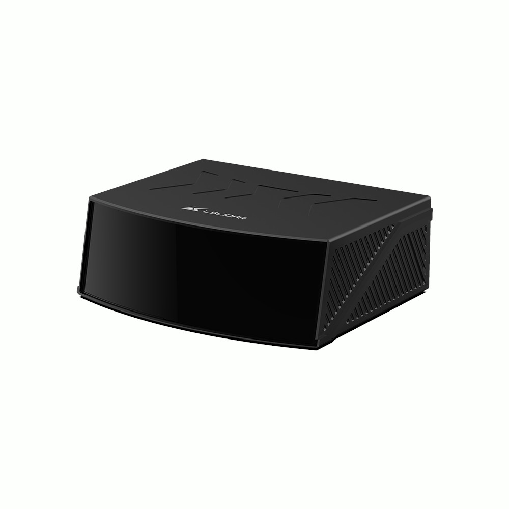
LS Lidar CX126S3 126 Channel Long Range 3D LiDAR
Get the best price for your setup
Contact us for expected delivery time.
- Fast response
- Expert configuration advice
- No overpaying for features you do not need
The LS Lidar CX126S3 is a compact 126-channel hybrid solid-state 3D LiDAR designed for autonomous vehicles, robotics, industrial machines and perception systems. Its 120° × 25° field of view provides wide forward coverage, while a detection range of up to 200 m and 160 m at 10% reflectivity helps identify darker objects at useful working distances. With up to 840,000 points per second, ≤3 cm range precision and a lightweight 635 g housing, the CX126S3 delivers dense real-time 3D environmental data without requiring a large mechanical LiDAR.
LS Lidar CX126S3 Highlights
| LiDAR type | 126-channel hybrid solid-state 3D LiDAR |
|---|---|
| Detection range | Up to 200 m, 160 m at 10% reflectivity |
| Range precision | ≤3 cm |
| Field of view | 120° horizontal × 25° vertical |
| Point rate | 840,000 points/sec |
| Channels | 126 |
| Protection | IP6K9K |
Valued customers:










Find RTK Networks
Search NTRIP providers and connect to reliable RTK correction services.
Description
Compact 126 Channel LiDAR for Real Time 3D Perception
The LS Lidar CX126S3 is a hybrid solid-state 3D LiDAR developed for autonomous vehicles, robotics, industrial machinery and other applications that require detailed real-time information about the surrounding environment. Its 126 laser channels create multiple vertical measurement layers across a wide forward-facing field of view, allowing software to determine the distance, shape and position of objects in three dimensions.
Compared with a traditional rotating 360° LiDAR, the CX126S3 concentrates its measurements into the area in front of the sensor. This makes it particularly suitable for integration into vehicles, robots and machines where forward perception, obstacle detection and environmental awareness are the main requirements.
Long Range Detection Including Dark Targets
The CX126S3 provides a maximum detection distance of up to 200 metres and is specified for approximately 160 metres at 10% target reflectivity. The 10% reflectivity figure is particularly useful when comparing LiDAR sensors because dark surfaces such as black vehicles, tyres and some construction materials return less laser energy than brighter objects.
In practical use, this long-range capability gives an autonomous or machine-control system more distance over which to identify surrounding objects and calculate their location. Actual detection distance will still depend on target reflectivity, weather, installation and environmental conditions.
126 Channels for Detailed 3D Coverage
The CX126S3 uses 126 measurement channels distributed across a 25° vertical field of view. These vertical layers allow the sensor to measure objects at different heights rather than only across a single horizontal plane.
This is useful when detecting vehicles, pedestrians, machinery, kerbs, structures and other objects with three-dimensional shape. For robotics and autonomous systems, the additional vertical information can help software distinguish the road or ground surface from obstacles and surrounding infrastructure.
120 Degree Horizontal Field of View
A 120° horizontal field of view gives the CX126S3 broad forward coverage. This allows one sensor to observe a large area in front of a vehicle or machine without requiring full mechanical rotation.
The wide viewing angle is particularly practical for front-mounted perception systems, mobile robots and industrial vehicles where obstacles can approach from different directions. It can also reduce the number of sensors required to cover the main operating area, depending on the geometry of the installation.
Up to 840000 Points Per Second
The CX126S3 produces up to 840,000 measurement points per second. These points form a dense 3D representation of the sensor’s surroundings that can be processed by autonomous driving, robotics or industrial perception software.
A high point rate helps preserve object shape and environmental detail as the vehicle or machine moves. This is useful for applications such as obstacle recognition, free-space detection, localisation and environmental modelling where software needs more information than a simple distance measurement can provide.
≤3 cm Range Precision
The CX126S3 is specified with ≤3 cm range precision. This provides consistent distance measurements for locating objects and surfaces within the LiDAR point cloud.
For an autonomous machine or robot, consistent ranging data helps perception software determine where an obstacle is located relative to the sensor. Final system accuracy will also depend on sensor calibration, mounting, vehicle movement and any GNSS, IMU or camera data used alongside the LiDAR.
Adjustable Scanning Frequency
The CX126S3 supports frame rates of 5, 10 and 20 Hz. This gives integrators the flexibility to select an update rate appropriate for the movement speed and processing capacity of the system.
At higher update rates, the perception system receives more frequent information about moving objects and changes in the environment. Lower frame rates may be appropriate where movement is slower or where reducing processing load is more important.
Fine Angular Resolution
Horizontal angular resolution can be configured at approximately 0.09°, 0.18° or 0.36°, while vertical resolution is specified at approximately 0.2°. Finer angular resolution means measurements are positioned closer together, allowing smaller details and object boundaries to be represented more clearly in the point cloud.
This makes the CX126S3 suitable not only for basic obstacle detection but also for perception applications that benefit from detailed object contours and consistent spatial coverage.
Compact and Lightweight Vehicle Integration
At approximately 110 × 100.4 × 45 mm and only 635 g, the CX126S3 is significantly smaller than many traditional multi-channel mechanical LiDAR sensors. Its compact housing makes it easier to install in a vehicle body, front bumper, robot or custom sensor enclosure.
Low weight is also useful on mobile platforms where payload matters. It can simplify mounting and reduce the mechanical load placed on robotic, vehicle or other moving systems.
Low Power Consumption
The CX126S3 operates from 9–16 VDC and has a specified power consumption of approximately 13.5 W. This relatively low power requirement is useful for battery-powered robots and vehicle installations where several cameras, computers and positioning sensors may already be drawing power from the same electrical system.
Lower power consumption also reduces the amount of heat that needs to be managed inside a compact sensor installation.
Automotive Ethernet Connectivity
Point-cloud data is transmitted through Automotive Ethernet, allowing the CX126S3 to connect to an embedded computer or automotive perception controller. The high-speed interface is suitable for transferring the sensor’s dense real-time point-cloud stream.
For complete autonomous or robotic systems, the LiDAR data can be combined with cameras, GNSS, IMUs and other sensors. Sensor fusion software can then use the strengths of each sensor to build a more complete representation of the operating environment.
Designed for Demanding Mobile Applications
The CX126S3 carries an IP6K9K protection rating and is specified for operation from -40°C to +85°C. LS Lidar also publishes vibration and shock specifications intended for integration into moving equipment and vehicles.
These characteristics make the sensor suitable for installations where vibration, dust, water and large temperature changes need to be considered. As with any LiDAR installation, the final mounting position, cable routing and sensor window should be designed to keep the optical surface clear and correctly aligned.
Typical Applications
- Autonomous vehicles and ADAS development
- Autonomous mobile robots and industrial robots
- Construction and industrial machine perception
- Obstacle and collision avoidance systems
- Environmental perception and object detection
- Research and autonomous platform development
- Multi-sensor systems using LiDAR cameras GNSS and IMU data
CX126S3 Compared with Single Channel LiDAR
A single-channel LiDAR measures objects along one scanning plane and can be an efficient solution for simple obstacle detection or 2D mapping. The CX126S3 adds 126 measurement channels across a 25° vertical viewing area, allowing it to capture the three-dimensional shape and height of surrounding objects.
This makes the CX126S3 more suitable when software needs to distinguish different parts of a scene, detect objects at varying heights or create a detailed 3D perception model. Applications that only require a simple horizontal distance profile may not need the additional data produced by a multi-channel sensor.
Buying the LS Lidar CX126S3 from Global GPS Systems
Global GPS Systems supplies professional LiDAR, GNSS and positioning equipment for autonomous systems, robotics, construction, surveying and industrial applications. Our team can help evaluate whether the CX126S3 provides the right balance of detection range, field of view, point density and integration requirements for your project.
When a LiDAR is being combined with GNSS, an IMU, cameras or an embedded processing computer, the complete system architecture should be considered before selecting individual components. Global GPS Systems can assist with choosing compatible positioning and perception equipment for the intended workflow.
Specifications
LSLiDAR CX126S3 Auto-Grade Hybrid Solid-State LiDAR Specifications
Product Overview
| Product name | LSLiDAR CX126S3 |
|---|---|
| Product family | CX Series |
| Product type | Automotive-grade hybrid solid-state 3D LiDAR |
| Measurement principle | Time of Flight (ToF) |
| Scanning channels | 126 |
| Primary purpose | Long-range, high-density 3D environmental perception and obstacle detection |
| Primary applications | Autonomous driving, ADAS, intelligent transportation, rail transportation, security, smart logistics, mapping, robotics and industrial automation |
| Vehicle integration | Compact form factor designed for roof, front-bumper and other vehicle-integrated installations |
Laser Specifications
| Laser wavelength | 905 nm |
|---|---|
| Laser safety class | Class 1 |
| Eye-safe operation | Class 1 eye-safe when operated according to manufacturer requirements |
| Detection technology | Direct Time of Flight |
| Anti-interference technology | Laser coding technology for resistance to strong sunlight and interference from other LiDAR sensors |
Detection Range and Accuracy
| Detection range – current seller / recent manufacturer documentation | 180 m at 10% target reflectivity |
|---|---|
| Alternative manufacturer specification | Some LSLiDAR CX126S3 documentation specifies 200 m maximum range with 160 m at 10% reflectivity |
| Range accuracy | ≤3 cm |
| Low-reflectivity target capability | Designed for detection of dark and low-reflectivity objects |
| Long-range application | Designed for medium- to long-distance vehicle and environmental perception |
Field of View
| Horizontal field of view | 120° |
|---|---|
| Vertical field of view | 25° |
| Vertical angular coverage | -12.5° to +12.5° |
| Combined field of view | 120° × 25° (H × V) |
| Vertical angular resolution | 0.2° |
Scanning Frequency and Horizontal Resolution
| Frame Rate | Horizontal Angular Resolution |
|---|---|
| 5 Hz | 0.09° |
| 10 Hz | 0.18° |
| 20 Hz | 0.36° |
Point Cloud Performance
| Maximum point generation rate | 840,000 points/second |
|---|---|
| Channel count | 126 channels |
| Supported frame rates | 5 Hz, 10 Hz and 20 Hz |
| Point cloud dimensionality | 3D |
| Distance information | Supported |
| Reflectivity information | Supported |
| Environmental reconstruction | High-density point cloud suitable for real-time 3D perception |
Communication and Data Interface
| Communication interface | Automotive Ethernet |
|---|---|
| Primary data output | Real-time LiDAR point cloud and sensor data |
| Vehicle-network integration | Designed for integration into automotive electronic and perception architectures |
| Parameter configuration | Configuration and integration depend on the production interface, firmware and host-system implementation |
Electrical Specifications
| Input voltage | 9–16 VDC |
|---|---|
| Power consumption | 13.5 W |
| Power profile | Low-power design intended for continuous vehicle-integrated operation |
Automotive Functional Safety
| Automotive-grade design | Yes |
|---|---|
| Functional safety classification | ASIL B according to manufacturer documentation |
| AUTOSAR documentation | ASIL B is specified under the AUTOSAR / functional-safety field in LSLiDAR product documentation |
| Self-check functionality | High-coverage self-diagnostic / self-check functionality |
| Interference mitigation | Laser coding reduces interference from strong sunlight and other LiDAR transmitters |
Environmental Specifications
| Ingress protection | IP6K9K |
|---|---|
| Operating temperature | -40°C to +85°C |
| Vibration resistance | 5–2000 Hz, 3 g RMS |
| Shock resistance | 500 m/s² for 11 ms |
| Approximate shock acceleration | Approximately 51 g |
| Dust protection | Protected for automotive outdoor operation under the IP6K9K classification |
| Water protection | Protected against high-pressure / high-temperature water-jet exposure in accordance with the specified IP6K9K configuration |
Physical Specifications
| Length | 110 mm |
|---|---|
| Width | 100.4 mm |
| Height | 45 mm |
| Overall dimensions | 110 × 100.4 × 45 mm |
| Weight | 635 g |
| Form factor | Compact, low-profile automotive LiDAR housing |
| Typical installation locations | Vehicle roof, front bumper or other integrated perception-system location |
Perception and Detection Features
| Long-range obstacle detection | Supported |
|---|---|
| 3D environmental perception | Supported |
| Vehicle detection | Supported application |
| Pedestrian detection | Supported application |
| Road-object detection | Supported application |
| Low-reflectivity object detection | Designed for improved detection of dark targets |
| Strong sunlight resistance | Laser coding and signal-processing architecture designed to reduce strong-light interference |
| Multi-LiDAR interference resistance | Supported through LSLiDAR laser-coding anti-interference technology |
Typical Applications
| Application | Typical CX126S3 Function |
|---|---|
| Autonomous driving | Long-range 3D detection and perception for intelligent vehicles |
| ADAS | Obstacle, vehicle and road-user detection |
| Intelligent transportation | High-density environmental monitoring and object detection |
| Rail transportation | 3D environmental and obstacle sensing |
| High-end security | Long-range 3D detection and monitoring |
| Smart logistics | Environmental perception and obstacle detection |
| Mapping | High-density 3D point cloud acquisition |
| Industrial automation | 3D detection and automated-system perception |
CX126S3 and CX128S2 Comparison
| Specification | CX126S3 | CX128S2 |
|---|---|---|
| Channels | 126 | 128 |
| Laser wavelength | 905 nm | 905 nm |
| Detection method | ToF | ToF |
| Recent documented detection range | 180 m at 10% | 200 m at 10% |
| Range accuracy | ≤3 cm | ±3 cm |
| Horizontal FOV | 120° | 120° |
| Vertical FOV | 25° | 25° |
| Vertical resolution | 0.2° | 0.125° ROI / 0.25° non-ROI |
| Maximum point rate | 840,000 pts/sec | 1,530,000 pts/sec |
| Power consumption | 13.5 W | 15 W in applicable manufacturer documentation |
| Weight | 635 g | Approximately 935 g or less depending on revision |
Published Range Specification Differences
| Documentation | Published CX126S3 Detection Range |
|---|---|
| Global GPS Systems product listing | 180 m at 10% reflectivity |
| Recent LSLiDAR manufacturer brochure | 180 m at 10% reflectivity |
| LSLiDAR EN-V2.2 product brochure | 200 m maximum, 160 m at 10% reflectivity |
| Earlier manufacturer literature | 150 m at 10% reflectivity in some older CX126S3 documentation |
| Configuration note | Detection-range specifications have changed between manufacturer document revisions; confirm the exact production revision when the required range is critical to the application |
Documentation and Revision Notes
| Manufacturer | Leishen Intelligent System Co., Ltd. / LSLiDAR |
|---|---|
| Recent manufacturer specification basis | LSLiDAR CX Series product documentation and manufacturer product brochures |
| Seller specification basis | Global GPS Systems CX126S3 product listing |
| Current seller range | 180 m at 10% reflectivity |
| Current seller point rate | 840,000 points/second |
| Current seller power consumption | 13.5 W |
| Production-revision note | Range, housing dimensions and certain interface details have varied between LSLiDAR documentation revisions; integration specifications should be confirmed against the datasheet supplied with the exact production unit |
Specifications and package contents may vary by configuration, region or manufacturer update. Always check the current configuration before ordering.
Reviews (0)
Only logged in customers who have purchased this product may leave a review.
FAQ
LS LiDAR CX126S3 FAQ
CX126S3 LiDAR & Applications
What is the LS LiDAR CX126S3?
The LS LiDAR CX126S3 is a 126-channel automotive-grade hybrid solid-state 3D LiDAR sensor designed for high-resolution environmental perception, object detection, mapping and obstacle avoidance. It uses 905 nm Time of Flight technology and produces a dense three-dimensional point cloud across a wide field of view.
Is the LS LiDAR CX126S3 a 3D LiDAR?
Yes. The CX126S3 is a multi-channel 3D LiDAR with 126 scanning channels. It measures across both horizontal and vertical angles, allowing it to reconstruct surrounding objects and surfaces as a three-dimensional point cloud rather than producing only a single scan line.
What applications is the CX126S3 designed for?
The CX126S3 is designed for applications including autonomous vehicles, ADAS, intelligent transportation, railway applications, high-end security, smart logistics, surveying and mapping, industrial automation, robotics and other systems that require real-time 3D environmental perception.
Is the CX126S3 suitable for autonomous vehicles and ADAS?
Yes. Automotive perception is one of the main applications of the CX126S3. Its compact housing, wide field of view, dense point cloud, long detection range and automotive-grade design make it suitable for integration into vehicle roofs, front bumpers and other perception-system locations.
Can the CX126S3 be used for surveying and 3D mapping?
Yes. The CX126S3 can provide dense 3D point cloud measurements for mobile mapping, robotics and other mapping applications. For accurately georeferenced surveying from a moving platform, the LiDAR normally needs to be combined with suitable GNSS and inertial navigation equipment, accurate time synchronization and system calibration.
What does hybrid solid-state LiDAR mean?
Hybrid solid-state LiDAR uses a compact optical scanning architecture instead of the large continuously rotating assembly associated with traditional mechanical 360-degree LiDAR sensors. This allows the CX126S3 to provide a fixed 120-degree horizontal viewing area in a relatively small housing suitable for integration into vehicles and machines.
Range, Accuracy & Point Cloud Performance
What is the detection range of the LS LiDAR CX126S3?
The CX126S3 is designed for long-range perception. Current manufacturer specifications list a maximum detection capability of up to approximately 200 metres, with approximately 160 metres specified for a target with 10% reflectivity. Detection range can vary with product version, target reflectivity, object size, atmospheric conditions and installation.
How accurate is the CX126S3?
The CX126S3 has a specified ranging precision of 3 cm or better under suitable conditions. This specification refers to the LiDAR distance measurement itself. The accuracy of a complete mapping or positioning solution also depends on factors such as mounting, calibration, synchronization and the GNSS or inertial navigation equipment used with the LiDAR.
What is the field of view of the CX126S3?
The CX126S3 provides a 120-degree horizontal field of view and a 25-degree vertical field of view extending approximately from -12.5 degrees to +12.5 degrees. This allows the sensor to monitor a broad area in front of a vehicle, machine or fixed installation.
How many points per second does the CX126S3 generate?
The CX126S3 generates up to approximately 840,000 measurement points per second. This high point density helps the sensor reproduce the shape and position of vehicles, pedestrians, infrastructure and other objects in the surrounding environment.
What scanning frequencies does the CX126S3 support?
The CX126S3 supports scanning frequencies of 5 Hz, 10 Hz and 20 Hz. The selected frequency determines how frequently the surrounding 3D scene is refreshed and also affects the horizontal angular resolution.
What is the angular resolution of the CX126S3?
The CX126S3 provides horizontal angular resolutions of approximately 0.09 degrees at 5 Hz, 0.18 degrees at 10 Hz and 0.36 degrees at 20 Hz. Vertical angular resolution is approximately 0.2 degrees. This provides dense spatial sampling across the sensor's 120 by 25 degree field of view.
Laser, Communication & Integration
How does the LS LiDAR CX126S3 measure distance?
The CX126S3 uses Time of Flight technology. It sends laser pulses toward surrounding objects and measures how long the reflected light takes to return. These distance measurements are combined with the direction of each laser channel to calculate three-dimensional point cloud coordinates.
What laser wavelength does the CX126S3 use?
The CX126S3 uses a 905 nm near-infrared laser. This wavelength is widely used for automotive, robotics and industrial Time of Flight LiDAR applications.
Is the CX126S3 laser eye-safe?
Yes. The CX126S3 is specified as a Class 1 laser product according to applicable laser-safety requirements. The sensor should still be installed, operated and maintained according to the manufacturer's instructions, and the optical system should not be modified or disassembled.
How does the CX126S3 communicate with a computer or vehicle controller?
The CX126S3 uses automotive Ethernet for high-speed communication with an external processing system. The Ethernet connection carries the point cloud and sensor information required by perception, mapping or autonomous-control software.
Can the CX126S3 be combined with GNSS, an IMU or cameras?
Yes. The CX126S3 can form part of a multi-sensor system containing GNSS, an IMU, cameras or other perception sensors. Accurate time synchronization and calibration between the sensors are important when their measurements need to be combined for mobile mapping, localization or autonomous navigation.
How does the CX126S3 reduce interference from sunlight and other LiDAR sensors?
The CX126S3 uses a proprietary laser coding method designed to improve resistance to strong sunlight and interference from other LiDAR sensors. This helps reduce unwanted measurement noise when the sensor is used outdoors or in environments containing multiple active LiDAR systems.
Power, Durability & Installation
What power supply does the CX126S3 require?
The CX126S3 is specified for a 9 to 16 VDC input supply. Its typical power consumption is approximately 13.5 W, making it suitable for integration into vehicles, autonomous machines and other systems where power consumption and thermal management are important.
Is the LS LiDAR CX126S3 waterproof and dustproof?
Yes. The CX126S3 has an IP6K9K environmental protection rating. This provides a high degree of protection against dust and high-pressure, high-temperature water jets when the sensor and its connections are installed according to the manufacturer's requirements.
What temperature range can the CX126S3 operate in?
The CX126S3 has a specified operating temperature range of approximately -40°C to +85°C. This wide range is intended for automotive, industrial and outdoor systems that may experience significant changes in environmental temperature.
Is the CX126S3 resistant to vibration and shock?
Yes. The CX126S3 is designed for automotive and industrial installations. Manufacturer specifications include vibration testing from approximately 5 Hz to 2000 Hz at 3G RMS and shock testing of 500 m/s² for 11 ms.
How large and heavy is the LS LiDAR CX126S3?
The CX126S3 measures approximately 110 × 100.4 × 45 mm and weighs approximately 635 g. Its compact and lightweight design makes it easier to integrate into vehicles, robots and other platforms where installation space is limited.
What should be considered when installing the CX126S3?
The sensor should be mounted rigidly with an unobstructed 120-degree horizontal and 25-degree vertical field of view. The optical window should remain clean, and the installation should provide suitable electrical, thermal and environmental protection. Mapping and sensor-fusion applications should also accurately determine the LiDAR's position and orientation relative to the GNSS antenna, IMU, cameras or vehicle coordinate system.


 GPS & GNSS
 Total Stations
 Data collectors
 Software
 Correction services
 Machine control
 External radio
 Marine
 Accessories
Reviews
There are no reviews yet