


 GPS & GNSS
 Lidar scanning
 Total Station
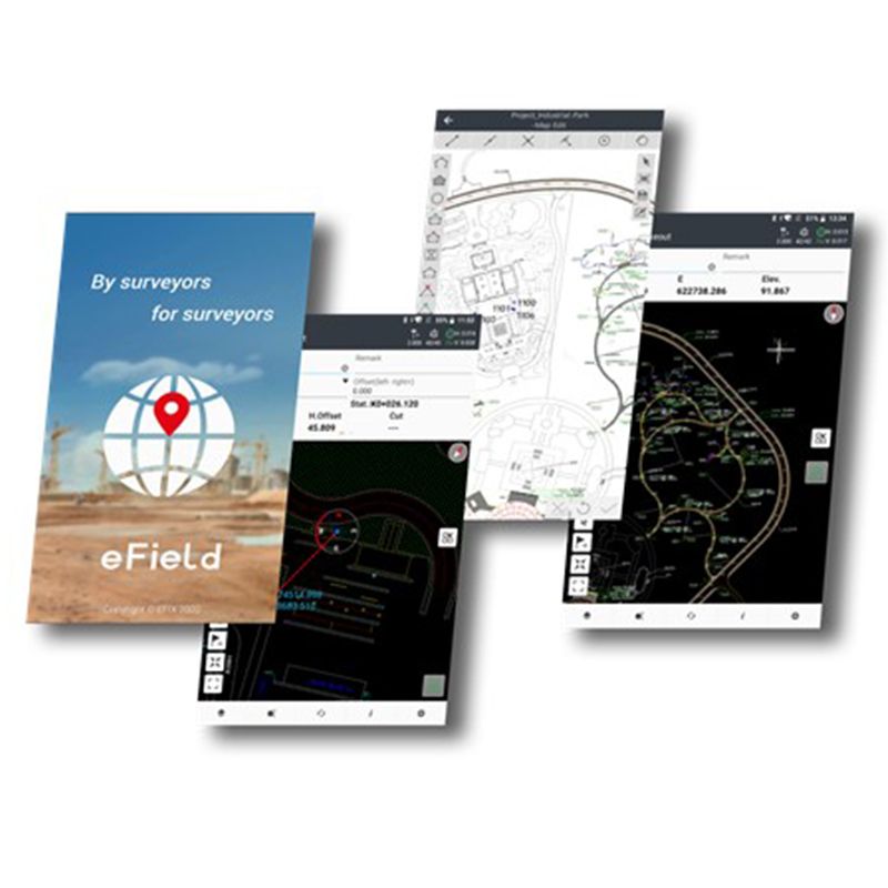
EFIX eField Android GNSS Surveying Software
Get the best price for your setup
Contact our experts for the best possible price and configuration.
- Fast response
- Expert configuration advice
- No overpaying for features you do not need
EFIX eField is Android-based GNSS surveying software for professional field data collection, RTK workflows, stakeout, mapping, road work, pipeline surveys and construction layout. It gives surveyors, engineers, GIS teams, drone mapping crews and construction professionals a practical field app for collecting points, working with design data, setting out coordinates and exporting survey results.
The software supports everyday field tasks such as point surveys, CAD-based layout, online and offline maps, GIS attributes, road stakeout and surface-related work. For crews using EFIX GNSS receivers and compatible Android controllers, eField helps keep field measurement, design checking and project handover in one clear workflow.
EFIX eField Highlights
| Software platform | Android surveying and GNSS field data collection app |
|---|---|
| GNSS workflows | RTK, static and PPK measurement support |
| Stakeout tools | Point, line, surface, CAD and road stakeout workflows |
| Map and design support | Online maps plus DXF, DWG, SHP, KML, KMZ and raster background data |
| Field applications | Surveying, construction layout, GIS data collection, road projects and pipeline surveys |
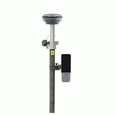
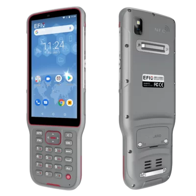
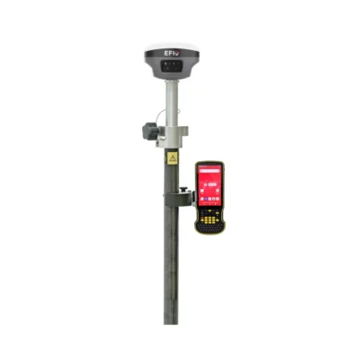

Valued customers:










Find RTK Networks
Search NTRIP providers and connect to reliable RTK correction services.
Description
EFIX eField Surveying Software
EFIX eField is a professional Android field software package for GNSS surveying, RTK data collection, stakeout, mapping, CAD/GIS workflows, road projects and pipeline surveys. It is designed for field teams that need more than simple point collection: surveyors, construction crews, engineers, GIS workers and mapping professionals can use eField to collect measurements, check design information, set out points and export usable project data.
In daily fieldwork, the value of surveying software comes from how quickly a crew can move from setup to measurement and from measurement to deliverable data. eField brings common GNSS workflows into one app, including receiver connection, work mode management, coordinate system handling, point survey, map survey, stakeout, road functions, import/export and reporting.
Built for GNSS Field Data Collection
EFIX eField supports professional GNSS measurement workflows including RTK, static and PPK. This makes it suitable for crews working with real-time corrections in the field, as well as projects where post-processing or static observations are part of the survey method.
For point collection, eField gives users several measurement options instead of forcing every job into one method. A surveyor can collect standard topographic points, use control-style measurements for important points, record quick points when speed matters, collect continuous points for tracks or profiles, and use offset workflows where the exact point cannot be occupied directly.
Practical Stakeout for Construction and Survey Work
Stakeout is one of the core uses of EFIX eField. The software supports point and line stakeout for common construction layout and boundary work, while surface and road stakeout tools help with more advanced site and infrastructure projects.
For construction professionals, this means the same field app can be used for setting out design points, checking linework, working from CAD data, comparing field positions with surfaces and handling road-related layout. This is useful on building sites, earthworks projects, utility corridors, roads and general infrastructure jobs where crews need clear guidance in the field.
CAD GIS and Map Based Workflows
EFIX eField supports both online and offline map use, giving field crews flexibility depending on the project location and available internet connection. Online map support helps with orientation, while imported CAD, GIS and raster files can be used as project background data during survey and stakeout work.
The software can work with common design and mapping formats such as DXF, DWG, SHP, KML, KMZ and image-based background data. In the field, this helps reduce manual coordinate entry and makes it easier to compare measured GNSS positions with project drawings, asset layers or site plans.
For GIS users, eField also supports custom attribute collection with media attachments. This is useful when a measured point or line needs more than a coordinate, such as a photo, inspection note, asset type, condition field or voice record.
Road Surveying and Infrastructure Tools
Road projects often require stationing, offsets, alignments, cross-sections and design elevation checks. EFIX eField includes road functionality for users working on road construction, corridor surveys and infrastructure layout. Road data can be created or imported, including LandXML workflows, so crews can work from design information instead of manually preparing every set-out coordinate.
These tools are useful for road surveyors, civil engineers and construction teams who need to set out road elements, check cross-sections, work with slopes and create road stakeout records in the field.
Pipeline Survey and Utility Mapping
EFIX eField is also suitable for pipeline and utility survey work. The software supports workflows that combine GNSS receiver data with pipeline detector information, helping users record pipeline positions and related attributes for later use in GIS, CAD or asset management systems.
This makes eField relevant for utility mapping companies, municipal asset teams, infrastructure surveyors and contractors documenting underground services.
Import Export and Reporting
Survey projects rarely start and end inside one app, so file handling is important. EFIX eField supports a wide range of import and export workflows for points, maps, CAD files, GIS data, reports and project information. Field teams can bring design data into the controller before starting work and export collected results for office processing, drafting, reporting or project delivery.
Supported workflows include point files, CAD and GIS reference data, code libraries, coordinate system files, background maps, stakeout reports and survey reports. This helps surveyors and engineers keep field data connected to the office workflow.
Cloud Sharing and Remote Support Functions
EFIX eField includes cloud-related tools for project upload and download, sharing project data and moving information between office and field users. These functions can be helpful for teams that need to share coordinate systems, work modes, project files, basemaps or survey data between multiple controllers or users.
The software also includes remote assistance functions, which can help support teams troubleshoot setup and workflow questions when a user is in the field.
Who Uses EFIX eField?
EFIX eField is mainly used by professionals who need accurate GNSS fieldwork and efficient data handling. Typical users include land surveyors collecting topo data, construction workers setting out points, civil engineers checking site designs, GIS teams mapping assets, drone pilots collecting ground control points and utility crews documenting pipeline or underground infrastructure positions.
Because the software combines measurement, stakeout, mapping, CAD/GIS support and reporting, it is a practical choice for buyers who want one Android app for many GNSS field tasks instead of separate tools for each workflow.
Buying EFIX eField from Global GPS Systems
Global GPS Systems supplies EFIX eField for professional GNSS users who need reliable field software, practical advice and support before and after purchase. If you are combining eField with an EFIX receiver, Android controller, RTK correction service or a complete rover set, Global GPS Systems can help check which configuration fits your surveying, construction, GIS or mapping workflow.
Specifications
EFIX eField Specifications
General
| Product Name | EFIX eField |
|---|---|
| Product Type | Surveying and field data collection software |
| Platform | Android |
| Developer | EFIX Geomatics Co., Ltd. |
| Software Version Referenced | eField User Guide V7.7.0.1 |
| Manual Revision | Updated December 2025 |
| Compatible Device Type | Android devices and EFIX data controllers |
| Primary Users | Surveyors, engineers, construction professionals, GIS teams, mapping users, road crews and utility survey teams |
| Main Applications | High-precision surveying, engineering, mapping, GIS data collection, construction layout, road stakeout and pipeline surveying |
Core Survey Functions
| Point Survey | Supported |
|---|---|
| Map Survey | Supported |
| Area Survey | Supported |
| Cross-Section Survey | Supported |
| Vision Survey | Supported where compatible hardware and software configuration allow |
| 3D Modeling Workflow | Supported where compatible hardware and software configuration allow |
| Static Measurement | Supported |
| RTK Measurement | Supported |
| PPK Measurement | Supported |
| Simultaneous RTK and PPK Measurement | Supported for topographic point or continuous point workflows |
Point Collection Methods
| Topographic Point | Supported |
|---|---|
| Control Point | Supported |
| Quick Point | Supported |
| Continuous Point | Supported |
| Offset Point | Supported |
| Tree Survey | Supported |
| Laser Survey | Supported with compatible laser measurement hardware |
| Point Averaging | Supported through point average tool |
Stakeout Functions
| Point Stakeout | Supported |
|---|---|
| Line / Arc Stakeout | Supported |
| Surface Stakeout | Supported with cut/fill information |
| Sideslope Stakeout | Supported |
| Foundation Stakeout | Supported |
| Visual Stakeout | Supported |
| Road Stakeout | Supported |
| CAD-Based Stakeout | Supported from CAD View workflow |
| Stakeout Reports | Point stakeout, road stakeout and surface stakeout reporting/export workflows supported |
GNSS Receiver Workflows
| GNSS Connection | Supported |
|---|---|
| GNSS Rover Configuration | Supported |
| GNSS Base Configuration | Supported |
| One-Click Fixed Workflow | Supported |
| Static Recording | Supported |
| NMEA Output | Supported |
| Elevation Mask Setting | Supported |
| Position Output Frequency | Configurable |
| Retrack All Satellites | Supported |
| NFC / Wi-Fi Receiver Functions | Supported where compatible hardware allows |
| Receiver Firmware Upgrade | Supported where compatible hardware allows |
| Instrument Information | Supported |
Map and Background Data Support
| Online Maps | OSM, BING, Google Image, WMS, V-World, Naver and Geoportal |
|---|---|
| Offline / Base Map Formats | DXF, DWG, SHP, JPG, TIFF, KML, KMZ and MBTILES |
| Additional Background Formats | WFSDB, JMTILES / Jmtiles and polyline files where supported |
| Layer Control | Supported for work layers and map files |
| Map File Management | Supported |
| Online Map Management | Supported |
| Image Management | Supported |
| Map Display Settings | Configurable |
| Snap Settings | Configurable |
CAD and Drawing Functions
| CAD View | Supported |
|---|---|
| Open CAD File | Supported |
| CAD Data Tools | Supported |
| Draw Tools | Supported |
| Edit Tools | Supported |
| Measure Tools | Supported |
| CAD Stakeout | Supported |
| Supported Geometry | Lines, polylines, polygons, circles and arcs |
| Object Snap | Supported |
| Redraw / Regenerate Drawing | Supported |
| Explode CAD Object | Supported |
| Add Text | Supported |
| Save / Delete Object | Supported |
GIS and Attribute Collection
| Custom GIS Attributes | Supported |
|---|---|
| Attribute Field Customization | Supported |
| Media Capture | Pictures, videos and voice notes |
| Multi-Code Function | Supported for surveying polylines and polygons while sharing data points |
| Code Categories | Supported |
| Code Library | Supported |
| Code Library Import | CSV, XML, CXL, FCL, FXL and MXL |
| Code Library Export | Supported |
Road Surveying Functions
| Road Stakeout | Supported |
|---|---|
| Road Manager | Supported |
| Horizontal Alignment | Supported |
| Vertical Alignment | Supported |
| Cross-Sections | Supported |
| Slopes | Supported |
| User-Defined Structures | Supported |
| Superelevation | Supported |
| Widening | Supported |
| Stakeout Side-Slope | Supported |
| Survey Cross-Section | Supported |
| Road Reports | Road stakeout report supported |
| Road Data Import | LandXML road elements and DXF polyline centreline workflows supported |
Pipeline Survey Functions
| Pipeline Survey Workflow | Supported |
|---|---|
| GNSS Receiver Data | Supported |
| Pipeline Detector Data | Supported with compatible pipeline detector hardware |
| Pipeline Coordinate Storage | Stores pipeline coordinates with attributes |
| Pipeline Export Formats | SHP and CSV |
Total Station Workflows
| Total Station Connection | Supported where compatible instrument and connection method allow |
|---|---|
| Total Station Settings | Supported |
| Total Station Rotate | Supported where compatible instrument allows |
| Resection / Free Station | Supported |
| Backsight to Known Point | Supported |
| Backsight by Azimuth | Supported |
| Total Station Survey | Supported |
| Total Station Point Stakeout | Supported |
| Total Station Line Stakeout | Supported |
| Total Station Surface Stakeout | Supported |
| Total Station Road Stakeout | Supported |
Coordinate System and Localization
| Coordinate System Management | Supported |
|---|---|
| Ellipsoid Settings | Supported |
| Projection Settings | Supported |
| Datum Transformation | Supported |
| Horizontal Adjustment | Supported |
| Vertical Adjustment | Supported |
| Geoid File | Supported in project setup |
| Site Calibration | Supported |
| Base Shift | Supported |
| CORS Shift | Supported |
| Single Point Localization | Supported |
| Localization Packages | Predefined coordinate system files, device connection profiles, grid files, online map database files, coordinate system library files, antenna files, software help link files and font files |
Import Formats and Data Input
| Point Import | Points and points to stakeout import supported |
|---|---|
| Text / Point File Formats | CSV, DAT, XLSX, XLS and TXT workflows supported |
| Reference Map Import | DXF, DWG, SHP, KML, KMZ and XML |
| 3D CAD Import | 3D DXF supported |
| Reference Point Import | CSV fixed format |
| Lines / Arcs Import | LNS, PXY and KOF |
| Code / Code Library Import | CSV, XML, CXL, FCL, FXL and MXL |
| Background Image Import | TIF, TIFF, JPG, MBTILES, JMTILES / Jmtiles and WFSDB |
| Coordinate System Import | DC, JXL, CAL, LOK and CRD |
| Site Calibration Import | CAL, LOC, COT and TXT |
| Carlson File Support | CRD / CRDB import supported |
| Load from Existing Project | Supported |
| Custom Import Contents | CSV, DAT or TXT formats |
Export Formats and Reports
| CAD Export | DWG and DXF |
|---|---|
| GIS Export | SHP, KML and KMZ |
| Text / Spreadsheet Export | CSV, DAT, TXT and XLSX |
| Raw Data Export | RAW supported |
| HTML Export | Supported |
| Survey Reports | HTML and CSV report workflows supported |
| Point Stakeout Report | Supported |
| Hydro Survey Report | Supported |
| Measurement Report | Supported |
| Area Report | Supported |
| Verified Survey Report | Supported |
| Slovenia Report | HTML report supported |
| Star*Net Export | DAT and GPS report formats supported |
| Trimble JXL Export | JXL supported |
| MicroStation Export | TXT format supported |
| Surface Stakeout Export | CSV, TXT and DAT |
| Custom Export Contents | CSV, DAT or TXT formats |
Project and Cloud Functions
| Project Creation | Supported |
|---|---|
| Create Project from File | Supported |
| Project Backup | Supported |
| Restore Project from Local Backup | Supported |
| Restore Project from Cloud | Supported |
| Cloud Upload / Download | Projects, coordinate systems, work modes and related data |
| Sharing Code | Supported for sharing or downloading projects, coordinate systems, points and base maps |
| My Cloud Disk | Supported |
| Collaborative Work | Supported |
| Upload Position to eField Cloud | Supported |
| Remote Assistance Tool | Supported |
| Feedback Tool | Supported |
| Video Help | Supported |
Field Tools and Calculations
| Map Adjustment | Supported |
|---|---|
| Volumes | Supported |
| Inverse Calculation | Supported |
| Plot Deed | Supported |
| Transformation | Supported |
| Area Subdivision | Supported |
| Area Calculation | Supported |
| Angle Conversion | Supported |
| Parameter Calculation | Supported |
| Calculator | Supported |
| Ruler | Supported |
| Point to Line Distance | Supported |
| Offset Distance | Supported |
| Deflection | Supported |
| Rotation | Supported |
| Intersection | Supported |
| Bisect Angle | Supported |
| Divide Line | Supported |
| Tangent Point | Supported |
Software Settings
| Keyboard Shortcuts | Supported |
|---|---|
| Sensor Settings | Supported |
| Cloud Service Settings | Supported |
| Auto OK / Accept | Supported |
| Units | Configurable |
| Decimals | Configurable |
| Coordinate Order | Configurable |
| Point Naming | Configurable |
| GNSS Settings | Configurable |
| Total Station Settings | Configurable |
| Map Display Settings | Configurable |
| Audio Prompt | Supported |
| Warn if Base Changes | Supported |
| Record Track | Supported |
| Interface Settings | Configurable |
Installation and Activation
| Manual Installation | Supported |
|---|---|
| Auto Update | Supported |
| Software Registration | Supported |
| Free Trial | Supported; requires network connection |
| Online Activation | Supported |
| Offline Activation | Supported |
| License Type | Not specified in available product documentation |
Compatibility Notes
| Compatible GNSS Receivers | Not fully specified; compatibility may depend on receiver model, firmware, license and connection workflow |
|---|---|
| Compatible Total Stations | Not fully specified; compatibility may depend on instrument model, license and connection method |
| Vision / Laser / IMU Functions | Availability depends on compatible hardware and enabled software workflow |
| Pipeline Detector Compatibility | Requires compatible pipeline detector hardware |
Specifications and package contents may vary by configuration, region or manufacturer update. Always check the current configuration before ordering.
Reviews (10)
10 reviews for EFIX eField Android GNSS Surveying Software
Only logged in customers who have purchased this product may leave a review.
FAQ
EFIX eField FAQ
Product Overview
What is EFIX eField?
EFIX eField is Android-based surveying software for GNSS field data collection, RTK workflows, stakeout, CAD/GIS mapping, road work, pipeline surveys and construction layout. It is designed to help field crews collect measurements, work with maps and design files, manage coordinate systems and export survey results.
Who is EFIX eField designed for?
eField is designed for professional surveyors, construction layout teams, civil engineers, GIS mapping teams, utility surveyors, road survey crews and other professionals who need reliable field data collection and stakeout tools.
What industries use eField?
eField is commonly used in land surveying, construction, civil engineering, road construction, GIS data collection, municipal infrastructure, utilities, pipeline surveying and RTK GNSS fieldwork.
Does eField work on Android devices?
Yes. eField is Android-based field surveying software and is built for use on compatible Android devices and EFIX data controllers.
What makes eField different from basic point collection software?
eField does more than collect points. It combines GNSS surveying, stakeout, CAD and GIS workflows, road tools, pipeline survey functions, coordinate system management, reporting, surface tools and data import/export in one field application.
Surveying, GNSS and Stakeout
Can eField be used for RTK GNSS surveying?
Yes. eField is suitable for RTK GNSS workflows and supports professional field data collection with compatible GNSS receivers and correction services.
Does eField support PPK and static measurement?
Yes. eField supports static, RTK and PPK measurement workflows, giving survey teams flexibility for different field conditions and accuracy requirements.
What point measurement methods are available in eField?
eField supports several point collection methods, including topographic point, control point, quick point, continuous point, offset point, corner point and other specialized field workflows.
Can eField be used for stakeout?
Yes. eField includes multiple stakeout tools, including point stakeout, line and arc stakeout, surface stakeout, sideslope stakeout, foundation stakeout, visual stakeout and road stakeout.
Can eField help with construction layout?
Yes. eField is suitable for construction layout because it can set out points, lines, arcs, surfaces, foundations and design data using compatible GNSS equipment and imported project files.
Does eField show GNSS status in the field?
Yes. eField displays important receiver and GNSS information such as battery status, satellite information and solution status, helping users monitor field measurement conditions.
Mapping, CAD, GIS and Data Formats
Does eField support CAD files?
Yes. eField supports CAD and background map workflows, including DXF and DWG files, so users can view design information and use CAD data during fieldwork.
Which import formats does eField support?
eField supports a wide range of import formats, including DXF, SHP, KML, KMZ, JPG, CSV, DAT, XLSX, TXT, TIFF, MBTILES and CGO formats.
Which export formats does eField support?
eField can export project and survey data to formats such as DXF, SHP, KML, KMZ, RAW, HTML, CSV, DAT, TXT and XLSX.
Can eField collect GIS attributes?
Yes. eField supports user-defined GIS attributes, allowing users to add custom field information to measured features. This is useful for asset mapping, utilities, municipal surveys and infrastructure records.
Can photos, videos or voice notes be attached to field data?
Yes. eField can collect media such as pictures, videos and voice notes with GIS attributes, making it useful when survey data needs supporting field evidence or asset information.
Can eField use online and offline maps?
Yes. eField supports online map sources and offline background maps, including CAD, GIS and raster files, so users can work with visual context in the field.
Roads, Pipelines, Cloud and Workflow
Can eField be used for road surveying?
Yes. eField includes road functions for horizontal and vertical alignment, cross-sections, slopes, user-defined structures and road stakeout workflows.
Can eField import road design data?
Yes. eField can import road design elements from LandXML files and can also use polylines from DXF files as road centerlines for road stakeout and survey workflows.
Can eField be used for pipeline surveying?
Yes. eField includes pipeline survey tools for collecting high-precision underground pipeline coordinates and attributes when used with compatible equipment and workflows.
Does eField support pipeline detectors and laser rangefinders?
Yes. eField supports selected peripherals, including compatible pipeline detectors and laser rangefinders, for specialized field measurement tasks.
Does eField include cloud project sharing?
Yes. EFIX Cloud Service allows users to upload and download projects, coordinate systems, work modes, points and base maps. It also supports sharing by code and remote assistance workflows.
Can eField manage coordinate systems and correction files?
Yes. eField includes coordinate system management and supports grid and geoid correction workflows, helping users work with the correct project coordinate settings in the field.
Can Global GPS Systems help with eField setup?
Yes. Global GPS Systems can advise on compatible GNSS equipment, RTK correction setup, field workflows and software configuration for eField users.


 GPS & GNSS
 Total Stations
 Data collectors
 Software
 Correction services
 Machine control
 External radio
 Marine
 Accessories
Pedro s. (verified owner) –
i like software. colleague use too
Louis Moreau (verified owner) –
Easy to use and good
Noah Poirier (verified owner) –
Easy to use and good looking software
Oskar Nordström (verified owner) –
I like how this software makes it really easy to import and export dxf files.
Thomas W. (verified owner) –
Great software!
Anonymous (verified owner) –
Had some issues with coordinate systeme however customer support har fast response and I managed to sort the issue apart from that the app is really well designed and intuitive.
Dennis Kuipers (verified owner) –
Ik kijk uit naar de update, waar een DTM module bij zit.
vytautas b. (verified owner) –
easy to use
Soren Varga (verified owner) –
Good software, easy to learn. Surprised of all the features it has
William M. (verified owner) –
Easy to get started. Does have a lot of handy surveying functions i already use