

 GPS & GNSS
 Lidar scanning
 Total Station

Aplitop TcpTunnel
Get the best price for your setup
Contact our experts for the best possible price and configuration.
- Fast response
- Expert configuration advice
- No overpaying for features you do not need
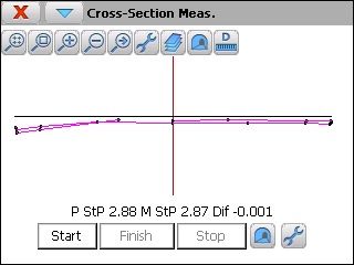
each project is defined by the horizontal and vertical alignments, superelevations and tunnel templates, that can be converted from a cad drawing, defined by parameters or points measured with total station. as a proper step to surveying and setting out, the station should be oriented by coordinates, angle or resection. user can be selected between local and UTM projected coordinates. Tcp tunnel performs automatic and unattended cross section measurement for each station defined by angle, arc length or height differences intervals. singular points and roadbed can be measured and exclusion areas defined ass well.
Valued customers:










Find RTK Networks
Search NTRIP providers and connect to reliable RTK correction services.
Description
surfaces calculation
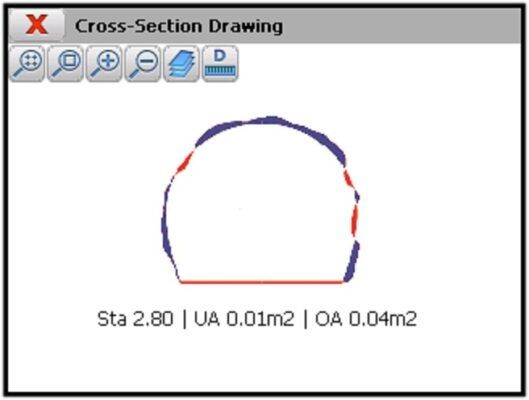
the application allows to compare graphically theoretical and measured cross-sections along the alignment, showing in different colors the under excavation and over-excavation ares with their values for each cross-section. other available tools are point analysis over the alignment distance and ares calculation and instrumental settings. The programs has full control over the total station including the compensator, laser pointer measurement with or without prism and battery status, which are constantly monitored.
How to position the total station by resection in Aplitop TcpTunnel
How to automatically survey tunnel cross-sections with Aplitop TcpTunnel.
Reviews (0)
Only logged in customers who have purchased this product may leave a review.

 GPS & GNSS
 Total Stations
 Data collectors
 Software
 Correction services
 Machine control
 External radio
 Marine
 Accessories
Reviews
There are no reviews yet