


 GPS & GNSS
 Lidar scanning
 Total Station


a-Geo S60III Pro Rugged RTK GNSS Data Collector with 2cm accuracy
Get the best price for your setup
Contact our experts for the best possible price and configuration.
- Fast response
- Expert configuration advice
- No overpaying for features you do not need
The a-Geo S60 III Pro is a rugged handheld GNSS RTK data controller for centimeter-level field positioning, mapping, and asset data collection. Its integrated 1,408-channel GNSS receiver tracks GPS, GLONASS, Galileo, BeiDou, QZSS, and SBAS signals, while 4G, Wi-Fi, Bluetooth, and USB-C support connected field workflows. The 5.5-inch sunlight-readable touchscreen, physical QWERTY keypad, 13 MP camera, and laser point positioning help surveyors and crews capture information efficiently on construction sites, utility inspections, GIS projects, environmental surveys, landscaping, and drone ground-control work. With Android 12, IP68 protection, a 9,000 mAh battery, and support for MicroSD storage, the S60 III Pro is suited to demanding outdoor operations.
a-Geo S60 III Pro Highlights
| GNSS Channels | 1,408 channels; GPS, GLONASS, Galileo, BeiDou, QZSS and SBAS |
|---|---|
| RTK Accuracy | 2 cm HRMS |
| Display | 5.5-inch 1080 × 1920 sunlight-readable touchscreen, 500 nits |
| Field Durability | IP68 protection and 1.2 m drop resistance |
| Battery and Storage | 9,000 mAh battery, up to 22 hours typical use, 64 GB storage |

Valued customers:










Find RTK Networks
Search NTRIP providers and connect to reliable RTK correction services.
Description
a-Geo field-ready RTK GNSS data collection
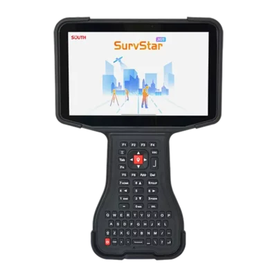
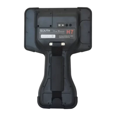
The a-Geo S60III Pro is a rugged handheld RTK GNSS data collector designed for professionals who need accurate positioning, reliable field data capture, and a practical all-in-one device for outdoor work. It combines a multi-constellation GNSS receiver, integrated antenna, Android 12 operating system, large sunlight-readable touchscreen, physical QWERTY keypad, cellular connectivity, camera, storage, and field-ready protection in one portable unit.
Instead of carrying a separate handheld computer and GNSS receiver for every task, the S60III Pro gives surveyors, construction teams, GIS technicians, utility inspectors, environmental workers, and mapping professionals a single device for collecting points, viewing maps, checking project data, recording site information, and working with compatible surveying or GIS applications. It is suited to jobs where dependable positioning and straightforward field operation are more important than carrying a large, specialized survey controller.
High-precision GNSS for practical field measurements
The S60III Pro uses an integrated Unicorecomm UM980 RTK module and a multi-band GNSS antenna to track signals from GPS, GLONASS, Galileo, BeiDou, and QZSS satellite systems. Supporting multiple constellations and frequency bands helps the receiver maintain a stronger selection of usable satellite signals, particularly when working near buildings, trees, slopes, vehicles, or other sources of obstruction.
When connected to a suitable RTK correction source, the receiver is designed to deliver centimeter-level positioning. The published RTK performance is up to approximately 2 cm HRMS under suitable conditions, while SBAS positioning is specified at less than 1 m HRMS. Actual accuracy depends on correction service quality, satellite visibility, multipath, atmospheric conditions, setup, field procedures, and the software being used. For this reason, the S60III Pro is best understood as a professional RTK field terminal that can support precise point collection when it is operated with an appropriate correction workflow.
The device supports common GNSS signal bands including GPS L1, L2, and L5; GLONASS L1 and L2; Galileo E1, E5a, E5b, and E6; BeiDou B1, B1C, B2, B2a, B2b, and B3; and QZSS signals where supported. Its 1,408-channel architecture gives the receiver the capacity to process a broad range of satellite observations at the same time, helping it work effectively across different regions and correction environments.
Designed as a complete mobile field terminal
The S60III Pro is more than a GNSS receiver. It is also an Android field computer with the processing power and storage needed for mapping, inspection, construction, and data collection applications. Android 12 with Google Mobile Services support allows users to work with compatible professional applications as well as communication, cloud storage, document, and file-transfer tools.
A Qualcomm Snapdragon 662 octa-core processor and 4 GB of RAM provide practical performance for viewing project maps, handling field forms, managing coordinate data, and working with compatible CAD or GIS files. The integrated 64 GB of storage provides room for applications and project files, while the MicroSDHC slot supports additional storage of up to 128 GB for users who need to carry larger datasets, imagery, or multiple projects in the field.
For teams that need to move information between the field and office, the S60III Pro supports 4G cellular connectivity through a Nano-SIM card, dual-band Wi-Fi, Bluetooth 5.0, and USB Type-C with OTG support. This makes it possible to connect to online services, transfer files, communicate with project staff, and use compatible wireless accessories without relying on a separate smartphone or tablet.
Clear outdoor display and physical keypad
The 5.5-inch industrial touchscreen has a 1920 × 1080 resolution and a brightness rating of 500 nits. In practical field use, this helps operators read point attributes, map layers, measurements, stakeout information, inspection forms, and photographs in bright outdoor conditions. The display is intended for direct field operation, including touch input and stylus use, while the protective Corning glass helps resist everyday scratches and wear.
Unlike a standard smartphone, the S60III Pro also includes a physical QWERTY-style keypad with dedicated function and shortcut keys. This can be useful when working with gloves, standing on uneven ground, or entering repeated codes and descriptions without constantly switching to an on-screen keyboard. Programmable keys can help reduce the number of screen taps required for common actions in compatible field software, such as starting a survey, opening a measurement tool, or moving between data-entry screens.
The keypad and touch interface give users flexibility in different working conditions. A surveyor can use the touchscreen for map interaction and the physical keys for fast data entry, while a construction worker or utility inspector can operate the device more confidently when conditions are dusty, wet, cold, or otherwise unsuitable for delicate smartphone-style operation.
Rugged protection for construction and outdoor work
Field equipment is often exposed to rain, dust, mud, vibration, accidental drops, and changing temperatures. The S60III Pro has an IP68-rated housing intended to protect the device against dust ingress and water exposure when the protective covers are correctly closed and the equipment is used within its specified limits. It is also designed to withstand a drop of approximately 1.2 metres onto concrete, helping reduce the risk of damage during normal site handling.
The rugged design is useful for construction layout, topographic data collection, utility inspections, environmental surveys, agricultural mapping, and other work where equipment may be carried for long periods or placed on rough surfaces. The device weighs approximately 420 grams with its battery and measures about 228 × 96 × 21 mm, making it easier to carry than many larger survey controllers while still providing a full field-computing interface.
Although the housing is designed for demanding field environments, IP68 protection does not mean the device should be left submerged or exposed to water for extended periods. Ports and covers should be kept clean and properly sealed, especially after charging or changing the SIM or memory card. Following normal care procedures helps maintain the equipment’s protection over time.
Long battery life for full-day data collection
A 9,000 mAh lithium-ion battery provides a published operating time of up to approximately 22 hours, depending on GNSS use, screen brightness, cellular connectivity, software activity, temperature, and battery condition. This capacity is well suited to full-day field assignments where charging opportunities may be limited.
The device uses USB Type-C charging and has a typical charging time of around four hours. Carrying a suitable power bank or vehicle charger can provide additional flexibility for crews working away from the office, particularly when using continuous mobile data, high screen brightness, camera functions, or demanding mapping applications.
Useful tools for mapping, inspection, and documentation
The integrated 13-megapixel rear camera includes autofocus and flash, allowing operators to attach site photographs to collected points, inspection records, asset inventories, or field notes where the application supports image capture. This can be useful for documenting construction progress, utility conditions, drainage features, road assets, boundary evidence, environmental observations, or installed equipment.
The S60III Pro also includes supporting sensors such as an electronic compass, gyroscope, G-sensor, and light sensor. These features can assist with orientation, device interaction, and application functionality. The device also supports RFID or NFC-related workflows where the chosen software and accessories make use of those capabilities, which may be helpful for asset identification and field data management.
For point positioning and detailed site documentation, the product information also identifies laser point positioning. This can help users reference a visible target or point of interest during compatible field operations, although the exact workflow depends on the installed application and project requirements.
Suitable for a wide range of professional users
Surveyors and mapping professionals: The S60III Pro can be used for RTK point collection, topographic surveys, boundary work, site measurements, asset mapping, and field-to-office data transfer. Its integrated GNSS receiver reduces the need to connect a separate external antenna for basic handheld collection tasks, while the large display provides room for maps and measurement screens.
Construction workers and site engineers: Construction teams can use the device for site positioning, checking coordinates, collecting as-built information, documenting installed features, locating utilities, and reviewing drawings or base maps. The physical keypad and rugged housing are particularly useful when working around machinery, dust, concrete, earthworks, and changing weather.
GIS and asset-management teams: GIS users can collect structured attribute data, attach photographs, record asset locations, and synchronize information through mobile networks or Wi-Fi. The device’s Android platform supports a broad range of compatible GIS and inspection applications, allowing organizations to choose software that matches their existing workflow.
Utility and infrastructure inspectors: Power line, pipeline, road, drainage, telecommunications, and municipal inspection teams can use the S60III Pro to locate assets, record condition information, capture images, and maintain consistent field records. Cellular connectivity can help send updates to office teams when coverage and application support are available.
Environmental and natural-resource professionals: The unit is suitable for collecting locations of vegetation plots, water features, erosion points, monitoring stations, habitat observations, and other environmental data. Its weather-resistant design and long battery life are valuable for work that takes place away from vehicles and buildings.
Drone pilots and aerial mapping teams: The S60III Pro can support ground control point collection, site verification, mission-area mapping, and field documentation around UAV operations. It is not a drone flight controller, but its RTK positioning and mapping capabilities can complement photogrammetry and inspection workflows by helping teams measure and document ground locations accurately.
Important considerations when comparing RTK GNSS equipment
The S60III Pro is an integrated handheld RTK GNSS terminal rather than a conventional pole-mounted rover with a separate survey controller. This makes it convenient for GIS collection, asset mapping, inspections, and general field positioning, especially when portability and simple operation are priorities. Users who require a traditional survey-pole workflow, external antenna height measurement, advanced stakeout routines, or specialized survey accessories should confirm that their preferred field software and equipment configuration are compatible.
The unit does not include an IMU tilt sensor, so it should not be treated as a tilt-compensated rover that can measure points while the antenna is intentionally held off vertical. Operators who need tilt-based surveying should compare this device with a GNSS receiver that specifically includes IMU compensation. The S60III Pro also does not include an internal UHF radio, so RTK corrections will generally need to be supplied through a compatible internet, NTRIP, Wi-Fi, cellular, or other supported correction workflow rather than an integrated UHF base-rover radio link.
As with any RTK GNSS equipment, reliable results depend on more than the receiver itself. Good satellite visibility, a suitable correction service, correct coordinate-system settings, appropriate antenna handling, verification checks, and sound field procedures remain essential for professional work.
Why choose the a-Geo S60III Pro?
- Integrated multi-constellation, multi-frequency GNSS receiver for professional field positioning.
- RTK capability for centimeter-level results when used with suitable corrections.
- Android 12 platform for compatible surveying, GIS, inspection, and mapping applications.
- 5.5-inch 500-nit display for clearer outdoor viewing.
- Physical QWERTY keypad and programmable shortcut keys for efficient data entry.
- IP68-rated rugged design with approximately 1.2-metre drop resistance.
- 9,000 mAh battery with a published operating time of up to approximately 22 hours.
- 4G, Wi-Fi, Bluetooth, USB Type-C, camera, expandable storage, and integrated field sensors.
A practical RTK platform for field teams
The a-Geo S60III Pro is a practical choice for professionals who need accurate GNSS positioning in a compact, rugged Android handheld. It combines the core functions of a GNSS receiver, field controller, mobile data terminal, camera, and data-entry device, helping reduce the amount of equipment required for everyday mapping and inspection work.
For buyers comparing RTK GNSS equipment, the main strengths of this model are its integrated design, broad satellite support, outdoor-readable display, physical keypad, long battery life, and rugged protection. It is especially well suited to GIS collection, construction documentation, utility inspection, environmental monitoring, asset mapping, and other workflows where field data must be collected efficiently and transferred into an office or cloud system.
Global GPS Systems can help you assess whether the a-Geo S60III Pro matches your correction service, field software, accuracy requirements, and working method. Their product specialists can also help determine whether you need a handheld RTK terminal, a conventional rover receiver, a complete base-and-rover setup, or additional survey accessories for your projects.
Datasheets & Manuals
Specifications
S60III Pro Specifications
Product Overview
| Product type | Rugged GNSS RTK handheld terminal and data collector |
|---|---|
| Brand | α-GEO / AlphaGEO |
| Model | S60III Pro |
| Primary function | High-precision GNSS positioning, RTK surveying, GIS data collection and mobile field data management |
| Positioning capability | Centimeter- to decimeter-level positioning for professional field operations |
| Integrated technologies | GNSS receiver, RTK module, GNSS helical antenna, laser point positioning, RFID/NFC functionality, Android mobile computing and cellular connectivity |
| Intended users | Surveyors, GIS professionals, mapping teams, construction personnel, utility inspectors, environmental researchers, field-service technicians, landscapers and infrastructure contractors |
System and Processing
| Operating system | Android 12 with Google Mobile Services (GMS) support |
|---|---|
| Processor | Qualcomm SDM662 octa-core processor |
| Processor clock speed | Up to 2.0 GHz |
| Processor fabrication | 11 nm process |
| System memory | 4 GB SDRAM |
| Internal storage | 64 GB flash memory |
| Expandable storage | MicroSDHC card support up to 128 GB |
| Field software compatibility | Designed for GIS, CAD, mapping, surveying, inspection and mobile field-data applications compatible with Android |
Physical Construction
| Dimensions | 228 × 96 × 21 mm |
|---|---|
| Weight | Approximately 420 g including battery |
| Construction | Rugged industrial handheld design for field measurement and mapping operations |
| Water and dust protection | IP68-rated protection |
| Drop resistance | Designed to withstand a 1.2 m / 4 ft drop onto concrete |
| Shock and vibration | Designed for field use with shock and vibration resistance |
| Humidity tolerance | 5% to 95% relative humidity, non-condensing |
| Operating temperature | -20°C to +65°C / -4°F to +149°F |
| Storage temperature | -30°C to +70°C / -22°F to +158°F |
Display and Input
| Display size | 5.5 inches |
|---|---|
| Display type | IPS LTPS LCD |
| Display resolution | 1920 × 1080 pixels |
| Pixel density | 401 ppi |
| Brightness | 500 nits |
| Touchscreen | Capacitive multi-touch display |
| Screen protection | Scratch-resistant Corning glass |
| Outdoor visibility | Sunlight-readable display designed for outdoor data collection |
| Physical keyboard | QWERTY keyboard |
| Keyboard function | Physical key input and shortcut access for field applications |
| Stylus support | Supported; stylus included as a standard accessory |
GNSS and RTK Performance
| GNSS channels | 1,408 channels |
|---|---|
| GNSS receiver module | Integrated Unicorecomm UM980 RTK module |
| GNSS antenna | Integrated interference-resistant four-wall helical GNSS antenna |
| GPS signals | L1C/A, L2C, L2P and L5 |
| GLONASS signals | L1 and L2 |
| BeiDou signals | B1, B1C, B2, B2a, B2b and B3 |
| Galileo signals | E1, E5a, E5b and E6 |
| QZSS signals | L1, L2, L5 and L6 |
| SBAS support | WAAS, EGNOS, MSAS, GAGAN and SDCM |
| RTK horizontal accuracy | 2 cm HRMS |
| SBAS accuracy | Less than 1 m HRMS |
| L-band functionality | PPP support and Galileo E6 High Accuracy Service (HAS) support |
| A-GPS | Supported |
| Laser point positioning | Integrated laser point positioning function |
| Tilt-compensated surveying | No dedicated IMU tilt sensor is specified for this model |
| UHF radio | Not integrated |
Cellular and Wireless Communications
| SIM card type | Nano-SIM |
|---|---|
| Cellular modem | Integrated 4G cellular modem |
| GSM bands | 850, 900, 1800 and 1900 MHz |
| WCDMA bands | B1, B2, B4, B5 and B8 |
| LTE-TDD bands | B34, B38, B39, B40 and B41 |
| LTE-FDD bands | B1, B2, B3, B4, B5, B7, B8, B12, B13, B17, B20, B25, B26 and B28 |
| Wi-Fi standard | IEEE 802.11 a/b/g/n/ac |
| Wi-Fi frequency support | Dual-band 2.4 GHz and 5 GHz Wi-Fi |
| Wi-Fi operating modes | Client connectivity and access point mode |
| Bluetooth | Bluetooth 5.0 |
| Bluetooth Low Energy | Supported through Bluetooth 5.0 |
| NFC | Supported |
| RFID functionality | Integrated RFID technology for field data collection and asset identification workflows |
Ports and Interfaces
| USB connector | USB Type-C |
|---|---|
| USB functionality | OTG support and high-speed data transfer |
| Charging interface | USB Type-C |
| Memory expansion slot | MicroSDHC card slot supporting cards up to 128 GB |
| External GNSS antenna | Integrated helical antenna design; detachable antenna assembly is referenced in the operating documentation |
Camera and Multimedia
| Rear camera | 13 megapixels |
|---|---|
| Camera focus | Auto-focus |
| Camera illumination | Integrated flash |
| Camera applications | Site documentation, asset records, inspection photography, GIS feature capture and field evidence collection |
| Microphone | Integrated microphone |
| Speaker | Integrated speaker |
Sensors and Positioning Aids
| G-sensor | Supported |
|---|---|
| Gyroscope | Supported |
| Electronic compass | Supported |
| Light sensor | Supported |
| GNSS positioning sensor | Integrated multi-constellation GNSS receiver |
| Laser positioning | Integrated laser point positioning for point-location workflows |
| IMU tilt compensation | Not specified; the product page identifies the IMU tilt sensor as not included |
Battery and Power
| Battery type | Rechargeable lithium-ion battery |
|---|---|
| Battery capacity | 9,000 mAh |
| Typical operating time | Up to approximately 22 hours |
| Charging time | Approximately 4 hours under typical conditions |
| Charging method | USB Type-C charging |
| Operating-time conditions | Actual battery life varies with GNSS use, cellular connectivity, Wi-Fi, Bluetooth, screen brightness, software and environmental conditions |
Applications and Industries
| GIS and mapping | Asset mapping, field data collection, feature attribution, map updating and geospatial database creation |
|---|---|
| Land surveying | RTK point collection, boundary surveys, topographic mapping, control-point measurement and site documentation |
| Construction | Construction site development, field verification, layout support, progress documentation and as-built data collection |
| Infrastructure | Road, rail, civil engineering, utility and infrastructure inspection workflows |
| Power and utilities | Power line inspections, utility asset inventories, maintenance records and right-of-way mapping |
| Environmental monitoring | Environmental surveys, habitat mapping, sample-point positioning and field research |
| Landscaping and urban planning | Landscape inventories, park and public-space mapping, site planning and urban asset management |
| Asset management | RFID/NFC-assisted identification, location recording, inspection tracking and field asset databases |
| Field-service operations | Mobile inspections, work-order documentation, photographic records and real-time data synchronization |
Certifications and Compliance
| Ingress protection | IP68 |
|---|---|
| Product certifications | CE and FCC |
| Environmental design | Designed for outdoor and demanding field environments |
Standard Included Accessories
| Item | Quantity | Notes |
|---|---|---|
| S60III Pro handheld terminal | 1 | Rugged Android GNSS RTK handheld terminal |
| Rechargeable battery | 1 | 9,000 mAh lithium-ion battery |
| A/C charger | 1 | For battery charging; regional plug configuration may vary |
| USB cable | 1 | USB Type-C cable |
| Stylus | 1 | For touchscreen operation |
| Handstrap | 1 | For handheld field use |
Specifications and package contents may vary by configuration, region or manufacturer update. Always check the current configuration before ordering.
Reviews (0)
Only logged in customers who have purchased this product may leave a review.
FAQ
a-Geo S60III Pro FAQ
Product Overview and Accuracy
What is the a-Geo S60III Pro?
The a-Geo S60III Pro is a rugged GNSS RTK handheld terminal and field data collector for professional surveying, GIS mapping, construction, infrastructure, environmental monitoring, utilities, landscaping, and other mobile field operations. It combines a multi-constellation GNSS receiver, Android 12 smart-device functionality, a sunlight-readable display, physical keypad, camera, mobile connectivity, and field data collection capabilities in one portable device.
What is the a-Geo S60III Pro used for?
The device is used for high-precision positioning, GIS data collection, asset mapping, construction site measurement, utility and power line inspections, environmental surveys, landscaping, infrastructure documentation, boundary work, mapping, and field inspections where accurate location data and rugged equipment are required.
How accurate is the a-Geo S60III Pro?
With a suitable RTK correction service and good satellite visibility, the manufacturer specifies approximately 2 cm HRMS RTK accuracy. Actual accuracy depends on the correction source, satellite geometry, multipath, obstructions, atmospheric conditions, survey method, antenna position, and field software settings.
Can the a-Geo S60III Pro provide centimeter-level positioning?
Yes. The integrated GNSS and RTK technology is designed to provide centimeter-level positioning when connected to a compatible RTK correction source, such as an NTRIP service, CORS network, or suitable base station workflow.
Can it be used without an RTK correction service?
Yes. The a-Geo S60III Pro can still provide autonomous GNSS or SBAS positioning without RTK corrections, but the accuracy will be lower than centimeter-level RTK positioning. For precise surveying and stakeout, an RTK correction source is normally required.
Which satellite systems and signals does it support?
The receiver supports multiple GNSS constellations and frequency bands, including GPS, GLONASS, BeiDou, Galileo, QZSS, and SBAS services. Supported signals include multi-band GPS, GLONASS, BeiDou, Galileo, and QZSS signals, subject to firmware, regional availability, and correction-service compatibility.
Connectivity, Software and Field Workflows
How does the a-Geo S60III Pro receive RTK corrections?
RTK corrections can typically be received through an NTRIP or CORS service using the built-in 4G mobile modem or Wi-Fi connection. The exact connection method depends on the field software, correction provider, SIM card, network coverage, and project requirements.
Does the a-Geo S60III Pro require a SIM card?
A Nano-SIM card is optional but useful when receiving NTRIP corrections over a mobile network, synchronizing field data, accessing cloud services, or working online away from Wi-Fi. A SIM card and suitable mobile data plan are not necessarily required for offline data collection or Wi-Fi-based workflows.
Does it support 4G mobile connectivity?
Yes. The device includes a cellular modem with support for multiple GSM, WCDMA, LTE-TDD, and LTE-FDD bands. Mobile network compatibility should be checked with the local carrier before purchase, especially for international use.
Which operating system does it use?
The a-Geo S60III Pro runs Android 12 with GMS support. This allows users to operate compatible Android field applications, mapping tools, GIS software, cloud platforms, communication apps, and productivity software.
Can I install my own Android surveying or GIS applications?
Yes, compatible Android applications can generally be installed on the device. Before deployment, verify that the required application supports the device’s Android version, GNSS interface, RTK workflow, file formats, screen size, and required external equipment.
Can it be used with SurPro field software?
The a-Geo S60III Pro is designed for professional GNSS data collection and is compatible with field-survey workflows such as point collection, mapping, measurement, stakeout, and project data management. SurPro availability and licensing depend on the selected configuration and supplier package, so confirm the software included with your order.
Does the device support offline field data collection?
Yes. Field teams can collect and store project data without continuous internet access when the selected application supports offline maps, local storage, and offline measurement workflows. Internet access is required for online correction services, cloud synchronization, live basemap updates, or other connected functions.
How can data be transferred from the a-Geo S60III Pro?
Data can be transferred using USB Type-C with OTG support, Wi-Fi, Bluetooth, mobile data, compatible cloud services, or removable MicroSD storage. The best method depends on the application, file size, project security requirements, and office workflow.
Hardware, Durability and Battery
Is the a-Geo S60III Pro suitable for outdoor and harsh environments?
Yes. The device has an IP68-rated rugged design for protection against dust and water and is designed for demanding field conditions. The manufacturer also specifies resistance to a drop of approximately 1.2 metres onto concrete, although protective handling is still recommended.
Can it be used in rain or dusty construction areas?
The IP68 housing is designed to protect the device from dust and water exposure during outdoor work. All ports, covers, connectors, and accessories should be correctly closed and maintained to preserve the intended level of protection.
What temperatures can the a-Geo S60III Pro operate in?
The specified operating temperature range is approximately -20°C to +65°C. Storage is specified at approximately -30°C to +70°C. Battery performance and operating time may vary in very cold or very hot conditions.
How long does the battery last?
The 9,000 mAh battery is specified for up to approximately 22 hours of operation under typical conditions. Actual battery life depends on GNSS tracking, screen brightness, mobile connectivity, Bluetooth, Wi-Fi, camera use, temperature, field software, and correction-service activity.
How long does the battery take to charge?
The typical charging time is approximately four hours. Charging time can vary depending on the charger, cable, battery level, temperature, and whether the device is being used while charging.
What type of display does it have?
The device has a 5.5-inch 1920 × 1080 capacitive multi-touch display with approximately 500 nits of brightness. It is designed to make maps, GIS forms, CAD drawings, imagery, and field data easier to view outdoors, including in bright daylight.
Does it have a physical keyboard?
Yes. The a-Geo S60III Pro includes a physical QWERTY-style keypad with shortcut keys designed for faster field data entry and operation when users are wearing gloves or working in conditions where touchscreen-only input is inconvenient.
Does it include a camera?
Yes. It includes a 13-megapixel rear camera with autofocus and flash. The camera can be used for site documentation, asset photographs, inspection records, geotagged evidence, and field notes when supported by the selected application.
Industries, Features and Compatibility
Which industries use the a-Geo S60III Pro?
Typical users include land surveyors, GIS professionals, civil engineers, construction contractors, infrastructure teams, utility companies, power line inspection crews, environmental consultants, forestry and land-management teams, landscape contractors, municipalities, asset managers, and field-service organizations.
How can construction companies use this GNSS RTK handheld?
Construction teams can use it for site mapping, topographic surveys, point collection, as-built documentation, utility mapping, quantity and location records, machine-control support workflows, layout preparation, and stakeout when paired with compatible RTK corrections and field software.
How is it used for GIS and asset management?
GIS teams can use the device to capture accurately located points, lines, and polygons; update asset inventories; collect attributes and photographs; inspect infrastructure; record maintenance information; and synchronize field observations with a GIS or cloud database.
Can it be used for utility and power line inspections?
Yes. The rugged design, GNSS positioning, camera, mobile connectivity, and field data collection capabilities make it suitable for documenting poles, cables, substations, corridors, access routes, and inspection observations. The required inspection application and data model must be configured separately.
Does it support RFID or NFC workflows?
Product information describes the S60III Pro as integrating GNSS positioning with long-range RFID technology. The technical specifications also list NFC support. This can help field teams identify or associate tagged assets with location records, provided the chosen application and tag technology are compatible.
Does the a-Geo S60III Pro have IMU tilt compensation?
The product page specifies that the device does not include an IMU tilt sensor. It does include other sensors such as a gyroscope, accelerometer, and electronic compass, but these should not be confused with survey-grade pole-tilt compensation. For tilt-based measurement, use a GNSS receiver and workflow specifically designed for IMU tilt surveying.
Does it include a built-in UHF radio?
No. The product specifications indicate that the a-Geo S60III Pro does not include an integrated UHF radio. RTK corrections are therefore normally received through NTRIP over 4G or Wi-Fi, or through another compatible external correction workflow.
What is included with the a-Geo S60III Pro?
Standard accessories listed for the device include an AC charger, USB cable, stylus, and handstrap. Depending on the supplier configuration, packages may also include field software, GNSS service access, mounting equipment, or other accessories. Confirm the exact contents of the quotation or order before purchase.
Is the a-Geo S60III Pro suitable for professional surveying?
Yes. It is intended for professional GNSS RTK data collection and mapping. However, surveyors should select the correct antenna setup, correction service, coordinate reference system, field procedures, quality controls, and office-processing workflow for the required accuracy and legal or engineering standards.
What should I check before choosing this device?
Confirm that the device meets your required RTK accuracy, correction-service method, mobile-network bands, field-software compatibility, coordinate-system requirements, battery expectations, display and keypad preferences, data-storage needs, and accessory requirements. Also verify whether your project requires IMU tilt compensation, UHF radio, an external antenna, or specialized surveying functionality.

 GPS & GNSS
 Total Stations
 Data collectors
 Software
 Correction services
 Machine control
 External radio
 Marine
 Accessories
Reviews
There are no reviews yet