
 GPS & GNSS
 Lidar scanning
 Total Station

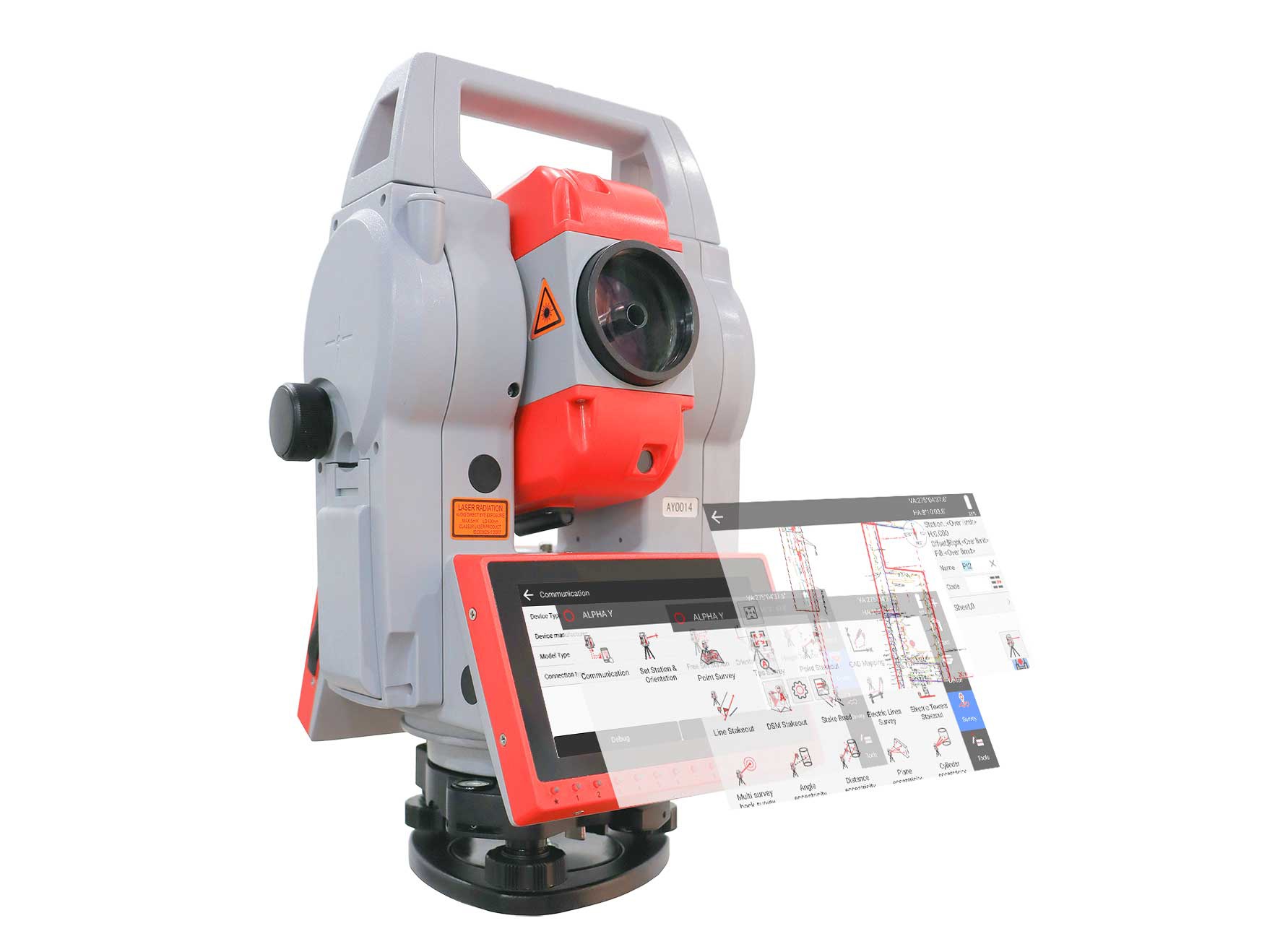
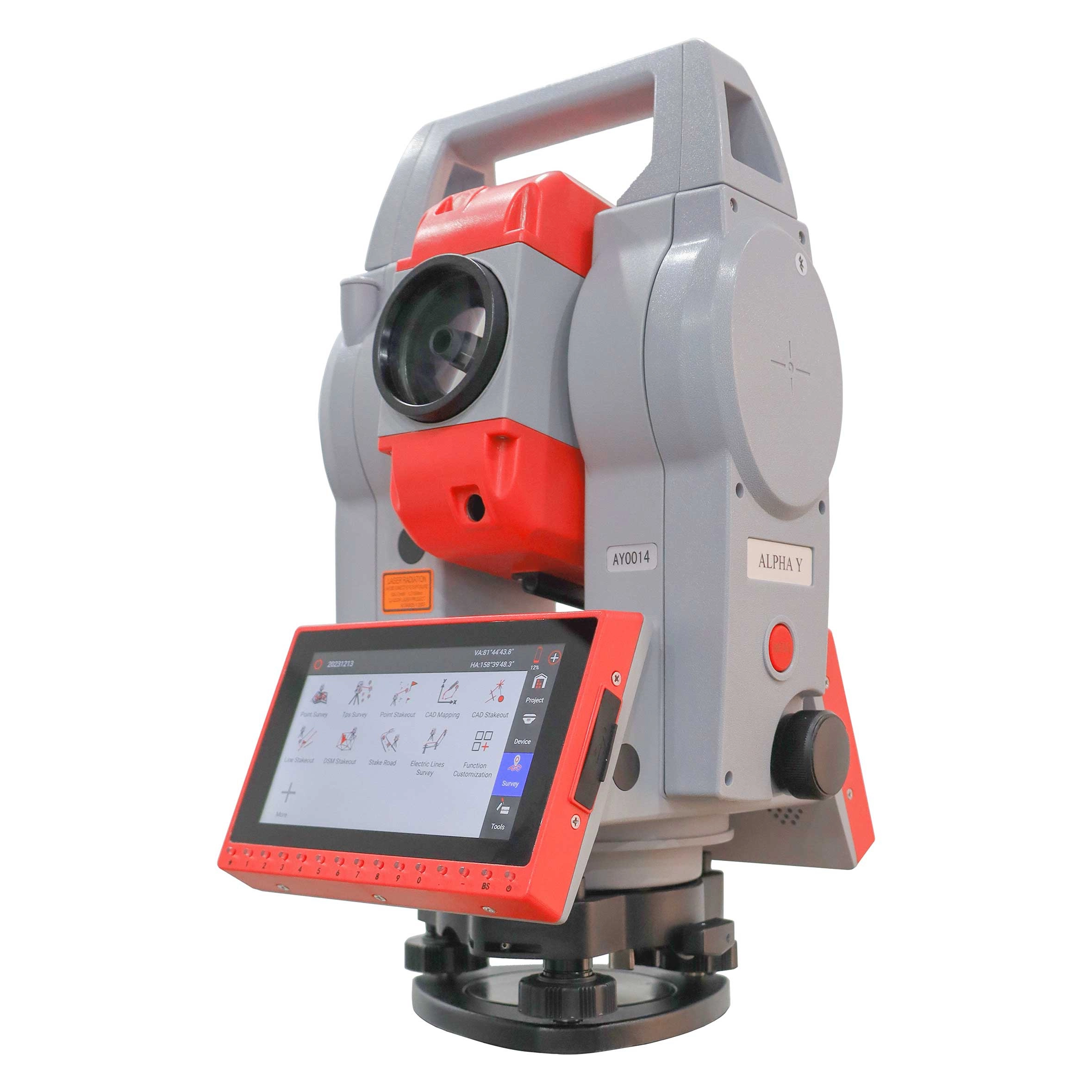
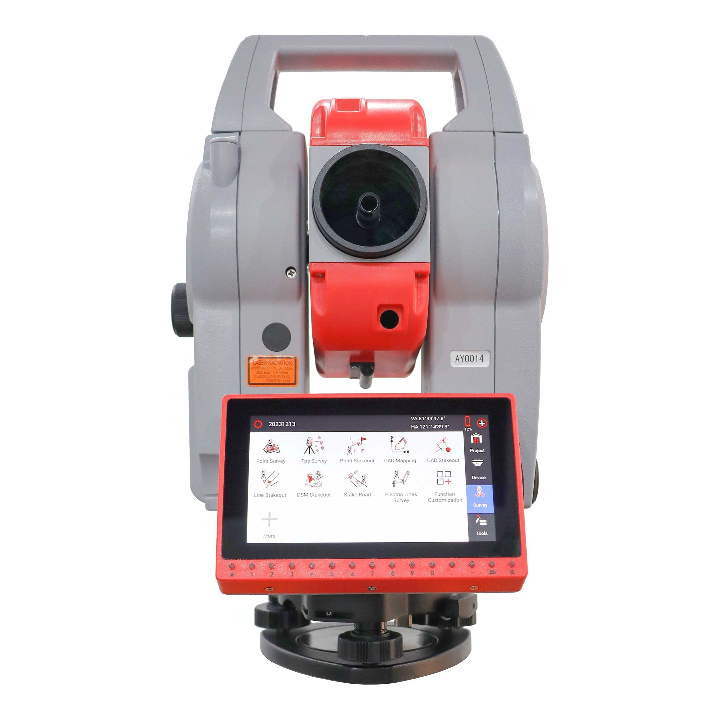

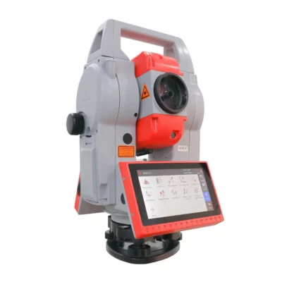
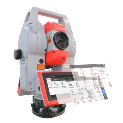
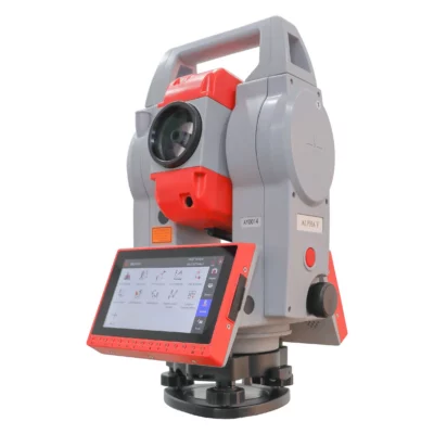
A-geo ALPHA Y Android Total Station with SurPro
This product is available
Get the best price for your setup
Contact our experts for the best possible price and configuration.
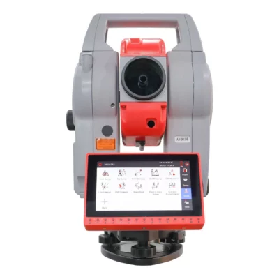
The ALPHA Y is a 2″ Android total station developed for construction layout, engineering surveys, topographic measurement and general site work. It combines precise angle and distance measurement with a 5.5-inch touchscreen and SurPro 6.0 field software, allowing users to manage projects, collect points, perform calculations and complete stakeout work directly on the instrument.
A reflectorless range of up to 1,000 m helps operators measure façades, structures, stockpiles and other inaccessible points without placing a prism. For longer control and survey observations, the instrument measures up to 5,000 m with a single prism. CAD stakeout, road stakeout and flexible data import and export make the ALPHA Y suitable for construction workers, surveyors and engineers who want an integrated field workflow without using a separate data collector for every task.
ALPHA Y Highlights
| Angular accuracy | 2″ |
|---|---|
| Reflectorless range | Up to 1,000 m |
| Prism range | Up to 5,000 m with a single prism |
| Distance accuracy | 2 mm + 2 ppm |
| Field software | SurPro 6.0 with CAD and road stakeout functions |
| Operating system | Android 11 |
| Display | 5.5-inch 720 × 1280 touchscreen |
| Environmental protection | IP55 dust and water protection |
Valued customers:










Find RTK Networks
Search NTRIP providers and connect to reliable RTK correction services.
Description
Android total station for construction and engineering surveys
The ALPHA Y Android Total Station brings optical surveying and modern field software together in one instrument. It is designed for surveyors, construction professionals, civil engineers and site teams carrying out setting-out, topographic surveys, control measurements, as-built checks and infrastructure work.
Unlike a basic total station that depends heavily on external software or a separate controller, the ALPHA Y runs Android 11 and supports SurPro 6.0 directly onboard. This gives field users access to project management, station setup, data collection, stakeout and calculation tools from the instrument’s touchscreen.
Precise angle and distance measurement
With 2″ angular accuracy, the ALPHA Y is suitable for routine construction control, building layout, road projects and general engineering surveys. Its absolute encoder angle-measurement system provides dependable horizontal and vertical observations for positioning and alignment work.
Distance measurements have a stated accuracy of 2 mm + 2 ppm when working reflectorless, with reflective targets or with a prism. In practical fieldwork, this supports accurate coordinate measurement, dimensional checks and stakeout across small and medium-sized construction sites as well as longer survey baselines.
Measure up to 1,000 m without a prism
The reflectorless electronic distance meter can measure suitable surfaces at distances of up to 1,000 m under good conditions. This is useful when a survey point is difficult, unsafe or time-consuming to reach with a prism.
Typical reflectorless applications include building façades, roof edges, bridge elements, tunnel surfaces, stockpiles, excavations and features located behind barriers. The operator can capture these points directly, reducing the need to place personnel in hazardous or restricted areas.
Long-range prism measurement
For control work and longer observations, the ALPHA Y offers a stated range of up to 5,000 m with a single prism. Reflective-sheet measurement is available up to 1,200 m under suitable conditions.
Prism measurement remains useful where stable target definition and repeatable observations are required. It can be used for site control, alignment checks, structural positioning, road construction and other tasks where the surveyor can place a prism at the required point.
SurPro 6.0 onboard surveying software
SurPro 6.0 turns the ALPHA Y into a complete field surveying workstation. Users can create and manage projects, organise point databases, import design information and export measured results without transferring every task to office software first.
Station setup functions include known-point orientation, multipoint backsight, azimuth setup, free-station setup, orientation to a line and height transfer. These options help field teams establish the instrument in different site conditions, including locations where it is not practical to set up directly over a known control point.
Point and CAD stakeout
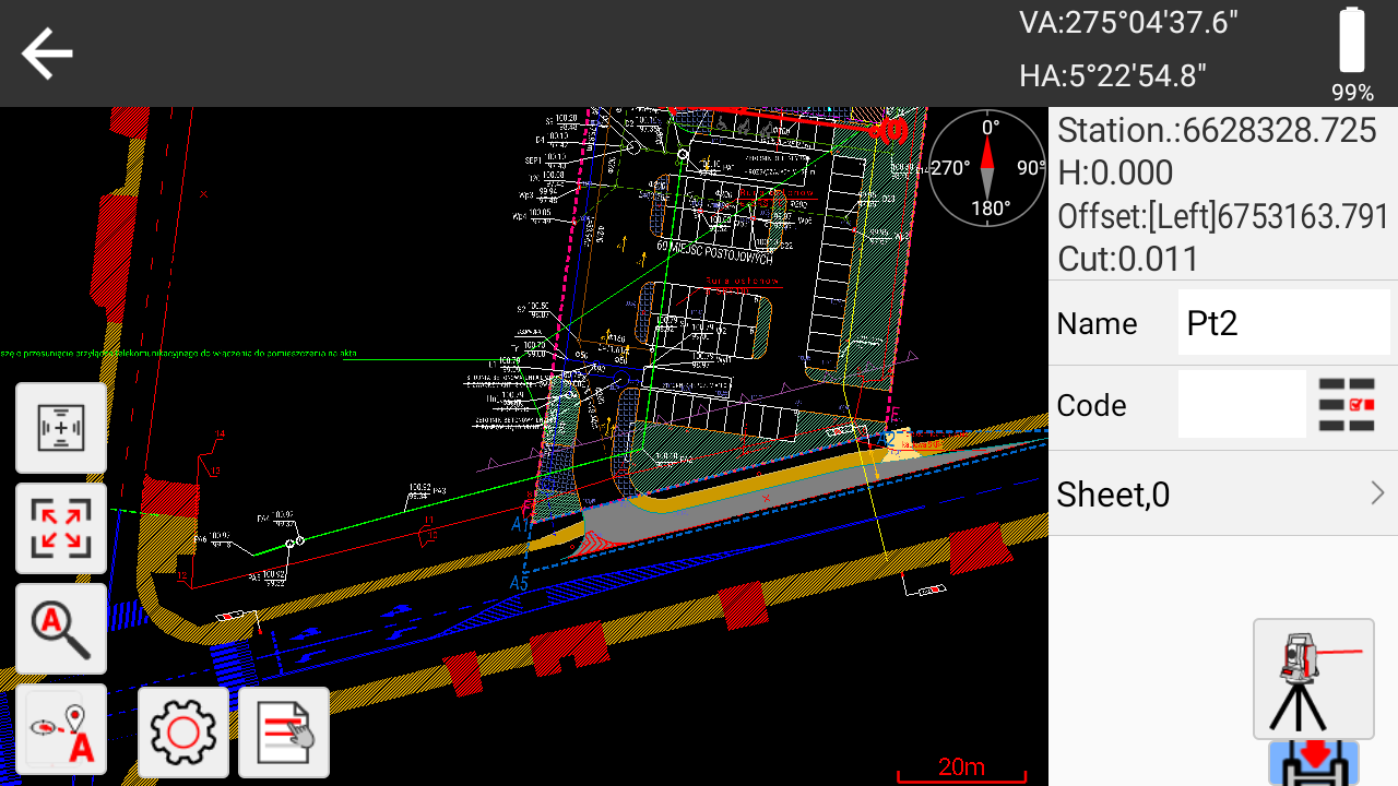
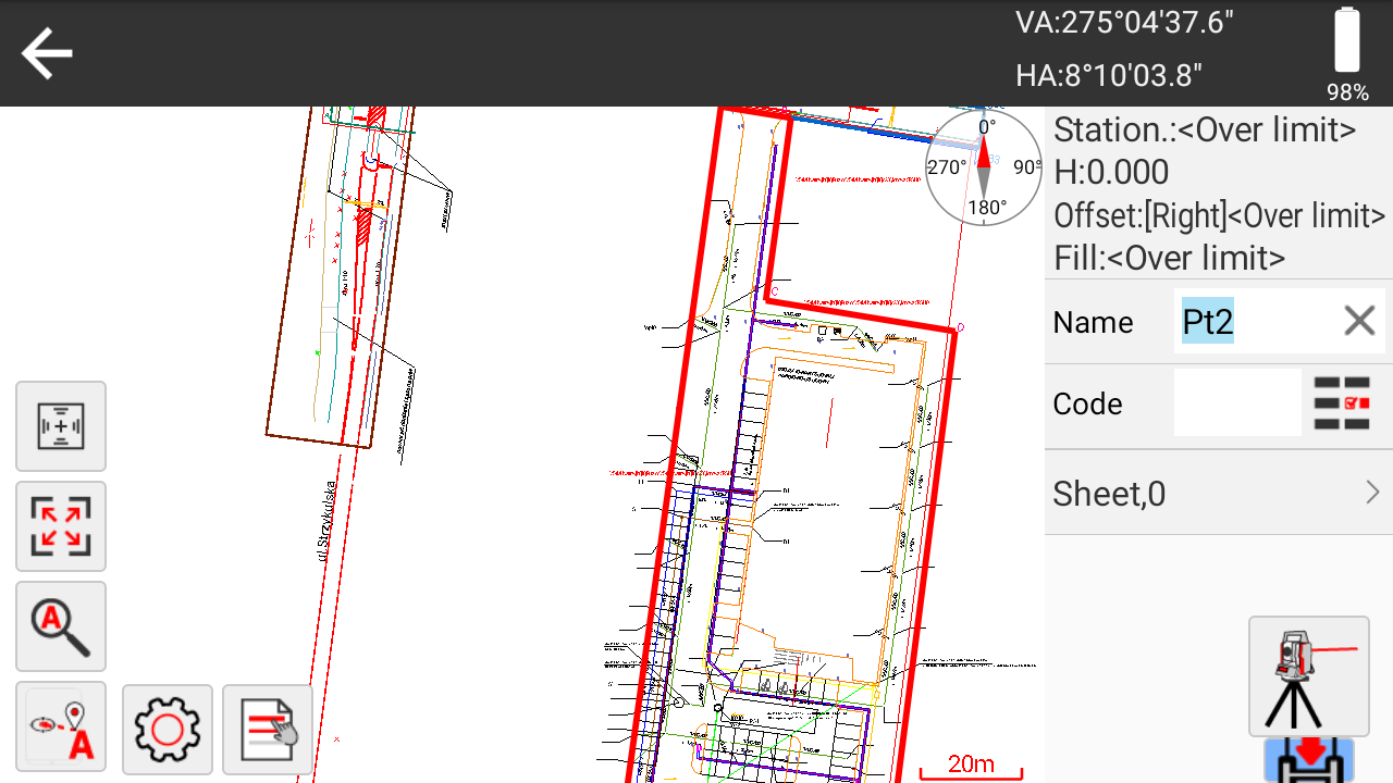
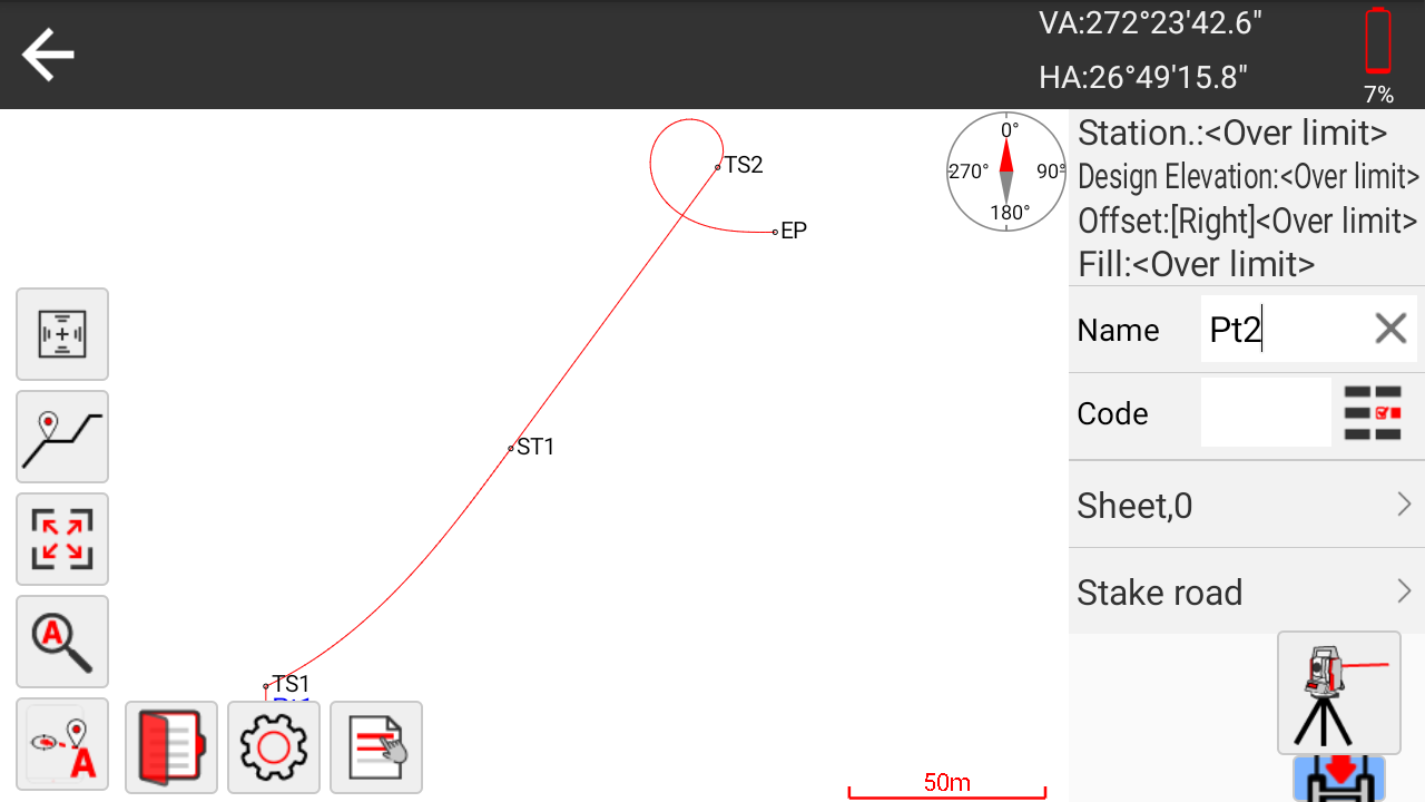
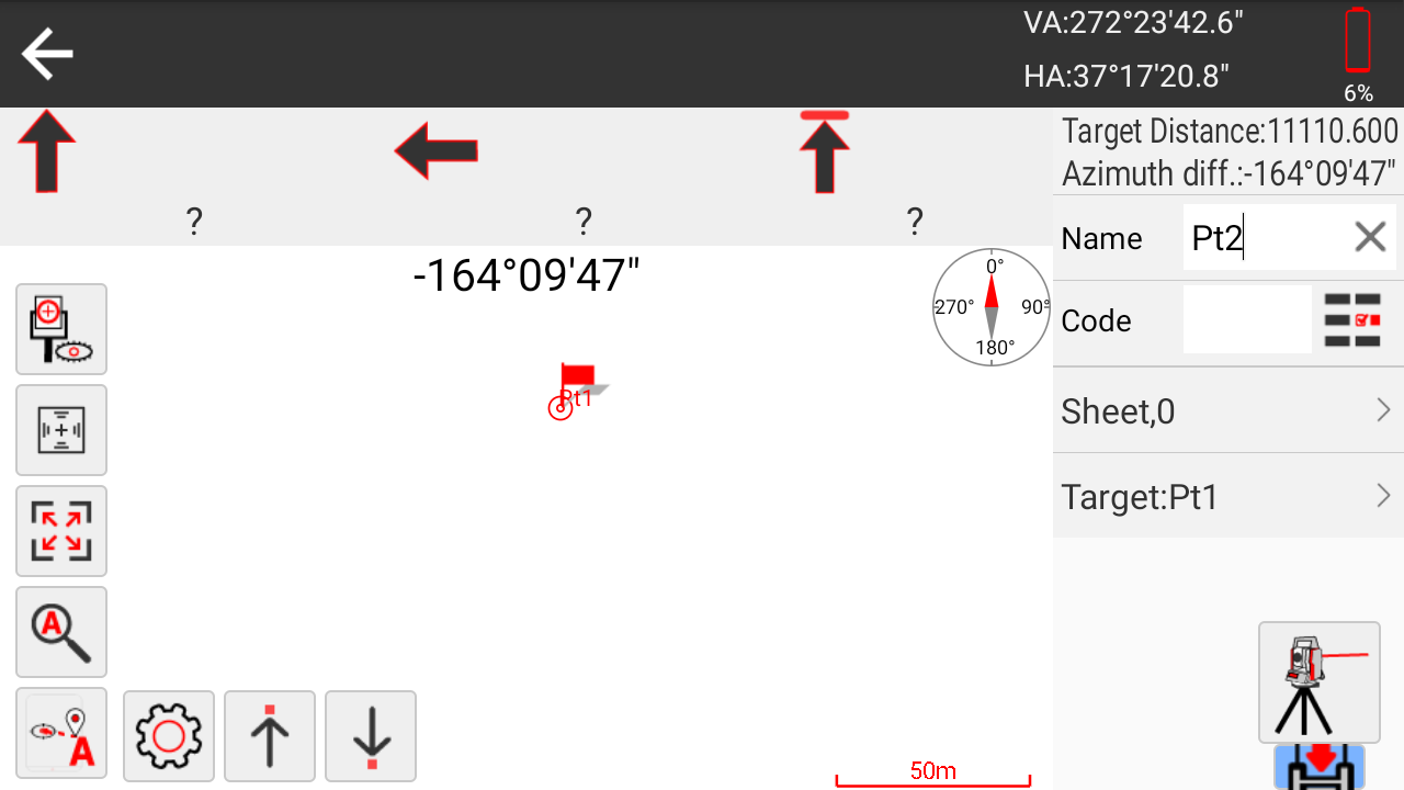
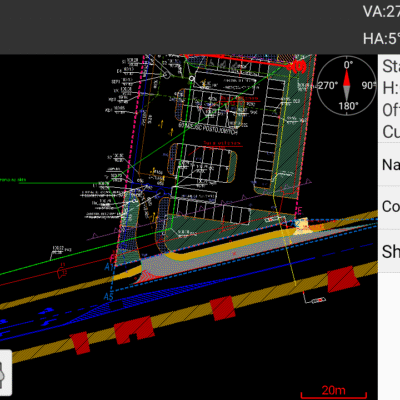
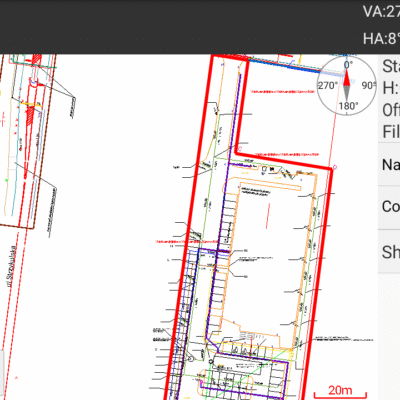
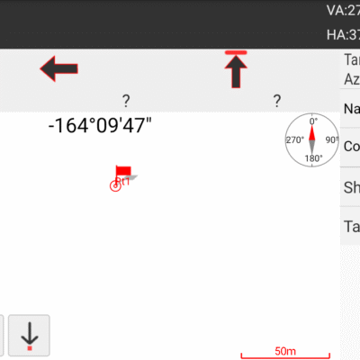
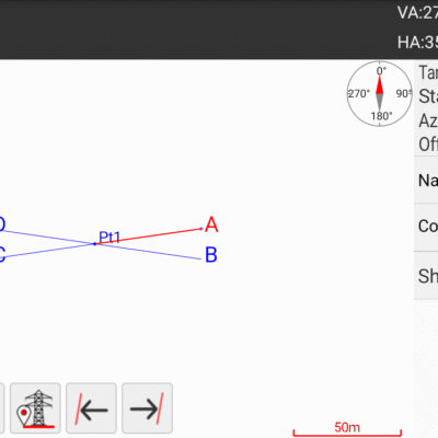
The software supports point, line, spiral, CAD and road stakeout. CAD drawings can be used as a graphical background, helping the operator identify design points and lines visually rather than relying only on long coordinate lists.
This is especially practical for foundations, grid lines, utilities, kerbs, structural elements and landscape features. The operator can select the required design position, follow the displayed stakeout guidance and record the completed work within the same project.
Road and infrastructure workflows
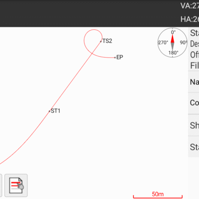
Road-design and stakeout functions support alignment-based engineering projects. Survey teams can work with centre lines, vertical profiles, chainages, cross-sections, slopes and related design elements when setting out or checking road construction.
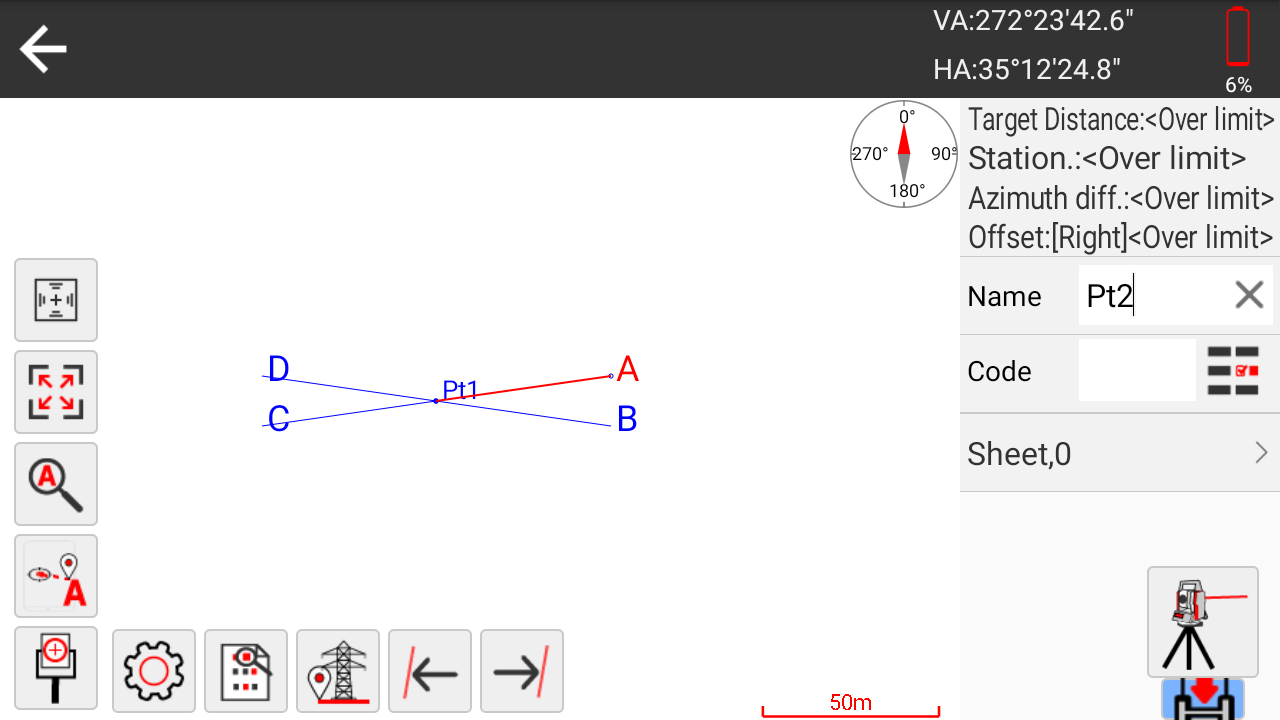
Additional functions for remote height, offset measurement, multi-round observations, electric-line surveys and tower stakeout expand the instrument’s use across utilities, transport, energy and civil-engineering projects.
Field calculations without returning to the office
SurPro 6.0 includes practical coordinate and geometry tools for calculations that regularly arise on site. These include area and volume calculations, coordinate forward and inverse calculations, intersections, resections, offsets, centre-point calculations and point-on-line work.
Completing these calculations at the instrument can help operators respond more quickly when design information changes or an unexpected measurement is required. It also reduces manual transcription between calculators, notebooks and separate software packages.
Clear touchscreen and Android operation
The 5.5-inch colour display has a resolution of 720 × 1280 pixels and presents survey information, menus and graphical stakeout guidance in a familiar Android-style interface. A physical 15-key keyboard is also provided for users who prefer buttons for common field commands or need to work while wearing gloves.
The quad-core 64-bit ARM Cortex-A55 processor runs at up to 2 GHz. Standard memory is 4 GB RAM with 32 GB internal storage, with an optional configuration of 8 GB RAM and 128 GB storage. This provides space for project files, drawings, software and collected data.
Flexible data transfer and connectivity
Available interfaces include USB, USB Type-C, Bluetooth, Wi-Fi and RS-232C. An optional 4G module can provide mobile-network connectivity where supported. These communication options make it easier to exchange survey data with computers, controllers and other field equipment.
SurPro 6.0 supports common coordinate and survey data workflows, while drawing layers can include formats such as DXF, DWG, SHP and LandXML. File compatibility should always be checked against the exact software version and the project’s office workflow before deployment.
Designed for everyday site conditions
The ALPHA Y has an IP55 rating for protection against dust and water ingress. Its stated operating temperature range is from -20°C to +50°C, making it suitable for normal outdoor construction and surveying environments when handled according to professional instrument-care practices.
A dual-axis compensator helps correct small setup deviations, while the standard laser plummet assists with accurate centring over a survey point. The 30× telescope provides a clear view of prisms and site features during manual aiming.
Battery performance for a working day
The rechargeable 5,200 mAh lithium-ion battery provides a stated operating time of approximately eight hours at 20°C. Actual endurance will depend on screen brightness, measurement frequency, connectivity, temperature and software use.
For longer shifts or remote projects, carrying a charged spare battery and suitable charging equipment helps maintain uninterrupted field productivity.
Typical ALPHA Y applications
- Building grid, foundation and structural layout
- Topographic surveys and site-detail collection
- Road, utility and civil-engineering stakeout
- As-built measurement and dimensional checks
- Façade, stockpile and inaccessible-point measurement
Who is the ALPHA Y for
The ALPHA Y is suited to teams that need more field capability than a basic manual total station but do not require robotic prism tracking. Its onboard Android software reduces dependence on a separate data collector and gives operators direct access to graphical stakeout, road functions and field calculations.
It is a practical option for construction companies, independent surveyors, engineering contractors, utility teams and educational organisations looking for an integrated total-station workflow with conventional manual aiming.
Buying and support from Global GPS Systems
Global GPS Systems can help buyers review the required angular accuracy, measurement range, software workflow and accessory configuration before selecting the ALPHA Y. Proper setup, compatible data formats, suitable prisms and operator training are important for obtaining reliable results in daily fieldwork.
Datasheets & Manuals
Specifications
AlphaGeo ALPHA Y Android Total Station Specifications
Product Overview
| Manufacturer | Guangzhou Alpha Geo-Info Co., Ltd. (AlphaGeo / α-GEO) |
|---|---|
| Model | ALPHA Y |
| Product Type | High-end intelligent Android total station |
| Operating System | Android 11 |
| Onboard Surveying Software | SurPro 6.0 |
| Software Platform | Open Android platform with support for third-party applications and customized industry-specific apps |
| Primary Applications | Engineering surveying, construction layout, topographic surveying, CAD mapping, road stakeout, tower stakeout and point stakeout |
Key Features
| Android Application Support | Supports third-party Android surveying software and customized applications |
|---|---|
| Angle Measurement Technology | CCD array angle measurement system designed to reduce systematic measurement errors |
| Drive System | Endless drive for rapid manual target aiming |
| CAD Support | Supports CAD drawing import, CAD mapping and graphical CAD stakeout |
| Graphical Stakeout | Supported through the onboard SurPro 6.0 software |
| Data Sharing | Supported |
| OTA Updates | Supports over-the-air software upgrades |
| Power Management | Intelligent power-management system designed for extended field operation |
| Display Configuration | Supports single-side and dual-side display configurations |
Telescope
| Telescope Length | 156 mm |
|---|---|
| Image | Erect |
| Telescope Objective Aperture | 45 mm |
| Distance-Measuring Aperture | 50 mm |
| Magnification | 30× |
| Field of View | 1°30′ |
| Minimum Focusing Distance | 1.0 m |
Angle Measurement
| Angle Reading System | Absolute encoder |
|---|---|
| Angle Measurement Technology | CCD array angle measurement system |
| Angular Accuracy | 2″ |
| Selectable Angle Units | 360°, 400 gon or 6400 mil |
| Selectable Angle Display Resolution | 1″, 5″ or 10″ |
| Selectable Gon Display Resolution | 0.2 mgon, 1 mgon or 2 mgon |
Distance Measurement Range
| Target Type | Measurement Range | Accuracy |
|---|---|---|
| Reflectorless | 1 to 1,000 m | ±(2 mm + 2 ppm) |
| Reflective Sheet / RP60 | 1 to 1,200 m | ±(2 mm + 2 ppm) |
| Single Prism | 1 to 5,000 m | ±(2 mm + 2 ppm) |
Distance Measurement Performance
| Fine Measurement Time | Approximately 0.5 seconds |
|---|---|
| Tracking Measurement Time | Approximately 0.3 seconds |
| Selectable Distance Display Resolution | 0.1 mm or 1 mm |
| Distance Units | Metres or inches selectable |
| Prism Constant Correction Range | -99.9 mm to +99.9 mm |
| Atmospheric Pressure Input Range | 500 to 1,500 hPa |
| Pressure Input Increment | 1 hPa |
| Temperature Input Range | -40°C to +60°C |
| Temperature Input Increment | 1°C |
| Atmospheric Sensors | Integrated temperature and air-pressure sensors |
Laser Classification
| Measurement Mode | Laser Class | Standard |
|---|---|---|
| Reflectorless Measurement | Class 3R | IEC 60825-1 |
| Reflective Sheet / RP60 Measurement | Class 3R | IEC 60825-1 |
| Prism Measurement | Class 1 | IEC 60825-1 |
Compensator
| Compensator Type | Dual-axis compensator |
|---|---|
| Compensation Range | ±3′ |
| Setting Accuracy | 1″ |
Leveling System
| Plate Level Sensitivity | 30″ per 2 mm |
|---|---|
| Circular Level Sensitivity | 8′ per 2 mm |
Laser Plummet
| Configuration | Standard |
|---|---|
| Plummet Accuracy | ±1 mm at an instrument height of 0.8 to 1.5 m |
| Laser Spot Size | 2.0 mm or less at an instrument height of 0.8 to 1.5 m |
Optional Optical Plummet
| Availability | Factory option |
|---|---|
| Accuracy | ±0.8 mm at an instrument height of 1.5 m |
| Image | Erect |
| Magnification | 3× |
| Field of View | 4° |
| Focusing Range | 0.5 m to infinity |
Display and Controls
| Display Size | 5.5 inches |
|---|---|
| Display Resolution | 720 × 1280 pixels |
| Display Definition | 720p HD |
| Outdoor Visibility | High-brightness display designed to remain visible in strong light |
| Display Layout | Single-side or dual-side display configuration |
| Physical Keyboard | 15 keys below the display |
| Trigger Key | Supported |
| Screen Backlight Adjustment | Supported |
| Voice Output | Supported |
| Buzzer Output | Supported |
| Real-Time Clock | Supported |
Processor and Memory
| Component | Standard Configuration | Optional Configuration |
|---|---|---|
| Processor | Quad-core 64-bit ARM Cortex-A55 | Not specified |
| Maximum Processor Clock | 2 GHz | Not specified |
| RAM | 4 GB | 8 GB |
| Internal Storage | 32 GB ROM | 128 GB ROM |
| Expandable Storage | TF card supported | Capacity not specified |
Communication and Interfaces
| USB | Supported |
|---|---|
| USB Type-C | Supported |
| USB Flash Drive Support | Supported |
| Bluetooth | Supported |
| Wi-Fi | Supported |
| Serial Interface | RS-232C |
| Mobile Network | 4G full-network module available as an option |
| Memory Card Interface | TF card slot |
Data Formats and Transfer
| Supported Survey Data Formats | CSW, TXT and DAT |
|---|---|
| Data Import | Supported |
| Data Export | Supported |
| CAD Drawing Import | Supported |
| CAD Data Workflow | Supports CAD mapping, CAD drawing display and graphical CAD stakeout |
| Wireless Data Transfer | Available through Bluetooth, Wi-Fi and optional 4G connectivity |
| Wired Data Transfer | Available through USB, USB Type-C and RS-232C |
SurPro 6.0 Surveying Functions
| CAD Stakeout | Supported |
|---|---|
| CAD Mapping | Supported |
| Road Stakeout | Supported |
| Tower Stakeout | Supported |
| Point Stakeout | Supported |
| Graphical Stakeout | Supported |
| Internal and External Field Surveying | Supported through integrated measurement programs |
| Data Sharing | Supported |
| Software Updates | OTA upgrade supported |
Power System
| Battery Type | Rechargeable lithium-ion battery |
|---|---|
| Battery Capacity | 5,200 mAh |
| Output Voltage | 7.4 V DC |
| Continuous Operating Time | Approximately 8 hours at +20°C |
| Charging Time | Approximately 4 hours at +20°C |
| Power Management | Intelligent power-management system |
Environmental Specifications
| Ingress Protection | IP55 |
|---|---|
| Ingress Protection Standard | IEC 60529 |
| Operating Temperature | -20°C to +50°C |
| Storage Temperature | -40°C to +55°C |
Optional Configurations
| Option | Standard Configuration | Optional Configuration |
|---|---|---|
| Memory and Storage | 4 GB RAM and 32 GB ROM | 8 GB RAM and 128 GB ROM |
| Mobile Connectivity | Wi-Fi and Bluetooth | 4G full-network module |
| Plummet | Laser plummet | Factory-installed optical plummet |
| Display Configuration | Single-side display | Dual-side display configuration |
Typical Applications
| Engineering Surveying | Site measurement, control surveys and engineering data collection |
|---|---|
| Construction Layout | Point and graphical stakeout for building and infrastructure projects |
| Topographic Surveying | Field measurement and CAD-based mapping |
| Road Construction | Road alignment and road stakeout workflows |
| Tower Construction | Tower-point layout and stakeout |
| CAD-Based Surveying | CAD drawing import, CAD mapping and CAD graphical stakeout |
| Custom Industry Workflows | Supports specialized Android applications developed for different industries |
Specifications and package contents may vary by configuration, region or manufacturer update. Always check the current configuration before ordering.
FAQ
ALPHA Y Android Total Station FAQ
Product Overview and Applications
What is the ALPHA Y Android Total Station?
The ALPHA Y is a high-end intelligent total station that combines precise optical surveying hardware with an Android 11 operating system and SurPro 6.0 engineering survey software. It is designed to perform field measurement, mapping, calculation and stakeout tasks directly on the instrument.
Who is the ALPHA Y designed for?
The ALPHA Y is designed for land surveyors, civil engineers, construction contractors, road survey teams, utility specialists, tower installation crews and other professionals who require accurate angle, distance and coordinate measurements.
What engineering projects can the ALPHA Y be used for?
The total station can support topographic surveys, construction layout, point stakeout, road stakeout, tower stakeout, cadastral work, as-built surveys, control surveys, CAD mapping and other civil engineering or infrastructure projects.
Is the ALPHA Y a robotic total station?
No. The ALPHA Y is an intelligent manual total station rather than a fully robotic instrument. Its endless-drive controls help the operator aim quickly and smoothly, while measurements and calculations are managed through the onboard Android interface.
Can the ALPHA Y be used where GNSS reception is unavailable?
Yes. The ALPHA Y measures angles and distances optically, so it can be used near tall structures, beneath bridges, inside buildings and in other locations where satellite reception may be obstructed or unreliable.
What are the main advantages of an Android total station?
An Android total station provides a familiar touchscreen interface, onboard engineering applications, graphical workflows, flexible file management and access to compatible third-party software. This can reduce the need for separate field controllers and manual office calculations.
Measurement Range and Accuracy
What is the angular accuracy of the ALPHA Y?
The ALPHA Y has a specified angular accuracy of 2 arc-seconds. It uses an absolute encoder and supports selectable angle display resolutions of 1, 5 or 10 arc-seconds.
What is the maximum reflectorless measurement range?
The specified reflectorless measurement range is from 1 metre to 1,000 metres under good measuring conditions. Actual range can vary according to the target surface, atmospheric conditions, visibility and measurement angle.
How far can the ALPHA Y measure with a prism?
The ALPHA Y can measure from 1 metre to approximately 5,000 metres using a single prism under good conditions.
Can the ALPHA Y measure reflective sheets?
Yes. The specified measurement range with a reflective sheet or RP60 target is from 1 metre to approximately 1,200 metres under suitable conditions.
What is the distance measurement accuracy?
The specified distance measurement accuracy is ±(2 mm + 2 ppm) for prism, reflective-sheet and reflectorless measurements.
How fast does the ALPHA Y take a measurement?
The specified measuring time is approximately 0.5 seconds in fine mode and 0.3 seconds in tracking mode, helping survey teams collect field points efficiently.
Does the ALPHA Y have a dual-axis compensator?
Yes. The ALPHA Y includes a dual-axis compensator with a specified working range of ±3 minutes. It helps correct small instrument-levelling errors during angle measurements.
SurPro 6.0 Software and Field Workflows
What is SurPro 6.0?
SurPro 6.0 is Android-based engineering surveying software developed for total station fieldwork. It manages projects, instrument setup, point databases, coordinate systems, measurement routines, calculations, mapping and stakeout operations.
Which survey functions are available in SurPro 6.0?
SurPro 6.0 supports workflows such as point surveying, station setup, known-point orientation, free-station setup, coordinate measurement, point stakeout, CAD stakeout, road stakeout, tower stakeout and engineering calculations.
Can the ALPHA Y perform graphical CAD stakeout?
Yes. CAD drawings can be displayed in SurPro 6.0 so operators can select and stake points or design elements from a graphical plan. This makes complex construction layout easier to understand in the field.
Can CAD drawings be imported into the ALPHA Y?
Yes. The ALPHA Y supports CAD drawing import for graphical mapping and stakeout workflows. Project files should be prepared in a format and coordinate system supported by the installed SurPro 6.0 software.
Which survey data files can the ALPHA Y import and export?
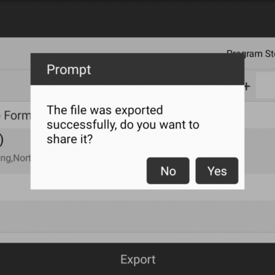
The product supports convenient importing and exporting of common survey data formats, including CSW, TXT and DAT files. Available formats may depend on the installed SurPro 6.0 version and project configuration.
Can the ALPHA Y be used for road stakeout?
Yes. SurPro 6.0 includes road-oriented stakeout tools for setting out alignment points and other road design information, making the instrument suitable for highway, railway and linear infrastructure projects.
Does the ALPHA Y support third-party Android applications?
The Android 11 platform is open and scalable, allowing compatible third-party applications to be installed. Application compatibility and access to the total station hardware should be confirmed before deployment.
Display, Connectivity and Field Durability
What display does the ALPHA Y use?
The ALPHA Y has a 5.5-inch HD display with a resolution of 720 by 1280 pixels. The screen is designed to remain readable during outdoor fieldwork and can be operated together with the instrument’s physical keys.
What processor and storage are included?
The instrument uses a 2 GHz quad-core 64-bit ARM Cortex-A55 processor. The standard configuration includes 4 GB of RAM and 32 GB of internal storage, with an optional 8 GB RAM and 128 GB storage configuration.
Which communication interfaces does the ALPHA Y support?
The ALPHA Y supports USB, USB Type-C, Bluetooth, Wi-Fi, RS-232C and TF card connectivity. An optional 4G module is available for mobile network communication.
How long does the ALPHA Y battery operate?
The 5200 mAh rechargeable lithium-ion battery provides approximately eight hours of continuous operation at 20°C. Runtime can vary with screen brightness, wireless connections, temperature and measurement activity.
How long does the battery take to charge?
The specified charging time is approximately four hours at 20°C. Charging performance may vary with battery condition and ambient temperature.
Is the ALPHA Y protected against dust and water?
Yes. The instrument has an IP55 protection rating under IEC 60529, providing protection against dust ingress and water jets. It should not be submerged and should be stored dry after use in wet conditions.
What temperatures can the ALPHA Y operate in?
The specified operating temperature range is -20°C to +50°C. The specified storage temperature range is -40°C to +55°C.
Does the ALPHA Y include a laser plummet?
Yes. A laser plummet is included as standard for positioning the instrument above a survey point. An optical plummet is available as a factory option.
Reviews (0)
Only logged in customers who have purchased this product may leave a review.
 GPS & GNSS
 Total Stations
 Data collectors
 Software
 Correction services
 Machine control
 External radio
 Lasers & levellers
 Marine
 Accessories
Reviews
There are no reviews yet