
 GPS & GNSS
 Lidar scanning
 Total Station
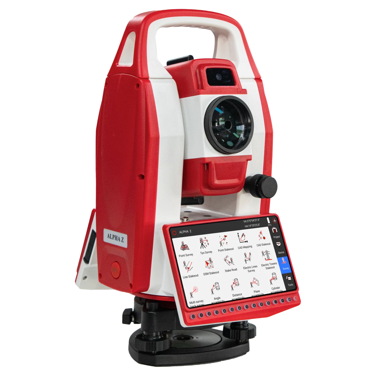
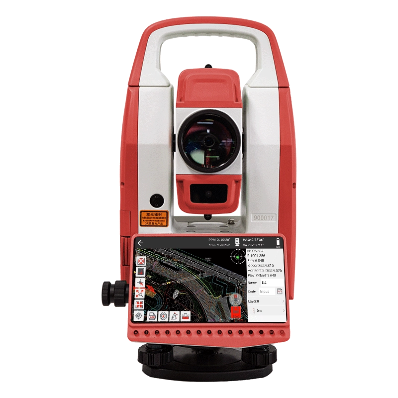





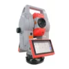
A-geo ALPHA Z Android Visual Total Station with SurPro
This product is available
Get the best price for your setup
Contact our experts for the best possible price and configuration.
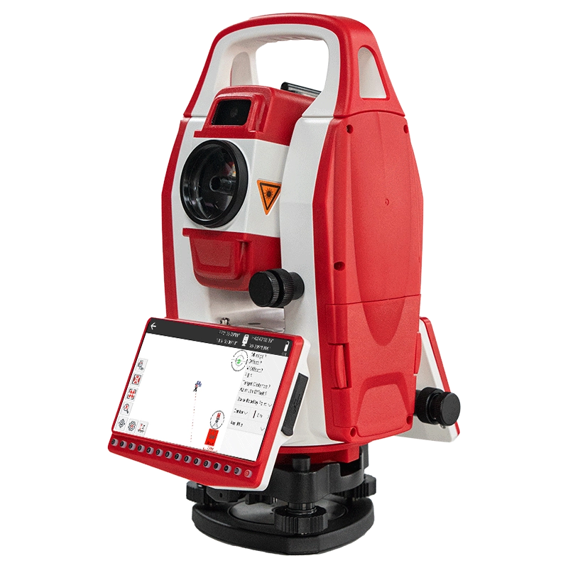
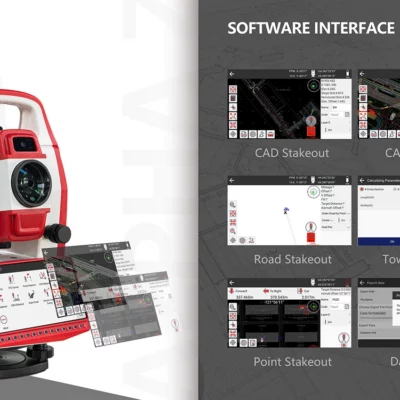
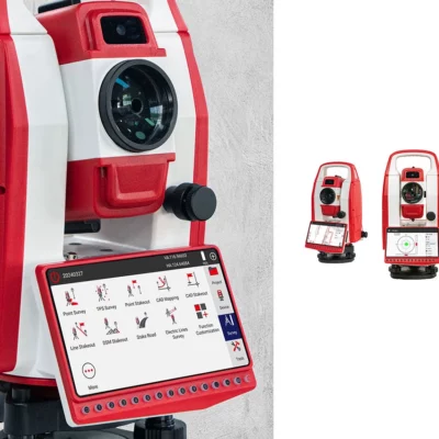
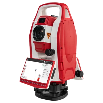
The ALPHA Z is a 2″ Android total station designed for construction layout, engineering surveys, topographic measurement and infrastructure projects. It combines accurate optical measurement with an integrated auxiliary aiming camera, a 5.5-inch touchscreen and SurPro 6.0 field software, helping operators aim at targets, collect survey data and complete graphical stakeout directly on the instrument.
With reflectorless measurement up to 1,000 m and single-prism measurement up to 5,000 m, the ALPHA Z can handle both inaccessible detail points and longer control observations. CAD graphical stakeout, road and tower applications, onboard calculations and 4G, Wi-Fi and Bluetooth connectivity support an efficient digital workflow for surveyors, site engineers and construction teams.
ALPHA Z Highlights
| Angular accuracy | 2″ |
|---|---|
| Image-assisted measurement | Integrated auxiliary aiming camera with visual targeting support |
| Reflectorless range | Up to 1,000 m with 3 mm + 2 ppm accuracy |
| Prism range | Up to 5,000 m with 2 mm + 2 ppm accuracy |
| Graphical stakeout | CAD mapping and CAD graphical stakeout with SurPro 6.0 |
| Operating system | Android 12 |
| Display | 5.5-inch capacitive touchscreen with 1280 × 720 resolution |
| Connectivity | 4G, Wi-Fi, Bluetooth, USB Type-A and USB Type-C |
| Environmental protection | IP55 dust and water protection |
Valued customers:










Find RTK Networks
Search NTRIP providers and connect to reliable RTK correction services.
Description
Visual Android total station for modern field surveying
The ALPHA Z Android Total Station is designed for surveyors, construction professionals and engineering teams that want accurate manual total-station measurement with an integrated digital field workflow. It combines a 2″ angle-measurement system, long-range electronic distance measurement, image-assisted aiming and SurPro 6.0 software in one instrument.
This configuration is suitable for building layout, topographic surveys, road construction, utility projects, structural positioning and as-built measurement. Project data, drawings, survey functions and field calculations can be accessed from the instrument without relying on a separate controller for every operation.
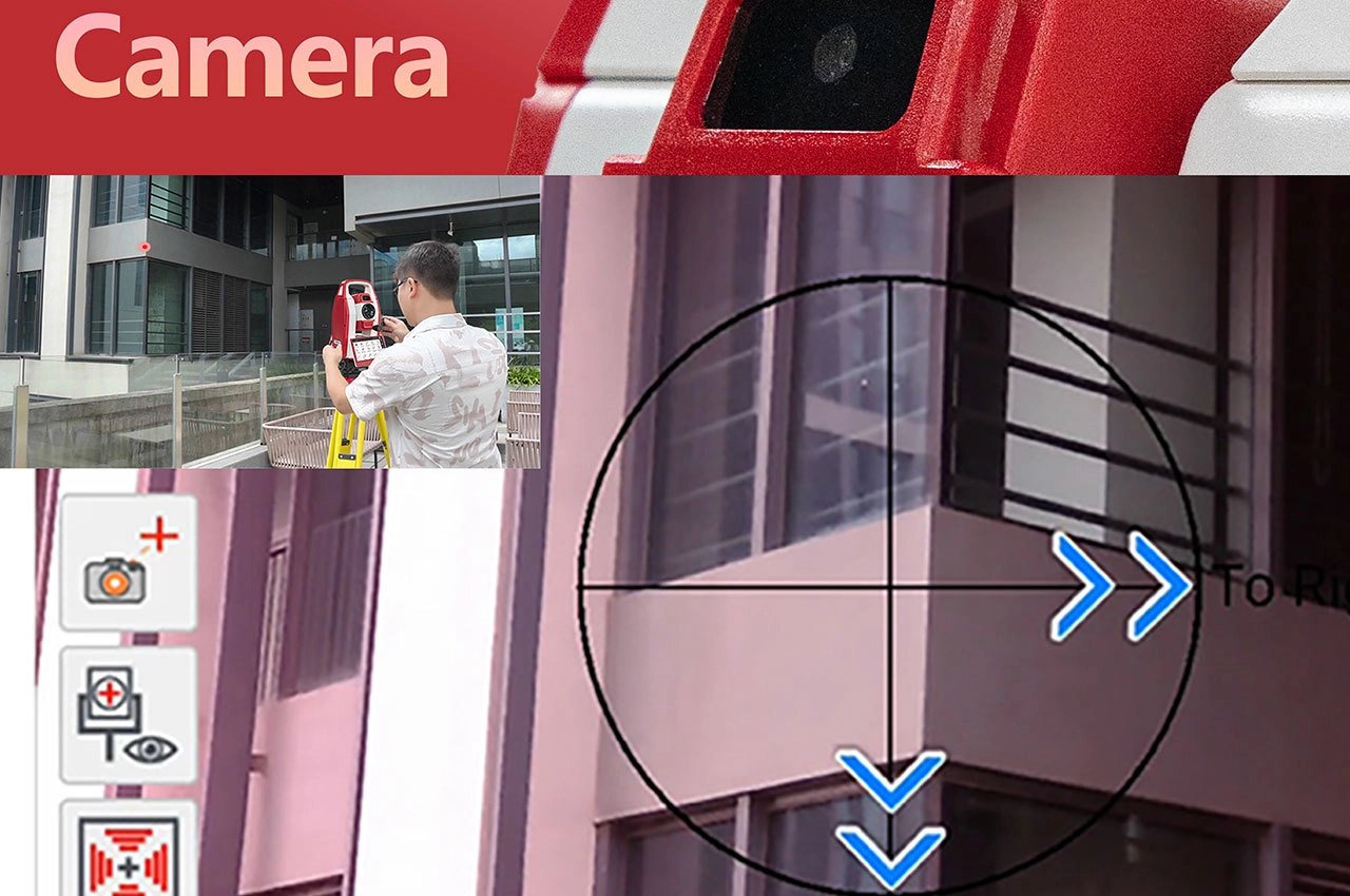
Image-assisted aiming for faster target alignment
An integrated auxiliary camera provides visual support while aiming the total station. Instead of depending only on the optical telescope during initial target alignment, the operator can use the camera view to identify the working area and bring the instrument onto the required prism, reflector or detail point more efficiently.
This is particularly useful when targets are difficult to locate through the telescope, when working across busy construction sites or when repeated points must be observed during layout and detail surveys. Image assistance does not replace careful final aiming, but it can reduce the time spent searching for the target and make the measurement process easier for less experienced operators.
Accurate angle and distance measurement
The ALPHA Z provides 2″ angular accuracy using an absolute-encoding angle system. This accuracy class is suitable for general engineering surveys, construction setting-out, building control, roadwork and other routine professional measurement tasks.
Distance accuracy is stated as 2 mm + 2 ppm when measuring to a prism or reflective sheet. Reflectorless measurements have a stated accuracy of 3 mm + 2 ppm. In field terms, this allows the instrument to support precise coordinate collection and layout while giving operators the flexibility to choose the most suitable target method for each point.
Measure inaccessible points without a prism
The reflectorless electronic distance meter offers a stated range of up to 1,000 m under good conditions. This allows suitable surfaces to be measured without sending a worker to hold a prism at every location.
Reflectorless measurement can be useful for façades, roof edges, bridge components, excavation faces, stockpiles, tunnel surfaces and points behind fences or other obstacles. It helps reduce unnecessary access to hazardous or restricted areas while allowing the surveyor to collect coordinates from the instrument position.
Long-range prism observations
For control surveys and longer observations, the ALPHA Z can measure up to 5,000 m using a single prism under suitable conditions. Reflective-sheet measurement is available up to 1,000 m.
Prism measurement is well suited to construction control, alignment work, traverse observations and stakeout where a clearly defined target is required. The instrument provides precision, fast and tracking measurement modes, allowing the operator to balance measurement speed and observation requirements.
SurPro 6.0 field software
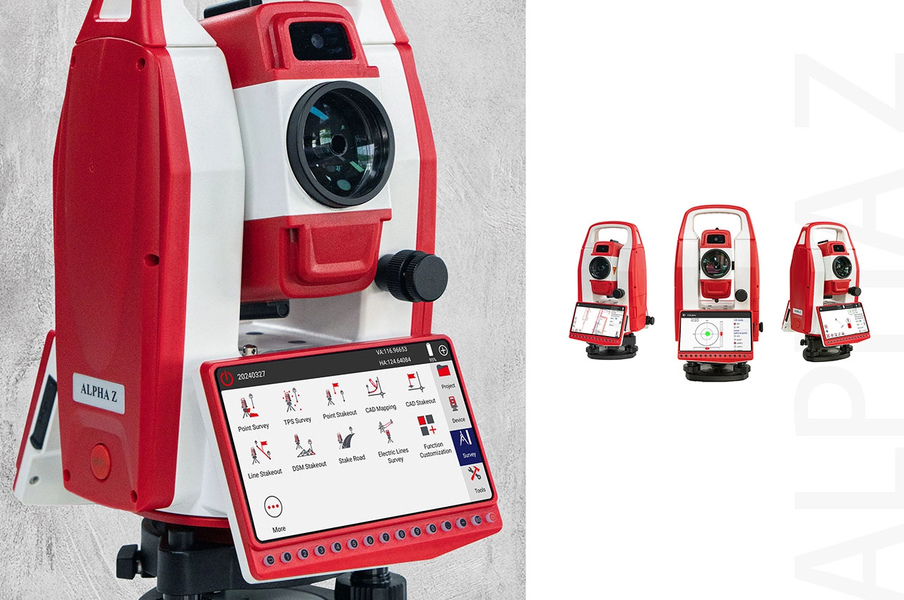
SurPro 6.0 provides the onboard tools required for common surveying and construction tasks. Users can manage projects, collect points, perform station setup, calculate coordinates and guide stakeout work from the ALPHA Z touchscreen.
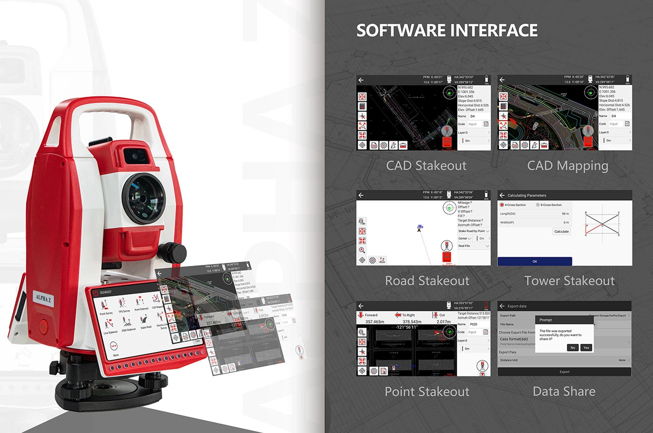
The software interface includes applications for point surveying, total-station surveying, point stakeout, line stakeout, CAD mapping, CAD stakeout, road stakeout, tower stakeout and electric-line surveys. These functions make the instrument suitable for a broad range of building, civil-engineering and infrastructure workflows.
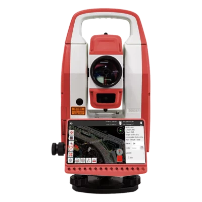
CAD graphical stakeout
CAD graphical stakeout allows design information to be viewed visually rather than working only from coordinate lists. The operator can use the drawing to select the required point or feature and follow the displayed direction and distance guidance to move the prism towards the design position.
This workflow is practical for setting out foundations, columns, grid lines, kerbs, utilities, boundaries and structural elements. Graphical guidance can also reduce the risk of choosing the wrong point on projects containing large coordinate databases or complex site plans.
Road and specialist engineering applications
Road stakeout functions support alignment-based construction and survey work. These tools can help teams position or check points along centre lines, offsets and cross-sections while working on roads, access routes and other linear infrastructure.
Dedicated tower and electric-line functions extend the instrument’s use to energy and utility projects. The available field applications can reduce the number of separate calculations required during specialist setting-out and measurement tasks.
Android 12 operating platform
The ALPHA Z runs Android 12 on a quad-core Cortex-A55 processor operating at up to 2.0 GHz. The open Android platform supports SurPro 6.0 and provides a familiar touchscreen environment for navigating projects, drawings and measurement applications.
The standard configuration includes 2 GB RAM and 16 GB internal storage. This provides space for field software, coordinate files, drawings and survey projects while maintaining an integrated instrument-based workflow.
Clear touchscreen with physical controls
A 5.5-inch capacitive touchscreen with 1280 × 720 resolution displays measurements, maps and graphical stakeout information. The colour interface is especially useful when viewing CAD drawings or following visual positioning guidance.
Fifteen physical keys are positioned below the display, and a separate trigger key allows measurements to be started without repeatedly reaching for an on-screen command. The instrument also includes precision handwheels for controlled horizontal and vertical aiming.
Flexible communication and data transfer
The ALPHA Z supports cellular 4G, Wi-Fi, Bluetooth and virtual RS-232 communication through USB Type-C. It also includes USB Type-A, USB Type-C and Nano SIM connections.
These options support data exchange between the total station, computers and compatible field equipment. Coordinate and survey files can be imported or exported, while CAD drawings can be transferred to the instrument for mapping and stakeout work. File compatibility should be checked against the exact office-software workflow used by the survey team.
Dual-axis compensation and reliable setup
A dual-axis compensator with a stated working range of ±6 minutes helps account for small instrument-levelling deviations. This supports more reliable angle observations after the total station has been carefully set up and levelled.
The standard laser plummet assists with positioning the instrument over a known survey mark. Its specified accuracy is ±1 mm between approximately 0.8 and 1.5 m, helping the operator centre the total station during control and traverse setups.
Designed for everyday site conditions
The ALPHA Z has an IP55 rating for protection against dust and water. Its stated operating-temperature range is from -20°C to +50°C, making it suitable for normal outdoor surveying and construction environments when used and maintained according to professional instrument-care procedures.
The instrument weighs approximately 5.8 kg with its battery installed. A 3,200 mAh rechargeable lithium-ion battery provides a stated operating time of around six hours at 20°C, with an approximate charging time of three hours. Actual endurance will depend on screen use, communication settings, measurement frequency and temperature.
Typical ALPHA Z applications
- Building grids, foundations and structural setting-out
- Topographic surveys and site-detail collection
- Road, utility and infrastructure construction
- CAD-based point and line stakeout
- Façade, stockpile and inaccessible-point measurement
Who is the ALPHA Z for
The ALPHA Z is suited to surveyors and engineering teams that want more visual guidance and onboard software capability than a conventional manual total station provides. It is also a practical option for construction companies that need CAD stakeout and field calculations but do not require a fully robotic instrument.
The visual aiming system, Android interface and graphical applications can simplify routine work for experienced surveyors while making modern digital survey workflows more approachable for construction personnel who work under professional survey control.
Buying and support from Global GPS Systems
Global GPS Systems can help buyers assess whether the ALPHA Z matches their required angular accuracy, measurement range, CAD workflow and communication needs. Selecting suitable prisms, tripods, poles, software formats and field accessories is important for building a dependable total-station setup.
Professional product configuration, workflow advice and technical support help teams introduce the instrument effectively and maintain consistent results across construction, surveying and engineering projects.
Datasheets & Manuals
Datasheets and manuals
Datasheets & manuals
Specifications
AlphaGeo ALPHA Z Android Total Station Specifications
Product Overview
| Manufacturer | Guangzhou Alpha Geo-Info Co., Ltd. (AlphaGeo / α-GEO) |
|---|---|
| Model | ALPHA Z |
| Product Type | Android intelligent total station |
| Operating System | Android 12 |
| Onboard Surveying Software | SurPro 6.0 |
| Third-Party Software Support | Supported |
| Application Platform | Open Android platform supporting application customization for different industries |
| Primary Use | Engineering surveying, mapping, CAD graphical stakeout and image-assisted field measurement |
Key Features
| CAD Graphical Stakeout | Supported through SurPro 6.0 |
|---|---|
| Visual Targeting | Intelligent visual targeting with an internal auxiliary aiming camera |
| Image-Assisted Measurement | Supported using the integrated aiming camera and image-processing algorithms |
| Angle Measurement Technology | Absolute-encoding system using a two-channel linear-array CMOS detector |
| Fine-Aiming Control | High-precision handwheel |
| Measurement Trigger | Dedicated trigger key |
| Mobile Connectivity | Integrated 4G full-network cellular connectivity |
| Google Services | Integrated support for Google services, subject to regional service availability |
| Field Data Access | Supports real-time field-data capture and online information access through compatible network services |
| Display Visibility | High-definition display designed for visibility in strong outdoor light |
| Power Management | Intelligent power-management system |
Distance Measurement Range and Accuracy
| Target Type | Maximum Range | Accuracy |
|---|---|---|
| Single Prism | 5,000 m in good conditions | ±(2 mm + 2 ppm) |
| Reflective Sheet / RP60 | 1,000 m in good conditions | ±(2 mm + 2 ppm) |
| Reflectorless | 1,000 m in good conditions | ±(3 mm + 2 ppm) |
Distance Measurement Performance
| Precision Measurement Time | Approximately 0.5 seconds |
|---|---|
| Fast Measurement Time | Approximately 0.3 seconds |
| Tracking Measurement Time | Approximately 0.25 seconds |
| Selectable Distance Resolution | 0.1 mm or 1 mm |
| Atmospheric Correction | Automatic temperature and air-pressure correction |
| Prism Constant Correction Range | -99.9 mm to +99.9 mm |
Measurement Laser Classification
| Measurement Mode | Laser Class | Applicable Standard |
|---|---|---|
| Reflectorless | Class 3R | IEC 60825-1 |
| Reflective Sheet / RP60 | Class 3R | IEC 60825-1 |
| Prism | Class 1 | IEC 60825-1 |
Angle Measurement
| Angle Measurement Method | Absolute encoding |
|---|---|
| Angular Accuracy | 2″ |
| Detection Method | Mirror two-channel linear-array CMOS |
| Selectable Angle Units | 360°, 400 gon or 6400 mil |
| Selectable Minimum Angle Reading | 0.1″ or 1″ |
Telescope
| Telescope Length | 156 mm |
|---|---|
| Image | Erect |
| Telescope Objective Aperture | 45 mm |
| Distance-Measuring Aperture | 50 mm |
| Magnification | 30× |
| Field of View | 1°30′ |
| Minimum Focusing Distance | 1 m |
| Resolving Power | 4″ |
Compensator
| Compensator Type | Dual-axis |
|---|---|
| Compensation Range | ±6′ |
| Compensator Accuracy | ±2″ per 1′ |
Leveling System
| Plate Level Sensitivity | 30″ per 2 mm |
|---|---|
| Circular Level Sensitivity | 8′ per 2 mm |
Laser Plummet
| Configuration | Standard |
|---|---|
| Plummet Accuracy | ±1 mm at an instrument height of 0.8 to 1.5 m |
| Laser Spot Size | 2.0 mm or less at an instrument height of 0.8 to 1.5 m |
Display and Controls
| Display Type | Capacitive touchscreen |
|---|---|
| Display Size | 5.5 inches |
| Display Resolution | 1280 × 720 pixels |
| Display Definition | 720p HD |
| Outdoor Readability | Designed to remain clearly visible in strong light |
| Physical Keyboard | 15 keys below the display |
| Trigger Key | One dedicated trigger key |
| Display-Side Configuration | Supports single-side and dual-side display operation |
Camera and Visual Measurement
| Integrated Aiming Camera | Internal auxiliary aiming camera |
|---|---|
| Image Processing | Advanced image-processing algorithms |
| Visual Targeting | Supported |
| Image-Assisted Measurement | Supported |
Processor and Memory
| Processor Architecture | 64-bit ARM Cortex-A55 |
|---|---|
| Processor | Quad-core |
| Maximum Processor Clock | 2.0 GHz |
| RAM | 2 GB |
| Internal Storage | 16 GB ROM |
Communication and Interfaces
| USB Type-A | One port |
|---|---|
| USB Type-C | One port |
| SIM Card Slot | One Nano-SIM slot |
| Serial Communication | Virtual RS-232 through USB Type-C |
| Bluetooth | Supported |
| Wi-Fi | Supported |
| Cellular Network | 4G full-network connectivity |
| USB Flash Drive Support | Supported through the USB Type-A interface |
Data and Software Functions
| Surveying Software | SurPro 6.0 Android surveying software |
|---|---|
| Survey Programs | Includes multiple onboard programs for indoor and outdoor surveying workflows |
| CAD Drawing Import | Supported |
| CAD Graphical Stakeout | Supported |
| CSW File Import and Export | Supported |
| TXT File Import and Export | Supported |
| DAT File Import and Export | Supported |
| Third-Party Android Applications | Supported |
| Customized Applications | Supported through the open Android platform |
| Online Data Access | Supported through Wi-Fi or 4G connectivity and compatible services |
Power System
| Battery Type | Rechargeable lithium-ion battery |
|---|---|
| Battery Capacity | 3,200 mAh |
| Output Voltage | 7.4 V DC |
| Continuous Operating Time | Approximately 6 hours at +20°C |
| Charging Time | Approximately 3 hours at +20°C |
| Power Management | Intelligent power-management system |
Environmental Specifications
| Ingress Protection | IP55 |
|---|---|
| Ingress Protection Standard | IEC 60529 |
| Operating Temperature | -20°C to +50°C |
| Storage Temperature | -40°C to +55°C |
Physical Specifications
| Weight | 5.8 kg including battery |
|---|
Typical Applications
| Engineering Surveying | Control surveys, site measurement and engineering data collection |
|---|---|
| Construction Layout | Point positioning and graphical stakeout for construction projects |
| Topographic Surveying | Field-data collection and mapping |
| CAD-Based Stakeout | Stakeout directly from imported CAD drawings |
| Reflectorless Measurement | Remote measurement of surfaces and inaccessible points without a prism |
| Visual Field Measurement | Image-assisted aiming and target identification |
| Connected Field Workflows | Real-time data exchange and online information access through Wi-Fi or 4G |
| Customized Industry Applications | Specialized Android-based surveying and measurement workflows |
Specifications and package contents may vary by configuration, region or manufacturer update. Always check the current configuration before ordering.
FAQ
ALPHA Z Android Total Station FAQ
Product Overview and Applications
What is the ALPHA Z Android Total Station?
The ALPHA Z is an intelligent total station that combines high-precision angle and distance measurement with Android 12 and SurPro 6.0 surveying software. It allows surveyors to measure, calculate, map, manage data and perform graphical stakeout directly in the field.
Who is the ALPHA Z designed for?
The ALPHA Z is designed for land surveyors, civil engineers, construction contractors, road and infrastructure teams, cadastral surveyors, utility professionals and other users who need accurate field measurements and engineering stakeout capabilities.
What types of projects can the ALPHA Z be used for?
The instrument can support topographic surveys, construction layout, cadastral surveys, control surveys, as-built measurements, road engineering, utility projects, architectural surveys, coordinate collection and CAD-based stakeout.
Is the ALPHA Z a robotic total station?
No. The ALPHA Z is an intelligent manual total station. The operator aims the telescope using the instrument controls, while the Android interface, onboard software and image-assisted functions simplify measurement and stakeout workflows.
Can the ALPHA Z be used where GNSS signals are unavailable?
Yes. The ALPHA Z uses optical angle and distance measurement, so it can work near tall buildings, beneath bridges, inside structures and in other locations where satellite reception is blocked or unreliable.
What is image-assisted measurement on the ALPHA Z?
The ALPHA Z includes an internal auxiliary aiming camera and image-processing technology. This provides a visual reference on the display to help the operator identify targets, aim the instrument and complete field measurements more efficiently.
Measurement Range and Accuracy
What is the angular accuracy of the ALPHA Z?
The ALPHA Z has a specified angular accuracy of 2 arc-seconds. It uses an absolute encoding angle-measurement system and supports selectable minimum readings of 0.1 or 1 arc-second.
How far can the ALPHA Z measure with a prism?
The ALPHA Z has a specified measurement range of up to 5,000 metres with a single prism under good atmospheric and visibility conditions.
Can the ALPHA Z measure without a prism?
Yes. The reflectorless electronic distance meter can measure suitable surfaces at distances of up to 1,000 metres under good conditions.
What is the ALPHA Z measurement range with a reflective sheet?
The specified measurement range with an RP60 reflective sheet is up to 1,000 metres under suitable measuring conditions.
What is the distance measurement accuracy of the ALPHA Z?
The specified accuracy is ±(2 mm + 2 ppm) when measuring with a prism or reflective sheet. Reflectorless measurement accuracy is specified as ±(3 mm + 2 ppm).
How quickly does the ALPHA Z take measurements?
The specified measuring time is approximately 0.5 seconds in precision mode, 0.3 seconds in fast mode and 0.25 seconds in tracking mode.
Does the ALPHA Z automatically correct atmospheric measurements?
Yes. The instrument supports automatic temperature and pressure correction for parts-per-million distance adjustments. It also allows prism constant corrections from -99.9 mm to +99.9 mm.
SurPro 6.0 Software and Data Management
What surveying software is installed on the ALPHA Z?
The ALPHA Z includes SurPro 6.0, an Android-based engineering surveying application with measurement, calculation, mapping, project management and stakeout functions.
Can the ALPHA Z perform CAD graphical stakeout?
Yes. CAD drawings can be imported into SurPro 6.0 and displayed on the instrument. Surveyors can use the graphical plan to select and stake out design points and other drawing elements in the field.
Which survey data formats can the ALPHA Z import and export?
The ALPHA Z supports convenient importing and exporting of common field data formats, including CSW, TXT and DAT files. Supported formats can depend on the installed software version and project settings.
Can third-party Android applications be installed?
Yes. The Android 12 platform supports compatible third-party applications and can be adapted for different industry workflows. Compatibility with the total station hardware and required Android services should be confirmed before installation.
Does the ALPHA Z support Google services?
The ALPHA Z product configuration supports integrated Google services for compatible online applications, field information access and connected workflows. Service availability can depend on the country, network and software configuration.
Can survey data be transferred directly in the field?
Yes. Files can be transferred using USB Type-A, USB Type-C, Bluetooth, Wi-Fi, virtual RS-232 or a 4G mobile connection, depending on the receiving device and field workflow.
Display, Connectivity and Field Durability
What display does the ALPHA Z use?
The ALPHA Z has a 5.5-inch capacitive touchscreen with a resolution of 1280 by 720 pixels. The HD display is designed to remain visible during bright outdoor working conditions.
What processor and storage are included in the ALPHA Z?
The instrument uses a quad-core ARM Cortex-A55 processor with a maximum clock speed of 2.0 GHz. It includes 2 GB of RAM and 16 GB of internal storage.
Which communication options does the ALPHA Z provide?
The ALPHA Z supports Bluetooth, Wi-Fi, cellular 4G, USB Type-A, USB Type-C and virtual RS-232 communication. It also includes a Nano SIM card slot for compatible mobile network connections.
How long does the ALPHA Z battery last?
The 3200 mAh rechargeable lithium-ion battery provides approximately six hours of continuous operation at 20°C. Actual operating time varies with display use, measurements, wireless connections, temperature and battery condition.
How long does the ALPHA Z take to charge?
The specified charging time is approximately three hours at 20°C. Charging time may vary according to the battery condition, charger and ambient temperature.
Is the ALPHA Z protected against dust and water?
Yes. The ALPHA Z has an IP55 rating under IEC 60529, providing protection against dust ingress and water jets. The instrument should not be submerged and should be dried before storage after use in wet conditions.
Reviews (0)
Only logged in customers who have purchased this product may leave a review.
 GPS & GNSS
 Total Stations
 Data collectors
 Software
 Correction services
 Machine control
 External radio
 Lasers & levellers
 Marine
 Accessories
Reviews
There are no reviews yet