

 GPS & GNSS
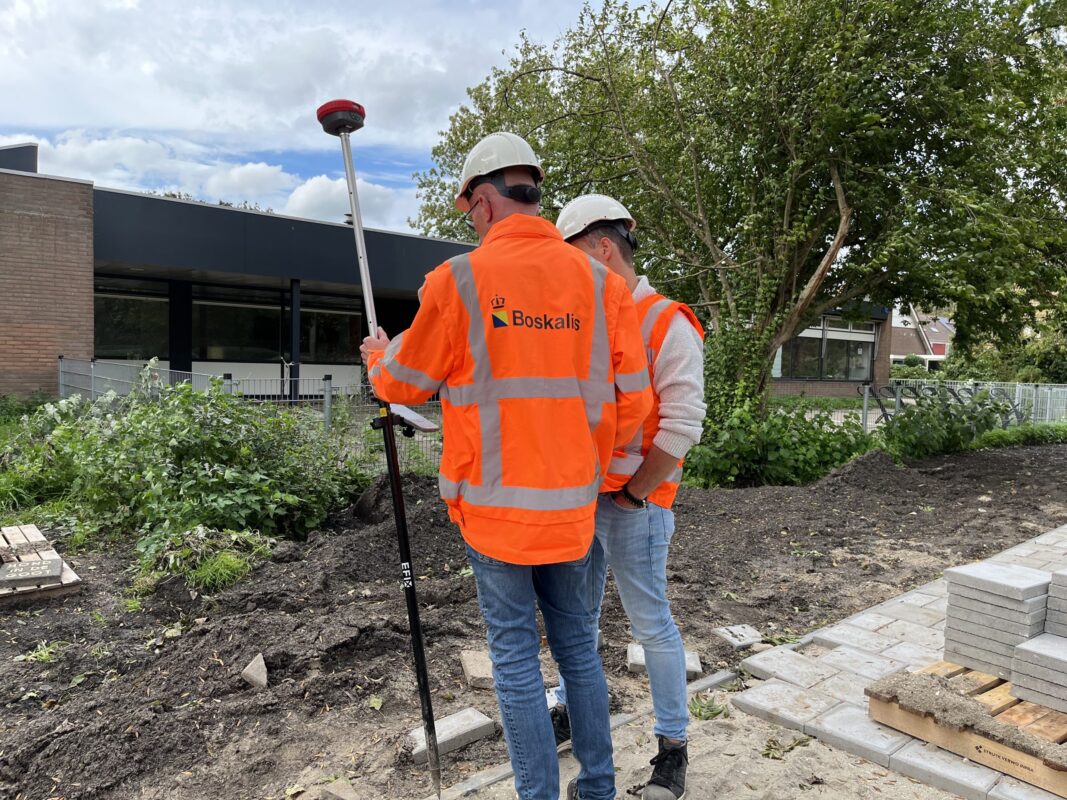
 Lidar scanning
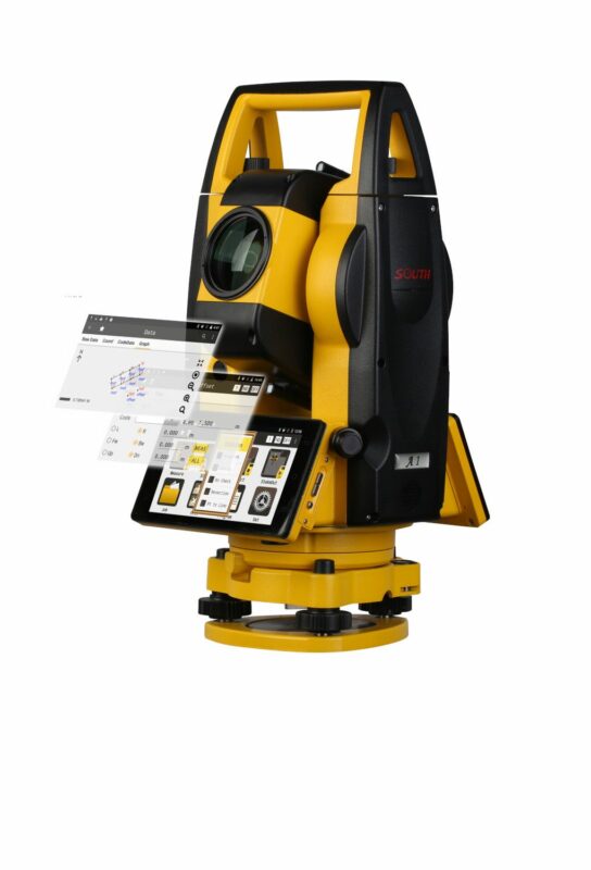
 Total Station
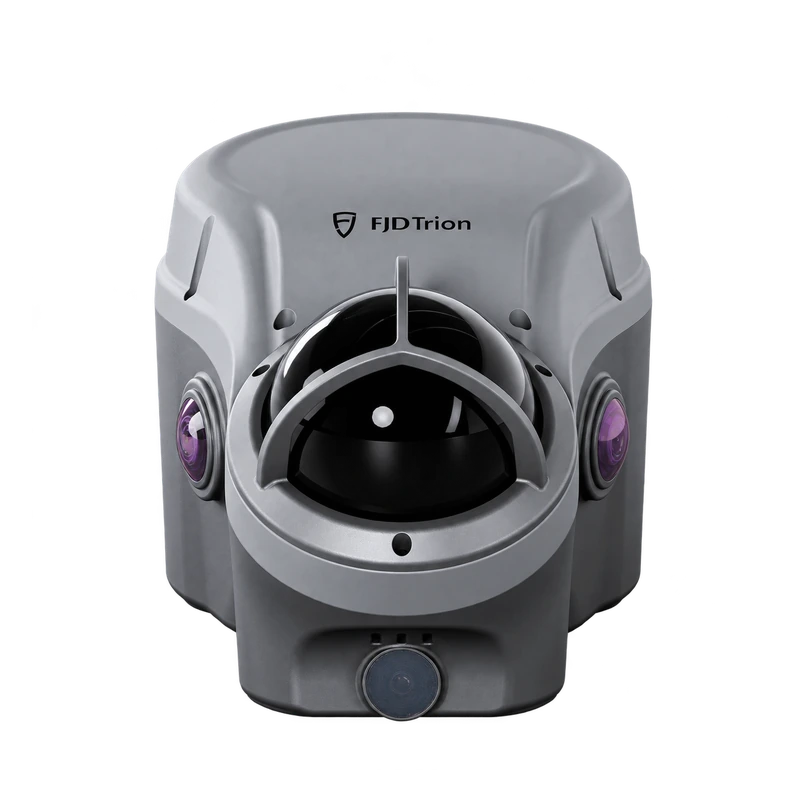
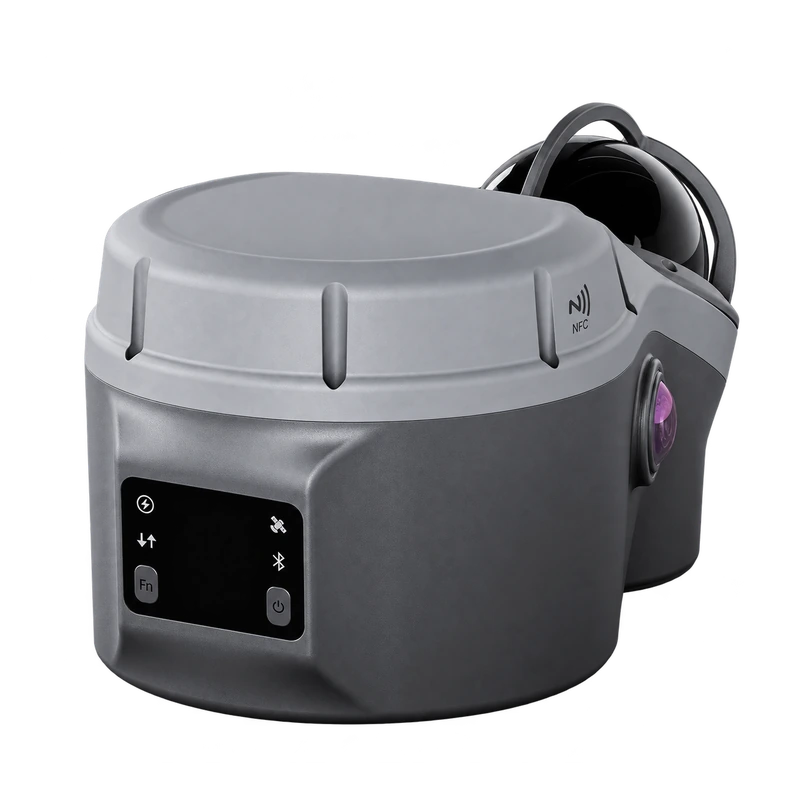
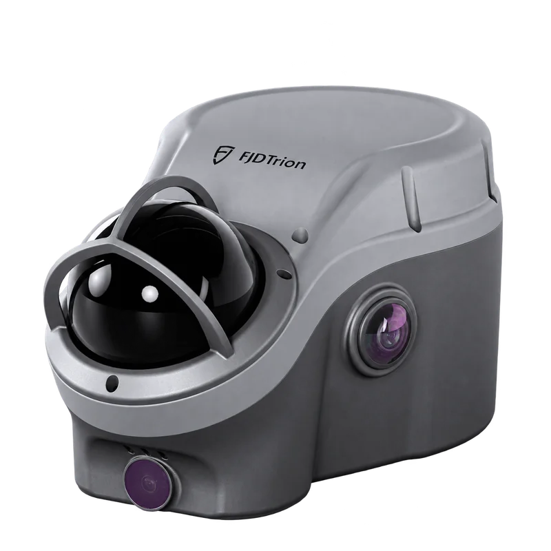
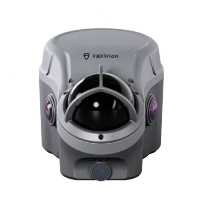
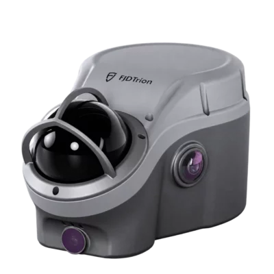
FJD Trion V100F RTK GNSS Receiver with SLAM LiDAR
Get the best price for your setup
Contact our experts for the best possible price and configuration.
- Fast response
- Expert configuration advice
- No overpaying for features you do not need
The FJD Trion V100F combines professional RTK GNSS surveying with 3D SLAM LiDAR scanning, camera-based measurement and IMU tilt compensation in one field instrument. Designed for land surveyors, construction professionals and civil engineers, it allows users to measure individual survey points, capture detailed 3D environments and continue selected measurements in areas with limited satellite visibility.
With a 32-channel LiDAR scanner offering up to 60 m range, 360° scanning, 60° IMU tilt compensation and SureFix technology, the V100F is built for demanding fieldwork. Its integrated cameras support visual measurement, while FJD Trion Survey and Trion Model provide tools for point cloud processing, cross-sections and volume calculations. The combination of RTK positioning and mobile LiDAR makes it especially useful for roadworks, utility trenches, bridges, tunnels and earthwork surveys.
FJD Trion V100F Highlights
| Surveying technology | RTK GNSS, 3D SLAM LiDAR, cameras and IMU |
|---|---|
| RTK accuracy | Horizontal 8 mm + 1 ppm; vertical 15 mm + 1 ppm RMS |
| LiDAR scanner | 32 channels; 360° horizontal × 62° vertical field of view |
| LiDAR range | 40 m at 10% reflectivity; 60 m at 80% reflectivity |
| LiDAR survey accuracy | Typically ±5 cm at 20 m |
| IMU tilt compensation | Up to 60°; 8 mm + 0.6 mm per degree RMS |
| SureFix | Typically ±5 cm within a 20 m radius under specified conditions |
| Imaging | 12 MP surveying camera, two 12 MP colour cameras and 2 MP bottom camera |
| Connectivity | Built-in UHF, 4G, Wi-Fi, Bluetooth and NFC |
| Battery life | Up to 5 hours LiDAR scanning or 22 hours RTK rover operation |
| Weight and protection | 1.75 kg; IP65 |

Valued customers:









Find RTK Networks
Search NTRIP providers and connect to reliable RTK correction services.
Description
FJD Trion V100F RTK GNSS Receiver with Integrated SLAM LiDAR
The FJD Trion V100F is a professional GNSS and LiDAR surveying system designed for land surveying, construction, civil engineering and infrastructure mapping. Combining centimetre-level RTK GNSS positioning with 3D LiDAR scanning, cameras and an inertial measurement unit, it allows surveyors to collect individual coordinates and detailed spatial information using the same instrument.
Conventional RTK surveying is useful for measuring individual points, but complex sites often require additional information about surrounding terrain, structures and inaccessible surfaces. The Trion V100F brings these workflows together. Surveyors can measure points in the usual way, scan an area while walking and use camera-assisted measurements for selected targets that are difficult or unsafe to approach.
With a 32-channel LiDAR scanner, 60 m maximum scanning range, 60° IMU tilt compensation and SureFix technology for GNSS-limited conditions, the V100F is particularly suited to road construction, utility trenches, bridges, tunnels, mining and earthwork projects.
RTK GNSS Surveying with Centimetre-Level Accuracy
At its core, the FJD Trion V100F is a professional multi-constellation RTK GNSS receiver. It supports GPS, GLONASS, Galileo, BeiDou, QZSS, NavIC and SBAS signals, helping surveyors maintain reliable satellite observations across different working environments.
The receiver provides specified RTK accuracy of 8 mm + 1 ppm horizontally and 15 mm + 1 ppm vertically under reference conditions. This makes it suitable for common surveying tasks such as recording ground points, measuring site boundaries, collecting construction features and establishing coordinates for engineering projects.
Position updates are available at rates up to 20 Hz. The receiver also supports static surveying, post-processed kinematic positioning and compatible PPP workflows, giving professional users several options for managing positioning data.
Actual GNSS accuracy depends on satellite visibility, correction quality, environmental conditions and surveying procedures. Independent control measurements remain important for projects requiring verified coordinates.
Integrated 3D SLAM LiDAR for Fast Spatial Capture
The V100F features a 32-channel LiDAR scanner with a 360° horizontal and 62° vertical field of view. Its laser measurement range extends to 40 metres on surfaces with 10% reflectivity and 60 metres on surfaces with 80% reflectivity.
Using SLAM technology, the system can capture a three-dimensional representation of the surrounding environment as the operator walks through the site. Instead of measuring every individual feature separately, surveyors can record the visible geometry of slopes, roads, walls, buildings, tunnels and other structures in a continuous scanning session.
For construction and engineering teams, this provides a practical way to document existing site conditions and collect data for cross-sections, surface models and volume calculations. The scanning system has a typical LiDAR survey accuracy of ±5 cm at 20 metres under specified conditions, which should be considered separately from its RTK point positioning accuracy.
When GNSS reception is available, positioning information can be combined with scanning data to produce georeferenced point clouds in the project coordinate system. When satellite reception is unavailable, the scanner can also work in a local coordinate system using SLAM, with appropriate registration or control required if georeferenced results are needed.
SureFix Technology for Areas with Limited GNSS Reception
One of the distinguishing features of the FJD Trion V100F is SureFix, a surveying function designed to support measurements when satellite reception becomes restricted.
On construction sites, GNSS signals may be obstructed by bridges, buildings, retaining walls or surrounding terrain. These conditions can interrupt conventional RTK measurements, particularly when surveyors need to record points close to large structures.
SureFix combines the instrument’s positioning and spatial sensing capabilities to maintain measurement continuity when moving from suitable GNSS conditions into nearby obstructed areas. The manufacturer specifies typical SureFix accuracy of ±5 cm within a 20 m radius under defined conditions.
For example, a surveyor working beside a bridge can begin in an open area with reliable GNSS reception and continue collecting selected points closer to the structure using the supported SureFix workflow. This can reduce the need to switch immediately to a separate surveying instrument.
SureFix is not a replacement for conventional RTK under all conditions. Its performance and operating range depend on correct initialization, the surrounding environment and the measurement procedure.
60 Degree IMU Tilt Compensation for Easier Point Measurement
The integrated IMU enables tilt-compensated GNSS surveying at pole angles up to 60°. This allows surveyors to measure points without holding the surveying pole perfectly vertical for every observation.
In everyday fieldwork, tilt compensation is useful when measuring corners close to walls, points beside fences, trench edges and other locations where positioning the pole vertically would be inconvenient.
The specified tilt-compensated positioning accuracy is 8 mm + 0.6 mm per degree of tilt RMS under reference conditions. The instrument uses its orientation measurements to compensate for the position of the pole tip, helping operators work more naturally around obstacles.
For construction workers and surveyors who collect many points throughout the day, this can make point measurement faster and more convenient. As with all tilt-compensated surveying, suitable initialization and field checks are important for reliable results.
Camera-Based Measurement for Hard-to-Reach Points
The FJD Trion V100F includes a 12 MP surveying camera, two 12 MP colour cameras and a separate 2 MP bottom camera. These sensors provide visual information for field measurements, spatial capture and point cloud colourisation.
For selected non-contact measurement tasks, surveyors can identify targets in captured imagery and use the system’s LiDAR measurements to determine their coordinates. The manufacturer specifies typical accuracy of ±5 cm within a 20 m working distance for the supported LiDAR-based visual measurement workflow.
This is useful for features such as wall corners, trench boundaries, bridge elements and slope edges that may be difficult or unsafe to reach directly with a surveying pole.
Rather than walking to every point, the operator can capture appropriate visual and laser information from a safer or more convenient position. Measurement results depend on target visibility, scanning geometry and the supported software procedure.
Surveying and 3D Scanning in One Field Workflow
The V100F is particularly useful for projects that require a combination of individual RTK measurements and detailed 3D surface information. Operators can work with conventional survey points when only coordinates are required and switch to LiDAR scanning when the shape of an area needs to be documented.
For example, a road construction team can measure important control points using RTK, scan an embankment or excavation with LiDAR and prepare cross-sections or earthwork calculations from the captured data.
The scanner can be initialized in an area with reliable GNSS reception before entering more restricted environments. This supports georeferenced scanning where the selected workflow and site conditions allow. For indoor or underground areas, scanning can continue using a local coordinate system, with additional registration or control used when necessary.
Combining these measurement methods helps reduce equipment changes during complex surveying projects while providing a broader record of existing site conditions.
Cross-Sections and Volume Calculations in the Field
For earthwork and civil engineering projects, capturing surface geometry can be more useful than measuring a limited set of individual elevation points. The V100F allows operators to scan stockpiles, slopes, excavations and other terrain features and use the resulting spatial data for further analysis.
Through FJD Trion Survey, users can work with supported measurements, cross-sections and on-site volume calculations. This is particularly relevant for contractors who need to document material quantities, check excavation progress or assess terrain changes during construction.
For example, a surveyor can scan a stockpile or excavation area, review the captured surface and prepare a volume calculation using an appropriate reference surface. The accuracy of the calculated result depends on scan coverage, control, processing and the selected calculation method.
The ability to capture and review this information in the field can help identify missing data before leaving the project location.
Integrated UHF Radio and Flexible RTK Corrections
The FJD Trion V100F includes a built-in UHF radio for supported RTK base and rover communication. The radio operates within region-dependent frequency bands of 410–470 MHz or 902–928 MHz and provides up to 2 W transmit power.
The manufacturer specifies a typical communication range of 6–12 km, with up to 16 km possible under optimal conditions. Actual radio performance depends on terrain, antenna installation, interference and local operating restrictions.
The receiver also supports mobile network connectivity, Wi-Fi, Bluetooth and NFC. These communication options allow surveyors to connect compatible field controllers, correction services and project workflows.
With support for industry-standard correction and positioning data formats, including RTCM, NMEA and RINEX, the V100F can be incorporated into a variety of professional GNSS workflows. Radio frequency availability and compatibility should be confirmed for the intended country and correction setup.
Integrated Cameras and Colourised Point Clouds
Alongside the LiDAR scanner, the V100F includes cameras that support visual documentation and the generation of colourised point clouds. The two 12 MP colour cameras capture imagery that can be associated with laser measurements, making scanned objects easier to recognise during review.
Colourised point clouds are useful when documenting buildings, roads, construction features and other visible objects. Instead of viewing only geometric points, users can see photographic colour information that provides additional context about the scanned environment.
For engineering and inspection projects, this can make it easier to identify specific structures, understand site conditions and communicate findings with colleagues who do not regularly work with raw LiDAR data.
Designed for Demanding Surveying Environments
The FJD Trion V100F weighs approximately 1.75 kg and has dimensions of 215 × 130 × 120 mm. Its integrated construction combines surveying, scanning and imaging hardware in a compact instrument suitable for professional fieldwork.
The enclosure is rated IP65 for protection against dust and water jets and IK08 for mechanical impact resistance. The specified operating temperature range is -20°C to +55°C, making the receiver suitable for a variety of construction and outdoor surveying environments.
Battery endurance depends on the selected operating mode. The manufacturer specifies up to 22 hours of typical UHF or 4G RTK rover operation and up to 5 hours of LiDAR scanning. The 74 Wh rechargeable battery supports 45 W PD charging, with a specified charging time of approximately 3.5 hours.
With 450 GB of internal storage, the V100F can record substantial amounts of scanning and survey data. Operators should plan available storage and battery capacity according to the project size and selected capture settings.
Applications in Surveying Construction and Infrastructure
Land Surveying and Topographic Mapping
Surveyors can use RTK GNSS for collecting individual ground points and use LiDAR scanning to record the geometry of surrounding terrain. This combination is useful when a project requires both discrete survey coordinates and a more detailed representation of the existing surface.
Road Construction and Civil Engineering
Construction teams can use the V100F to measure control points, document road surfaces, capture embankments and prepare cross-section information. The ability to switch between RTK and scanning is particularly useful on construction projects where ground conditions change throughout the working area.
Utility Trenches and Underground Infrastructure
For trench surveys, the scanner can capture visible excavation geometry and surrounding structures. Camera-assisted measurement can also help record selected edges and corners from a more convenient position. This information can support as-built documentation and excavation analysis.
Bridges and Viaducts
GNSS reception is often restricted beneath bridges or close to large structures. The combination of SureFix technology and LiDAR scanning provides additional measurement options in these environments, helping surveyors record selected points and visible structural geometry.
Tunnels and Underground Mapping
The V100F can capture 3D point clouds in GNSS-denied environments using its LiDAR and SLAM workflow. This can support tunnel documentation, cross-section measurement and geometric analysis. Where project coordinates are required, suitable initialization and survey control are necessary.
Mining Quarries and Earthworks
Mining and earthwork professionals can use the scanner to document accessible excavations, stockpiles, slopes and terrain surfaces. Processed point clouds can support volume calculations, surface comparisons and project monitoring.
GIS and Infrastructure Asset Mapping
GIS professionals can use georeferenced survey points and processed point clouds to document infrastructure assets, visible features and terrain. The collected spatial information can support mapping projects and further analysis in compatible GIS and engineering applications.
FJD Trion Survey and Trion Model Software
The V100F works with FJD Trion Survey for field data collection and surveying operations. The software supports GNSS measurements, LiDAR scanning, coordinate system management and field workflows involving cross-sections and volume calculations.
For office-based processing, FJD Trion Model provides tools to work with collected point cloud data, review measurements and prepare information for surveying, construction and engineering deliverables.
Depending on the selected workflow, scanning data can be processed into georeferenced point clouds and transferred into compatible applications using supported export formats such as LAS. The V100F also supports standard GNSS data formats for positioning and correction workflows.
Available advanced processing functions, software licenses and cloud services should be confirmed for the selected system configuration.
FJD Trion V100F at Global GPS Systems
The FJD Trion V100F is a practical choice for professional surveyors, civil engineers, construction companies and infrastructure specialists who regularly work across changing site conditions. By combining RTK GNSS surveying with 3D SLAM LiDAR scanning, visual measurements and IMU tilt compensation, it provides several measurement methods in one field instrument.
At Global GPS Systems, we help customers choose suitable GNSS and LiDAR equipment for their projects. Contact our team for assistance with the FJD Trion V100F, compatible survey controllers, correction services, scanning accessories and software requirements for your surveying workflow.
Specifications
FJ Dynamics Trion V100F GNSS & LiDAR FAQ
General Information and Key Features
What is the FJ Dynamics Trion V100F GNSS & LiDAR system?
The FJD Trion V100F is a professional GNSS and LiDAR fusion surveying system developed by FJDynamics. It combines high-precision RTK GNSS positioning, 3D LiDAR scanning, cameras and an inertial measurement unit (IMU) in one device. Unlike conventional GNSS receivers that primarily measure individual survey points, the V100F can also capture surrounding terrain, structures and surfaces as 3D point clouds. It is designed for land surveying, construction, road engineering, mining, earthworks, infrastructure inspection and surveying in environments with limited GNSS reception.
What are the main features of the FJD Trion V100F?
The FJD Trion V100F combines centimeter-level RTK GNSS surveying with a 32-line LiDAR scanner, a 360-degree horizontal scanning field of view, integrated cameras and IMU tilt compensation. It supports LiDAR measurements up to 60 meters, RTK accuracy of 8 mm + 1 ppm horizontally and 15 mm + 1 ppm vertically, and 3D scanning workflows with typical accuracy of ±5 cm at 20 meters. Additional features include SureFix measurement technology, a built-in UHF radio, 4G connectivity, 450 GB of internal storage, IP65 protection and an integrated OLED display.
What is the difference between a conventional RTK GNSS receiver and the FJD Trion V100F?
A conventional RTK GNSS receiver measures individual geographic coordinates using satellite signals and correction data. The FJD Trion V100F performs these traditional GNSS surveying tasks while also incorporating a 3D LiDAR scanner for capturing surrounding surfaces and objects. This allows surveyors to combine point measurements with continuous spatial data acquisition. The integrated cameras and IMU also support visual measurement, tilt compensation and positioning workflows in challenging environments. The V100F can therefore reduce the need to switch between separate GNSS and LiDAR instruments during a survey.
How accurate is the FJD Trion V100F?
The FJD Trion V100F has a specified RTK positioning accuracy of 8 mm + 1 ppm RMS horizontally and 15 mm + 1 ppm RMS vertically under suitable conditions. Its LiDAR scanning system provides typical survey accuracy of ±5 cm at a distance of 20 meters. SureFix measurements also have a specified typical accuracy of ±5 cm within a 20-meter radius. These specifications refer to different measurement functions and should not be interpreted as identical accuracy for every workflow. Actual results depend on satellite reception, corrections, calibration, scanning conditions and processing quality.
What is the maximum LiDAR scanning range of the FJD Trion V100F?
The FJD Trion V100F has a maximum specified LiDAR scanning range of 60 meters for targets with 80% reflectivity and 40 meters for targets with 10% reflectivity. Its 32-line LiDAR sensor provides a 360-degree horizontal and 62-degree vertical scanning field of view. The effective measuring range depends on surface reflectivity, environmental conditions and scanning geometry. Dark surfaces generally return less laser energy and may be detected at shorter distances than highly reflective surfaces.
What is SureFix technology on the FJD Trion V100F?
SureFix is a measurement function designed to support surveying in environments where obtaining a conventional RTK fixed solution is difficult. It uses the V100F's integrated sensor capabilities to help determine survey positions when GNSS reception is obstructed or unreliable. FJDynamics specifies a typical SureFix accuracy of ±5 cm within a 20-meter radius under suitable conditions. This makes it useful around buildings, under bridges and in other GNSS-challenging environments. Actual performance depends on the available positioning information, operating conditions and measurement procedure.
Applications and Professional Surveying
What industries and professionals use the FJD Trion V100F?
The FJD Trion V100F is designed for land surveyors, civil engineers, construction professionals, geospatial specialists, mining surveyors and infrastructure inspection teams. Its combination of RTK GNSS positioning and 3D LiDAR scanning is suitable for topographic surveying, road construction, bridge inspection, tunnel mapping, utility trench measurement, earthworks calculations and construction site documentation. Professionals working across open terrain and GNSS-obstructed environments can use the V100F to collect both individual coordinates and detailed spatial data with one integrated surveying system.
Can the FJD Trion V100F be used for topographic and land surveying?
Yes. The FJD Trion V100F supports traditional topographic and land surveying through high-precision RTK GNSS positioning. Surveyors can measure points, lines, elevations and terrain features using compatible FJD Trion Survey software. The integrated LiDAR scanner also captures 3D point clouds that can be used for surface modeling, terrain analysis and volumetric measurements. Combining point surveying with continuous spatial scanning is particularly useful for projects involving uneven terrain, complex site geometry and areas where measuring every feature individually would be inefficient.
Can the FJD Trion V100F be used in areas with poor GNSS reception?
Yes. The FJD Trion V100F is specifically designed to support surveying in environments where satellite reception is obstructed or limited. Its integrated LiDAR scanner, IMU and SureFix technology provide additional measurement capabilities beyond conventional RTK positioning. The system can also perform SLAM-based 3D scanning without GNSS, creating point clouds in a local coordinate system. This is useful near tall buildings, beneath bridges, around complex infrastructure and in underground environments. Accurate georeferencing may require additional control points or suitable positioning data.
Is the FJD Trion V100F suitable for road construction and civil engineering?
Yes. The FJD Trion V100F is suitable for road engineering, transportation infrastructure and civil construction surveying. Its RTK GNSS capabilities support point measurement, line surveying, stakeout and elevation checks, while the integrated LiDAR scanner can capture road surfaces, embankments, slopes and surrounding structures. Processed data can support terrain modeling, road cross-section analysis, earthworks calculations and construction documentation. The ability to combine GNSS measurements with 3D scanning is especially useful around bridges, viaducts and other areas with obstructed satellite visibility.
Can the FJD Trion V100F be used for mining, stockpile measurement and earthworks calculations?
Yes. The FJD Trion V100F can support mining surveys, quarry measurements, stockpile documentation and construction earthworks analysis. Its LiDAR scanner captures three-dimensional measurements of accessible terrain, excavations and material surfaces without requiring individual point measurements across the entire area. Processed point clouds can be used to generate terrain models, cross-sections and volume calculations. Reliable results require sufficient scanning coverage, appropriate georeferencing and compatible analysis software. Actual measurement accuracy depends on site conditions and the selected survey workflow.
Can the FJD Trion V100F be used for tunnels, bridges and underground surveying?
Yes. The FJD Trion V100F supports 3D scanning in tunnels, beneath bridges and in other environments where GNSS reception may be unavailable or obstructed. Its LiDAR scanner can collect continuous geometric information using SLAM technology without requiring satellite positioning throughout the scan. This enables the capture of tunnel walls, structural features, bridge undersides and surrounding infrastructure. Scanned data can be used for cross-section analysis, geometric documentation and engineering measurements. Projects requiring real-world coordinates may need control points or additional georeferencing procedures.
Technical Specifications and Hardware
Which satellite systems does the FJD Trion V100F support?
The FJD Trion V100F supports multiple global navigation satellite systems, including GPS, GLONASS, BeiDou, Galileo, QZSS, NavIC and SBAS. Multi-constellation reception increases the number of available satellite signals and can improve positioning reliability in challenging surveying environments. The receiver supports positioning update rates of 1, 2, 5, 10 and 20 Hz. Actual GNSS performance depends on satellite visibility, atmospheric conditions, correction quality and interference from nearby structures or equipment.
Does the FJD Trion V100F support IMU tilt compensation?
Yes. The FJD Trion V100F includes IMU-based tilt compensation for GNSS surveying. It supports pole tilt angles from 0 to 60 degrees, allowing surveyors to measure points without keeping the surveying pole perfectly vertical. The manufacturer specifies tilt-compensated accuracy of 8 mm + 0.6 mm per degree of tilt RMS under suitable conditions. This capability is particularly useful when measuring points near walls, fences, trenches, building corners and other locations where positioning the pole vertically may be difficult.
Does the FJD Trion V100F include cameras for visual surveying and colorized point clouds?
Yes. The FJD Trion V100F integrates four cameras for different surveying and visualization functions. These include one 12 MP surveying camera, two 12 MP color cameras and one 2 MP downward-facing camera. The cameras support visual measurement, spatial documentation and color information for LiDAR workflows. Combining photographic information with LiDAR geometry can help operators interpret scanned environments and verify site conditions. Available image processing and colorization functions depend on the selected software workflow.
Does the FJD Trion V100F have a built-in UHF radio and 4G connectivity?
Yes. The FJD Trion V100F includes a built-in UHF radio, 4G network modem, dual-band Wi-Fi, Bluetooth and NFC. Its UHF radio supports transmission and reception with a specified output power of 2 W and a typical communication range of 6 to 12 km, potentially reaching 16 km under optimal conditions. Supported radio protocols include TRIMTALK, TRIMTALK 450S, TRANSEOT, TRIMMARK 3, SATEL and LoRa. The receiver also supports network corrections through compatible services and protocols. Regional frequency compatibility and communication restrictions should be verified before operation.
How much does the FJD Trion V100F weigh and what are its dimensions?
The FJD Trion V100F weighs approximately 1.75 kg and measures 215 × 130 × 120 mm. Its compact housing integrates the GNSS receiver, LiDAR sensor, cameras, positioning technology and communication hardware into one portable instrument. The device also includes a 1.41-inch true-color OLED display with a resolution of 320 × 360 pixels, four LED indicators and two physical buttons. This integrated design is intended for professional field surveying without requiring separate LiDAR and GNSS sensor units.
What are the battery life and environmental protection specifications of the FJD Trion V100F?
The FJD Trion V100F uses a 74 Wh lithium-ion battery with a specified operating time of up to 22 hours in UHF or 4G RTK rover mode and up to 5 hours during LiDAR or point cloud scanning. It supports 45 W USB Power Delivery fast charging, with a charging time of approximately 3.5 hours. The device has an IP65 ingress protection rating, IK08 impact protection and an operating temperature range of -20°C to +55°C. Battery endurance depends on operating mode, temperature and field conditions. IP65 protection does not make the instrument suitable for immersion.
Software, LiDAR Processing and Surveying Workflow
Which software is used with the FJD Trion V100F?
The FJD Trion V100F is supported by FJD Trion Survey for GNSS measurement, stakeout and field surveying workflows. Trion Survey provides functions for point measurement, coordinate system management, visual measurement, laser measurement, scanning, PPK surveying and engineering calculations. FJD Trion Model and related processing tools can be used for point cloud processing, spatial analysis and preparation of 3D survey deliverables. FJD Trion GNSS Studio supports professional GNSS post-processing. Available functions and licensing depend on the software configuration.
Can the FJD Trion V100F create 3D point clouds without GNSS?
Yes. The FJD Trion V100F supports mobile 3D scanning using LiDAR and Simultaneous Localization and Mapping (SLAM) technology. When GNSS positioning is unavailable, the scanner can still capture surrounding geometry and generate a 3D point cloud in a local coordinate system. This is useful for indoor spaces, tunnels, underground structures and environments with obstructed satellite reception. When GNSS is available, positioning information can be combined with the scanning data to generate georeferenced point clouds in the project coordinate system.
Can the FJD Trion V100F be used for RTK, PPK and static GNSS surveying?
Yes. The FJD Trion V100F supports real-time kinematic (RTK), post-processed kinematic (PPK) and static GNSS positioning workflows. Its specified PPK accuracy is 3 mm + 1 ppm RMS horizontally and 5 mm + 1 ppm RMS vertically. High-precision static measurements are specified at 2.5 mm + 0.1 ppm RMS horizontally and 3.5 mm + 0.4 ppm RMS vertically under reference conditions. The system also supports Galileo High Accuracy Service precise point positioning. Suitable correction data, observation conditions and processing software are required for achieving the stated performance.
Can the FJD Trion V100F perform stakeout and visual measurement?
Yes. The FJD Trion V100F supports conventional GNSS stakeout and visual measurement workflows through compatible FJD Trion Survey software. Supported functions include point stakeout, line stakeout, road stakeout, slope stakeout, CAD-based stakeout and augmented reality guidance. Its integrated cameras and positioning sensors can assist operators when locating and measuring site features. These capabilities are useful for construction layout, road engineering, utility installation and general land surveying. Available functions depend on the software version and project configuration.
What file formats does the FJD Trion V100F support?
The FJD Trion V100F supports standard GNSS and LiDAR data formats, including NMEA-0183, RTCM 3.x, RINEX and LAS. NMEA is commonly used for positioning information, RTCM for GNSS correction data, RINEX for satellite observation files and LAS for LiDAR point cloud datasets. Compatible FJD Trion Survey workflows also support formats such as ASCII, DXF, DWG, KML and SHP for survey data exchange. Actual import and export options depend on the software module and workflow used.
How much storage does the FJD Trion V100F have and how much scanning data can it record?
The FJD Trion V100F includes 450 GB of internal storage for GNSS observations, LiDAR scanning data and project information. According to the manufacturer's reference calculations, on-site scanning data uses approximately 36 GB per hour, allowing up to 12.5 hours of recordings based on the full storage capacity. Processed point cloud data uses approximately 18 GB per hour, corresponding to up to 25 hours of data. These figures are theoretical estimates, and actual storage requirements depend on scanning settings and project conditions. Regular data transfer and backup are recommended.
Reviews (0)
Only logged in customers who have purchased this product may leave a review.
FAQ
FJ Dynamics Trion V100F GNSS & LiDAR FAQ
General Information and Key Features
What is the FJ Dynamics Trion V100F GNSS & LiDAR system?
The FJD Trion V100F is a professional GNSS and LiDAR fusion surveying system developed by FJDynamics. It combines high-precision RTK GNSS positioning, 3D LiDAR scanning, cameras and an inertial measurement unit (IMU) in one device. Unlike conventional GNSS receivers that primarily measure individual survey points, the V100F can also capture surrounding terrain, structures and surfaces as 3D point clouds. It is designed for land surveying, construction, road engineering, mining, earthworks, infrastructure inspection and surveying in environments with limited GNSS reception.
What are the main features of the FJD Trion V100F?
The FJD Trion V100F combines centimeter-level RTK GNSS surveying with a 32-line LiDAR scanner, a 360-degree horizontal scanning field of view, integrated cameras and IMU tilt compensation. It supports LiDAR measurements up to 60 meters, RTK accuracy of 8 mm + 1 ppm horizontally and 15 mm + 1 ppm vertically, and 3D scanning workflows with typical accuracy of ±5 cm at 20 meters. Additional features include SureFix measurement technology, a built-in UHF radio, 4G connectivity, 450 GB of internal storage, IP65 protection and an integrated OLED display.
What is the difference between a conventional RTK GNSS receiver and the FJD Trion V100F?
A conventional RTK GNSS receiver measures individual geographic coordinates using satellite signals and correction data. The FJD Trion V100F performs these traditional GNSS surveying tasks while also incorporating a 3D LiDAR scanner for capturing surrounding surfaces and objects. This allows surveyors to combine point measurements with continuous spatial data acquisition. The integrated cameras and IMU also support visual measurement, tilt compensation and positioning workflows in challenging environments. The V100F can therefore reduce the need to switch between separate GNSS and LiDAR instruments during a survey.
How accurate is the FJD Trion V100F?
The FJD Trion V100F has a specified RTK positioning accuracy of 8 mm + 1 ppm RMS horizontally and 15 mm + 1 ppm RMS vertically under suitable conditions. Its LiDAR scanning system provides typical survey accuracy of ±5 cm at a distance of 20 meters. SureFix measurements also have a specified typical accuracy of ±5 cm within a 20-meter radius. These specifications refer to different measurement functions and should not be interpreted as identical accuracy for every workflow. Actual results depend on satellite reception, corrections, calibration, scanning conditions and processing quality.
What is the maximum LiDAR scanning range of the FJD Trion V100F?
The FJD Trion V100F has a maximum specified LiDAR scanning range of 60 meters for targets with 80% reflectivity and 40 meters for targets with 10% reflectivity. Its 32-line LiDAR sensor provides a 360-degree horizontal and 62-degree vertical scanning field of view. The effective measuring range depends on surface reflectivity, environmental conditions and scanning geometry. Dark surfaces generally return less laser energy and may be detected at shorter distances than highly reflective surfaces.
What is SureFix technology on the FJD Trion V100F?
SureFix is a measurement function designed to support surveying in environments where obtaining a conventional RTK fixed solution is difficult. It uses the V100F's integrated sensor capabilities to help determine survey positions when GNSS reception is obstructed or unreliable. FJDynamics specifies a typical SureFix accuracy of ±5 cm within a 20-meter radius under suitable conditions. This makes it useful around buildings, under bridges and in other GNSS-challenging environments. Actual performance depends on the available positioning information, operating conditions and measurement procedure.
Applications and Professional Surveying
What industries and professionals use the FJD Trion V100F?
The FJD Trion V100F is designed for land surveyors, civil engineers, construction professionals, geospatial specialists, mining surveyors and infrastructure inspection teams. Its combination of RTK GNSS positioning and 3D LiDAR scanning is suitable for topographic surveying, road construction, bridge inspection, tunnel mapping, utility trench measurement, earthworks calculations and construction site documentation. Professionals working across open terrain and GNSS-obstructed environments can use the V100F to collect both individual coordinates and detailed spatial data with one integrated surveying system.
Can the FJD Trion V100F be used for topographic and land surveying?
Yes. The FJD Trion V100F supports traditional topographic and land surveying through high-precision RTK GNSS positioning. Surveyors can measure points, lines, elevations and terrain features using compatible FJD Trion Survey software. The integrated LiDAR scanner also captures 3D point clouds that can be used for surface modeling, terrain analysis and volumetric measurements. Combining point surveying with continuous spatial scanning is particularly useful for projects involving uneven terrain, complex site geometry and areas where measuring every feature individually would be inefficient.
Can the FJD Trion V100F be used in areas with poor GNSS reception?
Yes. The FJD Trion V100F is specifically designed to support surveying in environments where satellite reception is obstructed or limited. Its integrated LiDAR scanner, IMU and SureFix technology provide additional measurement capabilities beyond conventional RTK positioning. The system can also perform SLAM-based 3D scanning without GNSS, creating point clouds in a local coordinate system. This is useful near tall buildings, beneath bridges, around complex infrastructure and in underground environments. Accurate georeferencing may require additional control points or suitable positioning data.
Is the FJD Trion V100F suitable for road construction and civil engineering?
Yes. The FJD Trion V100F is suitable for road engineering, transportation infrastructure and civil construction surveying. Its RTK GNSS capabilities support point measurement, line surveying, stakeout and elevation checks, while the integrated LiDAR scanner can capture road surfaces, embankments, slopes and surrounding structures. Processed data can support terrain modeling, road cross-section analysis, earthworks calculations and construction documentation. The ability to combine GNSS measurements with 3D scanning is especially useful around bridges, viaducts and other areas with obstructed satellite visibility.
Can the FJD Trion V100F be used for mining, stockpile measurement and earthworks calculations?
Yes. The FJD Trion V100F can support mining surveys, quarry measurements, stockpile documentation and construction earthworks analysis. Its LiDAR scanner captures three-dimensional measurements of accessible terrain, excavations and material surfaces without requiring individual point measurements across the entire area. Processed point clouds can be used to generate terrain models, cross-sections and volume calculations. Reliable results require sufficient scanning coverage, appropriate georeferencing and compatible analysis software. Actual measurement accuracy depends on site conditions and the selected survey workflow.
Can the FJD Trion V100F be used for tunnels, bridges and underground surveying?
Yes. The FJD Trion V100F supports 3D scanning in tunnels, beneath bridges and in other environments where GNSS reception may be unavailable or obstructed. Its LiDAR scanner can collect continuous geometric information using SLAM technology without requiring satellite positioning throughout the scan. This enables the capture of tunnel walls, structural features, bridge undersides and surrounding infrastructure. Scanned data can be used for cross-section analysis, geometric documentation and engineering measurements. Projects requiring real-world coordinates may need control points or additional georeferencing procedures.
Technical Specifications and Hardware
Which satellite systems does the FJD Trion V100F support?
The FJD Trion V100F supports multiple global navigation satellite systems, including GPS, GLONASS, BeiDou, Galileo, QZSS, NavIC and SBAS. Multi-constellation reception increases the number of available satellite signals and can improve positioning reliability in challenging surveying environments. The receiver supports positioning update rates of 1, 2, 5, 10 and 20 Hz. Actual GNSS performance depends on satellite visibility, atmospheric conditions, correction quality and interference from nearby structures or equipment.
Does the FJD Trion V100F support IMU tilt compensation?
Yes. The FJD Trion V100F includes IMU-based tilt compensation for GNSS surveying. It supports pole tilt angles from 0 to 60 degrees, allowing surveyors to measure points without keeping the surveying pole perfectly vertical. The manufacturer specifies tilt-compensated accuracy of 8 mm + 0.6 mm per degree of tilt RMS under suitable conditions. This capability is particularly useful when measuring points near walls, fences, trenches, building corners and other locations where positioning the pole vertically may be difficult.
Does the FJD Trion V100F include cameras for visual surveying and colorized point clouds?
Yes. The FJD Trion V100F integrates four cameras for different surveying and visualization functions. These include one 12 MP surveying camera, two 12 MP color cameras and one 2 MP downward-facing camera. The cameras support visual measurement, spatial documentation and color information for LiDAR workflows. Combining photographic information with LiDAR geometry can help operators interpret scanned environments and verify site conditions. Available image processing and colorization functions depend on the selected software workflow.
Does the FJD Trion V100F have a built-in UHF radio and 4G connectivity?
Yes. The FJD Trion V100F includes a built-in UHF radio, 4G network modem, dual-band Wi-Fi, Bluetooth and NFC. Its UHF radio supports transmission and reception with a specified output power of 2 W and a typical communication range of 6 to 12 km, potentially reaching 16 km under optimal conditions. Supported radio protocols include TRIMTALK, TRIMTALK 450S, TRANSEOT, TRIMMARK 3, SATEL and LoRa. The receiver also supports network corrections through compatible services and protocols. Regional frequency compatibility and communication restrictions should be verified before operation.
How much does the FJD Trion V100F weigh and what are its dimensions?
The FJD Trion V100F weighs approximately 1.75 kg and measures 215 × 130 × 120 mm. Its compact housing integrates the GNSS receiver, LiDAR sensor, cameras, positioning technology and communication hardware into one portable instrument. The device also includes a 1.41-inch true-color OLED display with a resolution of 320 × 360 pixels, four LED indicators and two physical buttons. This integrated design is intended for professional field surveying without requiring separate LiDAR and GNSS sensor units.
What are the battery life and environmental protection specifications of the FJD Trion V100F?
The FJD Trion V100F uses a 74 Wh lithium-ion battery with a specified operating time of up to 22 hours in UHF or 4G RTK rover mode and up to 5 hours during LiDAR or point cloud scanning. It supports 45 W USB Power Delivery fast charging, with a charging time of approximately 3.5 hours. The device has an IP65 ingress protection rating, IK08 impact protection and an operating temperature range of -20°C to +55°C. Battery endurance depends on operating mode, temperature and field conditions. IP65 protection does not make the instrument suitable for immersion.
Software, LiDAR Processing and Surveying Workflow
Which software is used with the FJD Trion V100F?
The FJD Trion V100F is supported by FJD Trion Survey for GNSS measurement, stakeout and field surveying workflows. Trion Survey provides functions for point measurement, coordinate system management, visual measurement, laser measurement, scanning, PPK surveying and engineering calculations. FJD Trion Model and related processing tools can be used for point cloud processing, spatial analysis and preparation of 3D survey deliverables. FJD Trion GNSS Studio supports professional GNSS post-processing. Available functions and licensing depend on the software configuration.
Can the FJD Trion V100F create 3D point clouds without GNSS?
Yes. The FJD Trion V100F supports mobile 3D scanning using LiDAR and Simultaneous Localization and Mapping (SLAM) technology. When GNSS positioning is unavailable, the scanner can still capture surrounding geometry and generate a 3D point cloud in a local coordinate system. This is useful for indoor spaces, tunnels, underground structures and environments with obstructed satellite reception. When GNSS is available, positioning information can be combined with the scanning data to generate georeferenced point clouds in the project coordinate system.
Can the FJD Trion V100F be used for RTK, PPK and static GNSS surveying?
Yes. The FJD Trion V100F supports real-time kinematic (RTK), post-processed kinematic (PPK) and static GNSS positioning workflows. Its specified PPK accuracy is 3 mm + 1 ppm RMS horizontally and 5 mm + 1 ppm RMS vertically. High-precision static measurements are specified at 2.5 mm + 0.1 ppm RMS horizontally and 3.5 mm + 0.4 ppm RMS vertically under reference conditions. The system also supports Galileo High Accuracy Service precise point positioning. Suitable correction data, observation conditions and processing software are required for achieving the stated performance.
Can the FJD Trion V100F perform stakeout and visual measurement?
Yes. The FJD Trion V100F supports conventional GNSS stakeout and visual measurement workflows through compatible FJD Trion Survey software. Supported functions include point stakeout, line stakeout, road stakeout, slope stakeout, CAD-based stakeout and augmented reality guidance. Its integrated cameras and positioning sensors can assist operators when locating and measuring site features. These capabilities are useful for construction layout, road engineering, utility installation and general land surveying. Available functions depend on the software version and project configuration.
What file formats does the FJD Trion V100F support?
The FJD Trion V100F supports standard GNSS and LiDAR data formats, including NMEA-0183, RTCM 3.x, RINEX and LAS. NMEA is commonly used for positioning information, RTCM for GNSS correction data, RINEX for satellite observation files and LAS for LiDAR point cloud datasets. Compatible FJD Trion Survey workflows also support formats such as ASCII, DXF, DWG, KML and SHP for survey data exchange. Actual import and export options depend on the software module and workflow used.
How much storage does the FJD Trion V100F have and how much scanning data can it record?
The FJD Trion V100F includes 450 GB of internal storage for GNSS observations, LiDAR scanning data and project information. According to the manufacturer's reference calculations, on-site scanning data uses approximately 36 GB per hour, allowing up to 12.5 hours of recordings based on the full storage capacity. Processed point cloud data uses approximately 18 GB per hour, corresponding to up to 25 hours of data. These figures are theoretical estimates, and actual storage requirements depend on scanning settings and project conditions. Regular data transfer and backup are recommended.
 GPS & GNSS
 Total Stations
 Data collectors
 Software
 Correction services
 Machine control
 External radio
 Marine
 Accessories
Reviews
There are no reviews yet