Spherefix SP10 Rover Base Set Product Review
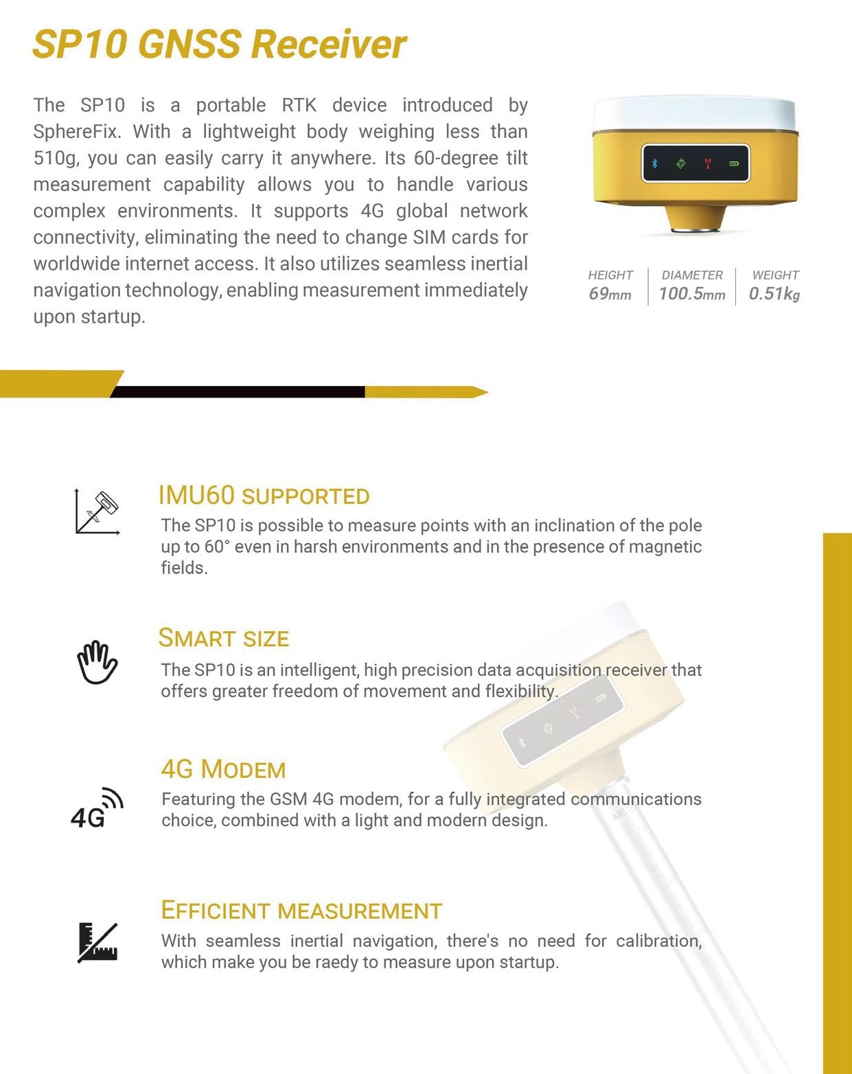
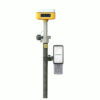
The SP10, launched by Spherefix, is a lightweight portable RTK device, weighing under 510g for easy transport. With a 60-degree tilt measurement capability, it effectively manages diverse and challenging environments. Its support for 4G global network connectivity means there’s no need to switch SIM cards to access the internet worldwide. Additionally, it features seamless inertial navigation technology, allowing for immediate measurement right after startup.
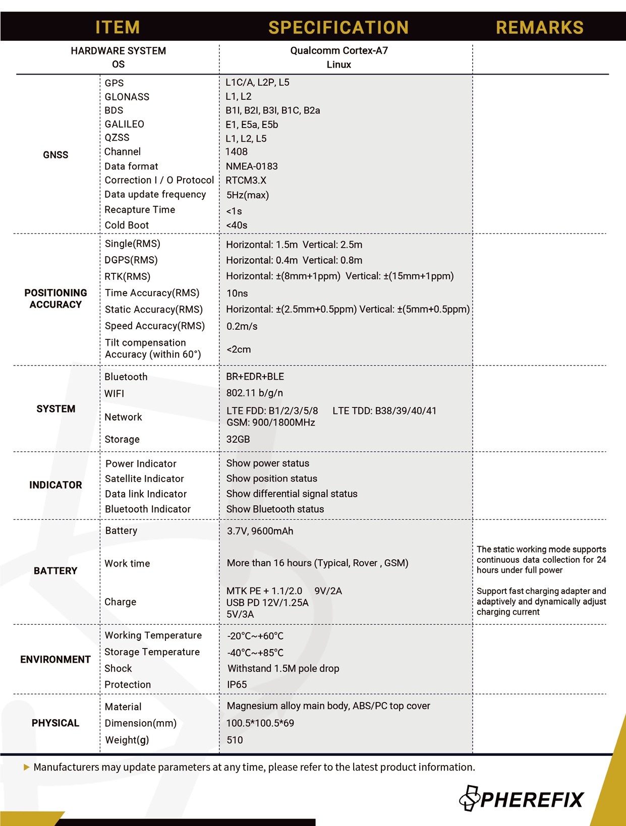
| ✅ Channels |
1408 |
| ✅ IMU Tilt Sensor |
60º |
| ✅ Internet Modem |
4G |
| ❌ UHF Radio |
None |
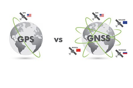
| GPS |
L1C/A, L2P, L5 |
| GLONASS |
L1, L2 |
| GALILEO |
E1, E5a, E5b |
| BEIDOU |
B1l, B1C, B2l, B2a |
Spherefix SP10 Rover and Base Set – Precision, Speed, and Convenience
The Ultimate GNSS Rover and Base Set for Land Surveying
The Spherefix SP10 Rover and Base Set is a game-changer for professionals in land surveying and construction. This compact and lightweight RTK device offers unparalleled accuracy, speed, and ease of use. Whether you’re working in a dense urban environment or a remote construction site, this advanced GNSS rover and base set for land surveying delivers pinpoint precision without the hassle of cumbersome equipment.
Say Goodbye to Inaccurate Measurements and Slow Setup
Traditional surveying tools can be time-consuming, prone to errors, and difficult to maneuver in challenging environments. The Spherefix SP10 GNSS rover and base set eliminates these frustrations with its cutting-edge features:
- Lightweight and Portable – Weighing under 510g, the SP10 is easy to carry and transport.
- IMU Tilt Compensation – With a GPS set with IMU tilt sensor, you can measure at up to a 60-degree tilt, making it perfect for uneven terrain and complex structures.
- Global Connectivity – The SP10 supports 4G global network connectivity, ensuring seamless communication without the need to switch SIM cards.
- Instant Activation – Thanks to its advanced inertial navigation technology, the SP10 is ready to measure immediately after startup.
Built for the Demands of Modern Construction and Surveying
For construction professionals, accuracy and efficiency are non-negotiable. The GNSS set for construction ensures high-precision positioning, even in the most demanding job sites. Its GPS set for construction capabilities allow for rapid measurements, reducing downtime and improving workflow efficiency.
Comprehensive Accessories for Enhanced Versatility
The Spherefix SP10 rover and base set comes complete with all the essential accessories to maximize your efficiency and adaptability in the field:
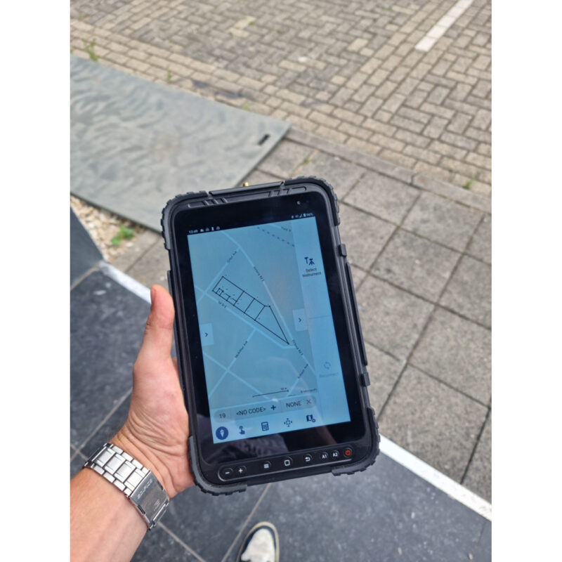
- Spherefix C100 Data Collector: The Spherefix C100 data collector is a robust and reliable device for managing your survey data.
- Spherefix Surveying Software: The Spherefix software is an intuitive software solution that streamlines your workflow and ensures precise results.
- Surveying Pole and Data Collector Bracket: For convenient and stable operation during surveys.
- Tripod, Tribrach, and Adapter: Ensures stability and accuracy for fixed-point measurements.
Customizable Accessories for Your Needs
The Spherefix SP10 rover and base set is flexible to match your specific requirements. Prefer using a tablet instead of the included controller? Or need different software for your workflow? These accessories can be easily modified or upgraded to suit your preferences, ensuring the perfect fit for your projects.


Reviews
There are no reviews yet.