
 GPS & GNSS
 Lidar scanning
 Total Station
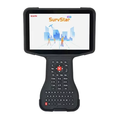
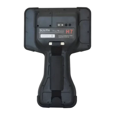
SOUTH H7 Rugged 7 Inch Android Survey Data Controller
This product is available
Get the best price for your setup
Contact our experts for the best possible price and configuration.
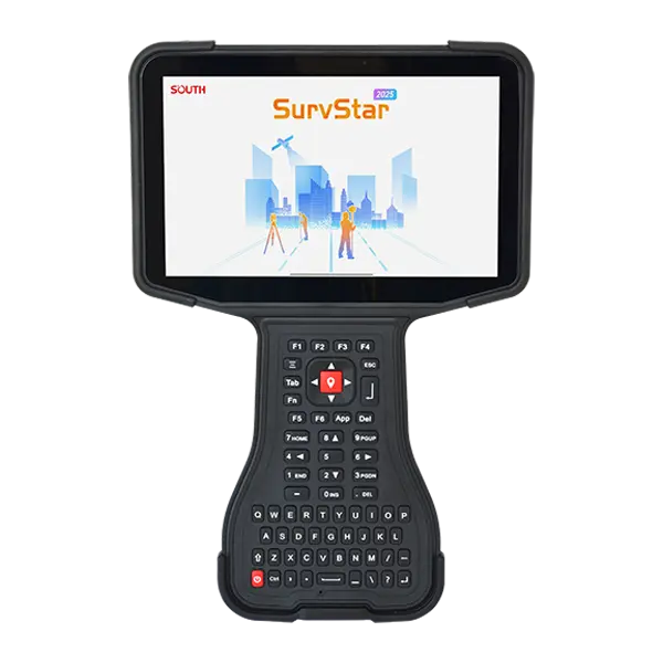
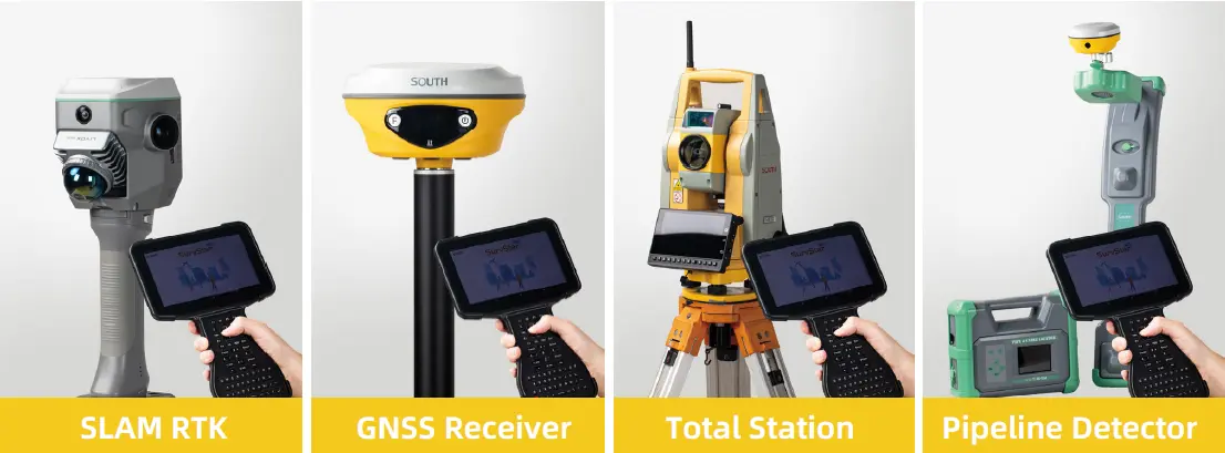
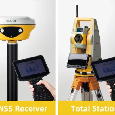
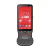
The SOUTH H7 is a rugged 7-inch Android data controller built for surveying, construction layout, GIS data collection and utility mapping. Its bright 850-nit display, backlit QWERTY keypad and large 11550mAh battery support efficient fieldwork with GNSS receivers, total stations, SLAM RTK systems and pipeline detectors. Optional GNSS and Zigbee modules allow the H7 to be configured as a high-precision GIS collector or as a controller for compatible robotic total stations.
SOUTH H7 Highlights
| Display | 7-inch IPS LCD with 1920 × 1200 resolution and 850-nit brightness |
|---|---|
| Field controls | Backlit QWERTY keypad with function keys |
| Performance | Android 12, octa-core processor, 8GB RAM and 256GB storage |
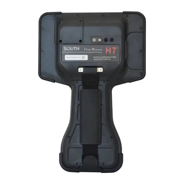
| Battery | 11550mAh battery with USB-C PD fast charging |
| Rugged protection | IP67 rated and tested for 1.5m drops onto concrete |
| Optional GNSS module | 1698 channels with RTK accuracy of 0.8cm + 1ppm horizontal and 1.5cm + 1ppm vertical |
| Optional Zigbee module | Connection range up to 600m in optimal conditions |
Valued customers:










Find RTK Networks
Search NTRIP providers and connect to reliable RTK correction services.
Description
A Versatile Field Controller for Surveying and GIS Work
The SOUTH H7 is a rugged Android data controller developed for professionals who need a larger screen, physical keyboard and dependable connectivity while working outdoors. It can be used as the central field interface for compatible GNSS receivers, SLAM RTK systems, total stations and pipeline detectors, giving surveying and construction teams one practical platform for measurement, stakeout, mapping and asset-data workflows.
Its 7-inch IPS display provides a 1920 × 1200 resolution and 850-nit brightness. The larger landscape format gives users more room to review survey maps, CAD drawings, point information and field forms than a conventional compact handheld controller. A backlit QWERTY keypad with function keys also makes it easier to enter codes, point names and descriptions when gloves, rain or bright sunlight make touchscreen-only operation less convenient.
Android Performance for Survey Software and Project Data
The H7 runs Android 12 on an octa-core processor with 8GB RAM and 256GB internal storage. This combination is suited to everyday surveying software, CAD files, background maps, photographs and larger field datasets. MicroSD support provides additional flexibility for transferring or expanding project storage, while the 13MP rear camera can be used to record site conditions, assets and measured features alongside the survey data.
Communication options include 4G LTE, dual-band Wi-Fi, Bluetooth 5.0, NFC and USB-C. These connections allow the controller to exchange data with field instruments, access network RTK correction services, synchronise projects and send completed work back to the office where network coverage is available.
Optional GNSS and Robotic Total Station Functions
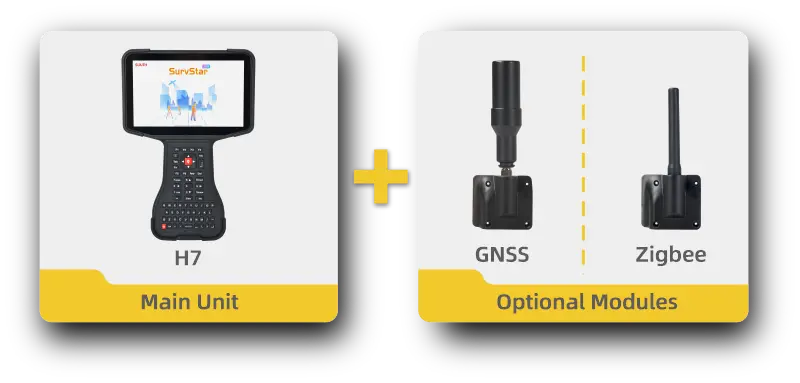
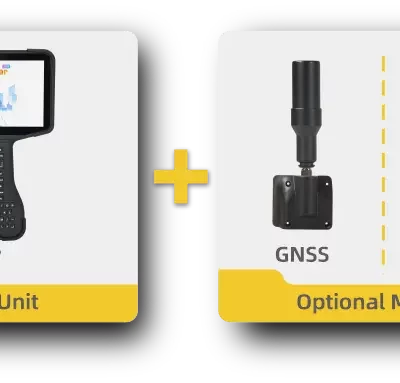
The modular design allows the H7 to be adapted to different types of fieldwork. With the optional high-precision GNSS module, the controller can operate as an integrated GIS data collector. The module tracks multiple satellite constellations and can be paired with suitable antenna options for accurate point collection. This configuration is useful for utility inventories, asset mapping, topographic data capture, construction checks and other GIS tasks where position quality must go beyond the accuracy of a standard tablet or phone.
The optional Zigbee module is intended for communication with compatible robotic total stations. It can support prism-tracking and combined GNSS and total-station workflows, helping surveyors move between open-sky positioning and optical measurement without changing their main field controller. The manufacturer specifies a Zigbee connection distance of up to 600 metres under optimal conditions.
Designed for Demanding Outdoor Conditions
An impact-resistant TPU shell, IP67 protection and a tested 1.5-metre drop resistance help prepare the H7 for use on construction sites, roads, utility corridors and other demanding locations. Its stated operating range of -30°C to +66°C supports work across a wide range of climates. The standard unit weighs approximately 824g, providing the screen area of a small field tablet while remaining portable enough for pole, tripod and mobile site work.
The integrated 11550mAh battery is designed to support extended field sessions. USB-C charging with Power Delivery compatibility makes it easier to recharge the controller using modern site, vehicle or office charging equipment.
Who Is the SOUTH H7 For?
The H7 is particularly suitable for land surveyors carrying out topographic surveys and setting-out work, construction teams working from CAD drawings, GIS professionals collecting assets, utility crews mapping underground infrastructure and engineering teams operating several types of positioning equipment. It can also support drone-survey teams during ground-control measurement, site verification and field data management when connected to suitable GNSS equipment.
Supply and Support from Global GPS Systems
Global GPS Systems can help buyers select the appropriate SOUTH H7 configuration for their existing instruments and working method. Because the GNSS and Zigbee functions are optional, it is important to match the controller, module, antenna and software setup to the required application. This ensures that the delivered system supports the intended GNSS receiver, robotic total station, GIS workflow or utility-mapping equipment.
Datasheets & Manuals
Datasheets and manuals
Datasheets & manuals
Specifications
SOUTH H7 Rugged Android Field Controller Specifications
Product Overview
| Product Type | Rugged Android field controller and GIS data collector |
|---|---|
| Model | H7 |
| Form Factor | All-in-one landscape-format handheld controller |
| Primary Applications | Land surveying, construction surveying, GIS data collection, CAD stakeout, robotic total station control and field mapping |
| Compatible Equipment Types | SLAM RTK systems, GNSS receivers, robotic and conventional total stations, pipeline detectors and other supported surveying instruments |
| Modular Configuration | Standard controller with optional high-precision GNSS/GIS module or Zigbee module |
Physical Specifications
| Dimensions | 290 × 195 × 30 mm |
|---|---|
| Weight | 824 g standard configuration; 860 g with Zigbee module; 890 g with GIS module |
| Housing Material | Impact-resistant TPU shell |
| Orientation | Landscape |
| Keypad | Backlit QWERTY keypad with function keys |
Display and Camera
| Display Size | 7 inches |
|---|---|
| Display Type | IPS LCD |
| Display Resolution | 1920 × 1200 pixels |
| Display Brightness | 850 nits |
| Rear Camera | 13 MP |
| Camera Application | Field documentation and project record capture |
Processor, Memory and Operating System
| Processor | Octa-core CPU |
|---|---|
| Processor Configuration | 2 performance cores at 2.0 GHz and 6 efficiency cores at 1.8 GHz |
| Operating System | Android 12 |
| RAM | 8 GB |
| Internal Storage | 256 GB |
| Expandable Storage | MicroSD card support |
| Supported Field Workloads | Designed for surveying applications, CAD file viewing, CAD stakeout and point-cloud browsing |
Battery and Charging
| Battery Capacity | 11,550 mAh |
|---|---|
| Battery Voltage | 3.85 V |
| Battery Installation | Built-in |
| Charging Input | 5 V / 2 A |
| Charging Connector | USB Type-C |
| Fast Charging | USB Power Delivery fast charging supported |
Ports and Interfaces
| USB Interface | USB Type-C |
|---|---|
| NFC | Supported |
| Memory Card Interface | MicroSD card slot |
Wireless and Cellular Communication
| Wi-Fi Standards | IEEE 802.11 a/b/g/n/ac |
|---|---|
| Wi-Fi Frequency Bands | 2.4 GHz and 5 GHz dual-band |
| Wi-Fi Roaming | Fast roaming supported |
| Bluetooth | Bluetooth 2.1 + EDR, 3.0, 4.1 LE, 4.2 and 5.0 support |
| Cellular Network | 4G LTE |
| Short-Range Communication | NFC |
Environmental and Ruggedness Specifications
| Operating Temperature | -30°C to +66°C |
|---|---|
| Storage Temperature | -30°C to +70°C |
| Ingress Protection | IP67 |
| Dust Protection | Dust-tight under the IP67 rating |
| Water Protection | Protected against temporary water immersion under the IP67 rating |
| Drop Resistance | Tested for a 1.5 m drop onto a concrete surface on all six faces |
| Salt Spray Test | 5% NaCl solution, pH 6.5–7.2, continuous spray for 24 hours, settling index 1.0–2.0 ml/80 cm² per hour |
| Vibration Test | Fixed frequency of 50 Hz, 100 mm amplitude and 30-minute duration |
Optional Modules and Configurations
| Configuration | Primary Function | Weight |
|---|---|---|
| Standard | General-purpose Android surveying field controller | 824 g |
| Zigbee | Wireless connection and control for supported robotic total stations | 860 g |
| GIS / High-Precision GNSS | High-precision GNSS positioning and GIS point collection | 890 g |
Optional GNSS Receiver
| GNSS Channel Count | 1,698 channels |
|---|---|
| Supported Satellite Systems | GPS, BeiDou, GLONASS, Galileo, QZSS, NavIC and SBAS |
| GIS Collector Capability | Supports high-precision GIS data collection when equipped with the optional GNSS/GIS module |
| Antenna Options | Supports a portable short antenna; compatible configurations may also use an optional dish antenna, antenna cable and carbon-fibre pole |
Supported GNSS Signals
| Satellite System | Supported Signals |
|---|---|
| GPS | L1 C/A, L1C, L2P(Y), L2C and L5 |
| BeiDou | B1I, B2I, B3I, B1C, B2a and B2b |
| GLONASS | G1, G2 and G3 |
| Galileo | E1, E5a, E5b and E6 |
| QZSS | L1 C/A, L1C, L2C and L5 |
| NavIC | L5 |
| SBAS | L1 C/A |
Optional GNSS Positioning Accuracy
| Positioning Mode | Horizontal Accuracy | Vertical Accuracy |
|---|---|---|
| Single-Point Positioning, RMS | 1.5 m | 2.5 m |
| DGPS, RMS | 0.4 m | 0.8 m |
| RTK, RMS | 0.8 cm + 1 ppm | 1.5 cm + 1 ppm |
Optional Zigbee Module
| Connection Technology | Zigbee |
|---|---|
| Maximum Connection Distance | Up to 600 m in an optimal environment |
| Primary Function | Connection to and control of supported robotic total stations |
| Integrated Workflow | Can be used independently or together with a GNSS receiver to support prism tracking and combined positioning workflows |
| Surveying Application | Supports robotic total station operation, prism tracking and CAD stakeout workflows |
Key Functional Features
| Modular Design | Switchable optional Zigbee and high-precision GNSS/GIS modules allow the controller to be configured for different field applications |
|---|---|
| Outdoor Readability | High-resolution 7-inch IPS display with 850-nit brightness for field use |
| Physical Data Entry | Backlit full QWERTY keypad with dedicated function keys |
| Surveying Ecosystem | Designed as a single controller platform for multiple types of surveying and mapping equipment |
| GIS Data Collection | Can be converted into a high-precision GIS collector using the optional GNSS/GIS module and compatible antenna equipment |
| Robotic Total Station Control | Optional Zigbee module supports connection to compatible robotic total stations |
| Field Documentation | Integrated 13 MP rear camera supports photographic project records |
| Field Connectivity | 4G LTE, dual-band Wi-Fi, Bluetooth 5.0 compatibility and NFC |
Specifications and package contents may vary by configuration, region or manufacturer update. Always check the current configuration before ordering.
FAQ
SOUTH H7 Data Controller FAQ
Product Overview and Applications
What is the SOUTH H7?
The SOUTH H7 is a rugged, landscape-format Android data controller designed for professional surveying, GIS data collection, construction layout and other field measurement workflows. It combines a 7-inch display, physical QWERTY keypad, mobile connectivity and optional positioning or Zigbee modules in one field device.
Who is the SOUTH H7 designed for?
The H7 is designed for land surveyors, GIS professionals, construction survey teams, civil engineers, utility mapping crews, infrastructure inspectors and other users who need to control surveying instruments or collect spatial data in the field.
Which industries can use the SOUTH H7?
The controller is suitable for land surveying, construction, civil engineering, cadastral work, GIS mapping, utilities, pipeline detection, infrastructure development, deformation monitoring and other geospatial or engineering applications.
What types of fieldwork can be completed with the H7?
Depending on the connected equipment, software and optional module, the H7 can support topographic surveys, stakeout, cadastral surveys, GIS feature collection, robotic total station operation, GNSS surveying, utility mapping, pipeline detection and CAD-based fieldwork.
Can the H7 replace multiple field controllers?
The H7 is designed as a multi-purpose controller that can communicate with several types of surveying and mapping equipment. Its compatibility with GNSS receivers, total stations, SLAM RTK systems and pipeline detectors can reduce the need to carry a separate controller for every instrument.
Can the H7 be used as a GIS data collector?
Yes. When configured with the optional high-precision GNSS or GIS module and a suitable antenna, the H7 can operate as a high-precision GIS collector for accurate point and feature collection.
Display, Performance and Field Operation
What display does the SOUTH H7 use?
The H7 has a 7-inch IPS LCD with a resolution of 1920 by 1200 pixels. Its landscape layout provides additional screen space for maps, survey software, CAD drawings, point clouds and field forms.
Is the H7 screen readable outdoors?
The display has a rated brightness of 850 nits, making it suitable for outdoor field use. Actual visibility can vary with direct sunlight, viewing angle and screen settings.
Does the H7 have a physical keyboard?
Yes. It includes a backlit QWERTY keypad with function keys. The physical keyboard supports faster data entry and can be useful when working at night, in low-light environments or while wearing suitable field gloves.
Which operating system does the H7 use?
The SOUTH H7 runs Android 12, providing an Android-based platform for compatible surveying, GIS, CAD and field data collection applications.
How much memory and storage does the H7 have?
The H7 includes 8 GB of RAM and 256 GB of internal storage. This capacity is intended to support large project files, field applications, CAD drawings, imagery and point-cloud data.
Can the H7 open CAD files and point clouds?
The H7 is designed with sufficient screen size, memory and storage for viewing compatible CAD files and browsing point-cloud data. File support and editing functions depend on the software installed on the controller.
Connectivity, Instruments and Optional Modules
Which surveying instruments can connect to the H7?
The H7 is designed for use with a range of equipment, including compatible GNSS receivers, robotic and conventional total stations, SLAM RTK systems and pipeline detectors. Compatibility should be confirmed for the specific instrument model and field software.
What is the optional Zigbee module used for?
The optional Zigbee module enables wireless communication with compatible robotic total stations. It can be used independently or together with a GNSS receiver to support prism tracking and integrated positioning workflows.
What is the maximum Zigbee connection distance?
The specified Zigbee connection distance is up to 600 metres in an optimal environment. Actual range may be reduced by buildings, terrain, interference, antenna position and other site conditions.
What accuracy can the optional GNSS module provide?
The optional GNSS module is specified for RTK accuracy of 0.8 centimetres plus 1 ppm horizontally and 1.5 centimetres plus 1 ppm vertically. It also supports DGPS and standalone positioning. Achievable accuracy depends on corrections, satellite conditions, antenna setup and the survey environment.
Which satellite constellations does the optional GNSS module support?
The optional 1698-channel GNSS module supports signals from GPS, BeiDou, GLONASS, Galileo, QZSS, NavIC and SBAS. Multi-constellation tracking can improve satellite availability in challenging field environments.
What wireless connections are available?
The H7 supports 4G LTE, dual-band 2.4 GHz and 5 GHz Wi-Fi, Bluetooth up to version 5.0 and NFC. These connections can be used for internet access, correction services, data transfer and communication with compatible instruments.
Battery, Durability and Hardware
What is the battery capacity of the SOUTH H7?
The H7 has a built-in 11,550 mAh, 3.85 V battery designed for extended field operation. Actual operating time depends on display brightness, mobile networks, connected instruments, GNSS use, applications and environmental temperature.
How is the H7 charged?
The controller charges through USB-C and supports 5 V, 2 A charging and USB Power Delivery fast charging. Use a compatible charger and cable that meet the manufacturer’s requirements.
Is the SOUTH H7 waterproof and dustproof?
The H7 has an IP67 protection rating. This indicates protection against dust and temporary water immersion under defined test conditions. Ports and covers must be correctly closed to maintain the rated protection.
Can the H7 withstand drops?
The controller is specified to withstand a 1.5-metre drop onto a concrete surface on all six faces under test conditions. Its impact-resistant TPU shell provides additional protection for demanding field environments.
What temperatures can the H7 operate in?
The specified operating temperature range is -30°C to +66°C. The specified storage temperature range is -30°C to +70°C. Battery performance and display response may vary at temperature extremes.
What ports and hardware features are included?
The H7 includes a USB Type-C interface, NFC, a MicroSD card slot and a 13-megapixel rear camera. The camera can be used to create visual records and attach site photographs to compatible field projects.
Reviews (0)
Only logged in customers who have purchased this product may leave a review.
 GPS & GNSS
 Total Stations
 Data collectors
 Software
 Correction services
 Machine control
 External radio
 Lasers & levellers
 Marine
 Accessories
Reviews
There are no reviews yet