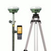
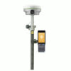
Satlab Eyr Rover and Base set Product Review
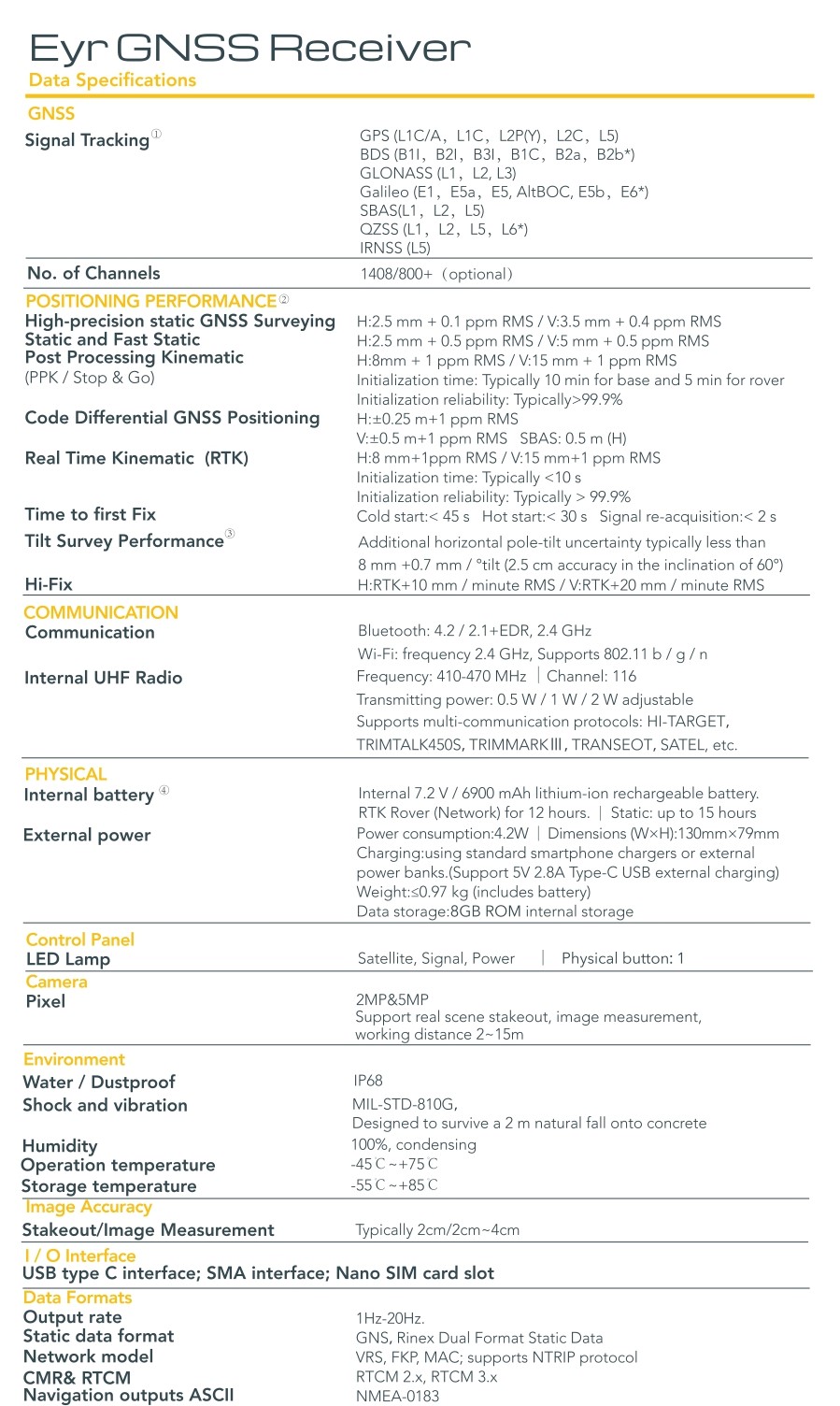
Satlab Eyr RTK GNSS Receiver
Experience unmatched precision and efficiency with the Satlab Eyr, a high-performance RTK GNSS receiver designed for land surveying and construction. Featuring dual cameras for AR live-view stakeout, robust satellite tracking, and superior tilt compensation, the Satlab Eyr RTK GNSS Receiver ensures accurate, contact-free measurements. Paired with advanced software and multi-protocol connectivity, it’s the ultimate GNSS receiver for land surveying and a dependable GPS set for construction.
| ✅ Channels |
1408 |
| ✅ IMU Tilt Sensor |
60° |
| ❌ Internet Modem |
None |
| ✅ UHF Radio |
410 – 470MHz |
| GPS |
L1C/A, L1C, L2P(Y), L2C, L5 |
| GLONASS |
L1, L2, L3 |
| GALILEO |
E1, E5a, E5b, E6, AltBOC |
| BEIDOU |
B1I, B2I, B3I, B1C, B2a, B2b |
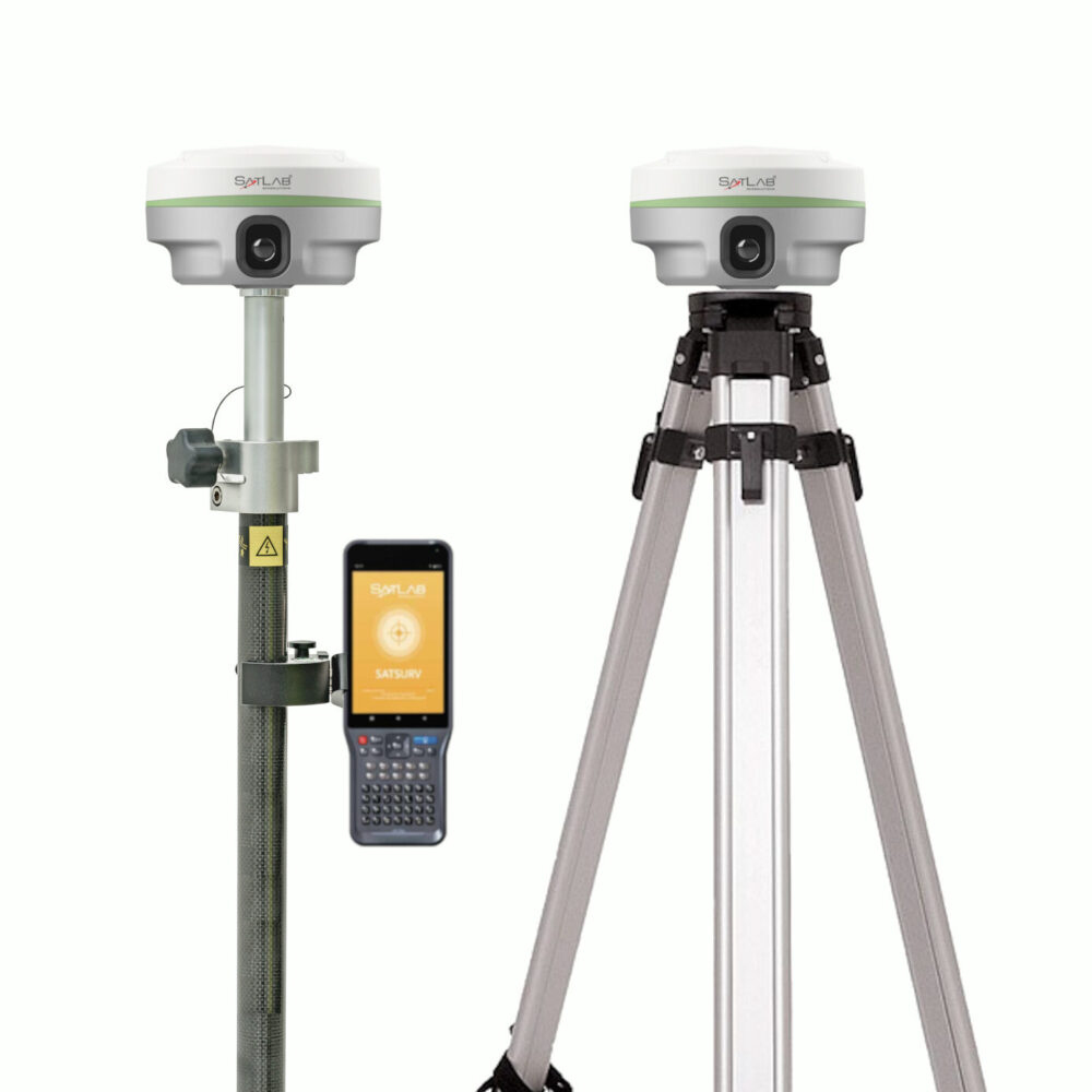
Experience Unmatched Precision with the Satlab Eyr Rover and Base Set
The Satlab Eyr rover and base set redefines precision in land surveying and construction tasks. Designed with state-of-the-art technology, this GNSS rover and base set for land surveying combines cutting-edge features to deliver accurate, reliable results in even the most challenging environments. Say goodbye to errors and inefficiencies—the Satlab Eyr is here to elevate your workflow.
Key Features of the Satlab Eyr GNSS Rover and Base Set
- AR Live-View Stakeout with Dual Cameras: Simplify complex stakeout operations with augmented reality. The dual-camera system provides real-time visual guidance, enhancing accuracy and reducing time spent in the field.
- Advanced IMU Tilt Compensation: With its built-in IMU tilt sensor, the Satlab Eyr ensures precise measurements, even on uneven terrain. This GPS set with IMU tilt sensor eliminates the need for perfect alignment, saving you time and effort.
- Robust Satellite Tracking: Enjoy uninterrupted performance thanks to superior satellite connectivity. The system is optimized for multi-constellation tracking, ensuring dependable results no matter where you are.
- Anti-Jamming Technology: Work with confidence in signal-dense environments. The Satlab Eyr’s anti-jamming capabilities ensure seamless operations, even under challenging conditions.
- Multi-Protocol Connectivity: Pair the device effortlessly with advanced software for data sharing and analysis. It’s the ultimate GNSS set for construction, designed to integrate seamlessly with your existing tools.

Why Choose the Satlab Eyr?
- Unparalleled Accuracy: Trust in precise results, even in the most demanding conditions.
- Enhanced Productivity: Streamline your operations with advanced features like AR live-view stakeout and tilt compensation.
- Built to Last: Designed for durability, the Satlab Eyr thrives in tough environments.
- Versatility: Ideal for both land surveying and construction projects, this GPS set is your all-in-one solution.
Comprehensive Accessories for Enhanced Versatility
The Satlab Eyr rover and base set comes complete with all the essential accessories to maximize your efficiency and adaptability in the field:
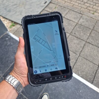
- Satlab SHC55 Data Collector: The Satlab SHC55 data collector is a robust and reliable device for managing your survey data.
- SurvStar Surveying Software: The SatSurv software is an intuitive software solution that streamlines your workflow and ensures precise results.
- Surveying Pole and Data Collector Bracket: For convenient and stable operation during surveys.
- Tripod, Tribrach, and Adapter: Ensures stability and accuracy for fixed-point measurements.
Customizable Accessories for Your Needs
The Satlab Eyr rover and base set is flexible to match your specific requirements. Prefer using a tablet instead of the included controller? Or need different software for your workflow? These accessories can be easily modified or upgraded to suit your preferences, ensuring the perfect fit for your projects.


Reviews
There are no reviews yet.