

 GPS & GNSS
 Lidar
 RTK Data & NTRIP
 Total Station
EFIX eSteer 20 Auto Steering System
Get the best price for your setup
Contact our experts for the best possible price and configuration.
- Fast response
- Expert configuration advice
- No overpaying for features you do not need
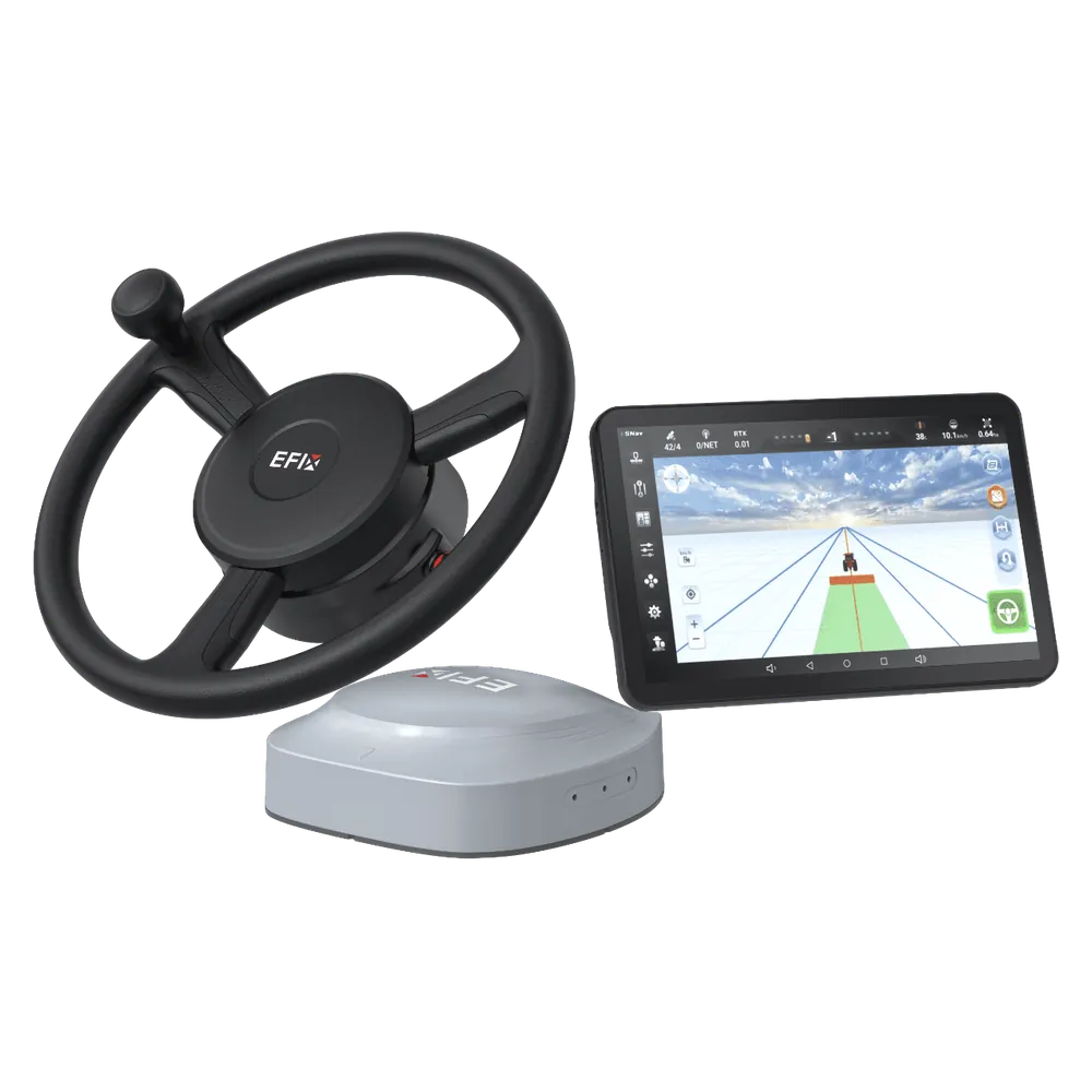
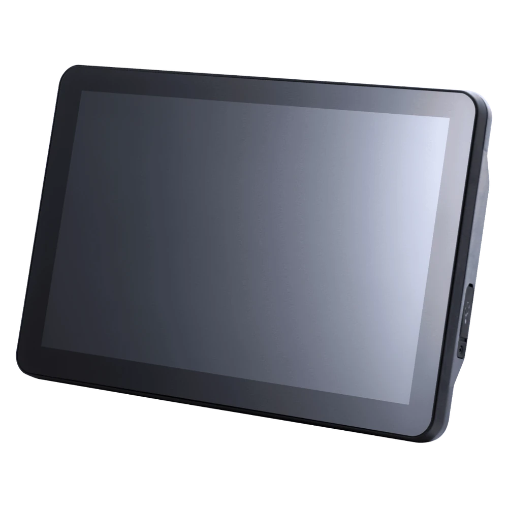
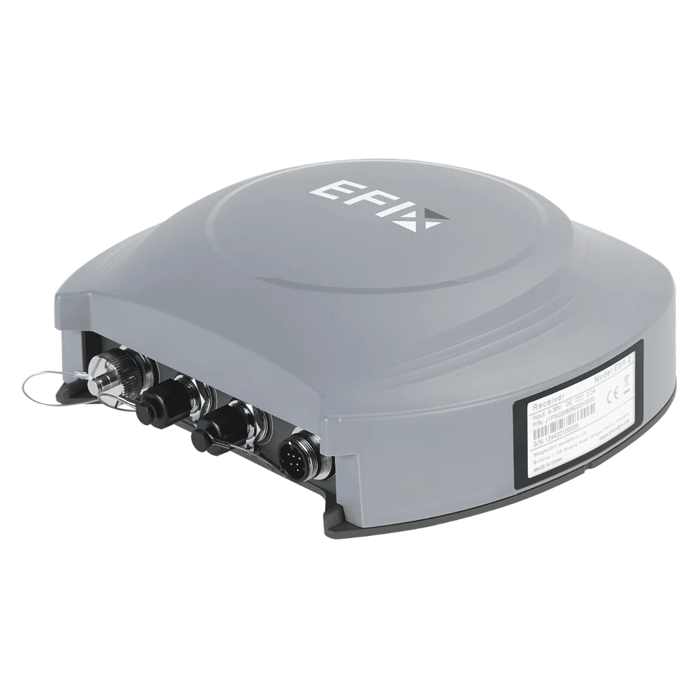
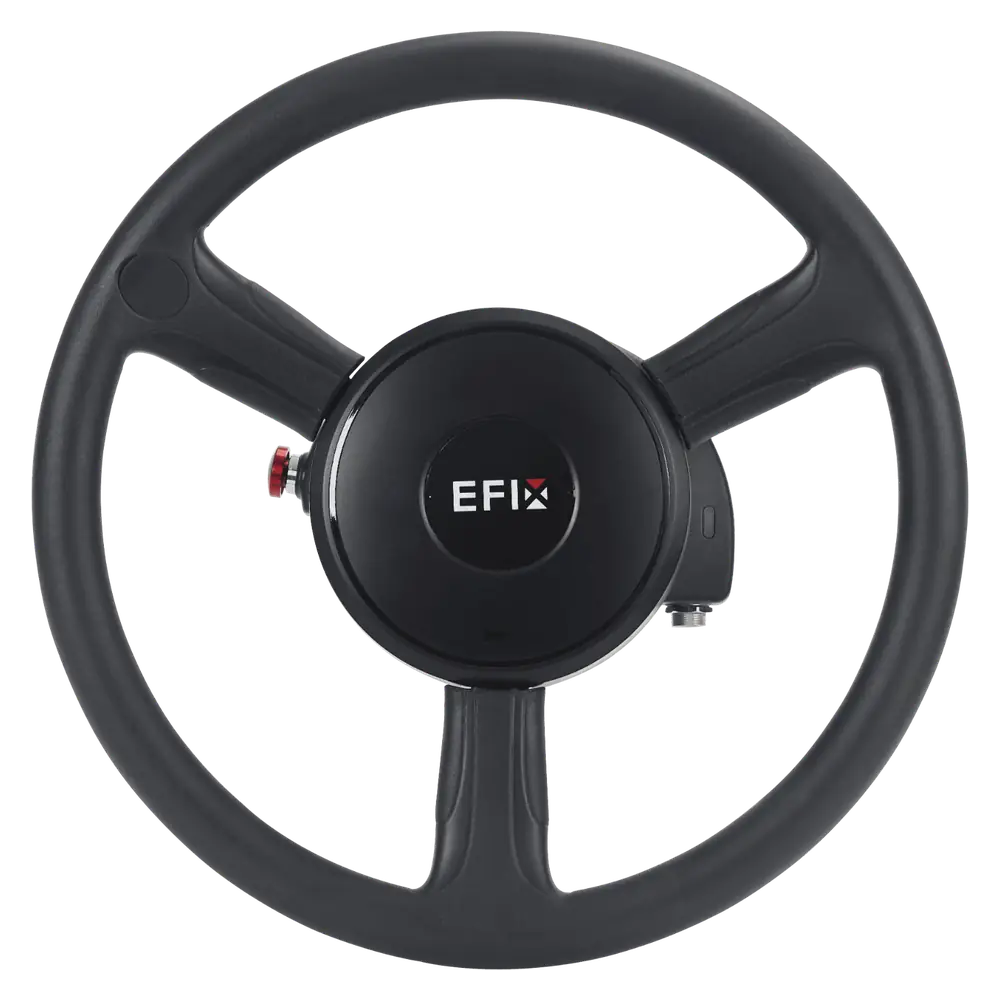
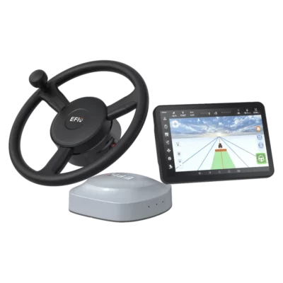
The EFIX eSteer 20 is an RTK GNSS auto steering system designed to help farmers and agricultural contractors maintain accurate, consistent driving lines. Combining multi-constellation satellite positioning, an electric steering wheel and an intuitive in-cab display, it supports precision farming tasks including seeding, planting, spraying, fertilising, tillage and harvesting.
With specified pass-to-pass guidance accuracy of ±2.5 cm and an operating speed range of 0.1–30 km/h, the eSteer 20 helps reduce unnecessary overlap and missed strips during field operations. Multiple guidance patterns, automated U-turn options and support for different agricultural vehicle types make it suitable for both regular and irregular fields. RTK and supported satellite-based correction modes provide flexible positioning options, while the integrated GNSS receiver and electric steering system help operators maintain accurate field guidance with less manual steering effort.
EFIX eSteer 20 Highlights
| Guidance accuracy | ±2.5 cm pass-to-pass under specified conditions |
|---|---|
| Operating speed | 0.1–30 km/h |
| GNSS constellations | GPS, GLONASS, Galileo, BeiDou and QZSS |
| Positioning modes | RTK, DGPS, E-PPP, H-PPP and SkyTrix |
| RTK positioning accuracy | Horizontal ±8 mm + 1 ppm RMS; vertical ±15 mm + 1 ppm RMS |
| Guidance patterns | AB line, A+ line, curves, circular patterns and field boundary guidance |
| Automatic turns | Multiple U-turn and headland guidance options |
| Steering technology | Electric steering wheel with 7 Nm rated torque |
| In-cab display | Android 11 touchscreen; 10.1-inch specification subject to configuration confirmation |
| Connectivity | 4G LTE, Wi-Fi, Bluetooth and compatible GNSS correction radio protocols |
| Power supply | 9–36 V DC |
Valued customers:










Find RTK Networks
Search NTRIP providers and connect to reliable RTK correction services.
Description
EFIX eSteer 20 RTK GNSS Auto Steering System for Precision Agriculture
The EFIX eSteer 20 is a GNSS-based automatic steering system designed for agricultural tractors and compatible farm machinery. By combining accurate satellite positioning with an electric steering wheel and intelligent guidance software, it helps operators follow consistent driving lines during seeding, planting, spraying, fertilising, tillage and harvesting.
With specified pass-to-pass guidance accuracy of ±2.5 cm under suitable positioning conditions, the eSteer 20 helps farmers work with more consistent row spacing and reduce unnecessary overlap between field passes. The system supports a wide operating speed range from 0.1 to 30 km/h, making it suitable for both slow, precise operations and faster fieldwork.
Its flexible guidance patterns, automatic U-turn functions and compatibility with different agricultural steering configurations make the eSteer 20 a practical solution for farmers and agricultural contractors looking to introduce GNSS auto steering into their daily operations.
Centimetre-Level GNSS Guidance for Accurate Fieldwork
Accurate driving lines are important during many agricultural operations. When a tractor moves slightly away from its intended path, it can leave untreated strips, overlap previously worked areas or create inconsistent row spacing. These small differences become more significant when working across large fields or repeating operations throughout the growing season.
The EFIX eSteer 20 uses multi-constellation GNSS positioning and automatic steering control to guide compatible agricultural machinery along a selected route. Under specified conditions, the system provides pass-to-pass guidance accuracy of ±2.5 cm, helping operators maintain consistent working lines.
For seeding and planting, this supports more uniform row spacing and positioning. During spraying or fertilising, consistent guidance can help reduce unnecessary overlap and missed strips when the implement width and guidance settings are correctly configured.
Actual field performance depends on the GNSS correction mode, satellite reception, vehicle calibration, terrain conditions and steering response. The guidance accuracy specification should not be confused with the separate positioning accuracy of the GNSS receiver.
Automatic Steering from 0.1 to 30 km/h
The eSteer 20 supports automatic steering over an operating speed range of 0.1 to 30 km/h. This makes the system relevant to a variety of agricultural tasks that require different working speeds.
At low speeds, accurate guidance can be useful for planting, vegetable cultivation and other operations where maintaining a steady route is important. At higher field speeds, the same system can support spraying, fertiliser application and other work covering larger areas.
The electric steering wheel automatically adjusts the vehicle’s steering direction according to the selected guidance line and the position calculated by the GNSS system. This reduces the amount of continuous manual steering required from the operator.
By reducing repetitive steering work, the system can make long field operations more comfortable. The driver must nevertheless remain attentive, monitor the vehicle and implement, and be ready to take manual control whenever necessary.
Multi-Constellation GNSS and Flexible Correction Modes
The EFIX eSteer 20 supports GPS, GLONASS, Galileo, BeiDou and QZSS satellite signals. Tracking multiple satellite constellations helps the receiver obtain positioning observations across different agricultural environments.
For high-precision guidance, the system supports RTK corrections using compatible local base stations or network correction services. Supported positioning modes also include DGPS, E-PPP, H-PPP and EFIX SkyTrix satellite-based correction technology.
These options provide flexibility for farms operating in areas with different network coverage and correction infrastructure. RTK corrections are particularly useful when accurate, repeatable driving lines are required, while supported satellite-based services can provide additional options where mobile data coverage is limited.
The GNSS receiver has specified RTK positioning accuracy of ±8 mm + 1 ppm horizontally and ±15 mm + 1 ppm vertically under reference conditions. Actual vehicle guidance accuracy also depends on steering control, calibration and other operating factors.
The availability of individual correction services, subscriptions and regional coverage should be confirmed for the intended operating location.
Multiple Guidance Patterns for Different Field Shapes
Not every agricultural field has straight boundaries or a regular rectangular shape. The EFIX eSteer 20 provides multiple guidance patterns so operators can select routes suited to the geometry of the field and the task being performed.
Available guidance functions include AB lines, A+ lines, free curves, circular patterns, boundary-related guidance and other field path options. Straight-line guidance is useful for conventional planting, spraying and cultivation, while curved guidance can be used when following irregular field boundaries or working around obstacles.
For example, a farmer working in a rectangular field can establish an AB line and use parallel guidance passes across the working area. In a field with curved edges, a suitable curve pattern can help the tractor follow the required shape more consistently.
Correctly configuring the working width, vehicle geometry and guidance pattern is important for maintaining suitable spacing between passes and reducing unnecessary overlap.
Automatic U-Turn Functions for Headland Operations
At the end of a field pass, turning the tractor into the next working line requires attention to the vehicle, implement and available headland space. The eSteer 20 includes several automatic U-turn functions to support this part of the fieldwork process.
Depending on the selected configuration, operators can use supported guidance patterns including single-line, curve, boundary and headland-related U-turns. These functions help the steering system follow a planned turning route rather than requiring every steering adjustment to be performed manually.
This is particularly useful during repetitive operations such as seeding, tillage and spraying, where many turns may be required during a working day.
Automatic turns must be configured according to the vehicle dimensions, implement, field boundary and available turning space. The operator remains responsible for checking the surroundings and maintaining safe control of the machine.
Electric Steering Wheel for Agricultural Machinery
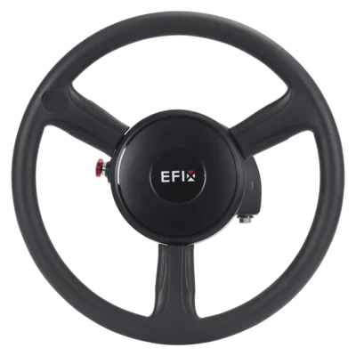
The EFIX eSteer 20 uses an electrically driven steering wheel to control the vehicle’s direction. This provides a practical way to add automatic steering to compatible agricultural machines without requiring a completely new tractor.
The electric steering system uses a torque motor with a specified rated torque of 7 Nm and a rated operating speed of 120 rpm. Depending on the installation configuration, steering wheel diameters of 360 mm and 400 mm are supported.
The electric steering wheel works together with the GNSS receiver, guidance software and vehicle calibration to calculate and apply steering corrections while the machine follows its selected route.
This retrofit approach is particularly relevant for farms operating several tractors or specialised agricultural vehicles. Compatibility must be checked against the existing steering mechanism, vehicle dimensions, available electrical power and supported installation hardware.
Compatible with Different Agricultural Vehicle Types
The eSteer 20 is designed to support a variety of agricultural vehicles and steering arrangements. Supported configurations include front-wheel steering, rear-wheel steering, articulated vehicles, tracked machinery, transplanters and self-propelled sprayers, subject to the appropriate installation and calibration.
This flexibility is useful for agricultural contractors who work with different machines throughout the year. A guidance system may be needed for a tractor during soil preparation, another machine during planting and a sprayer later in the growing season.
Installation requirements depend on the vehicle’s steering layout and mechanical condition. The steering wheel, receiver, display and associated components must be installed correctly before calibration.
The system is not universally compatible with every agricultural vehicle, and transferring equipment between machines may require additional mounting components and recalibration.
Integrated Display and Easy Guidance Operation
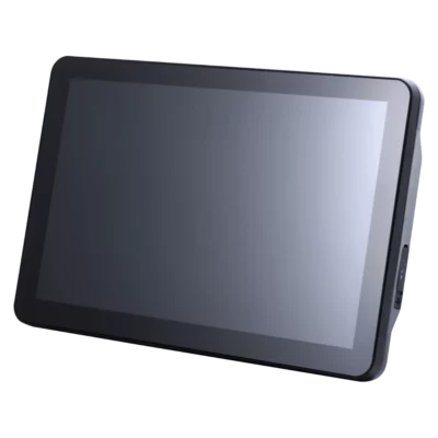
The EFIX eSteer 20 includes an Android-based in-cab display providing a graphical interface for configuring guidance lines, monitoring vehicle position and managing field operations. The technical configuration specifies a 10.1-inch touchscreen with a resolution of 1280 × 800 pixels and Android 11.
The display presents the tractor’s position relative to the selected guidance line, helping the operator understand the direction of travel and any lateral deviation from the planned route.
Operators can create guidance paths, select correction modes, configure vehicle settings and manage field tasks through the software interface. Information about working speed, guidance status and worked area is also available during operation.
The graphical workflow makes the system accessible to agricultural operators who want to use automatic steering without managing complex surveying software. Initial setup and calibration should still be completed carefully to achieve reliable performance.
Vehicle Calibration and Steering Adjustment
Correct calibration is essential for automatic steering performance. After installation, the eSteer 20 requires the vehicle type, steering configuration and relevant dimensions to be entered into the system.
The setup workflow includes steering calibration and adjustments that account for the behaviour of the vehicle. This helps the guidance system determine how the machine responds to steering commands and how to correct deviations from the selected route.
For example, an articulated tractor and a conventional front-steered tractor respond differently when the steering wheel is turned. Selecting the correct vehicle configuration and performing the required calibration helps the system apply suitable steering corrections.
Calibration should be carried out in an appropriate open area, following the supported procedure and at the recommended operating speed. Steering response may need to be checked again when the system is transferred to a different machine or when significant mechanical changes are made.
Applications in Precision Agriculture
Seeding and Planting
During seeding and planting, accurate guidance helps operators maintain consistent passes and row spacing across the field. This is useful when preparing parallel planting lines and when subsequent operations need to follow the same general field layout.
Spraying and Crop Protection
For spraying, the eSteer 20 helps guide the tractor or compatible self-propelled sprayer along planned routes. Consistent vehicle positioning can reduce unnecessary overlapping passes and missed strips when the sprayer width and guidance settings are correctly configured.
Fertiliser Application
During fertiliser spreading, accurate guidance helps operators follow consistent driving lines and maintain suitable coverage across the working area. This supports more controlled application planning and can help avoid repeated passes over the same ground.
Soil Preparation and Tillage
For ploughing, harrowing and other soil preparation tasks, automatic steering reduces the need for continuous manual correction while following long field passes. This can make repetitive fieldwork more comfortable and help maintain consistent coverage.
Vegetable Farming and Transplanting
The system’s low-speed operating capability makes it relevant to specialised planting and transplanting operations. With a compatible machine and correctly configured guidance pattern, the operator can maintain a controlled route during slow working passes.
Harvesting
During harvesting, automatic guidance can help maintain the intended vehicle path through the field. This is useful when operating over long distances or following previously established working lines, although the driver must continue monitoring crop conditions and machine operation.
Agricultural Contracting
Contractors working across different farms can use the system’s guidance patterns and vehicle configuration options to support varied field operations. Suitable installation components and machine-specific calibration help adapt the system to the requirements of different agricultural vehicles.
Field Operations and Data Management
The eSteer 20 guidance interface provides functions for creating field tasks, reviewing guidance lines and monitoring worked areas. This helps operators organise field operations and keep track of the routes used during agricultural work.
Guidance paths can be selected according to the intended field operation, while compatible configuration options support features such as tramlines, access paths and field boundaries.
Additional functions, including selected ISOBUS implement control and advanced task management features, may require separate activation, compatible implements or additional software licensing. These capabilities should be confirmed for the supplied system configuration.
EFIX eSteer 20 at Global GPS Systems
The EFIX eSteer 20 is a practical agricultural auto steering solution for farmers, agricultural contractors and precision farming operators who want accurate guidance during everyday fieldwork.
Its combination of RTK GNSS positioning, electric steering control, flexible guidance patterns and automatic U-turn functions makes it suitable for a wide range of agricultural tasks, from soil preparation and seeding to fertilising and spraying.
At Global GPS Systems, we help customers select GNSS guidance equipment for their agricultural machinery and working conditions. Contact our team for assistance with vehicle compatibility, system configuration, RTK correction options, installation accessories and the guidance functions required for your farm.
Specifications
EFIX eSteer 20 Auto Steering System Specifications
General Specifications
| Manufacturer | EFIX Geomatics Co., Ltd. |
|---|---|
| Brand | EFIX |
| Product Name | EFIX eSteer 20 Auto Steering System |
| Model | eSteer 20 |
| Product Category | GNSS-based automatic steering system for agricultural machinery |
| Steering Technology | GNSS-guided electric steering wheel with integrated navigation and control software |
| Published Pass-to-Pass Accuracy | ±2.5 cm under suitable correction and operating conditions |
| Operating Speed Range | 0.1–30 km/h |
| Steering Actuator | Electric torque motor with replacement steering wheel |
| Electric Steering Wheel Model | ESW-2 |
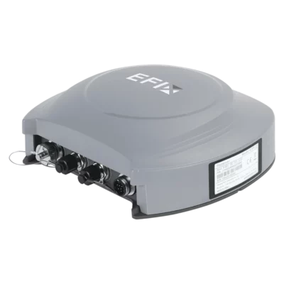
| GNSS Receiver Model | ESR-2 |
| Display Controller Model | ESD-1 Pro |
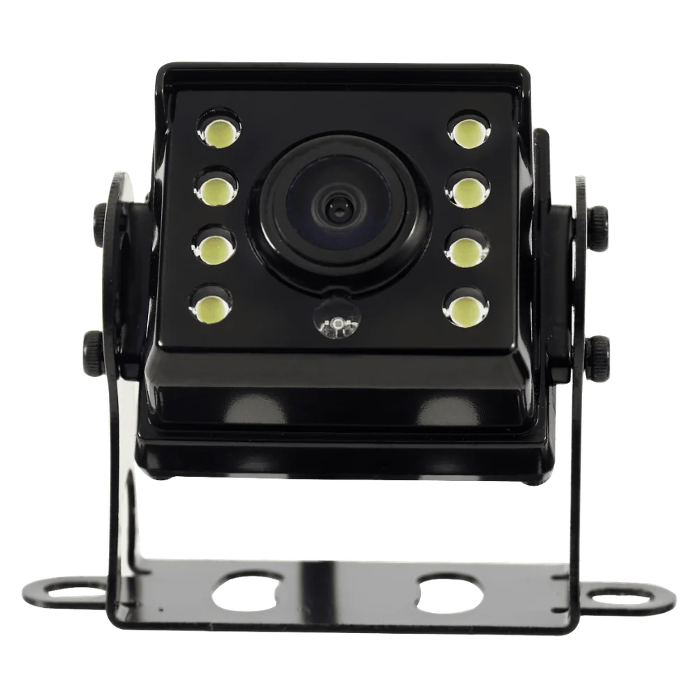
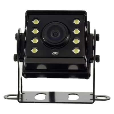
| Camera Model | X-MC011A |
| GNSS Correction Modes | SPP, DGPS, RTK, E-PPP, H-PPP, SkyTrix and EFIX-PPP |
| GNSS Constellations | GPS, GLONASS, Galileo, BeiDou and QZSS |
| RTK Horizontal Positioning Accuracy | ±(8 mm + 1 ppm) RMS |
| RTK Vertical Positioning Accuracy | ±(15 mm + 1 ppm) RMS |
| Satellite-Based SkyTrix Horizontal Accuracy | ±2.5 cm CEP95 |
| Satellite-Based SkyTrix Vertical Accuracy | ±5 cm RMS |
| Display | 10.1-inch touchscreen |
| Display Operating System | Android 11 |
| Display Resolution | 1280 × 800 pixels |
| Motor Rated Torque | 7 N·m |
| Motor Rated Speed | 120 RPM |
| Vehicle Power Supply | 9–36 V DC |
| Integrated Receiver Communication | 4G cellular and radio corrections |
| Tablet Communication | 4G LTE, dual-band Wi-Fi and Bluetooth 4.2 |
| Steering Guidance | Multiple straight, curved, irregular and field-boundary guidance patterns |
| Automatic U-Turn Functions | Skip-line, curve, boundary and headland U-turn patterns |
| Vehicle Compatibility | Compatible front-steered, rear-steered, articulated, tracked, rice-transplanter and self-propelled agricultural machinery configurations |
| Calibration | Vehicle and steering calibration with software-guided setup |
| Main Applications | Seeding, planting, spraying, fertilising, soil cultivation, tillage, trenching and other precision agriculture operations |
| Operational Requirement | Operator supervision and a suitable vehicle installation are required; this is not a fully autonomous obstacle-avoidance system. |
Steering Accuracy and Operating Performance
| Pass-to-Pass Guidance Accuracy | ±2.5 cm, manufacturer-published |
|---|---|
| Minimum Published Operating Speed | 0.1 km/h |
| Maximum Published Operating Speed | 30 km/h |
| Low-Speed Steering Operation | Supported |
| Automatic Straight-Line Tracking | Supported |
| Automatic Curved-Line Tracking | Supported |
| Automatic U-Turn Guidance | Supported |
| Vehicle Heading and Attitude Compensation | Supported using GNSS and inertial measurement data |
| Cross-Track Error Monitoring | Supported |
| Real-Time Lateral Deviation Display | Supported |
| Steering Response Adjustment | Configurable in the steering control software |
| On-Line Steering Aggressiveness | Adjustable |
| Line Approach Aggressiveness | Adjustable |
| Reverse Steering Gain | Adjustable through applicable advanced settings |
| Vehicle-Specific Calibration | Supported |
| Accuracy Qualification | Pass-to-pass accuracy is an agricultural guidance performance figure. It is not identical to GNSS receiver positioning accuracy and depends on corrections, vehicle calibration, terrain, steering condition and operating speed. |
Supported Vehicle and Steering Configurations
| Front-Steered Agricultural Vehicles | Supported with a compatible installation |
|---|---|
| Rear-Steered Vehicles | Supported with a compatible installation |
| Articulated Agricultural Vehicles | Supported with a compatible installation |
| Tracked Agricultural Machinery | Supported with a compatible installation |
| Rice Transplanters | Supported with a compatible installation |
| Self-Propelled Sprayers | Supported with a compatible installation |
| Electric Motor Steering | Supported |
| Hydraulic Steering Control | Supported in applicable vehicle configurations |
| Wheel Angle Sensor | Supports compatible sensor-based and sensorless configurations |
| Potentiometer Wheel Angle Sensor | Supported configuration |
| GAsensor Wheel Angle Device | Supported configuration |
| Sensorless Steering | Supported where suitable for the vehicle and calibration |
| Vehicle Steering Wheel Adaptation | Requires compatible steering shaft and mechanical mounting components |
| Vehicle Steering Inspection | Required before installation, including checking steering free play and mechanical condition |
| Vehicle Compatibility Qualification | Compatibility depends on steering column dimensions, vehicle geometry, electrical supply, mechanical condition and installation components. A supported vehicle category does not guarantee that every model can be fitted without additional adapters. |
GNSS Receiver Specifications
| Receiver Model | ESR-2 |
|---|---|
| Receiver Type | Multi-constellation, multi-frequency GNSS positioning receiver |
| Integrated GNSS Receiver | Yes |
| Integrated Inertial Measurement | Supported |
| Integrated Cellular Communication | Supported |
| Integrated Radio Communication | Supported |
| GPS | Supported |
| BeiDou | Supported |
| GLONASS | Supported |
| Galileo | Supported |
| QZSS | Supported |
| L-Band Reception | Supported |
| RTK Positioning | Supported |
| Satellite-Based PPP Positioning | Supported with an applicable correction service |
| Receiver Input Voltage | 9–36 V DC |
| Receiver Dimensions | 208 × 191 × 73 mm |
| Receiver Operating Temperature | -20°C to +70°C |
| Receiver Storage Temperature | -40°C to +85°C |
| Receiver Ingress Protection | IP67 |
| GNSS Tracking Channel Count | Not specified in the eSteer 20 product datasheet |
| Positioning Output Rate | Not specified in the eSteer 20 product datasheet |
GNSS Satellite Signal Tracking
| GPS Signals | L1 C/A, L2P(Y), L2C, L5 |
|---|---|
| GLONASS Signals | G1, G2 |
| Galileo Signals | E1, E5a, E5b, E6 |
| BeiDou Signals | B1I, B2I, B3I, B1C, B2a, B2b |
| QZSS Signals | L1, L2, L5 |
| L-Band | Supported |
| Multi-Constellation Tracking | Supported |
| Multi-Frequency Tracking | Supported |
| Satellite Signal Qualification | The listed frequencies follow the eSteer 20 technical datasheet. Actual tracking and correction availability depend on satellite coverage, regional configuration and firmware. |
Positioning Modes and Accuracy
| Positioning Mode | Published Accuracy / Capability | Requirements |
|---|---|---|
| SPP | Supported | Autonomous satellite positioning |
| DGPS | Supported | Compatible differential corrections |
| RTK | Horizontal: ±(8 mm + 1 ppm) RMS; vertical: ±(15 mm + 1 ppm) RMS | Suitable GNSS reception and RTK corrections |
| E-PPP | Supported | Compatible precise positioning corrections |
| H-PPP | Supported | Compatible high-precision PPP corrections |
| SkyTrix | Horizontal: ±2.5 cm CEP95; vertical: ±5 cm RMS | Compatible satellite-based correction service |
| EFIX-PPP | Supported | Compatible EFIX PPP correction service |
GNSS Corrections and Radio Communication
| Network RTK Corrections | Supported |
|---|---|
| Radio RTK Corrections | Supported |
| Satellite-Based Precise Corrections | Supported |
| EFIX Radio Protocol | CHC |
| TT450 Radio Protocol | Supported |
| Transparent Radio Protocol | Supported |
| SATEL Radio Protocol | Supported |
| Radio Antenna | External antenna provided in the manufacturer-documented kit |
| Base Station Correction Status | Displayed on the steering application |
| Correction Latency Monitoring | Supported |
| Radio Channel Status | Displayed when radio correction mode is active |
| Network Correction Status | Displayed when network mode is active |
| Correction Service Qualification | RTK and satellite-based correction availability may depend on network access, regional coverage, correction service access and firmware configuration. |
ESD-1 Pro Display Controller Specifications
| Controller Model | ESD-1 Pro |
|---|---|
| Controller Type | Vehicle-mounted agricultural steering display |
| Screen Size | 10.1 inches |
| Screen Resolution | 1280 × 800 pixels |
| Screen Brightness | 750 nits |
| Operating System | Android 11 |
| Touchscreen Interface | Supported |
| Bluetooth | Version 4.2 |
| 2.4 GHz Wi-Fi | Supported |
| 5 GHz Wi-Fi | Supported |
| Cellular Connectivity | Integrated 4G LTE and supported legacy cellular networks |
| Power Supply | 9–36 V DC |
| Dimensions (W × H × D) | 249 × 167.5 × 41 mm |
| Weight | 1.5 kg |
| Operating Temperature | -20°C to +70°C |
| Tablet GNSS Specification | GLONASS L1/L2 listed in the manufacturer datasheet |
| Display Functions | Guidance line monitoring, position status, steering settings, field task management, area tracking and camera viewing |
| Specification Qualification | The manufacturer technical table specifies a 10.1-inch display. Some descriptive material refers to a 12-inch display; the technical table is used here for the documented ESD-1 Pro configuration. |
Tablet Wireless and Cellular Bands
| Wi-Fi 2.4 GHz Range | 2.400–2.4835 GHz |
|---|---|
| Wi-Fi 5 GHz Range | 5.150–5.850 GHz |
| Bluetooth Version | 4.2 |
| FDD-LTE Bands | B1, B2, B3, B4, B5, B7, B8, B12, B13, B18, B19, B20, B25, B26, B28 |
| TDD-LTE Bands | B38, B39, B40, B41 |
| UMTS Bands | B1, B2, B4, B5, B6, B8, B19 |
| GSM Bands | B2, B3, B5, B8 |
| Regional Cellular Compatibility | Depends on supplied hardware revision, operator frequency bands and active mobile service |
ESW-2 Electric Steering Wheel Specifications
| Steering Wheel Model | ESW-2 |
|---|---|
| Actuator Type | Electric torque motor |
| Rated Torque | 7 N·m |
| Maximum Motor Speed | 180 RPM |
| Rated Motor Speed | 120 RPM |
| Rated Current | 15 A |
| Peak Current | 38 A |
| Power Supply | 9–36 V DC |
| Motor Dimensions | Diameter 165 × 58 mm |
| Motor Weight | Up to 3.8 kg |
| Steering Wheel Diameter Options | 400 mm / 360 mm |
| Electrical Interface | 1 × CAN / tractor horn interface |
| Operating Temperature | -25°C to +70°C |
| Storage Temperature | -40°C to +85°C |
| Ingress Protection | IP65 |
| Installation | Vehicle steering wheel replacement using the appropriate mounting hardware |
| Steering Control | Automatic electric actuation using GNSS guidance and vehicle calibration data |
| Steering Wheel Configuration | Wheel diameter and adapters depend on the selected vehicle installation |
X-MC011A Camera Specifications
| Camera Model | X-MC011A |
|---|---|
| Camera Type | External agricultural monitoring camera |
| Camera Resolution | 1920 × 1080 pixels |
| Video Output Interface | AHD |
| Field of View | 150° |
| White Balance | Automatic |
| Exposure Control | Automatic |
| Signal-to-Noise Ratio | Greater than 52 dB (AGC off) |
| Operating Temperature | -20°C to +70°C |
| Ingress Protection | IP67 |
| Camera Monitoring | Supported through the compatible display interface |
| Camera Application | Rear-facing or implement-area visibility, depending on mounting position |
| Automatic Obstacle Detection | Not established as a supported safety function in the reviewed eSteer 20 technical datasheet |
| Camera Safety Qualification | The camera provides visual information and does not replace direct observation of the vehicle, nearby people, obstacles or implements. |
Guidance Line Patterns
| AB Line | Supported |
|---|---|
| A+ Line | Supported |
| Curved Line | Supported |
| Circular Curve | Supported |
| Irregular Rake Line | Supported |
| 90-Degree Line | Supported |
| Boxed Line | Supported |
| All-Path Line | Supported |
| Path-Planning Line | Supported |
| Multiple Guidance Paths | Supported |
| Guidance Line Selection | Supported |
| Guidance Line Number Display | Supported |
| Lateral Deviation Display | Supported |
| Field Boundary Integration | Supported through the applicable guidance and field management functions |
Automatic U-Turn Functions
| Skip-Line U-Turn | Supported |
|---|---|
| Curve U-Turn | Supported |
| Boundary U-Turn | Supported |
| Headland U-Turn | Supported |
| Automatic End-of-Row Steering | Supported through compatible U-turn guidance functions |
| U-Turn Path Selection | Supported |
| Field Boundary Awareness | Supported within the manufacturer's guidance workflow |
| Automatic U-Turn Requirements | Requires appropriate field boundary information, vehicle calibration, implement clearance and operator supervision |
| U-Turn Availability Qualification | The available turn patterns and operating limits depend on software version, vehicle type, terrain and enabled functions. |
Software and Field Operation Functions
| Guidance Software | EFIX eSteer 20 agricultural guidance application |
|---|---|
| Software Platform | Android 11 display controller |
| GNSS Satellite Status | Supported |
| GNSS Fix Status | Supported |
| RTK Correction Settings | Supported |
| Base Station Status | Supported |
| Vehicle Speed Display | Supported |
| Cross-Track Deviation Display | Supported |
| Guidance Line Display | Supported |
| Worked Area Measurement | Supported |
| Field Task Creation | Supported |
| Historical Task Review | Supported |
| Field Boundary Management | Supported |
| Vehicle Calibration | Supported |
| Steering Sensitivity Settings | Supported |
| Camera Monitoring | Supported |
| Survey Unit Settings | Selectable units for relevant field measurements |
| Automatic Steering Engagement | Supported when operational conditions and calibration are satisfied |
| Software Version Qualification | Individual features and interface settings depend on the installed eSteer 20 software and firmware version. |
Installation and Calibration
| Vehicle Electrical System | Compatible 12 V or 24 V agricultural vehicle electrical system |
|---|---|
| Supported Equipment Voltage Range | 9–36 V DC |
| Installation Method | Replacement steering wheel, mounted GNSS receiver and cab display controller |
| Original Steering Wheel Removal | Required for the documented ESW-2 installation |
| Receiver Mounting | Vehicle-mounted using compatible brackets |
| Tablet Mounting | Bracket and adjustable arm assembly |
| Camera Installation | Vehicle-mounted at a suitable viewing position |
| Main Electrical Harness | Integrated system cable |
| Radio Antenna Installation | Supported |
| Vehicle Type Configuration | Supported |
| Steering Geometry Calibration | Required |
| Vehicle Dimensions Configuration | Required for accurate guidance |
| Steering Responsiveness Calibration | Supported |
| Wheel Angle Sensor Configuration | Supported for compatible installations |
| GNSS Correction Setup | Required for the selected positioning mode |
| Mechanical Steering Inspection | Required before installation |
| Installation Qualification | Installation must match the vehicle steering system and manufacturer's instructions. Mechanical adapters, wiring or calibration requirements may differ between vehicle models. |
Electrical and Environmental Specifications by Component
| Component | Operating Temperature | Ingress Protection | Power Supply |
|---|---|---|---|
| ESD-1 Pro Display | -20°C to +70°C | Not specified in the eSteer 20 technical table | 9–36 V DC |
| ESR-2 GNSS Receiver | -20°C to +70°C | IP67 | 9–36 V DC |
| ESW-2 Electric Steering Wheel | -25°C to +70°C | IP65 | 9–36 V DC |
| X-MC011A Camera | -20°C to +70°C | IP67 | Not specified separately in the technical table |
Agricultural Applications
| Seeding | GNSS-guided parallel passes and consistent line spacing |
|---|---|
| Planting | Automatic guidance along planned field lines |
| Crop Spraying | Steered passes for field coverage and reduced overlap |
| Fertiliser Application | Guided field passes for spreading operations |
| Soil Cultivation | Automatic guidance during compatible soil preparation activities |
| Tillage | Straight and curved-line guidance for compatible cultivation equipment |
| Trenching | Guidance along planned work lines |
| Rice Transplanting | Supported with compatible transplanter installation |
| Field Headland Operations | Supported through applicable automatic U-turn functions |
| Irregular Field Geometry | Supported through curve, boundary and irregular guidance patterns |
| Precision Agriculture | Position-based steering and field task monitoring |
| Cross-Field Repeatability | Depends on correction method, vehicle calibration and GNSS reception |
Manufacturer-Documented Package Contents
| Item | Quantity | Notes |
|---|---|---|
| ESW-2 Electric Steering Wheel | 1 | Electric motor-driven steering wheel assembly |
| ESR-2 GNSS Receiver | 1 | Integrated GNSS positioning and correction receiver |
| ESD-1 Pro Tablet | 1 | 10.1-inch Android guidance display |
| X-MC011A Camera | 1 | External vehicle camera |
| Ball Holders | 2 | Display mounting accessories |
| Double Socket Arm | 1 | Adjustable display mount |
| Standard Bracket | 1 | Mounting component |
| T-Bracket | 1 | Installation accessory |
| T Mount Kit (A and B) | 1 set | Mounting components A and B |
| Integrated Main Cable | 1 | System power and electrical harness |
| Radio Antenna | 1 | GNSS correction radio antenna |
| Vehicle-Specific Steering Adapter | Configuration-dependent | Confirm compatibility and required adapter with the vehicle model |
| Optional Wheel Angle Sensor | Configuration-dependent | Applicable to installations using external steering angle measurement |
| RTK Correction Subscription | Not confirmed | Availability depends on selected correction service and configuration |
| Satellite Correction Service Access | Configuration-dependent | Confirm SkyTrix or EFIX-PPP availability and service terms |
| User Manual | Available digitally | EFIX eSteer 20 User Manual, October 2024 |
Manufacturer Documentation and Technical Notes
| Product Page | Global GPS Systems – EFIX eSteer 20 Auto Steering System |
|---|---|
| Technical Datasheet | EFIX eSteer 20 Technical Datasheet (PDF) |
| User Manual | EFIX eSteer 20 User Manual (PDF) |
| User Manual Edition | October 2024 |
| Guidance Accuracy Qualification | The manufacturer publishes ±2.5 cm pass-to-pass accuracy for appropriate precision agriculture conditions. Actual guidance performance depends on corrections, calibration, terrain, steering mechanics and operating speed. |
| GNSS Accuracy Qualification | RTK receiver positioning accuracy and SkyTrix satellite correction accuracy are separate measurements from vehicle pass-to-pass steering accuracy. |
| Display Size Qualification | The reviewed technical datasheet specifies a 10.1-inch display with 1280 × 800 resolution, although other marketing descriptions refer to a 12-inch display. Verify the display revision of the supplied kit. |
| Motor Specifications Qualification | These values apply to the ESW-2 electric steering wheel documented for eSteer 20 and should not be replaced with motor values from the eSteer 10 or eSteer 20 Max. |
| Package Contents Qualification | The listed main components and quantities are based on the eSteer 20 User Manual package table. Vehicle-specific adapters and optional correction services require separate verification. |
| Vehicle Compatibility Qualification | Vehicle category compatibility is subject to suitable steering mechanics, electrical system, installation hardware and software calibration. |
| Safety Qualification | The operator must remain responsible for controlling the agricultural vehicle, monitoring the surroundings and ensuring safe operation. Camera monitoring and GNSS guidance do not provide a certified autonomous obstacle-avoidance or collision-prevention system. |
| Product Identification | These specifications apply specifically to the EFIX eSteer 20 Auto Steering System, not the eSteer 10, eSteer 20 Max or eSteer Ready systems. |
Specifications and package contents may vary by configuration, region or manufacturer update. Always check the current configuration before ordering.
Reviews (0)
Only logged in customers who have purchased this product may leave a review.
FAQ
EFIX eSteer 20 Auto Steering System FAQ
General Information and Key Features
What is the EFIX eSteer 20 Auto Steering System?
The EFIX eSteer 20 is a GNSS-based automatic steering system designed for precision agriculture. It helps tractors and compatible agricultural vehicles follow predefined guidance lines with a specified pass-to-pass accuracy of approximately 2.5 cm under suitable positioning conditions. The system combines an electric steering wheel, GNSS receiver, inertial measurement unit (IMU) and touchscreen guidance software. It is designed for agricultural operations such as seeding, planting, spraying, fertilizing, tillage and field preparation, helping farmers maintain consistent driving paths and reduce unnecessary overlaps.
What are the main features of the EFIX eSteer 20?
The EFIX eSteer 20 features GNSS-guided automatic steering, approximately 2.5 cm pass-to-pass accuracy, an integrated GNSS and IMU positioning system, 4G connectivity and an electric steering wheel. It supports multiple guidance patterns, vehicle profiles, implement settings, automatic steering calibration and field task management. Its all-in-one receiver design simplifies installation and enables the system to be transferred between compatible agricultural vehicles. Additional functions include field boundary recording, worked-area monitoring, correction signal configuration and camera-assisted equipment monitoring.
How accurate is the EFIX eSteer 20 automatic steering system?
The EFIX eSteer 20 is designed to achieve approximately 2.5 cm pass-to-pass steering accuracy when operating with suitable high-precision GNSS corrections and properly calibrated equipment. Pass-to-pass accuracy describes how consistently the vehicle follows adjacent guidance paths during field operations. Actual performance depends on correction signal quality, satellite reception, vehicle calibration, driving speed, terrain, implement configuration and steering system condition. This accuracy specification should not be confused with guaranteed long-term repeatability of the same field position across different seasons.
How does the EFIX eSteer 20 automatic steering system work?
The EFIX eSteer 20 uses GNSS satellite positioning to determine the agricultural vehicle's location relative to a selected guidance line. Its integrated IMU provides information about vehicle movement and orientation, while the control software calculates the steering adjustments required to follow the intended route. An electric steering wheel automatically turns the vehicle's steering mechanism during operation. The operator remains responsible for monitoring the vehicle, controlling its speed and ensuring safe operation, particularly around obstacles, field boundaries and other people.
What is the difference between the EFIX eSteer 20 and conventional GPS guidance?
Conventional GPS guidance systems typically display a recommended driving line and require the operator to steer manually to remain on that line. The EFIX eSteer 20 adds automatic steering control, allowing a compatible tractor or agricultural vehicle to follow a selected guidance path without continuous manual steering adjustments. This reduces the need for constant steering corrections and helps maintain consistent working widths. The system still requires operator supervision and does not provide fully autonomous, unattended vehicle operation.
What are the benefits of using the EFIX eSteer 20 in precision agriculture?
The EFIX eSteer 20 helps farmers maintain consistent driving lines during repetitive agricultural operations. Accurate guidance can reduce unnecessary overlaps and missed strips, improve field coverage, support more consistent seed and fertilizer placement and reduce operator fatigue during long working days. It can also support repeatable field workflows and more organized operation of agricultural implements. The practical benefits depend on field shape, implement working width, correction signal availability and the farming operation being performed.
Agricultural Applications and Vehicle Compatibility
Which agricultural operations can the EFIX eSteer 20 be used for?
The EFIX eSteer 20 is suitable for seeding, planting, spraying, fertilizing, soil cultivation, tillage, trenching and other field operations that benefit from consistent vehicle guidance. The system allows operators to establish guidance lines and maintain appropriate spacing between successive passes. This is particularly useful when working across large agricultural fields, performing repetitive operations or following previously established field patterns. Correct implement width and offset settings are important for maintaining the intended coverage.
Which tractors and agricultural vehicles are compatible with the EFIX eSteer 20?
The EFIX eSteer 20 supports several agricultural vehicle configurations, including front-steered tractors, rear-steered vehicles, articulated vehicles, tracked machinery and transplanting machines. The system can be adapted to compatible vehicles through the appropriate steering hardware, mounting components and calibration settings. Compatibility depends on steering mechanism, available installation space, electrical supply and vehicle geometry. The exact vehicle make, model and steering configuration should be checked before installation.
Can the EFIX eSteer 20 be installed on an older tractor?
Yes. The EFIX eSteer 20 is designed as a retrofit automatic steering solution and can be installed on many agricultural vehicles that were not originally equipped with factory autosteering. Its electric steering wheel provides steering control without necessarily requiring modifications to the tractor's hydraulic steering circuit. Installation suitability depends on the existing steering column, mounting hardware, electrical system and mechanical condition of the tractor. Proper calibration is required after installation to achieve reliable guidance performance.
Can the EFIX eSteer 20 be transferred between different tractors?
Yes. The EFIX eSteer 20 is designed to support installation and transfer between compatible agricultural vehicles. Its integrated receiver design and modular components can simplify relocation when suitable mounting hardware is available. The guidance software supports vehicle configuration profiles for different steering and dimensional settings. After transferring the system, the installation measurements, receiver positioning, steering calibration and implement settings should be checked before beginning field operations. The transfer procedure depends on the differences between the vehicles.
Can the EFIX eSteer 20 be used for both straight and curved field guidance?
Yes. The EFIX eSteer 20 supports multiple guidance patterns for different field shapes and agricultural tasks. Operators can create and follow straight guidance lines, curved paths and other supported field guidance configurations. Guidance settings allow the system to calculate parallel working passes based on the selected implement width and field geometry. The available guidance patterns depend on the installed software version and operating mode. Appropriate route planning is important near irregular field boundaries, obstacles and headlands.
Can the EFIX eSteer 20 help reduce overlaps during spraying, seeding and fertilizing?
Yes. The EFIX eSteer 20 helps operators maintain consistent spacing between field passes, which can reduce overlapping coverage and untreated or unworked strips. By configuring the implement width and relevant offsets, the guidance system calculates the intended spacing between successive routes. This supports more consistent application and planting patterns. The eSteer 20 controls vehicle steering rather than automatically regulating every attached implement, so automatic section control or variable-rate application requires separately supported equipment and functionality.
GNSS Positioning, Correction Signals and Technical Features
Does the EFIX eSteer 20 require RTK corrections for 2.5 cm accuracy?
High-precision GNSS correction data is required to achieve the eSteer 20's specified centimeter-level guidance performance. RTK correction services provide positioning corrections using a reference station or an appropriate correction network. Without suitable corrections, GNSS positioning errors can increase and steering accuracy may be insufficient for demanding agricultural operations such as precision planting. Correction availability, network coverage, supported protocols and receiver configuration should be verified for the intended operating area.
Can the EFIX eSteer 20 use NTRIP correction services?
Yes. The EFIX eSteer 20 supports network-based GNSS correction workflows, allowing compatible correction services to provide positioning data over an internet connection. NTRIP is commonly used to deliver RTK correction data from agricultural and surveying reference networks. The system's integrated 4G communication capability supports connected field operation where mobile network coverage is available. Users must configure the appropriate correction service, connection parameters and coordinate reference settings. Supported correction formats and services depend on the installed receiver firmware and software version.
Does the EFIX eSteer 20 work with a local GNSS base station?
Yes. The EFIX eSteer 20 supports correction workflows using compatible local GNSS base stations and radio communication configurations. A local base station can provide RTK corrections in agricultural areas where network-based correction services are unavailable or impractical. The receiver and base station must use compatible communication protocols, radio frequencies and correction formats. Reliable operation also depends on the base station's positioning setup, antenna installation, terrain and communication range.
Does the EFIX eSteer 20 have an integrated IMU and GNSS receiver?
Yes. The EFIX eSteer 20 integrates a GNSS positioning module and inertial measurement unit (IMU) into its receiver assembly. The GNSS system determines the vehicle's location using satellite signals and compatible correction data, while the IMU provides information about orientation and vehicle movement. These measurements help the steering controller account for vehicle dynamics and changes in terrain. Proper receiver installation and system calibration are necessary to achieve reliable positioning and steering performance.
Does the EFIX eSteer 20 support 12 V and 24 V agricultural vehicles?
Yes. The EFIX eSteer 20 installation documentation describes connections for agricultural vehicles with 12 V and 24 V electrical systems. The system uses the vehicle's electrical supply to power its steering controller and associated equipment. Electrical connections must follow the manufacturer's wiring instructions, including correct polarity, suitable cable routing and appropriate protection. Installation should be performed with the vehicle safely immobilized and electrical power disconnected where required.
What is the difference between the EFIX eSteer 20 and eSteer 20 Max?
The EFIX eSteer 20 and eSteer 20 Max are GNSS-based agricultural automatic steering systems, but they are different product configurations. The eSteer 20 provides an electric steering wheel, GNSS positioning, IMU-assisted guidance and field management functions. The newer eSteer 20 Max adds an updated hardware and software platform, including a specified 12.1-inch display, expanded guidance functions and broader ISOBUS integration capabilities. Features advertised for the eSteer 20 Max should not automatically be assumed to be available on the original eSteer 20. Exact differences depend on hardware and software versions.
Installation, Calibration, Software and Field Operation
What components are included with the EFIX eSteer 20 system?
The standard EFIX eSteer 20 configuration described in the manufacturer's user manual includes an ESW-2 electric steering wheel, ESR-2 GNSS receiver, ESD-1 Pro guidance tablet, X-MC011A camera, mounting brackets, a double-socket mounting arm, main connection cable and radio antenna. Additional mounting components are provided for installation. Package contents may vary according to the supplied configuration, vehicle requirements and hardware revision, so the component list should be verified for the specific system.
How is the EFIX eSteer 20 installed on a tractor?
Installation involves checking the tractor's existing steering mechanism, fitting the compatible electric steering wheel, mounting the GNSS receiver, installing the guidance tablet and optional camera, and connecting the required electrical cables. The installer then configures the vehicle type, steering geometry, antenna position and implement dimensions in the guidance software. Steering and installation-error calibration must be completed before automatic steering is used. The installation procedure should follow the official EFIX manual and the tractor manufacturer's safety requirements.
Does the EFIX eSteer 20 support automatic steering calibration?
Yes. The EFIX eSteer 20 provides guided steering calibration functions to help configure the system for the vehicle's steering behavior and dimensions. The setup procedure includes vehicle parameter entry, steering calibration and installation-error calibration. Certain calibration steps require driving the vehicle along a prescribed route at a controlled speed in a safe, open area. Calibration should be repeated or verified after significant changes to the steering installation, receiver positioning or vehicle configuration.
Can the EFIX eSteer 20 monitor field coverage and completed work?
Yes. The EFIX eSteer 20 guidance software displays information such as vehicle speed, lateral deviation from the guidance line, current guidance line, worked area and remaining area. Operators can create field tasks and review historical task information. Coverage calculations can help farmers track progress and identify areas that may still require attention. Accurate coverage information depends on correct implement settings, field boundaries and task configuration. Displayed coverage should not be interpreted as independent verification that an implement applied material correctly.
Can field data and guidance settings be imported or exported?
Yes. The EFIX eSteer 20 software includes data transfer functions for sharing supported project information, including file import and export using USB storage. Its field management interface provides configuration areas for vehicles, implements, guidance tasks and other agricultural settings. Data-sharing functionality can help operators organize field operations and transfer supported information between systems. Available file formats and transfer options depend on the installed software version and should be checked against the user manual.
Can the EFIX eSteer 20 operate without mobile internet coverage?
The EFIX eSteer 20 can use suitable radio-based GNSS correction data without depending on a mobile internet connection. However, network-based RTK correction services normally require internet access through the integrated 4G connection or another supported network source. If high-precision correction data is lost, positioning accuracy may decrease and automatic steering performance can be affected. The system should only be used for precision guidance when its positioning status meets the requirements of the intended agricultural operation.
Does the EFIX eSteer 20 allow manual steering and operator intervention?
Yes. The EFIX eSteer 20 is an operator-supervised automatic steering system, not a fully autonomous tractor driving solution. The operator must remain in control of the vehicle and be prepared to intervene whenever required. Automatic steering should only be engaged under suitable field conditions and with the positioning and steering systems functioning correctly. Operators must manually manage hazards, people, obstacles and other situations that cannot be safely handled by the guidance system. Always follow the manufacturer's instructions for engaging and disengaging automatic steering.
 GPS & GNSS
 Total Stations
 Data collectors
 Software
 Correction services
 Machine control
 External radio
 Marine
 Accessories
Reviews
There are no reviews yet