
 GPS & GNSS
 Lidar scanning
 Total Station

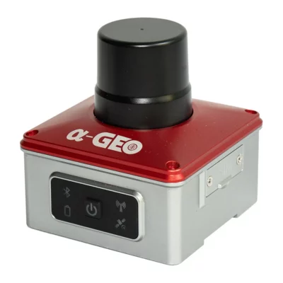
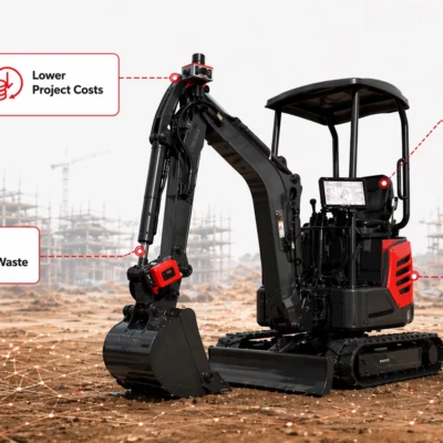
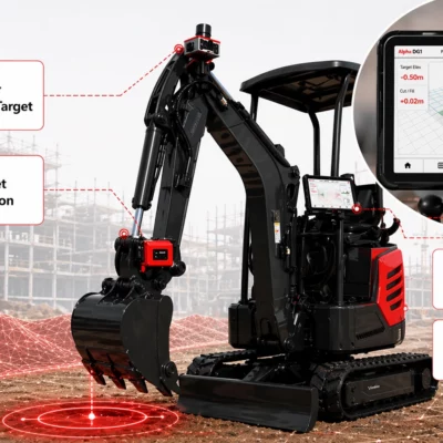
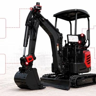
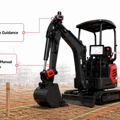
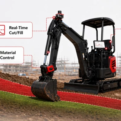
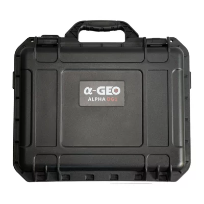
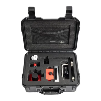
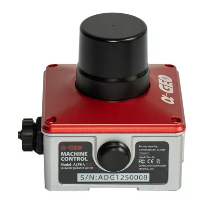
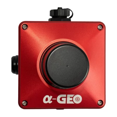
AlphaGeo ALPHA DG1 GNSS Excavator Guidance System
This product is available
Get the best price for your setup
Contact our experts for the best possible price and configuration.
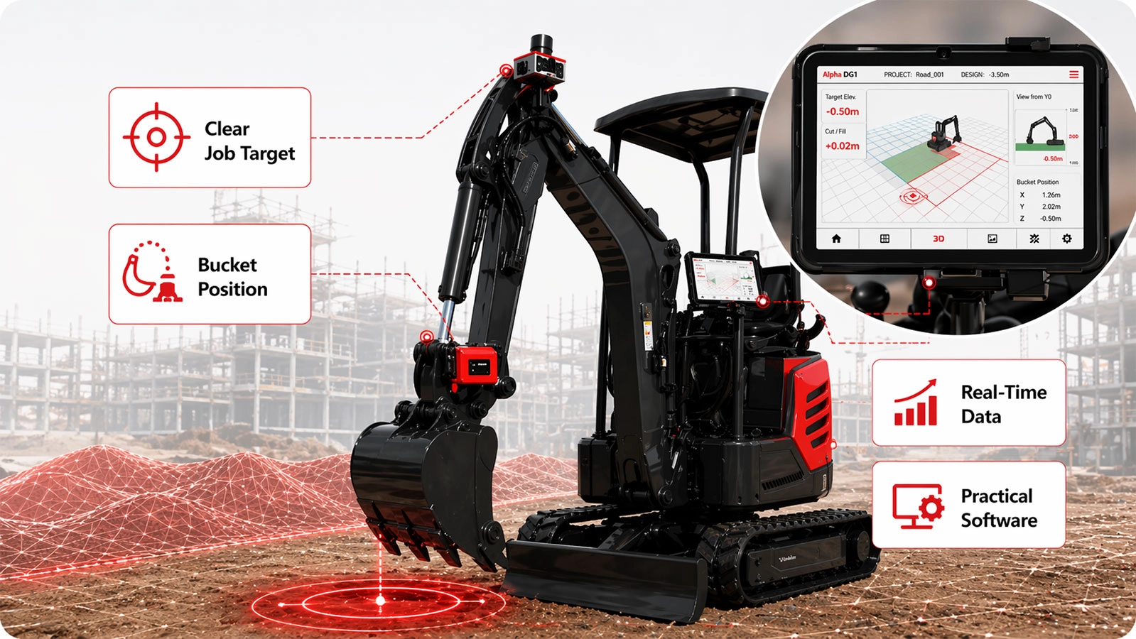
The AlphaGeo ALPHA DG1 is a GNSS excavator guidance system that displays the machine and bucket position relative to the project design in real time. It gives operators clear in-cab guidance for excavation, levelling, trenching, slope construction and work on complex surfaces.
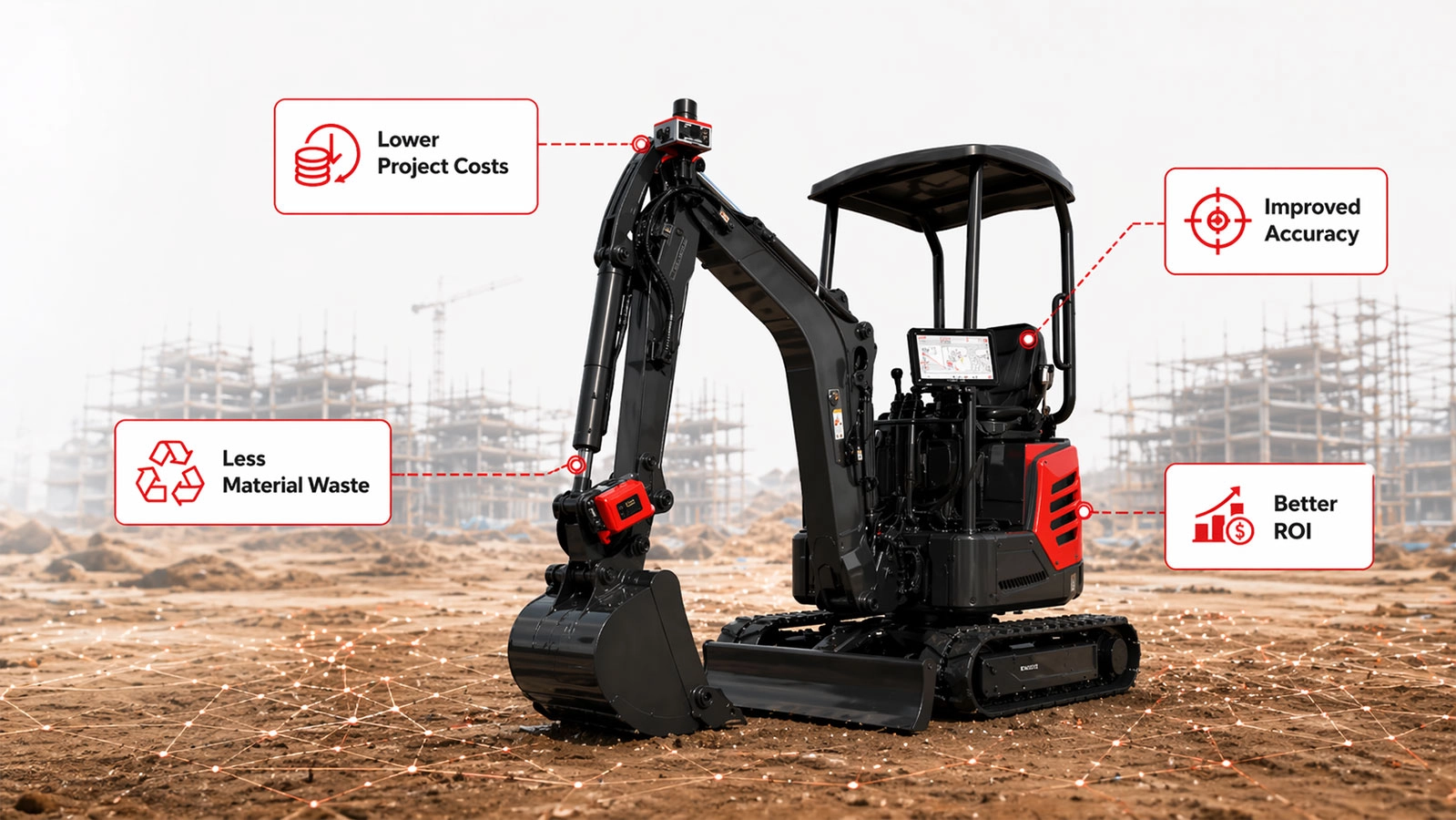
By combining centimetre-level RTK positioning, a high-shock tilt sensor and operator-friendly SmartSite software, the DG1 helps crews work closer to the required depth, elevation and slope without relying on constant manual grade checks. This can reduce over-excavation, unnecessary material movement and repeated staking while helping operators complete earthworks more consistently.
AlphaGeo ALPHA DG1 Highlights
| Guidance applications | Excavation, levelling, trenching, slope work, points, lines and complex surfaces |
|---|---|
| GNSS tracking | 1408 channels with GPS, GLONASS, BeiDou, Galileo, QZSS, SBAS and L-Band support |
| RTK accuracy | Horizontal 8 mm + 1 ppm RMS; vertical 15 mm + 1 ppm RMS |
| Tilt compensation | 0–120° range with accuracy below 2.5 cm within the stated range |
| Project file support | DXF, XML and SJW |
| Connectivity | 4G, Bluetooth, USB Type-C and optional 410–470 MHz UHF communication |
| Environmental protection | IP67 GNSS receiver with a -40°C to +75°C operating range |
Valued customers:










Find RTK Networks
Search NTRIP providers and connect to reliable RTK correction services.
Description
Real-Time Excavator Guidance for More Controlled Earthworks
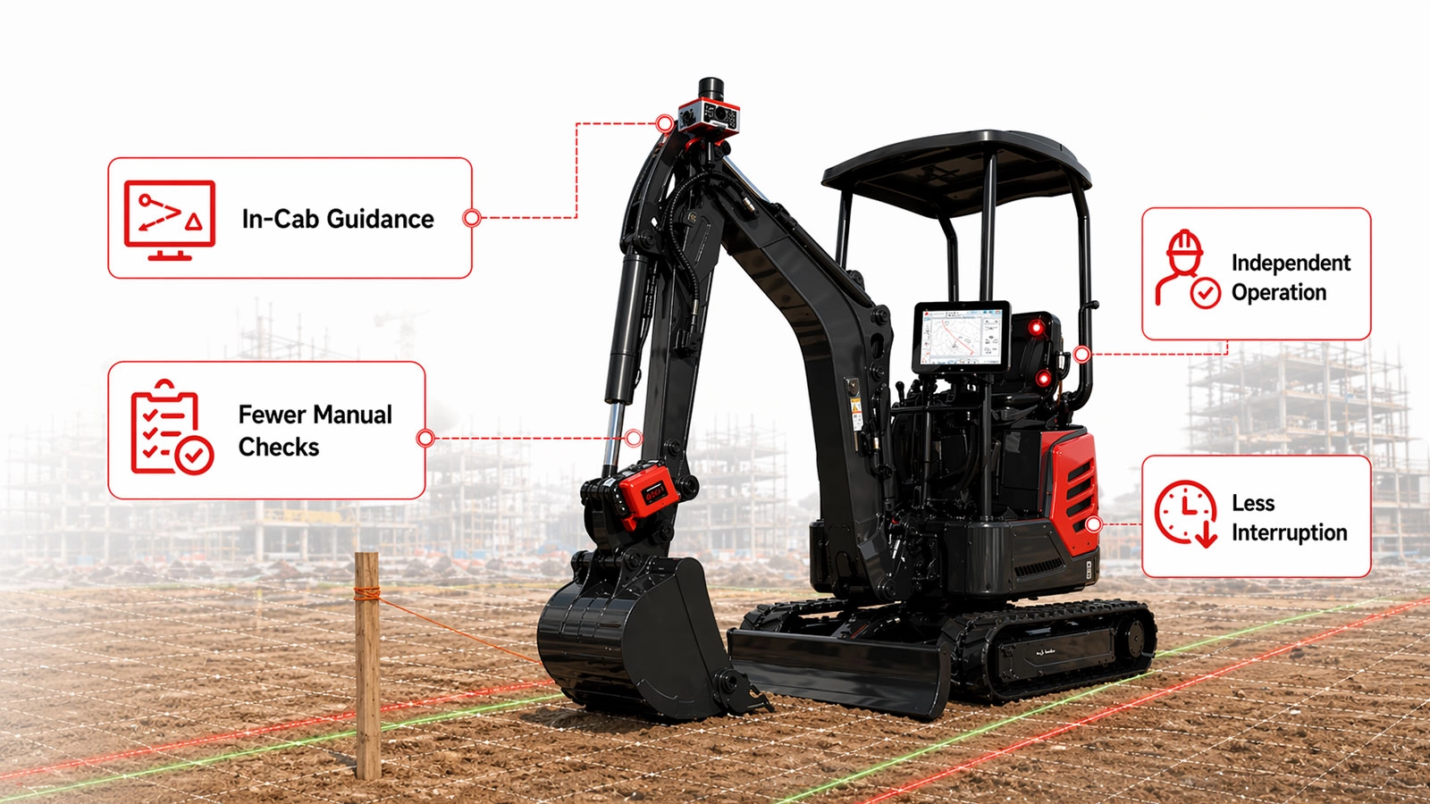
The AlphaGeo ALPHA DG1 GNSS Excavator Guidance System gives excavator operators a live visual reference between the bucket and the required construction surface. Instead of working only from stakes, string lines or repeated measurements from a surveyor, the operator can see the target elevation, depth, line or slope directly inside the cab.
The system is intended for contractors carrying out building construction, roadworks, utility installation, drainage, bridge works and other earthmoving projects. It supports common tasks including bulk excavation, formation work, pad preparation, trenching, batter construction and final surface trimming.
Know the Bucket Position While You Work
The DG1 combines GNSS positioning with machine-mounted sensing to calculate the working position of the excavator. SmartSite software then presents the relevant guidance information to the operator in a practical visual format.
This allows the operator to compare the current bucket position with the project target during each pass. When digging a foundation, for example, the display helps indicate whether the bucket is above, below or approaching the required level. During trenching or slope work, it helps the operator follow the specified alignment and profile more consistently.
Reduce Repeated Grade Checks and Manual Staking
Traditional excavation often requires a surveyor or site engineer to place stakes, mark offsets and return regularly to check the finished level. These checks remain important for project control, but real-time machine guidance can reduce how often the excavator must stop while waiting for routine measurements.
With the design information available in the cab, operators can work more independently between formal quality checks. This helps keep the machine productive and reduces interruptions for the survey or engineering team. It is particularly useful on long trenches, large pads and variable surfaces where a limited number of physical markers may not provide enough information across the entire working area.
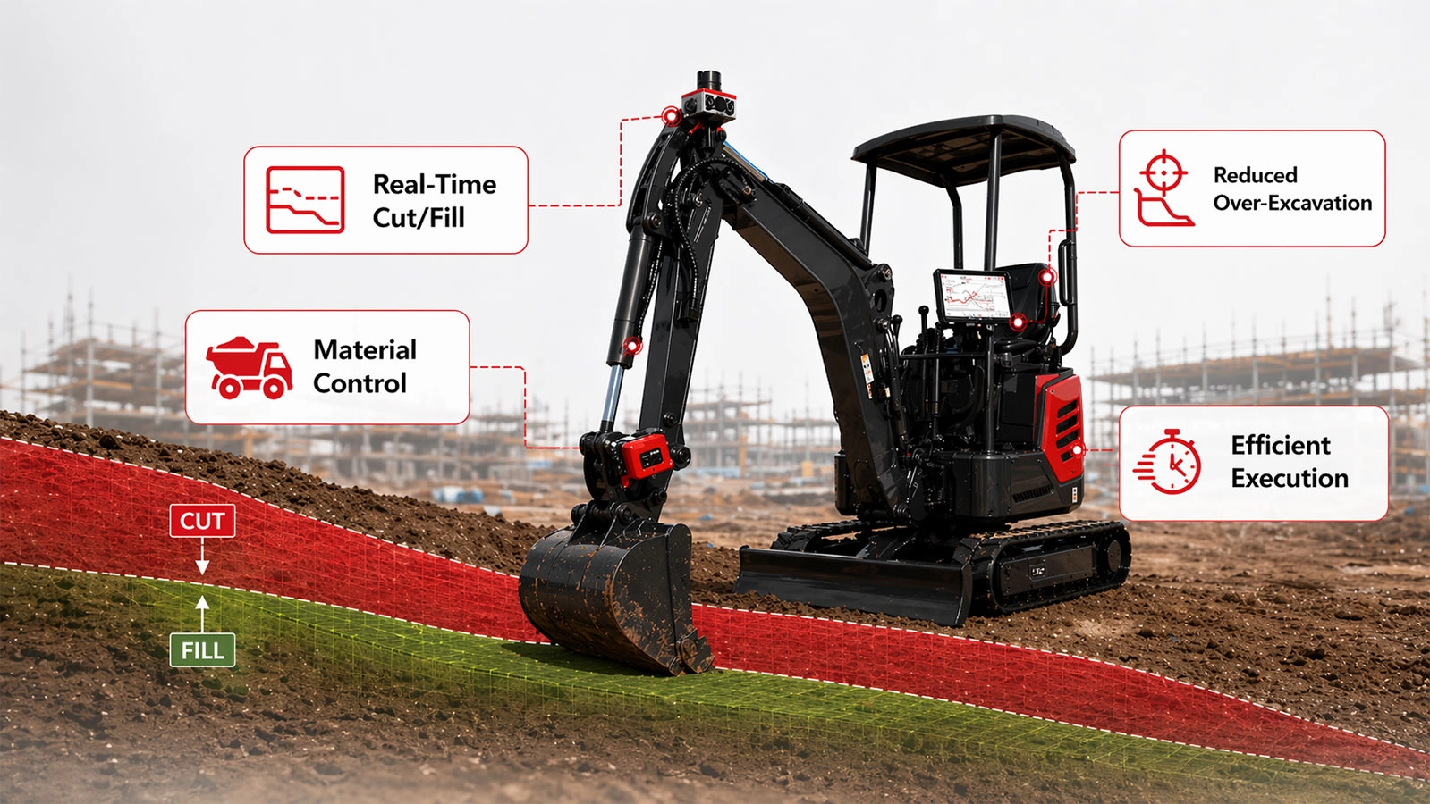
Better Control of Cut and Fill
Over-excavation creates extra work. Material must be removed, transported and often replaced with approved fill before the area can be brought back to level. Digging too little also adds extra machine passes and can delay the next construction activity.
The ALPHA DG1 provides continuous guidance so the operator can approach the design surface in a more controlled way. This supports more consistent cut depths, cleaner trench profiles and improved material management. The practical benefit is not that the excavator works automatically, but that the operator receives better information while controlling the machine.
Levelling and Formation Work
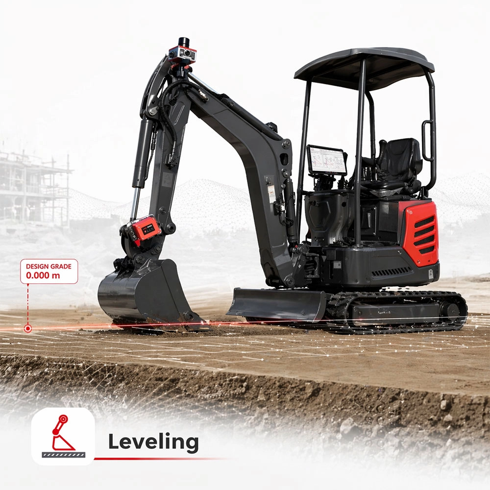
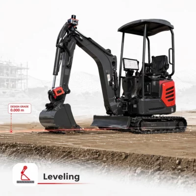
For pads, foundations and general site preparation, the system provides bucket-elevation guidance relative to a defined level or project surface. Operators can use this information while cutting high areas and filling low areas, helping them create a more uniform formation before final verification or compaction.
This is useful during building-platform preparation, road subgrade construction, landscaping and other work where maintaining a consistent level across a wider area is difficult using visual judgement alone.
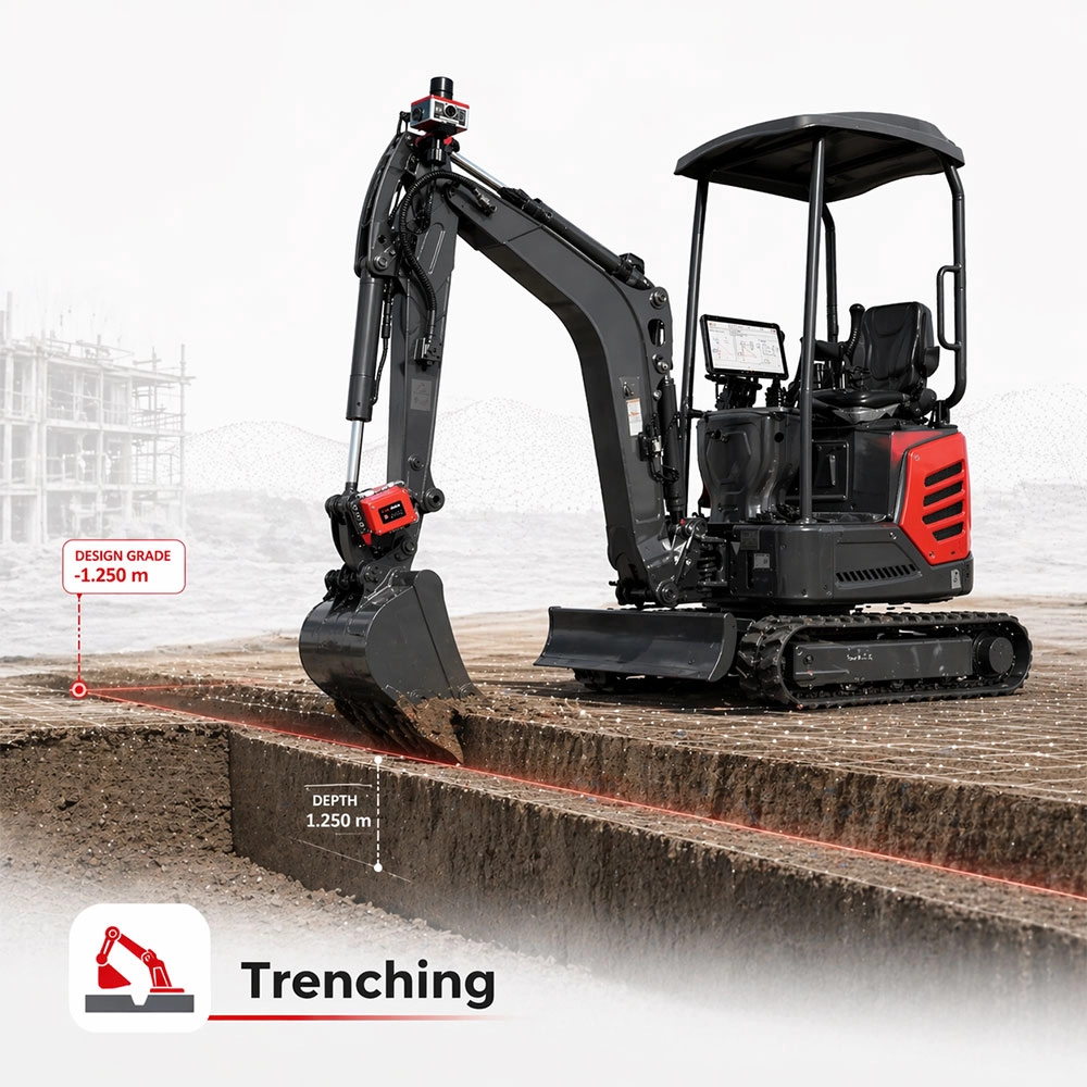
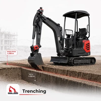
Guidance for Straight and Consistent Trenches
The DG1 supports trenching and ditching workflows for utilities, drainage systems and pipelines. It helps the operator follow the required direction and depth while progressing along the trench.
Continuous guidance is especially valuable where the trench invert changes along its length. Rather than relying solely on isolated depth marks, the operator can use the on-screen information to follow the intended profile between control points.
Slope and Batter Construction
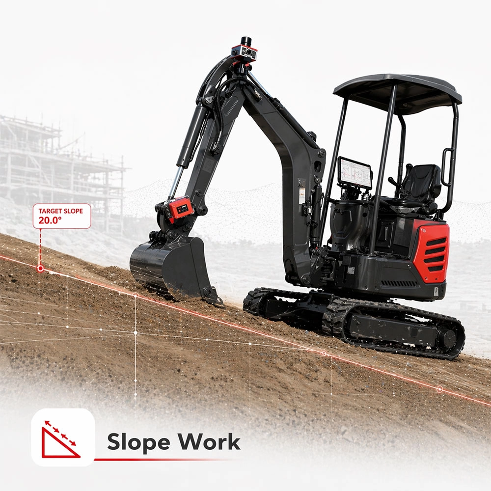
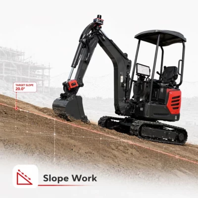
For embankments, cuttings, drainage banks and other inclined surfaces, the system provides guidance relative to the required slope. This helps operators control the bucket while rough cutting or trimming an angled surface.
A clearer reference to the target slope can reduce excessive cutting and the number of correction passes required. It also makes it easier to maintain a repeatable profile over a longer section of work.
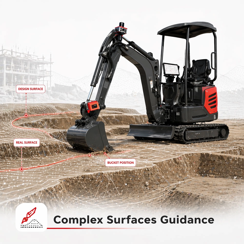
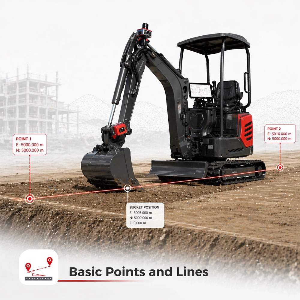
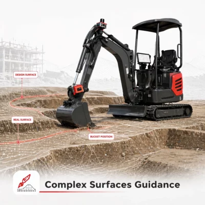
Support for Lines, Points and Complex Surfaces
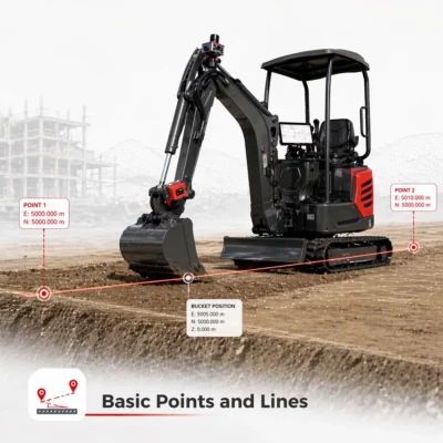
Not every excavation task requires a complete three-dimensional model. SmartSite can support work based on basic points and lines as well as more detailed variable surfaces. This means the system can be used for straightforward site layouts and more complex designs.
Supported project-file formats include DXF, XML and SJW. File preparation and compatibility should be confirmed as part of the project setup because the information required depends on the design software, coordinate system and intended guidance workflow.
Multi-Constellation RTK GNSS Positioning
The DG1 GNSS receiver has 1408 channels and tracks signals from GPS, GLONASS, BeiDou, Galileo, QZSS and SBAS. It also supports BeiDou B2b PPP and Galileo E6b High Accuracy Service signals.
Using several satellite constellations gives the system access to more satellites across the sky. On an open construction site, this can improve satellite geometry and help the receiver maintain a stable position as the excavator moves and rotates. Buildings, trees, bridges, deep excavations and other obstructions can still affect GNSS availability, so the installation and working environment must be considered.
Centimetre-Level RTK Performance
The receiver’s published RTK specification is 8 mm + 1 ppm RMS horizontally and 15 mm + 1 ppm RMS vertically under suitable operating conditions. RTK initialization is specified at under 10 seconds, with signal reacquisition below one second and positioning output from 1 to 20Hz.
Actual machine-guidance performance also depends on the correction source, machine calibration, sensor installation, satellite visibility, design data and the mechanical condition of the excavator. The system should therefore be correctly installed and calibrated for each machine rather than treated as a universal plug-in measurement device.
High-Rate Tilt and Machine-Movement Sensing
The system’s tilt compensation operates through a range of up to 120° with a 400Hz update rate. The separate core sensor measures pitch and roll, with a stated tilt accuracy of 0.2° and resolution of 0.0055°.
For excavator guidance, fast sensor updates are important because the boom, arm and bucket continually change position. The sensor data helps the system follow these movements and update the guidance display while the operator works.
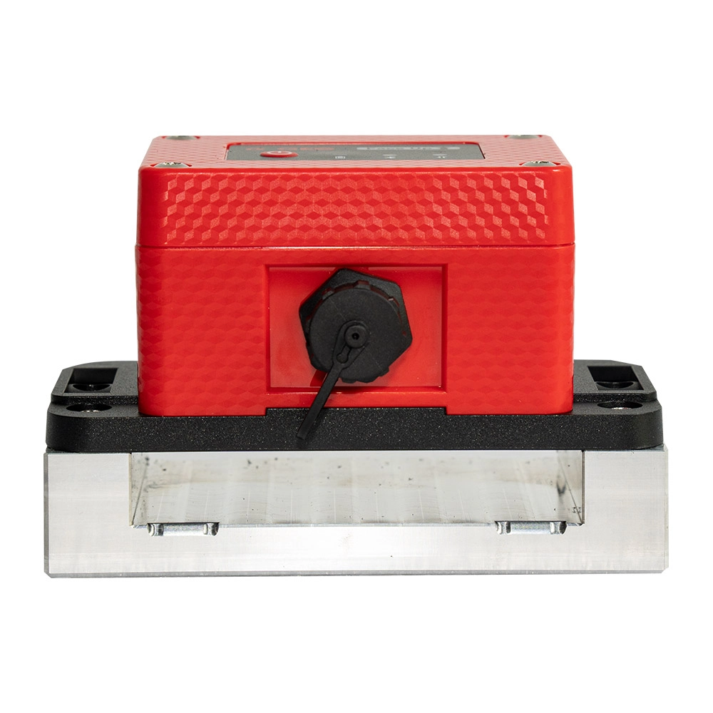
The core sensor is specified for shock loads up to 20,000g. This is relevant for equipment installed on an excavator, where vibration, impact and sudden machine movements are part of normal site operation.
SmartSite Software for Operators and Site Teams
SmartSite brings the machine-guidance, project and measurement functions together in one interface. Operators can choose guidance modes for levelling, trenching, slopes, lines and surfaces while monitoring the status of the GNSS receiver and sensors.
The software also supports field measurement using a pole-mounted GNSS receiver. This can give site teams a more connected workflow for guidance, data collection and project execution, depending on the selected configuration and accessories.
Flexible Correction and Data Communication
The GNSS receiver supports multi-band 4G communication, dual-mode Bluetooth and USB Type-C. An integrated UHF option operates between 410 and 470MHz with selectable 0.5W or 1.5W output and support for several common radio protocols.
This allows the system to receive RTK corrections through a mobile internet service, a compatible local base station or an appropriate radio link. The best correction method depends on network coverage, regional radio rules and the existing GNSS equipment used on the site.
Rugged Receiver for Construction Environments
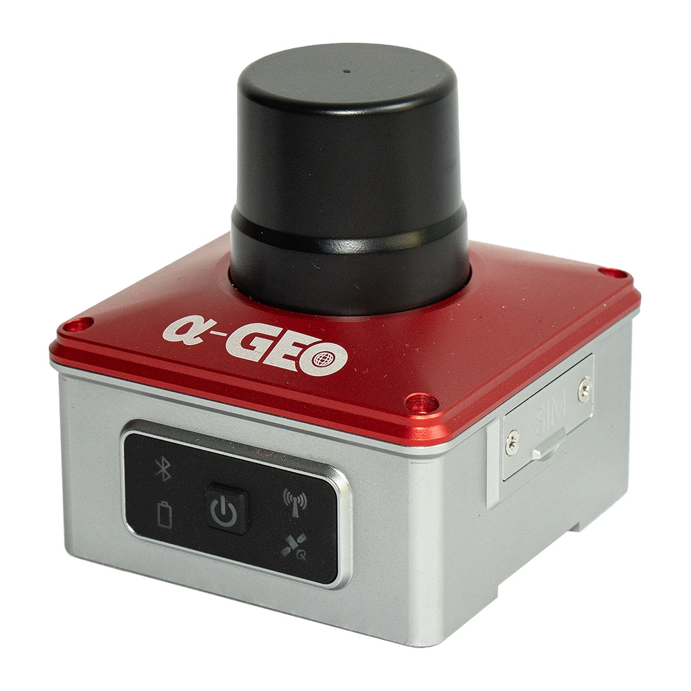
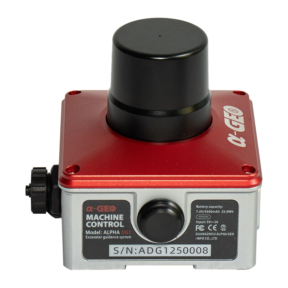
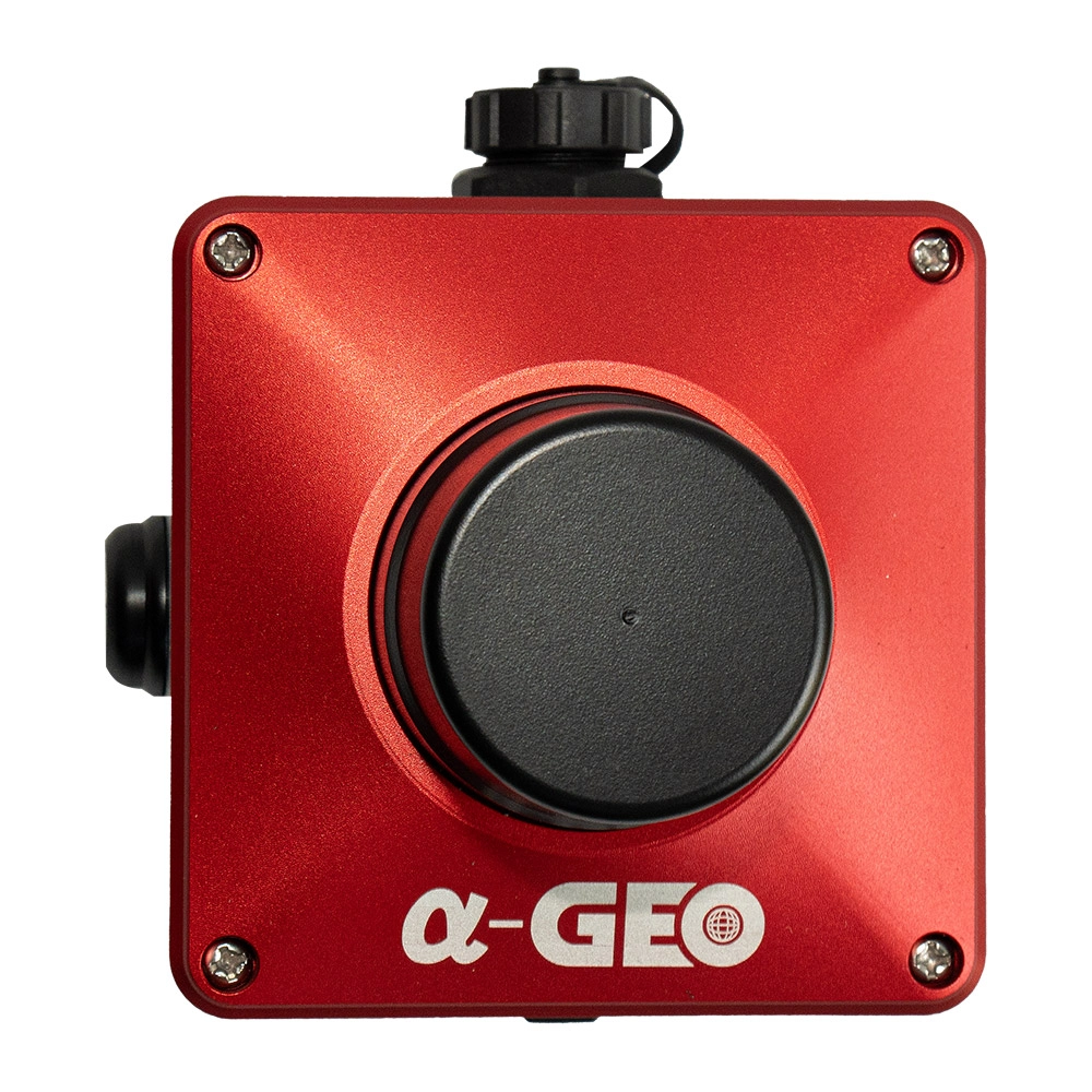
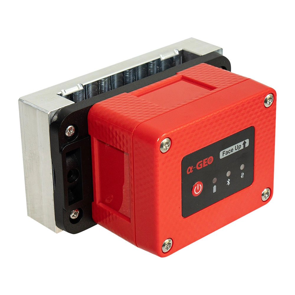
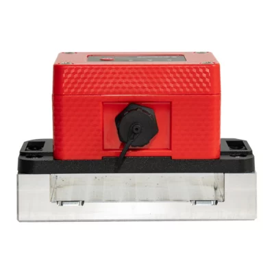
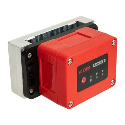
The compact GNSS receiver measures 82 × 82 × 89.3mm and weighs approximately 430g. Its enclosure is rated IP67 for resistance to dust and temporary water immersion, and the specified operating range is -40°C to +75°C.
The internal 7.4V 3500mAh battery provides more than 12 hours in data-collector internet mode, more than 10 hours in device internet mode and more than nine hours when using the internal UHF radio. Operating time in a complete excavator installation will depend on the system configuration and available machine power.
Typical ALPHA DG1 Applications
- Building pads, foundations and site levelling
- Road formation, subgrade and drainage work
- Utility, cable, pipe and sewer trenching
- Slopes, batters, embankments and cuttings
- Bridge and infrastructure earthworks
- Variable-depth and complex-surface excavation
Who Uses the ALPHA DG1?
The system is designed for excavator operators, earthmoving contractors, site engineers, surveyors and construction managers who need closer control over excavation work. It is relevant to both experienced operators and crews moving from traditional grade control towards digital construction workflows.
Surveyors and engineers remain responsible for establishing reliable site control, checking design data and verifying completed work. The DG1 helps transfer that project information to the machine operator so routine excavation decisions can be made with clearer positional guidance.
System Configuration and Professional Support
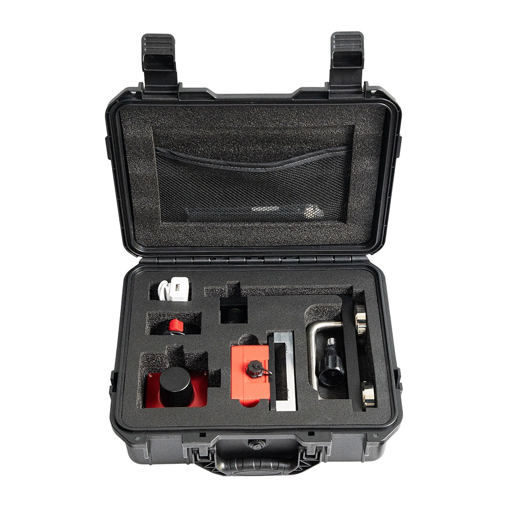
A standard configuration may include the GNSS receiver, core sensor, SmartSite software, mounting accessories, connection and installation components, and a protective transport case. The final equipment package can vary according to the excavator, correction method and project requirements.
Global GPS Systems can help determine the appropriate system configuration, correction source, mounting arrangement and data workflow for a particular machine or construction project. Professional installation and machine calibration are essential because the accuracy of the guidance display depends on correctly measured machine dimensions, sensor alignment and project coordinates.
Datasheets & Manuals
Datasheets and manuals
Datasheets & manuals
Specifications
ALPHA DG1 GNSS Excavator Guidance System Specifications
Product Overview
| Manufacturer | ALPHAGEO |
|---|---|
| Model | ALPHA DG1 |
| Product Type | GNSS excavator guidance and machine-control system |
| Guidance Platform | SmartSite software with high-precision GNSS positioning and integrated machine sensors |
| Primary Functions | Real-time excavation, leveling, trenching, slope and surface guidance |
| Operator Interface | Real-time visual guidance showing the excavation target and current bucket position |
| Surveying Capability | Supports field surveying and measurement using a pole-mounted GNSS receiver |
| Typical Machine Type | Hydraulic excavators |
Guidance Modes and Functions
| Leveling Guidance | Bucket-elevation guidance for flat surfaces, reference-based leveling, site preparation and foundation work |
|---|---|
| Trenching Guidance | Guidance for creating straight and consistent trench profiles for utilities, drainage and pipelines |
| Slope Guidance | Guidance for controlled slope excavation, inclined surfaces and slope trimming |
| Complex Surface Guidance | Supports excavation on irregular or variable design surfaces using continuous position feedback |
| Points and Lines | Supports guidance from points, lines and simple construction references |
| Cut-and-Fill Guidance | Provides real-time excavation information to improve material control and reduce over-excavation |
| GNSS Status Monitoring | Real-time monitoring of GNSS positioning and receiver status |
| Sensor Status Monitoring | Real-time monitoring of installed machine sensors |
| Field Measurement Tools | Integrated tools for collecting and recording field measurements |
| Project Management | Integrated project, guidance and measurement workflow within SmartSite software |
SmartSite Software
| Software Name | SmartSite |
|---|---|
| User Interface | Operator-focused graphical interface designed for in-cab use |
| Guidance Display | Displays design targets, excavation information and current bucket position in real time |
| Supported Workflows | Leveling, trenching, slope work, points, lines and complex surfaces |
| Project File Import | DXF, XML and SJW |
| Survey Mode | Supports surveying with a pole-mounted GNSS receiver |
| Measurement Functions | Field data collection and measurement tools |
| Workflow Integration | Combines machine guidance, project execution, surveying and measurement functions |
GNSS Receiver Performance
| GNSS Channels | 1408 |
|---|---|
| Positioning Output Rate | 1–20 Hz |
| Cold Start Time | <60 seconds |
| Hot Start Time | <15 seconds |
| Signal Reacquisition | <1 second |
| RTK Initialization Time | <10 seconds |
| Initialization Reliability | 99.99% |
| Time Accuracy | 20 ns |
| Differential Data Format | RTCM 3.x |
| Position Data Output Format | NMEA 0183 |
GNSS Signal Tracking
| Satellite System | Supported Signals |
|---|---|
| GPS | L1 C/A, L2C, L2P, L5 |
| GLONASS | G1, G2, G3 |
| BeiDou | B1, B1C, B2, B2a, B2b, B3 |
| Galileo | E1, E5a, E5b, E6 |
| QZSS | L1, L2, L5 |
| SBAS | L1 C/A |
| L-Band Services | B2b for BeiDou PPP and E6b for Galileo HAS |
Positioning Accuracy
| Positioning Mode | Horizontal Accuracy | Vertical Accuracy |
|---|---|---|
| Code Differential GNSS | 0.25 m + 1 ppm RMS | 0.50 m + 1 ppm RMS |
| RTK | 8 mm + 1 ppm RMS | 15 mm + 1 ppm RMS |
GNSS Receiver Tilt Compensation
| Tilt Update Rate | 400 Hz |
|---|---|
| Compensation Range | 0–120° |
| Tilt-Compensated Accuracy | <2.5 cm within 120° |
GNSS Receiver Communications and Interfaces
| USB Interface | USB Type-C |
|---|---|
| SIM Card Slot | Nano-SIM |
| UHF Antenna Interface | Integrated external UHF antenna connection |
| Bluetooth | Dual-mode Bluetooth supporting SPP and BLE |
| Cellular Module | Multi-band 4G cellular communication module |
| Cellular Region | EMEA and APAC |
Cellular Network Bands
| Network Type | Supported Bands |
|---|---|
| LTE FDD | B1, B3, B5, B7, B8, B20, B28 |
| LTE TDD | B38, B40, B41 (120M) |
| WCDMA | B1, B5, B8 |
| GSM, GPRS and EDGE | 850, 900 and 1800 MHz |
UHF Radio
| Operating Frequency | 410–470 MHz |
|---|---|
| Duplex Mode | Half-duplex |
| Modulation | CSS, GFSK and 4FSK |
| Supported Radio Protocols | TrimTalk, TransEOT, TrimMark III, South and Satel |
| GFSK Channel Spacing | 12.5 kHz or 25 kHz |
| LoRa Channel Spacing | 250 kHz |
| RF Output Power | 0.5 W or 1.5 W selectable |
GNSS Receiver Electrical Specifications
| Battery Type | Rechargeable lithium-ion battery |
|---|---|
| Battery Voltage | 7.4 V |
| Battery Capacity | 3500 mAh |
GNSS Receiver Battery Life
| Operating Mode | Battery Life |
|---|---|
| Data Collector Internet Mode | >12 hours |
| Device Internet Mode | >10 hours |
| Internal UHF Mode | >9 hours |
GNSS Receiver Physical and Environmental Specifications
| Dimensions | 82 × 82 × 89.3 mm |
|---|---|
| Weight | 430 g |
| Operating Temperature | -40°C to +75°C |
| Storage Temperature | -55°C to +85°C |
| Ingress Protection | IP67 water- and dust-resistant |
| Humidity | 100% non-condensing |
Core Sensor Pitch and Roll Performance
| X-Axis Range | ±180° |
|---|---|
| Y-Axis Range | ±90° |
| Tilt Accuracy | 0.2° |
| Resolution | 0.0055° |
| Temperature Drift | ±0.2° from -40°C to +85°C |
Core Sensor Data and Interface
| Communication Interface | UART |
|---|---|
| UART Baud Rate | 4800–230400 bps |
| Output Data | On-board time, 3-axis acceleration, 3-axis angular velocity, 3-axis magnetic field and 3-axis angle |
| Output Rate | 0.2–200 Hz |
| Startup Time | 1000 ms |
| Shock Resistance | 20,000 g |
Core Sensor Electrical and Environmental Specifications
| Power Consumption | 130 mA at 3.3 V |
|---|---|
| Operating Temperature | -40°C to +85°C |
| Storage Temperature | -40°C to +90°C |
| Maximum Storage Temperature | +100°C |
| Humidity | 95% non-condensing |
Core Sensor Physical Specifications
| Dimensions | 86 × 68 × 52.3 mm |
|---|---|
| Weight | 300 g |
System Advantages
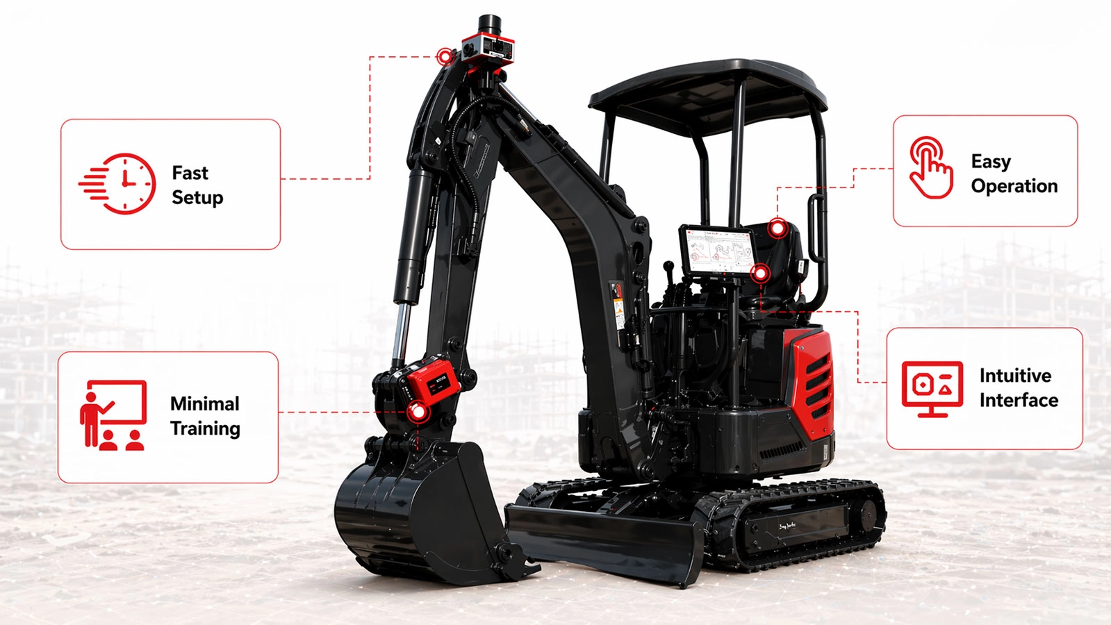
| Installation | Compact hardware designed for straightforward installation on excavators |
|---|---|
| Operator Training | Intuitive interface designed to reduce training requirements |
| Manual Staking | Reduces dependence on manual staking and repeated grade checking |
| Excavation Control | Improves control of cut, fill, depth, elevation and slope |
| Rework Reduction | Real-time guidance helps reduce rework and over-excavation |
| Workflow Visibility | Visualizes design targets and bucket position directly in the excavator cab |
| Operator Independence | Allows operators to work with fewer interruptions for external measurements or checks |
Applications
| Building Construction | Foundations, pads, site preparation and general excavation |
|---|---|
| Road Construction | Road formation, grading, drainage and slope work |
| Tunnel Construction | Excavation and profile guidance in tunnel projects |
| Bridge Construction | Foundation, earthworks and approach construction |
| Utility Installation | Trenching for cables, water lines, drainage and other utilities |
| Pipeline Construction | Guided trench excavation and profile control |
| Earthmoving | Cut-and-fill, surface shaping, slope trimming and material control |
Standard Configuration May Include
| Item | Quantity | Notes |
|---|---|---|
| GNSS Receiver | Configuration dependent | Provides high-precision positioning and communication functions |
| Core Sensor | Configuration dependent | Measures excavator component angles and movement |
| SmartSite Software | 1 licence or installation | Guidance, project management, surveying and measurement platform |
| Mounting Accessories | Configuration dependent | Selected according to excavator type and installation requirements |
| Connection and Installation Components | Configuration dependent | Cables, brackets and related installation hardware |
| Protective Transport Case | Configuration dependent | For storage and transport of system components |
Specifications and package contents may vary by configuration, region or manufacturer update. Always check the current configuration before ordering.
FAQ
ALPHA DG1 GNSS Excavator Guidance System FAQ
System Overview and Applications
What is the ALPHA DG1 GNSS Excavator Guidance System?
The ALPHA DG1 is a professional excavator guidance system that combines high-precision GNSS positioning, machine sensors and SmartSite software. It provides operators with real-time visual guidance for excavation, leveling, trenching, slope work and complex surface construction.
How does the ALPHA DG1 excavator guidance system work?
The system uses a GNSS receiver to determine the excavator’s position and sensors to measure the orientation and movement of the machine. SmartSite software processes this information and displays the bucket position, target elevation and excavation guidance inside the cab.
Which types of excavation work can the ALPHA DG1 support?
The ALPHA DG1 supports surface leveling, utility trenching, drainage work, pipeline excavation, slope cutting, foundation preparation, road construction and excavation on irregular or variable surfaces.
Who is the ALPHA DG1 designed for?
The system is designed for excavation contractors, civil engineering companies, road builders, utility contractors, survey teams, machine operators and construction companies that need more accurate and efficient earthmoving operations.
Can the ALPHA DG1 be used for building construction?
Yes. The system can guide excavation and leveling work for foundations, building pads and other construction areas where accurate depth, elevation and surface preparation are required.
Is the ALPHA DG1 suitable for road, bridge and tunnel construction?
Yes. The ALPHA DG1 is intended for applications including road construction, bridge construction and tunnel-related earthworks. Project suitability depends on GNSS reception, the required accuracy and the available design data.
Guidance Functions and SmartSite Software
What information does the operator see in the excavator cab?
SmartSite software presents the current bucket position, project references, target surfaces and excavation guidance in a clear visual interface. This helps the operator understand where to cut, fill, level or stop digging.
Does the ALPHA DG1 support leveling work?
Yes. The system provides bucket elevation guidance for flat surfaces and reference-based leveling. It can be used for site preparation, foundation areas, construction pads and similar grading tasks.
Can the ALPHA DG1 guide trench excavation?
Yes. The system helps operators create straight and consistent trench profiles for utility lines, drainage channels, pipelines and other linear excavation projects.
Does the system support slope excavation?
Yes. The ALPHA DG1 provides guidance for controlled slope cutting and trimming. Operators can use the displayed position and surface information to work more accurately on embankments, ditches and inclined surfaces.
Can operators work from points and lines?
Yes. SmartSite supports basic points, lines and simple construction references. These functions are useful for standard excavation layouts and projects that do not require a complete complex surface model.
Which project file formats can SmartSite import?
SmartSite supports project file imports in DXF, XML and SJW formats. The project coordinate system, units and design data should be checked before excavation begins.
Does SmartSite include surveying and measurement tools?
Yes. The software includes field measurement tools and supports surveying workflows with a pole-mounted GNSS host. This allows guidance, measurement and project execution functions to be managed within one platform.
GNSS Accuracy and Communication
Which satellite navigation systems does the ALPHA DG1 support?
The GNSS receiver supports GPS, GLONASS, BeiDou, Galileo, QZSS and SBAS signals. It also supports BeiDou B2b PPP and Galileo E6b HAS L-band signals.
How many GNSS channels does the ALPHA DG1 receiver have?
The receiver provides 1,408 GNSS tracking channels, allowing it to track multiple constellations and frequencies simultaneously.
What RTK positioning accuracy does the receiver provide?
The specified RTK surveying accuracy is 8 mm + 1 ppm RMS horizontally and 15 mm + 1 ppm RMS vertically. Actual excavation accuracy also depends on sensor calibration, machine geometry, correction quality, satellite visibility and installation conditions.
How quickly can the ALPHA DG1 initialize an RTK solution?
The specified RTK initialization time is less than 10 seconds, with an initialization reliability of 99.99% under suitable operating conditions.
What positioning update rate does the GNSS receiver support?
The receiver supports positioning output rates from 1 Hz to 20 Hz. A higher update rate provides more frequent position information while the excavator is moving.
How does the ALPHA DG1 receive RTK corrections?
The GNSS receiver supports a multi-band 4G cellular module and an internal UHF radio. RTK corrections can therefore be received through a compatible network service, base station or radio link, depending on the project configuration.
Which correction and output formats are supported?
The receiver supports RTCM 3.x differential correction data and NMEA-0183 output. Its UHF radio supports Trimtalk, TransEOT, Trimmark III, South and Satel protocols.
Installation, Hardware and Jobsite Use
What components are included with the ALPHA DG1?
A standard configuration may include a GNSS receiver, machine sensor, SmartSite software, mounting accessories, connection and installation components and a protective transport case. The exact configuration can vary according to the excavator and project requirements.
Can the ALPHA DG1 be installed on different excavator models?
The system is designed for installation on excavators, but the mounting arrangement, sensor setup and machine calibration must be matched to the specific excavator model, boom, arm and bucket configuration.
Does the system need to be calibrated after installation?
Yes. Accurate calibration is necessary so the software understands the excavator’s dimensions, sensor positions and bucket geometry. Recalibration may also be required after changing buckets, moving sensors or modifying the machine configuration.
Can the system reduce manual staking and grade checking?
Yes. Real-time guidance inside the cab can reduce dependence on repeated staking and manual grade checks. Survey control and independent quality verification may still be required according to the project specification.
How can the ALPHA DG1 reduce over-excavation and rework?
The system continuously shows the relationship between the bucket and the target surface. This helps operators stop at the required depth, improve cut-and-fill control and avoid removing more material than necessary.
Is the GNSS receiver suitable for outdoor construction environments?
Yes. The receiver has an IP67 dustproof and waterproof rating and an operating temperature range of −40°C to +75°C. Correct mounting and protected cable connections remain important for reliable jobsite operation.
What are the receiver battery life and dimensions?
The receiver has a 7.4 V, 3,500 mAh lithium-ion battery. Specified battery life is more than 12 hours in data-collector internet mode, more than 10 hours in device internet mode and more than 9 hours in internal UHF mode. The receiver measures 82 × 82 × 89.3 mm and weighs approximately 430 g.
Reviews (0)
Only logged in customers who have purchased this product may leave a review.
 GPS & GNSS
 Total Stations
 Data collectors
 Software
 Correction services
 Machine control
 External radio
 Lasers & levellers
 Marine
 Accessories
Reviews
There are no reviews yet