
 GPS & GNSS
 Lidar scanning
 Total Station

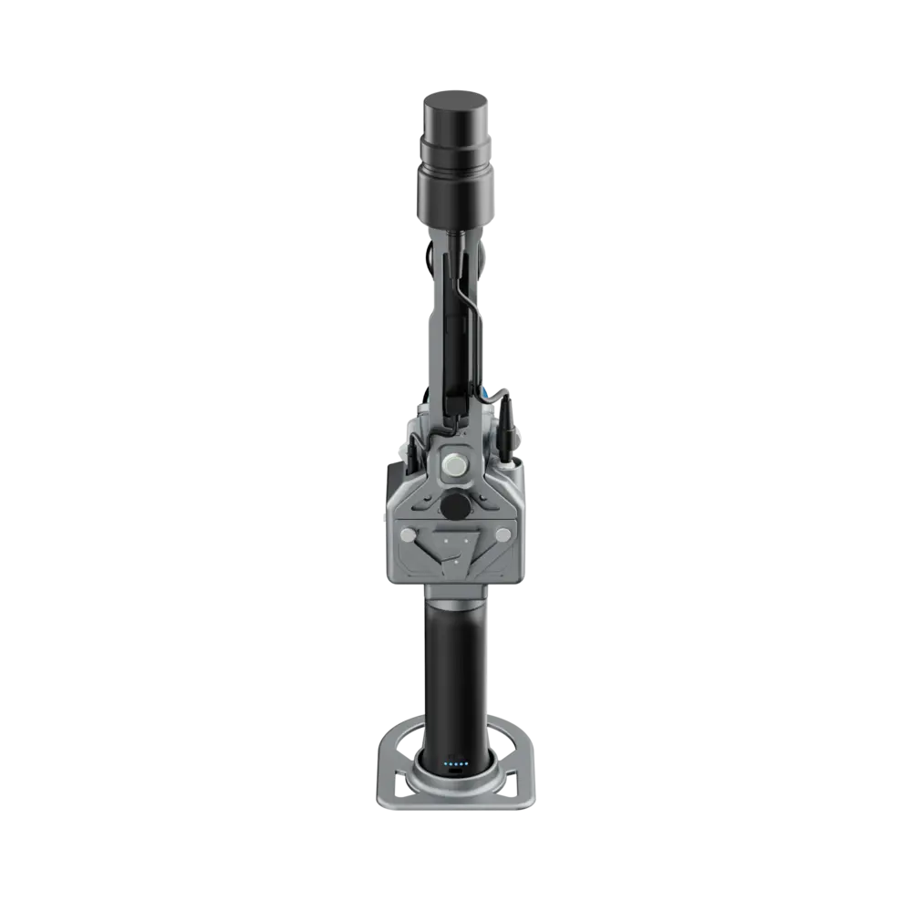

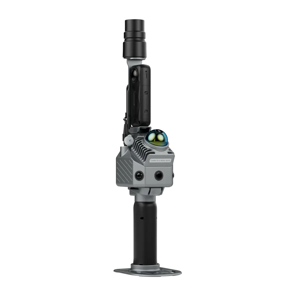



FJ Dynamics Trion P2
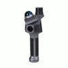
The FJ Dynamics Trion P2 LiDAR Scanner is a compact mobile mapping system for surveyors, engineers, construction teams, BIM specialists and 3D scanning professionals who need fast, high-density point cloud capture in the field. With up to 70 m scanning range, real-time colorized point clouds, Multi-SLAM fusion and RTK/PPK support, the Trion P2 is built for efficient indoor and outdoor scanning workflows.
| Best for | Surveying, construction, BIM, digital twins, facility mapping and mobile 3D scanning |
|---|---|
| Scanning range | 40 m @ 10% reflectivity / 70 m @ 80% reflectivity |
| Point rate | 200,000 pts/s |
| Post-processed point cloud accuracy | Relative ≤ 1 cm / Absolute 3 cm |
| Weight | 700 g excluding battery, external camera and RTK module |
| Battery life | Up to 4 hours with RTK module, excluding external camera |
What makes the FJD Trion P2 stand out is its combination of portable 700 g scanner body, real-time true-color point clouds, HyperDense+ support, RTK/PPK positioning and multi-format deliverables from one scan.
Valued customers:










Find RTK Networks
Search NTRIP providers and connect to reliable RTK correction services.
Description
FJ Dynamics Trion P2 LiDAR Scanner
The FJ Dynamics Trion P2 is a portable LiDAR scanner designed for professional mobile mapping, surveying, construction documentation, BIM workflows, facility management and 3D reality capture. It combines LiDAR SLAM, visual camera data and RTK/PPK positioning to help users capture detailed point clouds quickly in both indoor and outdoor environments.
For surveyors and scanning professionals, the Trion P2 is especially useful when speed, portability and field verification matter. The scanner supports real-time colorized point clouds, so users can check the scan while working instead of waiting until they are back in the office. With a scanning range up to 70 m and post-processed relative point cloud accuracy up to 1 cm, it is suitable for many practical mapping and documentation tasks where fast data capture and reliable geometry are required.
Key advantages
- Compact LiDAR scanner body weighing 700 g, excluding battery, external camera and RTK module.
- Up to 70 m scanning range depending on target reflectivity.
- Real-time true-color point cloud generation with built-in cameras and upgraded processing.
- Multi-SLAM fusion using LiDAR, vision camera data and RTK/PPK positioning.
- Supports HyperDense+ for denser point clouds and improved visual detail.
- Multi-format export for CAD, BIM, modelling and point cloud processing workflows.
- Designed for handheld and pole-mounted scanning with a 5/8″ standard interface.
Portable scanning for field teams
The Trion P2 is built around a lightweight scanner body that is easy to carry between scan areas, floors, rooms or outdoor project locations. This makes it practical for users who need to document complex sites without setting up a large static scanner at every position. For construction and engineering teams, this can help reduce time on site while still producing useful point cloud data for measurement, modelling and progress documentation.
The scanner supports handheld operation and seamless pole mounting through a 5/8″ standard interface. This gives field crews flexibility when scanning interiors, building façades, tunnels, open areas, industrial sites and other locations where different capture heights or scan positions are needed.
Multi-SLAM fusion with RTK and PPK support
The FJD Trion P2 uses Multi-SLAM algorithms that combine LiDAR SLAM, visual camera information and RTK/PPK positioning. In real fieldwork, this helps the scanner maintain more stable positioning and reduce drift, including in challenging spaces such as tunnels, corridors, parks, beaches and areas with limited features.
RTK and PPK support is important for users who need georeferenced outputs. With the RTK module package or panoramic external camera plus RTK module configuration, the Trion P2 can support workflows where point clouds need to be connected to site coordinates for surveying, asset documentation, digital twin creation and GIS-ready deliverables.
Real-time true-color point clouds
The Trion P2 includes three built-in cameras and supports real-time colorization. This allows the operator to see a more understandable visual representation of the scanned environment during data collection. Instead of working only with a monochrome point cloud, users can review colorized scan data in the field and spot missing areas, occlusions or scanning problems before leaving the site.
For BIM, facility management and construction documentation, colorized point clouds can make it easier to interpret surfaces, objects, walls, equipment and structural details. This improves communication between field crews, office teams and project stakeholders.
HyperDense+ for high-detail point cloud output
With the HyperDense+ feature in FJD Trion Model, the Trion P2 can deliver 5–7 times denser clouds with spacing up to 1 mm. This is useful when the project requires more detailed geometry, better colorization or improved visual quality for modelling and inspection.
This feature is especially relevant for users creating CAD or BIM references, documenting interior spaces, producing digital twins, or capturing details in heritage, architecture, engineering and facility management projects.
One scan, multiple deliverables
The FJ Dynamics Trion P2 is designed to help users get more deliverables from a single scan. Depending on the workflow and software used, scan data can support point clouds, 2D floor plans, 3D mesh models, 3D Gaussian splatting and georeferenced panoramas.
For survey and construction teams, this means the same capture session can support measurement, design verification, BIM coordination, floor plan generation and visual project documentation. For facility managers and digital twin specialists, georeferenced panoramas and 3D visual outputs can help with asset management and remote site review.
FJD Trion software ecosystem
The Trion P2 integrates with the FJD Trion software ecosystem for data collection, processing, deliverable generation and sharing. The workflow includes FJD Trion Scan for app-based control and scan file management, FJD Trion Model for data processing, FJD Trion Model for Tablets for on-site post-processing and preview on iPad and Android, and FJD Trion Explorer for online sharing and team collaboration.
This software workflow is useful for teams that want to move from field capture to deliverables without building a complicated multi-vendor process. It also helps users check data on site, process project outputs and share results with colleagues or clients.
Applications
- Land surveying and site documentation
- Construction progress capture and as-built recording
- BIM and CAD point cloud workflows
- 2D floor plan generation
- Facility management and digital twins
- Forestry, mining and infrastructure reporting workflows
- Indoor mapping, tunnels, corridors and complex environments
- Georeferenced panoramas and immersive visualization
Technical specifications
LiDAR specifications
| Point rate | 200,000 pts/s |
|---|---|
| LiDAR field of view | 360° x 59° |
| Scanning range | 40 m @ 10% reflectivity / 70 m @ 80% reflectivity |
| Laser safety level | Class 1, eye safe |
| Laser wavelength | 905 nm |
| HyperDense+ | Supported |
| Continue scanning | Supported |
Accuracy and positioning
| Post-processed point cloud accuracy | Relative ≤ 1 cm / Absolute 3 cm |
|---|---|
| Hardware manual accuracy value | 12 mm |
| RTK horizontal accuracy | 8 mm + 1 ppm RMS |
| RTK vertical accuracy | 15 mm + 1 ppm RMS |
| Positioning rate | 10 Hz |
| PPK | Supported |
GNSS support
| BDS | B1I / B2I / B3I / B1C / B2a / B2b |
|---|---|
| GPS | L1 C/A / L1C / L2P(Y) / L2C / L5 |
| GLONASS | G1 / G2 / G3 |
| Galileo | E1 / E5a / E5b / E6 |
| QZSS | L1C/A / L1C / L2C / L5 |
| IRNSS and SBAS | Supported by firmware upgrade |
Built-in camera
| Front camera FOV | 70° |
|---|---|
| Side camera FOV | 280° x 149° |
| Front camera resolution | 2 MP |
| Side camera resolution | 2 x 12 MP |
| Visual SLAM | Supported |
| Image export | Supported |
| Image format | .jpg |
External camera support
| Supported models | Insta360 X3 / Insta360 X5 |
|---|---|
| Insta360 X3 video resolution | 5.7K, 5760 x 2880 @ 30 / 25 / 24 fps |
| Insta360 X5 video resolution | 8K, 7680 x 3840 @ 30 / 25 / 24 fps |
System parameters
| Dimensions | 110 x 106 x 280 mm |
|---|---|
| Alternative manual dimension listing | 87 x 90 x 270 mm, excluding camera module |
| Weight | 700 g excluding battery, external camera and RTK module |
| Weight with battery and RTK module | 1200 g |
| Weight with battery, external camera and RTK module | 1500 g |
| Manual weight listing | 1 kg excluding camera module and base plate |
| Storage | 512 GB, 1 TB expandable |
| Operating temperature | -20°C to 50°C |
| Storage temperature | -40°C to 60°C |
| Ingress protection | IP54 |
| Data export | Wireless network, USB Type-C, USB flash disk |
| Point cloud formats | .las / .ply / .pts / .e57 |
Electrical specifications
| Battery life | 4 hours with 1 set of 2 batteries, including RTK module, excluding external camera |
|---|---|
| Battery life with external camera | 3 hours with 1 set of 2 batteries, including RTK module and external camera |
| Power supply | DC handheld battery |
| Power consumption | 15 W excluding external camera / 21 W including external camera |
| Charger | 67 W fast charging |
| Simultaneous dual-battery charging | Supported |
| Independent battery charging time | About 1.5 hours |
| Wi-Fi | 2.4 GHz |
Configuration options
The hardware manual lists two P2 LiDAR Scanner system configurations: Option A: panoramic external camera + RTK module integration and Option B: RTK module package. Please confirm the exact package contents, camera option, RTK module and accessories when requesting a quote.
Why buy from Global GPS Systems?
Global GPS Systems supplies professional surveying, GNSS, LiDAR and mapping equipment to customers worldwide. When you order the FJ Dynamics Trion P2 from Global GPS Systems, you can request expert advice before purchase and receive support with choosing the right scanning setup for your workflow.
We ship worldwide from the Netherlands with insured delivery and can assist with import, export, tax and duties questions where relevant. Warranty and buyer protection are included, and our product specialists can help with RTK workflows, correction services, field setup and practical equipment selection for surveying, construction, GIS and 3D scanning projects.
FAQ
What is the FJ Dynamics Trion P2?
The FJ Dynamics Trion P2 is a portable LiDAR scanner for mobile 3D scanning, surveying, construction documentation, BIM, digital twins and mapping workflows. It combines LiDAR scanning, visual SLAM and RTK/PPK support.
What accuracy does the FJ Dynamics Trion P2 provide?
The brochure specifies post-processed point cloud accuracy of relative ≤ 1 cm and absolute 3 cm. The hardware manual also lists an accuracy value of 12 mm. Actual results depend on the environment, workflow, control quality and processing method.
What is the scanning range of the FJD Trion P2?
The Trion P2 supports 40 m range at 10% reflectivity and 70 m range at 80% reflectivity.
Can the FJD Trion P2 create colorized point clouds?
Yes. The Trion P2 supports real-time true-color point clouds using its built-in camera system and processing workflow.
Does the FJD Trion P2 support RTK and PPK?
Yes. The brochure lists RTK and PPK support, with RTK horizontal accuracy of 8 mm + 1 ppm RMS and vertical accuracy of 15 mm + 1 ppm RMS.
What point cloud formats can the Trion P2 export?
The supported point cloud formats listed in the brochure are .las, .ply, .pts and .e57.
What software works with the FJ Dynamics Trion P2?
The Trion P2 works within the FJD Trion software ecosystem, including FJD Trion Scan, FJD Trion Model, FJD Trion Model for Tablets and FJD Trion Explorer.
Is the FJD Trion P2 suitable for BIM and CAD workflows?
Yes. The Trion P2 can produce high-density point clouds for CAD and BIM integration and supports deliverables such as 2D floor plans, 3D mesh models and georeferenced panoramas, depending on the software workflow.
How long does the battery last?
The brochure lists up to 4 hours with one set of two batteries including the RTK module and excluding the external camera. With RTK module and external camera, the listed battery life is 3 hours.
Can I buy the FJ Dynamics Trion P2 with worldwide shipping?
Yes. Global GPS Systems offers worldwide shipping from the Netherlands with insured delivery, warranty, expert product advice and support for field setup and scanning workflows.
Datasheets & Manuals
Datasheets and manuals
Datasheets & manuals
Reviews (1)
1 review for FJ Dynamics Trion P2
| 5 star | 0% | |
| 4 star | 100% | |
| 3 star | 0% | |
| 2 star | 0% | |
| 1 star | 0% |
Only logged in customers who have purchased this product may leave a review.
 GPS & GNSS
 Total Stations
 Data collectors
 Software
 Correction services
 Machine control
 External radio
 Drones
 Lasers & levellers
 Marine
 Accessories
Dario Petrescu (verified owner) –
Very good lidar, nice and light