
 GPS & GNSS
 Lidar scanning
 Total Station
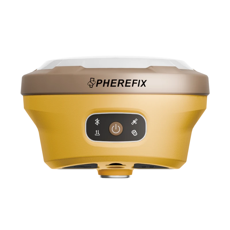
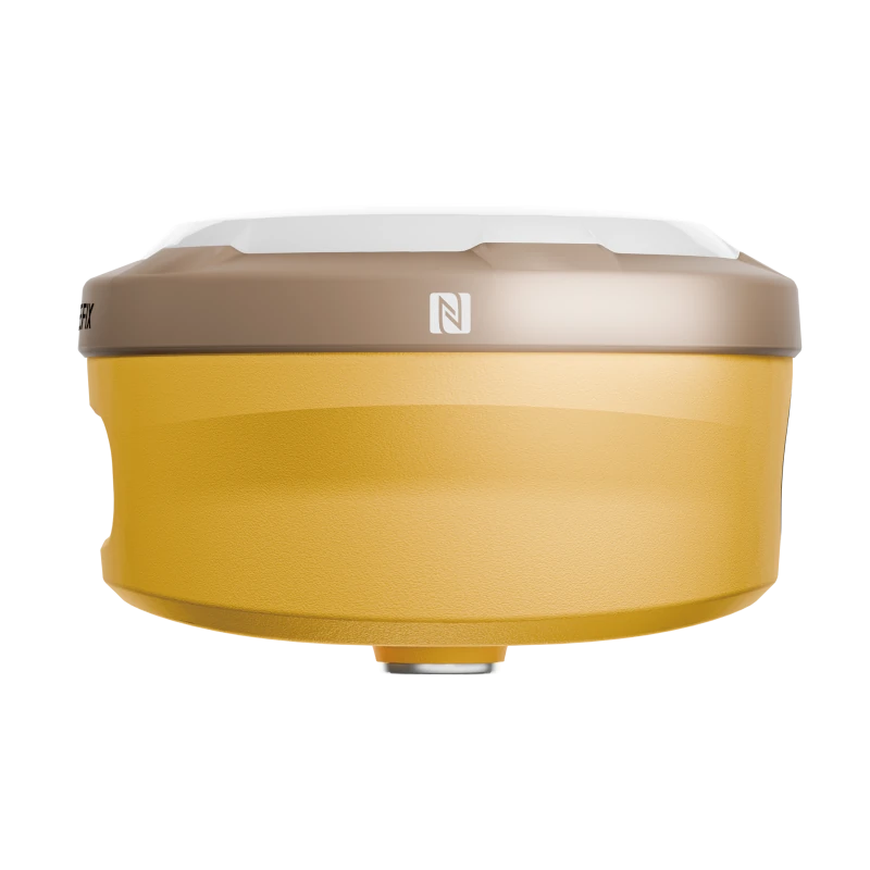
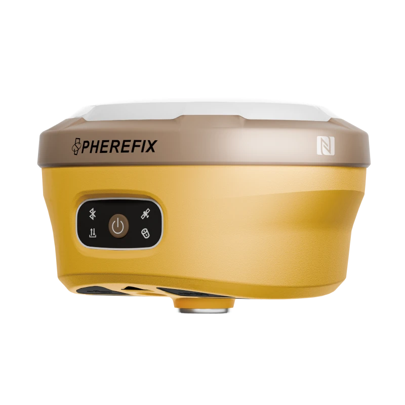


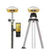
Spherefix SP30Se RTK GNSS Receiver with IMU
This product is available
Get the best price for your setup
Contact our experts for the best possible price and configuration.
The Spherefix SP30Se GNSS Receiver is a compact RTK solution for surveyors, construction teams, GIS professionals and other field users who need reliable centimetre-level positioning. Its 1,408-channel GNSS engine tracks signals from GPS, GLONASS, Galileo, BeiDou, QZSS, SBAS and NavIC, helping maintain a dependable solution across changing site conditions.
Built-in IMU tilt compensation allows points to be measured with the pole tilted by up to 60 degrees. This makes it easier to survey corners, building edges, road features and other locations where holding the pole perfectly vertical is difficult. Integrated 4G, Wi-Fi, Bluetooth and a 5 W radio support both network RTK and local base-and-rover workflows.
Spherefix SP30Se Highlights
| GNSS tracking | 1,408 channels with GPS, GLONASS, Galileo, BeiDou, QZSS, SBAS and NavIC support |
|---|---|
| RTK accuracy | Horizontal ±(8 mm + 1 ppm); vertical ±(15 mm + 1 ppm) |
| IMU tilt surveying | Less than 2 cm tilt compensation accuracy within 60° |
| Communication | 4G, Wi-Fi, Bluetooth and integrated 1 W, 2 W or 5 W radio |
| Field protection | IP68-rated housing and resistance to a 1.5 m pole drop |
| Battery | 7.4 V 10,000 mAh rechargeable battery |


Valued customers:










Find RTK Networks
Search NTRIP providers and connect to reliable RTK correction services.
Description
Flexible RTK GNSS positioning for everyday fieldwork
The Spherefix SP30Se is a professional multi-constellation RTK GNSS receiver designed for topographic surveying, construction layout, GIS data collection, machine control preparation and other positioning tasks. Its lightweight receiver format combines high-accuracy GNSS measurement, IMU tilt compensation and several communication methods in one field-ready system.
The receiver can be used as a rover with corrections supplied through an NTRIP network or as part of a local base-and-rover setup. This gives teams the flexibility to work with existing correction services or establish their own correction link in areas where mobile coverage is limited.
Multi-constellation signal tracking
A 1,408-channel positioning engine tracks signals from GPS, GLONASS, Galileo, BeiDou, QZSS, SBAS and NavIC. Access to multiple constellations and frequencies gives the receiver more satellite observations to work with, which is particularly useful near buildings, trees, earthworks and other locations where part of the sky may be obstructed.
With suitable correction data and normal RTK operating conditions, the SP30Se provides specified horizontal accuracy of ±(8 mm + 1 ppm) and vertical accuracy of ±(15 mm + 1 ppm). For field crews, this makes it suitable for recording survey points, setting out foundations, checking levels, mapping utilities and collecting accurate site features.
IMU tilt compensation for faster point collection
The integrated inertial measurement system supports pole tilt of up to 60 degrees, with specified tilt compensation accuracy below 2 cm. Operators do not need to level the survey pole for every observation, helping them work more quickly on uneven terrain or around obstacles.
Tilt surveying is useful when measuring points beside walls, underneath parked equipment, close to fences or at the edge of an excavation. The pole tip can be placed directly on the required point while the receiver remains in a position with a clearer view of the sky.
Network RTK and radio workflows
The SP30Se includes 4G mobile connectivity for receiving corrections from compatible network RTK and NTRIP services. Wi-Fi and Bluetooth provide additional links to field controllers, smartphones and surveying software.
An integrated 410–470 MHz radio supports selectable 1 W, 2 W and 5 W transmission power and common radio protocols. In a local base-and-rover configuration, the higher-power setting can help extend correction coverage across large open sites. Actual radio range depends on terrain, antenna height, interference, regional regulations and the selected configuration.
Designed for demanding outdoor environments
The receiver has an IP68 protection rating for resistance to dust and water ingress. Its magnesium-alloy and engineered-plastic housing is designed for regular outdoor use and is specified to withstand a 1.5 m drop while mounted on a pole under normal test conditions.
A working temperature range from −20°C to +60°C supports operation across a wide variety of climates. At approximately 1 kg, the receiver remains manageable for full-day survey work and can be transported easily between projects.
Power for extended survey sessions
The built-in 7.4 V 10,000 mAh battery supports long operating sessions, including more than ten hours in base mode under the stated test conditions. USB Power Delivery, standard USB charging and external 9–24 V DC power support provide several options for charging or powering the receiver in the office, vehicle or field.
Suitable applications
The Spherefix SP30Se can support a broad range of professional positioning work, including construction stakeout, cadastral and topographic surveying, road and utility mapping, earthwork checks, GIS asset collection, control-point establishment and drone ground-control-point measurement.
Construction crews benefit from straightforward point positioning and layout workflows, while surveyors can use the receiver for detailed measurement and control work. GIS teams can collect accurate assets and boundaries, and drone operators can establish ground control or checkpoints for photogrammetry projects.
Buying and support from Global GPS Systems
Global GPS Systems can help buyers select a suitable SP30Se configuration for network RTK, base-and-rover surveying or integration into an existing GNSS workflow. Configuration requirements can vary by country because radio frequencies, correction services, SIM compatibility and field software differ between regions.
Before ordering, consider the intended correction source, radio frequency requirements, controller compatibility and the accessories needed for your application. This helps ensure that the complete system is prepared for the type of surveying, construction or GIS work you plan to carry out.
Datasheets & Manuals
Datasheets and manuals
Datasheet
Specifications
Spherefix SP30Se GNSS Receiver Specifications
Product Overview
| Product Type | Multi-frequency, multi-constellation GNSS RTK receiver |
|---|---|
| Primary Applications | Land surveying, construction layout, mapping, stakeout, cadastral surveying, topographic surveying and base-rover RTK operation |
| Operating System | Linux |
| Processor Architecture | ARM Cortex-A7 |
| Tilt Surveying | Supported, with tilt compensation through an inclination range of up to 60° |
| Integrated Communications | 4G cellular modem, Wi-Fi, Bluetooth and internal 5 W LoRa data radio |
GNSS Tracking
| Constellation | Supported Signals | Notes |
|---|---|---|
| GPS | L1 C/A, L1C, L2P(Y), L2C, L5 | Multi-frequency tracking |
| GLONASS | L1, L2, L3 | Multi-frequency tracking |
| BeiDou | B1I, B2I, B3I, B1C, B2a, B2b | Supports PPP-B2b |
| Galileo | E1, E5a, E5b, E6 | Supports PPP-E6 |
| QZSS | L1, L2, L5 | Regional satellite navigation support |
| SBAS | L1 | Satellite-based augmentation support |
| NavIC / IRNSS | L5 | May require the latest firmware |
GNSS Engine and Data
| Tracking Channels | 1408 channels |
|---|---|
| Maximum Data Update Rate | 20 Hz |
| Position Data Format | NMEA 0183 |
| Correction Data Protocol | RTCM 3.x |
| Signal Recapture Time | Less than 1 second |
| Cold Start Time | Less than 40 seconds |
| Internal Storage | 32 GB |
Positioning Accuracy
| Positioning Mode | Horizontal Accuracy | Vertical Accuracy |
|---|---|---|
| Single Point Positioning, RMS | 1.5 m | 2.5 m |
| DGPS, RMS | 0.4 m | 0.8 m |
| RTK, RMS | ±(8 mm + 1 ppm) | ±(15 mm + 1 ppm) |
| Static Surveying, RMS | ±(2.5 mm + 1 ppm) | ±(5 mm + 1 ppm) |
Additional Measurement Performance
| Tilt Compensation Accuracy | Less than 2 cm within a tilt range of up to 60° |
|---|---|
| Speed Accuracy, RMS | 0.03 m/s |
| Time Accuracy, RMS | 20 ns |
| Positioning Capability | Centimetre-level real-time positioning when suitable correction data and operating conditions are available |
Internal Data Radio
| Radio Type | Integrated LoRa UHF data radio / transceiver |
|---|---|
| Frequency Range | 410–470 MHz |
| Selectable Transmit Power | 1 W, 2 W or 5 W |
| Air Baud Rates | 9600 bps and 19,200 bps |
| Supported Radio Protocols | TRIMTALK, TRIMMK3, SOUTH and TRANSEOT |
| Maximum Open-Area Range | Up to 30 km when operating as a 5 W LoRa base station under suitable open-area conditions |
| Base Station Operation | Supported using the integrated high-power radio |
Wireless and Cellular Connectivity
| Interface | Specification | Supported Bands or Modes |
|---|---|---|
| Bluetooth | Bluetooth BR, EDR and BLE | Classic Bluetooth and Bluetooth Low Energy |
| Wi-Fi | IEEE 802.11 b/g/n | Wireless local-area connectivity |
| 4G LTE FDD | Integrated cellular modem | B1, B2, B3, B4, B5, B7, B8, B18, B19, B20, B25, B26 and B28 |
| 4G LTE TDD | Integrated cellular modem | B38, B39, B40 and B41 |
| WCDMA | Integrated cellular modem | B1, B2, B4, B5, B6, B8 and B19 |
| GSM | Integrated cellular modem | B2, B3, B5 and B8 |
Status Indicators
| Power Indicator | Displays receiver power status |
|---|---|
| Satellite Indicator | Displays satellite positioning status |
| Bluetooth Indicator | Illuminates when a Bluetooth connection is active |
| Data-Link Indicator | Displays differential correction signal status |
Battery and Power
| Battery Type | Integrated rechargeable lithium battery |
|---|---|
| Battery Voltage | 7.4 V |
| Battery Capacity | 10,000 mAh |
| Network Rover Operating Time | More than 24 hours in cellular phone-network data-link mode |
| Base Mode Operating Time | More than 10 hours, depending on radio power, configuration and operating conditions |
| USB Power Delivery Charging | 12 V / 2 A USB PD supported |
| USB DCP Charging | 5 V / 3 A supported |
| External Power Input | 9–24 V DC |
Environmental Specifications
| Operating Temperature | -20°C to +60°C |
|---|---|
| Storage Temperature | -20°C to +70°C |
| Ingress Protection | IP68 dustproof and water-resistant enclosure |
| Drop Resistance | Designed to withstand a 1.5 m pole drop at room temperature |
| Field Environment | Designed for professional outdoor surveying and mapping environments |
Physical Specifications
| Receiver Diameter | 145.7 mm |
|---|---|
| Receiver Height | Approximately 93.6 mm |
| Weight | Approximately 1000 g |
| Housing Materials | Magnesium-alloy shell with ABS/PC plastic upper cover |
| Construction | Compact, lightweight and rugged field enclosure |
Key Functions
| Multi-Constellation Operation | Tracks GPS, GLONASS, BeiDou, Galileo, QZSS, SBAS and NavIC signals |
|---|---|
| RTK Rover Operation | Supports centimetre-level positioning using cellular or radio correction links |
| RTK Base Operation | Supports correction transmission through the integrated 410–470 MHz radio |
| Network RTK Connectivity | Integrated cellular modem supports internet-based correction services, subject to software and network configuration |
| Pole Tilt Measurement | Allows compensated point measurement without keeping the survey pole perfectly vertical |
| Static Data Collection | Supported using onboard storage |
Specifications and package contents may vary by configuration, region or manufacturer update. Always check the current configuration before ordering.
FAQ
Spherefix SP30Se GNSS Receiver FAQ
Product Overview and Applications
What is the Spherefix SP30Se GNSS receiver?
The Spherefix SP30Se is a professional multi-constellation GNSS receiver designed for high-precision surveying, mapping, positioning and stakeout work. It combines a 1408-channel GNSS engine, tilt compensation, 4G connectivity, Bluetooth, Wi-Fi and an integrated 5W radio in a portable Linux-based receiver.
Who is the SP30Se GNSS receiver designed for?
The SP30Se is designed for land surveyors, civil engineers, construction teams, mapping professionals, GIS specialists, utility contractors, agricultural surveyors and other users who need reliable centimetre-level positioning in the field.
What types of surveying work can the SP30Se perform?
The receiver can be used for topographic surveys, cadastral surveys, construction layout, road and infrastructure projects, control-point establishment, GIS data collection, earthwork measurements and general RTK positioning applications.
Can the SP30Se be used as both an RTK base and rover?
Yes. The SP30Se can be configured as an RTK base station or rover. Its integrated radio and mobile network connectivity support flexible base-rover, network RTK and correction-data workflows.
Which industries commonly use the SP30Se?
The SP30Se is suitable for land surveying, construction, civil engineering, transportation, utilities, mining, agriculture, environmental mapping, municipal projects and geospatial data collection.
Does the SP30Se run its own operating system?
Yes. The receiver uses a Linux-based intelligent operating system powered by an ARM Cortex-A7 processor. This platform manages GNSS positioning, communications, data collection and receiver configuration.
GNSS Performance and Accuracy
Which satellite constellations does the SP30Se support?
The SP30Se supports GPS, GLONASS, BeiDou, Galileo, QZSS, SBAS and NavIC satellite systems. Multi-constellation tracking improves satellite availability and positioning reliability in demanding field environments.
How many GNSS channels does the SP30Se have?
The SP30Se is equipped with 1408 high-speed GNSS channels, allowing it to track multiple frequencies and signals from several satellite constellations simultaneously.
What RTK accuracy can the SP30Se achieve?
The specified RTK accuracy is approximately ±(8 mm + 1 ppm) horizontally and ±(15 mm + 1 ppm) vertically under suitable operating conditions. Actual results depend on satellite geometry, correction quality, baseline length, multipath and the surrounding environment.
What static surveying accuracy does the SP30Se provide?
The specified static accuracy is approximately ±(2.5 mm + 1 ppm) horizontally and ±(5 mm + 1 ppm) vertically when appropriate static-survey procedures and processing methods are used.
Does the SP30Se support tilt surveying?
Yes. The SP30Se includes tilt compensation for measuring points without holding the survey pole perfectly vertical. This helps users collect points faster and reach locations beside walls, obstacles, trenches and other difficult features.
How accurate is the SP30Se when the pole is tilted?
The receiver is specified to provide positioning accuracy of less than 2 cm within a tilt range of up to 60 degrees under suitable GNSS and correction conditions.
Does tilt compensation require the receiver to be levelled first?
Tilt compensation reduces the need to keep the pole precisely vertical during every measurement. The system must still be correctly initialized and operated according to the field software and receiver instructions to maintain reliable results.
Connectivity, Corrections and Data
What communication options are built into the SP30Se?
The SP30Se includes 4G mobile network connectivity, Bluetooth, Wi-Fi and an integrated UHF/LoRa radio. These options allow the receiver to exchange correction data with a base station, RTK network, controller or other compatible equipment.
Does the SP30Se have a built-in radio?
Yes. The receiver has an integrated radio operating in the 410–470 MHz range with selectable 1 W, 2 W and 5 W transmission power, subject to the configuration and radio regulations in the country of use.
What is the maximum radio range of the SP30Se?
The product is designed for long-range correction transmission and the manufacturer states a range of up to 30 km in open areas for compatible LoRa operation. Actual range can be lower because of terrain, buildings, vegetation, antenna height, interference, radio settings and local regulations.
Which radio protocols does the SP30Se support?
Published specifications list support for commonly used protocols including TRIMTALK, TRIMMK3, SOUTH and TRANSEOT. Compatibility should be confirmed when connecting the SP30Se to radios or GNSS receivers from another manufacturer.
Can the SP30Se connect to an NTRIP or network RTK service?
Yes. Its integrated 4G modem can be used with compatible field software and a suitable SIM card to receive correction data from an NTRIP caster or regional CORS network.
Can the SP30Se connect to a data controller?
Yes. The receiver can connect to a compatible field controller through Bluetooth or Wi-Fi. The controller is used to configure the receiver, manage RTK connections, collect points, perform stakeout and export survey data.
How much internal storage does the SP30Se have?
The SP30Se includes 32 GB of internal storage for receiver data and field records. Available capacity may vary depending on system files, logging settings and installed firmware.
Battery, Field Use and Compatibility
How long does the SP30Se battery last?
The built-in 7.4 V, 10,000 mAh battery is designed for extended field use. Published specifications indicate more than 10 hours of continuous operation in base mode and more than 24 hours in mobile-network data-link mode, although runtime varies with radio power, temperature, connectivity and receiver settings.
How is the SP30Se charged?
The receiver supports USB Power Delivery charging at 12 V/2 A and USB DCP charging at 5 V/3 A. It can also support an external 9–24 V DC power supply when used with the appropriate equipment.
What temperatures can the SP30Se operate in?
The specified operating temperature range is approximately -20°C to +60°C, with a stated storage temperature range of approximately -20°C to +70°C.
How large and heavy is the SP30Se?
The receiver is approximately 145.7 mm in diameter, 86.6 mm high and weighs about 1 kg. Its compact format is intended for portable base-station and rover use.
Can the SP30Se work with other GNSS receiver brands?
It may exchange correction data with compatible third-party GNSS equipment when both systems use matching frequencies, protocols and correction formats. Radio, NTRIP, RTCM and software compatibility should be verified before field deployment.
What affects GNSS and RTK performance in the field?
Performance can be affected by buildings, trees, bridges, power lines, reflective surfaces, radio interference, poor satellite geometry, long RTK baselines and interrupted correction links. For best results, use the receiver with a clear view of the sky and a stable correction source.
Reviews (0)
Only logged in customers who have purchased this product may leave a review.
 GPS & GNSS
 Total Stations
 Data collectors
 Software
 Correction services
 Machine control
 External radio
 Lasers & levellers
 Marine
 Accessories
Reviews
There are no reviews yet