Satlab SL900 rover Set Review
The Satlab SL900 RTK GNSS Receiver
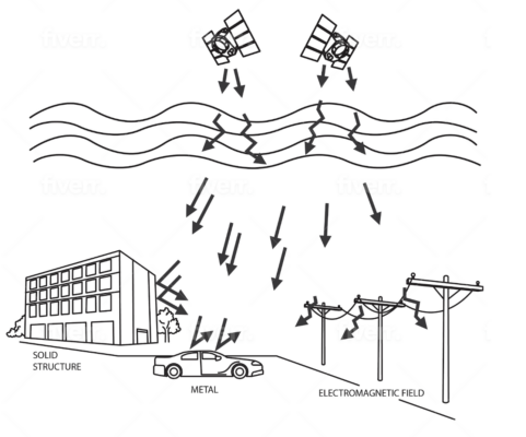
The Satlab SL900 is a high-precision GNSS receiver for land surveying and construction, offering centimeter-level accuracy with RTK technology. Equipped with an advanced IMU tilt sensor for tilt compensation, robust connectivity (Bluetooth, 4G, UHF radio), and a durable IP67 design, the Satlab SL900 RTK GNSS Receiver is the ultimate land surveying equipment for reliable and efficient fieldwork.
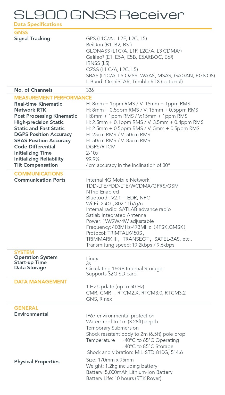
| ✅ Channels |
336 |
| ✅ IMU Tilt Sensor |
30° |
| ✅ Internet Modem |
4G |
| ✅ UHF Radio |
403 – 473MHz |
| GPS |
L1C/A , L2E, L2C, L5 |
| GLONASS |
L1C/A, L1P, L2C/A, L3 CDMA |
| GALILEO |
E1, E5A, E5B, E5AltBOC, E6 |
| BEIDOU |
B1, B2, B3 |
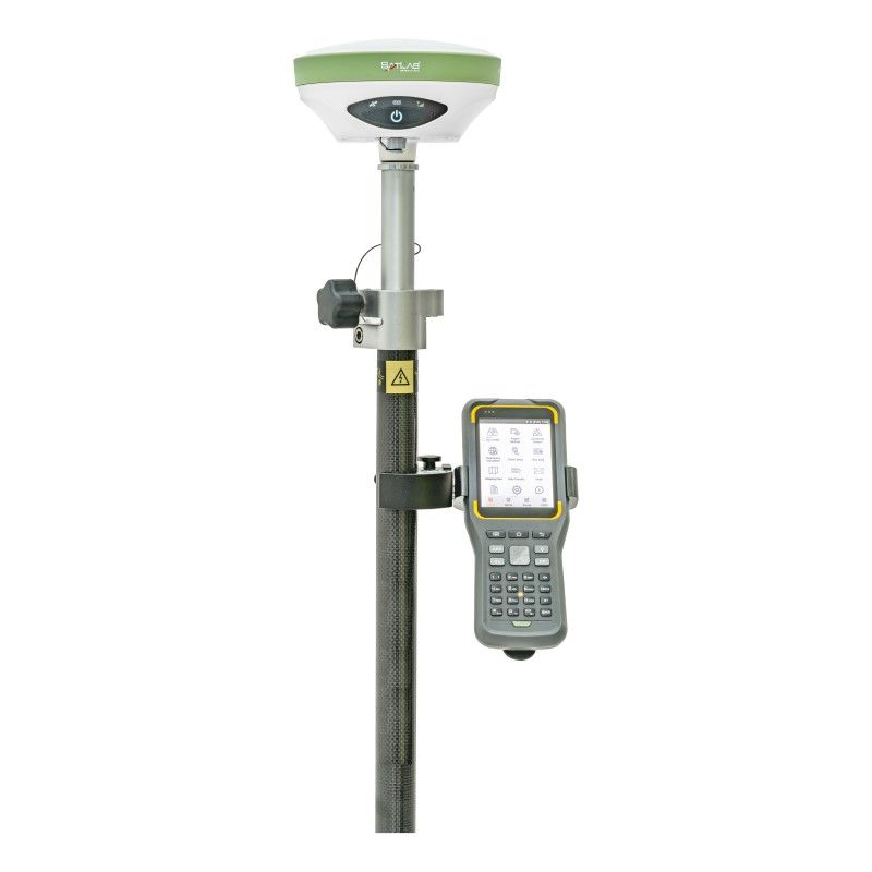
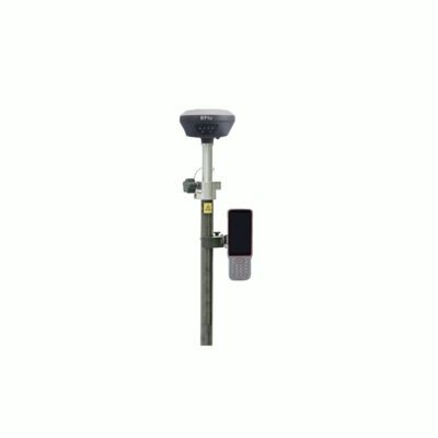
Revolutionize Your Land Surveying and Construction Tasks with the Satlab SL900 Rover Set
The Satlab SL900 rover set is your ultimate companion for precision and reliability in land surveying and construction. Designed with cutting-edge GNSS technology, this rover set delivers unmatched accuracy, durability, and ease of use, making it an indispensable tool for professionals.
Key Features that Elevate Your Work
High-Precision GNSS Technology
The Satlab SL900 GNSS rover set utilizes advanced RTK technology to deliver centimeter-level accuracy. Whether you are conducting detailed land surveys or managing intricate construction layouts, this level of precision ensures your data is reliable and actionable.
IMU Tilt Compensation for Efficiency
Tired of spending extra time leveling your equipment? GPS set with IMU tilt sensor offers superior tilt compensation, enabling you to measure even in challenging angles and terrains. Say goodbye to productivity losses caused by uneven surfaces and focus on getting the job done faster.
Robust and Durable Design
Fieldwork can be unpredictable, but the Satlab SL900 rover set is built to handle it all. With an IP67-rated design, it’s resistant to water, dust, and shocks, ensuring it performs reliably in tough environments. From muddy construction sites to remote surveying locations, this rover is ready for the challenge.
Seamless Connectivity
Stay connected with integrated Bluetooth, 4G, and UHF radio options. Effortlessly transfer data and stay in control of your project, no matter where you are.

Benefits for Land Surveying and Construction Professionals
Solve Common Surveying Struggles
- Accuracy Challenges: With the Satlab SL900’s GNSS technology, achieve precise measurements and eliminate costly errors.
- Time Wastage: The IMU tilt sensor ensures efficient operation, even on uneven surfaces, saving you hours in the field.
- Durability Concerns: With its rugged build, the Satlab SL900 GNSS rover set minimizes downtime and repair costs.
Versatile Applications
Whether you need a GNSS rover set for land surveying or a GPS set for construction, the Satlab SL900 offers the flexibility to adapt to your needs. Its robust features and intuitive design make it the perfect choice for professionals across various industries.
Included Accessories
The Satlab SL900 rover set comes with essential accessories to maximize your productivity:
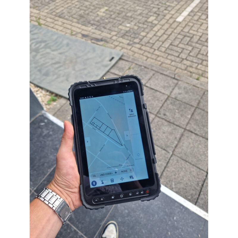
- Satlab SHC30 Data Collector: The Satlab SHC30 is a powerful, user-friendly device that streamlines data collection and integration with the Satlab SL900.
- SatSurv Software: The SatSurv software is a intuitive and efficient software designed for seamless operation and data management.
- Telescopic Pole and Controller Bracket: Built for stability and flexibility, these accessories enhance your setup and are perfect for various environments.
While these accessories provide an all-in-one solution, they can be customized to fit your specific needs. Swap out the telescopic pole, controller bracket, or other components with compatible accessories to tailor the set to your projects.


Reviews
There are no reviews yet.