

 GPS & GNSS
 Lidar scanning
 Total Station
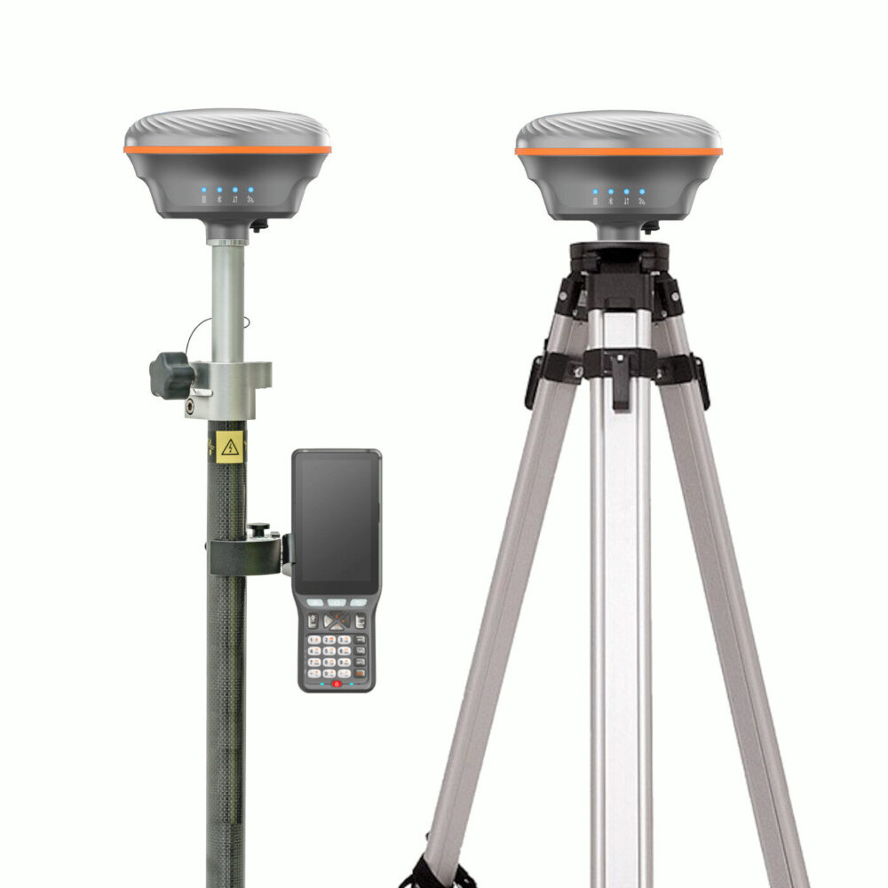
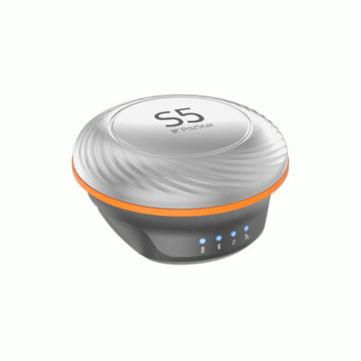
PozStar S5 RTK GNSS Rover Base Set with 60 Degree IMU
Get the best price for your setup
Contact our experts for the best possible price and configuration.
- Fast response
- Expert configuration advice
- No overpaying for features you do not need
The PozStar S5 RTK GNSS Rover Base Set is a complete centimetre-accurate positioning system for land surveying, construction layout, infrastructure measurement and GIS fieldwork. One PozStar S5 receiver is set up over a known or assigned base point, while the second receiver is carried as the rover. This allows the system to generate and receive local RTK corrections without relying entirely on a mobile-data correction network.
Both compact S5 receivers use 1,408-channel, multi-frequency GNSS technology and support GPS, GLONASS, Galileo, BeiDou, QZSS, NavIC and SBAS signals. The rover’s integrated MEMS IMU compensates for pole angles of up to 60 degrees, making it easier to measure beside walls, inside trenches, near fences and at other points where the pole cannot be held vertically.
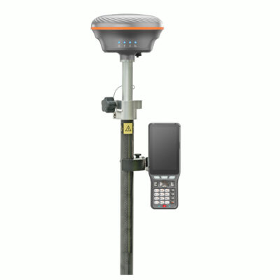
The set includes a rugged P9IV Android controller with PozPad surveying software, along with the main accessories required for pole-mounted rover work and stable base-station setup. Its local UHF correction workflow makes the package particularly useful on remote sites, large construction projects and projects outside dependable cellular coverage.
PozStar S5 Rover Base Set Highlights
| System configuration | PozStar S5 base receiver and PozStar S5 rover receiver |
|---|---|
| GNSS channels | 1,408 channels with multi-constellation and multi-frequency tracking |
| Satellite constellations | GPS, GLONASS, Galileo, BeiDou, QZSS, NavIC and SBAS |
| IMU tilt measurement | Up to 60° pole tilt compensation |
| RTK accuracy | Horizontal 0.8 cm + 1 ppm and vertical 1.5 cm + 1 ppm RMS |
| UHF communication | 410–470 MHz optional internal radio with 0.5 W or 1 W output |
| Field controller | Geoelectron P9IV rugged Android controller with PozPad software |
| Environmental protection | IP67 dust and water protection with 2 m drop resistance |
| Main accessories | Survey pole, controller bracket, tripod, tribrach and base adapter |
Valued customers:










Find RTK Networks
Search NTRIP providers and connect to reliable RTK correction services.
Description
Complete RTK GNSS Base and Rover System
The PozStar S5 RTK GNSS Rover Base Set provides a complete local correction system for surveyors, construction teams, civil engineers and GIS professionals who need centimetre-level positioning. The package uses one PozStar S5 receiver as a stationary base and a second S5 as the mobile rover.
The base receiver is installed over a fixed point using the included tripod, tribrach and adapter. It observes the same satellite signals as the rover and transmits correction data through the configured UHF radio link. The rover applies these corrections in real time, enabling accurate measurement and setting out without requiring every project to be within range of a public or commercial NTRIP network.
Suitable for Independent RTK Work
A base-and-rover configuration is particularly useful on remote construction sites, rural surveys, road projects, agricultural developments and other locations where mobile internet coverage is weak or a regional correction service is unavailable. It also gives project teams control over the position of their own base station and the correction source used by the rover.
The system can still be used with an NTRIP correction service when required. This gives users the flexibility to work with a local UHF base on one project and use network RTK on another, depending on site conditions and the available infrastructure.
Multi-Constellation and Multi-Frequency GNSS
Each PozStar S5 contains a 1,408-channel GNSS board that tracks signals from GPS, GLONASS, Galileo, BeiDou, QZSS, NavIC and supported SBAS services. Tracking several constellations and frequencies gives the receivers access to more satellite observations than basic GPS-only equipment.
In practical fieldwork, this can help the receiver obtain and maintain a fixed RTK solution when parts of the sky are obstructed by buildings, machinery or vegetation. Satellite visibility, multipath, radio conditions and correct base setup still affect the final result, so normal GNSS surveying procedures remain important.
Centimetre-Level RTK Positioning
The PozStar S5 has a specified RTK accuracy of 0.8 cm + 1 ppm horizontally and 1.5 cm + 1 ppm vertically under suitable conditions. This makes the system suitable for construction stakeout, topographic surveying, control-point work, road measurement, utility mapping and accurate GIS data collection.
For construction teams, the rover can be used to locate design coordinates, mark foundation points, check installed features and record completed work. Surveyors can use it to collect coded points and site features, while GIS operators can accurately map assets such as inspection chambers, utility lines, signs and boundaries.
60 Degree IMU Tilt Compensation
The S5 rover includes a MEMS IMU that compensates for survey-pole angles of up to 60 degrees. The operator can place the pole tip directly on the required point while holding the receiver away from an obstruction.
This is useful beside building façades, beneath overhangs, close to fences, inside excavations and around parked equipment. It also reduces the time spent carefully levelling the pole during repetitive point collection, helping operators work more comfortably on uneven ground.
Local UHF Base to Rover Corrections
The optional internal UHF radio operates in the 410–470 MHz range and supports 0.5 W and 1 W transmission settings. The manufacturer specifies an operating range of approximately 3 to 5 km under its stated conditions. Actual working range depends on terrain, antenna height, buildings, vegetation, interference and the radio settings permitted in the country of use.
Supported radio protocols include TRIMTALK, TRIMMK3, TRANSEOT and DTSCOMM. This can make integration with compatible GNSS equipment possible, although radio frequency, protocol and channel settings must be matched before field deployment.
Rugged P9IV Android Field Controller
The included Geoelectron P9IV is a professional Android controller intended for outdoor surveying. It has a 5-inch HD touchscreen, an octa-core processor, Bluetooth 5.0 and IP67 environmental protection. Its physical keypad provides an alternative to touchscreen-only operation when the user is wearing gloves or working in wet conditions.
The controller connects to the rover through Bluetooth and provides the interface for configuring the receiver, entering antenna heights, selecting coordinate systems, collecting points and carrying out stakeout work. Its mobile-data capability can also be used for NTRIP corrections when the system is operated without the local base.
PozPad Surveying Software
PozPad is the Android field application supplied with the set. It supports control-point and survey-data collection, map input, drawing operations and stakeout workflows. The software displays receiver information and allows collected points to be stored as part of the active survey project.
Construction workers can use the software to navigate towards design coordinates, while surveyors can collect coded points for later CAD processing. GIS users can record accurate asset positions and descriptive information in one field workflow.
Designed for Demanding Field Conditions
The PozStar S5 receiver has an IP67-rated housing for protection against dust and temporary water immersion. Its die-cast structure, elastomer protection and durable coating are intended to withstand normal site handling, and the manufacturer specifies resistance to a two-metre drop under its test conditions.
Each receiver weighs approximately 793 grams. The relatively low rover weight reduces the load at the top of the survey pole, which can make a noticeable difference during long topographic surveys and repetitive construction measurements.
Battery Life and Data Management
Each S5 contains a rechargeable 6,700 mAh lithium-ion battery. The stated operating time is up to 12 hours in RTK rover use and up to 18 hours for static observations, depending on radio use, communication settings and other operating conditions.
A USB Type-C port is used for charging, data transfer and firmware updates. The receiver also includes Bluetooth, Wi-Fi access-point functionality and 8 GB of internal memory. Supported data formats include RTCM 2.x, RTCM 3.x, NMEA 0183 and static RINEX files.
Typical Applications
- Construction layout and as-built checks
- Topographic and land surveying
- Road and infrastructure projects
- Utility and underground-asset mapping
- Boundary and cadastral fieldwork
- GIS feature and asset collection
- Control-point establishment and static observations
What Is Included in the PozStar S5 Rover Base Set?
The set is configured with the principal equipment needed to establish a base station and carry out pole-mounted RTK rover measurements:
- PozStar S5 receiver for rover use
- PozStar S5 receiver for base-station use
- Geoelectron P9IV rugged Android controller
- PozPad surveying software
- Telescopic survey pole
- Controller bracket
- Survey tripod
- Tribrach and receiver adapter
The precise radio configuration, antenna accessories and regional frequency settings should be confirmed before ordering. Radio regulations vary by country, and the base and rover must be configured with compatible frequencies and protocols.
Configuration and Support from Global GPS Systems
Global GPS Systems can help configure the PozStar S5 Rover Base Set for the intended project and country of use. This includes matching the UHF settings, preparing the controller and field software, checking coordinate-system requirements and selecting any additional base or rover accessories.
Correct base coordinates, antenna heights, radio settings and project parameters are essential for reliable RTK results. A properly prepared system gives surveying and construction teams an independent positioning solution that can be moved between sites and used with either local radio corrections or a compatible NTRIP service.
Specifications
PozStar S5 Rover Base Set Specifications
System Overview
| Product type | Complete RTK GNSS rover-and-base surveying system |
|---|---|
| GNSS receivers | 2 × PozStar S5 multi-frequency RTK GNSS receivers |
| Operating configuration | One S5 receiver configured as the RTK base and one S5 receiver configured as the rover |
| Data collector | Geoelectron P9IV rugged Android field controller |
| Field software | PozPad Android surveying software |
| Primary correction link | UHF radio corrections transmitted from the base receiver to the rover receiver |
| Alternative correction source | NTRIP network corrections through the connected field controller |
| Advertised field accuracy | Sub-3 cm RTK positioning under suitable satellite, correction-link and environmental conditions |
| Primary applications | Land surveying, cadastral surveying, construction layout, stakeout, topographic surveys, mapping, control-point establishment and site measurement |
| Receiver manufacturing origin | Designed and manufactured in South Korea |
Base and Rover Operation
| Function | Base receiver | Rover receiver |
|---|---|---|
| Primary role | Occupies a known or surveyed point and generates RTK corrections | Receives corrections and calculates centimetre-level field positions |
| Typical mounting | Survey tripod with tribrach and receiver adapter | Telescopic survey pole |
| UHF operation | Transmits correction data when supplied with a transmit-capable radio configuration | Receives correction data from the base |
| IMU tilt measurement | Normally not required while fixed on a tripod | Supports pole-tilt compensation up to 60° |
| Network RTK use | Can be omitted when the rover receives corrections from an NTRIP service | Receives NTRIP corrections through the P9IV controller |
| Static observation | Can record static GNSS observations | Can record static or fast-static GNSS observations |
PozStar S5 Receiver Architecture
| Receiver type | Multi-constellation, multi-frequency high-precision GNSS receiver |
|---|---|
| GNSS channels | 1,408 |
| GNSS main board | PozStar-developed high-precision GNSS board based on a GNSS system-on-chip architecture |
| Signal tracking | Independent tracking of supported frequencies from multiple GNSS constellations |
| Positioning modes | RTK base, RTK rover, network RTK, static, fast static, PPK, code differential, SBAS and standalone positioning |
| Position update rate | Up to 20 Hz, depending on configuration and output settings |
| Interference management | Designed to identify and reduce the effects of unwanted-frequency interference |
| Challenging-environment performance | Designed to maintain stable positioning near buildings, beneath vegetation and in other multipath-prone environments |
Supported GNSS Constellations and Signals
| Satellite system | Supported signals |
|---|---|
| GPS | L1 C/A, L1C, L2P(Y), L2C and L5 |
| GLONASS | G1, G2 and G3 |
| Galileo | E1, E5a, E5b and E6 |
| BeiDou | B1I, B2I, B3I, B1C, B2a and B2b |
| QZSS | L1, L2 and L5 |
| NavIC | L5 |
| SBAS | Compatible with supported regional satellite-based augmentation services |
Positioning Accuracy
| Positioning mode | Horizontal accuracy | Vertical accuracy |
|---|---|---|
| Static and fast static | 3 mm + 0.5 ppm RMS | 5 mm + 0.5 ppm RMS |
| RTK | 8 mm + 1 ppm RMS | 15 mm + 1 ppm RMS |
| Standalone positioning | 1.5 m RMS | 2.5 m RMS |
| Code differential | 0.4 m RMS | 0.8 m RMS |
| SBAS | 0.3 m RMS | 0.6 m RMS |
RTK Initialization and Performance
| Cold-start time | Less than 12 seconds under suitable conditions |
|---|---|
| Warm-start time | Less than 4 seconds under suitable conditions |
| RTK initialization reliability | Greater than 99.9% under suitable operating conditions |
| RTK baseline dependency | Accuracy includes a parts-per-million component based on the distance between the base and rover |
| Performance dependencies | Accuracy and initialization time depend on satellite geometry, multipath, correction latency, radio conditions, baseline length and atmospheric conditions |
IMU Tilt Compensation
| Tilt technology | Integrated MEMS IMU |
|---|---|
| Maximum pole inclination | Up to 60° |
| Primary use | Allows the rover to measure points without holding the survey pole perfectly vertical |
| Initialization | Fast IMU initialization for field surveying |
| Calibration | Simplified IMU calibration for flexible tilt measurements |
| Magnetic interference | IMU-based tilt measurement is designed to remain unaffected by magnetic disturbances |
| Typical benefits | Improved access to obstructed points, building corners, walls, trenches, road edges and points beneath overhangs |
UHF Radio System
| Integrated UHF radio | Available according to selected receiver and regional configuration |
|---|---|
| Product configuration frequency range | 450–470 MHz |
| Broader S5 radio range | Some S5 configurations support 410–470 MHz |
| Base radio mode | Transmit or transmit/receive, depending on installed radio hardware and regional configuration |
| Rover radio mode | Receive or transmit/receive, depending on installed radio hardware and regional configuration |
| Supported radio protocols | TRIMTALK, TRIMMK3, TT450, TRANSEOT, SATEL and DTSComm-compatible protocols, depending on firmware |
| Radio link rate | 4,800–19,200 bps |
| Radio antenna connector | External UHF antenna port |
| Typical radio range | Up to approximately 15 km in open conditions and approximately 5 km in urban conditions, depending on antenna height, terrain, interference and permitted transmit power |
| Regional restrictions | Available frequencies, transmit power and transmitting capability depend on local radio regulations |
Correction Data and Output Formats
| RTK correction formats | RTCM 2.x and RTCM 3.x |
|---|---|
| Position output | NMEA 0183 |
| Static observation format | RINEX-compatible GNSS observation data |
| Network RTK protocol | NTRIP through an internet-connected Android controller |
| Integrated receiver modem | No integrated cellular internet modem |
| Mobile internet source | The P9IV field controller supplies LTE or Wi-Fi internet access for NTRIP operation |
| Post-processing support | Static, fast-static and PPK workflows, subject to the selected field and office software |
Receiver Connectivity and Interfaces
| Bluetooth | Bluetooth Low Energy 4.1 |
|---|---|
| Wi-Fi | IEEE 802.11 b/g/n with access-point functionality |
| USB port | 1 × USB Type-C |
| USB functions | Battery charging, data download and firmware updates |
| UHF antenna port | 1 × external radio antenna connector |
| Auxiliary interface | 5-pin interface on supported receiver configurations for external power, radio or data functions |
| External NMEA output | Supported through compatible receiver interfaces and configuration |
| Controller connection | Wireless Bluetooth connection to compatible Android field devices |
Receiver Storage, Controls and Status Indicators
| Internal storage | 8 GB |
|---|---|
| Front-panel indicators | 4 LED status indicators |
| Indicated functions | Power, data communication, Bluetooth and satellite-signal status |
| Physical control | Front-panel power button |
| Speaker | Integrated 1 W speaker |
| Audio functions | Receiver status, operating prompts and connection information |
Receiver Power and Battery
| Battery type | Built-in rechargeable Samsung lithium-ion battery |
|---|---|
| Battery capacity | 6,700 mAh per receiver |
| RTK rover operating time | Up to approximately 12 hours |
| Static operating time | Up to approximately 18 hours |
| Base operating time | Depends on UHF transmit power, radio duty cycle, satellite tracking and environmental conditions |
| Typical power consumption | Approximately 2.2 W, depending on operating mode and radio use |
| External power input | 5 V DC, 3 A |
| Charging interface | USB Type-C |
| Battery replacement | Internal battery construction; servicing should be performed according to manufacturer procedures |
Receiver Physical Specifications
| Receiver dimensions | Approximately 135 mm diameter × 88.2 mm height |
|---|---|
| Receiver weight | Approximately 793–825 g, depending on hardware and radio configuration |
| Housing construction | Compact, rugged, all-in-one die-cast housing |
| Impact protection | Dual-elastomer protective construction |
| Exterior finish | Powder-coated surface for improved hardness and scratch resistance |
| Internal protection | Shielded internal structure designed to protect the GNSS main board and electronic components |
| Receiver mounting | Standard survey-pole and tripod mounting through the supplied adapter system |
Receiver Environmental Specifications
| Ingress protection | IP67 dustproof and waterproof |
|---|---|
| Water immersion protection | Protected against temporary immersion in water to a depth of 1 m under the test conditions defined by IP67 |
| Drop resistance | Designed to withstand a drop of up to 2 m |
| Durability standard | MIL-STD-810H certified |
| Operating temperature | -40°C to +65°C |
| Storage temperature | -40°C to +85°C |
| Humidity | Up to 100% |
Geoelectron P9IV Controller
| Device type | Professional rugged Android GNSS field controller |
|---|---|
| Operating system | Android 11 |
| Processor | MTK 8-core processor operating at up to 2.0 GHz |
| RAM | 3 GB |
| Internal storage | 32 GB |
| Expandable storage | TF or microSD card support up to 512 GB |
| Google services | Google Mobile Services support, depending on installed firmware and regional version |
| Field ergonomics | Designed for one-handed operation during surveying and stakeout |
P9IV Display and Input
| Display size | 5.0 inches |
|---|---|
| Display type | HD capacitive touchscreen |
| Display resolution | 720 × 1280 pixels |
| Outdoor visibility | Sunlight-readable display design using Casio Blanview display technology |
| Touch modes | Finger, stylus, glove and wet-hand operation |
| Physical keypad | Survey-oriented alphanumeric and function-key keypad |
| Survey key | Dedicated key for opening or switching to surveying software and collecting points |
| Function keys | Programmable function keys for field workflows |
| Directional controls | Physical navigation keys with secondary volume and brightness functions |
P9IV Wireless and Mobile Connectivity
| Bluetooth | Bluetooth 5.0 |
|---|---|
| Wi-Fi | Dual-band 2.4 GHz and 5 GHz Wi-Fi |
| Wi-Fi standards | IEEE 802.11 a/b/g/n/ac |
| Mobile network support | GSM, WCDMA and LTE |
| SIM configuration | Dual Nano-SIM support |
| USB interface | USB Type-C |
| RTK network function | Provides mobile-data or Wi-Fi connectivity for NTRIP correction services |
P9IV Supported Mobile Bands
| Network | Supported bands |
|---|---|
| GSM | 850, 900, 1800 and 1900 MHz |
| WCDMA | B1, B2, B4, B5 and B8 |
| LTE-TDD | B38, B39, B40 and B41 |
| LTE-FDD | B1, B2, B3, B4, B5, B7, B8, B12, B13, B17, B20 and B28 |
P9IV Camera, GNSS and Sensors
| Rear camera | 13 MP autofocus camera |
|---|---|
| Camera flash | Integrated LED flash |
| Integrated handheld GNSS | GPS, GLONASS and BeiDou positioning for general navigation |
| Controller GNSS accuracy | Approximately 1–3 m under suitable conditions |
| Motion sensors | Gyroscope and accelerometer |
| Additional sensors | Electronic compass, magnetometer, proximity sensor, gravity sensor and ambient-light sensor |
| Audio | Integrated speaker and microphone |
P9IV Battery and Power
| Battery type | Rechargeable lithium-ion battery |
|---|---|
| Battery capacity | 6,400 mAh |
| Continuous operating time | Up to approximately 15 hours while connected to a GNSS receiver by Bluetooth and collecting data |
| Standby time | Up to approximately 30 days |
| Charging time | Approximately 3 hours |
| Charging interface | USB Type-C |
P9IV Physical and Environmental Specifications
| Dimensions | Approximately 221.5 × 82 × 27 mm |
|---|---|
| Weight | Approximately 450 g including battery |
| Internal structure | Integrated magnesium-alloy support bracket |
| Ingress protection | IP67 |
| Drop resistance | Designed to withstand a drop of approximately 1.2 m onto a hard surface |
| Operating temperature | -30°C to +60°C |
| Storage temperature | -40°C to +80°C |
| Humidity | Up to 95% relative humidity, non-condensing |
PozPad Field Software
| Software platform | Android |
|---|---|
| Receiver connection | Bluetooth connection to either PozStar S5 receiver |
| Base configuration | Supports base-point setup, coordinate entry, averaged positioning and radio-correction configuration |
| Rover configuration | Supports UHF rover and NTRIP network-rover operation |
| Survey functions | Point collection, control-point measurement, topographic surveying, mapping and stakeout |
| Tilt surveying | Supports S5 IMU-compensated measurements with the survey pole inclined by up to 60° |
| Project management | Project creation, point storage, point coding and coordinate-system management |
| Data exchange | Survey-data import and export in supported field formats |
| User interface | Graphical menus designed for field surveying workflows |
| Language support | Multiple languages may be available according to the installed software version |
| Software customization | Functions and workflows may be customized or updated by the supplier or manufacturer |
Included Items
| Item | Quantity | Notes |
|---|---|---|
| PozStar S5 RTK GNSS receiver | 2 | One receiver for base operation and one receiver for rover operation |
| Geoelectron P9IV field controller | 1 | Rugged Android controller with mobile data, Wi-Fi, Bluetooth and physical survey keypad |
| PozPad surveying software | 1 licence | Installed or supplied for use with the Android field controller |
| Telescopic survey pole | 1 | For mounting and operating the rover receiver |
| Controller pole bracket | 1 | Secures the P9IV controller to the rover pole |
| Survey tripod | 1 | Provides a stable mounting platform for the base receiver |
| Tribrach | 1 | Used for centring and levelling the base receiver above a survey point |
| Base receiver adapter | 1 | Connects the S5 receiver to the tribrach or tripod assembly |
| UHF radio antennas | Configuration dependent | Supplied according to the radio configuration selected for the base and rover receivers |
| Receiver charging and data cables | 1 set | For charging, data transfer and firmware updates |
| Receiver power adapters | 1 set | Plug type and quantity may vary by destination and package configuration |
| P9IV charging cable and adapter | 1 set | USB Type-C charging equipment; regional plug type may vary |
| P9IV hand strap | 1 | For secure handheld field use |
| P9IV stylus | 1 | For touchscreen operation |
| Transport case or cases | Configuration dependent | Case design, quantity and internal layout may vary with the selected package |
Specifications and package contents may vary by configuration, region or manufacturer update. Always check the current configuration before ordering.
Reviews (0)
Only logged in customers who have purchased this product may leave a review.
FAQ
PozStar S5 Rover Base Set FAQ
Set Overview and Applications
What is the PozStar S5 Rover Base Set?
The PozStar S5 Rover Base Set is a complete RTK GNSS surveying solution consisting of a rover receiver and a local base receiver. It is designed to provide centimetre-level positioning for land surveying, construction layout, mapping and infrastructure work without relying entirely on a third-party RTK network.
Who is the PozStar S5 Rover Base Set designed for?
The set is designed for land surveyors, construction contractors, civil engineers, infrastructure teams, mapping professionals and other users who need reliable high-accuracy positioning across a project site.
What can the PozStar S5 Rover Base Set be used for?
Typical applications include topographic surveying, cadastral measurements, construction stakeout, road and utility work, site control, earthworks, as-built surveys, boundary measurements and geospatial data collection.
What is the difference between a rover set and a rover-base set?
A rover-only set normally receives corrections from an external RTK network or an existing base station. A rover-base set includes a separate receiver that can be installed over a known or temporary reference point and transmit corrections directly to the rover.
Can the PozStar S5 Rover Base Set be used where no RTK network is available?
Yes. The local base receiver can generate correction data and send it to the rover by UHF radio, making the set suitable for locations where mobile internet or an NTRIP correction service is unavailable or unreliable.
Is the set suitable for construction stakeout?
Yes. The combination of RTK positioning, rapid satellite acquisition and IMU tilt compensation makes the set suitable for staking out points, lines, levels, boundaries and construction elements on active job sites.
Accuracy and GNSS Performance
What accuracy can the PozStar S5 Rover Base Set achieve?
The PozStar S5 is designed to provide sub-3 cm positioning when the rover has a fixed RTK solution and receives reliable corrections from the base. Actual accuracy depends on the base coordinates, baseline length, satellite geometry, radio link, atmospheric conditions and the surrounding environment.
How many GNSS channels does each PozStar S5 receiver have?
Each PozStar S5 receiver has 1,408 GNSS channels, allowing it to track multiple satellite constellations and frequencies simultaneously.
Which satellite constellations does the PozStar S5 support?
The receiver supports GPS, GLONASS, Galileo and BeiDou signals. Multi-constellation tracking improves satellite availability and helps maintain reliable positioning in challenging field conditions.
Does the PozStar S5 support multi-frequency GNSS signals?
Yes. It supports multiple frequencies, including GPS L1, L2 and L5, GLONASS G1, G2 and G3, Galileo E1, E5 and E6, and several BeiDou frequencies.
How quickly does the PozStar S5 obtain an RTK fix?
The receiver is designed for fast satellite acquisition and rapid RTK initialization. The time required to obtain a fixed solution depends on satellite visibility, base-rover distance, correction quality, radio communication and local obstructions.
Can the system work near buildings or trees?
The multi-frequency, multi-constellation receiver is designed to maintain stable tracking in demanding environments such as construction zones, urban areas and locations with partial tree cover. Severe signal blockage or multipath reflections can still reduce accuracy and initialization speed.
Base Station, Radio and IMU
How does the PozStar S5 base station send corrections to the rover?
The base receiver can transmit RTK correction data to the rover through its integrated UHF radio. The rover applies these corrections to calculate an accurate real-time position.
Which UHF radio frequencies does the PozStar S5 support?
The PozStar S5 supports UHF communication in the 450–470 MHz range. The selected frequency, transmission power and radio protocol must be compatible between the base and rover and must comply with local radio regulations.
What is the operating range between the base and rover?
The practical UHF operating range depends on terrain, antenna height, radio power, interference and obstructions between the receivers. An elevated base antenna and a clear line of sight generally provide the most reliable connection.
Does the PozStar S5 Rover Base Set require mobile internet?
No. A direct UHF radio link between the local base and rover can be used without mobile internet. Internet access may still be used for online correction services, project transfers or other connected field-software functions.
Can the rover also connect to an NTRIP correction network?
Yes. The rover can receive NTRIP corrections through the internet connection of a compatible Android controller, smartphone or tablet. This allows the rover to be used independently from the included local base when network corrections are available.
Does the PozStar S5 have a built-in cellular modem?
No. The receiver does not have an integrated cellular internet modem. Online corrections are normally received through the mobile-data or Wi-Fi connection of the connected field controller.
Does the rover support IMU tilt compensation?
Yes. The PozStar S5 has an integrated IMU that supports tilt-compensated measurements at pole angles of up to 60 degrees, allowing points to be measured without holding the survey pole perfectly vertical.
When is 60-degree tilt compensation useful?
Tilt compensation is useful for measuring building corners, walls, trenches, road edges, fenced locations and other points that are difficult or unsafe to reach with a vertical survey pole.
Included Equipment and Field Setup
What is included in the PozStar S5 Rover Base Set?
The set includes PozStar S5 receivers for rover and base operation, a Geoelectron P9IV data collector, PozPad surveying software, a survey pole, a controller bracket, a tripod, a tribrach and an adapter. The exact configuration should be confirmed before ordering because compatible accessories may be customized.
What is the Geoelectron P9IV data collector used for?
The data collector is used to configure the receivers, establish radio or network correction connections, manage survey projects, collect points, perform stakeout work and export field data.
Which surveying software is supplied with the set?
The set includes PozPad, an Android-based field application for GNSS configuration, survey-data collection, mapping, stakeout and project management.
Why are a tripod and tribrach included?
The tripod and tribrach provide a stable and accurately levelled mounting platform for the base receiver. A stable base setup is important because movement or an incorrect base position will affect every rover measurement.
Does the base station need to be placed over a known point?
For work requiring coordinates in an established reference system, the base should be installed over a known control point or assigned accurately determined coordinates. A temporary autonomous base position may be used for local or relative measurements, but it may not match official project coordinates.
What should be checked before beginning a survey?
Users should verify the base coordinates, coordinate system, antenna and pole heights, radio channel, correction status, satellite availability, RTK solution type and project settings. Measuring a known control point is recommended before collecting or staking critical data.

 GPS & GNSS
 Total Stations
 Data collectors
 Software
 Correction services
 Machine control
 External radio
 Marine
 Accessories
Reviews
There are no reviews yet