

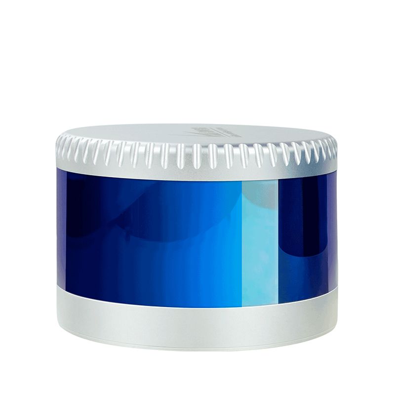


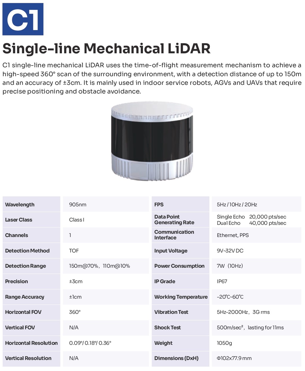
LS Lidar C series
This product is available
Get the best price for your setup
Contact our experts for the best possible price and configuration.
The LS Lidar C Series is a high-speed, high-precision Lidar Scanning System offering 360° 3D scanning, up to 200m range, and ±3cm accuracy. Compact and powerful, this advanced SLAM Lidar System delivers rich point cloud data for autonomous vehicles, robotics, smart transportation, and more.

Valued customers:


Find RTK Networks
Search NTRIP providers and connect to reliable RTK correction services.
Description
LS Lidar C Series: Advanced Lidar Scanning System for Precision and Performance
Revolutionize Your Data Collection with the LS Lidar C Series
The LS Lidar C Series is a cutting-edge Lidar Scanning System designed for professionals seeking precise, high-speed 3D scanning in real-time. With a powerful combination of range, accuracy, and compact design, this SLAM Lidar System is your solution for seamless and reliable 360° data capture across a range of industries.
Key Features of the LS Lidar C Series
- 360° 3D High-Speed Scanning: Capture your environment with complete horizontal coverage and a 32° vertical field of view.
- Exceptional Accuracy: Enjoy measurement accuracy of up to ±3 cm and a maximum range of 200 meters.
- High Point Density: Generate approximately 640,000 points per second for rich, detailed point cloud data.
- Fine Vertical Resolution: With up to 0.33° vertical angular resolution, this Lidar Scanner ensures precision-focused data collection, especially in front-facing applications.
- Lightweight & Compact Design: Easy to integrate into vehicles, robots, drones, and more.
Solve Common Lidar Struggles with Precision
Tired of bulky equipment that lacks real-time responsiveness? Struggling with inconsistent data quality or gaps in coverage? This lidar system eliminates these issues with its streamlined form factor and ultra-fast Lidar Scanner capabilities. It’s built to deliver consistent, actionable data for autonomous vehicles, ADAS, smart transportation, security systems, logistics, and mapping professionals.
Whether you’re navigating a dynamic urban environment or conducting complex surveys, this Point Cloud Scanner provides the high-resolution, real-time feedback needed for smart decision-making.

Ideal for a Wide Range of Applications
- Autonomous Vehicles & ADAS: Ensure safe, reliable navigation with high-density, 360° environment sensing.
- Smart Transportation & Security: Enhance situational awareness and response efficiency.
- Surveying & Mapping: Capture highly accurate point cloud data with minimal setup and maximum mobility.
- Robotics & Logistics: Improve obstacle detection and path planning with top-tier SLAM Lidar capabilities.
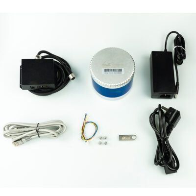
Datasheets & Manuals
Datasheets and manuals
Additional information
| Weight | 3 kg |
|---|---|
| Dimensions | 15 × 15 × 15 cm |
Reviews (0)
Only logged in customers who have purchased this product may leave a review.

Reviews
There are no reviews yet