

 GPS & GNSS
 Lidar scanning
 Total Station
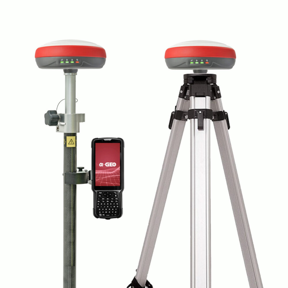
a-GEO L300 IMU RTK GNSS Rover and Base Set
Get the best price for your setup
Contact our experts for the best possible price and configuration.
- Fast response
- Expert configuration advice
- No overpaying for features you do not need
The a-GEO L300 Rover and Base Set is a complete RTK GNSS surveying system for construction setting out, topographic surveys, civil engineering, site measurement and accurate GIS data collection. With one L300 operating as the base and the other as the rover, teams can create a local correction link without depending entirely on mobile internet or a regional RTK network.
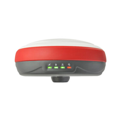
Both compact receivers feature 1408-channel multi-constellation GNSS tracking, integrated 410–470 MHz UHF radios, 4G connectivity and rugged magnesium-alloy housings. The rover’s calibration-free IMU supports measurements with the pole tilted by up to 60°, making it easier to reach points beside walls, fences, machinery and excavations.
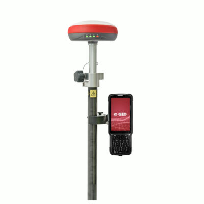
The set also includes an a-GEO S50III Android data collector, SurPro surveying software, a survey pole, controller bracket, tripod, tribrach and adapter. This provides the essential equipment needed for a practical base-and-rover field setup.
a-GEO L300 Rover and Base Set Highlights
| System type | Complete RTK GNSS base-and-rover surveying set |
|---|---|
| GNSS channels | 1408 tracking channels per L300 receiver |
| Satellite constellations | GPS, GLONASS, Galileo, BeiDou, QZSS and SBAS |
| IMU tilt measurement | Calibration-free tilt compensation up to 60° |
| Single-baseline RTK accuracy | Horizontal 8 mm + 1 ppm and vertical 15 mm + 1 ppm |
| Base-to-rover communication | Integrated 410–470 MHz UHF Tx and Rx radio |
| Internet connectivity | Integrated 4G modem, Wi-Fi and Bluetooth |
| Included field equipment | S50III controller, SurPro software, survey pole, bracket, tripod, tribrach and adapter |
Valued customers:










Find RTK Networks
Search NTRIP providers and connect to reliable RTK correction services.
Description
Complete RTK GNSS base-and-rover system
The a-GEO L300 Rover and Base Set gives surveying and construction teams the equipment needed to establish a local RTK correction source and measure with a mobile rover. It is suitable for projects where centimetre-level positioning is required but access to an NTRIP or CORS correction network is unavailable, unreliable or not preferred.
One a-GEO L300 receiver is installed over a known or assigned reference point and configured as the base. The second L300 is mounted on the survey pole and used as the rover. Correction data is transmitted from the base to the rover through the integrated UHF radios, allowing the rover to calculate an accurate real-time position across the project area.
Designed for survey and construction workflows
This base-and-rover set can be used for construction layout, topographic measurement, road and utility projects, earthworks, site documentation, control surveys and accurate GIS data collection. It is particularly practical for contractors and surveyors working on private sites, remote projects or changing locations where setting up an independent base is more convenient than arranging access to a correction service.
The complete package includes an a-GEO S50III Android data collector, SurPro surveying software, a survey pole and controller bracket for rover work. A tripod, tribrach and adapter are supplied for securely mounting and centring the base receiver over the reference point.
1408-channel multi-constellation tracking
Each L300 receiver uses a 1408-channel GNSS board capable of tracking signals from GPS, GLONASS, Galileo, BeiDou, QZSS and SBAS constellations. Access to multiple constellations and frequencies provides the receiver with a broad selection of satellite observations throughout the working day.
Under suitable conditions, the documented single-baseline RTK accuracy is 8 mm + 1 ppm horizontally and 15 mm + 1 ppm vertically. Static GNSS observations are specified at 2.5 mm + 0.5 ppm horizontally and 5 mm + 0.5 ppm vertically. Actual results depend on factors such as satellite geometry, base position quality, baseline length, radio communication, atmospheric conditions, multipath and nearby obstructions.
Calibration-free IMU tilt measurement
The L300 includes a nine-axis IMU that supports calibration-free tilt compensation up to 60°. During rover measurements, the survey pole does not have to remain perfectly vertical. The operator can place the pole tip on the required point while holding the receiver at an angle.
This makes it easier to measure points beside buildings, fences, vehicles, stored materials and site machinery. It is also helpful at excavation edges, against kerbs and on uneven ground where carefully levelling the pole would otherwise slow down the work.
Integrated UHF radio for local RTK corrections
The integrated 410–470 MHz UHF radio can transmit and receive RTK corrections. In this set, the base receiver transmits correction data while the rover receives it. Radio frequencies, protocols, channels and power settings can be configured to suit the project and compatible equipment.
The receiver manual specifies selectable 1 W and 2 W transmission power and a working range greater than 4 km under appropriate conditions. Practical range varies with terrain, antenna height, buildings, vegetation, interference, radio configuration and local regulations. Raising the base receiver and maintaining a clear path between the base and rover can improve communication reliability.
Network RTK remains available
Although this package is designed for local base-and-rover operation, each L300 also includes an integrated 4G modem. The rover can therefore connect to an NTRIP or CORS service when a suitable mobile network and correction subscription are available. This gives the team the choice between using its own base or working through an established correction network.
The receiver can also be configured to transmit corrections through an internet connection. Available operating options include internal UHF, network communication, NTRIP client, NTRIP server and NTRIP caster workflows.
S50III controller with SurPro software
The included a-GEO S50III data collector provides a dedicated Android controller for configuring the rover and completing survey tasks. It mounts to the supplied survey pole using the controller bracket, keeping receiver status, mapping information and measurement controls within reach while moving around the site.
SurPro software supports common GNSS field operations such as project creation, coordinate-system configuration, point measurement, line and point stakeout and field data management. This allows operators to collect coordinates, navigate to design positions and review survey information directly in the field.
Static observations and post-processing
The L300 is not limited to real-time rover measurements. It can also record raw GNSS observations for static surveys and post-processed workflows. This is useful when establishing control, checking reference coordinates or collecting data in locations where a stable real-time correction link cannot be maintained.
Its internal storage supports commonly used GNSS data and correction formats, including RTCM, RINEX and NMEA. Survey files can be managed through USB Type-C or the receiver’s browser-based Web UI.
Web-based receiver configuration
Each receiver can create a Wi-Fi hotspot that provides access to its Web UI through a phone, tablet or computer. From the interface, users can review satellite and receiver status, choose a base or rover operating mode, configure the UHF radio, enter network settings and manage recorded data.
This browser-based approach allows many receiver settings to be changed without installing a separate desktop configuration application.
Rugged receivers for regular site use
The a-GEO L300 uses a magnesium-alloy housing and has an IP67 environmental rating. It is documented as dustproof and protected against temporary immersion to a depth of one metre for up to 30 minutes. The receiver is also specified to survive a two-metre pole drop onto concrete, although careful handling remains important for any precision surveying instrument.
Each receiver has an internal 6800 mAh lithium-ion battery with USB Type-C charging. Published operating time is up to 12 hours in rover mode, approximately 7 hours in base mode and up to 15 hours in static mode. Battery life in practice depends on radio output, mobile-network use, temperature, receiver settings and battery condition.
Typical applications
- Construction point, line and level stakeout
- Topographic and detail surveying
- Road, utility and civil engineering measurement
- Earthworks, excavation and machine-control reference surveys
- Site control and coordinate checks
- As-built surveys and project documentation
- Accurate GIS and infrastructure asset collection
Choosing and configuring the set
Reliable base-and-rover results require the base receiver to be installed over a stable point and configured with suitable coordinates. An incorrect base coordinate will be transferred to every rover measurement, even when the rover reports a fixed RTK solution. Projects tied to an official coordinate reference system may therefore require a surveyed control point or an appropriate site calibration.
Global GPS Systems can help confirm the correct radio settings, coordinate-system workflow, controller configuration and accessories for the intended construction, surveying or GIS application. The controller, field software and selected accessories can also be adapted where a project requires a different setup.
Specifications
a-GEO L300 Rover and Base Set Specifications
Set Overview
| Brand | a-GEO / Alpha GEO |
|---|---|
| Product Name | a-GEO L300 Rover and Base Set |
| Product Type | Complete dual-receiver RTK GNSS base-and-rover surveying system |
| Receiver Model | a-GEO L300 |
| Receiver Quantity | 2 receivers configured for base-and-rover operation |
| Data Collector | a-GEO S50III rugged Android data collector |
| Field Software | a-GEO SurPro surveying software |
| Primary Applications | Land surveying, construction layout, topographic surveying, control-point establishment, site measurement, mapping, GIS data collection, road stakeout, cadastral work, static GNSS surveying and PPK data collection |
| Supported Receiver Roles | Base station, rover, static receiver and correction-data relay |
| Supported Survey Methods | UHF RTK, Network RTK, static, fast static, PPK, E-RTK, DGPS, SBAS and single-point positioning |
Base and Rover Workflow
| Function | Base Receiver | Rover Receiver |
|---|---|---|
| Primary Role | Generates and transmits GNSS correction data from a fixed position | Receives corrections and calculates centimetre-level positions in real time |
| UHF Operation | Transmits corrections through the integrated 410 MHz to 470 MHz radio | Receives corrections through the integrated 410 MHz to 470 MHz radio |
| Network Operation | Can transmit correction data through NTRIP Server, NTRIP Caster or TCP/IP | Can receive CORS or NTRIP corrections through the internal 4G modem or controller internet connection |
| Static and PPK Recording | Can record raw observations for static base or post-processing workflows | Can record raw observations while operating in rover mode for PPK |
| Position Entry | Supports known coordinates or an averaged autonomous base position | Uses incoming corrections for real-time positioning and stakeout |
| Mounting | Tripod, tribrach and receiver adapter | Survey pole with data collector bracket |
GNSS Tracking
| Tracking Channels | 1408 |
|---|---|
| Supported Constellations | GPS, GLONASS, BeiDou, Galileo, QZSS, SBAS and IRNSS/NavIC |
| GPS Signals | L1 C/A, L1C, L2C, L2P and L5 |
| GLONASS Signals | L1 C/A, L1P, L2 C/A and L2P |
| BeiDou Signals | B1I, B1C, B2I, B2a, B2b and B3 |
| Galileo Signals | E1, E5a, E5b and AltBOC |
| QZSS Signals | L1, L2C and L5 |
| SBAS Services | WAAS, EGNOS, MSAS, GAGAN and SDCM |
| IRNSS/NavIC Signal | L5 |
| L-Band | Supported according to the L300 datasheet |
| Positioning Output Rate | 1 Hz to 20 Hz |
| Cold Start | Less than 60 seconds |
| Hot Start | Less than 15 seconds |
| Signal Reacquisition | Less than 1 second |
| RTK Initialization Time | Less than 10 seconds |
| Initialization Reliability | Greater than 99.99% |
| Time Accuracy | 20 ns |
Positioning Accuracy
| Positioning Mode | Horizontal Accuracy | Vertical Accuracy |
|---|---|---|
| Code Differential GNSS | 0.25 m + 0.5 ppm RMS | 0.50 m + 1 ppm RMS |
| Static GNSS Surveying | 3 mm + 0.1 ppm RMS | 3.5 mm + 0.4 ppm RMS |
| Fast Static | 2.5 mm + 0.5 ppm RMS | 5 mm + 0.5 ppm RMS |
| E-RTK, Baseline Below 100 km | 0.2 m + 1 ppm | 0.4 m + 1 ppm |
| Single-Baseline RTK, Baseline Below 30 km | 8 mm + 1 ppm RMS | 15 mm + 1 ppm RMS |
| Network RTK | 8 mm + 0.5 ppm RMS | 15 mm + 0.5 ppm RMS |
Additional Positioning Performance
| DGPS Accuracy | Less than 0.4 m RMS |
|---|---|
| SBAS Accuracy | 1 m 3D RMS under suitable operating conditions |
| Single-Point Accuracy | 1.5 m 3D RMS |
| Recommended Single-Baseline RTK Length | Less than 30 km |
| Centimetre-Level RTK | Supported when suitable correction data, satellite geometry and operating conditions are available |
| Accuracy Conditions | Performance depends on satellite visibility, multipath, atmospheric conditions, correction quality, baseline length and electromagnetic interference |
IMU Tilt Compensation
| IMU Type | Integrated high-performance 9-axis inertial measurement unit |
|---|---|
| Maximum Pole Tilt | Up to 60° |
| Specified Tilt Performance | Designed to maintain measurement accuracy within approximately 2 cm at supported tilt angles |
| Pole-Tip Uncertainty | Typically less than 8 mm + 0.4 mm per degree of tilt at inclinations up to 30° |
| Calibration | Calibration-free operation |
| Initialization | Fast dynamic initialization |
| Magnetic Interference | Inertial tilt technology does not rely on a magnetic compass heading |
| Supported Tasks | Tilt-compensated point measurement, topographic data collection and stakeout without keeping the survey pole vertical |
Integrated UHF Radio
| Radio Type | Integrated transmit-and-receive UHF radio modem in each receiver |
|---|---|
| Frequency Range | 410 MHz to 470 MHz |
| Frequency Configuration | User-selectable frequency and channel |
| Transmit Power | 1 W / 2 W switchable |
| Standard Working Range | Greater than 4 km under suitable conditions |
| Maximum Stated Range | Up to approximately 15 km under suitable conditions using the AlphaTalk15 protocol |
| Supported Protocols | AlphaTalk15, TrimTalk450S, SOUTH, Satel and PCC-EOT |
| Radio Relay | Supported |
| CORS Correction Retransmission | Supported |
| Third-Party Compatibility | Compatible with selected third-party receivers using supported correction and radio protocols |
| Antenna Requirement | The external UHF antenna must be connected whenever the integrated radio is used |
| Range Factors | Actual range depends on antenna height, terrain, obstructions, interference, protocol, transmit power and local radio regulations |
Cellular and Network Communication
| Cellular Modem | Integrated full-frequency multiband 4G modem |
|---|---|
| Supported Mobile Standards | WCDMA, CDMA2000, TDD-LTE and FDD-LTE |
| SIM Card | Nano-SIM |
| Cellular Antenna | Integrated 4G antenna; no external cellular antenna is normally required |
| NTRIP Client | Supported |
| NTRIP Server | Supported |
| NTRIP Caster | Supported through the receiver WebUI |
| TCP/IP Streaming | Supported |
| TCP/IP Server Channels | Up to five simultaneous server destinations with independently selectable data streams |
| CORS Compatibility | Supports compatible external CORS and NTRIP correction services |
| Network Relay | Supports forwarding CORS correction data for multi-rover workflows |
| Controller-Assisted Corrections | The rover can receive network corrections through the internet connection of a compatible Android data collector |
Wi-Fi, Bluetooth and WebUI
| Wi-Fi Standard | 802.11 b/g |
|---|---|
| Wi-Fi Modes | Access point and client |
| Wi-Fi Hotspot | Each receiver can operate as a hotspot for configuration, monitoring, correction transfer and data access |
| Bluetooth | Fully integrated Bluetooth 4.0 |
| Bluetooth Range | Up to 50 m under suitable conditions |
| WebUI Access | Browser-based interface accessible from compatible computers, smartphones, tablets and data collectors |
| Default WebUI Address | 192.168.10.1 |
| Default Wi-Fi Security | No password required by default |
| Receiver Boot Time Before WebUI Access | Approximately 20 seconds |
| WebUI Functions | Receiver monitoring, base and rover configuration, coordinate setup, antenna-height entry, radio configuration, cellular settings, NTRIP setup, TCP/IP streaming, firmware updates and raw-data download |
| Cable-Free Data Access | Static and PPK files can be accessed through the WebUI over Wi-Fi |
Correction and Data Formats
| RTCM Formats | RTCM 2.x, RTCM 3.x and RTCM 3.2 |
|---|---|
| CMR Formats | CMR, CMR+ and sCMRx |
| Output and Recording Formats | DAT, RINEX and NMEA |
| Raw Observation Recording | Supported for static and PPK workflows |
| Rover PPK Recording | Supported while operating in rover mode |
| Serial Data Output | Configurable through the receiver WebUI and serial interface |
Internal Storage
| Storage Capacity | 8 GB internal memory |
|---|---|
| Cyclic Storage | Supported |
| Observation Capacity | Designed to store more than one year of raw observations at a 5-second recording interval, subject to file settings and available memory |
| Data Download Methods | USB Type-C or WebUI over Wi-Fi |
Receiver Interfaces
| 5-Pin LEMO Port | External DC power input, serial-port control and external radio communication |
|---|---|
| USB Port | USB Type-C |
| USB Functions | Battery charging, data download, raw-file transfer and firmware-file transfer |
| SIM Card Slot | 1 × Nano-SIM slot |
| UHF Antenna Port | 1 × dedicated UHF antenna interface |
| Survey Mount | Standard receiver mounting connector for survey poles, adapters and base-station accessories |
| LEMO Pin 1 | 12 V power |
| LEMO Pin 2 | Signal ground |
| LEMO Pin 3 | RXD |
| LEMO Pin 4 | TXD |
| LEMO Pin 5 | Power ground |
Receiver Power and Battery
| Battery Type | Internal rechargeable lithium-ion battery |
|---|---|
| Battery Capacity | 6800 mAh per receiver |
| External Power Input | 5 V to 27 V DC through the 5-pin LEMO port according to the L300 datasheet |
| Charging Interface | USB Type-C |
| Fast Charging | Supported |
| External Base Power | Supported through the 5-pin LEMO connector for extended base-station operation |
Receiver Battery Operating Time
| Operating Mode | Specified Runtime | Operating Notes |
|---|---|---|
| Rover Mode | Up to 12 hours | Runtime depends on radio, cellular, Wi-Fi, Bluetooth, temperature and battery condition |
| Base Mode | Up to 7 hours | UHF transmit power, correction rate and radio duty cycle affect runtime |
| Static Mode | Up to 15 hours | Based on typical static observation operation |
Receiver Physical Specifications
| Housing Material | Magnesium alloy |
|---|---|
| Dimensions | Approximately 150 mm diameter × 71 mm high |
| Body Height Without Bottom Connector | Approximately 60 mm |
| Weight | 1.0 kg or less per receiver |
| GNSS Antenna | Integrated compact multi-frequency, multi-constellation zero-phase-centre antenna |
| Operating System | Intelligent Linux operating system |
| Controls | Single power key |
| Status Indicators | Power and battery, satellite tracking, data link and Bluetooth indicators |
| Audio Feedback | Integrated speaker with intelligent voice prompts |
Receiver Environmental Specifications
| Ingress Protection | IP67 |
|---|---|
| Dust Protection | Dust-tight |
| Water Protection | Protected against immersion for up to 30 minutes at a depth of 1 m |
| Operating Temperature | -40°C to +75°C |
| Storage Temperature | -55°C to +85°C |
| Drop Resistance | Designed to survive a 2 m survey-pole drop onto concrete |
| Vibration Standard | MIL-STD-810G |
| Humidity Resistance | 100% condensing humidity |
Base Station Configuration
| Base Datalink Options | Integrated UHF radio, integrated cellular network, NTRIP Server, NTRIP Caster, TCP/IP and compatible external radio |
|---|---|
| Coordinate Configuration | Supports manual known-coordinate entry and receiver-derived base coordinates |
| Antenna Height Entry | Supported through the WebUI or compatible field software |
| Correction Message Selection | Configurable through the WebUI |
| PDOP Limit | User configurable |
| Elevation Mask | User configurable |
| Radio Settings | Protocol, channel, frequency and transmit power are configurable |
| Network Settings | APN, server, port, mountpoint, username and password settings are configurable |
Rover Configuration
| Default Operating Role | Rover mode |
|---|---|
| UHF Rover | Receives correction data from the L300 base using matching frequency, channel and protocol settings |
| Network Rover | Receives NTRIP corrections through the internal 4G modem or compatible data collector |
| PPK Option | Raw GNSS data can be recorded while the receiver operates as a rover |
| Controller Connection | Bluetooth or Wi-Fi |
| Tilt Surveying | Supports point collection and stakeout with the pole tilted by up to 60° |
a-GEO S50III Data Collector
| Device Type | Rugged Android surveying data collector with smartphone functionality |
|---|---|
| Display | 5-inch sunlight-readable touchscreen |
| Keypad | Full physical backlit keypad |
| Battery Type | Rechargeable lithium-ion battery |
| Battery Capacity | 7000 mAh |
| Cellular Connectivity | Integrated 4G modem |
| Bluetooth | Integrated Bluetooth for communication with the L300 receiver and compatible devices |
| Camera | Integrated autofocus camera for field documentation |
| Ingress Protection | IP67 |
| Intended Use | Survey data collection, receiver control, field calculations, stakeout, drawing, documentation and mobile communication |
a-GEO SurPro Field Software
| Software Type | Android GNSS field-surveying, data-collection and stakeout software |
|---|---|
| Main Modules | Project, instrument, survey and tools |
| Project Management | Project creation, project data management, software settings and coordinate-system configuration |
| Coordinate Functions | Coordinate-system parameters, conversion parameters, base-station translation calibration and coordinate libraries |
| Code Management | Code-library management and survey-area settings |
| Receiver Configuration | Communication settings, rover mode, base mode, static mode, receiver information and receiver settings |
| Satellite Information | Satellite sky plot, satellite map and positioning-status display |
| Point Measurement | Supported |
| Fragment Measurement | Supported |
| Control-Point Measurement | Supported |
| Point Stakeout | Supported |
| Line Stakeout | Supported |
| CAD Functions | CAD drawing, graphical field review and CAD-based stakeout |
| Road Design and Stakeout | Supported |
| Construction Stakeout | Supported |
| Site Elevation Control | Supported |
| GIS Data Collection | Supported |
| Field Calculations | Coordinate conversion, angle conversion, perimeter calculation, area calculation and calculator tools |
| Menu Configuration | Customizable functional menu display |
Included Set Components
| Item | Quantity | Notes |
|---|---|---|
| a-GEO L300 GNSS Receiver | 2 | One receiver for base operation and one for rover operation; both support IMU, 4G, Wi-Fi, Bluetooth and integrated UHF radio |
| a-GEO S50III Data Collector | 1 | Rugged Android field controller with touchscreen, physical keypad, 4G and Bluetooth |
| a-GEO SurPro Software | 1 licence | Field data collection, receiver configuration, calculations, CAD and stakeout software |
| Survey Pole | 1 | For rover measurements and stakeout |
| Data Collector Bracket | 1 | Mounts the S50III controller to the survey pole |
| Tripod | 1 | Provides a stable base-station installation |
| Tribrach | 1 | Used for centring and levelling the base receiver over a survey point |
| Base Receiver Adapter | 1 | Connects the receiver to the tribrach or tripod assembly |
Specifications and package contents may vary by configuration, region or manufacturer update. Always check the current configuration before ordering.
Reviews (0)
Only logged in customers who have purchased this product may leave a review.
FAQ
a-GEO L300 Rover and Base Set FAQ
Set Contents and Applications
What is the a-GEO L300 Rover and Base Set?
The a-GEO L300 Rover and Base Set is a complete RTK GNSS surveying system with two a-GEO L300 receivers. One receiver operates as the fixed base station while the second is used as the mobile rover, allowing centimetre-level field measurements without relying on a third-party correction network.
What is included in the a-GEO L300 Rover and Base Set?
The set includes two a-GEO L300 GNSS receivers, an a-GEO S50III data collector, SurPro surveying software, a survey pole, a data collector bracket, a tripod, a tribrach and a tribrach adapter. The exact controller, software and accessory configuration can be adapted to the required workflow.
What is the difference between a rover set and a rover-and-base set?
A rover set contains one mobile GNSS receiver and normally requires correction data from an NTRIP or CORS network or another base station. A rover-and-base set includes two receivers, allowing users to establish their own local base station and transmit corrections directly to the rover.
Who is the a-GEO L300 Rover and Base Set designed for?
The set is designed for land surveyors, construction companies, civil engineers, contractors, mapping professionals and infrastructure teams that need an independent, professional RTK GNSS solution.
Which projects can the a-GEO L300 Rover and Base Set be used for?
It can be used for topographic surveys, cadastral measurements, construction stakeout, road and utility projects, earthworks, site layout, control-point surveys, as-built documentation and other high-precision positioning tasks.
Can the contents of the set be customized?
Yes. The data collector, tablet, field software and selected accessories can be changed or upgraded to suit a specific survey workflow. Compatibility should be confirmed before selecting an alternative configuration.
GNSS Performance and Surveying
Does the a-GEO L300 Rover and Base Set provide centimetre-level accuracy?
Yes. When the base is correctly established and the rover has a fixed RTK solution, the system is designed for centimetre-level positioning. Actual accuracy depends on satellite visibility, the base coordinates, baseline length, correction quality and local field conditions.
How does the base receiver send corrections to the rover?
The base receiver can transmit RTK correction data through its integrated UHF radio. The rover receives these corrections using matching radio frequencies, protocols and correction settings.
Can the rover also use an NTRIP or CORS correction network?
Yes. The rover can connect to a compatible NTRIP or CORS service through the receiver's integrated 4G modem. This allows the rover to be used independently of the supplied base when mobile internet coverage and correction-service access are available.
Which satellite constellations does the a-GEO L300 support?
The a-GEO L300 tracks multiple signals from GPS, GLONASS, Galileo and BeiDou. Multi-frequency, multi-constellation tracking improves satellite availability and helps provide reliable positioning in demanding survey environments.
How many GNSS channels does each a-GEO L300 receiver have?
Each a-GEO L300 receiver has 1408 GNSS tracking channels. This enables the receiver to track multiple satellite constellations and frequencies simultaneously.
Can the system be used near trees and buildings?
Multi-constellation and multi-frequency tracking can improve performance in areas with partial satellite obstruction. However, dense vegetation, tall buildings, reflective surfaces and severe signal blockage can still affect accuracy and the ability to maintain an RTK fixed solution.
IMU, Radio and Connectivity
What does the 60-degree IMU tilt compensation do?
The rover's integrated IMU compensates for survey-pole tilt at angles of up to 60 degrees. This allows points to be measured without holding the pole perfectly vertical, making it easier to survey corners, walls, trenches and locations near obstacles.
Does the a-GEO L300 IMU require calibration?
The IMU is designed for fast, calibration-free operation and does not depend on a magnetic compass. Users should follow the initialization guidance shown in the field software before collecting tilted measurements.
Does each receiver have a built-in UHF radio?
Yes. Both a-GEO L300 receivers include an internal transmitting and receiving UHF radio operating from 410 to 470 MHz. This allows either receiver to be configured as the base or rover.
How far can the base transmit corrections to the rover?
The practical UHF range depends on transmission power, antenna position, terrain, buildings, vegetation, interference and local radio regulations. Mounting the base in an open, elevated location generally provides the most reliable radio link.
Does the a-GEO L300 support 4G, Wi-Fi and Bluetooth?
Yes. Each receiver includes an integrated 4G modem, Wi-Fi and Bluetooth. These connections support NTRIP corrections, controller communication, receiver configuration and data management.
How are the base and rover configured?
The receivers can be configured through SurPro field software or the browser-based Web UI. Users can select base or rover mode, enter base coordinates, configure radio settings, connect to correction networks and check receiver status.
What is SurPro surveying software used for?
SurPro is used to connect to the GNSS receivers, configure base and rover operation, create survey projects, manage coordinate systems, collect points, perform stakeout and export field data.
Setup, Battery and Durability
How is the a-GEO L300 base station set up?
The base receiver is normally mounted on the supplied tripod using the tribrach and adapter. It must be levelled over a known or newly established point, assigned accurate coordinates and configured to transmit corrections to the rover.
Why are accurate base coordinates important?
The rover's calculated positions are referenced to the coordinates entered for the base. An error in the base coordinates will therefore create a corresponding shift in every rover measurement collected during the survey.
How long does the a-GEO L300 battery last?
Each receiver has a built-in 6800 mAh lithium-ion battery designed for extended field use. Actual operating time depends on whether the receiver is functioning as a base or rover, the UHF transmission settings, 4G use, temperature and other operating conditions.
How are the a-GEO L300 receivers charged?
The receivers can be charged through their USB Type-C connections. The Type-C port can also be used for data transfer and receiver management.
Is the a-GEO L300 suitable for harsh field conditions?
Yes. The receiver has a rugged magnesium-alloy body designed for professional land-surveying and construction environments. It is built to withstand dust, moisture, vibration and regular outdoor field use.
Is the a-GEO L300 waterproof and dustproof?
The receiver has an IP67 protection rating. This means it is protected against dust and temporary water immersion when its ports, covers and connections are properly secured.

 GPS & GNSS
 Total Stations
 Data collectors
 Software
 Correction services
 Machine control
 External radio
 Marine
 Accessories
Reviews
There are no reviews yet