

 GPS & GNSS
 Lidar scanning
 Total Station
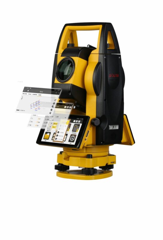
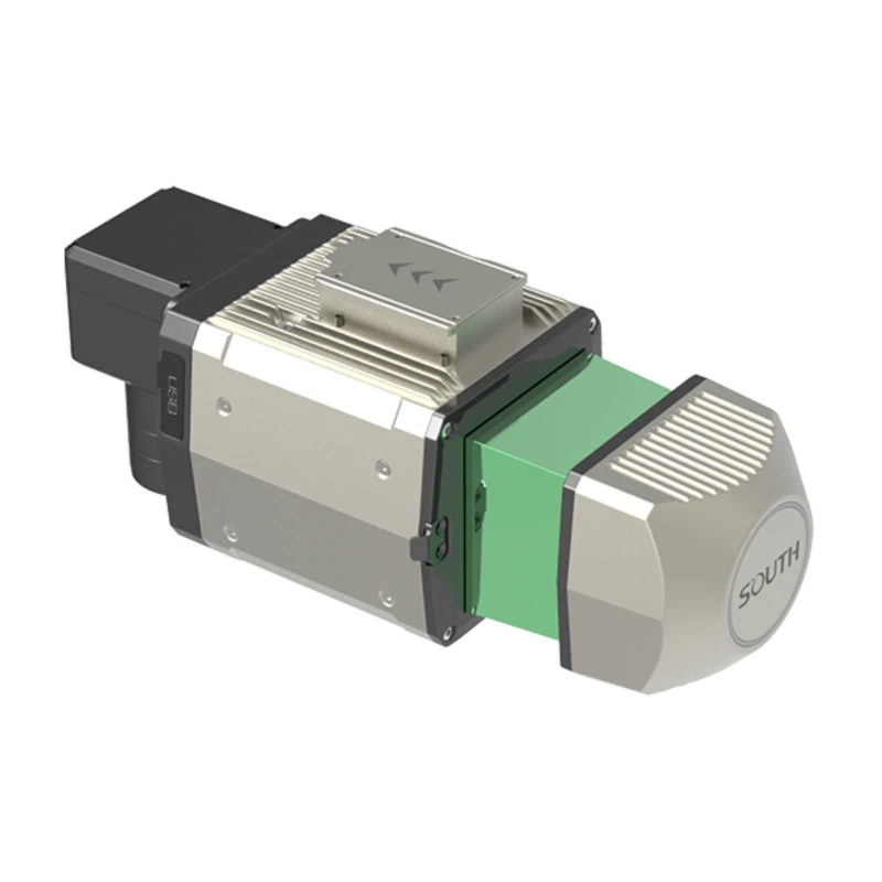
SOUTH SG130 360 Degree LiDAR Scanner
Get the best price for your setup
Contact our experts for the best possible price and configuration.
- Fast response
- Expert configuration advice
- No overpaying for features you do not need
The SOUTH SG130 is a professional multi-platform LiDAR scanner designed for aerial surveying, mobile mapping, topographic surveys and infrastructure inspection. Its integrated GNSS/IMU positioning system and configurable 360° laser scanning allow surveyors to capture detailed, georeferenced 3D point clouds from compatible drones and vehicle-mounted platforms.
With up to 800,000 measurements per second, 12 laser returns and a measurement range of up to 1,000 m on highly reflective natural targets, the SG130 is suitable for terrain mapping, forestry, construction and road surveys. The lightweight 2 kg scanner features a cable-free design with an integrated sliding mount for easier platform changes, while optional high-resolution RGB cameras support colourised point cloud mapping.
SOUTH SG130 Highlights
| Scanning field of view | Configurable up to 360° |
|---|---|
| Maximum measurement range | Up to 1,000 m on natural targets with over 80% reflectivity |
| Measurement rate | Up to 800,000 points per second |
| Laser returns | Up to 12 returns |
| System accuracy | ±3 cm horizontal and vertical under specified test conditions |
| GNSS/IMU | Integrated positioning with 500 Hz IMU update rate |
| RGB camera | 45 MP or 61 MP configurations |
| Platforms | Compatible UAV and vehicle-mounted systems |
| Weight and protection | 2 kg without camera; IP64 |
Valued customers:





Find RTK Networks
Search NTRIP providers and connect to reliable RTK correction services.
Description
SOUTH SG130 Multi-Platform LiDAR Scanner for UAV and Mobile Mapping
The SOUTH SG130 is a professional multi-platform LiDAR scanning system developed for aerial surveying, vehicle-based mapping, topographic surveys and infrastructure inspection. Combining a high-performance laser scanner with integrated GNSS and inertial navigation, it enables surveyors and engineers to capture detailed, georeferenced 3D point clouds across a wide range of environments.
Unlike LiDAR systems designed exclusively for drones, the SG130 can be installed on compatible UAVs and vehicle-mounted platforms. Its cable-free design and integrated sliding mounting system make it easier to transfer the scanner between different configurations, allowing surveying companies to use the same equipment for aerial and ground-based mapping projects.
With a configurable scanning field of view of up to 360°, up to 800,000 measurements per second and a maximum of 12 laser returns, the SG130 is suitable for surveying terrain, buildings, vegetation, roads and other infrastructure. Optional high-resolution RGB camera configurations also support the creation of colourised 3D point clouds.
One LiDAR System for Multiple Surveying Platforms
One of the main advantages of the SOUTH SG130 is its ability to work across different surveying platforms. The scanner can be installed on compatible professional drones for aerial mapping or mounted on vehicles for mobile data collection.
For land surveyors, this flexibility is useful when a project contains areas that require different measurement methods. A drone can collect elevation information across open terrain, fields and difficult-to-access locations, while a vehicle-mounted configuration can support detailed mapping along roads, industrial sites and infrastructure corridors.
The integrated sliding mount and cable-free design simplify the physical change between supported platforms. This allows companies working in surveying, construction and GIS to adapt their equipment to different project requirements without relying on a completely separate LiDAR scanner for every application.
Suitable mounting hardware, positioning configuration and calibration are required for each platform to maintain reliable measurement results.
360 Degree LiDAR Scanning for Detailed 3D Mapping
The SOUTH SG130 offers a configurable scanning field of view of up to 360°, making it suitable for collecting spatial information around the scanner. This is particularly useful for mobile mapping applications where buildings, road surfaces, vegetation and roadside structures need to be captured from different angles.
When installed on an aerial platform, the scanning configuration can be adjusted according to the intended survey. For vehicle-mounted applications, the wide scanning angle helps collect measurements of surrounding infrastructure and other visible surfaces as the vehicle travels through the area.
The scanner uses 1550 nm Class 1 laser technology and provides up to 800,000 measurements per second. This enables the collection of dense point clouds containing detailed information about terrain, structures and other surveyed objects.
The resulting data can be processed into three-dimensional models and other geospatial deliverables for use in surveying, engineering and GIS applications.
Long Range Laser Measurements for Large Survey Areas
The SG130 is designed for long-range LiDAR measurements across a variety of surveying environments. The scanner supports a maximum measurement range of up to 1,000 metres on natural targets with reflectivity above 80% under specified conditions.
For typical aerial surveying configurations, the measurement range depends on the selected laser pulse repetition rate and target reflectivity. At 600 kHz, the specified range reaches 250 metres on targets with more than 20% reflectivity and 300 metres on targets with more than 80% reflectivity. At 300 kHz, these values increase to 450 and 600 metres respectively.
This flexibility allows operators to select a configuration according to the required measurement distance and point density. Higher measurement rates are useful for detailed scanning at shorter distances, while other configurations can support greater measurement distances.
Actual performance depends on the surveyed surface, atmospheric conditions, operating platform and survey geometry. Maximum laser range should not be confused with recommended drone flight altitude.
Up to 12 Laser Returns for Forestry and Vegetation Mapping
The SOUTH SG130 supports up to 12 returns from a laser pulse, making it particularly useful when working in areas containing vegetation and complex surfaces.
When a laser pulse passes through openings in a tree canopy, it may encounter leaves, branches, lower vegetation and the ground. Multiple-return scanning allows the system to record several reflections, providing additional information about the different surfaces along the laser path.
For forestry specialists, this helps collect data for vegetation height analysis, canopy structure mapping and digital terrain model generation. Surveyors can also use multiple-return information when mapping wooded construction sites, utility corridors and environmental areas.
Ground visibility depends on vegetation density and survey conditions. Multiple returns improve the available information but do not guarantee that laser measurements will reach the ground beneath dense foliage.
Integrated GNSS and IMU for Accurate Positioning
To generate georeferenced point clouds, the SOUTH SG130 combines LiDAR measurements with integrated GNSS positioning and an inertial measurement unit. The positioning system tracks the location of the scanner, while the IMU records its orientation and movement during data collection.
The system provides a 500 Hz IMU update rate, with specified positioning accuracy of 1 cm horizontally and 2 cm vertically under reference conditions. Angular accuracy is specified at 0.006° for roll and pitch and 0.019° for heading.
By combining position, orientation and laser measurements during processing, the SG130 can generate 3D point clouds that can be aligned with project coordinates and existing survey information.
The system offers specified absolute horizontal and vertical accuracy of ±3 cm under SOUTH test conditions at 150 metres above ground level and a flight speed of 8 m/s. Actual accuracy depends on calibration, GNSS reference observations, trajectory processing and the survey environment.
For engineering and other accuracy-sensitive applications, independent ground control measurements should be used to verify the final point cloud.
Optional 45 MP and 61 MP RGB Cameras
The SOUTH SG130 supports high-resolution RGB camera configurations with 45 MP or 61 MP imaging capability. These cameras allow operators to capture photographic information alongside LiDAR measurements, supporting colourised 3D point clouds and visual interpretation of surveyed environments.
Combining LiDAR geometry with RGB imagery makes it easier to recognise roads, buildings, vegetation and other visible features in the finished point cloud. This can be particularly useful when reviewing survey results or presenting three-dimensional site information to engineers, contractors and project managers.
The camera system uses an 18 mm focal length and supports a wide 90° imaging field of view. Camera availability, resolution and the supplied configuration should be confirmed when selecting the complete scanning system.
Compact Design for Professional Surveying
With a scanner weight of approximately 2 kg without the camera and dimensions of 234 × 112 × 120 mm, the SG130 is designed for integration with professional surveying platforms.
The compact housing makes it possible to install the scanner on suitable UAV systems while also supporting vehicle-mounted configurations. Supported aerial platforms include the SOUTH SF1200, SOUTH VTOL UAV systems and compatible DJI Matrice 300 RTK, Matrice 350 RTK and Matrice 400 platforms with the correct mounting equipment.
The SG130 provides 256 GB of internal storage for collected survey data and operates with a specified power consumption of 40 W. Its IP64 enclosure provides protection against dust and splashing water, while the stated operating temperature range of -20°C to +55°C supports use in different field environments.
Before installation, operators should verify aircraft payload limits, mounting requirements, power supply and the complete weight of the selected scanner and camera configuration.
Applications in Surveying, Construction and GIS
Topographic and Land Surveying
The SG130 can capture detailed elevation data across open and uneven terrain, making it useful for topographic mapping, digital terrain model generation and land development projects. Surveyors can use processed point clouds to create contours, surface models and other spatial information for engineering and planning.
Construction and Civil Engineering
For construction companies, the SG130 provides a practical way to document existing site conditions and create 3D models of construction areas. The collected data can support earthwork analysis, terrain assessments, project planning and comparisons between survey stages.
Road and Railway Mapping
The ability to install the SG130 on a vehicle makes it particularly relevant for road and railway corridor surveys. Vehicle-mounted LiDAR can collect spatial information along routes, including road surfaces, surrounding terrain, buildings and other visible infrastructure.
Forestry and Environmental Surveys
With up to 12 laser returns, the scanner is suitable for collecting information about vegetation, tree canopies and terrain in partially wooded environments. Forestry and environmental specialists can use the resulting data to analyse vegetation height, canopy structure and ground elevation.
Utilities and Power Line Corridors
The SG130 can support the mapping of utility corridors, power line routes and surrounding vegetation. Surveyors can collect point clouds showing the spatial relationships between infrastructure, trees and terrain, providing useful information for inspection and maintenance planning.
Mining and Earthwork Projects
Mining companies and earthwork contractors can use LiDAR point clouds to document excavation areas, stockpiles and terrain surfaces. When combined with suitable processing software and survey control, this information can support volume calculations and comparisons between different survey periods.
Urban and 3D City Mapping
The combination of aerial and vehicle-mounted surveying makes the SG130 useful for collecting information about urban environments. Point clouds can support 3D building models, road corridor mapping, infrastructure documentation and GIS projects requiring detailed spatial information.
Point Cloud Processing with AcuteLas Studio
The SOUTH SG130 is supported by AcuteLas Studio, SOUTH’s LiDAR processing software for working with aerial and ground-based scanning data.
AcuteLas Studio supports processing of laser measurements and positioning information to generate georeferenced point clouds. It can also process multiple datasets, allowing surveyors to combine information collected during different flights or scanning sessions.
Available functions include point cloud optimisation, point classification, terrain modelling and orthophoto generation. These tools help transform collected measurements into practical deliverables for engineering, construction, surveying and GIS applications.
The software workflow also supports combining and checking point clouds from different survey sections. This is useful when projects involve large areas or multiple data collection sessions.
Operators should confirm the included software modules, licenses and supported export formats for their selected system configuration.
SOUTH SG130 at Global GPS Systems
The SOUTH SG130 is a versatile LiDAR solution for surveying companies, drone operators, civil engineers, GIS specialists and infrastructure professionals who need accurate three-dimensional data across different working environments.
Its combination of multi-platform mounting, configurable 360° scanning, multiple laser returns and integrated GNSS/IMU positioning makes it particularly relevant for organisations working on both aerial and mobile mapping projects.
At Global GPS Systems, we help customers select professional GNSS and LiDAR equipment suited to their surveying requirements. Contact our team for guidance on SG130 configurations, compatible UAV platforms, vehicle mounting solutions, RGB camera options and point cloud processing software.
Specifications
SOUTH SG130 Multi-Platform LiDAR System Specifications
General Specifications
| Manufacturer | SOUTH Surveying & Mapping Technology Co., Ltd. |
|---|---|
| Product Name | SOUTH SG130 |
| Model | SG130 |
| Product Series | AcuteLas Series |
| Product Type | Professional multi-platform 3D LiDAR scanning system |
| Measurement Technology | Long-range pulsed laser scanning with integrated GNSS and inertial navigation |
| Supported Survey Platforms | Multirotor UAVs, VTOL UAVs and vehicle-mounted mobile mapping systems |
| Maximum Laser Measurement Range | 1,000 m at greater than 80% target reflectivity, according to the V.202509 datasheet |
| Maximum Measurement Rate | 800,000 points/second |
| Laser Pulse Repetition Frequencies | 300 kHz, 400 kHz and 600 kHz |
| Scanning Field of View | Up to 360°, selectable |
| Maximum Number of Laser Returns | 12 |
| Laser Wavelength | 1,550 nm |
| Laser Safety Classification | Class 1, IEC 60825-1:2014 |
| Absolute System Accuracy | ±3 cm horizontally and vertically, under the manufacturer's specified test conditions |
| Integrated Storage | 256 GB flash drive |
| RGB Camera Options | 45 MP or 61 MP |
| Weight | 2 kg, according to the V.202509 datasheet |
| Dimensions | 234 × 112 × 120 mm, excluding camera |
| Operating Temperature | -20°C to +55°C |
| Ingress Protection | IP64 |
| Power Consumption | 40 W |
| Mounting Design | Integrated slider-style mounting design with cable-free platform switching concept |
| Primary Applications | Airborne surveying, vehicle-based mapping, topographic surveying, forestry, infrastructure inspection, power line surveying, railway mapping, archaeology, construction and mine surveying |
LiDAR Scanner Specifications
| Scanner Type | Long-range 3D laser scanner |
|---|---|
| Measurement Principle | Pulsed laser ranging |
| Laser Wavelength | 1,550 nm |
| Maximum Published Measurement Range | 1,000 m at target reflectivity greater than 80% |
| Alternative Published Measurement Range | 900 m in earlier manufacturer literature |
| Maximum Point Measurement Rate | 800,000 points/second |
| Laser Pulse Repetition Rate | 300 kHz / 400 kHz / 600 kHz |
| Maximum Scanning Field of View | 360° |
| Field of View Configuration | Selectable; usable angular coverage depends on mounting and platform integration |
| Maximum Laser Returns | 12 |
| Single-Measurement Accuracy | 10 mm |
| Repeat Measurement Accuracy | 5 mm |
| Laser Safety Class | Class 1 |
| Laser Safety Standard | IEC 60825-1:2014 |
| Multiple-Return Measurement | Supported |
| Vegetation Penetration | Multiple laser returns support extraction of ground points beneath vegetation where laser pulses reach lower surfaces |
| Point Cloud Output | Georeferenced 3D point cloud data after positioning and orientation processing |
| Survey Scanning Modes | Airborne and vehicle-mounted scanning configurations |
Laser Range and Flight Height Comparison
| Specification | 600 kHz | 400 kHz | 300 kHz |
|---|---|---|---|
| Laser Pulse Repetition Rate | 600,000 pulses/second | 400,000 pulses/second | 300,000 pulses/second |
| Maximum Range at >20% Reflectivity | 250 m | 350 m | 450 m |
| Maximum Range at >80% Reflectivity | 300 m | 450 m | 600 m |
| Typical Flying Height | 120 m | 200 m | 250 m |
Measurement Accuracy and Survey Performance
| Absolute Horizontal Accuracy | ±3 cm |
|---|---|
| Absolute Vertical Accuracy | ±3 cm |
| Absolute Accuracy Test Height | 150 m above ground level |
| Absolute Accuracy Test Speed | 8 m/s |
| Laser Single-Measurement Accuracy | 10 mm |
| Laser Repeat Measurement Accuracy | 5 mm |
| Post-Processed Horizontal Position Accuracy | 0.01 m |
| Post-Processed Vertical Position Accuracy | 0.02 m |
| Roll Accuracy | 0.006° |
| Pitch Accuracy | 0.006° |
| Heading Accuracy | 0.019° |
| IMU Update Frequency | 500 Hz |
| Maximum Measurement Rate | 800,000 points/second |
| Maximum Laser Returns | 12 |
| Survey Accuracy Conditions | Published absolute accuracy is based on SOUTH test conditions of 150 m above ground level and 8 m/s flight speed |
| Measurement Range Conditions | Manufacturer range values represent typical performance under average measurement conditions |
| Accuracy Qualification | Actual accuracy depends on target reflectivity, atmosphere, positioning data, mounting calibration, platform movement and survey processing |
GNSS and Inertial Navigation Specifications
| Navigation Technology | Integrated GNSS and inertial measurement unit (IMU) |
|---|---|
| Positioning and Orientation Data | Position, roll, pitch and heading measurements for direct georeferencing |
| GNSS/IMU Positioning Accuracy | 0.01 m horizontal and 0.02 m vertical |
| IMU Roll Accuracy | 0.006° |
| IMU Pitch Accuracy | 0.006° |
| IMU Heading Accuracy | 0.019° |
| IMU Update Rate | 500 Hz |
| Trajectory Post-Processing | Supported through AcuteLas Studio |
| Multiple Flight Trajectory Processing | Supported |
| Point Cloud Georeferencing | LiDAR measurements are combined with processed position and orientation data |
| Point Cloud Optimisation | Laser, navigation and orientation data can be refined through processing workflows |
| Ground Control Point Workflows | Point cloud optimisation can be performed with or without ground control points, according to manufacturer software documentation |
| Navigation Configuration | The V.202509 datasheet specifies 0.006° roll/pitch, 0.019° heading and 500 Hz; earlier manufacturer documentation lists alternative IMU configurations |
RGB Mapping Camera Specifications
| Camera Type | RGB mapping camera |
|---|---|
| Available Camera Resolutions | 45 MP / 61 MP |
| Published Focal Length | 18 mm |
| Published Image Sensor Size | 36 × 24 mm |
| Published Image Dimensions | 8192 × 5460 pixels, specified alongside the 45 MP configuration |
| Published Pixel Size | 4.4 µm |
| Camera Field of View | 90° |
| Ground Sampling Distance at 200 m | 4.9 cm, for the manufacturer-specified camera configuration |
| Camera Integration | Optional/configuration-dependent RGB imaging payload |
| RGB Point Cloud Colourisation | Supported through compatible processing software |
| Orthophoto Production | Supported with suitable image data and processing workflow |
| Camera Configuration Qualification | The published sensor dimensions, image dimensions, pixel size and ground sampling distance do not independently establish the specifications of every available 61 MP camera variant |
Mechanical and Physical Specifications
| Design | Compact multi-platform LiDAR scanning payload |
|---|---|
| Length | 234 mm |
| Width | 112 mm |
| Height | 120 mm |
| Overall Dimensions | 234 × 112 × 120 mm |
| Dimension Reference | Without camera |
| Weight | 2 kg |
| Mounting Design | Integrated slider-style mounting interface |
| Platform Switching | Cable-free design concept for switching between compatible aerial and ground-based platforms |
| UAV Installation | Supported with compatible payload mounting hardware |
| Vehicle Installation | Supported with compatible vehicle mounting and electrical integration |
| Payload Configuration | Laser scanner with integrated navigation components and optional RGB camera configuration |
| Transport Arrangement | Dependent on the supplied package and accessories |
Power and Environmental Specifications
| Power Consumption | 40 W |
|---|---|
| Input Voltage | Not specified in the manufacturer V.202509 SG130 datasheet |
| Power Source | Compatible platform power supply or dedicated external supply according to installation configuration |
| Operating Temperature | -20°C to +55°C |
| Ingress Protection Rating | IP64 |
| Dust Protection | IP6X — dust-tight |
| Water Protection | IPX4 — protection against splashing water |
| Laser Safety Classification | Class 1 |
| Laser Safety Standard | IEC 60825-1:2014 |
| Laser Wavelength | 1,550 nm |
| Storage Temperature | Not specified in the manufacturer V.202509 datasheet |
| Operating Humidity | Not specified in the manufacturer V.202509 datasheet |
Supported Platforms and Mounting Compatibility
| Multi-Platform Operation | Supported |
|---|---|
| Multirotor UAV Mounting | Supported |
| VTOL UAV Mounting | Supported |
| Vehicle-Mounted Mapping | Supported |
| SOUTH SF1200 Quadcopter | Manufacturer-documented platform |
| SOUTH VTOL UAV | Manufacturer-documented platform category |
| DJI Matrice 300 RTK | Manufacturer-documented compatible platform |
| DJI Matrice 350 RTK | Manufacturer-documented compatible platform |
| DJI Matrice 400 | Manufacturer-documented platform in the V.202509 SG130 brochure |
| SUV / Ground Vehicle Integration | Manufacturer-documented mobile mapping platform type |
| Mounting Requirements | Compatible slider mounting assembly, power supply, payload clearance and navigation integration |
| Platform Compatibility Qualification | Installation hardware and compatibility must be confirmed for the specific aircraft or vehicle configuration |
Data Acquisition and Storage
| Internal Storage | 256 GB flash drive |
|---|---|
| Laser Data Acquisition | Up to 800,000 measured points per second |
| Multiple-Return Acquisition | Up to 12 laser returns |
| GNSS/IMU Data | Position and orientation information for post-processing |
| RGB Image Acquisition | Supported when configured with compatible RGB camera |
| Georeferenced Point Cloud Generation | Supported |
| Multi-Flight Data Processing | Supported through AcuteLas Studio |
| Flight Strip Data Processing | Supported |
| Point Cloud Classification | Supported through compatible processing software |
| Ground Point Extraction | Supported |
| Orthophoto Generation | Supported through compatible imaging and processing workflows |
| Point Cloud Data Optimisation | Supported |
| Software-Compatible Point Cloud Formats | AcuteLas Studio V3.0 documents LAS/SLAS, PLY, E57, PCD and XYZ support; exact SG130 raw-data export formats are not specified |
Software and Data Processing
| Manufacturer Processing Software | AcuteLas Studio |
|---|---|
| Documented Software Version | AcuteLas Studio V3.0 |
| Airborne LiDAR Data Processing | Supported |
| Terrestrial LiDAR Data Processing | Supported by compatible software modules |
| Mobile Mapping Data Processing | Supported by compatible software modules |
| Multi-Flight Data Import | Supported |
| GNSS/IMU Trajectory Processing | Supported |
| Flight Strip Division | Supported |
| Multi-Flight Data Fusion | Supported |
| One-Click Airborne Point Cloud Processing | Supported |
| Point Cloud Optimisation | Supported |
| Point Cloud Noise Removal | Supported |
| Point Cloud Smoothing | Supported |
| Point Cloud Colourisation | Supported |
| Point Cloud Classification | Automatic and manual classification functions |
| Ground Point Extraction | Supported |
| Digital Elevation Model Generation | Supported |
| Digital Elevation Model Editing | Supported |
| Digital Surface Model Generation | Supported |
| Orthophoto Generation | Supported |
| Point Cloud Quality Inspection | Supported |
| Accuracy Reports | Supported |
| Coordinate Transformation | Supported |
| 3D Distance Measurement | Supported |
| Area and Volume Measurement | Supported |
| Cross-Section Analysis | Supported |
| Power Line Surveying | Supported through applicable application modules |
| Mine Volume Analysis | Supported through applicable application modules |
| Software Licensing | Module availability depends on the supplied AcuteLas Studio edition and licence |
Surveying and Mapping Applications
| Airborne Topographic Surveying | High-density georeferenced terrain and surface mapping |
|---|---|
| Mobile Mapping | Vehicle-based 3D LiDAR data acquisition |
| Digital Terrain Modelling | Terrain extraction using classified ground points |
| Digital Surface Modelling | Surface elevation mapping |
| Forestry Surveying | Vegetation structure and terrain measurement |
| Vegetation Penetration | Multiple laser returns assist in recording lower vegetation layers and ground surfaces |
| Energy and Utilities | Power transmission and utility corridor mapping |
| Power Line Surveying | 3D corridor data collection and clearance analysis through compatible software |
| Railway Surveying | Railway corridor mapping and terrain documentation |
| Construction and Engineering | Site mapping, spatial measurement and terrain analysis |
| Mining | Mine terrain mapping and volume measurement |
| Archaeology | Terrain feature detection and 3D site documentation |
| Urban Mapping | 3D spatial data acquisition for buildings and infrastructure |
| Land Surveying | Georeferenced elevation and terrain data capture |
| Road Corridor Mapping | Aerial or vehicle-based transport corridor surveying |
| Environmental Surveying | Vegetation, landform and landscape documentation |
Package Contents and Available Components
| Item | Quantity | Notes |
|---|---|---|
| SOUTH SG130 LiDAR Scanner | 1 system | Main multi-platform laser scanning payload |
| GNSS/IMU Navigation System | Configuration-dependent | Navigation hardware according to the selected SG130 configuration |
| RGB Mapping Camera | Optional / configuration-dependent | 45 MP or 61 MP camera configuration |
| Internal Storage | 1 integrated storage unit | 256 GB flash drive |
| Slider Mounting Assembly | Configuration-dependent | Platform mounting design described in manufacturer documentation |
| UAV Mounting Accessories | Configuration-dependent | Specific aircraft hardware must be confirmed |
| Vehicle Mounting Accessories | Configuration-dependent | Required for vehicle-mounted installations |
| Electrical and Connection Accessories | Configuration-dependent | Verify supplied power and connection components |
| AcuteLas Studio Software | Configuration-dependent | Processing software and licence inclusion to be confirmed |
| Protective Transport Case | Not confirmed | Not itemised in the reviewed manufacturer datasheet |
| User Documentation | Configuration-dependent | Manufacturer datasheet and applicable installation documentation |
| UAV or Vehicle Platform | Not confirmed as included | Supplied separately unless specified as part of a complete mapping system |
Manufacturer Documentation and Specification Notes
| Product Page | Global GPS Systems – SOUTH SG130 |
|---|---|
| Product Datasheet | SOUTH SG130 LiDAR Datasheet (PDF) |
| Datasheet Version | V.202509 |
| Manufacturer Product Specifications | SOUTH AcuteLas SG130 Manufacturer Product Page |
| Processing Software Documentation | AcuteLas Studio V3.0 Software Datasheet (PDF) |
| Maximum Range Revision | Manufacturer V.202509 specifications list a maximum measuring range of 1,000 m at greater than 80% reflectivity. Earlier documentation lists 900 m. |
| Absolute Accuracy Revision | The V.202509 datasheet lists ±3 cm horizontal and vertical absolute accuracy under the specified test conditions; earlier manufacturer documentation lists ±5 cm. |
| Ranging Accuracy Revision | The V.202509 datasheet lists 10 mm single-measurement accuracy and 5 mm repeat accuracy; earlier documentation lists 15 mm and 10 mm respectively. |
| Camera Specification Revision | The V.202509 datasheet lists 45 MP and 61 MP camera options. Earlier product literature also lists a 26 MP camera configuration. |
| Measuring Range Qualification | Maximum measuring range depends on laser pulse repetition frequency, target reflectivity and environmental conditions. |
| Absolute Accuracy Qualification | Manufacturer test conditions for the published ±3 cm accuracy specify 150 m above ground level and 8 m/s flight speed. |
| Field of View Qualification | 360° scanning is selectable; mechanical mounting and platform integration may limit usable scanning coverage. |
| Model Identification | These specifications apply to the SOUTH SG130 and should not be substituted with specifications from the SG130 Lite, SA130 or SA130 Pro. |
Specifications and package contents may vary by configuration, region or manufacturer update. Always check the current configuration before ordering.
Reviews (0)
Only logged in customers who have purchased this product may leave a review.
FAQ
SOUTH SG130 Multi-Platform LiDAR Scanner FAQ
General Information and Key Features
What is the SOUTH SG130 LiDAR scanner?
The SOUTH SG130 is a professional multi-platform LiDAR scanning system designed for high-precision 3D mapping, topographic surveying and geospatial data collection. It combines a long-range laser scanner with GNSS and inertial navigation technology to produce georeferenced 3D point clouds. Unlike airborne-only LiDAR systems, the SG130 is designed for integration with both unmanned aerial vehicles (UAVs) and ground-based vehicles. It supports up to 360-degree scanning, 12 laser returns and a maximum measurement rate of 800,000 points per second.
What are the main features of the SOUTH SG130?
The SOUTH SG130 features a long-range 1550 nm laser scanner, selectable scanning frequencies of 300, 400 and 600 kHz, a measurement rate of up to 800,000 points per second and a configurable field of view of up to 360 degrees. It supports up to 12 laser returns, high-precision GNSS/INS positioning, 256 GB of internal storage and optional high-resolution RGB imaging configurations. The scanner weighs approximately 2 kg and features a cable-free design with an integrated sliding mounting interface for switching between compatible aerial and vehicle platforms.
What is the maximum scanning range of the SOUTH SG130?
The SOUTH SG130 has a maximum specified measuring range of 1,000 meters for natural targets with reflectivity above 80 percent. Its practical detection range depends on the selected laser pulse repetition rate and target reflectivity. At 300 kHz, the specified range reaches 450 meters for targets with more than 20 percent reflectivity and 600 meters for targets with more than 80 percent reflectivity. At 600 kHz, these distances are approximately 250 and 300 meters respectively. Actual performance depends on environmental conditions and surface characteristics.
How accurate is the SOUTH SG130 LiDAR system?
The SOUTH SG130 has a specified absolute horizontal and vertical system accuracy of approximately ±3 cm under the manufacturer's reference test conditions of 150 meters above ground level and a flight speed of 8 m/s. The laser scanner provides a specified single-measurement ranging accuracy of 10 mm and repeatability of 5 mm. Actual survey accuracy depends on GNSS conditions, trajectory processing, system calibration, scanning geometry and the use of suitable survey control.
How many laser points per second can the SOUTH SG130 capture?
The SOUTH SG130 can capture up to 800,000 laser measurement points per second. The scanner supports selectable laser pulse repetition rates of 300, 400 and 600 kHz, allowing operators to balance measurement range and point density according to project requirements. Higher measurement density can improve the representation of small objects, vegetation and infrastructure. Actual point cloud density depends on the scanning configuration, flight or vehicle speed, distance to targets and survey geometry.
What makes the SOUTH SG130 different from a conventional airborne LiDAR scanner?
The SOUTH SG130 is designed as a multi-platform LiDAR system rather than a scanner restricted to airborne surveying. Its configurable field of view of up to 360 degrees, cable-free design and integrated sliding interface allow it to be transferred between compatible drone and vehicle platforms. This enables both aerial mapping and ground-based mobile mapping workflows using one LiDAR platform. The system is particularly useful for surveying companies that need to collect geospatial data across different project environments.
Applications and Professional Surveying
What industries use the SOUTH SG130 LiDAR scanner?
The SOUTH SG130 is suitable for land surveying, geospatial mapping, civil engineering, construction, forestry, mining, railway surveying, energy utilities, archaeology and infrastructure management. Surveyors, GIS specialists, engineering consultants and mobile mapping professionals can use the system to collect detailed 3D measurements of terrain, buildings, vegetation and infrastructure. Its multi-platform design makes it suitable for organizations working with both UAV mapping and vehicle-based surveying.
Can the SOUTH SG130 be used for topographic and land surveying?
Yes. The SOUTH SG130 is designed for professional topographic surveying, terrain mapping and land measurement. It collects georeferenced 3D point clouds that can be processed into digital terrain models (DTMs), digital surface models (DSMs), elevation maps and contour lines. Its long-range measurement capability and multiple-return technology are useful for mapping uneven terrain, large construction sites and areas with vegetation. Final mapping accuracy depends on the survey configuration and processing workflow.
Is the SOUTH SG130 suitable for forestry and vegetation mapping?
Yes. The SOUTH SG130 supports up to 12 laser returns, allowing it to collect information from multiple reflective surfaces along the same laser pulse. In forest environments, these reflections can originate from tree canopies, branches, understory vegetation and exposed ground. The resulting point clouds can support canopy height analysis, forest structure mapping, vegetation classification, terrain model generation and forest inventory workflows. Ground point detection depends on canopy density, flight configuration and available gaps in the vegetation.
Can the SOUTH SG130 be used for power line and utility corridor mapping?
Yes. The SOUTH SG130 can collect detailed 3D measurements of power transmission corridors, utility infrastructure and surrounding vegetation. The point cloud data can support the identification of transmission towers, conductors, ground surfaces and nearby obstacles. When processed using suitable LiDAR analysis software, this information can be used for corridor mapping, vegetation clearance assessments, infrastructure documentation and maintenance planning.
Can the SOUTH SG130 be used for mining and construction surveys?
Yes. The SOUTH SG130 is suitable for open-pit mining surveys, quarry mapping, earthworks measurement, construction site documentation and stockpile analysis. Its high-density LiDAR data can be used to create terrain surfaces, calculate material volumes, measure excavation areas and compare changes between survey dates. The ability to operate on aerial and ground-based platforms provides additional flexibility when surveying complex construction sites or mining environments.
Can the SOUTH SG130 be used for railway surveying and archaeological mapping?
Yes. SOUTH identifies railway surveying and archaeology among the SG130's professional applications. For railway projects, its point clouds can support corridor documentation, surrounding terrain mapping and infrastructure analysis. In archaeology, LiDAR measurements can help identify subtle terrain features, historic earthworks and landscape structures that may be difficult to recognize in conventional imagery. Interpretation requires appropriate point cloud classification and terrain visualization methods.
Technical Specifications and Platform Compatibility
Which drones and vehicles are compatible with the SOUTH SG130?
The SOUTH SG130 is designed for integration with UAVs and ground-based vehicles. SOUTH identifies the SOUTH SF1200 quadcopter, SOUTH VTOL UAV platforms and DJI Matrice 300 RTK, Matrice 350 RTK and Matrice 400 RTK as supported aerial platforms in its product documentation. Vehicle-based installations are also possible through compatible mounting and positioning configurations. Integration must account for payload capacity, mounting hardware, electrical connections and supported control interfaces.
How much does the SOUTH SG130 weigh and what are its dimensions?
The SOUTH SG130 weighs approximately 2 kg and measures 234 × 112 × 120 mm without the camera. Its relatively compact housing is designed for installation on compatible professional drones and mobile mapping vehicles. The total installed payload weight can increase when RGB cameras, mounting hardware, cables and additional accessories are included. Aircraft and vehicle integrations should be checked against the complete system weight and power requirements.
Does the SOUTH SG130 provide full 360-degree LiDAR scanning?
Yes. The SOUTH SG130 supports a selectable scanning field of view of up to 360 degrees. This allows the sensor to capture measurements in multiple directions around the scanning axis, making it suitable for both aerial surveying and vehicle-mounted mapping. The available scanning coverage depends on the selected configuration and installation orientation. When integrated into a moving platform, mounting geometry and physical obstructions can affect the effective field of view.
Does the SOUTH SG130 include GNSS and an inertial navigation system?
Yes. The SOUTH SG130 combines laser scanning with high-precision GNSS and inertial navigation technology. The published positioning specifications include horizontal accuracy of 0.01 m, vertical accuracy of 0.02 m, roll and pitch accuracy of 0.006 degrees, and heading accuracy of 0.019 degrees. The inertial measurement system has a specified update rate of 500 Hz. These values describe the positioning subsystem under suitable conditions and should not be interpreted as guaranteed final point cloud accuracy.
Does the SOUTH SG130 support RGB cameras for colorized point clouds?
Yes. The SOUTH SG130 supports high-resolution RGB imaging configurations, with the manufacturer's current datasheet identifying 45 MP and 61 MP camera options. The camera specifications include an 18 mm focal length, a full-frame sensor configuration and an approximately 90-degree field of view. Camera imagery can be combined with georeferenced LiDAR measurements during processing to create true-color 3D point clouds and support orthophoto generation.
What laser technology and safety classification does the SOUTH SG130 use?
The SOUTH SG130 uses a 1550 nm laser scanner and is specified as a Class 1 laser product under IEC 60825-1:2014. This classification indicates that the laser emission complies with the applicable Class 1 limits under the manufacturer's specified operating conditions. The scanner uses multiple-return laser measurement technology to collect spatial information from different surfaces. Operators should follow the manufacturer's installation, operating and laser safety instructions.
What are the environmental protection and power specifications of the SOUTH SG130?
The SOUTH SG130 has an IP64 ingress protection rating, a specified operating temperature range of -20°C to +55°C and power consumption of approximately 40 W. IP64 provides protection against dust ingress and splashing water, but does not make the scanner waterproof or suitable for immersion. Operators should verify the electrical supply, thermal conditions and environmental limitations of the complete LiDAR and carrier platform installation.
Data Processing, Survey Performance and Operation
Which software is used to process SOUTH SG130 LiDAR data?
The SOUTH SG130 is supported by SOUTH AcuteLas Studio software for processing aerial and ground-based LiDAR data. The software provides workflows for positioning and orientation processing, combining multiple survey datasets, flight strip management, point cloud optimization, point cloud classification and orthophoto generation. AcuteLas Studio can also process multiple datasets in batches, making it suitable for projects involving several flights or survey sessions.
What mapping products can the SOUTH SG130 generate?
The SOUTH SG130 collects laser measurements and positioning information that can be processed into georeferenced 3D point clouds. Depending on the survey configuration and processing workflow, these datasets can be used to produce classified point clouds, ground point datasets, digital terrain models (DTMs), digital surface models (DSMs), elevation maps and terrain profiles. With a compatible RGB camera, colorized point clouds and orthophotos can also be generated. These outputs are suitable for GIS, surveying, engineering and infrastructure applications.
How does the 12-return LiDAR technology of the SOUTH SG130 work?
The SOUTH SG130 can record up to 12 laser returns from an emitted pulse when multiple reflective surfaces are encountered. A laser pulse travelling through vegetation, for example, may generate returns from the upper canopy, branches, lower vegetation and exposed ground. Multiple-return measurements can improve the amount of vertical information collected in complex environments and help with ground point extraction. The number of valid returns depends on the surfaces encountered and the conditions during scanning.
What is the recommended flight altitude for SOUTH SG130 aerial LiDAR surveying?
The SOUTH SG130 manufacturer specifies typical flight heights of approximately 120 meters at 600 kHz, 200 meters at 400 kHz and 250 meters at 300 kHz. These reference configurations balance laser pulse repetition rate, measurement range and survey coverage. The appropriate altitude for an actual project depends on point density requirements, terrain, vegetation, required accuracy, aircraft capability and local aviation restrictions. Maximum laser measuring range should not be interpreted as a recommended flight altitude.
Can the SOUTH SG130 process multiple flights or survey sessions together?
Yes. SOUTH AcuteLas Studio supports importing and processing multiple LiDAR datasets within a single workflow. Its functions include processing positioning and orientation data from several flights, managing flight strips and combining point clouds from different survey sessions. This is particularly useful for large-area mapping projects where several flights or vehicle-based surveys are needed to cover the entire site. Consistent coordinate systems and suitable quality control are important when combining datasets.
Can the SOUTH SG130 generate orthophotos and classified point clouds?
Yes. SOUTH AcuteLas Studio provides point cloud classification, ground point extraction and orthophoto generation capabilities for compatible SG130 survey data. LiDAR measurements can be classified into terrain and other object categories, while imagery from a compatible RGB camera can be processed into orthophotos. These datasets support topographic mapping, vegetation analysis, construction documentation, GIS applications and engineering design.
How much onboard storage does the SOUTH SG130 have?
The SOUTH SG130 includes 256 GB of onboard flash storage for recording LiDAR measurements and associated survey data. Actual storage requirements depend on scan duration, measurement frequency, recorded returns, camera acquisition settings and the number of survey sessions. Operators should check the available storage capacity before beginning a project and regularly transfer and back up survey data to maintain a reliable processing workflow.
 GPS & GNSS
 Total Stations
 Data collectors
 Software
 Correction services
 Machine control
 External radio
 Marine
 Accessories
Reviews
There are no reviews yet