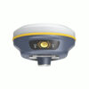
The South Insight V2 Receiver
The South Insight V2 RTK GNSS receiver sets a new standard for land surveying equipment. With integrated GNSS, a high-performance IMU tilt sensor, and AR technology, this palm-sized device ensures fast, precise, and effortless stakeouts. Its cutting-edge features include virtual guidelines, real-time altitude calculations, and an ultra-long-range UHF radio module powered by “Farlink” technology. Ideal for both surveying and construction, the GNSS receiver with AR stakeout simplifies complex tasks and delivers unmatched accuracy.
| ✅ Channels |
1598 |
| ✅ IMU Tilt Sensor |
60º |
| ❌ Internet Modem |
None |
| ✅ UHF Radio |
410 – 470MHz |
| GPS |
L1C/A, L2C, L2P, L5 |
| GLONASS |
L1C/A, L1P, L2C/A, L2P |
| GALILEO |
E1, E5A, E5A, E5AltBOC*, E6 |
| BEIDOU |
B1, B2, B3 |
Introducing the South Insight V2 Rover Set: Revolutionizing Land Surveying and Construction
The South Insight V2 rover set redefines precision and efficiency for professionals in land surveying and construction. Designed with cutting-edge technology, this compact yet powerful GNSS rover set for land surveying ensures accurate results even in the most challenging environments. Whether you’re marking boundaries, measuring topography, or laying the foundation for a construction project, the South Insight V2 is your ultimate companion.
Key Features of the South Insight V2 GNSS Rover Set
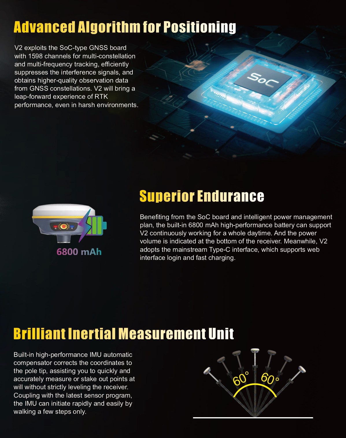
Exceptional GNSS Performance with IMU Tilt Sensor
Equipped with a high-performance IMU tilt compensation system, the South Insight V2 eliminates the need to keep the pole perfectly vertical. This feature ensures faster measurements and accurate readings, even on uneven terrain or obstructed sites. Forget the hassle of repeated adjustments—the GPS set with IMU tilt sensor adapts effortlessly to your workflow.
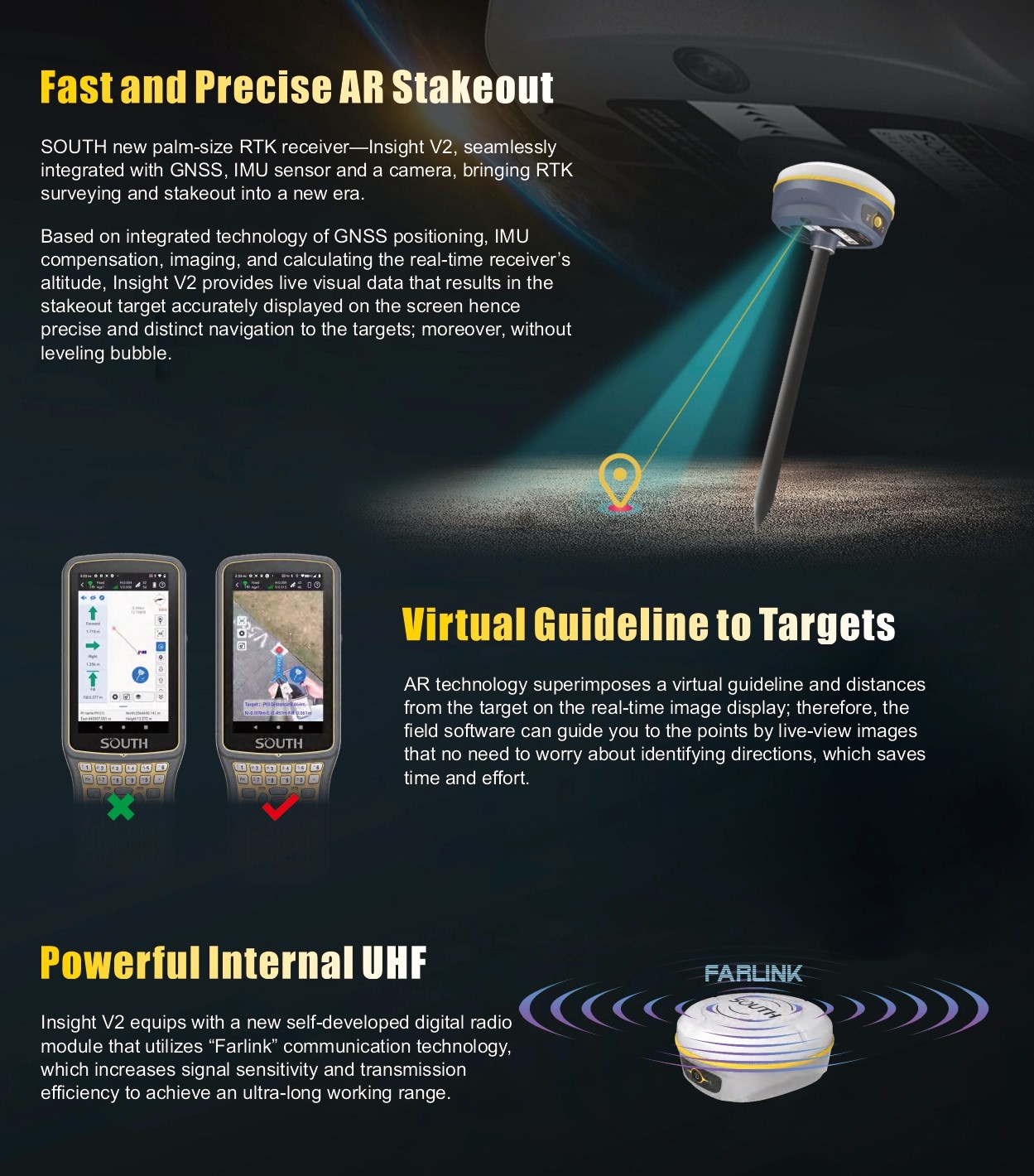
Advanced AR Stakeout Technology
The built-in augmented reality (AR) technology takes precision to a new level. Visualize stakeouts directly on your device for faster and more intuitive operations. This innovative feature ensures that complex tasks, such as boundary demarcations and construction layouts, are completed with unmatched accuracy and speed.
Unmatched Connectivity and Range
With the ultra-long-range UHF radio module powered by “Farlink” technology, the South Insight V2 rover set maintains strong connections over vast distances. Whether working in urban or remote areas, you can trust this GNSS set for construction to deliver consistent results.
How the South Insight V2 Creates Solutions for Common Challenges
- Challenge: Maintaining accuracy in difficult terrains and obstructed environments.
Solution: The IMU tilt compensation feature ensures precise measurements without needing a perfectly vertical pole.
- Challenge: Time-consuming and complex stakeout processes.
Solution: AR technology simplifies and speeds up stakeout tasks, allowing you to focus on critical project milestones.
- Challenge: Limited connectivity in remote areas.
Solution: The Farlink technology offers reliable communication and performance over long distances.
Why Choose the South Insight V2 GNSS Rover Set?
The South Insight V2 combines reliability, advanced technology, and user-friendly design to meet the demands of modern professionals. Its palm-sized portability doesn’t compromise on functionality, making it a go-to land surveying set for experts worldwide. Whether you’re surveying land, managing construction layouts, or conducting topographic assessments, this GPS set for construction delivers unparalleled results.
Key Benefits
- Faster and more accurate measurements.
- Simplified operations with AR stakeout technology.
- Reliable performance in any environment.
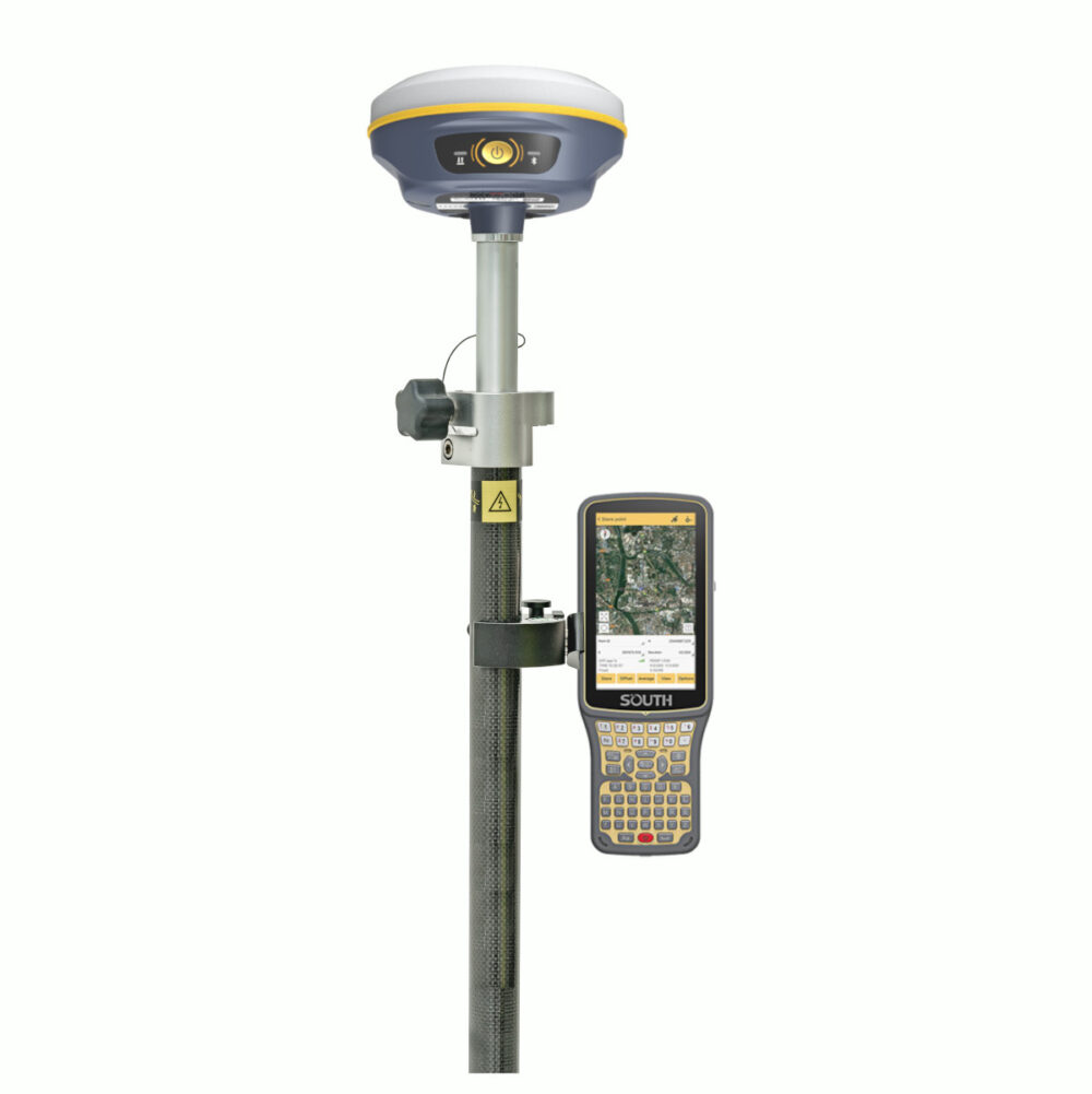
Included Accessories
The South Insight V2 rover set comes with essential accessories to maximize your productivity:
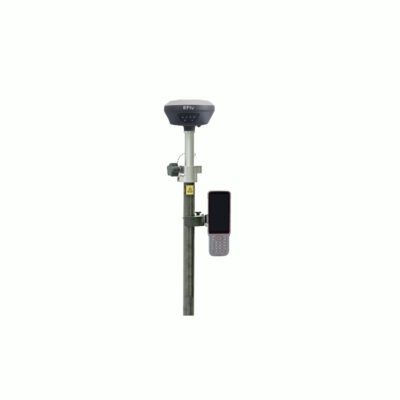
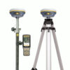
- South H6 Data Collector: The South H6 is a powerful, user-friendly device that streamlines data collection and integration with the South Insight V2.
- SurvStar Software: The SurvStar software is a intuitive and efficient software designed for seamless operation and data management.
- Telescopic Pole and Controller Bracket: Built for stability and flexibility, these accessories enhance your setup and are perfect for various environments.
While these accessories provide an all-in-one solution, they can be customized to fit your specific needs. Swap out the telescopic pole, controller bracket, or other components with compatible accessories to tailor the set to your projects.


Reviews
There are no reviews yet