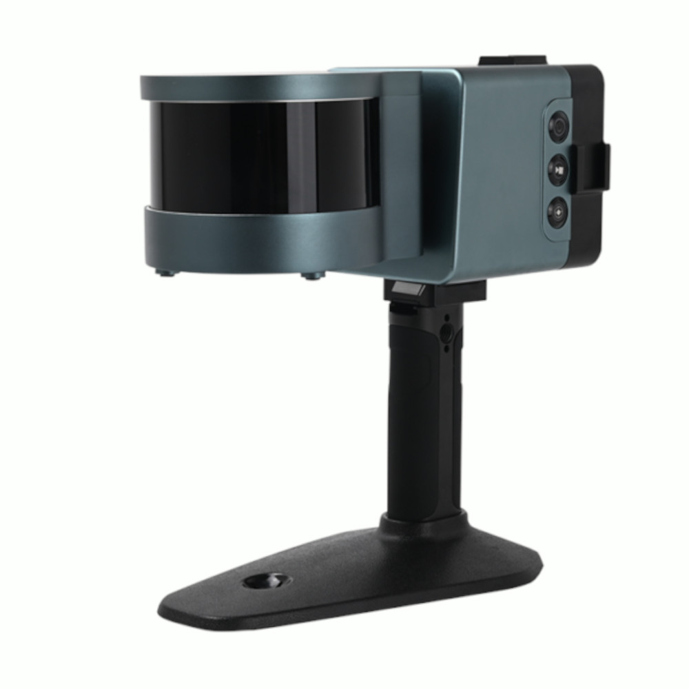
MANAGE YOUR RTK - CONNECT ANY NETWORK

Satlab Cygnus

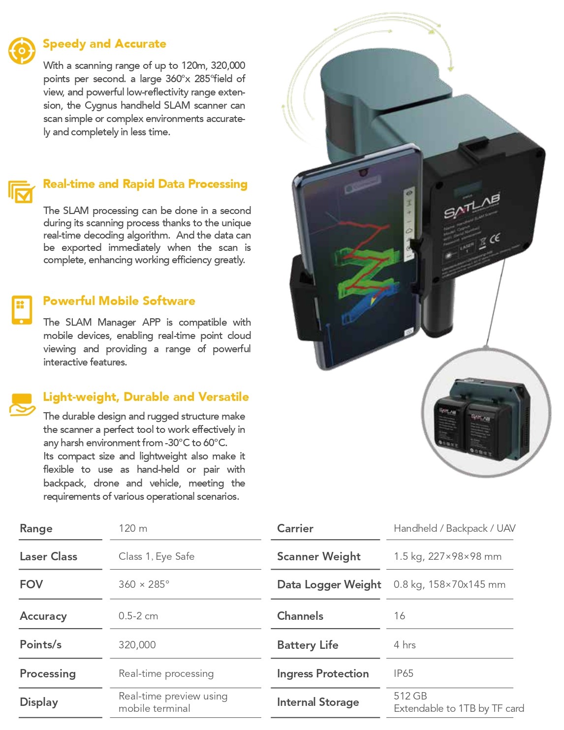
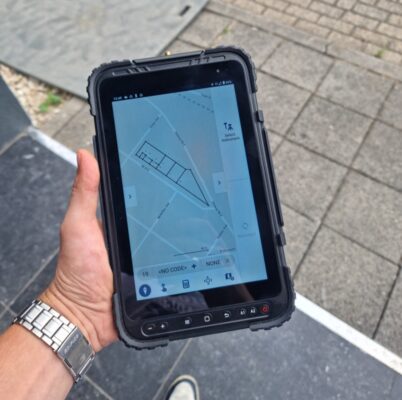
Experience high-efficiency 3D mapping with the Satlab Cygnus, a handheld SLAM Lidar Scanner that offers fast, accurate data acquisition even in GNSS-denied environments. Ideal for construction, mining, forestry, and underground applications, the Satlab Cygnus Lidar Scanner processes real-time data and simplifies post-processing for streamlined workflows.

Datasheets and manuals

RECOMMENDED DATA COLLECTORS: 

RECOMMENDED SOFTWARE: 

Satlab Cygnus

SKU: satlab-cygnus Categories: ,
Brand:Satlab

Global GPS Systems
What Our Clients Say
4.73 store rating (442 reviews) | 4.72 product rating

Ads1

MANAGE YOUR RTK - CONNECT ANY NETWORK

Description

Satlab Cygnus Product Review

SLAM Lidar System

Satlab Cygnus: The Ultimate Handheld LiDAR Scanner for Professional 3D Mapping

Revolutionize Your Workflow with the Satlab Cygnus

If you’re searching for a cutting-edge handheld Lidar Scanning System designed to simplify 3D data collection while delivering pinpoint accuracy, look no further than the Satlab Cygnus. Built on the foundation of advanced SLAM Lidar technology, the Satlab Cygnus is engineered to perform in environments where traditional GNSS systems fall short.

Lidar Scanning System

Why Choose the Satlab Cygnus?

Say Goodbye to GNSS Limitations

Traditional LiDAR systems often struggle in GPS-denied environments like underground tunnels, dense forests, or indoor settings. The Satlab Cygnus Lidar Scanner breaks through these limitations by using SLAM Lidar System technology to accurately map spaces without the need for GNSS signals.

Real-Time Data Processing

No more waiting around for data to render. The Satlab Cygnus provides fast, real-time previews of scanned environments, enabling immediate validation and reducing the need for repeat site visits.

Post-Processing Made Simple

Equipped with multiple post-processing capabilities, the Satlab Cygnus offers flexibility in how your data is refined and utilized. Whether you’re in mining, construction, forestry, or underground digitization, this Lidar Scanner seamlessly fits into your workflow.

SLAM Lidar

Key Features at a Glance

  • Portable and User-Friendly: Lightweight and easy to operate in all kinds of environments.
  • Powerful SLAM Lidar System: Navigate and scan complex areas without GPS.
  • Efficient Data Acquisition: Improve speed and accuracy of 3D point cloud data collection.
  • Versatile Application: Ideal for mining, construction, forestry, and more.
Reviews (0)

Reviews

There are no reviews yet.

Only logged in customers who have purchased this product may leave a review.

RTK GNSS With 60° tilt:

GPS & GNSS

South INNO7

RTK GNSS Receivers

Kolida K30

GPS & GNSS

Carlson BRX7

GPS & GNSS

Stonex S990A

42%

GPS & GNSS

Kolida K1 Pro

GPS & GNSS

EFIX F7

RTK GNSS With internet:

GPS & GNSS

South INNO7

RTK GNSS Receivers

Kolida K30

GPS & GNSS

Tersus Oscar

GPS & GNSS

Carlson BRX7

GPS & GNSS

Stonex S990A

42%

GPS & GNSS

Kolida K1 Pro

Select your currency
EUR Euro