MANAGE YOUR RTK - CONNECT ANY NETWORK

Efield software

This product is available

Get the best price for your setup

Contact our experts for the best possible price and configuration.

Fast response Expert configuration advice No overpaying for features you do not need

[ggs_product_ai_chat button_text="Ask about this product"]

Limited time offer! 1 year free RTK license with every Lidar or GNSS purchase!

Get a personalised quotation with detailed advise from our experts.

The FJD Trion V10i Rover Set is a professional RTK GNSS solution for surveyors, construction teams, GIS users and engineering crews who need accurate field measurements with a faster, more visual workflow. With dual cameras, AR stakeout and Visual Measure, the V10i helps you locate, measure and stake points more intuitively, including points that are difficult or unsafe to reach directly.

Its 60° calibration-free IMU tilt compensation allows measurements without keeping the pole perfectly upright, making everyday work faster around obstacles, slopes, fences, kerbs and busy construction areas. Built-in 4G, UHF, Wi-Fi, Bluetooth and NFC give the rover flexible correction and connection options for both network RTK and local base-rover setups.

FJD Trion V10i Highlights

Visual Positioning Dual cameras with Visual Measure and AR Stakeout
IMU Tilt Compensation Calibration-free tilt survey up to 60°
GNSS Channels 1408 channels with GPS, GLONASS, Galileo, BeiDou, QZSS and SBAS
RTK Accuracy 8 mm + 1 ppm horizontal, 15 mm + 1 ppm vertical
Connectivity 4G modem, UHF radio, Wi-Fi, Bluetooth and NFC

Datasheets and manuals

Valued customers:

Efield software

Limited time offer! 1 year free RTK license with every Lidar or GNSS purchase!

Get a personalised quotation with detailed advise from our experts.

Category:

Global GPS Systems
Independently verified
4.74 store rating (580 reviews) | 4.68 product rating

Visa
MasterCard
American Express
IDeal
Invoice
Bancontact
Bank Transfer
Belfius
Eps
PayPal
Description

FJD Trion V10i Rover Set for modern RTK surveying

The FJD Trion V10i Rover Set is designed for field teams that want more than a standard RTK GNSS receiver. It combines multi-constellation GNSS tracking, IMU tilt compensation and visual positioning in one rover, helping surveyors, construction workers, drone mapping teams, GIS professionals and engineers collect reliable positioning data with less time spent fighting difficult site conditions.

For daily fieldwork, the main advantage of the V10i is its visual workflow. The receiver uses a 2 MP forward camera and a 5 MP downward camera to support Visual Measure and AR Stakeout. This allows users to capture points through images and receive visual guidance during stakeout, instead of relying only on numbers and arrows on a controller screen. On construction sites, road projects, utility surveys and boundary work, this can make it easier to understand where a point is located and how to get there quickly.

Visual Measure and AR Stakeout

Visual Measure is useful when a point is hard to access, unsafe to stand on, or awkward to measure directly with the pole. Examples include points near traffic, behind a fence, close to a trench, on a slope, near water, or in places where the pole cannot easily be placed upright. By combining GNSS, IMU data and camera information, the V10i helps the operator capture practical field measurements without always needing to physically occupy the point.

AR Stakeout gives a more intuitive staking experience by showing guidance visually through the live camera view. For less experienced users, this can make stakeout easier to understand. For experienced surveyors, it can help reduce wasted movement on site and make point navigation more direct, especially when setting out points in busy or visually complex environments.

60 degree IMU tilt for faster measurements

The FJD Trion V10i supports calibration-free IMU tilt compensation up to 60°. In real surveying work, this means the pole does not always need to be held perfectly vertical. That is helpful when measuring beside walls, under tree cover, next to parked machinery, along kerbs, around stockpiles or in narrow construction areas where a straight pole position is not practical.

Tilt compensation can also make work easier for construction crews and GIS teams who need accurate RTK data but do not want to slow down for every single point. The operator can keep moving, measure more naturally and still maintain a professional RTK workflow when site conditions are suitable.

Reliable GNSS performance for demanding sites

With 1408 channels and support for major satellite constellations including GPS, GLONASS, Galileo, BeiDou, QZSS and SBAS, the V10i is built for dependable satellite tracking in different regions and working conditions. The receiver is suitable for cadastral surveys, topographic surveys, construction layout, road and bridge work, utility infrastructure mapping, river and coastline surveys, and general engineering measurement tasks.

The V10i delivers RTK positioning accuracy of 8 mm + 1 ppm horizontally and 15 mm + 1 ppm vertically under suitable conditions. For field users, this means the rover is capable of the centimetre-level accuracy expected for professional GNSS surveying, machine control preparation, site checks, as-built documentation and mapping workflows where RTK precision is required.

Flexible connection options for base rover and network RTK

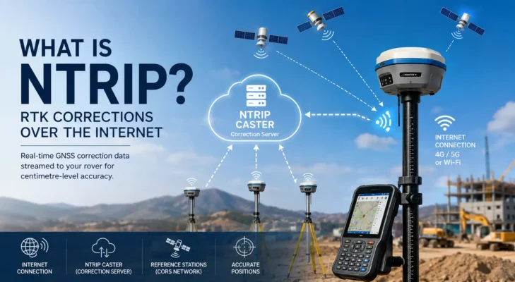
The FJD Trion V10i includes several communication options to fit different job sites and correction workflows. The integrated 4G modem can be used for network RTK corrections through a SIM card and NTRIP service. The built-in UHF radio supports local base-rover operation where a mobile network is not available or where a dedicated base setup is preferred.

Wi-Fi, Bluetooth and NFC make pairing and data transfer easier in the field. This flexibility is valuable for teams that move between urban sites, rural projects, remote infrastructure areas and mixed working environments where one correction method is not always enough.

Built for outdoor survey work

Survey equipment is used in rain, dust, mud, vibration and long working days. The FJD Trion V10i is built with IP68 protection and a rugged housing designed to survive a 2 metre pole drop. Its internal battery supports long rover operation, while USB Type-C and external power input give teams more options for charging and extended use.

The 1.41 inch OLED display on the receiver gives quick access to working status in the field. Physical buttons allow essential setup and operation without always depending on a controller, which is useful when checking receiver status, switching modes or working in fast-moving site conditions.

Who is the FJD Trion V10i Rover Set for?

The FJD Trion V10i Rover Set is a strong choice for professionals who need accurate GNSS data and want a more visual, easier-to-use RTK workflow. It is suitable for land surveyors carrying out boundary and topographic work, construction teams setting out points and checking levels, GIS workers collecting asset data, drone pilots placing ground control points, and engineering crews documenting site conditions.

It is especially useful for users who regularly work around obstacles or hard-to-reach points. The combination of visual measurement, AR stakeout and tilt compensation helps make GNSS work more practical on real job sites where the ideal measurement position is not always available.

Buying from Global GPS Systems

Global GPS Systems supplies the FJD Trion V10i Rover Set with professional advice, worldwide delivery and support for customers choosing RTK GNSS equipment. Our team can help you compare this rover with other GNSS receivers, check compatibility with your correction service, and choose the right setup for surveying, construction, GIS or drone mapping work.

The FJD Trion V10i Rover Set is a practical RTK GNSS solution for teams that want visual positioning, reliable accuracy, flexible connectivity and field-ready durability in one complete rover package.


Datasheets & Manuals

Datasheets and manuals

Specifications

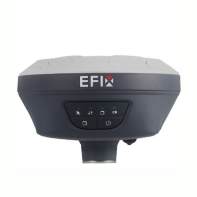
EFIX F7 Rover Set Specifications

Product Overview

Product Name EFIX F7 Rover Set
Product Type RTK GNSS rover set for land surveying, construction layout, mapping and engineering applications
Receiver Model EFIX F7 GNSS receiver
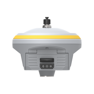
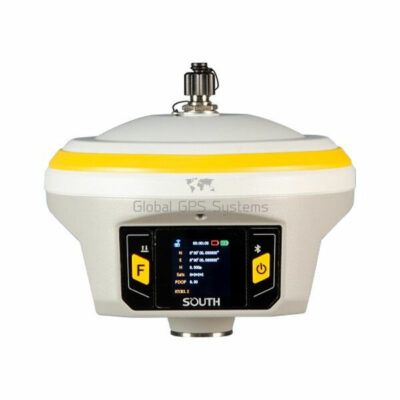
Receiver Design Palm-size GNSS + IMU receiver
Main Use RTK rover surveying, stakeout, topographic surveys, construction set-out, mapping, GIS collection and post-processing workflows
Included Field Controller EFIX FC2 data collector
Included Field Software EFIX eField surveying software
GNSS Feature GNSS with IMU tilt compensation

GNSS Performance

GNSS Channels 1608 channels
GPS Signals L1C/A, L2C, L2P(Y), L5
GLONASS Signals L1, L2
Galileo Signals E1, E5a, E5b, E6*
BeiDou Signals B1I, B2I, B3I, B1C, B2a, B2b
QZSS Signals L1, L2, L5, L6*
PPP Support B2b-PPP
SBAS Support L1, L5
Positioning Rate 1 Hz, 5 Hz and 10 Hz
GNSS Engine Features Advanced RTK algorithm, adaptive anti-interference and multipath mitigation
Future Signal Availability Note Galileo E6 and QZSS L6 are listed as subject to future firmware upgrade / service availability

GNSS Accuracy

Mode Horizontal Accuracy Vertical Accuracy
Real-Time Kinematic (RTK) 8 mm + 1 ppm RMS 15 mm + 1 ppm RMS
Post-Processing Kinematic (PPK) 3 mm + 1 ppm RMS 5 mm + 1 ppm RMS
Post-Processing Static 2.5 mm + 0.5 ppm RMS 5 mm + 0.5 ppm RMS
Code Differential 0.4 m RMS 0.8 m RMS
Autonomous 1.5 m RMS 3.0 m RMS

RTK Initialization and Time to First Fix

RTK Initialization Time < 10 seconds
RTK Initialization Reliability > 99.9%
Cold Start < 45 seconds
Hot Start < 10 seconds
Signal Re-Acquisition < 1 second

IMU Tilt Compensation

Tilt Sensor Type Calibration-free IMU for pole-tilt compensation
Magnetic Disturbance Resistance Immune to magnetic disturbance
Tilt Measurement Capability Up to 60° tilt compensation stated for the rover set
RTK Tilt Compensation Accuracy Additional horizontal pole-tilt uncertainty typically less than 10 mm + 0.7 mm/° tilt
Productivity Benefit Designed to measure points where centering is difficult, unsafe or time-consuming

Communication and Data Recording

Wi-Fi 802.11 b/g/n, access point mode
Bluetooth Bluetooth v4.1
Internal Internet Modem None in F7 receiver; NTRIP Client available via PDA/controller network
Data Storage 8 GB high-speed internal memory
Data Download Methods USB Type-C, FTP download and web server download
Computer Connection USB Type-C connection for serial data transfer, settings and logged data download
Controller Connection Wi-Fi or Bluetooth connection through eField software

Receiver Ports and Interfaces

USB Port 1 x USB Type-C port for data download, charging and firmware update
UHF Antenna Port 1 x TNC female UHF antenna port
Threaded Mount 5/8-11 threaded insert
Front Panel 4 status LEDs and 2 buttons
External Power Input 5 V / 2 A via USB Type-C

UHF Radio

Internal Radio Type Standard internal Rx
UHF Frequency Range 450 – 470 MHz
Rover Kit Antenna UHF bar antenna, 410 – 470 MHz
Radio Protocols EFIX, Transparent, TT450
Link Rate 9,600 bps
Use Case Receiving RTK correction data through UHF radio link

Data Formats and Correction Formats

CMR CMR input and output
RTCM RTCM 2.x and RTCM 3.x input and output
NMEA NMEA 0183 output
Static Data Formats HCN, HRC and RINEX static formats
NTRIP NTRIP Client on PDA/controller network

Receiver Power and Battery

Power Consumption 2.2 W, depending on user settings
Internal Battery Built-in non-removable Li-ion battery
Battery Capacity 6,800 mAh
RTK Rover Operating Time Up to 24 hours
Static Operating Time Up to 25 hours
Charging Port USB Type-C
Mobile Power Bank Support Receiver supports charging from a mobile power bank
Power Adapter Input 100 – 240 V AC power adapter, output to USB Type-C cable
Battery Runtime Note Battery life may vary depending on operating temperature and receiver configuration

Receiver Hardware and Environmental

Housing Magnesium alloy housing
Dimensions 119 mm x 119 mm x 85 mm / 4.7 in x 4.7 in x 3.3 in
Weight 0.77 kg / 1.60 lb
Ingress Protection IP67 dust and waterproof, protected from temporary immersion to depth 1 m
Shock Resistance Survives a 2 m pole drop
Operating Temperature -40 °C to +65 °C / -40 °F to +149 °F
Storage Temperature -40 °C to +85 °C / -40 °F to +185 °F
Humidity 100% condensation

EFIX FC2 Data Collector – System

Controller Model EFIX FC2
Operating System Android 8.1
Processor MediaTek MTK6762 Octa Core 2.0 GHz
RAM 4 GB
Internal Storage 64 GB flash memory
Expandable Storage Micro SD card, up to 128 GB
Keypad Alphanumeric keypad
USB Type-C, OTG

EFIX FC2 Data Collector – Display and Camera

Display Size 5.5 inch IPS LTPS LCD display
Touchscreen Capacitive multi-touch screen
Resolution HD 1440 x 720
Pixel Density 296 ppi
Glass Scratch-resistant glass
Outdoor Visibility Sun-light readable display
Camera 13-megapixel rear camera with auto-focus
Flashlight Integrated flashlight

EFIX FC2 Data Collector – Communications

Mobile Network 2G / 3G / 4G
LTE Bands FDD-LTE B1/B2/B3/B4/B5/B7/B8/B12/B17/B20/B28AB; TDD-LTE B34/B38/B39/B40/B41
3G Bands TD-SCDMA B34/B39; WCDMA B1/B2/B4/B5/B8; EV-DO BC0
2G Bands GSM 850/900/1800/1900
Wi-Fi 802.11 a/b/g/n/ac/d/e/h/i/k/r/v/w
Bluetooth Bluetooth v5.0 BLE
NFC Supported

EFIX FC2 Data Collector – Power and Physical

Battery Capacity 6,500 mAh Li-ion battery
Operating Time Up to 14 hours under normal conditions
Charging Time 4 hours typical
Dimensions 225 mm x 80 mm x 17 mm / 8.9 in x 3.2 in x 0.79 in
Weight 375 g / 13.2 oz with battery
Ingress Protection IP67
Drop Resistance 2 m / 6.5 ft fall onto concrete
Operating Temperature -20 °C to +55 °C / -4 °F to +131 °F
Storage Temperature -40 °C to +70 °C / -40 °F to +158 °F
Sensors and Integrated Features G-sensor, light sensor, NFC, gyroscope, E-compass and speaker
Certifications CE, FCC, MIL-STD-810H, RoHS, WPC

eField Software Functions

Software Type GNSS field surveying and data collection software
Receiver Connection Supports EFIX F7 connection via Wi-Fi or Bluetooth
Survey Workflows Point survey, line survey, polyline and surface workflows
Stakeout Workflows Point stakeout, line/arc stakeout, surface stakeout and sideslope stakeout
CAD View Open CAD files, view project drawings, use drawing data in the field and perform CAD stakeout
Online Maps OSM, BING, Google Image, WMS, V-World, Naver and Geoportal
Reference Map Support DXF, DWG, SHP, KML, KMZ and XML reference map workflows
Raster / Background Support TIF, JPG, MBTILES, JMTILES and WFSDB
GIS Attribute Collection Custom GIS attributes with support for pictures, videos and voice notes
Import Support Point files, reference maps, CSV reference points, LNS/PXY/KOF lines and arcs, code libraries, background images, coordinate systems and calibration files
Road Tools Road stakeout, road manager, LandXML import, horizontal alignment, vertical alignment, cross-section templates, superelevation, widening, cross-section survey, side-slope stakeout and road stakeout reports
Pipeline Survey Pipeline survey functionality with export to formats such as SHP and CSV

Package / Included Items

Item Quantity Notes
EFIX F7 GNSS Receiver 1 Main RTK GNSS rover receiver
EFIX FC2 Data Collector 1 Included controller for field operation
eField Software 1 Surveying and data collection software
UHF Bar Antenna 1 410 – 470 MHz antenna for UHF radio operation
USB Type-C Cable 1 For charging, data download and receiver connection
Tribrach Adaptor 1 For mounting and setup workflows
2 m Range Pole with Bag 1 Survey pole included in rover kit supply
Controller Bracket 1 For mounting the data collector to the pole
Auxiliary H.I. Tool 1 For antenna height measurement workflows
Power Adapter 1 For charging via USB Type-C
Transport Hard Case 1 Protective case for transport and storage

Important Accuracy and Availability Notes

Accuracy Conditions Accuracy and reliability are determined under open sky, free of multipath, with optimal GNSS geometry and atmospheric conditions, assuming at least 5 satellites and recommended GNSS practices.
Signal Availability Some listed signals and PPP services are subject to constellation service availability, ICD availability or firmware support.
Battery Life Conditions Battery life may vary depending on operating temperature and receiver working configuration.

Specifications and package contents may vary by configuration, region or manufacturer update. Always check the current configuration before ordering.

FAQ

EFIX F7 Rover Set FAQ

Product Overview

What is the EFIX F7 Rover Set used for?

The EFIX F7 Rover Set is used for RTK GNSS surveying, construction layout, stakeout, mapping, and accurate field data collection. It is designed for professionals who need reliable centimeter-level positioning on site.

Who is the EFIX F7 Rover Set best suited for?

The EFIX F7 Rover Set is best suited for land surveyors, construction layout teams, civil engineers, mapping professionals, infrastructure contractors, and field crews who need a complete GNSS rover solution.

What is included in the EFIX F7 Rover Set?

The set includes the EFIX F7 GNSS receiver, EFIX FC2 data collector, eField software, telescopic pole, controller bracket, and essential accessories for field surveying and stakeout work.

Is the EFIX F7 Rover Set a complete surveying solution?

Yes. The rover set is supplied as an all-in-one field solution with receiver, controller, software, pole, and accessories, making it ready for common RTK surveying and construction layout workflows.

Can the accessories in the set be customized?

Yes. Components such as the pole, controller bracket, and other compatible accessories can be adjusted or replaced to better match specific project requirements.

Accuracy, GNSS and RTK Performance

What accuracy can I expect from the EFIX F7?

The EFIX F7 is designed for centimeter-level RTK positioning when used with suitable correction data, good satellite visibility, and correct field procedures.

Does the EFIX F7 support RTK surveying?

Yes. The EFIX F7 is an RTK GNSS receiver designed for real-time rover work, point collection, stakeout, and other high-accuracy GNSS surveying tasks.

Which satellite constellations does the EFIX F7 support?

The EFIX F7 supports multiple GNSS constellations, including GPS, GLONASS, Galileo, BeiDou, and QZSS, helping improve availability and reliability in the field.

How many GNSS channels does the EFIX F7 have?

The EFIX F7 has 1608 GNSS channels, allowing it to track a wide range of satellite signals for reliable positioning performance.

Can the EFIX F7 work in challenging environments?

Yes. The EFIX F7 is designed to provide stable GNSS performance in demanding field conditions. However, accuracy can still be affected by obstructions, poor satellite geometry, buildings, heavy canopy, and multipath.

Can the EFIX F7 collect static GNSS data?

Yes. The EFIX F7 can log GNSS data for static observations and post-processing workflows, including support for RINEX data formats.

IMU Tilt Compensation and Field Use

What is IMU tilt compensation on the EFIX F7?

IMU tilt compensation allows the rover to measure points accurately even when the pole is tilted, reducing the need to keep the pole perfectly vertical for every observation.

How much tilt does the EFIX F7 support?

The EFIX F7 supports up to 60 degrees of IMU tilt compensation, making it useful for measuring points in hard-to-reach, obstructed, or uneven areas.

Do I need to keep the pole perfectly level?

No. Thanks to the built-in IMU tilt sensor, the EFIX F7 can compensate for pole tilt during supported measurements, helping improve speed and flexibility in the field.

Does the IMU tilt sensor improve productivity?

Yes. IMU tilt compensation can reduce time spent leveling the pole and can help speed up point collection and stakeout, especially on uneven terrain or around obstacles.

Can the EFIX F7 help measure inaccessible points?

Yes. Because the receiver can measure with pole tilt, it can help survey points near walls, fences, slopes, trenches, traffic areas, or other locations where standing directly over the point is difficult.

Can the EFIX F7 be used for stakeout?

Yes. The EFIX F7 Rover Set can be used for stakeout tasks when connected to the data collector and eField software, allowing field crews to locate design points on site.

Connectivity, Durability and Operation

Does the EFIX F7 have an internal internet modem?

No. The EFIX F7 receiver itself does not include an internal internet modem. Internet-based correction workflows may require a compatible controller, external connection, or other network setup.

Can the EFIX F7 use UHF radio corrections?

Yes. The EFIX F7 supports UHF radio operation and includes a UHF antenna connection for radio-based correction workflows.

What UHF frequency range does the EFIX F7 support?

The EFIX F7 supports UHF radio in the 430–470 MHz range. Local radio rules can vary, so users should check whether licensing or authorization is required in their country or region.

Can the EFIX F7 use NTRIP corrections?

Yes. The EFIX F7 can be configured for NTRIP correction workflows when used with the correct field setup, controller, software, and network connection.

How long does the EFIX F7 battery last?

The EFIX F7 is designed to provide up to 12 hours of operation, depending on settings, workflow, communication method, and field conditions.

Is the EFIX F7 waterproof and dustproof?

Yes. The EFIX F7 is rated IP67, meaning it is built to resist dust and water exposure during demanding outdoor survey work.

How rugged is the EFIX F7?

The EFIX F7 has a rugged, lightweight magnesium alloy housing and is designed to withstand drops of up to 2 meters, making it suitable for tough construction and surveying environments.

How heavy is the EFIX F7 receiver?

The EFIX F7 receiver weighs approximately 0.73 kg, making it compact and easy to carry during long field days.

Videos
Reviews (0)

Reviews

There are no reviews yet

Only logged in customers who have purchased this product may leave a review.

Independently verified
580 reviews