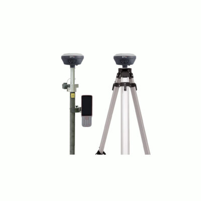
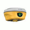
South ALPS1 Rover set Product Review
The South ALPS1 Receiver
The South ALPS1 is a high-performance land surveying equipment tool. Featuring video shooting, laser measurement, and IMU tilt compensation, it ensures fast, precise data capture in any environment. Ideal for construction, forestry, and UAV mapping, this GNSS receiver with laser function and GPS receiver with camera supports CAD integration for precise stakeouts. Experience unmatched efficiency and reliability with the South ALPS1.
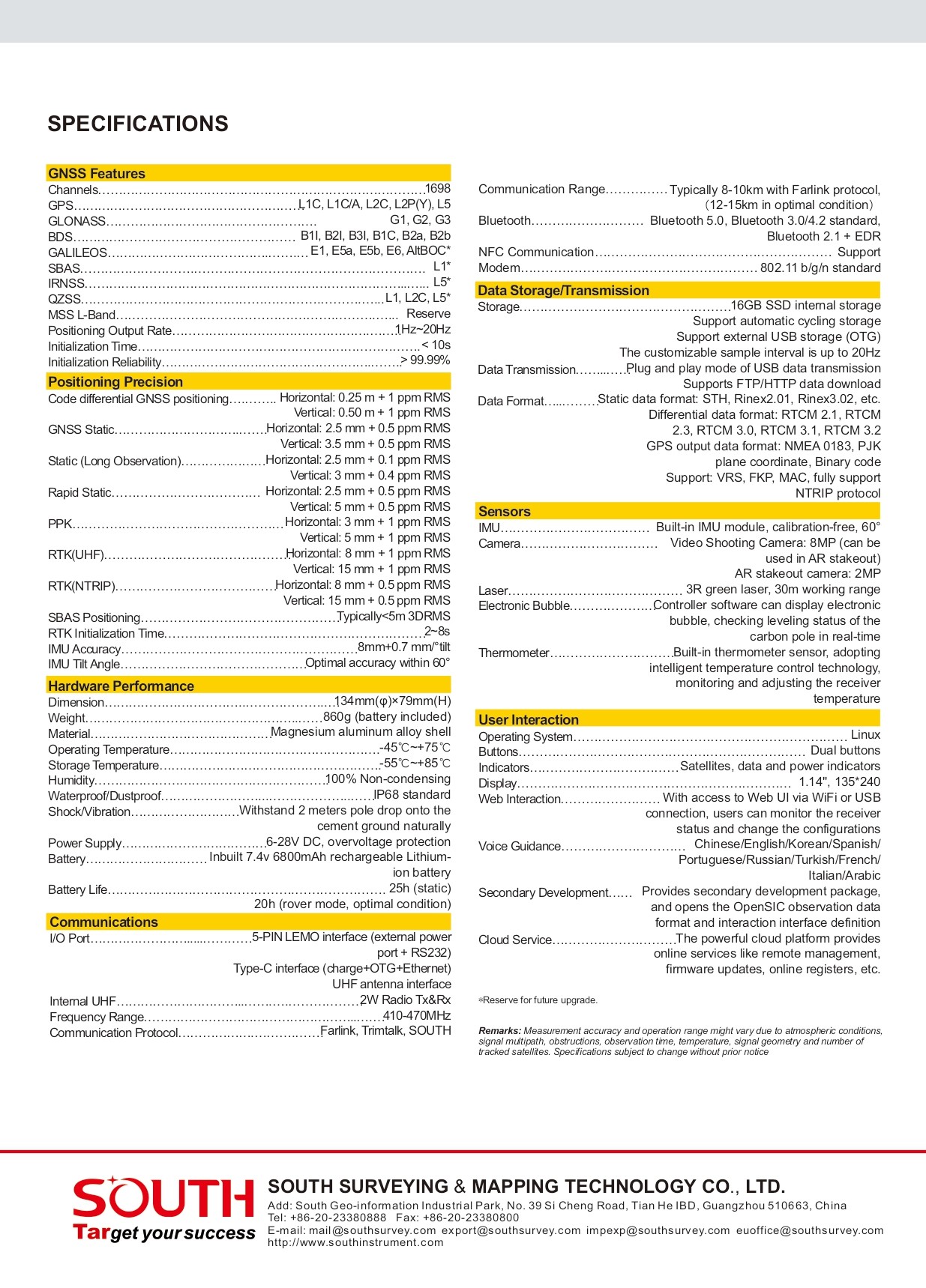
| ✅ Channels |
1698 |
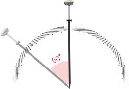
| ✅ IMU Tilt Sensor |
60° |
| ✅ Internet Modem |
4G |
| ✅ UHF Radio |
410 – 470MHz |
| GPS |
L1C, L1C/A, L2C, L2P(Y), L5 |
| GLONASS |
G1, G2, G3 |
| GALILEO |
E1, E5a, E5b, E6 |
| BEIDOU |
B1I, B2I, B3I, B1C, B2a, B2b |
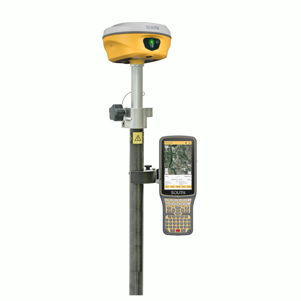
Elevate Your Workflow with the South ALPS1 Rover Set
Precision and Versatility for Professionals
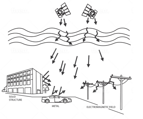
Meet the South ALPS1 rover set, a high-performance tool designed to transform the way professionals approach land surveying, construction, and mapping. Equipped with advanced IMU tilt compensation and laser measurement capabilities, this GNSS rover set for land surveying ensures unmatched accuracy and reliability, even on uneven or obstructed terrain.
Key Features of the South ALPS1 GNSS Rover Set
Advanced IMU Tilt Compensation
Say goodbye to time-consuming recalibrations and setup struggles. The South ALPS1 GNSS rover set features an advanced GPS set with IMU tilt sensor that delivers precise data, even when tilted, saving you time and improving efficiency.
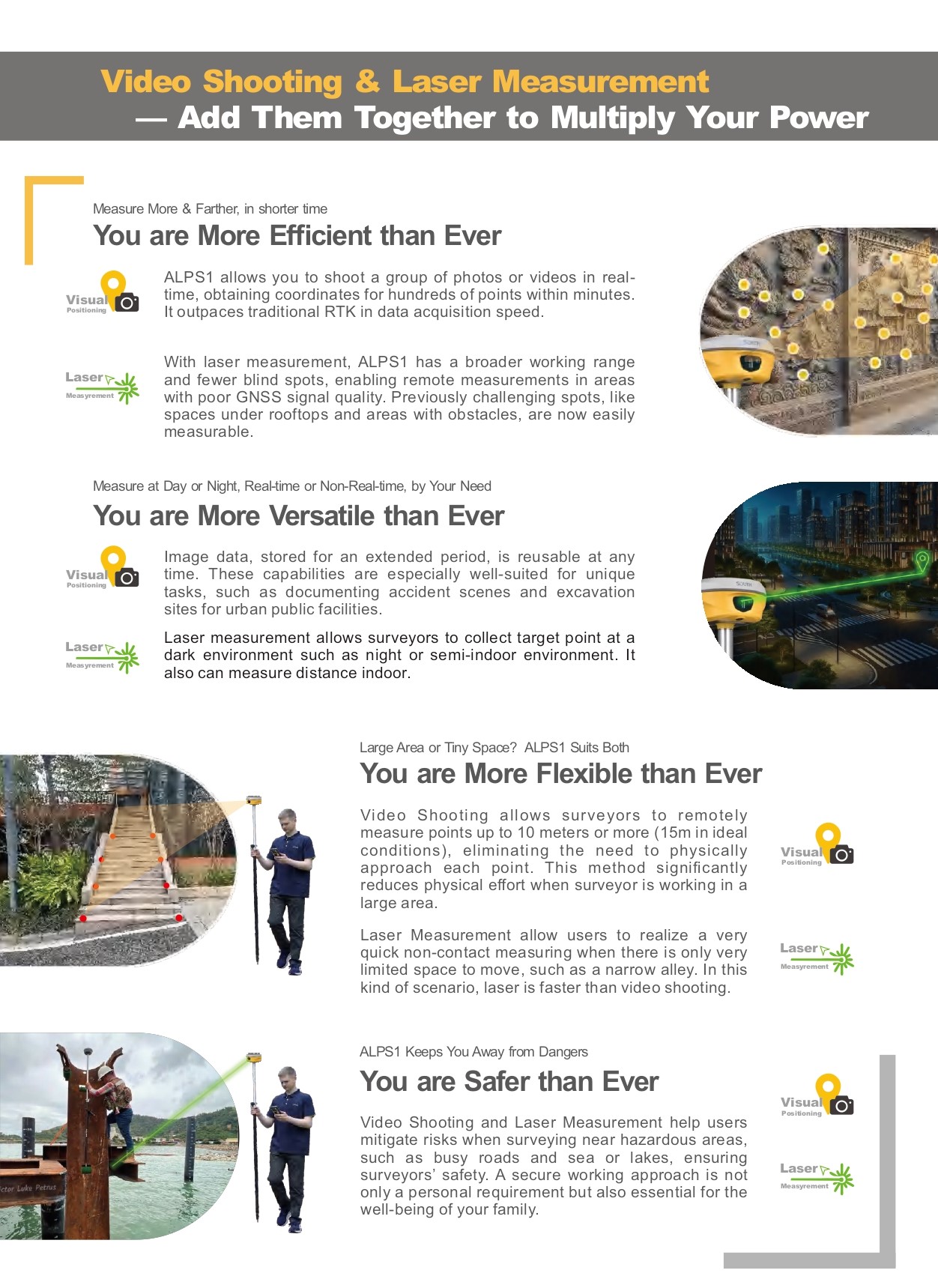
Laser Measurement for Unmatched Accuracy
The integrated laser measurement tool captures data with pinpoint precision, making it the perfect solution for tasks like stakeouts and construction layouts. This GNSS set for construction is designed to meet the demanding needs of professionals.
Built-in Camera for Documentation
The South ALPS1 rover set includes a built-in camera, enabling video shooting and photo documentation directly in the field. This unique feature enhances your workflow, making it easier to validate and share survey data.
Seamless CAD Integration
Simplify your project management with direct CAD compatibility. The land surveying set integrates easily with popular design tools, ensuring a smooth transition from field data to actionable plans.
Solve Common Struggles with the South ALPS1 Rover Set
Time-Consuming Setups? Not Anymore.
The South ALPS1’s IMU tilt compensation reduces the hassle of leveling the rod, enabling quicker data collection.
Struggling with Accuracy on Challenging Terrain?
Laser measurement technology ensures precision even in the toughest environments, making it the ideal GNSS set for construction or forestry.
Need Better Documentation?
Capture clear, accurate visual records with the built-in camera, reducing back-and-forth and improving communication with stakeholders.

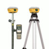
Included Accessories
The South ALPS1 rover set comes with essential accessories to maximize your productivity:
- South H6 Data Collector: The South H6 is a powerful, user-friendly device that streamlines data collection and integration with the South ALPS1.
- SurvStar Software: The SurvStar software is a intuitive and efficient software designed for seamless operation and data management.
- Telescopic Pole and Controller Bracket: Built for stability and flexibility, these accessories enhance your setup and are perfect for various environments.
While these accessories provide an all-in-one solution, they can be customized to fit your specific needs. Swap out the telescopic pole, controller bracket, or other components with compatible accessories to tailor the set to your projects.


Reviews
There are no reviews yet.