

 GPS & GNSS
 Lidar scanning
 Total Station
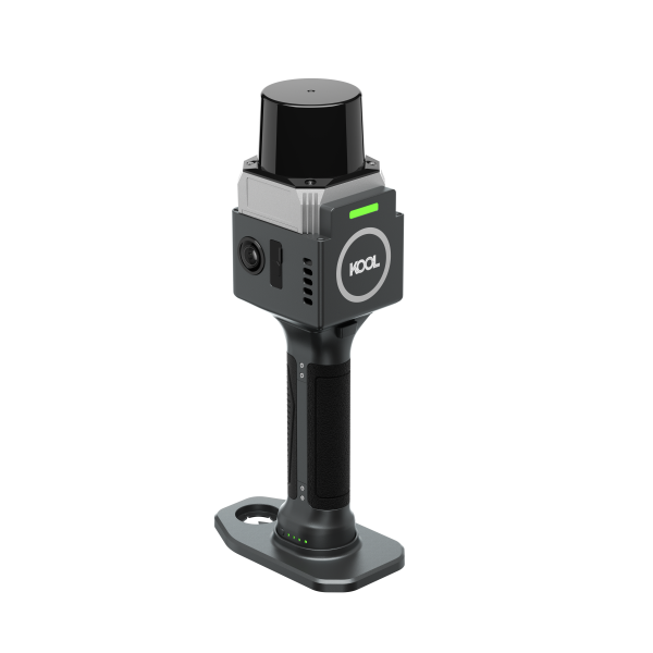
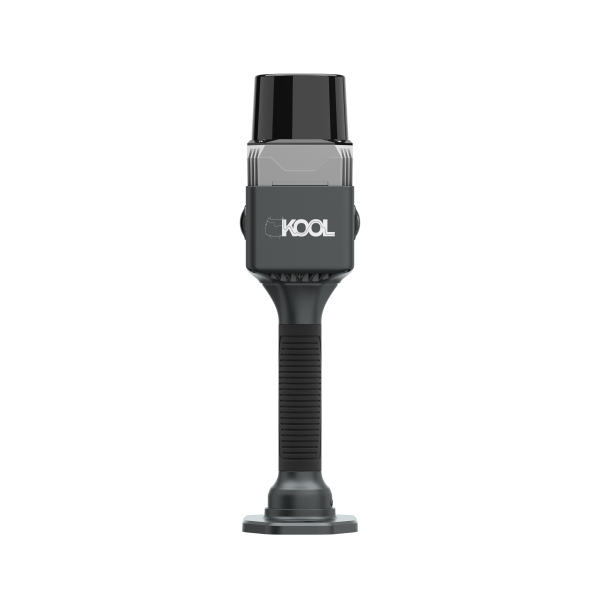
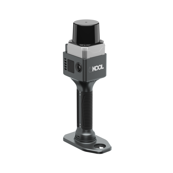
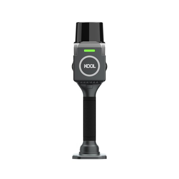
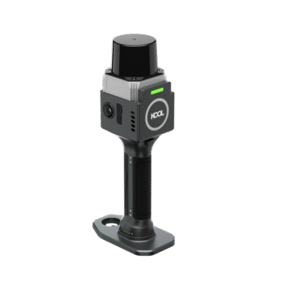
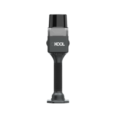
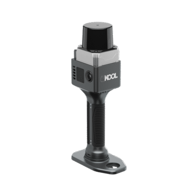
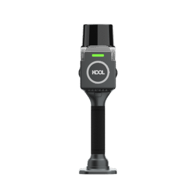
SOUTH KOOL Handheld 3D SLAM Laser Scanner
Get the best price for your setup
Contact our experts for the best possible price and configuration.
- Fast response
- Expert configuration advice
- No overpaying for features you do not need
The SOUTH KOOL Handheld 3D Laser Scanner is a compact SLAM LiDAR system for fast indoor and outdoor reality capture. Weighing only 1.12 kg, it allows surveyors, construction teams and engineers to collect detailed 3D point-cloud data while walking through buildings, tunnels, industrial sites and other complex environments.
A wide 360° horizontal and 130° vertical field of view helps capture floors, walls, ceilings and surrounding structures with fewer gaps. The scanner displays the point cloud in real time through MapStar, enabling the operator to check coverage before leaving the site. Two integrated 12 MP cameras provide imagery for creating photorealistic colourised point clouds.
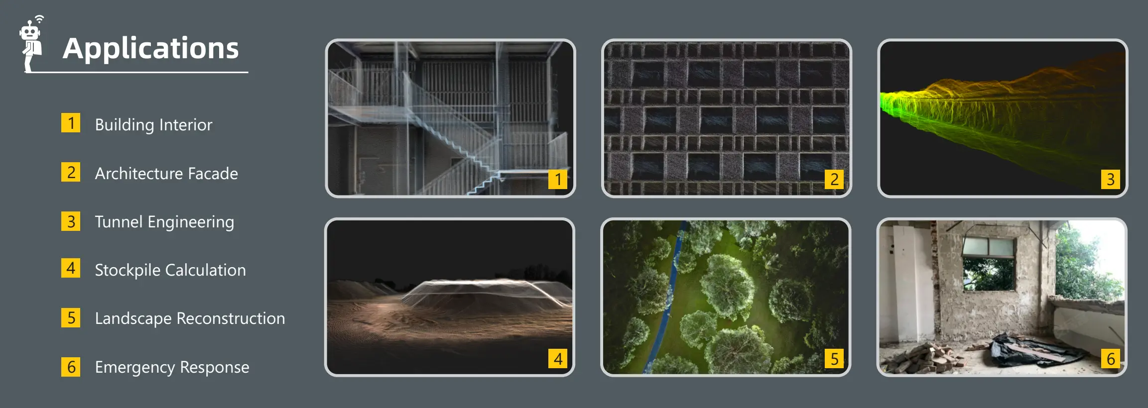
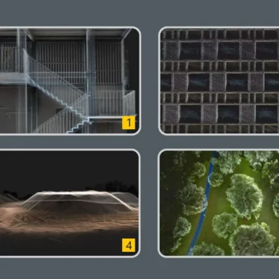
With a maximum stated scanning range of 100 metres on highly reflective surfaces and relative accuracy of up to 1 cm, the KOOL is suited to measured building surveys, façade documentation, stockpile calculations, tunnel mapping, landscape reconstruction and emergency-response recording. Data can be processed in AcuteLas Studio for measurement, point-cloud optimisation and further project deliverables.
SOUTH KOOL Handheld 3D Laser Scanner Highlights
| Scanning technology | Handheld SLAM LiDAR with real-time point-cloud display |
|---|---|
| Scanning range | 0.1–40 m at 10% reflectivity and up to 100 m at 90% reflectivity |
| Field of view | 360° horizontal × 130° vertical |
| Relative accuracy | Up to 1 cm |
| Point rate | 200,000 points per second with up to 1.2 million equivalent points per second |
| Integrated cameras | Two 12 MP cameras for point-cloud colourisation |
| Operating time | Up to 150 minutes |
| Weight | 1.12 kg |
Valued customers:










Find RTK Networks
Search NTRIP providers and connect to reliable RTK correction services.
Description
Fast handheld 3D scanning for real-world sites
The SOUTH KOOL Handheld 3D Laser Scanner is designed for professionals who need to capture buildings, structures and terrain more efficiently than with stationary scanning alone. Using SLAM technology, the scanner calculates its position while the operator moves through the site, allowing large areas and connected spaces to be recorded in a continuous survey.
This mobile workflow is particularly useful in environments where setting up an instrument at multiple stations would take too much time. Surveyors can walk through rooms, corridors, stairwells, tunnels or industrial areas while the KOOL records the surrounding geometry. The resulting point cloud provides a detailed digital representation that can support measurement, documentation, modelling and comparison work.
Wide coverage with fewer missed areas
The scanner has a 360° horizontal and 130° vertical field of view. In practical use, this broad viewing angle helps capture surfaces above, below and around the operator, including walls, floors, ceilings, pipework and structural elements. It reduces the need to repeatedly turn or reposition the scanner to cover the complete environment.
SOUTH uses a mixed solid-state laser sensor and a non-repetitive scanning pattern. Rather than repeatedly following identical scan lines, the system distributes measurements across the scene as the operator moves. This is intended to reduce blind spots and improve data coverage without creating unnecessarily large datasets.
Real-time point-cloud feedback
The KOOL supports real-time point-cloud display through the MapStar field application. Operators can review the developing scan during data collection and identify areas that may require another pass. This immediate visual check is valuable on busy construction sites, in restricted-access locations or during time-sensitive surveys, where returning to collect missing information may be difficult.
Both real-time and post-processing workflows are available. Real-time visualisation supports field quality control, while post-processing provides the tools required to refine, reference and prepare the point cloud for use in downstream software.
Detailed geometry and realistic colour
The scanner records 200,000 measured points per second. SOUTH states an equivalent rate of up to 1.2 million points per second through its non-repetitive scanning and variable-frequency technology. Relative accuracy is specified at up to 1 cm, making the system suitable for many building, engineering, volume and documentation tasks where centimetre-level point-cloud detail is required.
Two integrated 12 MP cameras collect image data for colourising the point cloud. Colour information makes scanned environments easier to interpret by helping users recognise materials, building elements, signs, equipment and surface changes. It can also improve the presentation of digital twins, condition records and visual project documentation.
Suitable applications and users
The KOOL is suited to land surveyors, measured-building surveyors, construction professionals, architects, BIM teams, civil engineers, tunnel specialists, mining and quarry personnel, GIS teams and emergency-response organisations.
For building interiors, the scanner can capture connected rooms, corridors and staircases for floor-plan production, renovation planning or as-built documentation. Architects and façade specialists can use the point cloud to record exterior geometry and complex building features. Construction teams can document progress, compare completed work with design information and preserve a digital record before areas are covered or altered.
In tunnels and underground environments, SLAM scanning provides a practical solution where GNSS reception is unavailable. For stockpiles, the collected surface data can be processed to calculate volumes of aggregates, soil, minerals or stored materials. Landscape and heritage teams can record irregular terrain and complex structures, while emergency-response users can rapidly document damaged or hazardous locations while limiting time spent in exposed areas.
Portable design for field use
At 1.12 kg, the KOOL is light enough for handheld operation across extended survey routes. Its compact dimensions of 111 × 222 × 33 mm make it easier to carry through narrow spaces and transport between projects. The handgrip contains a 3,150 mAh, 45.36 Wh battery, providing a stated operating time of up to 150 minutes under suitable conditions.
The scanner stores data on an expandable 128 GB memory system and supports TF card and USB Type-C data management. Its operating temperature range of -20°C to 45°C supports use across a wide variety of field environments. The IP5X rating provides protection against dust ingress, although the instrument should still be handled appropriately in rain, heavy dust and other demanding site conditions.
Point-cloud processing with AcuteLas Studio
Captured data can be processed using AcuteLas Studio. The wider software platform supports workflows such as SLAM processing, control-point adjustment, point-cloud colourisation, coordinate transformation, classification, measurement, volume calculation, terrain processing and specialised engineering analysis.
Control points can be used to localise the scan within a project coordinate system. This is important when the point cloud must align with existing survey control, CAD drawings, BIM models, GIS datasets or other geospatial information. The most suitable control method and field procedure will depend on the required absolute accuracy and the final project deliverables.
A practical tool for rapid reality capture
The SOUTH KOOL fills the gap between slower static scanning workflows and lower-detail visual documentation. Its combination of handheld operation, broad field of view, real-time feedback, colour cameras and compact weight makes it a practical choice for teams that need to capture complete environments quickly.
Global GPS Systems can advise on the scanner configuration, compatible field and processing software, control-point workflow and accessories required for your type of project. This helps ensure that the complete system matches the intended use, whether the priority is building documentation, construction verification, tunnel mapping, stockpile measurement or general 3D reality capture.
Datasheets & Manuals
Specifications
SOUTH KOOL Handheld 3D Laser Scanner Specifications
Product Overview
| Product Name | SOUTH KOOL Handheld 3D Laser Scanner |
|---|---|
| Product Type | Handheld SLAM-based 3D laser scanner |
| Primary Functions | Mobile 3D reality capture, point-cloud acquisition, digital reconstruction and photorealistic point-cloud colorization |
| Mapping Technology | Simultaneous Localization and Mapping (SLAM) |
| Point-Cloud Display | Real-time point-cloud display supported |
| Processing Modes | Real-time processing and post-processing |
Laser Scanner
| Scanner Sensor | Mixed solid-state laser sensor with a stable internal structure |
|---|---|
| Scanning Principle | Non-repetitive scanning with variable-frequency technology |
| Minimum Scanning Range | 0.1 m |
| Scanning Range at 10% Reflectivity | 0.1–40 m |
| Scanning Range at 90% Reflectivity | 0.1–100 m |
| Point Acquisition Rate | 200,000 points per second |
| Equivalent Effective Point Rate | Up to 1.2 million points per second through non-repetitive scanning and variable-frequency technology |
| Horizontal Field of View | 360° |
| Vertical Field of View | 130° |
| Combined Field of View | 360° horizontal × 130° vertical |
| Field-of-View Optimization | Optimized to reduce redundant scanning, data gaps and unnecessary point-cloud file size |
| Laser Safety Classification | Class 1 eye-safe laser |
Accuracy and Positioning
| Relative Accuracy | ≤1 cm |
|---|---|
| Localization Method | SLAM-based localization |
| Geo-referencing Method | Control-point establishment for point-cloud localization |
| Loop-Free Mobile Capture | Non-repetitive scanning is designed to improve point-cloud coverage and reduce blind spots while the scanner is moving |
Imaging and Colorization
| Camera Configuration | Dual integrated HD camera lenses |
|---|---|
| Camera Resolution | 2 × 12 MP |
| Total Camera Resolution | 24 MP across two camera lenses |
| Camera Function | Image capture for photorealistic point-cloud colorization |
| Colorized Output | Supported through the scanner camera system and associated processing software |
Field and Processing Software
| Fieldwork Control Software | MapStar |
|---|---|
| Desktop Processing Software | AcuteLas Studio |
| Field Visualization | Real-time point-cloud visualization |
| Post-processing | Point-cloud processing and digital reconstruction through AcuteLas Studio |
| Supported Workflow | Field acquisition, real-time visualization, data transfer, post-processing, point-cloud optimization, measurement and industry-specific analysis |
| Software Availability | Additional software modules and industry application tools may be available according to the selected configuration or licence |
Data Storage and Connectivity
| Internal Storage Capacity | 128 GB |
|---|---|
| Storage Expansion | Expandable |
| Storage Media | TF memory card |
| Data Interface | USB Type-C |
| Data Management | TF card storage and Type-C data connection |
Power System
| Power Supply | Battery integrated into the scanner handgrip |
|---|---|
| Battery Capacity | 3,150 mAh |
| Battery Energy | 45.36 Wh |
| Power Consumption | 23 W |
| Operating Endurance | Up to 150 minutes |
Physical Specifications
| Form Factor | Compact handheld scanner |
|---|---|
| Dimensions | 111 × 222 × 33 mm |
| Net Weight | 1.12 kg |
| Handling | Integrated handgrip with internal battery |
Environmental Specifications
| Ingress Protection | IP5X dust-protection rating |
|---|---|
| Operating Temperature | -20°C to +45°C |
| Storage Temperature | -20°C to +60°C |
| Operating Environment | Suitable for mobile indoor and outdoor reality-capture work within the specified environmental limits |
Key Features
| Long-range Mobile Scanning | Scanning range up to 100 m on surfaces with 90% reflectivity |
|---|---|
| Wide Coverage | 360° × 130° field of view for broad environmental capture |
| Non-repetitive Scan Pattern | Designed to reduce conventional fixed-beam line spacing, blind spots and missing data |
| Optimized Data Volume | Reduced redundant scanning can produce smaller point-cloud datasets and faster downstream processing |
| Real-time Operation | Supports live SLAM mapping and real-time point-cloud display |
| Color Capture | Dual 12 MP cameras support photorealistic point-cloud colorization |
| Portable Design | 1.12 kg handheld construction with integrated battery and storage |
| Flexible Processing | Supports both real-time workflows and desktop post-processing |
Applications and Industries
| Building Interiors | Interior measurement, floor-plan support, as-built capture and building documentation |
|---|---|
| Architecture and Construction | Existing-condition surveys, renovation planning, BIM data capture and construction verification |
| Building Facades | Exterior elevation capture and architectural facade documentation |
| Tunnel Engineering | Tunnel mapping, cross-section capture, clearance analysis and construction documentation |
| Stockpile Measurement | Point-cloud capture for stockpile volume calculation and inventory assessment |
| Landscape Reconstruction | Three-dimensional capture of terrain, vegetation and built landscape features |
| Emergency Response | Rapid spatial documentation of accident sites, damaged structures and hazardous environments |
| Surveying and Mapping | Mobile topographic capture, control-point-based localization and spatial data collection |
| Industrial Facilities | Plant documentation, equipment-layout capture and digital-twin data acquisition |
| Heritage and Cultural Documentation | Three-dimensional recording of buildings, monuments and complex spaces |
Typical Users
| Surveyors | Mobile mapping, as-built surveys, control-point-based scanning and measurement workflows |
|---|---|
| Architects and BIM Specialists | Existing-condition capture, scan-to-BIM preparation and renovation documentation |
| Civil and Tunnel Engineers | Infrastructure inspection, tunnel documentation and dimensional analysis |
| Construction Professionals | Progress capture, verification, quantity assessment and site documentation |
| Mining and Materials Teams | Stockpile capture and volume-calculation workflows |
| Emergency and Forensic Teams | Rapid, non-contact three-dimensional scene documentation |
| Digital-Twin and Reality-Capture Specialists | Point-cloud acquisition, digital reconstruction and industrial spatial-data production |
Specifications and package contents may vary by configuration, region or manufacturer update. Always check the current configuration before ordering.
Reviews (0)
Only logged in customers who have purchased this product may leave a review.
FAQ
KOOL Handheld 3D Laser Scanner FAQ
Product Overview and Applications
What is the KOOL Handheld 3D Laser Scanner?
The KOOL Handheld 3D Laser Scanner is a portable SLAM LiDAR system designed to capture three-dimensional point-cloud data while an operator walks through or around a site. It combines laser scanning, real-time mapping and integrated cameras for efficient reality capture and digital reconstruction.
Who is the KOOL handheld scanner designed for?
The scanner is designed for surveyors, mapping professionals, engineers, architects, construction teams, facility managers, inspection specialists and other users who need to document physical spaces in three dimensions.
What can the KOOL scanner be used for?
Typical applications include building documentation, topographic mapping, construction progress recording, infrastructure inspection, facility surveys, interior mapping, stockpile measurement, digital-twin data collection and as-built documentation.
Can the KOOL scanner capture indoor and outdoor environments?
Yes. Its SLAM-based mapping method allows it to collect point-cloud data in indoor, outdoor and mixed environments. Actual performance depends on site geometry, visibility, surface reflectivity and operating conditions.
Can the scanner be used in areas without GNSS reception?
Yes. The KOOL scanner uses simultaneous localization and mapping, or SLAM, to calculate its movement through an environment. This makes it suitable for interiors and other locations where satellite positioning is limited or unavailable.
Is the KOOL scanner suitable for digital-twin and BIM workflows?
Yes. The scanner can collect detailed spatial data that may be processed into point clouds for digital reconstruction, existing-condition documentation and scan-to-BIM workflows. Compatibility with a particular BIM platform depends on the export formats and workflow used during data processing.
Scanning Performance and Image Capture
What is the maximum scanning range of the KOOL scanner?
The specified range is up to 100 metres on surfaces with 90% reflectivity. On surfaces with 10% reflectivity, the specified scanning range is up to 40 metres. The minimum stated range is 0.1 metre.
Why does surface reflectivity affect scanning range?
LiDAR measures reflected laser energy. Bright or highly reflective surfaces generally return a stronger signal and may be detected at a greater distance, while dark or low-reflectivity surfaces may reduce the effective measurement range.
What is the field of view?
The scanner has a 360-degree horizontal and 130-degree vertical field of view. This wide coverage helps capture surrounding geometry while reducing blind spots and unnecessary repetitive scanning.
How fast does the KOOL scanner collect points?
The specified scan rate is 200,000 points per second. SOUTH also states an equivalent result of up to 1.2 million points per second through its non-repetitive scanning and variable-frequency technology.
What accuracy does the KOOL scanner provide?
The manufacturer specifies relative accuracy of 1 centimetre or better. Achievable project accuracy can also depend on the scanning path, environment, control points, processing method and operator technique.
Does the scanner capture colour point clouds?
Yes. The KOOL scanner includes two 12-megapixel camera lenses that can collect imagery for photorealistic point-cloud colourization.
Field Operation and Hardware
Can operators view the point cloud during scanning?
Yes. The scanner supports real-time point-cloud display, allowing operators to monitor data collection while working in the field.
Does the KOOL scanner support post-processing?
Yes. It supports both real-time and post-processing workflows. Fieldwork can be controlled through MapStar, while collected data can be processed using AcuteLas Studio.
How heavy is the KOOL handheld scanner?
The scanner has a specified net weight of 1.12 kilograms, making it suitable for handheld mobile mapping and extended field use.
What are the dimensions of the scanner?
The specified dimensions are 111 by 222 by 33 millimetres.
How long does the battery last?
The stated operating endurance is approximately 150 minutes. Actual battery life may vary according to temperature, battery condition, scanning activity and operating settings.
What type of battery does the scanner use?
The scanner is powered by a handgrip battery rated at 3,150 mAh and 45.36 Wh. Its specified power consumption is 23 W.
What operating temperatures does the scanner support?
The specified working temperature range is from -20°C to 45°C. The stated storage temperature range is also from -20°C to 45°C.
Data, Software and Project Setup
How is scan data stored?
Scan data is stored on a TF memory card. The scanner has a stated capacity of 128 GB and supports expandable storage.
How can data be transferred from the scanner?
The scanner supports data management through its TF card and a USB Type-C connection. The appropriate transfer method may depend on the field and office workflow.
What software is used with the KOOL scanner?
MapStar is specified for fieldwork control, including real-time operation and point-cloud viewing. AcuteLas Studio is specified for processing collected scan data and supporting subsequent reality-capture workflows.
Can scan data be georeferenced?
Yes. The system supports the establishment of control points for localization. Using surveyed control points can help position the scan within a required project coordinate system.
Does every project require control points?
Not every relative mapping project requires control points, but they are recommended when the point cloud must be accurately positioned, checked against survey control or integrated with other geospatial data.
Is the scanner safe for normal field use?
The KOOL scanner uses a Class 1 eye-safe laser. Operators should still follow the manufacturer’s operating instructions, site safety procedures and applicable workplace regulations.
Is the KOOL scanner waterproof?
The scanner has an IP5X ingress-protection rating, which indicates protection against dust ingress at a level that should not interfere with normal operation. An IP5X rating does not provide a water-resistance rating, so the unit should be protected from rain, splashes and immersion unless additional protection is provided.

 GPS & GNSS
 Total Stations
 Data collectors
 Software
 Correction services
 Machine control
 External radio
 Marine
 Accessories
Reviews
There are no reviews yet