

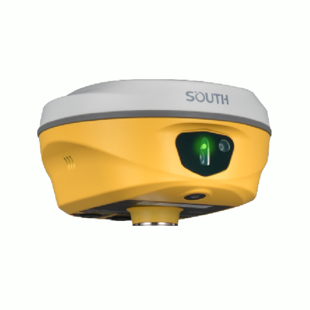


South ALPS1 Laser Vision IMU RTK GNSS Receiver
This product is Available
Contact our experts for the best possible price and configuration.
The South ALPS1 is a professional RTK GNSS receiver built for surveyors, construction teams, GIS users, forestry workers and drone mapping crews who need accurate positioning in difficult field conditions. With laser measurement, visual positioning, AR stakeout and 60° IMU tilt compensation, it helps users measure points that are unsafe, hard to reach or affected by weak satellite visibility.
South ALPS1 Highlights
| GNSS Channels | 1698 channels |
|---|---|
| Laser Surveying | 3R green laser with up to 30 m working range |
| IMU Tilt | Calibration-free IMU with up to 60° tilt compensation |
| Vision Features | 8 MP video shooting camera and 2 MP AR stakeout camera |
| RTK Accuracy | RTK NTRIP accuracy up to H: 8 mm + 0.5 ppm RMS, V: 15 mm + 0.5 ppm RMS |


Valued customers:


Find RTK Networks
Search NTRIP providers and connect to reliable RTK correction services.
Description
South ALPS1 Laser Vision IMU RTK GNSS Receiver
The South ALPS1 is an advanced RTK GNSS receiver designed for field teams that need more than standard pole-based measurement. It combines high-precision GNSS positioning with visual positioning, laser measurement, AR stakeout and IMU tilt compensation. In practical fieldwork, this means you can measure more points from safer positions, work around obstacles more easily and complete stakeout tasks with clearer guidance on the controller screen.
This receiver is a strong fit for surveyors, construction professionals, GIS teams, forestry users, UAV mapping crews and infrastructure contractors. It is especially useful on sites where traditional RTK measurement becomes slow or awkward, such as roadsides, embankments, tree-covered areas, narrow spaces, under roof edges, near water or around buildings that block satellite signals.
Measure difficult points with laser and visual positioning
The South ALPS1 uses a 3R green laser to measure target points without placing the pole directly on every point. For construction and surveying teams, this is useful when the point is across a ditch, near traffic, behind an obstacle or in a location where it is unsafe or impractical to stand. The laser also helps in tighter spaces where moving the pole into position takes too much time.
Visual positioning adds another layer of flexibility. The ALPS1 can use image and video data to help capture coordinates for multiple points. Instead of walking to every point individually, users can document the scene and extract measurements more efficiently. This can be valuable for accident scenes, excavation records, urban utility work, road measurements and areas where access is limited.
AR stakeout for clearer field guidance
Stakeout can be one of the most time-consuming parts of fieldwork, especially for less experienced operators or on busy construction sites. The South ALPS1 supports CAD AR stakeout, using its cameras to show design information in relation to the real-world scene. This makes it easier to understand direction, approach the target and complete stakeout work with fewer repeated checks.
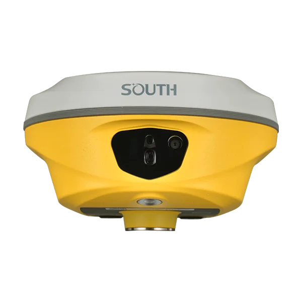
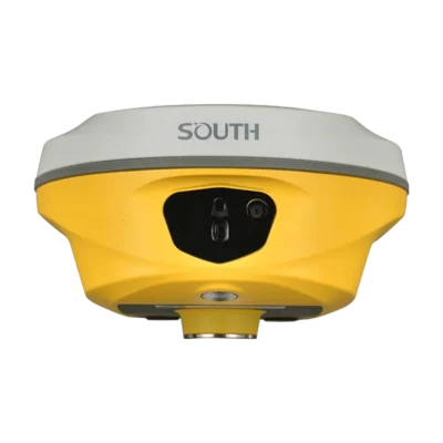
The front camera helps users find the general direction from a distance, while the lower camera supports more precise guidance when approaching the final point. For construction layout, road work, utilities and site preparation, this can make the workflow more intuitive than relying only on arrows and numbers.
60° IMU tilt for faster measurements
The built-in calibration-free IMU allows tilted measurements up to 60°. This helps users keep working when the pole cannot be held perfectly vertical, for example near walls, fences, slopes, parked machinery, tree trunks or other obstructions. In day-to-day use, tilt compensation reduces the need to constantly level the pole, helping crews collect points faster while maintaining reliable RTK positioning.
Built for demanding GNSS environments
With 1698 channels and support for GPS, GLONASS, BeiDou, Galileo, SBAS, IRNSS and QZSS signals, the South ALPS1 is designed to maintain strong satellite tracking in varied environments. This is important for users working in urban areas, near buildings, under partial canopy or in changing site conditions where satellite visibility is not always ideal.
The receiver supports RTK through UHF radio and NTRIP, making it suitable for both base-rover workflows and network RTK use. Its internal UHF radio supports 410–470 MHz operation and Farlink protocol, while the 4G modem allows connection to correction services through mobile data. For crews that move between open sites, urban projects and remote locations, this gives flexible ways to receive corrections.
Practical applications
For construction teams, the ALPS1 can support road measurements, site layout, volume-related measurements and general topographic work. The laser function is useful when measuring from a safe distance or when direct access to a point is limited.
For forestry and environmental work, the combination of laser measurement, eccentric measurement and positioning tools can help record tree positions and features without needing to place the pole directly at every point. This can save time in uneven or obstructed terrain.
For UAV mapping and 3D modelling workflows, the South ALPS1 can be used to measure control points, fill data gaps and support field measurements that complement drone data. This makes it useful for drone pilots and mapping teams that need accurate ground data alongside aerial imagery.
Rugged receiver for daily field use
The South ALPS1 is built with a magnesium aluminium alloy shell and IP68-rated protection against dust and water. It is designed for outdoor surveying environments where equipment may face rain, dust, mud, transport vibration and regular field handling. The integrated battery supports long operating times, helping crews complete full work sessions without constantly changing batteries.
Why buy the South ALPS1 from Global GPS Systems
Global GPS Systems supplies professional GNSS equipment to surveyors, contractors, engineers, GIS professionals and drone mapping users worldwide. When choosing a receiver like the South ALPS1, buyers often need more than a specification list. They need to know whether the instrument fits their workflow, correction setup, software and field conditions.
Global GPS Systems can help you compare the South ALPS1 with other RTK GNSS receivers, select suitable accessories and understand how features like laser surveying, AR stakeout, IMU tilt and NTRIP corrections apply to your work. This makes the ALPS1 a strong choice for users who want a modern GNSS receiver with practical tools for faster and safer measurement in the field.
Datasheets & Manuals
Datasheets and manuals
Specifications
South ALPS1 Specifications
Product Overview
| Product Name | South ALPS1 |
|---|---|
| Product Type | Total RTK GNSS receiver with visual positioning, laser measurement, IMU tilt compensation and remote stakeout functions |
| Manufacturer | SOUTH Surveying & Mapping Technology Co., Ltd. |
| Model | ALPS1 |
| Primary Users | Land surveyors, construction survey teams, forestry surveyors, UAV mapping teams, GIS and geospatial professionals |
| Typical Applications | RTK surveying, control surveys, construction measurement, forestry measurement, UAV ground supplementation, 3D modeling, CAD AR stakeout, laser stakeout and remote point measurement |
Key Measurement Features
| Visual Positioning | Supports image and video-based coordinate acquisition for points that are difficult to measure with traditional RTK methods |
|---|---|
| Video Shooting Measurement | Captures photos or videos for coordinate calculation and 3D modeling workflows |
| Laser Measurement | Supports non-contact point measurement, laser distance survey, laser point survey and laser stakeout |
| Remote Measurement | Supports measurement of targets that are difficult, unsafe or inconvenient to access directly |
| AR Stakeout | Supports augmented-reality stakeout using camera guidance and CAD integration |
| CAD AR Stakeout | Supports overlay of CAD drawing content with real-world scenes for visual stakeout guidance |
| 3D Modeling Support | Image measurement data can be used with SOUTH software and compatible third-party modeling workflows |
| Laser Intersection Function | Supports direct rendezvous and point-library rendezvous intersection methods for laser survey workflows |
GNSS Tracking
| Channels | 1698 |
|---|---|
| GNSS Board / Engine | SOUTH S805 GNSS technology |
| GPS | L1C, L1C/A, L2C, L2P(Y), L5 |
| GLONASS | G1, G2, G3 |
| BeiDou / BDS | B1I, B2I, B3I, B1C, B2a, B2b |
| Galileo | E1, E5a, E5b, E6, AltBOC* |
| SBAS | L1* |
| IRNSS | L5* |
| QZSS | L1, L2C, L5* |
| MSS L-Band | BDS-PPP, Galileo-HAS |
| Positioning Output Rate | 1 Hz to 20 Hz |
| Initialization Time | < 10 seconds |
| Initialization Reliability | > 99.99% |
Positioning Accuracy
| Mode | Horizontal Accuracy | Vertical Accuracy |
|---|---|---|
| Code Differential GNSS | 0.25 m + 1 ppm RMS | 0.50 m + 1 ppm RMS |
| GNSS Static | 2.5 mm + 0.5 ppm RMS | 3.5 mm + 0.5 ppm RMS |
| Static Long Observation | 2.5 mm + 0.1 ppm RMS | 3 mm + 0.4 ppm RMS |
| Rapid Static | 2.5 mm + 0.5 ppm RMS | 5 mm + 0.5 ppm RMS |
| PPK | 3 mm + 1 ppm RMS | 5 mm + 1 ppm RMS |
| RTK UHF | 8 mm + 1 ppm RMS | 15 mm + 1 ppm RMS |
| RTK NTRIP | 8 mm + 0.5 ppm RMS | 15 mm + 0.5 ppm RMS |
Laser, IMU and Tilt Measurement
| Laser Type | 3R green laser |
|---|---|
| Laser Working Range | 30 m |
| Laser Accuracy | 3 cm within 10 m, 5 cm within 20 m, or 1 cm + 2 mm/m |
| Laser Survey Functions | Laser distance survey, laser point survey, laser AR, laser intersection and laser stakeout |
| IMU | Built-in calibration-free IMU module |
| IMU Accuracy | 8 mm + 0.7 mm/° tilt |
| IMU Tilt Angle | Optimal accuracy within 120° |
| Electronic Bubble | Controller software can display electronic bubble and check pole leveling status in real time |
Cameras and Visual Functions
| Video Shooting Camera | 8 MP camera; can also be used in AR stakeout |
|---|---|
| AR Stakeout Camera | 2 MP camera |
| Dual-Camera Stakeout | Front camera assists with general direction and surrounding features; bottom camera assists with precise stakeout near the target |
| Photogrammetry Support | Supports image and video-based calculation workflows |
| Offline / Local Solution Support | Supports local photogrammetry solution without uploading images or videos to a server when internet access is unavailable |
| UAV Mapping Support | Can supplement UAV image data and help fill ground-level detail gaps for 3D modeling |
Hardware
| Dimensions | 134 mm diameter × 79 mm height |
|---|---|
| Weight | 860 g, battery included |
| Material | Magnesium aluminum alloy shell |
| Operating Temperature | -45°C to +75°C |
| Storage Temperature | -55°C to +85°C |
| Humidity | 100% non-condensing |
| Waterproof / Dustproof Rating | IP68 standard |
| Shock / Vibration | Withstands a natural 2 m pole drop onto cement ground |
| Power Supply | 6–28 V DC with overvoltage protection |
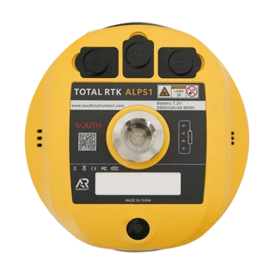
| Battery | Built-in 7.4 V 6800 mAh rechargeable lithium-ion battery |
Battery Life
| Static Mode | Up to 25 hours |
|---|---|
| UHF RTK Rover Without Camera | Up to 20 hours |
| Laser Survey | Up to 15 hours |
| Visual Stakeout | Up to 15 hours |
| UHF RTK Base | Up to 12 hours |
Communications and Connectivity
| I/O Ports | 5-pin LEMO interface for external power and RS232; Type-C interface for charging, OTG and Ethernet; UHF antenna interface |
|---|---|
| Internal UHF Radio | 2 W radio transmit and receive |
| UHF Frequency Range | 410–470 MHz |
| UHF Protocols | Farlink, Trimtalk, SOUTH, HUACE, Hi-target, Satel |
| UHF Communication Range | Typically 8–10 km with Farlink protocol; 12–15 km in optimal conditions |
| Bluetooth | Bluetooth 5.0, Bluetooth 3.0/4.2 standard, Bluetooth 2.1 + EDR |
| NFC Communication | Supported |
| Wi-Fi | 802.11 b/g/n standard |
| Internet Modem | 4G listed configuration |
| Web UI Access | Receiver status monitoring and configuration via Wi-Fi or USB connection |
| NTRIP Support | Fully supports NTRIP protocol |
| Network Model Support | VRS, FKP and MAC |
Data Storage and Data Formats
| Internal Storage | 16 GB SSD internal storage |
|---|---|
| Automatic Cycling Storage | Supported |
| External USB Storage | Supported via OTG |
| Custom Sample Interval | Up to 20 Hz |
| USB Data Transmission | Plug-and-play USB data transmission |
| FTP / HTTP Download | Supported |
| Static Data Formats | STH, RINEX 2.01, RINEX 3.02 and other formats |
| Differential Data Formats | RTCM 2.1, RTCM 2.3, RTCM 3.0, RTCM 3.1, RTCM 3.2 |
| GNSS Output Formats | NMEA 0183, PJK plane coordinate, binary code |
| Observation Data Interface | OpenSIC observation data format and interaction interface definition available for secondary development |
Sensors
| IMU Sensor | Built-in calibration-free IMU module |
|---|---|
| Camera Sensors | 8 MP video shooting / visual positioning camera and 2 MP AR stakeout camera |
| Laser Sensor | 3R green laser with 30 m working range |
| Electronic Bubble | Supported through controller software |
| Thermometer | Built-in thermometer sensor with intelligent temperature-control technology for monitoring and adjusting receiver temperature |
User Interface and Software Functions
| Operating System | Linux |
|---|---|
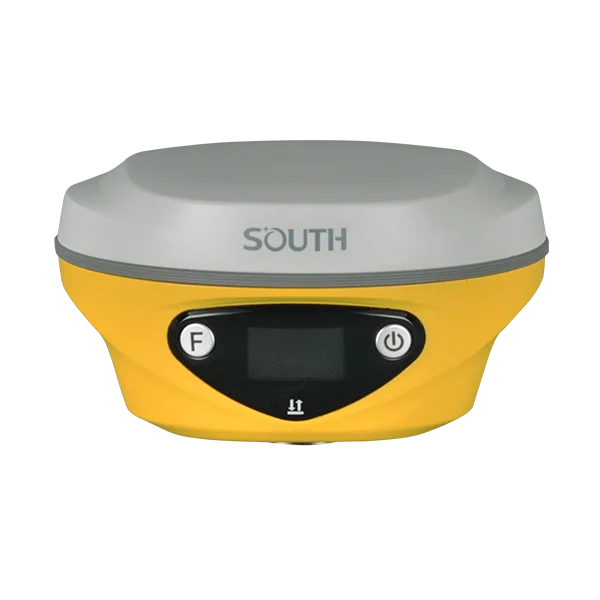
| Buttons | Dual buttons |
| Indicators | Satellite, data and power indicators |
| Display | 1.14 inch display, 135 × 240 pixels |
| Voice Guidance | Chinese, English, Korean, Spanish, Portuguese, Russian, Turkish, French, Italian and Arabic |
| Secondary Development | Provides secondary development package and opens the OpenSIC observation data format and interaction interface definition |
| Cloud Service | Supports online services such as remote management, firmware updates and online registration |
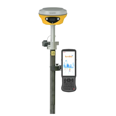
| Compatible Field Software | Designed for use with SOUTH field software such as SurvStar for RTK, AR stakeout, photogrammetry and laser survey workflows |
Supported Survey Workflows
| Control Survey | Supports high-precision static measurements for control and deformation observation tasks |
|---|---|
| Highway Survey | Supports control point densification, road topographic mapping, cross-section measurement and profile measurement workflows |
| CORS / NTRIP Operation | Supports network correction workflows using NTRIP and common network RTK models |
| Data Acquisition | Supports field data collection with SOUTH measurement software |
| Stakeout | Supports point, line and plane stakeout plus AR, CAD and laser stakeout workflows |
| Power Line Measurement | Supports orientation, ranging and angle calculation workflows |
| Marine Applications | Can be used for positioning support in marine surveying workflows such as dredging and piling operations |
| Forestry | Supports tree-position and trunk-center measurement workflows using laser and eccentric measurement methods |
| UAV Mapping | Supports ground image measurement and control point supplementation for UAV-derived 3D models |
Package / Accessory References
| Item | Quantity | Notes |
|---|---|---|
| ALPS1 Receiver | 1 | Main GNSS receiver unit |
| Instrument Case | Configuration dependent | Hard case with internal anti-collision foam referenced in the user manual |
| Charger / PD Adapter | Configuration dependent | Used for charging the internal battery via Type-C cable |
| Type-C Cable | Configuration dependent | Used for charging, static data transmission, Web UI access and firmware update |
| UHF Antenna | Configuration dependent | Required when using the receiver in internal UHF mode |
| Other Survey Accessories | Configuration dependent | May include items such as carbon fiber pole, controller bracket, connector or tribrach depending on kit configuration |
Specifications and package contents may vary by configuration, region or manufacturer update. Always check the current configuration before ordering.
FAQ
South ALPS1 FAQ
Product Overview
What is the South ALPS1?
The South ALPS1 is a professional RTK GNSS receiver designed for high-precision surveying. It combines traditional GNSS positioning with visual positioning, laser measurement, AR stakeout and CAD-assisted stakeout in one field-ready system.
Who is the South ALPS1 designed for?
The South ALPS1 is designed for land surveyors, construction survey teams, forestry professionals, UAV mapping specialists, engineers and geomatics users who need fast and accurate point collection in both open and challenging environments.
What makes the South ALPS1 different from a standard RTK GNSS receiver?
Unlike a standard RTK receiver, the South ALPS1 adds video-based measurement, laser measurement, AR stakeout and CAD integration. This allows users to measure points remotely, work around obstructions and complete stakeout tasks with more visual guidance.
Which industries commonly use the South ALPS1?
The South ALPS1 is suitable for land surveying, construction, infrastructure, forestry, UAV mapping, road surveys, topographic mapping, control surveys and 3D modelling support.
Can the South ALPS1 be used for everyday land surveying?
Yes. The South ALPS1 can be used for conventional RTK surveying as well as more advanced workflows such as visual positioning, laser survey, AR stakeout and CAD-based field layout.
GNSS, RTK and Accuracy
How many GNSS channels does the South ALPS1 have?
The South ALPS1 has 1698 GNSS channels, helping it track multiple satellite signals for reliable positioning in professional survey applications.
Which satellite constellations does the South ALPS1 support?
The South ALPS1 supports major GNSS constellations including GPS, GLONASS, BeiDou and Galileo. It also supports additional satellite signals such as SBAS, IRNSS, QZSS and MSS L-Band options depending on availability and configuration.
Does the South ALPS1 support RTK corrections?
Yes. The South ALPS1 supports RTK corrections through both UHF radio and NTRIP network correction workflows, making it suitable for rover, network RTK and base-rover field setups.
What RTK accuracy can the South ALPS1 achieve?
The South ALPS1 specification lists RTK accuracy at 8 mm + 1 ppm horizontal and 15 mm + 1 ppm vertical when using UHF RTK, and 8 mm + 0.5 ppm horizontal and 15 mm + 0.5 ppm vertical when using NTRIP RTK. Actual accuracy can vary with site conditions, satellite geometry, corrections and workflow.
Does the South ALPS1 work in weak GNSS signal areas?
The South ALPS1 is built to support challenging survey environments. Its multi-constellation GNSS tracking, IMU, camera and laser functions help users continue measuring in places where standard RTK workflows may be slower or more difficult.
Can the South ALPS1 be used with NTRIP correction services?
Yes. The South ALPS1 supports NTRIP and can work with correction methods such as VRS, FKP and MAC when supported by the correction service and field software.
Laser, Camera and Stakeout Functions
What is the laser measurement function used for?
The laser measurement function allows users to measure target points remotely. This is useful when a point is difficult, unsafe or inconvenient to reach directly with a survey pole.
What is the laser working range of the South ALPS1?
The South ALPS1 uses a 3R green laser with a listed working range of up to 30 metres. Practical performance can depend on the target surface, lighting and field conditions.
Can the South ALPS1 measure points without standing directly on them?
Yes. The laser and visual positioning functions allow remote point measurement, which can reduce the need to physically occupy every point in the survey area.
How does visual positioning help in the field?
Visual positioning allows the receiver to use image or video data to obtain coordinates for multiple points. This can speed up data collection and help measure areas that are obstructed, difficult to access or unsuitable for direct pole measurement.
Does the South ALPS1 support AR stakeout?
Yes. The South ALPS1 supports AR stakeout using its camera system, helping users navigate toward stakeout points with visual guidance in the field.
Can the South ALPS1 work with CAD drawings for stakeout?
Yes. The South ALPS1 supports CAD AR stakeout workflows, allowing CAD drawing content to be integrated with the real-world field view for more intuitive stakeout.
How many cameras does the South ALPS1 have?
The South ALPS1 includes an 8MP video shooting camera and a 2MP AR stakeout camera. These cameras support visual measurement, AR stakeout and CAD-assisted field workflows.
Field Performance, Connectivity and Data
Is the South ALPS1 waterproof and dustproof?
Yes. The South ALPS1 has an IP68 waterproof and dustproof rating, making it suitable for demanding outdoor surveying environments.
How durable is the South ALPS1?
The South ALPS1 has a magnesium-aluminium alloy shell and is specified to withstand a natural 2 metre pole drop onto cement ground, helping protect it during field use.
How long does the South ALPS1 battery last?
The listed battery life is up to 25 hours in static mode, up to 20 hours as a UHF RTK rover without camera use, up to 15 hours for laser survey or visual stakeout, and up to 12 hours as a UHF RTK base. Battery life depends on settings, usage and field conditions.
What connectivity options does the South ALPS1 support?
The South ALPS1 supports UHF radio, Bluetooth, NFC, Wi-Fi/Web UI access, Type-C connection, external power and data interfaces. It also supports NTRIP workflows for network RTK corrections.
What is the UHF radio range of the South ALPS1?
The South ALPS1 specification lists a typical Farlink UHF communication range of 8 to 10 km, with up to 12 to 15 km possible in optimal conditions. Actual range depends on terrain, antenna setup, interference and local radio conditions.
What data formats does the South ALPS1 support?
The South ALPS1 supports common professional survey data formats including RINEX, RTCM and NMEA 0183, along with other receiver and coordinate output formats used in GNSS workflows.
Can the South ALPS1 be configured through a Web UI?
Yes. The South ALPS1 can be accessed through a Web UI via Wi-Fi or USB connection, allowing users to monitor receiver status and change receiver configurations.
Videos
Reviews (1)
1 review for South ALPS1 Laser Vision IMU RTK GNSS Receiver
| 5 star | 100% | |
| 4 star | 0% | |
| 3 star | 0% | |
| 2 star | 0% | |
| 1 star | 0% |
Only logged in customers who have purchased this product may leave a review.

Matthew Bosci (verified owner) –
Has good functions, like it!