FJD Trion V1t Rover Set Product Review
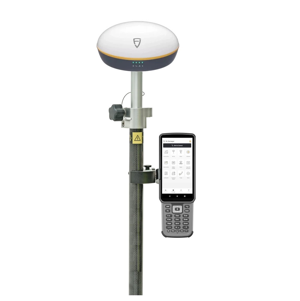
FJD Trion V1t Rover Set
The FJD Trion V1t Rover Set is a complete RTK GNSS rover package for professionals who need accurate positioning in the field without building a system from separate components. It is suitable for surveyors, construction workers, engineers, GIS teams, drone ground control workflows, agricultural mapping and infrastructure projects where reliable GNSS measurements are needed.
This rover set combines the FJD Trion V1t GNSS receiver, the FJD Trion E600 field controller and FJD Trion Survey software. Together, they form a full field solution for collecting points, measuring features, staking out designs, working from CAD drawings and managing GNSS data in one connected workflow.
Key advantages
- Complete RTK GNSS rover set with receiver, controller and field software.
- 1408-channel GNSS tracking for GPS, GLONASS, Galileo, BeiDou, QZSS, SBAS and IRNSS signals.
- IMU tilt survey support for faster point measurement without carefully levelling the pole every time.
- Internal UHF radio support for rover and base workflows where radio correction is required.
- FJD Trion Survey software supports point collection, stakeout, CAD stakeout, road stakeout, DTM stakeout and calculation tools.
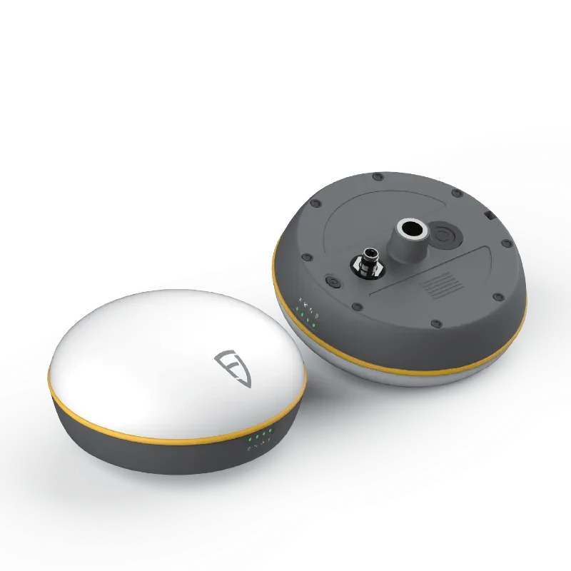
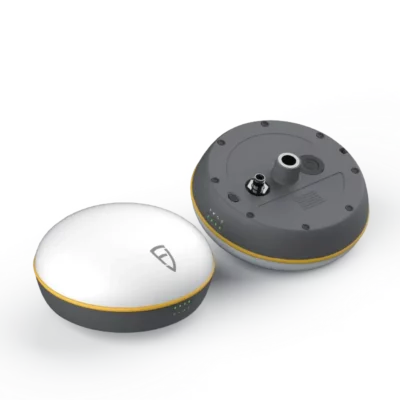
- IP67-rated receiver with 32 GB internal memory for demanding outdoor use.
Built for practical RTK fieldwork
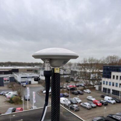
The FJD Trion V1t receiver is designed for survey and construction users who need centimetre-level positioning in real field conditions. With 1408 channels and support for multiple GNSS constellations, the receiver can track a wide range of satellite signals. This helps maintain stable positioning when working on open construction sites, roads, agricultural fields, infrastructure projects or mapping jobs.
The receiver supports RTK measurement with a typical RTK accuracy of ±(8 mm + 1 ppm) horizontal and ±(15 mm + 1 ppm) vertical. For surveyors and site engineers, this is the level of accuracy required for common layout, topographic survey, control work, machine control preparation, as-built checks and engineering measurements.
IMU tilt survey for faster measuring
The FJD Trion V1t includes a built-in IMU for tilt survey workflows. The specified tilt survey accuracy is 30° / 2.5 cm horizontal, with a maximum tilt angle of 60°. In practice, this helps users measure points near walls, fences, trenches, kerbs, stockpiles, buildings or other places where keeping the pole perfectly vertical is difficult.
For construction workers and survey crews, tilt compensation can reduce time spent levelling the pole and make it easier to capture points that would otherwise require awkward positioning. It is especially useful for quick topographic measurements, road edges, utility mapping and busy construction sites.
Internal UHF radio and correction workflows
The V1t receiver includes internal radio support with selectable radio protocols including TRIMTALK, TRIMMARK III, TT450S, TRANSEOT and Satel 3AS 4FSK. The radio frequency range is specified as 410–470 MHz / 902–928 MHz, with 1 W power consumption and 1.8 W optional.
This makes the rover set suitable for users who want to work with a local base station or compatible radio correction source. The receiver also supports standard GNSS data formats including RTCM3.X, NMEA-0183, CMR and RTCM2.X, which helps the V1t fit into different RTK workflows.
FJD Trion E600 field controller
The included FJD Trion E600 field controller gives operators a dedicated handheld device for running field software, managing jobs and controlling the rover. It has a 5.5-inch screen, 2.2 GHz CPU, 4 GB RAM + 64 GB storage, 7700 mAh battery and up to 24 hours battery life.
For field crews, this means the rover set is ready for full working days without depending on a personal phone. The E600 also supports USB Type-C with OTG and is listed as a 1.8-metre drop test survivor, making it a practical controller for construction sites, survey crews and outdoor GNSS work.
FJD Trion Survey software
FJD Trion Survey software turns the V1t rover into a complete field measuring system. The software supports the main tools surveyors and construction teams expect from a modern GNSS controller, including point measurement, auto measure, control measure, tilt measure, measure and draw, GIS survey, track measurement, visual measure, laser measure, scan measure and PPK measure.
For stakeout work, FJD Trion Survey supports stake points, stake lines, stake DTM, stake CAD, stake road, stake slope and AR stakeout. This makes the set useful not only for collecting data, but also for setting out designs directly in the field.
The software also includes calculation tools such as volume, area calculation, area division, inverse, point to line, traverse, offset point, deflection, slope, intersection, segment line, arc, bisect angle, triangle and rectangle tools. These functions help users complete more work directly on the controller instead of returning to the office for every calculation.
CAD, GIS and field-to-office workflow
FJD Trion Survey supports common data formats including ASCII, DWG, DXF, KML, SHP, NCN, SIM, GT, RW5 and PDF. This is especially useful for construction and engineering teams who receive drawings from designers and need to take those files directly into the field.
The software supports more than 6,000 predefined coordinate systems, with grid and geoid support. It also supports cloud-based data handling with 5 GB cloud storage, helping field and office teams exchange data, review measurements and manage project information more efficiently.
Applications
The FJD Trion V1t Rover Set is suitable for a wide range of professional GNSS jobs, from basic point collection to more advanced stakeout and construction workflows.
- Land surveying and topographic mapping
- Construction layout and site control
- Road construction and road stakeout
- GIS data collection and asset mapping
- Precision agriculture and field mapping
- Engineering monitoring and infrastructure projects
- Earthworks, mining and volume measurements
- Ground control points for drone mapping
Technical specifications
GNSS signal support
| Constellation / Signal |
Supported signals |
| GPS |
L1, L1C/A, L2C, L2P, L5 |
| BDS / BeiDou |
B1I, B2I, B3I, B1I, B3I, B1C, B2a, B2b |
| GLONASS |
G1, G2, G3* |
| Galileo |
E1, E5a, E5b, E6C*, AltBOC* |
| QZSS |
L1, L2C, L5, L1C*, L1-SALF |
| SBAS |
L1C/A, L5* |
| IRNSS |
L5* |
| HAS-PPP |
E6 |
Receiver specifications
| Specification |
FJD Trion V1t |
| Channels |
1408 |
| Size and weight |
Ø162 × 86 mm; 1070 g |
| IP rating |
IP67 |
| Internal memory |
32 GB |
| Battery capacity |
6500 mAh |
| Battery life |
Base 10 h, Rover 15 h typically |
| Indicators |
Power, data, satellite and Bluetooth |
Positioning performance
| Specification |
Value |
| Time to first fix |
< 20 s cold start; < 10 s hot start |
| Signal reacquisition |
< 1 s |
| Pseudo-range accuracy |
≤ 10 cm |
| Carrier phase accuracy |
≤ 1 mm |
| RTK initialization time |
< 5 s, baseline length < 10 km |
| Initialization reliability |
> 99.9% |
| Single positioning accuracy |
Horizontal ±1.5 m, Vertical ±2.5 m |
| Static accuracy |
Horizontal ±(2.5 mm + 0.5 ppm), Vertical ±(5 mm + 0.5 ppm) |
| RTK accuracy |
Horizontal ±(8 mm + 1 ppm), Vertical ±(15 mm + 1 ppm) |
| PPP accuracy |
Horizontal ±20 cm, Vertical ±40 cm |
| Timing accuracy |
20 ns |
| Update rate |
Raw observation data: 1, 2, 5, 10, 20 Hz; Real-time positioning data: 1, 2, 5, 10, 20 Hz |
| Tilt survey accuracy |
30° / 2.5 cm horizontal, max angle 60° |
| Data format |
Input & output: RTCM3.X, NMEA-0183; Input: CMR, RTCM2.X |
Communication, radio and ports
| Specification |
Value |
| Wi-Fi |
IEEE 802.11 b/g/n protocol standard |
| Bluetooth |
BR / EDR |
| Internal radio power |
1 W, 1.8 W optional |
| Internal radio modulation |
GMSK or 4FSK |
| Internal radio frequency |
410–470 MHz / 902–928 MHz |
| Internal radio protocol |
TRIMTALK, TRIMMARK III, TT450S, TRANSEOT, Satel 3AS 4FSK |
| Type-C port |
Supports 12 V DC fast charge |
| UHF antenna port |
Supports UHF antenna connection |
| 7-pin Lemo |
Supports 9–32 V DC power input, external radio port |
Power and environmental specifications
| Specification |
Value |
| Power supply |
USB PD fast charging 30 W; Aviation plug support 9–32 V DC |
| Operating temperature |
-30°C to +60°C |
| Storage temperature |
-40°C to +70°C |
| Humidity |
100%, condensing |
FJD Trion E600 controller specifications
| Specification |
Value |
| Screen |
5.5-inch screen |
| Battery |
7700 mAh |
| Battery life |
24 h |
| CPU |
2.2 GHz |
| Memory |
4 GB RAM + 64 GB storage |
| Connection |
USB Type-C, OTG support |
| Ruggedness |
1.8-metre drop test survivor |
FJD Trion Survey software functions
| Category |
Supported functions |
| Data collection |
Measure Points, Auto Measure, Control Measure, Tilt Measure, Measure & Draw, GIS Survey, Measure Track, Visual Measure, Laser Measure, Scan Measure, PPK Measure |
| Stakeout |
Stake Points, Stake Lines, Stake DTM, Stake CAD, Stake Road, Stake Slope, AR Stakeout |
| Calculation tools |
Volume, Area Calculation, Area Division, Inverse, Point to Line, Traverse, Offset Point, Deflection, Slope, Intersection, Segment Line, Arc, Bisect Angle, Triangle, Rectangle |
| Coordinate systems |
6000+ predefined, Grid, Geoid |
| Codes |
30+ symbols, customizable color |
| Data import / export |
ASCII, DWG, DXF, KML, SHP, NCN, SIM, GT, RW5, PDF |
| Differential link |
Internal radio, External radio, Wi-Fi, NTRIP, FDDS, TCP |
| Radio protocol |
TRIMTALK, TRIMMK3, TT450S, TRANSEOT, SATEL |
| Cloud drive |
Free 5 GB cloud storage, supports data upload, download and sharing |
| GNSS Studio |
Post-processing platform supporting RTCM, RINEX 2.x and RINEX 3.x |
Why buy from Global GPS Systems?
Global GPS Systems supplies professional GNSS equipment to surveyors, construction companies, GIS teams, drone pilots and engineering professionals worldwide. We ship from the Netherlands and offer insured delivery, so your equipment is protected during transport.
Our team can help with import and export questions, warranty, RTK correction workflows, NTRIP setup, radio setup and choosing the right receiver or rover set for your work. If you are comparing the FJD Trion V1t Rover Set with other RTK GNSS systems, Global GPS Systems can help you check whether this receiver, controller and software combination fits your workflow.
FAQ
What is included in the FJD Trion V1t Rover Set?
The set is built around the FJD Trion V1t GNSS receiver, the FJD Trion E600 field controller and FJD Trion Survey software. Exact accessories such as pole, bracket, charger, case or cables can depend on the package configuration, so check the current product bundle before ordering.
Is the FJD Trion V1t Rover Set suitable for construction layout?
Yes. The V1t rover set is suitable for construction layout, road work, point stakeout, line stakeout, CAD stakeout and site measurements. The FJD Trion Survey software includes stakeout tools that are useful for construction and engineering projects.
Does the FJD Trion V1t support tilt measurement?
Yes. The receiver supports IMU tilt survey with a specified 30° / 2.5 cm horizontal accuracy and a maximum tilt angle of 60°.
How accurate is the FJD Trion V1t in RTK mode?
The specified RTK accuracy is horizontal ±(8 mm + 1 ppm) and vertical ±(15 mm + 1 ppm). Actual field results depend on satellite visibility, correction quality, baseline length, environment and correct setup.
Which satellite systems does the FJD Trion V1t track?
The receiver supports GPS, BDS / BeiDou, GLONASS, Galileo, QZSS, SBAS, IRNSS and HAS-PPP signals as listed in the specifications.
Can the FJD Trion V1t work with a base station?
Yes. The receiver includes internal UHF radio support and supports radio protocols such as TRIMTALK, TRIMMARK III, TT450S, TRANSEOT and Satel 3AS 4FSK. It can be used in rover and base workflows when configured with compatible correction equipment.
Does the FJD Trion V1t have an internal internet modem?
The current product information lists the internet modem as none. For NTRIP workflows, the field controller or another connected device may be used depending on your setup.
What software comes with the FJD Trion V1t Rover Set?
The rover set uses FJD Trion Survey software. It supports point measurement, GIS survey, CAD stakeout, road stakeout, DTM stakeout, AR stakeout, calculation tools and common import/export formats such as DWG, DXF, SHP, KML and PDF.
Is the FJD Trion V1t suitable for GIS work?
Yes. The rover set can be used for GIS survey, asset mapping and field data collection. The software supports GIS survey tools and file formats such as SHP and KML.
Can Global GPS Systems help me choose the right RTK GNSS rover?
Yes. Global GPS Systems can help compare receivers, rover sets, correction services and software workflows so you can choose the right GNSS solution for your fieldwork.


Reviews
There are no reviews yet