

 GPS & GNSS
 Lidar scanning
 Total Station


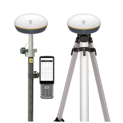


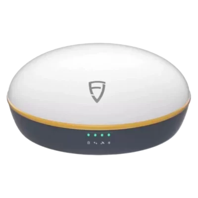
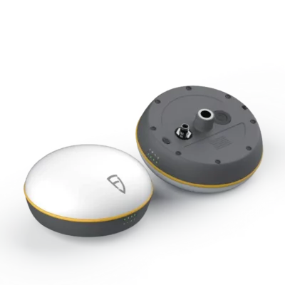










Independent RTK surveying with a complete rover and base system
The FJD Trion V1t Rover and Base Set provides two GNSS receivers for accurate surveying on sites where an RTK network is unavailable, unreliable or simply not preferred. One receiver is installed over a known or newly established point as the base station. It calculates local correction data and sends this information to the mobile V1t rover, allowing the operator to measure and set out points with centimetre-level accuracy.
This makes the system a practical choice for construction sites, remote projects and private work areas where crews want control over their own correction source. Because the base and rover communicate directly by UHF radio, the survey workflow does not have to depend on continuous mobile-data coverage.
Multi-constellation GNSS tracking
Each V1t receiver uses a 1408-channel GNSS board that tracks signals from GPS, GLONASS, Galileo, BeiDou, QZSS, SBAS and NavIC. Using several constellations gives the system access to more satellite observations throughout the working day.
For field crews, this supports more consistent positioning as the satellite geometry changes and when parts of the sky are restricted by buildings, machinery, vegetation or site structures. As with every GNSS system, the best results are achieved with a suitable view of the sky and a correctly positioned base station.
IMU tilt measurement for faster point collection
The integrated IMU allows the rover pole to be tilted while the software calculates the position of the pole tip. This reduces the need to centre the bubble perfectly before every observation and makes it easier to reach points beside walls, underneath overhangs, near fences or around stored materials.
Tilt surveying is particularly useful during dense topographic measurement and construction checks, where repeatedly levelling the pole can slow the operator down. The manufacturer specifies 2.5 cm horizontal tilt accuracy at 30 degrees, with a maximum supported angle of 60 degrees.
Long-range base-to-rover communication
The V1t is available with 2 W and 5 W internal UHF radio configurations. The higher-power version is intended for larger sites and can provide a stated communication range of up to 15 kilometres under open conditions. Actual range depends on terrain, obstructions, antenna placement, interference, radio settings and local frequency regulations.
Support for protocols including LoRa, TRIMTALK, TRIMMARK III and TT450S helps the system fit into different radio workflows. An external high-power radio can also be added for projects that require greater coverage or a more powerful base transmission setup.
Centimetre-level positioning for survey and construction work
With a fixed RTK solution, the system is specified for horizontal accuracy of ±(8 mm + 1 ppm) and vertical accuracy of ±(15 mm + 1 ppm) RMS. These figures make the V1t suitable for common professional tasks such as recording survey features, checking finished work, setting out site coordinates and collecting accurate asset positions.
Typical applications include:
- Topographic and cadastral surveying
- Construction layout and as-built measurement
- Road, bridge and infrastructure projects
- Utility and GIS asset mapping
- Ground-control and checkpoint surveys for drone mapping
Drone operators can use the rover to measure ground-control points and independent checkpoints before or after a flight. The V1t is used on the ground for control and verification rather than being installed directly on the aircraft.
Field controller and survey software
The set works with the FJD Trion E600 field controller and FJD Trion Survey software. The E600 combines a 5.5-inch display with physical keys, making it suitable for outdoor operation where gloves, wet conditions or bright sunlight can make touchscreen-only control less convenient.
FJD Trion Survey supports field functions such as point measurement, drawing, point and line stakeout, road stakeout, DTM stakeout, CAD stakeout and basic CAD editing. This allows crews to carry out both data collection and setting-out work from the same field interface.
Designed for full working days outdoors
The V1t receiver has an IP67-rated enclosure and is designed for use in dusty and wet field environments. Its operating temperature range supports work across a wide range of seasonal conditions, while the internal 6500 mAh battery reduces the need for frequent battery changes.
The current manufacturer specification lists up to 8 hours of base operation and up to 20 hours of rover operation when using 2 W transmit power. Working time varies with radio output, temperature, receiver settings and battery condition. Optional external power accessories can extend base-station operation during longer surveys.
Why choose a dedicated base and rover set?
A local base-and-rover setup is useful when no suitable correction network is available, when mobile reception is poor or when a project requires an independent correction source. It can also help maintain a consistent site coordinate workflow across repeated visits, provided the base is established correctly each time.
The base should be installed on a stable point with a clear sky view and configured with the correct antenna height and coordinates. Careful base setup is essential because an error at the base is transferred to every point measured by the rover.
Configuration and support from Global GPS Systems
Global GPS Systems can help match the FJD Trion V1t Rover and Base Set to the required radio frequency, transmission power, controller and field accessories. This is important because permitted UHF frequencies and radio power levels vary by country.
The final package should also be checked for the required rover pole, base tripod or tribrach, controller bracket, radio antennas, chargers and transport cases. Selecting the correct configuration ensures the system is ready for the intended surveying, construction or mapping workflow.


 GPS & GNSS
 Total Stations
 Data collectors
 Software
 Correction services
 Machine control
 External radio
 Marine
 Accessories
Reviews
There are no reviews yet