
 GPS & GNSS
 Lidar scanning
 Total Station
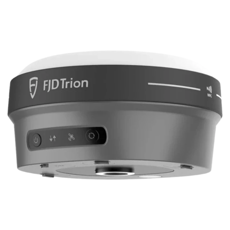

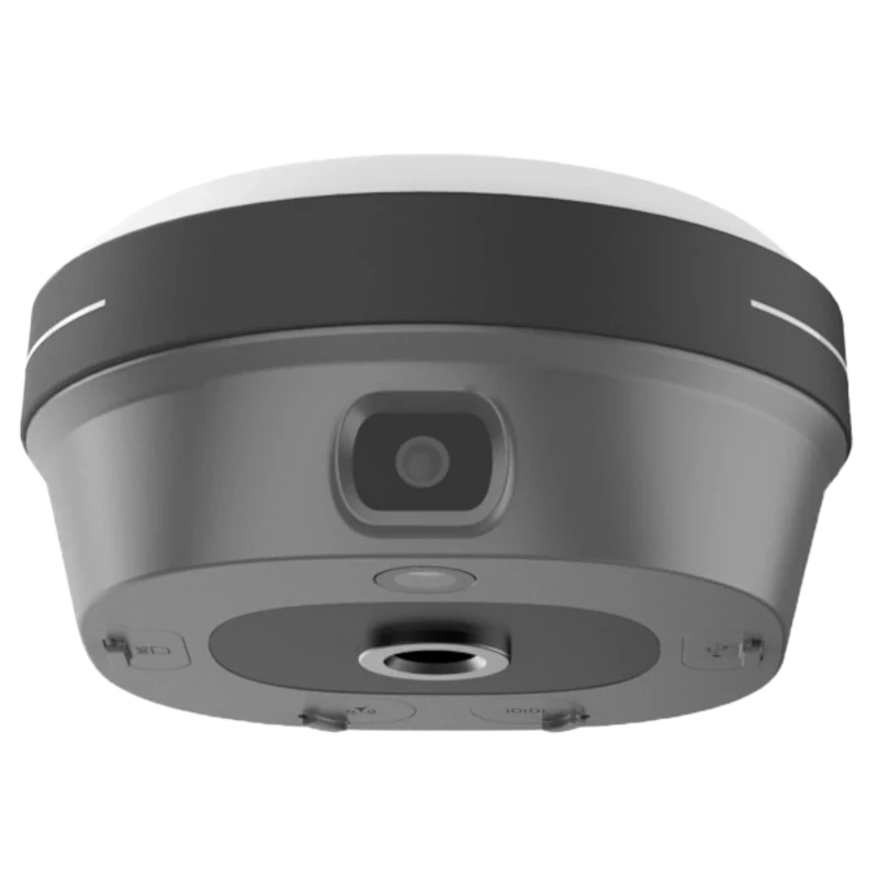
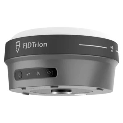


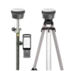
FJD Trion V10a RTK GNSS Receiver with AR Stakeout and 60° IMU
This product is available
Get the best price for your setup
Contact our experts for the best possible price and configuration.
The FJD Trion V10a is a compact RTK GNSS receiver developed for accurate surveying, construction layout and field data collection. Its dual 5 MP cameras provide visual guidance during stakeout, helping operators find points using the real jobsite view instead of relying only on arrows and coordinate values.
A 60° IMU tilt sensor allows measurements to be taken without holding the survey pole perfectly vertical. This is useful beside buildings, around obstacles, near road edges and in other positions where placing the pole directly above a point is difficult. With multi-constellation GNSS tracking, integrated UHF, 4G connectivity and an IP68 housing, the V10a is suitable for demanding everyday fieldwork.
FJD Trion V10a Highlights
| Visual stakeout | AR guidance with forward and downward 5 MP cameras |
|---|---|
| IMU tilt measurement | Up to 60° with magnetic-disturbance-resistant tilt compensation |
| RTK accuracy | Horizontal 8 mm + 1 ppm RMS and vertical 15 mm + 1 ppm RMS |
| GNSS tracking | 1,408 channels for GPS, GLONASS, Galileo, BeiDou, QZSS and additional signals |
| Communication | Integrated UHF radio, 4G modem, Wi-Fi, Bluetooth and NFC |
| Field protection | IP68 housing designed to survive a 2 m pole drop |
| Weight | Approximately 800 g |
| Battery runtime | Up to 15 hours as an RTK rover |


Valued customers:










Find RTK Networks
Search NTRIP providers and connect to reliable RTK correction services.
Description
Compact RTK GNSS Receiver with Visual Stakeout
The FJD Trion V10a combines professional RTK GNSS positioning with cameras, IMU tilt compensation and several correction-data options in a compact receiver. It is designed for surveyors, construction teams, engineers, GIS professionals and other field users who need accurate coordinates without carrying a large or heavy GNSS receiver.
Its main advantage is the combination of conventional satellite positioning with visual field guidance. Instead of navigating to a stakeout point using only directional arrows, the operator can view guidance over the live camera image. This makes it easier to understand where the point is located in relation to the actual ground, nearby structures and construction features.
AR Stakeout for Faster Point Location
The V10a uses a forward-facing camera and a downward-facing camera, each with a 5 MP resolution. During supported stakeout workflows, the system displays visual guidance over the real-world view. This can reduce the time spent walking back and forth while searching for a design point.
For construction layout, the visual workflow helps operators relate digital coordinates to foundations, kerbs, utilities, columns and other physical site elements. CAD information can also be displayed in the site view, allowing personnel to inspect how a proposed layout relates to existing conditions before or during construction.
Visual stakeout is particularly practical for teams that do not use surveying equipment every day. The camera view provides additional context, while experienced surveyors can use it to improve efficiency on sites with many closely spaced points.
Measure with the Pole Tilted up to 60 Degrees
The integrated IMU compensates for survey-pole tilt up to 60°. The pole therefore does not need to be held perfectly vertical for every measurement. This makes it easier to record points beside walls, underneath vegetation, near parked machinery, along trenches or in other locations where access directly above the point is restricted.
Tilt measurement also helps maintain a smoother working pace. Operators can position the pole tip on the required point and record the measurement without repeatedly checking and adjusting a physical bubble. The tilt sensor is designed to remain usable around magnetic interference, reducing the need for time-consuming field calibration procedures associated with conventional magnetic sensors.
Multi-Constellation GNSS Tracking
With 1,408 tracking channels, the FJD Trion V10a receives signals from major GNSS constellations including GPS, GLONASS, Galileo and BeiDou. It also supports signals from QZSS, SBAS and other regional or correction services, depending on firmware and local availability.
Tracking several constellations and frequencies gives the receiver access to more satellites across the sky. In practical use, this can support more stable positioning around buildings, machinery, trees and other partial obstructions than a receiver that tracks fewer signals. As with every GNSS instrument, the best accuracy is achieved with a suitable correction source and a sufficiently open view of the sky.
Professional RTK Positioning
The receiver provides specified RTK accuracy of 8 mm + 1 ppm RMS horizontally and 15 mm + 1 ppm RMS vertically under suitable operating conditions. This makes it suitable for tasks such as construction set-out, topographic detail surveys, cadastral measurements, road and bridge work, utility mapping and site verification.
The V10a can also collect static and post-processing data for workflows that require measurements to be processed after fieldwork. Its 32 GB internal memory provides space for survey data and raw observations.
Flexible RTK Correction Options
An integrated 4G modem allows the receiver to obtain corrections from an NTRIP or RTK network using a compatible SIM card and data service. This is a practical rover configuration in areas with reliable mobile coverage because no local base station is required.
For projects without dependable mobile internet, the built-in UHF radio can receive or transmit corrections between compatible GNSS receivers. This allows the V10a to be used in a rover and base workflow, subject to the selected configuration, local radio regulations and field conditions.
Wi-Fi, Bluetooth and NFC provide additional options for connecting a data controller, transferring information and pairing equipment. A USB Type-C connection and ports for an external radio and UHF antenna are also provided.
Designed for Everyday Field Conditions
The receiver weighs approximately 800 g and measures about 130 mm in diameter and 68 mm in height. Its smaller form reduces the weight carried at the top of the survey pole, which can make a noticeable difference during long days of continuous measurement and stakeout.
The IP68-rated enclosure is dustproof and protected against continuous immersion to a depth of 1 metre under the stated test conditions. It is also designed to survive a 2 m pole drop. These features make the receiver suitable for construction sites, wet weather, dusty environments and regular transport between projects.
The specified operating-temperature range is from -35°C to 65°C. A waterproof and breathable membrane helps manage moisture in demanding outdoor environments.
Battery Life for Full Working Days
The built-in 4,900 mAh battery provides up to 15 hours of rover operation, up to 10 hours in base mode and more than 25 hours during static measurement, depending on working mode, temperature, communications and camera use. Support for 30 W USB Power Delivery fast charging helps reduce turnaround time between jobs.
Applications
The FJD Trion V10a is suited to a broad range of accurate positioning and layout work:
- Construction point and line stakeout
- Topographic and cadastral surveying
- Road, bridge and infrastructure projects
- Utility and pipeline data collection
- Earthworks, volume checks and site verification
- GIS asset mapping and control-point measurement
- River, coastline and environmental surveys
Construction workers can use the visual guidance to locate design points more intuitively. Professional surveyors benefit from the RTK, static and PPK measurement options. Engineers and GIS teams can collect accurate coordinates for site documentation, asset inventories and progress checks.
Choosing the Correct FJD Trion V10a Configuration
The final system can be configured for network RTK, UHF rover and base operation, visual stakeout or larger CAD and GIS workflows. Available controller options range from compact field controllers to larger rugged tablets, allowing the system to be matched to the software, drawing size and working method used by the operator.
Global GPS Systems can help determine the appropriate receiver, controller, software and correction-service configuration for the intended country and application. This is especially important when selecting UHF frequencies, mobile-network compatibility and accessories for an existing GNSS workflow.
Datasheets & Manuals
Datasheets and manuals
Specifications
FJD Trion V10a GNSS Receiver Specifications
Product Overview
| Product type | Multi-constellation RTK GNSS receiver |
|---|---|
| Primary applications | Cadastral surveying, construction surveying, topographic surveying, river and coastline surveying, bridge and road surveying, and utility infrastructure surveying |
| Visual guidance | Augmented-reality stakeout with live camera guidance |
| CAD visualization | Supports mixed-reality visualization of CAD drawings within the live site view |
| Tilt surveying | IMU-assisted tilt compensation up to 60° |
| Receiver status indication | Four LED status indicators |
GNSS Tracking
| GNSS channels | 1408 |
|---|---|
| GPS signals | L1A, L1C, L2C, L2P, L5 |
| GLONASS signals | L1, L2, L3 |
| BeiDou signals | B1I, B2I, B3I, B1C, B2a, B2b |
| Galileo signals | E1, E5a, E5b, E6 |
| QZSS signals | L1, L2C, L5, L6 |
| NavIC / IRNSS signals | L5 |
| SBAS signals | L1 C/A |
| HAS-PPP signal | Galileo E6 |
| Firmware-dependent signals | QZSS L6 and NavIC / IRNSS L5 support may require a firmware upgrade |
Positioning Performance
| Positioning mode | Horizontal accuracy | Vertical accuracy |
|---|---|---|
| RTK | 8 mm + 1 ppm RMS | 15 mm + 1 ppm RMS |
| Post-processed static | 2.5 mm + 0.5 ppm RMS | 5 mm + 0.5 ppm RMS |
| High-precision static | 2.5 mm + 0.1 ppm RMS | 3.5 mm + 0.4 ppm RMS |
| PPK | 3 mm + 1 ppm RMS | 5 mm + 1 ppm RMS |
| PPP | ±20 cm RMS | ±40 cm RMS |
| Code differential | 0.4 m RMS | 0.8 m RMS |
| Autonomous | 1.5 m RMS | 2.5 m RMS |
RTK Initialization and Update Rates
| RTK initialization time | Less than 5 seconds |
|---|---|
| RTK initialization reliability | Greater than 99.9% |
| Positioning rates | 1 Hz, 2 Hz, 5 Hz, 10 Hz and 20 Hz |
| Cold-start time to first fix | Less than 20 seconds |
| Hot-start time to first fix | Less than 5 seconds |
| Signal re-acquisition | Less than 1 second |
| SBAS accuracy | 60 cm |
Tilt Compensation and Sensors
| Tilt range | 0° to 60° |
|---|---|
| Tilt-compensated RTK accuracy | 8 mm + 0.6 mm per degree of tilt RMS |
| Tilt sensor | IMU-based sensor designed to remain unaffected by magnetic disturbances |
| Electronic leveling | Electronic bubble level |
| Pole positioning | Automatically compensates for pole tilt without requiring the pole to be held vertically |
Camera and Visual Stakeout
| Forward camera | 5 MP |
|---|---|
| Downward camera | 5 MP |
| Camera field of view | 83° |
| Stakeout function | AR-assisted visual stakeout guidance |
| Live survey visualization | Displays survey points and CAD information over the real-world camera view |
| Typical visual-stakeout power consumption | 4.5 W |
Mobile Network and Wireless Connectivity
| SIM card | Nano-SIM |
|---|---|
| Cellular modem | Integrated 4G modem |
| Supported cellular networks | TDD-LTE, FDD-LTE, WCDMA, GSM, EDGE and GPRS |
| Wi-Fi | Dual-band 2.4 GHz and 5 GHz; IEEE 802.11a/b/g/n/ac |
| Bluetooth | Bluetooth 4.2 and Bluetooth Low Energy |
| NFC | One-touch NFC device pairing |
| RTK correction connectivity | Supports cellular, Wi-Fi, internal UHF radio and external radio workflows |
UHF Radio
| Built-in UHF frequency options | 410–470 MHz or 902–928 MHz, depending on regional configuration |
|---|---|
| Transmit power | Up to 2 W |
| Supported protocols | TRIMTALK, TRIMMARK III, TT450S, TRANSEOT, Satel 3AS 4FSK and LoRa |
| Radio link rate | 9,600 to 19,200 bps |
| Typical radio range | 6–12 km |
| Maximum stated radio range | Up to 16 km under suitable operating conditions |
| External radio support | Supported through the 7-pin LEMO port |
Ports and Data
| External radio port | 7-pin LEMO |
|---|---|
| UHF antenna connection | Dedicated UHF antenna port |
| USB connection | USB Type-C |
| Input and output data formats | NMEA 0183 and RTCM 3.x |
| Input data formats | RTCM 2.x and CMR |
| Internal storage | 32 GB |
Power and Battery
| Operating mode or parameter | Specification | Notes |
|---|---|---|
| Battery type | Built-in lithium-ion battery | Internal, non-swappable design |
| Battery capacity | 4900 mAh, 7.4 V | Operating time varies with temperature, radio use and operating mode |
| Fast charging | 30 W USB Power Delivery | USB Type-C charging |
| Rover operating time | Up to 15 hours | Internal battery |
| Base operating time | Up to 10 hours | Internal battery |
| Static operating time | More than 25 hours | Internal battery |
| External power input | 9–28 V DC | For extended field operation |
| Typical rover power consumption | 3 W | UHF or 4G RTK rover operation without camera |
| Typical visual-stakeout power consumption | 4.5 W | Camera-based visual stakeout operation |
Environmental Protection
| Ingress protection | IP68 |
|---|---|
| Dust protection | Dust-tight |
| Water protection | Protected against continuous immersion to a depth of 1 metre under the manufacturer’s specified conditions |
| Drop resistance | Designed to survive a 2 m survey-pole drop |
| Operating temperature | -35°C to +65°C |
| Storage temperature | -40°C to +70°C |
| Humidity | 95% non-condensing |
| Moisture management | Waterproof, breathable membrane intended to reduce water-vapour entry in harsh environments |
Physical Specifications
| Dimensions | Ø130 × 68 mm |
|---|---|
| Diameter | 130 mm |
| Height | 68 mm |
| Weight | Approximately 800 g |
| Housing design | Compact, lightweight receiver housing intended for outdoor surveying |
Compatible Field Workflows
| Rover operation | Network RTK, UHF RTK and external-radio RTK rover operation |
|---|---|
| Base operation | Can operate as an RTK base station with internal or external radio communication |
| Static surveying | Supports conventional and high-precision static GNSS surveying |
| Post-processing | Supports static post-processing and PPK workflows |
| Visual stakeout | Camera-assisted AR stakeout and live layout visualization |
| Controller options | Compatible with supported FJD Trion handheld controllers and field tablets; controller availability depends on package configuration |
Package and Included Items
| Item | Quantity | Notes |
|---|---|---|
| FJD Trion V10a GNSS receiver | 1 | Core receiver unit |
| Battery | 1 integrated | Built-in 4900 mAh lithium-ion battery |
| Charging equipment | Configuration dependent | Check whether the selected package includes a USB-C charger, power adapter and regional mains plug |
| UHF antenna | Configuration dependent | Frequency and antenna type may differ by region |
| Survey pole and accessories | Configuration dependent | May be sold separately or included in a kit |
| Field controller or tablet | Configuration dependent | Not necessarily included with receiver-only packages |
| Transport case | Configuration dependent | Confirm the current package contents before ordering |
| Software or RTK service access | Configuration dependent | Licences, subscriptions and correction-service access vary by seller and region |
Specifications and package contents may vary by configuration, region or manufacturer update. Always check the current configuration before ordering.
FAQ
FJD Trion V10a FAQ
Product Overview and Applications
What is the FJD Trion V10a?
The FJD Trion V10a is a compact, professional multi-frequency RTK GNSS receiver designed for accurate surveying, mapping and construction layout. It combines high-accuracy RTK positioning, dual cameras, augmented-reality stakeout guidance and IMU tilt compensation in a lightweight field-ready unit.
Who is the FJD Trion V10a designed for?
The FJD Trion V10a is designed for land surveyors, construction surveyors, civil engineers, site engineers, mapping professionals, utility contractors and field teams that need reliable high-accuracy positioning.
Which applications can the FJD Trion V10a support?
It can be used for cadastral surveying, topographic surveys, construction stakeout, road and bridge projects, utility mapping, control-point measurement, GIS data collection and other professional positioning tasks.
Can the FJD Trion V10a be used for construction stakeout?
Yes. Its dual cameras and augmented-reality guidance help operators navigate visually to design points, making construction layout and stakeout faster and easier to interpret in the field.
Can it be used for cadastral and boundary surveys?
Yes. When connected to a suitable RTK correction source and used in accordance with local surveying regulations, it can be used for boundary, cadastral and control surveys.
Can the FJD Trion V10a be used for topographic mapping?
Yes. Its multi-constellation GNSS tracking, RTK positioning and tilt compensation make it suitable for collecting terrain points, features, breaklines and other topographic survey data.
Accuracy, GNSS and Visual Stakeout
How accurate is the FJD Trion V10a?
Under suitable RTK conditions, the stated accuracy is 8 mm + 1 ppm RMS horizontally and 15 mm + 1 ppm RMS vertically. Actual accuracy depends on satellite visibility, correction quality, baseline length, multipath and site conditions.
What does the 60-degree IMU tilt compensation do?
The integrated IMU compensates for pole tilt at angles of up to 60 degrees. This allows operators to measure points without holding the survey pole perfectly vertical.
Does the IMU require calibration?
The tilt system is designed for efficient field use and resistance to magnetic interference. Operators should follow the current FJD Trion software instructions for initialization and measurement procedures.
What is AR stakeout?
AR stakeout places visual navigation guidance over the live camera view. This helps the operator locate target points in the real environment instead of relying only on arrows and numerical distances.
What are the dual cameras used for?
The forward-facing and downward-facing cameras support visual stakeout, alignment, real-time guidance and workflows that combine field imagery with survey or CAD information.
Can CAD information be displayed in the field?
Yes. In supported workflows, CAD drawings can be viewed in relation to the live site view, helping users compare the design with actual site conditions.
Which satellite constellations does it support?
The receiver supports multiple frequencies from major GNSS constellations, including GPS, GLONASS, Galileo and BeiDou.
RTK Corrections and Connectivity
Does the FJD Trion V10a need an RTK correction service?
RTK corrections are required to achieve the highest real-time positioning accuracy. Corrections can be received from an NTRIP or CORS network, a compatible base station or a UHF radio link.
Can it connect to an NTRIP network?
Yes. The integrated 4G modem can receive network RTK corrections from a compatible NTRIP service. A SIM card, mobile-data connection and valid NTRIP account may be required.
Can the FJD Trion V10a work as both a base and rover?
Yes. The receiver supports both base and rover operating modes, depending on the selected setup, radio configuration and software settings.
Does it have a built-in UHF radio?
Yes. The receiver supports internal UHF radio communication and can also be used in compatible external-radio workflows.
Which wireless connections are supported?
The receiver supports 4G mobile data, Wi-Fi, Bluetooth, NFC pairing and radio communication.
Which mobile networks are supported?
The integrated modem supports common network standards including TDD-LTE, FDD-LTE, WCDMA, GPRS and GSM/EDGE. Compatibility depends on the regional model and mobile operator.
Which controllers can be used with the FJD Trion V10a?
The receiver can be paired with compatible FJD Trion field controllers, including keyboard-controller and tablet options. Compatibility depends on the selected package and software version.
Battery, Durability and Field Use
How large and heavy is the FJD Trion V10a?
The receiver measures approximately 130 mm in diameter and 68 mm in height and weighs about 800 g.
How long does the battery last?
The built-in 4900 mAh battery provides up to approximately 15 hours in rover mode, 10 hours in base mode and more than 25 hours in static operation. Actual runtime depends on temperature, radio use, cameras and mobile connectivity.
Does it support fast charging?
Yes. The receiver supports 30 W Power Delivery fast charging through USB Type-C.
Is the FJD Trion V10a waterproof and dustproof?
Yes. It has an IP68 ingress-protection rating and is designed to resist dust and water under specified test conditions.
Can it survive accidental drops?
The receiver is designed to survive a two-metre pole drop, making it suitable for demanding field environments.
What is the operating temperature range?
The stated operating-temperature range is approximately -35°C to 65°C, with a storage range of approximately -40°C to 70°C.
Reviews (0)
Only logged in customers who have purchased this product may leave a review.
 GPS & GNSS
 Total Stations
 Data collectors
 Software
 Correction services
 Machine control
 External radio
 Lasers & levellers
 Marine
 Accessories
Reviews
There are no reviews yet