
 GPS & GNSS
 Lidar scanning
 Total Station
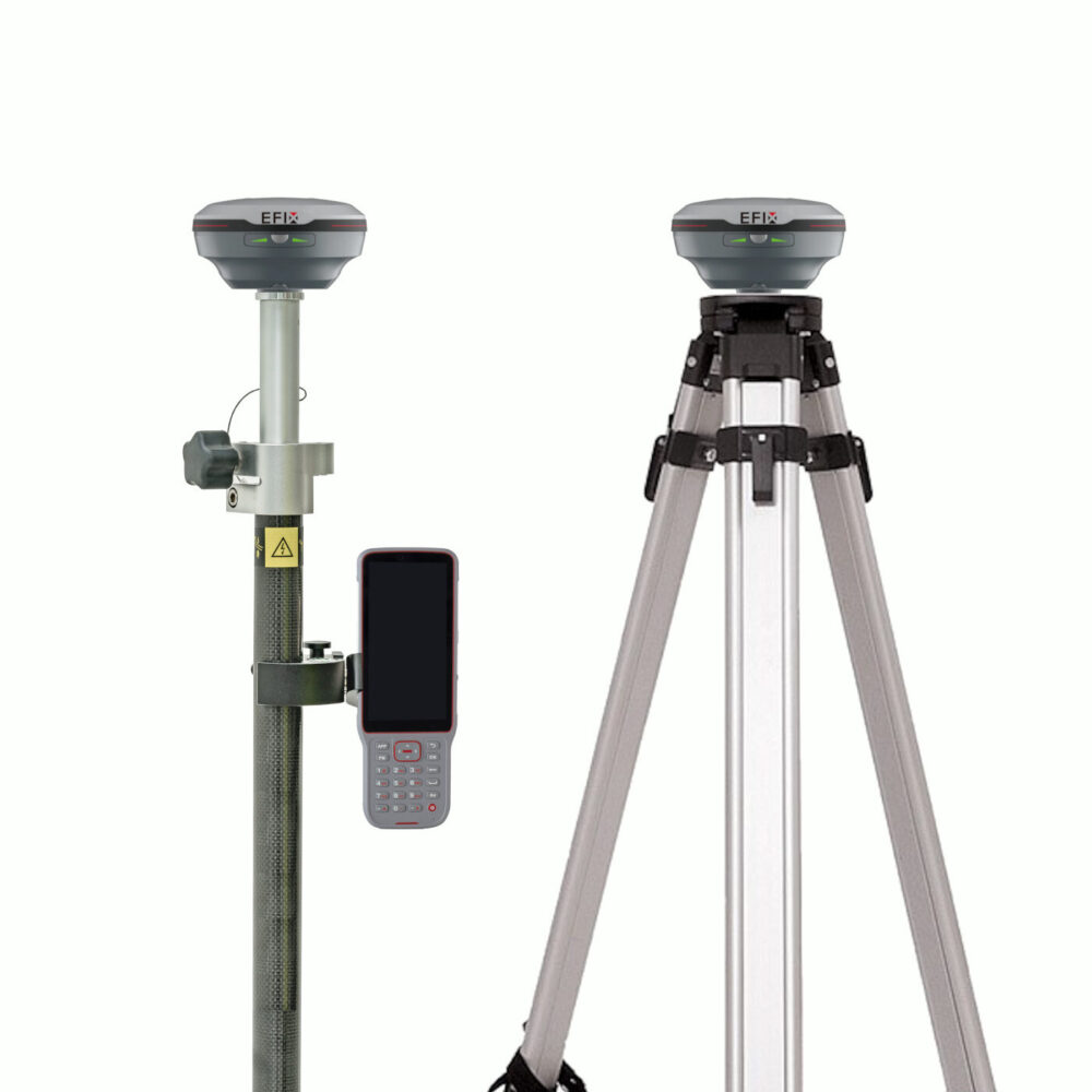
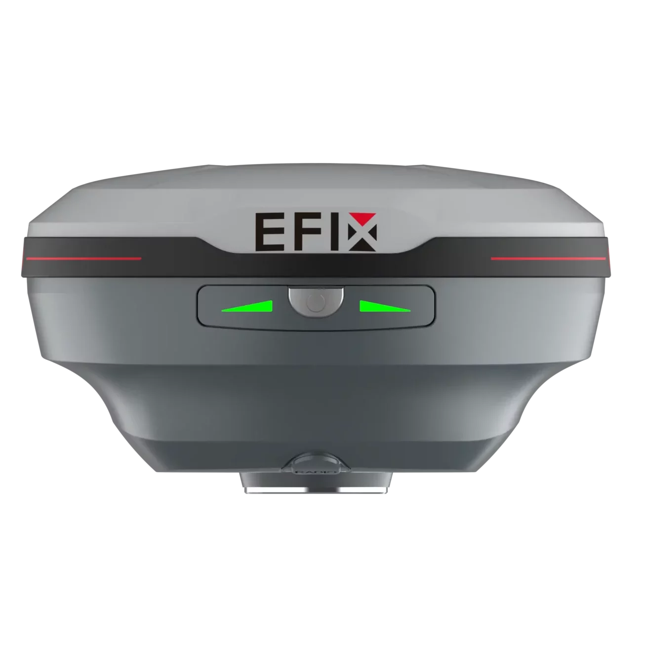




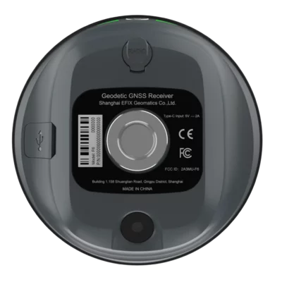
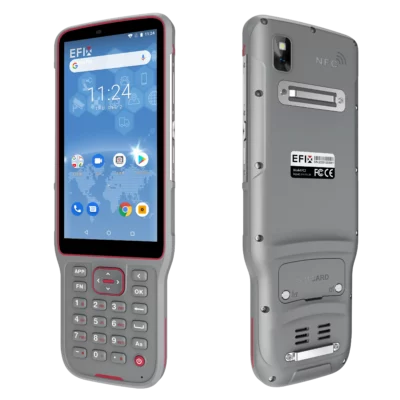



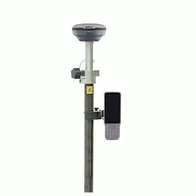
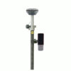
EFIX F6 Rover Base Set Vision IMU RTK GNSS Receiver
This product is Available
Contact our experts for the best possible price and configuration.
The EFIX F6 Rover Base Set is a compact RTK GNSS solution for surveyors, construction teams, GIS users and drone mapping professionals who need accurate positioning without relying only on an RTK network. With 1608 GNSS channels, 4D AUTO-IMU tilt compensation and AR vision stakeout, the F6 helps users measure and stake points faster in real field conditions.
Its lightweight 450 g receiver design, IP68 protection and long battery life make it practical for daily fieldwork on construction sites, infrastructure projects, topographic surveys and remote jobs where a local base and rover setup is the most reliable workflow.
EFIX F6 Rover Base Set Highlights
| GNSS Channels | 1608 channels with GPS, GLONASS, Galileo, BeiDou, QZSS, NavIC, SBAS and PPP support |
|---|---|
| RTK Accuracy | 8 mm + 1 ppm horizontal, 15 mm + 1 ppm vertical |
| IMU Tilt Compensation | 4D AUTO-IMU with tilt compensation up to 60° |
| Vision Stakeout | 2 MP camera with AR stakeout guidance in eField |
| Field Durability | 450 g receiver, IP68 rated, IK08 protection and 2 m pole drop resistance |


Valued customers:










Find RTK Networks
Search NTRIP providers and connect to reliable RTK correction services.
Description
Compact rover and base GNSS set for accurate fieldwork
The EFIX F6 Rover Base Set is designed for professionals who need reliable centimetre-level GNSS positioning on construction sites, survey projects, infrastructure work, GIS mapping and drone ground control tasks. By working with a local base and rover setup, the F6 is especially useful in areas where mobile internet coverage, CORS access or RTK network reliability cannot always be guaranteed.
For construction workers, surveyors and engineers, this means more control over corrections in the field. You can set up a local base on or near the job site and use the rover to measure, check, stake out or collect points with stable RTK performance. This makes the set suitable for earthworks, site layout, road projects, utilities, land surveying, boundary work and general machine control preparation.
Fast RTK positioning with full constellation tracking
The EFIX F6 uses a 1608-channel GNSS engine with support for multiple satellite constellations and frequency bands. In daily fieldwork, this helps the receiver keep a strong satellite lock and maintain reliable positioning, especially when conditions are less than perfect. For users working near buildings, trees, slopes or mixed terrain, stronger satellite tracking can make the difference between waiting for a fix and continuing the job.
With RTK accuracy specified at 8 mm + 1 ppm horizontally and 15 mm + 1 ppm vertically under suitable conditions, the F6 is built for professional measuring and stakeout tasks where dependable centimetre-level results are required. It supports common correction workflows including NTRIP and UHF radio communication, making it flexible for both network RTK and local rover-base operation.
4D AUTO-IMU tilt for quicker point measurement
The integrated 4D AUTO-IMU allows users to measure with the pole tilted up to 60°. This is useful when a point is difficult to access directly, such as near walls, fences, trenches, parked equipment, vegetation or building corners. Instead of spending extra time levelling the pole perfectly for every shot, operators can keep moving and collect points more efficiently.
The IMU is designed for automatic initialization during movement, which helps reduce setup time in the field. For practical use, this makes the EFIX F6 easier for both experienced surveyors and newer GNSS users who need a modern receiver that supports fast, flexible measurement routines.
AR vision stakeout for easier field guidance
The EFIX F6 includes AR vision stakeout using a built-in 2 MP camera. In supported workflows, the user can follow visual guidance on the controller screen instead of relying only on map arrows and distances. This is particularly helpful during construction layout, point staking and site checks where a clear visual direction can reduce mistakes and speed up the process.
For teams that regularly stake out points, lines or CAD-based design data, vision guidance makes the workflow more intuitive. It can help less experienced operators understand where to move, while still giving professional users the accuracy and GNSS performance they expect from an RTK rover.
Built for long days outside
At only 450 g, the EFIX F6 is a lightweight receiver that is comfortable to carry and use across long workdays. Its compact housing is designed for demanding field environments, with IP68 protection, IK08 impact resistance and 2 metre pole drop resistance. This makes it well suited to construction sites, open land surveys, road projects and remote field locations where equipment needs to handle dust, water and daily knocks.
The receiver supports up to 17 hours of operation in UHF or 4G RTK rover mode without camera use, up to 10 hours during vision stakeout and up to 22 hours in static mode. Charging is handled through USB Type-C, and power bank support makes it easier to keep working during long projects or travel days.
Useful software workflows for survey and construction
The EFIX F6 works with eField software for common field tasks such as map surveying, CAD stakeout, line and point work, CAD editing and earthwork volume calculations. This gives surveyors and construction professionals a practical workflow from measurement to stakeout without making the system unnecessarily complicated.
For GIS users and drone pilots, the F6 can also be useful for collecting accurate ground control points, checking site features and recording field data where better-than-handheld GPS accuracy is required. The combination of RTK GNSS, IMU tilt and visual stakeout makes it a versatile option for teams that need one compact receiver system for different field jobs.
Who is the EFIX F6 Rover Base Set for?
The EFIX F6 Rover Base Set is a good match for survey companies, construction contractors, civil engineering teams, road and utility crews, GIS departments and drone mapping professionals. It is especially useful for users who want the freedom of a rover and base setup instead of depending completely on local RTK networks.
Simple construction teams can use it for layout and checks, while surveyors can use it for accurate data collection, stakeout and control work. Drone pilots can use it for ground control points, and GIS users can improve the accuracy of field asset data. This makes the F6 a practical all-round RTK GNSS system for companies that work across different project types.
Buying from Global GPS Systems
Global GPS Systems supplies the EFIX F6 Rover Base Set to professionals who need accurate GNSS equipment with practical support before and after purchase. For buyers comparing RTK receivers, the F6 stands out through its lightweight design, 1608-channel GNSS engine, 4D AUTO-IMU tilt compensation, AR vision stakeout and rugged field-ready housing.
Whether you are upgrading from an older GNSS rover, adding a rover-base set for remote job sites or choosing your first professional RTK system, the EFIX F6 offers a strong balance of accuracy, portability and modern field functions.
Datasheets & Manuals
Datasheets and manuals
Specifications
EFIX F6 Rover Base Set Specifications
Product Overview
| Product type | GNSS RTK rover and base set |
|---|---|
| Receiver model | EFIX F6 Vision IMU-RTK GNSS receiver |
| Typical use | Land surveying, construction layout, staking, topographic mapping, earthworks and engineering field work |
| Main receiver features | 1608-channel GNSS, Full-Star technology, 4D AUTO-IMU tilt compensation, AR vision stakeout, internal UHF receiving radio and compact IP68-rated housing |
| Rover/base configuration | Configured as a rover and base set with receiver, controller, software and survey accessories; exact package may vary by selected configuration |
GNSS Performance
| GNSS channels | 1608 channels |
|---|---|
| GPS tracking | L1C/A, L2C, L2P(Y), L5 |
| GLONASS tracking | L1, L2, L3* |
| Galileo tracking | E1, E5a, E5b, E6* |
| BeiDou tracking | B1I, B2I, B3I, B1C, B2a, B2b* |
| QZSS tracking | L1C/A, L1C, L2C, L5 |
| NavIC / IRNSS tracking | L5 |
| SBAS tracking | L1, L5* |
| PPP support | B2b-PPP, E6B-HAS |
| Positioning rate | 1 Hz, 5 Hz and 10 Hz |
| Time to first fix | Cold start: <45 s; hot start: <10 s; signal re-acquisition: <1 s |
Positioning Accuracy
| Mode | Horizontal Accuracy | Vertical Accuracy |
|---|---|---|
| Real-time kinematic (RTK) | 8 mm + 1 ppm RMS | 15 mm + 1 ppm RMS |
| Post-processing kinematic (PPK) | 3 mm + 1 ppm RMS | 5 mm + 1 ppm RMS |
| Post-processing static | 2.5 mm + 0.5 ppm RMS | 5 mm + 0.5 ppm RMS |
| Code differential | 0.4 m RMS | 0.8 m RMS |
| Autonomous | 1.5 m RMS | 2.5 m RMS |
| Vision stakeout | 8 mm + 1 ppm RMS | 15 mm + 1 ppm RMS |
RTK Initialization
| RTK initialization time | <10 s |
|---|---|
| RTK initialization reliability | >99.9% |
| Accuracy conditions | Specified under open-sky, low-multipath conditions with optimal GNSS geometry and atmospheric conditions |
IMU and Tilt Compensation
| IMU type | 4D AUTO-IMU |
|---|---|
| IMU update rate | 200 Hz |
| IMU tilt angle | 0° to 60° |
| Additional horizontal pole-tilt error | Typically less than 2.5 cm within 30° |
| Tilt sensor behavior | Calibration-free IMU for pole-tilt compensation |
| Magnetic disturbance immunity | Immune to magnetic disturbance |
| Automatic initialization | Automatic initialization during motion; no manual IMU setup required |
Camera and AR Vision Stakeout
| Camera sensor | 2 MP |
|---|---|
| Aperture | F2.4 |
| Video frame rate | 30 fps |
| Camera function | Vision stakeout |
| AR stakeout function | Displays stakeout guidance with large arrows and real-time distance indication in eField software |
| Vision stakeout operating time | Up to 10 h |
Communications and Data
| Wi-Fi | 2.4 GHz 802.11 b/g/n and 5 GHz 802.11ac |
|---|---|
| Bluetooth | Bluetooth v4.2, backward compatible |
| NFC | NFC for device touch pairing |
| USB port | 1 x USB Type-C port for external power, data download and OTG firmware update |
| UHF antenna port | 1 x UHF antenna port, SMA female |
| Internal UHF radio | Internal receive-only radio, 410 MHz to 470 MHz |
| UHF protocols | EFIX, Transparent, TT450 |
| UHF link rate | 9600 bps to 19200 bps |
| Cellular modem | No integrated internet modem listed for the F6 receiver on the product page; network RTK can be used through compatible controller/software configuration |
| Correction/data formats | RTCM2.x, RTCM3.x, CMR input/output, Full Star HCN, RINEX 2.11, RINEX 3.02 |
| NMEA output | NMEA 0183 output |
| NTRIP support | NTRIP Client and NTRIP Caster |
| Internal data storage | 8 GB high-speed memory |
Power and Battery
| Charging port | USB Type-C |
|---|---|
| Charging time | Full charge in 4.5 hours |
| External power input | Type-C 5 V / 2 A |
| RTK operating time without camera | UHF/4G RTK rover without camera: up to 17 h |
| Vision stakeout operating time | Up to 10 h |
| Static operating time | Up to 22 h |
| Power bank support | Supports external power via USB Type-C power source |
| Battery runtime note | Battery life varies by operating temperature and operating mode |
Receiver Hardware and Durability
| Receiver dimensions | Φ106 mm x 55.6 mm (Φ4.17 in x 2.1 in) |
|---|---|
| Receiver weight | 450 g (0.99 lb) |
| Front panel | 2 synchronized LEDs + 1 button |
| Operating temperature | -40°C to +65°C (-40°F to +149°F) |
| Storage temperature | -40°C to +85°C (-40°F to +185°F) |
| Humidity | 100% non-condensing |
| Ingress protection | IP68 according to IEC 60529 |
| Shock resistance grade | IK08 |
| Drop resistance | Survives a 2-meter pole drop |
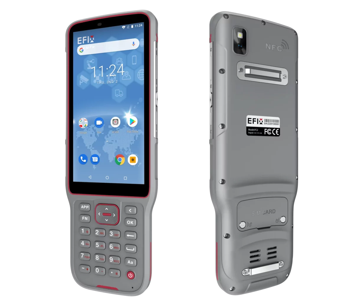
EFIX FC2 Data Collector
| Included controller | EFIX FC2 handheld data controller |
|---|---|
| Operating system | Android 8.1 |
| Processor | MediaTek MTK6762 Octa Core 2.0 GHz |
| RAM | 4 GB |
| Flash memory | 64 GB |
| Memory expansion | Micro SD card, up to 128 GB |
| Display | 5.5 in IPS LTPS LCD capacitive multi-touch screen, HD 1440 x 720, 296 ppi, scratch-resistant glass |
| Keypad | Alphanumeric keypad |
| Rear camera | 13 MP rear camera with auto-focus and flashlight |
| Controller Wi-Fi | IEEE 802.11 a/b/g/n/ac/d/e/h/i/k/r/v/w |
| Controller Bluetooth | Bluetooth v5.0 BLE |
| Mobile network support | 2G, 3G and 4G mobile network support |
| LTE bands | FDD-LTE B1/B2/B3/B4/B5/B7/B8/B12/B17/B20/B28AB; TDD-LTE B34/B38/B39/B40/B41 |
| Other cellular bands | TD-SCDMA B34/B39; WCDMA B1/B2/B4/B5/B8; GSM 850/900/1800/1900; EV-DO BC0 |
| USB | USB Type-C with OTG |
| Battery capacity | 6500 mAh Li-ion battery |
| Controller operating time | Up to 14 h under normal conditions |
| Controller charging time | 4 h typical |
| Controller sensors | G-sensor, light sensor, NFC, gyroscope, e-compass and speaker |
| Controller ingress protection | IP67 |
| Controller drop resistance | 2 m fall onto concrete |
| Controller weight | 375 g (13.2 oz) with battery |
| Controller dimensions | 225 mm x 80 mm x 17 mm (8.9 in x 3.2 in x 0.79 in) |
| Controller operating temperature | -20°C to +55°C (-4°F to +131°F) |
| Controller storage temperature | -40°C to +70°C (-40°F to +158°F) |
| Controller certifications | CE, FCC, MIL-STD-810H, RoHS, WPC |
eField Field Software
| Included software | EFIX eField surveying software |
|---|---|
| Map survey | Survey terrain types with corresponding line styles |
| CAD stakeout | Select and stake points and lines directly from CAD drawings |
| CAD editing | Modify CAD drawings in the field |
| Earthwork volume calculation | 3D view with earthwork volume calculation tools |
| Supported survey objects | Points, lines, polylines and surfaces |
| Project applications | Topographic survey, stakeout, road projects, earthworks and related field tasks |
Data Logging and Receiver Management
| Logged data download | FTP download, web server download and USB download supported |
|---|---|
| Browser configuration | Receiver can be configured through a web browser interface |
| Web interface menus | Status, Satellites, Receiver Configuration, Data Recording, IO Settings, Network Setting, Module Setting and Firmware |
| Firmware update | Firmware update supported through receiver management tools and USB Type-C OTG firmware update |
| Reference station settings | Reference station configuration available through the receiver web interface |
Package / Included Items
| Item | Quantity | Notes |
|---|---|---|
| EFIX F6 GNSS receiver | 2 | Rover and base configuration; verify exact configuration before ordering |
| EFIX FC2 data collector | 1 | Handheld Android field controller |
| EFIX eField software | 1 | Field surveying software for controller-based workflows |
| Surveying pole | 1 | For rover use |
| Data collector bracket | 1 | For mounting the FC2 controller to the survey pole |
| Tripod | 1 | For base station setup |
| Tribrach | 1 | For stable base setup and centering |
| Adapter | 1 | For mounting and base setup compatibility |
| Charging and data accessories | Configuration dependent | Verify included cables, chargers, antennas and cases with the current package configuration |
Compliance and Use Notes
| UHF regulatory note | Use of UHF datalink may be subject to local regulations and licensing requirements |
|---|---|
| Future firmware items | Some satellite signals and services marked with an asterisk in the datasheet may be provided through future firmware updates |
| Accuracy note | Accuracy depends on satellite availability, multipath conditions, GNSS geometry, atmospheric conditions and correct field practice |
| GNSS safety note | GNSS positioning should not be relied upon as the sole source for critical navigation or safety decisions |
Specifications and package contents may vary by configuration, region or manufacturer update. Always check the current configuration before ordering.
FAQ
EFIX F6 Rover Base Set FAQ
Product Overview and Applications
What is the EFIX F6 Rover Base Set used for?
The EFIX F6 Rover Base Set is used for professional RTK GNSS surveying, construction layout, mapping, stake-out, earthwork measurements, utility mapping, infrastructure projects and other field measurement tasks that require accurate real-time positioning.
Who is the EFIX F6 Rover Base Set designed for?
It is designed for land surveyors, construction professionals, civil engineers, road and infrastructure teams, utility mapping crews, drone surveyors, agriculture specialists and other users who need a complete rover-and-base GNSS system for fieldwork.
What is the difference between a rover set and a rover-base set?
A rover set normally uses one GNSS receiver as the mobile rover and often depends on an RTK network or NTRIP correction service. A rover-base set includes two GNSS receivers: one fixed base station and one mobile rover. This allows the user to create a local correction source on the job site.
When should I choose a rover-base set instead of a rover-only set?
A rover-base set is useful when there is no reliable RTK network, when mobile internet coverage is poor, or when you want to work independently from third-party correction services. It is also suitable for remote sites, private construction projects, rural areas and large fieldwork locations.
Can the EFIX F6 Rover Base Set be used for construction layout?
Yes. The EFIX F6 Rover Base Set can be used for construction layout and stake-out workflows. The AR vision stake-out function and eField software help users locate design points, lines and CAD elements more easily in the field.
Can the EFIX F6 be used for drone ground control points?
Yes. The EFIX F6 can be used to measure ground control points for drone mapping and photogrammetry projects, helping create accurately referenced field data for mapping and survey deliverables.
GNSS Accuracy, RTK and Corrections
Does the EFIX F6 support RTK surveying?
Yes. The EFIX F6 is an RTK GNSS receiver designed for real-time positioning workflows. In a rover-base setup, the base receiver sends correction data to the rover so users can measure, map and stake out points with high accuracy in the field.
How many GNSS channels does the EFIX F6 have?
The EFIX F6 has a 1608-channel GNSS receiver. This allows it to track multiple satellite constellations and frequency points for stable positioning performance in professional survey and construction workflows.
Which satellite constellations does the EFIX F6 support?
The EFIX F6 supports major GNSS constellations including GPS, GLONASS, Galileo, BeiDou, QZSS, NavIC/IRNSS and SBAS, depending on available signals, configuration and regional conditions.
What is Full-Star technology on the EFIX F6?
Full-Star technology is designed to optimise satellite signal acquisition and RTK performance. It helps the receiver track full constellations and frequency points for reliable positioning in demanding field environments.
Does the EFIX F6 have an internal UHF radio?
Yes. The EFIX F6 includes an internal UHF radio for rover-base correction communication. UHF use may depend on local regulations, so users should make sure the selected frequency and output settings are allowed in their working area.
Can the EFIX F6 work without mobile internet?
Yes. In a rover-base setup, the EFIX F6 can use local correction data from the base station instead of depending only on mobile internet or an RTK network. This makes it suitable for remote sites or locations with unreliable network coverage.
IMU Tilt, AR Vision and Field Software
What is 4D AUTO-IMU on the EFIX F6?
4D AUTO-IMU is the EFIX F6 tilt compensation system. It allows users to measure points with the pole tilted up to 60 degrees, helping improve speed and flexibility when measuring near obstacles, walls, trenches, fences or difficult terrain.
Does the EFIX F6 IMU need manual calibration?
The EFIX F6 uses automatic IMU initialization during movement, reducing the need for manual setup. This helps users start measuring faster and maintain efficient workflows in the field.
Can I measure points without holding the pole perfectly level?
Yes. The integrated IMU tilt compensation allows measurements with the pole tilted, up to the supported tilt angle. This is useful when the point is difficult to reach or when keeping the pole fully vertical is not practical.
What is AR vision stake-out?
AR vision stake-out uses the receiver camera and eField software to show stake-out guidance visually on screen. The system displays arrows and real-time distance information to help users find stake-out points more intuitively.
Does the EFIX F6 have a camera?
Yes. The EFIX F6 has a 2 MP camera used for AR vision stake-out. The camera helps guide users to points during stake-out tasks by combining visual field information with positioning guidance in the software.
What can I do with eField software?
eField software supports field survey workflows such as map survey, CAD stakeout, point and line stake-out, CAD editing and earthwork volume calculation. It helps users manage measurement and layout tasks directly in the field.
Can I stake out directly from CAD drawings?
Yes. With eField software, users can select and stake points and lines directly from CAD drawings. This is useful for construction layout, engineering work and field verification tasks.
Hardware, Battery and Included Accessories
How heavy is the EFIX F6 receiver?
The EFIX F6 receiver weighs approximately 450 g. Its compact palm-size design makes it easy to carry and suitable for long fieldwork sessions where portability matters.
Is the EFIX F6 waterproof and dustproof?
Yes. The EFIX F6 has an IP68 ingress protection rating, which means it is designed for demanding outdoor environments with dust, water and harsh field conditions.
Can the EFIX F6 withstand drops?
The EFIX F6 is built for rugged field use and has IK08 shock resistance. It is designed to survive a 2-metre pole drop under the stated test conditions.
How long does the EFIX F6 battery last?
The EFIX F6 can operate for up to 17 hours in UHF/4G RTK mode without the camera and up to 10 hours during vision stake-out. Battery life can vary depending on settings, temperature and field conditions.
How does the EFIX F6 charge?
The EFIX F6 charges via USB-C and can fully charge in about 4.5 hours. It also supports external power input, including compatible power banks, which is useful for long working days or remote projects.
What is included with the EFIX F6 Rover Base Set?
The set includes the equipment needed for a complete rover-and-base workflow, including EFIX F6 GNSS receivers, an EFIX FC2 data collector, eField surveying software, surveying pole, data collector bracket, tripod, tribrach and adapter. Exact package contents can be confirmed before ordering.
Reviews (0)
Only logged in customers who have purchased this product may leave a review.
 GPS & GNSS
 Total Stations
 Data collectors
 Software
 Correction services
 Machine control
 External radio
 Lasers & levellers
 Marine
 Accessories
Reviews
There are no reviews yet