


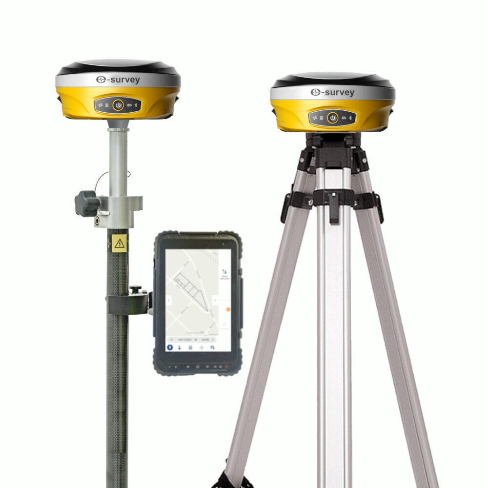
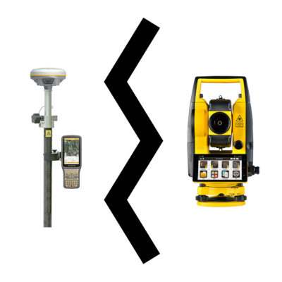
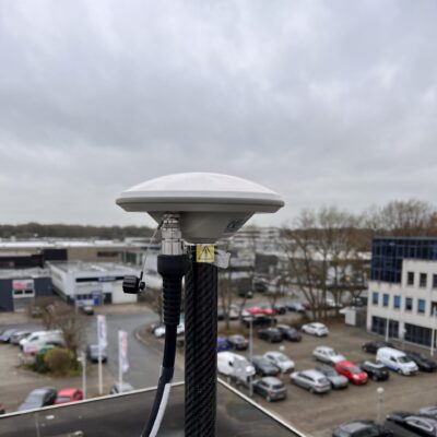
E-Survey E600 Rover and Base set
Login to view pricing or to request a quote
Log in

Request Black friday deal!
Don't miss out and get high discounts! Offer ends 29 November 2025!
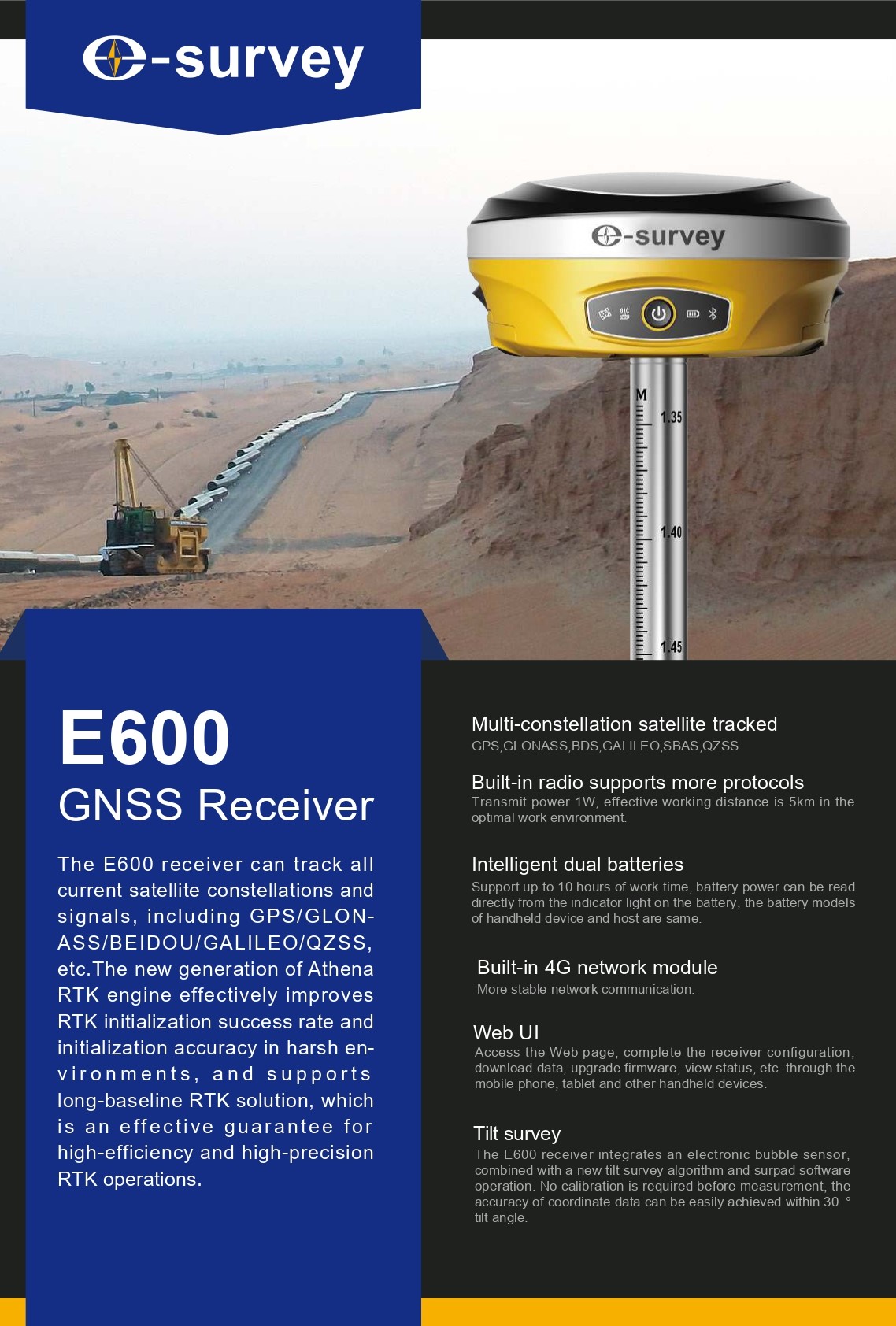
The E-Survey E600 rover and base set is a compact, powerful GNSS solution for land surveying and construction. With full satellite support, RTK + aRTK, and IMU tilt compensation, this GPS set with IMU tilt sensor ensures reliable, fast results. A rugged, easy-to-use land surveying set built for professionals.
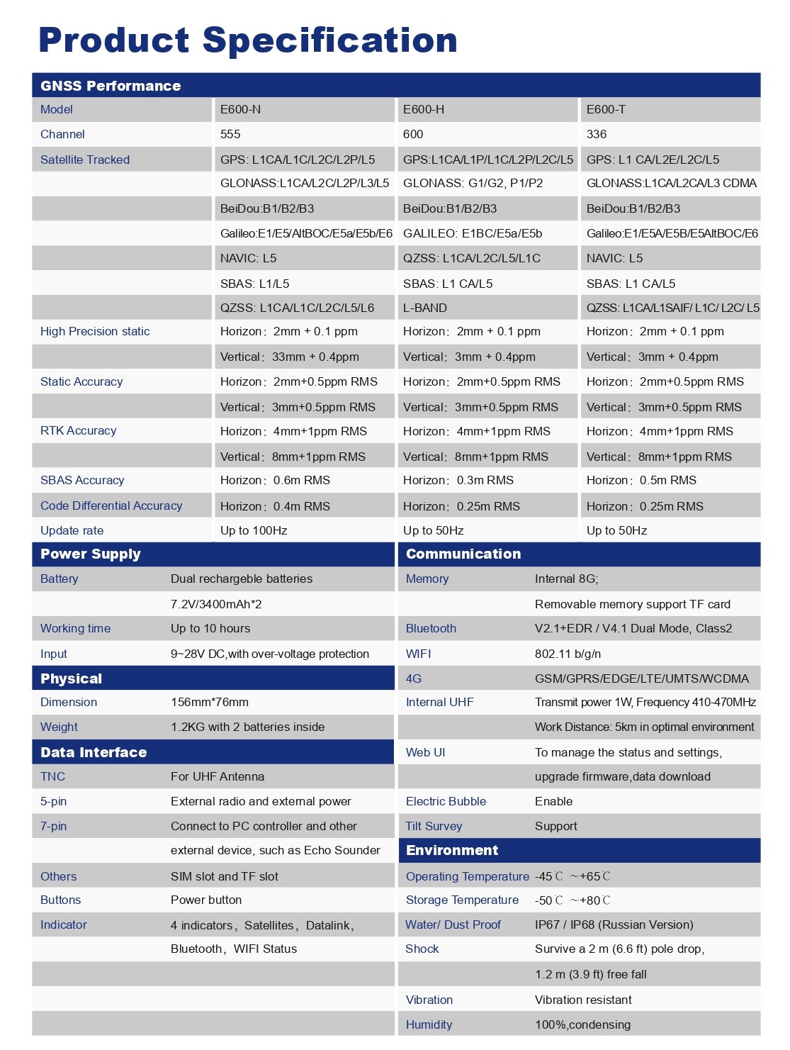
| ✅ Channels | 600 |
| ✅ IMU Tilt Sensor | 60° |
| ✅ Internet Modem | 4G |
| ✅ UHF Radio | 410 – 470MHz |
| GPS | L1CA, L1P, L1C, L2P, L2C, L5L1CA, L1P, L1C, L2P, L2C, L5
L1 CA, L2E, L2C, L5 |
| GLONASS | L1CA/b L2C, L2P, L3, L5G1, G2, G3, P1, P2
L1CA, L2CA, L3 CDMA |
| GALILEO | E1BC, E5a, E5bE1, E5, AltBOC, E5a, E5b, E6
E1, E5A, E5B, E5AltBOC, E6 |
| BEIDOU | B1, B2, B3 |


E-Survey E600 Rover and Base set
Login to view pricing or to request a quote
Log in
Black friday discount!
Don't miss out and get high discounts! Offer ends 29 November 2025!

Try our gnss guide!
Start GNSS guide
Worldwide Shipping From The Netherlands
100% Shipping Insurance on Damage and Loss
Experts in Import / Export / Tax and Duties
Premium Support from Product Experts


Reviews
There are no reviews yet.