


 GPS & GNSS
 Lidar scanning
 Total Station
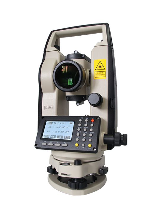
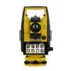
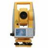
South NT-023 Theodolite
Get the best price for your setup
Contact our experts for the best possible price and configuration.
- Fast response
- Expert configuration advice
- No overpaying for features you do not need
The South NT-023 is a multifunctional digital theodolite for construction layout, surveying, alignment, and distance measurement. It combines 2-second angle accuracy with prism-based distance measurement up to 300 m, helping crews check positions, establish lines, and set out building axes without relying on a separate tape or distance meter. The onboard angle, distance, and axes stake-out programs simplify routine fieldwork, while the laser pointer and laser plummet assist with targeting and instrument setup. A 2.6-inch illuminated LCD, numeric keypad, single-axis compensator, and rechargeable lithium battery support practical use on active job sites. It is suited to surveyors, construction professionals, civil engineers, and contractors who need dependable optical measurement and layout tools.
South NT-023 Highlights
| Prism Distance Range | Up to 300 m |
|---|---|
| Distance Accuracy | ±(3 mm + 2 ppm × D) |
| Angle Accuracy | 2″; 1″ minimum display |
| Axes Stake-Out | Two layout methods for building axes and offsets |
| Battery Runtime | Approximately 8 hours |
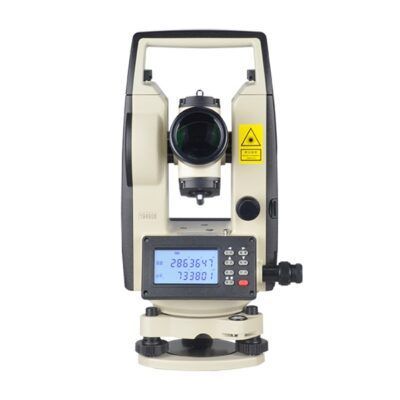
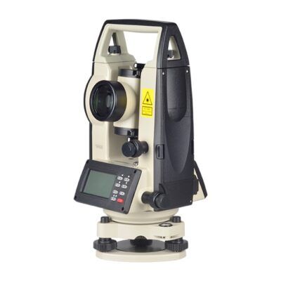
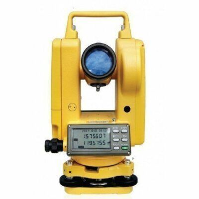
Valued customers:










Find RTK Networks
Search NTRIP providers and connect to reliable RTK correction services.
Description
South NT-023 Precision Theodolite for Construction and Surveying
The South NT-023 is a multifunctional electronic theodolite designed for construction layout, angle measurement, short-range prism distance measurement, and axis stakeout. It combines the core functions of a digital theodolite with an integrated electronic distance measurement system, laser pointer, laser plummet, illuminated display, and practical onboard programs. This makes it useful for surveyors, site engineers, construction crews, civil contractors, and other professionals who need dependable field measurements without moving to a full robotic total station or RTK GNSS workflow.
With its compact design and straightforward keypad operation, the NT-023 is suited to everyday work on building sites, structural projects, foundations, road construction, utility installation, and general engineering surveys. It can measure horizontal and vertical angles, calculate slope and horizontal distances to a prism, and assist with setting out points in relation to a defined construction axis.
What the South NT-023 Is Designed to Do
The South NT-023 is primarily an angle-measuring instrument, but its integrated distance measurement capability gives it more flexibility than a conventional electronic theodolite. When used with a suitable single prism, it can measure distances up to 300 metres. This allows field crews to check offsets, measure layout distances, set out points, and verify positions without relying on a separate tape or staff for every task.
The instrument is particularly useful where the work requires accurate relative positioning rather than full coordinate-based GNSS surveying. For example, a construction team can use the NT-023 to establish building lines, transfer reference directions, check column positions, align walls, verify foundation layouts, and set out points along a baseline. It can also display horizontal distance, vertical distance, and slope distance, helping users understand the relationship between the instrument and the prism target on sloping or uneven ground.
Accurate Angle Measurement for Site Layout
The NT-023 uses absolute encoder technology for horizontal and vertical angle measurement. It provides a minimum displayed reading of 1 arc-second and an angle accuracy of 2 arc-seconds. In practical fieldwork, this gives surveyors and construction professionals the control needed for alignment, squaring, structural positioning, and general setting-out tasks.
Horizontal angles can be set to zero when establishing a working direction, or a specific horizontal angle can be entered when the project requires a known bearing or orientation. The display also supports vertical angle and grade-related measurements, which can be useful when checking slopes, elevations, and the inclination of structural or civil works.
For demanding layout work, users should still follow normal surveying procedures, including careful centering, precise leveling, appropriate target setup, and regular instrument checks. The accuracy of any theodolite measurement depends not only on the instrument but also on tripod stability, atmospheric conditions, prism setup, sighting technique, and the quality of the control points being used.
Integrated Prism Distance Measurement up to 300 Metres
One of the main advantages of the South NT-023 is its built-in distance measurement system. With a single prism, the instrument can measure distances up to 300 metres and provides a stated distance accuracy of ±(3 mm + 2 ppm × D), where D is the measured distance. This specification is appropriate for many building, infrastructure, and general construction applications where short- to medium-range measurements are required.
The NT-023 can measure continuously in approximately 0.35 seconds or take a fine single measurement in approximately 1.5 seconds. Continuous measurement is helpful when guiding a prism operator toward a target position, while single measurement mode is useful when the surveyor wants to confirm a stable reading before recording or using it for stakeout.
The instrument supports atmospheric parameter input and prism constant correction. These settings help the system account for environmental and target-related factors that can influence electronic distance measurements. Users should enter appropriate project and prism information and apply good field procedures when the highest possible accuracy is required.
Axes Stakeout for Building and Construction Work
The onboard axes stakeout program is designed around the way many construction projects are laid out. Building axes and reference lines form the basis for positioning foundations, columns, walls, road elements, equipment bases, and other structural features. The South NT-023 helps users define an axis and guide a prism operator toward a point using line and offset values.
The instrument supports two practical methods. It can be positioned at one end of a known axis, or it can be set up at an arbitrary point away from the axis. In both cases, the user can enter the required distance along the axis and the perpendicular offset. The display then indicates how the prism should be moved until the target point is reached.
This workflow can reduce manual calculations during layout and makes it easier for a two-person crew to communicate positioning instructions on a busy site. Instead of calculating every movement separately, the operator can use the displayed differences to guide the prism pole left or right and forward or backward until the point is aligned with the design position.
Practical Laser Pointer and Laser Plummet
The South NT-023 includes a visible red laser pointer that can help identify the sighting direction and improve communication between the instrument operator and prism holder. On construction sites, the pointer can be useful when aligning with a target, explaining the working direction, or confirming the approximate line of sight before fine optical aiming.
A laser plummet is provided for centering the instrument over a ground point. The stated plummet accuracy is approximately ±1.5 mm at a 1.5 metre instrument height, with a spot diameter of approximately 2.5 mm at the same height. This can make setup faster when working over marked control points, foundation points, grid intersections, or temporary site references.
The lasers are Class II visible red lasers. They should never be directed toward people, vehicles, aircraft, reflective surfaces, or the eyes. The optical telescope should also not be aimed directly at the sun without an appropriate filter.
Clear Display and Direct Keypad Operation
The NT-023 uses an illuminated LCD display with a 160 × 96 dot matrix and a screen size listed at approximately 2.6 to 2.7 inches, depending on the product documentation version. The display is designed to show measurement information clearly while allowing the user to switch between angle, distance, and axes stakeout functions.
A full numeric keypad provides direct entry for angles, distances, offsets, prism constants, and other working values. Dedicated shortcut functions give quick access to the laser plummet, laser pointer, compensation setting, distance measurement mode, backlight, and sound settings. This approach is useful for field crews who prefer physical keys over a touchscreen, especially when wearing gloves or working in dusty construction environments.
The display can show commonly used measurements such as horizontal angle, vertical angle, horizontal distance, vertical distance, slope distance, and stakeout differences. The instrument also supports configurable units and settings for distance, angle, temperature, and air pressure.
Optical Telescope for Reliable Target Sighting
The telescope provides an erect image with approximately 26.5× magnification, a 40 mm telescope aperture, a 3-arc-second resolving power, and a minimum focusing distance of approximately 1.5 metres. This combination supports clear prism and target observation across typical construction and surveying distances.
The relatively short minimum focusing distance is useful when working in restricted areas, near building corners, around foundations, or on compact sites where the target may be close to the instrument. The 1°30′ field of view provides a practical balance between target visibility and magnification, helping the operator locate and center a prism without losing the surrounding reference area.
Single-Axis Compensation and Field Setup
The NT-023 includes a single-axis compensator with a working range of approximately ±3 arc-minutes and stated accuracy of approximately ±3 arc-seconds. The compensator helps account for small leveling variations within its operating range, but it does not replace careful tripod setup and precise leveling.
For consistent results, the instrument should be mounted on a stable tripod, centered accurately over the survey point, and leveled before measurement. The operating manual recommends using a wooden tripod when higher accuracy is required because wooden tripods can provide improved stability in some conditions. A sturdy tripod, careful setup, and protection from vibration are especially important when measuring angles or using the distance function over longer sight lines.
Battery Life for a Full Working Session
The South NT-023 uses a 7.4 V rechargeable lithium battery and is specified for approximately eight hours of continuous working time. This is suitable for many daily layout and surveying tasks, although actual runtime can vary with temperature, display backlight use, laser operation, measurement frequency, and battery condition.
Crews working long shifts or moving between several locations may benefit from carrying a charged spare battery or planning charging intervals. If the instrument will be stored for an extended period, the battery should be removed and maintained according to the manufacturer’s care recommendations.
Built for Outdoor Construction and Surveying Conditions
The NT-023 is specified for a working temperature range of approximately -20°C to 50°C. Its compact body measures approximately 165 × 160 × 340 mm and weighs about 4.7 kg, making it manageable to transport between setup points while still providing the physical stability expected from a conventional surveying instrument.
As with any precision optical and electronic instrument, the NT-023 should be protected from unnecessary shock, moisture, dust, and rapid temperature changes. When moving between a storage area and a hot or cold worksite, allowing the instrument to acclimatize inside its case can help reduce condensation and thermal effects. The optics should be cleaned only with suitable lens-cleaning materials, and the instrument should be dried promptly if it becomes wet.
Useful Functions for Everyday Fieldwork
The South NT-023 includes practical programs for angle measurement, distance measurement, distance stakeout, and axes stakeout. These functions make it suitable for a range of work where a surveyor or construction professional needs to measure, align, and position points efficiently.
- Set horizontal angles to zero or enter a known horizontal angle.
- Measure horizontal, vertical, and slope distances to a single prism.
- Stake out a specified horizontal, vertical, or slope distance.
- Define a construction axis using known points or a working direction.
- Guide a prism operator using line and perpendicular offset differences.
- Use the laser plummet and laser pointer for faster setup and alignment.
The instrument also includes calibration and checking functions for angle index errors and the additive constant. These functions are intended for users or service personnel who understand surveying instrument checks. If a calibration issue is suspected or a distance constant falls outside acceptable limits, professional inspection on a known baseline is recommended rather than making unnecessary adjustments in the field.
Who Uses the South NT-023?
The South NT-023 is a practical choice for surveyors and construction teams that need more than basic angle measurement but do not necessarily require robotic control, reflectorless measurement, onboard coordinate databases, or GNSS connectivity. It can be used by land surveyors, building layout crews, civil engineering contractors, concrete and foundation specialists, road construction teams, utility installers, and site supervisors responsible for checking position and alignment.
For construction workers, the axes stakeout program can simplify the process of locating points relative to a building grid or baseline. For surveyors, the instrument provides a compact tool for angle and short-range distance work. For engineers, it can support alignment checks, dimensional verification, and site control tasks. Drone pilots and GIS professionals may use it as a complementary instrument when ground control, structural layout, or verification measurements are needed alongside aerial mapping or GNSS data.
How It Compares with RTK GNSS Equipment
The South NT-023 and an RTK GNSS receiver serve different purposes. RTK GNSS is generally preferred for coordinate-based surveying over open areas where satellite visibility is good and correction services are available. It is useful for mapping, boundary work, machine control, topographic surveys, and projects that require direct coordinates in a known reference system.
The NT-023 is better suited to line-of-sight measurement, precise angle work, and construction layout where a prism can be observed from the instrument. It can continue to be useful in areas where satellite signals are obstructed by buildings, structures, trees, or other site conditions. It is also valuable when the work is based on local building axes, reference lines, and relative offsets rather than solely on GNSS coordinates.
For many professional teams, a digital theodolite and RTK GNSS receiver are complementary tools rather than direct substitutes. GNSS can establish or check site control, while the NT-023 can transfer lines, set out structural points, and perform precise optical alignment close to the work area.
What to Consider Before Choosing This Instrument
The South NT-023 is most appropriate when the project requires optical line-of-sight measurements, angle accuracy of approximately 2 arc-seconds, prism distance measurement up to 300 metres, and straightforward construction stakeout functions. It is not a robotic total station and should not be selected when automated target tracking, motorized turning, reflectorless measurement, extensive onboard data collection, Bluetooth communication, or direct GNSS coordinate workflows are essential.
Buyers should also confirm the required prism, tripod, carrying case, batteries, and field accessories for their intended setup. The instrument can be used with suitable prism equipment, and a stable tripod is important for achieving consistent results. For professional surveying work, users should establish a regular inspection and calibration routine and make sure the crew is trained in centering, leveling, target handling, laser safety, and measurement verification.
South NT-023 for Reliable Construction Layout
The South NT-023 provides a focused combination of electronic angle measurement, prism distance measurement, axis stakeout, laser alignment tools, and direct keypad control. Its 300 metre prism range, 2-arc-second angle accuracy, 26.5× telescope, single-axis compensator, illuminated display, and approximately eight-hour battery life make it suitable for many day-to-day construction and surveying tasks.
For teams working on foundations, structural grids, building lines, road layouts, utility corridors, and general site positioning, the NT-023 offers a practical way to carry out accurate optical measurements without the complexity of a robotic total station. It is also a useful complement to RTK GNSS equipment when a project requires both coordinate control and precise local layout.
Global GPS Systems can help buyers choose a suitable configuration for their work, including the appropriate prism, tripod, and supporting accessories. If you are comparing the South NT-023 with an RTK GNSS receiver, digital level, or total station, Global GPS Systems can help match the instrument to the site conditions, measurement range, accuracy requirements, and experience level of your field team.
Specifications
South NT-023 Specifications
Product Overview
| Product type | Multi-functional electronic theodolite with integrated prism distance measurement |
|---|---|
| Brand | South |
| Model | NT-023 |
| Primary functions | Angle measurement, prism distance measurement, horizontal and vertical distance calculation, slope distance measurement, stakeout and axis stakeout |
| Typical users | Land surveyors, construction surveyors, civil engineers, site engineers, contractors and layout crews |
| Typical industries | Construction, civil engineering, land surveying, building layout, infrastructure development, structural positioning and general outdoor surveying |
| Operating concept | Manual instrument operation with onboard angle, distance and axes stakeout programs |
Measurement Capabilities
| Distance measurement target | Single prism |
|---|---|
| Maximum prism distance | 300 m |
| Distance measurement accuracy | ±(3 mm + 2 ppm × D) |
| Continuous measurement time | Approximately 0.35 seconds |
| Single or fine measurement time | Approximately 1.5 seconds |
| Distance values displayed | Slope distance, horizontal distance and vertical distance |
| Atmospheric correction | Correction using entered atmospheric parameters; temperature and air-pressure settings are available |
| Prism constant correction | Correction using an entered prism constant |
| Scale factor setting | Available through the distance settings |
| Station elevation setting | Available through the distance settings |
| Stadia accuracy | ≤0.40%/L |
Angle Measurement
| Angle measurement method | Absolute encoder |
|---|---|
| Horizontal encoder detection | Dual detection |
| Vertical encoder detection | Dual detection |
| Encoder disk diameter | 79 mm |
| Minimum angle display | 1 arc-second |
| Angle accuracy | 2 arc-seconds |
| Horizontal angle functions | Horizontal angle measurement, zero setting, horizontal angle setting and left/right angle display |
| Vertical angle functions | Vertical angle measurement and slope or gradient display |
| Face selection | Face Left and Face Right switching |
| Angle units | Degrees, gon and mil settings are supported |
Telescope
| Telescope image | Erect |
|---|---|
| Magnification | 26.5× |
| Effective telescope aperture | 40 mm |
| Distance measurement aperture | 45 mm |
| Resolving power | 3 arc-seconds |
| Field of view | 1°30′ |
| Minimum focusing distance | 1.5 m |
| Telescope tube length | 155 mm |
| Optical components | Collimator, objective lens, focusing screw and telescope eyepiece |
Stakeout and Onboard Programs
| Onboard programs | Angle, distance and axes stakeout programs |
|---|---|
| Distance stakeout | Stakeout by vertical distance, horizontal distance or slope distance |
| Axes stakeout | Stakeout of points relative to a defined construction axis or baseline |
| Axes stakeout methods | Baseline defined from a station point and bearing, or from two measured points |
| One-side axis stakeout | Instrument positioned at one end of the axis and oriented toward the other end |
| Arbitrary-position axis stakeout | Instrument can be positioned away from the axis by measuring two reference points |
| Axis stakeout inputs | Line offset and perpendicular offset values |
| Stakeout guidance values | Horizontal angle difference, perpendicular offset and along-axis offset |
| Result guidance | Operator moves the prism until displayed differences approach zero |
Compensator and Leveling
| Compensator type | Single-axis liquid-electric compensator |
|---|---|
| Compensator working range | ±3 arc-minutes |
| Compensator accuracy or resolution | ±3 arc-seconds |
| Compensation control | Electronic compensation on the X axis can be enabled or disabled |
| Plate vial | 30 arc-seconds per 2 mm |
| Circular vial | 8 arc-minutes per 2 mm |
| Electronic bubble | Available through the instrument's electronic leveling and compensation functions |
Laser Pointer and Laser Plummet
| Laser pointer | Standard visible laser pointer for target guidance and alignment |
|---|---|
| Laser pointer wavelength | 635 ±20 nm |
| Laser pointer classification | Class II |
| Laser pointer spot diameter | ≤5 mm at 100 m |
| Laser pointer axis error | ≤10 arc-seconds |
| Laser plummet type | Visible red Class II laser plummet |
| Laser plummet wavelength | 635 ±20 nm |
| Laser plummet accuracy | ±1.5 mm at a 1.5 m instrument height |
| Laser plummet spot diameter | Approximately 2.5 mm at a 1.5 m instrument height |
| Laser safety standard | Designed as a Level II laser product meeting IEC 60825-1:2007 and GB 7247.1-2001 requirements |
Display, Keypad and User Interface
| Display type | Monochrome dot-matrix LCD |
|---|---|
| Display size | Approximately 2.6 to 2.7 inches, depending on specification revision |
| Display resolution | 160 × 96 dots |
| Display format | Four-line display |
| Display illumination | Backlit display for low-light conditions |
| Keypad | Full numeric keypad with function and navigation keys |
| Keypad functions | Shortcut access to laser plummet, laser pointer, X-axis compensation, distance settings, backlight and sound settings |
| Sound settings | Key-press beep and crosshair illumination controls |
| Supported distance units | Meters and feet |
| Supported environmental units | Degrees Celsius, degrees Fahrenheit, hPa, mmHg and inHg |
Power and Battery
| Battery type | Rechargeable lithium-ion battery |
|---|---|
| Battery voltage | 7.4 V |
| Battery capacity | Approximately 2,000 mAh according to newer product literature |
| Continuous operating time | Approximately 8 hours for distance measurement operation |
| Power management | Configurable sleep time and automatic power-off time |
| Battery monitoring | Battery capacity can be checked through the power settings |
| Long-term storage recommendation | Remove the battery for separate storage and recharge it approximately once per month when not in regular use |
Communication, Firmware and Calibration
| Communication interface | RS-232 serial interface |
|---|---|
| Firmware upgrade | Angle, distance and system firmware can be upgraded through a computer connection using the RS-232 interface |
| System information | Displays model name, serial number, device ID, system version, distance version and angle version |
| Angle calibration | Built-in calibration procedure for vertical index or i-angle error |
| Additive constant correction | Built-in inspection and correction procedure for the distance additive constant |
| Factory reset | Factory mode supports resetting the instrument to default settings |
| Distance correction parameters | Prism constant, atmospheric parameters, scale factor and station elevation |
Physical and Environmental Specifications
| Instrument dimensions | 165 × 160 × 340 mm |
|---|---|
| Instrument weight | Approximately 4.7 kg |
| Operating temperature | -20°C to +50°C |
| Recommended tripod type | A wooden tripod is recommended when maximum angular accuracy is required; an aluminum tripod may be used for general field work |
| Tribrach | Integrated tribrach with tribrach lock |
| Instrument controls | Horizontal tangent screw, vertical tangent screw, focusing screw and tribrach locking mechanism |
| Storage and transport | Store and transport in the carrying case with protection against shock, dust and humidity |
Safety and Maintenance
| Laser safety | Do not look directly into the laser beam, aim it at people or expose eyes to the beam |
|---|---|
| Sunlight protection | Do not aim the telescope directly at the sun without an appropriate filter |
| Temperature acclimatization | Allow the instrument to adapt to the worksite temperature when moving between locations with significant temperature differences |
| Optical cleaning | Clean exposed optical surfaces only with suitable degreased cotton or lint-free tissue |
| Exterior cleaning | Wipe the instrument with a soft woolen cloth and dry it immediately if it becomes wet |
| Service requirement | Do not disassemble the instrument unless qualified to perform maintenance or repair |
| Calibration recommendation | Check calibration and distance additive constant periodically, especially before precision construction layout work |
Included or Recommended Equipment
| Item | Quantity | Notes |
|---|---|---|
| NT-023 theodolite | 1 | Instrument configuration may vary by supplier or region |
| Rechargeable lithium battery | Configuration dependent | 7.4 V battery system |
| Battery charger | Configuration dependent | Verify charger type and regional power compatibility before ordering |
| Carrying case | Configuration dependent | Recommended for storage and transport |
| Aluminum tripod ATS-3 | Optional or recommended accessory | Listed as a recommended accessory; not confirmed as standard included equipment |
| Prism pole NLS15 | Optional or recommended accessory | Listed as a recommended accessory; not confirmed as standard included equipment |
| Prism set TK21T | Optional or recommended accessory | Listed as a recommended accessory; not confirmed as standard included equipment |
Specifications and package contents may vary by configuration, region or manufacturer update. Always check the current configuration before ordering.
Additional information
| Weight | 6 kg |
|---|---|
| Dimensions | 30 × 30 × 40 cm |
Reviews (0)
Only logged in customers who have purchased this product may leave a review.
FAQ
South NT-023 FAQ
Product Overview and Applications
What is the South NT-023 used for?
The South NT-023 is a multifunctional electronic theodolite designed for accurate angle measurement, prism-based distance measurement and construction set-out work. It is suitable for land surveying, construction layout, building axes set-out, engineering surveys and general outdoor site measurement.
Who uses the South NT-023?
The South NT-023 is used by land surveyors, civil engineers, construction layout teams, site engineers, contractors, utility installers, infrastructure companies, surveying students and technical colleges. It is especially useful for professionals who need accurate angle measurement and basic distance measurement without the complexity of a full robotic total station.
Which industries can benefit from the South NT-023?
Typical industries include land surveying, building construction, civil engineering, road and infrastructure construction, utility installation, foundation work, structural layout, industrial construction and surveying education.
Is the South NT-023 a theodolite or a total station?
The South NT-023 is a multifunctional electronic theodolite. It measures horizontal and vertical angles and also provides prism-based distance measurement and axis stake-out functions. It is not a full robotic total station and should not be selected when advanced data collection, reflectorless measurement, robotic tracking or integrated survey-data management is required.
What type of projects is the South NT-023 best suited for?
The instrument is well suited to construction layout, building axis set-out, checking alignment, measuring horizontal and vertical angles, establishing reference lines and measuring distances to prism targets on outdoor job sites.
Measurement Functions and Accuracy
What is the maximum distance measurement range?
The South NT-023 measures distances up to 300 metres when used with a single prism. The actual working range can depend on visibility, atmospheric conditions, prism quality, target alignment and the condition of the instrument.
What is the distance measurement accuracy?
The manufacturer specifies distance measurement accuracy of ±(3 mm + 2 ppm × D), where D is the measured distance. For example, the stated tolerance at 100 metres is approximately ±3.2 mm under suitable measurement conditions.
Can the South NT-023 measure horizontal, vertical and slope distances?
Yes. The distance measurement function can provide slope distance, horizontal distance and vertical distance, helping surveyors and construction teams collect practical site measurements from one instrument position.
What is the angular accuracy of the South NT-023?
The South NT-023 has a stated angular accuracy of 2 arc-seconds and a minimum displayed angle reading of 1 arc-second. It uses an absolute encoder with dual detection for horizontal and vertical angle measurement.
Does the South NT-023 require a prism for distance measurement?
Yes. The published 300-metre distance measurement specification is based on using a single prism. The South NT-023 should not be treated as a reflectorless laser distance meter unless the specific supplied configuration and documentation state otherwise.
Set-Out, Display and Ease of Use
What is the Axes Stake Out function?
The Axes Stake Out program helps users set out points in relation to building or construction axes. It is designed to make it easier to locate precise points from known reference points or from an instrument position placed away from the axis.
How many methods are available for axis stake-out?
The South NT-023 supports two axis stake-out methods. The instrument can be set up at one end of the axis, or it can be positioned at an arbitrary point outside the axis and used to stake out the required points.
Does the South NT-023 have a laser pointer?
Yes. The built-in laser pointer provides a visible aiming reference that can help the operator identify and target points more quickly, particularly during construction layout and alignment tasks.
Does the South NT-023 have a laser plummet?
Yes. The laser plummet helps position the instrument accurately over the survey point. The manufacturer specifies laser plummet accuracy of approximately ±1.5 mm at a 1.5-metre instrument height.
Is the display suitable for outdoor work?
The South NT-023 has an illuminated 2.6-inch LCD display with a 160 × 96 dot resolution. The backlit screen is designed to improve readability in changing outdoor light conditions, including lower-light site work.
Power, Setup and Compatibility
How long does the battery last?
The South NT-023 uses a rechargeable 7.4-volt lithium battery and is specified for approximately 8 hours of continuous operation. Actual battery life depends on temperature, display illumination, laser usage and measurement frequency.
What operating temperatures are supported?
The stated operating temperature range is approximately -20°C to 50°C. For reliable results, allow the instrument to acclimatise when moving it between significantly different temperatures and protect it from condensation, dust and moisture.
What accessories are used with the South NT-023?
Typical accessories include a stable surveying tripod, prism pole and compatible prism set. The manufacturer brochure references the ATS-3 aluminium tripod, NLS15 prism pole and TK21T prism set as recommended accessories. Confirm compatibility before ordering replacement or additional equipment.
Can the South NT-023 be used by one person?
Many basic measurement and set-out tasks can be completed by one trained operator, especially when the instrument is used with a prism and a stable tripod setup. Some construction and surveying workflows may still require a second person to hold the prism pole, mark points or verify measurements.
What are the size and weight of the South NT-023?
Published specifications vary by source and may refer to the instrument alone or to a packed configuration. The manufacturer brochure lists an instrument size of approximately 165 × 160 × 340 mm and a weight of about 4.7 kg, while the Global GPS Systems product listing gives 30 × 30 × 40 cm and 6 kg. Confirm the final packed weight and dimensions for your selected configuration.
 GPS & GNSS
 Total Stations
 Data collectors
 Software
 Correction services
 Machine control
 External radio
 Marine
 Accessories
Reviews
There are no reviews yet