


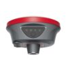
EFIX F8L Laser IMU-RTK GNSS Receiver
This product is Available
Contact our experts for the best possible price and configuration.
The EFIX F8L is a compact laser IMU-RTK GNSS receiver built for surveyors, construction teams, GIS users and field crews who need accurate positioning without carrying bulky equipment. With multi-constellation GNSS tracking, calibration-free IMU tilt compensation, visual stakeout and laser survey functions, it helps measure points faster in open sites, near obstacles and in hard-to-reach locations.
EFIX F8L Highlights
| GNSS Channels | 1608 channels |
|---|---|
| RTK Accuracy | 8 mm + 1 ppm horizontal / 15 mm + 1 ppm vertical |
| IMU Tilt Compensation | Calibration-free Auto-IMU, 0–60° tilt range |
| Laser & Visual Tools | Laser Survey, Visual Navigation and CAD AR Visual Stakeout |
| Field Protection | IP68 waterproof and dustproof, 2 m pole-drop resistance |


Valued customers:


Find RTK Networks
Search NTRIP providers and connect to reliable RTK correction services.
Description
EFIX F8L Laser IMU-RTK GNSS Receiver
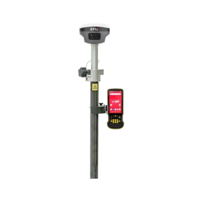
The EFIX F8L is a pocket-size laser IMU-RTK GNSS receiver designed for accurate and efficient field measurement. It combines GNSS, IMU tilt compensation, visual guidance and laser survey technology in a compact 800 g receiver, making it a practical choice for surveyors, construction workers, engineers, drone mapping teams, GIS professionals and site crews who need reliable positioning in daily fieldwork.
For land surveying and construction layout, the EFIX F8L helps reduce the time spent leveling the pole and walking around obstacles. The calibration-free Auto-IMU supports tilted measurements, allowing users to measure points more comfortably near walls, fences, trenches, traffic areas, building corners and other places where keeping the pole perfectly vertical is difficult. This is useful for topographic surveys, stakeout, utility mapping, road work, boundary checks and as-built measurements.
Laser Survey for Hard-to-Reach Points
The built-in laser survey function makes the F8L useful when a point cannot be reached safely or easily with the pole tip. Field crews can measure selected points at a distance, which can help when working around slopes, stockpiles, ditches, building facades, traffic edges, restricted zones or other difficult locations. For construction and engineering work, this can save time while also reducing unnecessary movement around the site.
Visual Navigation and AR Stakeout
The EFIX F8L includes dual cameras and visual tools that support Visual Navigation and CAD AR Visual Stakeout. In practical terms, this helps users find stakeout points more intuitively by using visual guidance instead of relying only on numbers and arrows on a controller screen. For crews setting out points, checking design positions or moving between points on busy sites, visual guidance can make the workflow easier to understand and faster to follow.
Multi-Constellation GNSS Performance
With 1608 channels and support for major satellite constellations including GPS, GLONASS, Galileo, BeiDou, QZSS, NavIC/IRNSS and SBAS, the F8L is built for modern RTK fieldwork. The receiver is designed to maintain strong satellite tracking in a wide range of environments, helping users achieve accurate positioning when working on construction sites, survey projects, agricultural land, infrastructure corridors and municipal mapping jobs.
In RTK mode, the F8L provides centimetre-level positioning accuracy under suitable field conditions. It also supports common GNSS data formats and workflows, including RTCM, CMR, RINEX, NMEA output, NTRIP Client and NTRIP Caster, making it suitable for use with RTK networks, base-rover setups and post-processing workflows.
Built for Daily Field Conditions
The receiver is designed for tough outdoor use. Its IP68-rated housing protects against dust and water, while the unit is built to survive a 2 metre pole drop. The operating temperature range from -40°C to +65°C makes it suitable for hot, cold, wet and dusty work environments. With internal battery operation of up to 15 hours in laser survey mode, the F8L is ready for long field days without adding unnecessary weight to the pole.
Who Uses the EFIX F8L?
The EFIX F8L is suitable for professionals who need accurate GNSS positioning in a compact and flexible receiver. Surveyors can use it for topographic work, boundary tasks, stakeout and control surveys. Construction teams can use it for layout, as-built checks and site measurements. GIS users can collect accurate asset positions for utilities, roads, municipal infrastructure and land management. Drone pilots and mapping teams can use it for ground control points and verification measurements.
Why Buy the EFIX F8L from Global GPS Systems?
Global GPS Systems supplies GNSS equipment for professionals who need dependable tools, clear product advice and practical support. The EFIX F8L is a strong option for buyers looking for a compact RTK receiver with laser measuring, IMU tilt compensation and visual stakeout functions in one field-ready unit. It is especially useful for crews who want to work faster, reduce setup time and measure difficult points without switching between multiple instruments.
Choose the EFIX F8L if you need a lightweight GNSS receiver for accurate surveying, construction layout, GIS mapping and everyday RTK fieldwork with modern visual and laser measurement tools.
Datasheets & Manuals
Datasheets and manuals
Datasheet & manuals
Specifications
EFIX F8L Specifications
Product Overview
| Product Name | EFIX F8L |
|---|---|
| Product Type | Advanced laser pocket-size IMU-RTK GNSS receiver |
| Primary Applications | Land surveying, engineering, construction layout, road stakeout, hard-to-reach point measurement, hazardous point measurement and GNSS RTK field data collection |
| Core Technologies | Laser survey, full-constellation GNSS, 4D Auto-IMU, AR navigation and vision stakeout |
| Compatible Field Software | EFIX eField software |
Key Features
| Laser Survey | Bright green laser with AI-assisted aiming and collection support for measuring complex scenes in real time |
|---|---|
| Full-Star GNSS Tracking | 1608 signal channels with full-constellation, multi-frequency GNSS support |
| RTK Engine | Advanced RTK engine with high-efficiency SoC processing |
| AR Navigation | AR guidance with on-screen arrows and real-time distance readouts |
| Vision Stakeout | AR Vision Stakeout overlays actual ground stakeout points in eField software |
| Auto-IMU | Automatic 4D IMU initialization while moving, with continuous IMU readiness during field operation |
| CAD Workflow Support | Dynamic CAD base-map orientation, large-scale CAD handling and road stakeout support through eField software |
| Earthwork / Road Tools | TIN filtering for earthwork calculations and LandXML cut/fill visualization support |
GNSS Performance
| Channels | 1608 channels |
|---|---|
| GPS | L1C/A, L2C, L2P(Y), L5 |
| GLONASS | L1, L2, L3* |
| Galileo | E1, E5a, E5b, E6* |
| BeiDou | B1I, B2I, B3I, B1C, B2a, B2b* |
| QZSS | L1C/A, L1C, L2C, L5 |
| NavIC / IRNSS | L5 |
| SBAS | EGNOS L1, L5* |
GNSS Accuracy
| RTK Horizontal Accuracy | 8 mm + 1 ppm RMS |
|---|---|
| RTK Vertical Accuracy | 15 mm + 1 ppm RMS |
| RTK Initialization Time | < 10 s |
| RTK Initialization Reliability | > 99.9% |
| PPK Horizontal Accuracy | 3 mm + 1 ppm RMS |
| PPK Vertical Accuracy | 5 mm + 1 ppm RMS |
| Post-Processing Static Horizontal Accuracy | 2.5 mm + 0.5 ppm RMS |
| Post-Processing Static Vertical Accuracy | 5 mm + 0.5 ppm RMS |
| Code Differential Accuracy | Horizontal: 0.4 m RMS; Vertical: 0.8 m RMS |
| Autonomous Accuracy | Horizontal: 1.5 m RMS; Vertical: 2.5 m RMS |
| Vision Stakeout Accuracy | Horizontal: 8 mm + 1 ppm RMS; Vertical: 15 mm + 1 ppm RMS |
| PPP Support | PPP-B2b and E6B-HAS supported |
| PPP Accuracy | Horizontal: 10 cm; Vertical: 20 cm |
| Positioning Rate | 1 Hz, 5 Hz and 10 Hz |
| Cold Start | < 45 s |
| Hot Start | < 10 s |
| Signal Re-Acquisition | < 1 s |
Laser Sensor
| Laser Survey Type | High-accuracy laser survey and rapid laser survey |
|---|---|
| High-Accuracy Laser Survey Accuracy | 2 cm within 5 m range; 3 cm within 10 m range |
| Rapid Laser Survey Accuracy | 3 cm within 5 m range; 5 cm within 10 m range |
| Laser Range | Up to 50 m |
| Range Accuracy | 2 mm |
| Laser Type | Class 3R green laser |
| Laser Safety Note | Avoid direct eye contact with the beam |
IMU Sensor
| IMU Type | 4D Auto-IMU |
|---|---|
| IMU Update Rate | 200 Hz |
| IMU Tilt Angle | 0° to 60° |
| Additional Horizontal Pole-Tilt Error | Typically less than 2.5 cm within 30° |
| Tilt Sensor | Calibration-free IMU for pole-tilt compensation; immune to magnetic disturbance |
Camera
| Sensor Pixels | 5 MP and 2 MP |
|---|---|
| Field of View | 75° |
| Video Frame Rate | 25 fps |
| Camera Functions | Vision stakeout and AR navigation support through eField software |
Communication
| Wi-Fi | 802.11 b/g/n/ac, access point mode |
|---|---|
| Bluetooth | Bluetooth v4.2 |
| NFC | Supported |
| Cellular Internet Modem | None integrated / not listed |
| USB Port | 1 x USB Type-C port for external power, data download and firmware update |
| UHF Antenna Port | 1 x UHF antenna port, SMA male |
| Network Functions | NTRIP Client and NTRIP Caster |
| Computer Connection | USB Type-C connection for data download |
| Controller Connection | Wi-Fi or Bluetooth connection with eField software |
UHF Radio
| Internal UHF Radio | Standard internal Tx/Rx |
|---|---|
| Frequency Range | 410 MHz to 470 MHz |
| Transmit Power | 0.5 W, 1 W |
| Protocols | EFIX, Transparent, TT450, Satel |
| Link Rate | 9,600 bps to 19,200 bps |
| Typical Range | 3 km typical |
| Maximum Range | Up to 8 km under optimal conditions |
| Regulatory Note | UHF datalink operation may be subject to local frequency and power-output regulations |
Data Formats and Storage
| Correction Data Formats | RTCM 2.x, RTCM 3.x, CMR input/output, Full Star |
|---|---|
| Static / Observation Formats | RINEX 2.11, RINEX 3.02, ECN and RINEX static formats |
| NMEA Output | NMEA 0183 output |
| Internal Data Storage | 8 GB high-speed memory |
| Data Download Methods | USB download and FTP download via receiver Wi-Fi |
| Static Data Storage Folder | Stored in receiver recording folders with ECN and RINEX format folders |
Electrical
| Battery Type | Rechargeable built-in lithium-ion battery |
|---|---|
| Battery Capacity | 4900 mAh, 7.2 V |
| Power Consumption | Typical 2.0 W, depending on user settings |
| External Power Input | 5 V / 2 A |
| Charging Port | USB Type-C |
| Battery Construction | Built-in non-removable lithium-ion battery |
Operating Time
| RTK Rover, UHF Mode Without Camera | Up to 20 hours |
|---|---|
| RTK Rover, Laser Survey | Up to 15 hours |
| RTK Rover, Vision Stakeout | Up to 15 hours |
| UHF RTK Base | Up to 12 hours |
| Battery Life Note | Battery life is subject to operating temperature and settings |
Hardware and Physical Specifications
| Dimensions | Φ133 mm x 90 mm / Φ5.24 in x 3.54 in |
|---|---|
| Weight | 800 g / 1.76 lb |
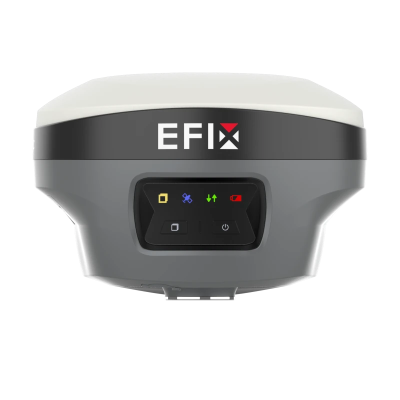
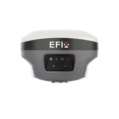
| Front Panel | 4 LEDs + 2 buttons |
| Front Panel Indicators | Correction LED, Satellite LED, Power LED and Static LED |
| Buttons | Power button and Fn button |
| Lower Housing Ports | USB Type-C port and SMA radio antenna port |
Environmental and Durability
| Operating Temperature | -40°C to +65°C / -40°F to +149°F |
|---|---|
| Storage Temperature | -40°C to +85°C / -40°F to +185°F |
| Humidity | 100% non-condensing |
| Ingress Protection | IP68 waterproof and dustproof; protected from temporary immersion to a depth of 1 m |
| Shock Resistance Grade | IK08 |
| Drop Resistance | Survives a 2 m pole drop |
Software and Workflow Functions
| Field Software | EFIX eField |
|---|---|
| AR Vision Navigation | Guidance with arrows and real-time distance readouts |
| AR Vision Stakeout | Overlays ground stakeout points in the live field view |
| Dynamic Map Orientation | CAD base map auto-rotates to align with the surveyor’s viewpoint |
| Large CAD Handling | Supports smooth navigation and editing of extensive CAD drawings |
| TIN Earthwork Support | Advanced filtering techniques for Triangulated Irregular Networks |
| Road Stakeout | LandXML cut/fill visualization for faster interpretation and execution |
| Receiver Configuration | Configuration through web interface via Wi-Fi connection |
Compliance and Standards
| International Standards | IEC 62133-2:2017, EN IEC 62368-1:2020, UN Manual Section 38.3, IEC60825-1:2007 |
|---|---|
| Laser Classification | Class 3R |
| FCC Statement | Device complies with Part 15 of FCC Rules |
| CE Declaration | Declared compliant with Directive 2014/53/EU |
Firmware and Availability Notes
| Future Firmware Items | GLONASS L3, Galileo E6, Galileo E6 HAS, BDS B2b and SBAS L5 are noted as available through future firmware upgrade |
|---|---|
| Positioning Rate Note | 10 Hz positioning rate is noted as available through future firmware upgrade |
| Radio Protocol Note | Satel protocol is noted as available through future firmware upgrade |
| Accuracy Conditions | Accuracy and reliability are specified for open-sky conditions, free of multipath, with optimal GNSS geometry and atmospheric conditions |
| Typical Values | Time-to-first-fix values are typical observed values |
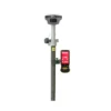
Base Kit Basic Supply
| Item | Quantity | Notes |
|---|---|---|
| F8L GNSS Receiver | Listed | Main GNSS receiver |
| SMA Whip Antenna | Listed | 410 MHz to 470 MHz UHF antenna |
| Power Adapter | Listed | For charging or external power |
| USB Type-C Cable | Listed | For charging, data download and connection |
| H.I. Tape | Listed | Height measurement accessory |
| Extension Pole | Listed | 30 cm extension pole |
| Tribrach with Optical Plummet | Listed | Base setup accessory |
| Auxiliary H.I. Tool | Listed | Height measurement support tool |
| Tribrach Adaptor | Listed | Base setup accessory |
| Transport Hard Case | Listed | Protective carry case |
Rover Kit Basic Supply
| Item | Quantity | Notes |
|---|---|---|
| F8L GNSS Receiver | Listed | Main GNSS receiver |
| SMA Whip Antenna | Listed | 410 MHz to 470 MHz UHF antenna |
| Power Adapter | Listed | For charging or external power |
| USB Type-C Cable | Listed | For charging, data download and connection |
| Range Pole | Listed | AR range pole listed in rover kit |
| Auxiliary H.I. Tool | Listed | Height measurement support tool |
| Transport Hard Case | Listed | Protective carry case |
Specifications and package contents may vary by configuration, region or manufacturer update. Always check the current configuration before ordering.
FAQ
EFIX F8L FAQ
Product Overview and Main Uses
What is the EFIX F8L?
The EFIX F8L is a professional laser GNSS IMU-RTK receiver designed for high-precision surveying, construction layout, engineering, mapping and stakeout work. It combines GNSS positioning, RTK accuracy, laser measurement, 4D Auto-IMU tilt compensation and AR vision tools in one field receiver.
Who is the EFIX F8L designed for?
The EFIX F8L is designed for land surveyors, construction professionals, civil engineers, infrastructure contractors, road survey teams, mapping specialists and GIS users who need fast, accurate field measurements in a wide range of site conditions.
What makes the EFIX F8L different from a standard GNSS receiver?
The EFIX F8L adds laser surveying, AR vision stakeout and 4D Auto-IMU technology to a high-performance RTK GNSS receiver. This helps users measure points that are difficult, unsafe or impossible to reach directly with a survey pole.
Can the EFIX F8L be used for construction layout?
Yes. The EFIX F8L is suitable for construction layout, stakeout, road work, earthworks and engineering projects. When used with eField software, it can support CAD-based workflows, visual stakeout guidance and road-related field tasks.
Can the EFIX F8L be used for land surveying?
Yes. The EFIX F8L is built for professional land surveying tasks including point collection, boundary work, topographic surveys, stakeout, mapping and high-precision RTK measurements.
GNSS, RTK Accuracy and IMU Performance
What GNSS constellations does the EFIX F8L support?
The EFIX F8L supports multiple GNSS constellations, including GPS, GLONASS, Galileo, BeiDou, QZSS, NavIC/IRNSS and SBAS. This multi-constellation support helps improve satellite availability and positioning reliability in the field.
How many GNSS channels does the EFIX F8L have?
The EFIX F8L has 1608 GNSS channels, allowing it to track multiple satellite signals across supported constellations and frequencies.
What RTK accuracy can the EFIX F8L achieve?
Under suitable open-sky conditions, the EFIX F8L can achieve RTK accuracy of 8 mm + 1 ppm horizontal and 15 mm + 1 ppm vertical. Actual accuracy depends on satellite geometry, correction quality, multipath, atmospheric conditions and field environment.
How fast does the EFIX F8L initialize an RTK fix?
The EFIX F8L has a typical RTK initialization time of less than 10 seconds under suitable conditions, helping surveyors start measuring quickly after setup.
What is 4D Auto-IMU on the EFIX F8L?
4D Auto-IMU is the receiver’s inertial tilt compensation system. It allows users to measure with the pole tilted instead of keeping it perfectly vertical, helping speed up work around obstacles, walls, slopes and busy job sites.
Does the EFIX F8L IMU need calibration?
The EFIX F8L uses a calibration-free IMU designed for pole-tilt compensation. It can initialize automatically while moving and is designed to be resistant to magnetic disturbance.
What tilt angle does the EFIX F8L support?
The EFIX F8L supports IMU tilt measurement from 0 to 60 degrees, allowing efficient tilted-pole measurement in many surveying and construction situations.
Laser Surveying, AR Stakeout and Field Software
What is laser surveying on the EFIX F8L?
Laser surveying lets the EFIX F8L measure points by aiming its integrated green laser at a target. This is useful for capturing hard-to-reach, hazardous, obstructed or signal-challenged points without placing the pole directly on the point.
How far can the EFIX F8L laser measure?
The EFIX F8L laser has a range of up to 50 m. Laser measurement performance can vary depending on target surface, lighting, distance, angle and site conditions.
Is the EFIX F8L laser safe to use?
The EFIX F8L uses a Class 3R green laser. Operators should avoid direct eye contact with the beam and follow the laser safety instructions in the product documentation.
What is AR Vision Stakeout?
AR Vision Stakeout uses the field view on the controller screen to guide users to stakeout points with visual overlays, arrows and distance information. This makes point location more intuitive than relying only on a map or numeric offsets.
Can the EFIX F8L work with CAD files?
Yes. When paired with eField software, the EFIX F8L can support CAD-based field workflows, including large-scale CAD handling, dynamic map orientation and graphical stakeout support.
Can the EFIX F8L be used for road stakeout?
Yes. The EFIX F8L can be used for road and infrastructure stakeout workflows. With eField software, it can support LandXML cut-and-fill visualization to help users interpret road design data more easily in the field.
What software is used with the EFIX F8L?
The EFIX F8L is commonly used with EFIX eField software, an Android field data collection application for GNSS surveying, RTK work, stakeout, mapping, GIS collection, road measurement, road design and construction layout workflows.
Connectivity, Durability and Field Operation
Does the EFIX F8L have a built-in UHF radio?
Yes. The EFIX F8L includes an internal UHF radio with a 410–470 MHz frequency range. UHF radio use may be subject to local regulations, so users should check permitted frequencies and power settings in their region.
Does the EFIX F8L have an internet modem?
The EFIX F8L does not include an internal internet modem. It can still be used with compatible field workflows and correction sources through supported communication methods and controller-based connectivity.
Does the EFIX F8L support NTRIP corrections?
Yes. The EFIX F8L supports NTRIP Client and NTRIP Caster functions, making it suitable for RTK correction workflows where network corrections are available.
What is the battery life of the EFIX F8L?
The internal battery can provide up to 20 hours in RTK rover UHF mode without camera, up to 15 hours in laser survey mode, up to 15 hours in vision stakeout mode and up to 12 hours when used as a UHF RTK base. Battery life depends on settings, operating mode and temperature.
Is the EFIX F8L waterproof and dustproof?
Yes. The EFIX F8L is IP68-rated for waterproof and dustproof protection and is designed for demanding field environments.
How rugged is the EFIX F8L?
The EFIX F8L is designed for field use with IK08 shock resistance, 2 m pole-drop survival, IP68 protection and an operating temperature range from -40°C to +65°C.
What data formats does the EFIX F8L support?
The EFIX F8L supports common surveying and GNSS data formats including RTCM, CMR, RINEX, NMEA 0183 and EFIX static formats, helping it fit into professional field and office workflows.
Reviews (1)
1 review for EFIX F8L Laser IMU-RTK GNSS Receiver
| 5 star | 100% | |
| 4 star | 0% | |
| 3 star | 0% | |
| 2 star | 0% | |
| 1 star | 0% |
Only logged in customers who have purchased this product may leave a review.
Soren Varga (verified owner) –
Fast to get a fix. Like the laser and cameras to find points