
 GPS & GNSS
 Lidar scanning
 Total Station
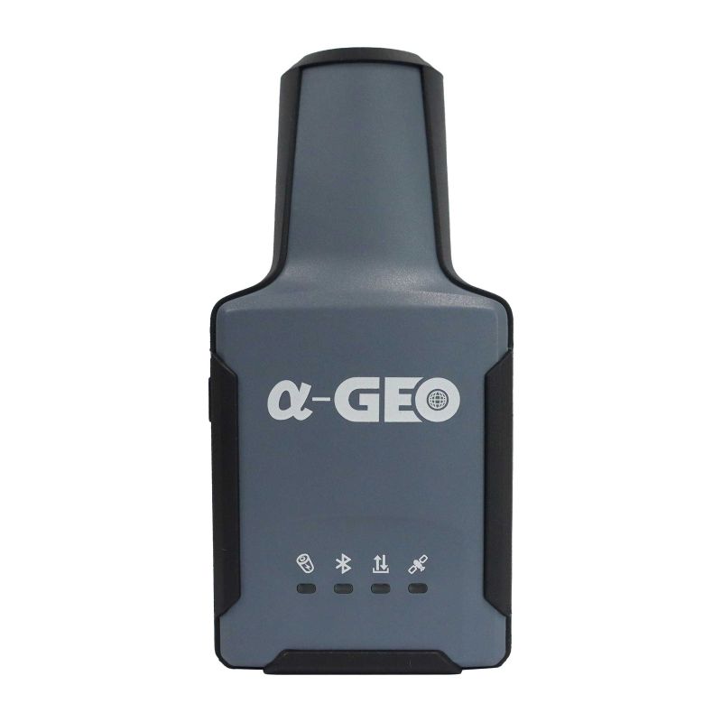
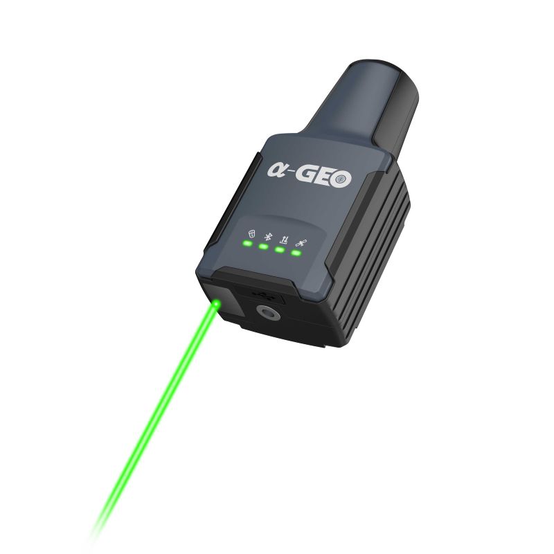

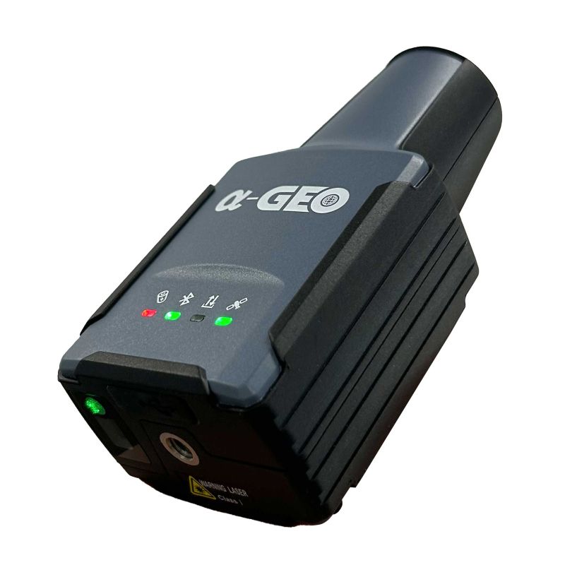
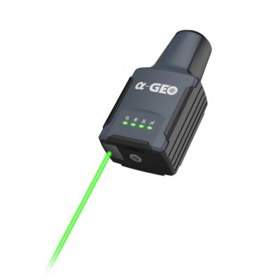
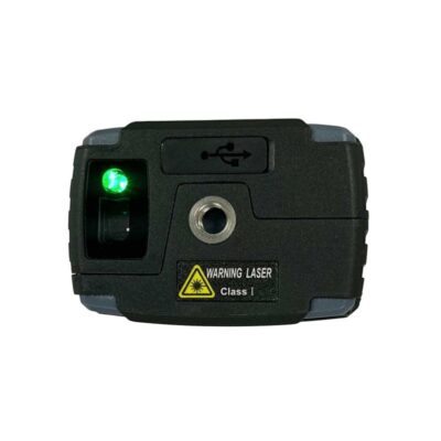
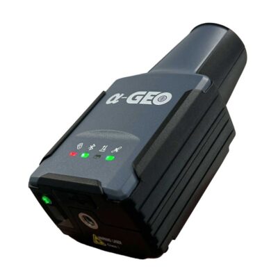
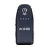
a Geo RTK L2 Plus Laser GNSS Receiver with 120° IMU
This product is Available
Contact our experts for the best possible price and configuration.
The a-Geo RTK L2 Plus is an ultra-compact handheld laser RTK GNSS receiver for surveyors, construction teams, GIS users, drone pilots and field engineers who need accurate measurements in a small and practical device. With its green laser, 1408-channel GNSS engine and 120° IMU tilt compensation, it helps measure points that are difficult, unsafe or inconvenient to reach directly.
a-Geo RTK L2 Plus Highlights
| Laser surveying | Green laser measurement with ±1 cm + 5 mm/m accuracy |
|---|---|
| IMU tilt | 4D IMU with 0–120° tilt compensation |
| GNSS channels | 1408 channels |
| Satellite constellations | GPS, GLONASS, Galileo, BeiDou, QZSS and SBAS |
| Connectivity | Bluetooth 4.0 and USB Type-C |
| Compact design | 120 x 61 x 41 mm body and 170 g weight |
| Field protection | IP67 rated with more than 12 hours battery life |


Valued customers:










Find RTK Networks
Search NTRIP providers and connect to reliable RTK correction services.
Description
a-Geo RTK L2 Plus handheld laser RTK GNSS receiver
The a-Geo RTK L2 Plus is made for field professionals who want centimetre-level GNSS measurement in a very small receiver. It combines RTK GNSS positioning, green laser measurement and IMU tilt compensation in a handheld body that weighs only 170 g. This makes it practical for surveyors, construction workers, GIS teams, drone mapping crews and engineers who move between sites and need accurate measurements without carrying a large receiver all day.
Its compact design is useful for normal survey work, construction checks, utility mapping, asset collection, road work, drainage surveys, façade points, manholes, ground control points and difficult-to-reach site features. The receiver can be used on a pole, but its handheld size and laser measurement also make it useful in places where a standard pole setup is slow or awkward.
Measure difficult points with the green laser
The integrated green laser helps the user capture points that cannot easily be occupied directly. In real fieldwork, this can mean measuring a point across a barrier, a feature near traffic, a manhole cover, a wall corner, a point on a slope, or an object where standing directly above the point is not safe or practical.
Laser surveying accuracy is specified as ±1 cm + 5 mm/m. This gives survey and construction teams a practical way to record target points while keeping a safer and more comfortable working position. The visible green beam is also useful outdoors because it is easier to aim at the target than a less visible beam.
120° IMU tilt compensation for flexible surveying
The a-Geo RTK L2 Plus includes a 4D IMU with tilt compensation up to 120°. This allows users to collect or stake out points when the receiver is not held perfectly vertical. On a busy construction site, along a wall, beside a fence or near an obstruction, this can save time because the user does not have to level the receiver carefully for every measurement.
The IMU is designed for fast initialization and is not affected by magnetic interference in the same way as compass-based tilt systems. That is helpful around vehicles, machinery, reinforced concrete, steel structures and other common site conditions.
Multi-constellation GNSS performance
With a 1408-channel GNSS engine, the L2 Plus tracks signals from GPS, GLONASS, Galileo, BeiDou, QZSS and SBAS. This gives the receiver access to a wide satellite environment, which can help maintain reliable positioning when working near buildings, trees, slopes or other partial obstructions.
For RTK surveying, the receiver is specified with horizontal accuracy of ±8 mm + 1 ppm and vertical accuracy of ±15 mm + 1 ppm under suitable conditions. For static GNSS work, the specified accuracy is ±2.5 mm + 0.5 ppm horizontally and ±5 mm + 0.5 ppm vertically. In practical terms, this makes the receiver suitable for professional positioning tasks where centimetre-level field results are required.
Small body for everyday field use
The L2 Plus measures only 120 x 61 x 41 mm and weighs 170 g including the internal battery. It is easy to keep in a vest pocket, carry between jobs or use for long measurement sessions without adding much weight to the field kit.
The receiver uses polymer engineering materials and is rated IP67 for protection against dust and water. It is also specified to survive a 2 m pole drop onto concrete, making it suitable for demanding outdoor work. The 2000 mAh internal battery provides more than 12 hours of operation, helping users complete a normal field day without constant charging.
Simple connectivity for controller based workflows
The a-Geo RTK L2 Plus uses Bluetooth 4.0 and USB Type-C connectivity. It does not include an internal internet modem, UHF radio, WiFi or WebUI interface, so it is best suited for workflows where correction data and field software are managed through a connected controller or mobile device.
This setup keeps the receiver compact and lightweight. For users working with network RTK, NTRIP corrections are typically handled through the controller and field software rather than directly through the receiver itself.
Who is the a-Geo RTK L2 Plus for?
The a-Geo RTK L2 Plus is a good fit for surveyors who want a small rover for fast point collection, construction teams that need accurate checks around a job site, GIS users mapping assets, drone pilots collecting ground control or check points, and utility teams measuring covers, chambers and site features. It is especially useful for professionals who value portability and laser measurement more than having an integrated radio or modem inside the receiver.
Buying from Global GPS Systems
Global GPS Systems supplies the a-Geo RTK L2 Plus with practical product advice for professional GNSS users worldwide. Our team can help you compare it with larger RTK rovers, laser GNSS receivers and complete rover sets, so you can choose the right receiver, controller and correction workflow for your surveying, construction, GIS or drone mapping projects.
Datasheets & Manuals
Datasheets and manuals
Datasheet
Specifications
a-Geo RTK L2 Plus Specifications
Product Overview
| Product Name | a-Geo RTK L2 Plus |
|---|---|
| Product Type | Handheld Laser RTK GNSS Receiver |
| Primary Use | High-precision GNSS surveying, topographic point collection, stakeout, construction surveys, land mapping and utility inspection |
| Design Type | Ultra-compact handheld RTK receiver with integrated laser measurement, GNSS board and IMU |
| Laser Measurement | Integrated laser measurement for target points that are hard to reach or unsafe to access directly |
| IMU Tilt Sensor | 120° tilt compensation |
| Internet Modem | None |
| UHF Radio | None |
GNSS Performance
| GNSS Channels | 1408 channels |
|---|---|
| Differential Data Format | RTCM 2.x, RTCM 3.x |
| GPS Signals | L1C/A, L2C, L2P, L5 |
| GLONASS Signals | L1, L2 |
| BeiDou Signals | B1, B1C, B2, B2a, B2b, B3 |
| Galileo Signals | E1, E5a, E5b, E6 |
| QZSS Signals | L1, L2, L5, L6 |
| SBAS Support | WAAS, EGNOS, MSAS, GAGAN, SDCM |
| Cold Start | <60 seconds |
| Hot Start | <15 seconds |
| Positioning Output Rate | 1 Hz to 50 Hz |
| Signal Reacquisition | <1 second |
| RTK Initialization Time | <5 seconds |
| Initialization Reliability | >99.99% |
| Time Accuracy | 20 ns |
Positioning Accuracy
| Mode | Horizontal Accuracy | Vertical Accuracy |
|---|---|---|
| Static GNSS Surveying | ±(2.5 mm + 0.5 ppm) | ±(5 mm + 0.5 ppm) |
| RTK Surveying | ±(8 mm + 1 ppm) | ±(15 mm + 1 ppm) |
Laser Surveying
| Laser Surveying Accuracy | ±1 cm + 5 mm/m |
|---|---|
| Laser Function | Laser-assisted coordinate measurement for capturing inaccessible or hazardous target points |
| Laser Beam | Bright green laser beam |
| Typical Laser Use Cases | High voltage towers, busy roads, overhead targets, restricted-access areas and points difficult to occupy with a pole |
IMU Tilt Compensation
| IMU Sensor | Supported, 4D IMU |
|---|---|
| IMU Initialization | 3 seconds |
| IMU Update Rate | 400 Hz |
| IMU Accuracy | <2.5 cm within 120° |
| Tilt Compensation Range | 0° to 120° |
| Calibration Requirement | Calibration-free |
| Magnetic Interference Resistance | Immune to magnetic interference |
| Supported Workflows | Topographic point collection and stakeout with high inclination angles |
Communication and Data Interfaces
| I/O Interface | USB Type-C |
|---|---|
| Bluetooth | Bluetooth V4.0 |
| Cellular Internet Modem | Not integrated |
| UHF Radio | Not integrated |
| External Power Support | Supported through Type-C interface |
Electrical
| Battery Type | Built-in Li-ion battery |
|---|---|
| Battery Capacity | 2000 mAh |
| Battery Life | >12 hours |
| Power / Charging Interface | USB Type-C, 5 V / 2 A |
| External Power Supply | Supported |
Physical Specifications
| Dimensions | 120 x 61 x 41 mm |
|---|---|
| Weight | 170 g, including internal battery |
| Housing Material | Polymer engineering materials |
| Keys | Power button |
| Indicators | Satellite indicator, Bluetooth indicator, data communication indicator, power indicator |
| Mounting / Handling | Handheld operation and pole-mounted surveying |
Environmental and Durability
| Operating Temperature | -20°C to +75°C |
|---|---|
| Storage Temperature | -40°C to +85°C |
| Ingress Protection | IP67 |
| Shockproof Rating | Survives a 2 m pole drop onto concrete |
| Vibration Resistance | MIL-STD-810G |
| Humidity | 100% non-condensing |
| Material Resistance | High-strength, temperature-resistant and corrosion-resistant polymer engineering material |
Supported Field Applications
| GNSS Surveying | RTK and static GNSS surveying |
|---|---|
| Topographic Surveys | Topo point collection with GNSS, IMU tilt compensation and laser-assisted measurement |
| Stakeout | Stakeout using high-inclination IMU support up to 120° |
| Construction Surveys | Construction layout, inspection and general site measurement workflows |
| Land Mapping | Precision mapping and point collection in open or complex environments |
| Utility Inspection | Measurement of infrastructure and utility points where direct access may be difficult |
| Challenging Environments | Designed for use near buildings, in dense forest conditions and in other environments with weak GNSS signal conditions |
Package Contents
| Item | Quantity | Notes |
|---|---|---|
| a-Geo RTK L2 Plus receiver | 1 | Main handheld laser RTK GNSS receiver |
| Additional accessories | Not specified | Package contents were not listed in the available product page or datasheet |
Specifications and package contents may vary by configuration, region or manufacturer update. Always check the current configuration before ordering.
FAQ
a-Geo RTK L2 Plus FAQ
Product Overview
What is the a-Geo RTK L2 Plus?
The a-Geo RTK L2 Plus is an ultra-compact handheld laser RTK GNSS receiver for professional surveying, mapping, construction layout and field measurement. It combines high-precision GNSS positioning, integrated green laser measurement and 120° IMU tilt compensation in a small and lightweight receiver.
Who is the a-Geo RTK L2 Plus designed for?
The receiver is designed for land surveyors, construction teams, civil engineers, GIS users, utility crews, infrastructure contractors, roadwork teams, drone mapping professionals and field crews who need accurate positioning in a portable format.
What makes the L2 Plus different from a standard RTK rover?
The a-Geo RTK L2 Plus combines RTK GNSS accuracy with laser measurement and a high-tilt IMU in a very compact handheld body. This makes it useful for measuring points that are hard, unsafe or time-consuming to reach directly with a traditional survey pole.
Can the a-Geo RTK L2 Plus be used handheld and on a pole?
Yes. The L2 Plus can be used as a handheld laser RTK receiver for flexible point collection and can also be used in pole-based workflows when conventional GNSS measurement is preferred.
Is the L2 Plus suitable for professional survey work?
Yes. The receiver is built for professional RTK workflows such as topographic surveys, construction layout, stakeout, GIS asset mapping, road and infrastructure work, utility mapping, as-built checks and drone ground control point measurement.
Laser Measurement and Field Applications
Does the a-Geo RTK L2 Plus have laser measurement?
Yes. The a-Geo RTK L2 Plus includes integrated green laser measurement. This helps users capture coordinates for target points that are difficult, unsafe or inconvenient to occupy directly with a pole.
What types of points can be measured with the laser?
The laser can help measure points such as road edges, manholes, fences, walls, slopes, building corners, utility features, bridge areas, objects near traffic and points behind small obstacles where direct pole placement is not practical.
How accurate is the laser surveying function?
The specified laser surveying accuracy is ±1 cm + 5 mm/m. Actual results can vary depending on the measurement distance, target visibility, aiming quality, GNSS correction quality and field conditions.
Why is the green laser useful for surveyors?
The green laser helps the user aim at target points more clearly during fieldwork. It improves productivity when measuring awkward or hard-to-access features and can reduce the need to physically stand on every measured point.
Can the L2 Plus be used for construction layout and stakeout?
Yes. The receiver can be used for construction layout, point stakeout, line stakeout, site checks, as-built measurements and infrastructure workflows when paired with compatible field software and a suitable RTK correction workflow.
Accuracy, GNSS and IMU Performance
How accurate is the a-Geo RTK L2 Plus in RTK mode?
The specified RTK surveying accuracy is ±8 mm + 1 ppm horizontally and ±15 mm + 1 ppm vertically. Real-world accuracy depends on correction data, satellite visibility, multipath, obstructions, baseline length and correct field setup.
Which GNSS constellations does the L2 Plus support?
The a-Geo RTK L2 Plus supports GPS, GLONASS, BeiDou, Galileo, QZSS and SBAS signals. Its 1408-channel GNSS engine helps track multiple satellite signals for reliable professional positioning.
Does the L2 Plus support IMU tilt compensation?
Yes. The receiver has a built-in 4D IMU with tilt compensation from 0° to 120°. This allows users to measure or stake points when the receiver or pole cannot be held perfectly vertical.
Does the IMU need calibration?
The IMU is described as calibration-free and resistant to magnetic interference. This helps simplify field use and allows surveyors and field crews to start measuring faster.
How fast does the RTK solution initialize?
The specified RTK initialization time is less than 5 seconds under suitable conditions. Initialization speed can vary depending on correction quality, satellite geometry, obstructions and the local survey environment.
What is the IMU accuracy of the L2 Plus?
The IMU accuracy is specified as less than 2.5 cm within 120° tilt. Actual performance depends on field conditions, measurement method, correction quality and correct use of the receiver.
Connectivity, Power and Durability
Does the a-Geo RTK L2 Plus have an internal UHF radio?
No. The a-Geo RTK L2 Plus does not include an internal UHF radio. Users who need radio-based base-rover corrections should check whether an external radio, different receiver or alternative correction workflow is required.
Does the L2 Plus have an internal internet modem?
No. The receiver itself does not include an internal internet modem. RTK corrections are typically handled through a connected data collector, network connection, NTRIP service or compatible external workflow.
What correction data formats does the L2 Plus support?
The receiver supports RTCM2.X and RTCM3.X correction data formats, making it suitable for RTK workflows with compatible controllers, field software and correction services.
Is the a-Geo RTK L2 Plus waterproof and dustproof?
Yes. The receiver has an IP67 protection rating, making it suitable for outdoor work where equipment may be exposed to dust, water and demanding field conditions.
How heavy is the a-Geo RTK L2 Plus?
The receiver weighs approximately 170 g including the internal battery. Its compact 61 × 41 × 120 mm body makes it easy to carry, store in a vehicle or use for quick field measurements.
How long does the battery last?
The receiver has a built-in 2000 mAh Li-ion battery with a specified battery life of more than 12 hours. It also supports external power through USB Type-C for longer field use.
Is the L2 Plus suitable for tough field environments?
Yes. The receiver is built with polymer engineering materials, has IP67 protection, vibration resistance and shockproof protection for a 2 m pole drop onto concrete, making it suitable for surveying and construction fieldwork.
Reviews (0)
Only logged in customers who have purchased this product may leave a review.
 GPS & GNSS
 Total Stations
 Data collectors
 Software
 Correction services
 Machine control
 External radio
 Lasers & levellers
 Marine
 Accessories
Reviews
There are no reviews yet