PozStar S5 Rover Base set Product Review
The PozStar S5 RTK GNSS Receiver is a game-changer for land surveying and construction. With sub-3 cm accuracy, ultra-fast satellite fix times, and a 60-degree IMU tilt sensor, it ensures precise measurements even in challenging environments. Designed for professionals, it offers customizable software, superior signal stability, and seamless operation.
| ✅ Channels |
1408 |
| ✅ IMU Tilt Sensor |
60º |
| ❌ Internet Modem |
None |
| ✅ UHF Radio |
450 – 470MHz |
| GPS |
L1C/A, L1C, L2P(Y),L2C, L5 |
| GLONASS |
G1, G2, G3 |
| GALILEO |
E1, E5a, E5b, E6 |
| BEIDOU |
B1l, B2l, B3l, B1C, B2a, B2b |
PozStar S5 Rover and Base Set – Precision and Reliability for Surveying and Construction
The Ultimate GNSS Rover and Base Set for Land Surveying and Construction Professionals
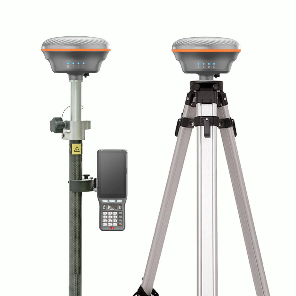
The PozStar S5 rover and base set is the ideal solution for surveyors and construction experts who need fast, accurate, and hassle-free positioning. This GNSS rover and base set for land surveying delivers sub-3 cm accuracy, ensuring pinpoint measurements in any environment. With advanced IMU tilt compensation, you can survey with ease, even in areas where holding the pole perfectly upright isn’t possible. Whether you’re tackling large construction projects or detailed land mapping, this GPS set for construction ensures you get the job done efficiently.

Unmatched Accuracy and Speed
Time is money in the field. The PozStar S5 GNSS rover and base set locks onto satellites in record time, meaning you can start surveying immediately without long delays. With a 60-degree IMU tilt sensor, this GPS set with IMU tilt sensor allows you to take measurements from angles that would be impossible with traditional GNSS receivers. Say goodbye to repositioning struggles and hello to smooth, uninterrupted workflows.
Built for Tough Job Sites
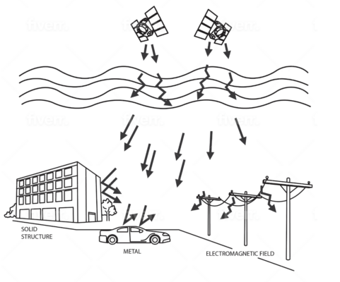
Surveying and construction sites present various challenges – uneven terrain, obstructions, and environmental interference. The PozStar S5 rover and base set is designed to withstand these challenges. Its advanced signal processing ensures stability in dense urban areas, forests, and construction zones. With superior resistance to interference, you can trust this GNSS set for construction to deliver accurate data in real-world conditions.
Easy Integration and User-Friendly Operation
No complicated setups or steep learning curves – the PozStar S5 GNSS rover and base set is built with user experience in mind. Compatible with a variety of software solutions, it integrates seamlessly into your existing workflow. Whether you’re a seasoned professional or just starting, this land surveying set makes precise positioning easier than ever.

Why Choose the PozStar S5?
- Sub-3 cm accuracy for high-precision surveying and construction
- Fast satellite lock for efficient fieldwork
- IMU tilt compensation (60-degree tilt sensor) for easy off-center measurements
- Rugged, interference-resistant design for real-world performance
- Seamless software compatibility for smooth operation
Comprehensive Accessories for Enhanced Versatility
The PozStar S5 rover and base set comes complete with all the essential accessories to maximize your efficiency and adaptability in the field:
- Geoelectron P9IV Data Collector: The Geoelectron P9IV data collector is a robust and reliable device for managing your survey data.
- PozPad Surveying Software: The PozPad software is an intuitive software solution that streamlines your workflow and ensures precise results.
- Surveying Pole and Data Collector Bracket: For convenient and stable operation during surveys.
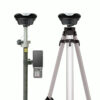
- Tripod, Tribrach, and Adapter: Ensures stability and accuracy for fixed-point measurements.
Customizable Accessories for Your Needs
The PozStar S5 rover and base set is flexible to match your specific requirements. Prefer using a tablet instead of the included controller? Or need different software for your workflow? These accessories can be easily modified or upgraded to suit your preferences, ensuring the perfect fit for your projects.


Reviews
There are no reviews yet.