Greenvalley LiAir 250 Pro

Request pricing
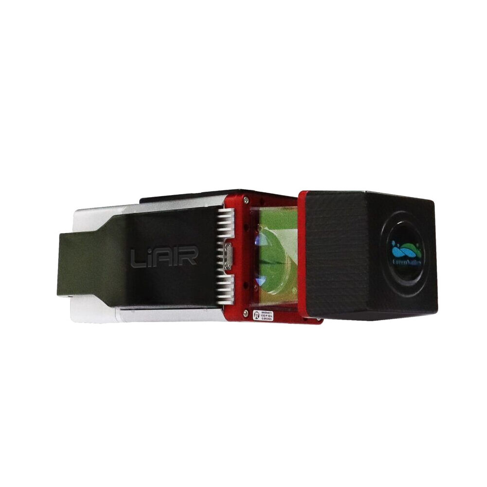
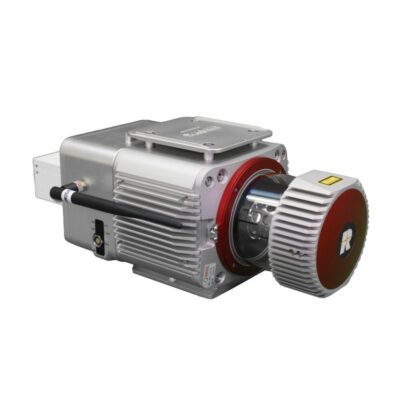
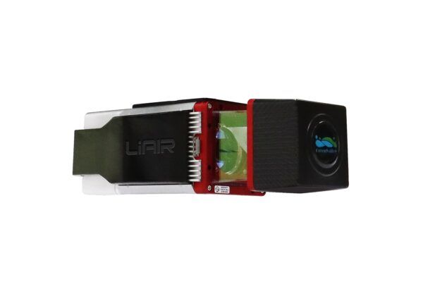
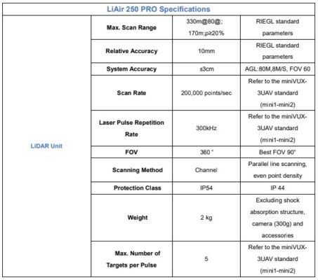
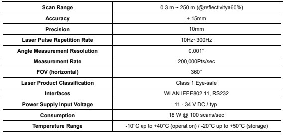
The LiAir 250 is a well-qualified choice for mapping the terrain beneath forest canopies. It can generate up to 5 data points per laser pulse from it’s upgraded Riegl miniVUX-3 sensor. It also has a stunning 250 meter range.
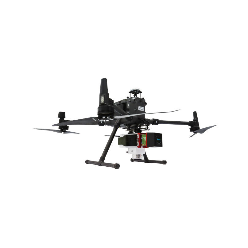
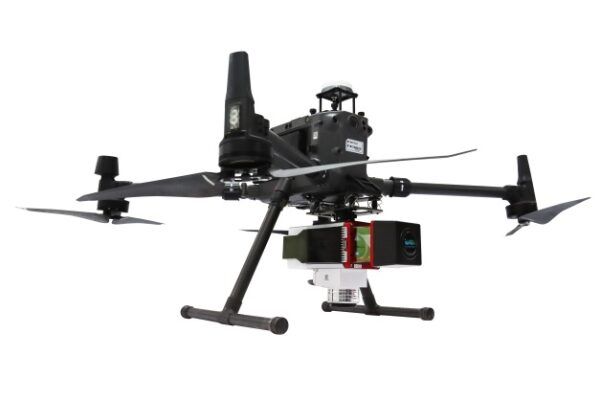
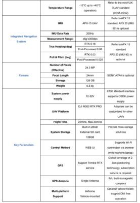
LiAir250 PRO is comprised mainly of three major components: LiDAR scanning system, inertial navigation system, and control & storage system, including:
- A GPS receiver used to measure the spatial position of the LiDAR signal transmission reference point.
- The attitude measurement unit used to measure the attitude parameters of the main optical axis of the scanning, that is, the inertial navigation unit.
- A laser ranging unit used to measure the distance between the LiDAR signal emission reference point and the ground laser foot point, which is the core part of the entire integrated system, that is, the laser scanner.
- A storage control system, used for data storage, system control, and controlling the parameter adjustment, data collection, and downloading functions of the system.
- The power supply system is used to supply power to the system.
LiGeoreference software included
- Weight: 1.9 kg (Excl. Battery)
- Target echoes: Up to 5
- Relative accuracy: ± 3cm @ AGL 80m
LiAir 250 Pro package includes:
- 1x LiDAR System
- 1x Network Cable
- 1x GNSS Antenna
- 2x GNSS Antenna Feeder Cable
- 2x DJI OSDK XT30 Power Connector
- 1x LiAir 250 Pro Mounting Moudle
- 1x Power XT30 Cable
- 1x Power OSDK Cable
- 1x GNSS Antenna Mounting Moudle
- 2x SD Card
- 1x USB SD Card Reader
- 1x Tool Set
Datasheets and manuals
You may also like…
UAV accessories
Greenvalley LiAir 250 Pro

Request pricing
Get a personalised quotation with detailed advise from our experts.

Try our GNSS guide!
Start GNSS Quide
Worldwide Shipping From The Netherlands

100% Shipping Insurance on Damage and Loss

Experts in Import / Export / Tax and Duties

Premium Support from Product Experts















Reviews
There are no reviews yet.