FJD Trion V10i Product Review
Below you will find a complete overview of the FJD Trion V10i.
Revolutionize Surveying with the FJD Trion V10i
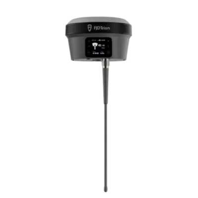
The FJD Trion V10i is redefining the boundaries of precision, speed, and user experience in the world of GNSS surveying. Designed for professional surveyors, engineers, and construction experts, this powerful GNSS receiver combines intelligent imaging, seamless connectivity, and rugged reliability to deliver an unparalleled performance in every measurement task.
5 Key Highlights of the FJD Trion V10i
-
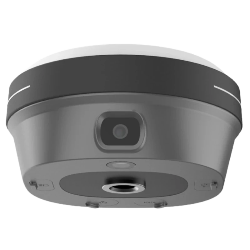
Dual global shutter cameras (2MP + 5MP) for crystal-clear imaging and AR-based measurements
-
Tilt compensation up to 60°, ensuring efficient measurements without upright pole holding
-
Rugged IP68-rated body, waterproof and 2m drop-proof for field durability
-
Full connectivity suite: 4G LTE, UHF, Wi-Fi, Bluetooth, NFC
-
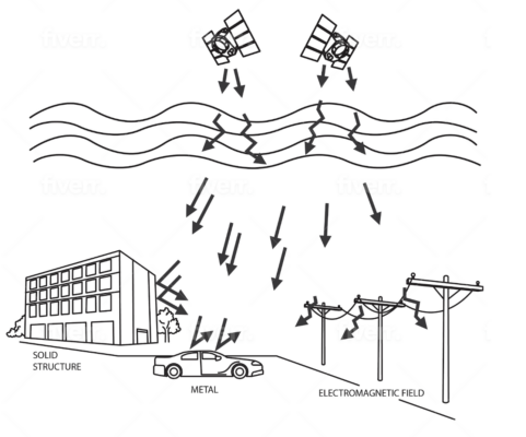
1408 channels with full satellite constellations for maximum GNSS signal stability
Capture More, Worry Less
The FJD Trion V10i makes surveying faster and smarter. Thanks to its integrated OLED screen, IMU, and dual high-resolution cameras (2MP front and 5MP bottom), users can enjoy AR Stakeout and Visual Measure functions that bring a completely new level of accuracy and convenience.
With the AR Stakeout, you can visualize real-time point positioning directly on your screen, while Visual Measure allows you to measure hard-to-reach points with just a few captured images. The result? Centimeter-level precision achieved effortlessly, even in complex environments.
Clear Vision, Precise Measurements
Equipped with global shutter cameras—a 2MP front camera and a 5MP bottom camera—the FJD Trion V10i ensures clear, distortion-free imagery for both AR guidance and image-based measurements. Its multi-engine algorithm and 4-core processor deliver smooth, real-time visual feedback and ultra-accurate coordinate extraction. Whether you’re mapping, staking out, or capturing detailed site data, every pixel contributes to reliable, high-precision measurements.
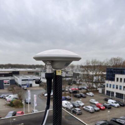
Built Tough, Engineered to Perform
Built to withstand the toughest field conditions, the FJD Trion V10i features a lightweight alloy body that’s IP68-rated and 2m drop-proof. Resistant to water, dust, and magnetic interference, it ensures consistent satellite signal tracking even in areas with obstructed views or harsh weather. This makes it the perfect GNSS receiver for use across construction sites, coastlines, and remote terrain.

Safer and More Efficient Surveying
The AR Stakeout feature replaces traditional stakeout methods with real-time visual guidance, allowing surveyors to locate points directly through a live video feed. Meanwhile, the Visual Measure function enables accurate coordinate calculations from photos—ideal for hazardous or inaccessible locations.
And with tilt compensation up to 60°, there’s no need to keep your pole perfectly vertical, meaning faster, more efficient data capture in tight spaces or uneven ground.
Intelligent Interaction with Ultimate Experience
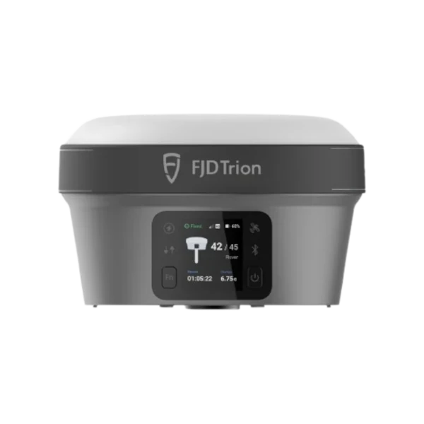
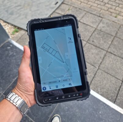
Stay in control with the intuitive OLED display, providing real-time system feedback, status indicators, and easy configuration—even under strong sunlight. You can set the FJD Trion V10i as a base station or switch to static mode using its physical buttons—no external controller required.
Full Connectivity and Flexibility
Connectivity is at the core of the FJD Trion V10i. With built-in 4G LTE, UHF, Wi-Fi, Bluetooth, and NFC, you’ll always stay linked to your devices and networks. Supporting 1408 channels and full satellite constellations, the V10i ensures fast signal acquisition and stable data collection anywhere in the world.
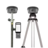
Multiple Controllers for Every Preference
Choose how you work best—whether with a compact keyboard controller or a tablet controller. Both offer powerful processors, responsive touchscreens, and auto-brightness displays for clear visibility even in direct sunlight. Seamlessly switch between controllers without compromising performance.

Applications Across Industries
The FJD Trion V10i GNSS receiver is perfect for a wide range of applications:
-
Cadastral Surveying
-
Topographic Mapping
-
Construction Layouts
-
River & Coastline Surveys
-
Roads, Bridges, and Utility Infrastructure
No matter your industry, the V10i offers reliable accuracy, rugged durability, and intelligent functionality to boost productivity in every project.


 Channels


Reviews
There are no reviews yet.