South Supreme ME Rover set Product Review
South Supreme ME Rover Set – Integrating LiDAR and GNSS for Next-Level Surveying
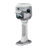
The South Supreme ME Rover Set elevates modern surveying by merging SLAM LiDAR scanning with GNSS RTK positioning in a single intelligent platform. This hybrid design allows surveyors to operate indoors, outdoors and in environments that were traditionally unreachable for GNSS systems. The Rover Set supports effortless switching between contact and contactless measurements, enabling work in complex, obstructed or hazardous locations without compromising accuracy. With advanced imaging technology, a high-precision LiDAR system and a powerful NVIDIA graphics processor, the ME Rover Set provides a superior balance of speed, precision and operational flexibility.
Air Meas. – Instant 3D Measurement Without Contact
Air Meas. technology combines laser sensing with an AI-driven image-matching engine, capturing up to 200,000 points per second. A single action produces multiple 3D coordinates, with measurements remaining accurate up to 5 cm at distances of 15 meters. This makes the system ideal for confined spaces, elevated or deep locations, and areas where traditional range poles cannot be used safely or efficiently. Air Meas. offers a workflow several times faster than Laser RTK or visual positioning RTK, significantly increasing productivity on large-scale projects.
Integrated Rover Technology for Complete Surveying Workflows
The ME Rover Set brings together all essential surveying components into one compact and efficient system. Its 1698-channel GNSS receiver integrates IMU technology, a UHF radio, network module and Bluetooth connectivity. The LiDAR module delivers high-resolution, high-frequency scanning for detailed 3D mapping. Four cameras—including two 12 MP panoramic SONY sensors, an 8 MP front camera and a 2 MP downward camera—enable photogrammetry, visual navigation and CAD-AR stakeout. A professional NVIDIA GPU ensures rapid color processing, point-cloud reconstruction and real-time visualization during fieldwork.

Uninterrupted Power for Long Working Hours
The ME Rover Set supports simultaneous use of the internal battery, battery handle and external power supply. Power switching occurs without rebooting or re-initializing, ensuring continuous operation during long field days. This uninterrupted workflow is ideal for scanning large industrial sites, infrastructure projects or extended SLAM missions where consistency and uptime are critical.
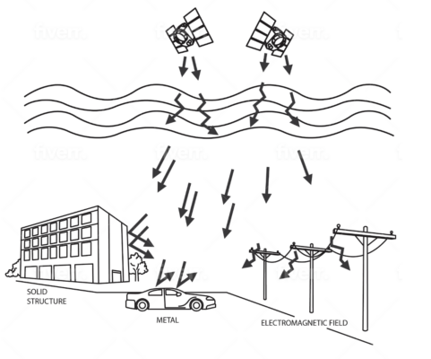
Magicalc – Maintain Accuracy When GNSS Is Lost
With Magicalc technology, the ME Rover Set continues to deliver approximately 5 cm accuracy for several minutes even when GNSS reception is interrupted. The system shifts from a fixed solution into a mixed-solution mode that remains reliable for ongoing measurement. This capability ensures uninterrupted surveying in tunnels, underground parking garages, beneath bridges or inside metal-dense structures.
Earthwork Volume and Point-Cloud Analysis
The ME Rover Set generates detailed 3D point clouds that support accurate earthwork calculations, stockpile analysis, terrain modeling and mining assessments. Its workflow simplifies volumetric surveying and provides high-quality deliverables for civil engineering, construction and excavation projects.
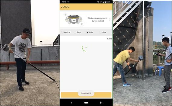
H9 Data Collector – Purpose-Built for SLAM and Photogrammetry
Included with the Rover Set, the H9 Data Collector features an 8-core 2.0 GHz CPU, a 7700 mAh battery, a 6-inch touchscreen and a physical QWERTY keypad. Built on Android 12, it is optimized for handling large SLAM and photogrammetry datasets, ensuring stable and efficient field processing.

AcuteLas Studio – Professional Office Software
AcuteLas Studio provides a comprehensive toolkit for post-processing SLAM and LiDAR data. Its functions include automated trajectory processing, point-cloud fusion, classification, QC reporting, coordinate transformation and terrain modeling. Together with the ME Rover Set, it forms a complete end-to-end workflow from field capture to final deliverables.
Top 5 Advantages of the South Supreme ME Rover Set
-
Hybrid GNSS RTK + SLAM LiDAR system for indoor and outdoor surveying
-
Contactless measurement at 200,000 pts/s with 5 cm accuracy up to 15 m
-
Mixed-solution mode maintains accuracy when GNSS reception is lost
-
Uninterrupted power design for long, continuous field sessions
-
Professional H9 controller and AcuteLas Studio software for a complete workflow


Reviews
There are no reviews yet.