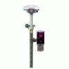
South ALPS2 Product Review
Unleash Precision and Safety with the South ALPS2
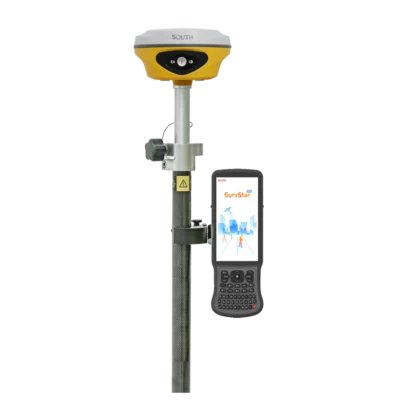
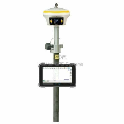
The South ALPS2 is a revolutionary RTK GNSS receiver that redefines how land surveyors work, delivering unmatched precision, efficiency, and safety. Whether you’re facing blind spots, dangerous environments, or tough-to-reach locations, this high-tech GNSS receiver for land surveying is engineered to get the job done with confidence.

Break Through Surveying Limitations
Traditional GNSS receivers struggle in low signal or obstructed environments. The South ALPS2 RTK GNSS Receiver changes the game with advanced laser measurement capabilities that allow you to measure points even under rooftops or in areas surrounded by obstacles. Say goodbye to survey blind spots—measure more, farther, and faster.
Night or Day, Indoors or Out
The built-in GPS receiver with laser function ensures your work never stops. Even in dim or fully dark environments, such as indoor areas or during nighttime fieldwork, the laser function helps you capture precise points with ease. This flexibility means fewer delays and greater productivity.

Prioritizing Surveyor Safety
Safety is paramount. The South ALPS2 lets you collect points from a distance—away from busy roads, hazardous terrain, or bodies of water—minimizing risk. With IMU tilt compensation, you can measure accurately without having to level the pole, increasing safety and efficiency in every situation.
Expand Your Capabilities with Vision & Precision
Survey smarter with integrated GNSS receiver with vision capabilities. Dual cameras—front and bottom—assist in locating target points and understanding the terrain around them. This GPS receiver with camera feature enhances the accuracy and speed of staking out targets, even in cluttered or complex field environments.

From CAD to Reality—Easier Staking Out
Integrate CAD drawings seamlessly with real-world scenes, and use the laser function to stake out from a distance. Even if the direct path is blocked or it’s inconvenient to reach the target, the South ALPS2 ensures your job continues smoothly.
Why Choose the South ALPS2?
- Laser Measurement: Unlock new measurement areas unreachable by traditional RTK.
- Camera-Assisted Stakeouts: Visual context and pinpoint precision.
- IMU Tilt Compensation: Hassle-free, pole-free leveling.
- Unmatched Versatility: Perfect for day/night, indoor/outdoor, and hazardous area surveying.


Reviews
There are no reviews yet.