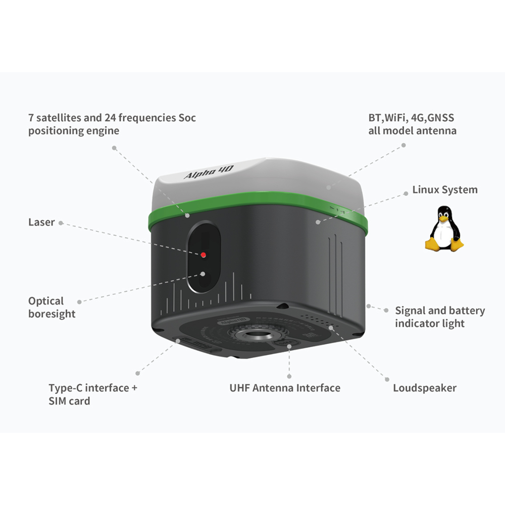
Alpha 40 GNSS RTK Product Review
Below youw ill find a complete overview of the Alpha 40.
Alpha 40 – The Next-Generation GNSS RTK Receiver for Precision and Power
The Alpha 40 GNSS RTK redefines precision surveying with dual-mode radio, optical calibration, and 0.015° inertial navigation. Perfect for professionals demanding top-tier performance in drone base station and RTK workflows.
Unleash the Power of the Alpha 40 GNSS System
The Alpha 40 represents the cutting edge of GNSS technology, engineered for professional surveyors, drone operators, and mapping experts who demand unparalleled accuracy and efficiency. This drone base station is more than just a receiver—it’s a complete, intelligent measurement platform integrating RTK, laser measurement, and inertial navigation into a compact and portable system.
Designed for the future, the Alpha 40 combines optical, electronic, and mechanical excellence, providing a non-contact measurement experience that exceeds industry standards. Whether you’re staking out in rugged terrain or mapping with drones, the Alpha 40 ensures unmatched data precision and reliability.

Professional Configuration for Field Efficiency
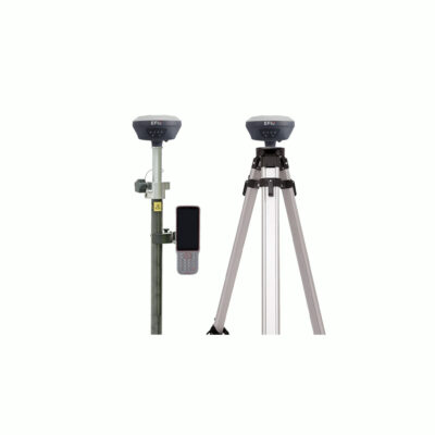
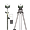
The Alpha 40 is built for the real-world professional. It comes equipped with a 1.8m lightweight carbon fiber pole, retractable to 75cm for easy transport. For extended field use, the 22cm high instrument box provides comfort and convenience—surveyors can even sit outdoors while working.
Its drone base station functionality and serial port customization enable seamless positioning fusion for unmanned systems and laser radar integration, empowering advanced workflows across multiple disciplines.
Dual-Mode Radio Transceiver: Unmatched Communication Flexibility
Equipped with a built-in 2W full-power compatible radio and LoRa low-power long-range transceiver, the Alpha 40 GNSS system ensures seamless global communication. Covering the entire 410–470MHz frequency band, it supports mainstream RTK protocols and easily connects to external radios via its serial port for extended range operations.
This dual-mode design allows you to maintain consistent communication, even in remote environments—maximizing productivity and minimizing downtime.
Dual AR Staking-Out for Real-World Precision
Experience immersive real-scene staking-out with dual AR guidance. From far to near, the Alpha 40 intelligently switches to near-view AR at a customizable 5-meter distance. Its 360° real-time display performs flawlessly under strong sunlight, overlaying design data on real-world images.
With image-level lenses and professional-grade algorithms, it achieves an astounding 1cm point-finding accuracy, ensuring what you see is truly what you get.
Breaking Barriers with 0.015° Military-Grade Inertial Navigation
The Alpha 40 GNSS RTK redefines precision with 0.015° inertial navigation accuracy—three times higher than industry-standard systems. This advancement breaks through traditional laser measurement limitations, setting a new benchmark for field data integrity.
By fusing INS, GNSS, and laser ranging technologies, the Alpha 40 delivers reliable positioning, even under extreme inclinations and high dynamic conditions.

Limitless Inertial Navigation for Ultimate Flexibility
Unlike conventional systems, the Alpha 40 GNSS supports 2cm accuracy at 60° inclination, without the need for initialization. Just walk a few steps, and it enters inertial navigation mode automatically.
This system surpasses the 90° limitation, allowing you to measure at any angle—perfect for complex urban or natural environments.
Optical Calibration for Precision Under Any Condition
Through its optical system calibration, the Alpha 40 synchronizes its crosshair with the actual laser measurement target. Even in intense sunlight, it maintains full-visibility positioning, ensuring accuracy and efficiency throughout your workflow.
This calibration unifies imaging, optical, and inertial systems, enhancing the precision and dependability of every measurement.
Alpha 40 Optic-Electric RTK: Intelligent Platform for the Future
The Alpha 40 Optic-Electric RTK is the next evolution in surveying technology, combining reliable laser measurement, optical calibration, and AR dual-camera integration. This synergy enables non-contact measurement accuracy and a superior layout experience.
Designed as an intelligent platform, the Alpha 40 GNSS features versatile communication modes and interfaces for seamless coordination with smart terminals, optoelectronic devices, and unmanned systems.

Key Features of the Alpha 40 GNSS RTK
-
Unmatched 0.015° inertial navigation accuracy
-
Dual-mode radio transceiver supporting RTK and LoRa communication
-
Drone base station functionality with serial port customization
-
Optical calibration for consistent accuracy under strong light
-
360° non-contact measurement with 3–5cm precision
Why Choose Alpha 40?
The Alpha 40 GNSS system combines durability, intelligence, and precision—empowering professionals across construction, surveying, mapping, and drone operations. Its fusion of GNSS, INS, and laser technologies makes it the ultimate choice for precision-driven projects worldwide.


 Channels


Reviews
There are no reviews yet.