


 GPS & GNSS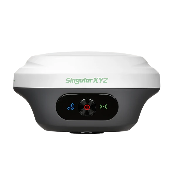





SingularXYZ Orion ONE Visueel Laser RTK GNSS Ontvanger
Krijg de beste prijs en setup
Vraag onze experts voor de beste prijs en setup.
- Snelle reactie
- Advies bij welke setup je nodig hebt
- We zorgen dat je niet voor functies betaald die je niet nodig hebt
The SingularXYZ Orion ONE is a compact multi-sensor RTK GNSS receiver for surveying, construction layout and geospatial fieldwork. It combines full-constellation satellite tracking with a 60° tilt-compensated IMU, camera-guided AR stakeout and non-contact laser measurement.
Visual guidance helps operators find design points directly in the live camera view, while the laser provides a practical way to measure locations where a survey pole cannot be placed safely or conveniently. With centimetre-level RTK accuracy, a lightweight 547 g body and IP67 protection, the Orion ONE is designed for productive everyday use on demanding sites.
SingularXYZ Orion ONE Highlights
| GNSS tracking | 1,408 channels with GPS, GLONASS, Galileo, BeiDou and QZSS |
|---|---|
| RTK accuracy | 8 mm + 1 ppm horizontal and 15 mm + 1 ppm vertical |
| Visual stakeout | 2 MP starlight-grade global-shutter camera with AR guidance |
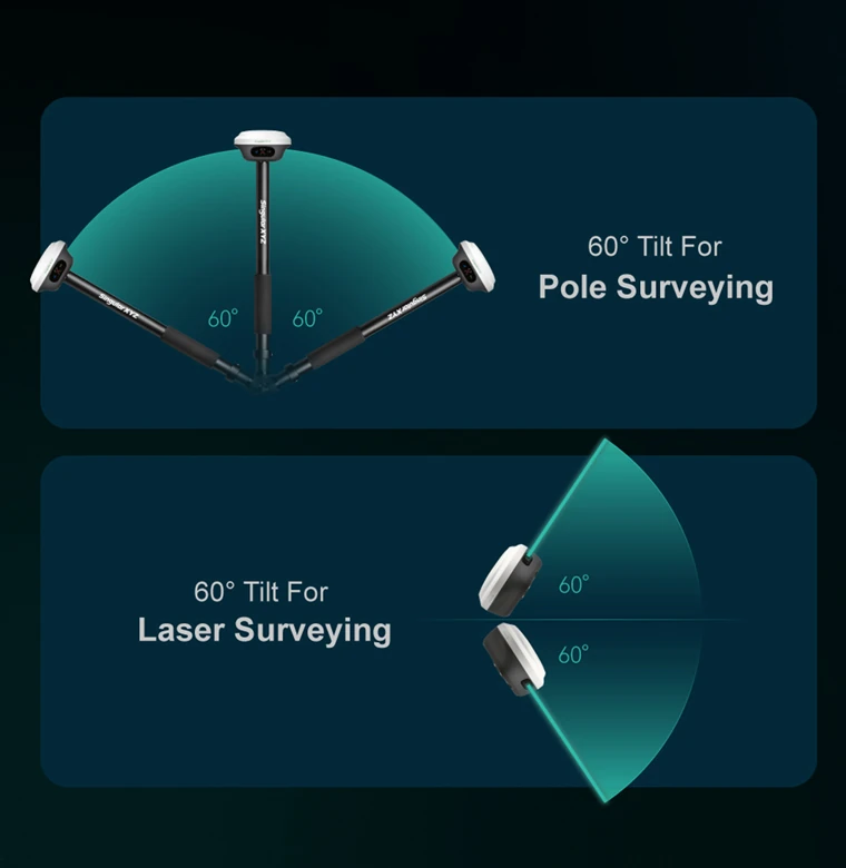
| Tilt compensation | IMU surveying at pole angles up to 60° |
| Laser surveying | Non-contact measurement for inaccessible and obstructed points |
| Field protection | IP67-rated housing designed to survive a 2 m drop onto concrete |
| Battery life | Up to 12 hours |
Onze Klantens:










Zoek RTK Netwerken
Zoek en beheer elke rtk netwerk via de RTK marktplaats.
Beschrijving
Visual, laser and tilt-assisted RTK surveying
The SingularXYZ Orion ONE brings GNSS positioning, camera guidance, laser measurement and IMU tilt compensation together in one compact receiver. It is designed for surveyors, construction crews, civil engineers and GIS professionals who need to collect or set out accurate points without slowing down at every obstacle.
In normal open-sky work, the receiver functions as a high-precision RTK rover for topographic surveys, site control, construction layout, utility mapping and as-built recording. When the point is difficult to reach, the camera, laser and tilt functions give the operator additional ways to complete the measurement while remaining in a safer or more convenient position.
Clear camera guidance during stakeout
Traditional stakeout often requires the operator to follow arrows, distances and direction indicators on the controller screen. The Orion ONE adds a 2 MP starlight-grade camera that displays the target within a live view of the site. This visual AR guidance makes it easier to understand which direction to move and where the design point lies in relation to nearby ground features.
The camera has a 75° field of view and is intended to remain useful in weaker lighting conditions. In practical terms, this can make point stakeout easier to follow around buildings, beneath structures or during early and late working hours. It is particularly helpful for construction workers or occasional GNSS users who may find visual guidance more intuitive than conventional map-based instructions.
Measure points that cannot be occupied with a pole
The integrated non-contact laser expands the range of locations that can be measured with an RTK receiver. Instead of positioning the pole tip directly on every point, the operator can aim at selected surfaces or objects from a nearby position.
This is useful for points beside traffic, across ditches, close to water, on steep slopes or underneath obstructions. It can also support measurements at building façades, bridge elements, utility features and other places where access is restricted or where standing directly on the point would require unnecessary effort or risk.
Laser surveying does not replace every conventional GNSS or total-station workflow. Its practical advantage is that it gives the field crew another measurement method for locations where direct pole placement is difficult.
60° tilt compensation for faster point collection
The built-in IMU supports pole surveying at tilt angles up to 60°. The receiver can therefore compensate for a pole that is not held perfectly vertical, allowing the operator to measure beside walls, fences, parked machinery, trenches and other obstacles.
Tilt compensation also reduces the time spent levelling the pole for routine observations. For dense topographic surveys or repeated construction checks, this can make fieldwork more comfortable and help maintain a steady working pace.
Reliable multi-constellation GNSS performance
The Orion ONE uses 1,408 tracking channels and supports signals from GPS, GLONASS, Galileo, BeiDou and QZSS. Tracking multiple constellations and frequencies provides access to more satellites across the sky, which is valuable when working near buildings, vegetation or other partial obstructions.
Specified RTK accuracy is 8 mm + 1 ppm horizontally and 15 mm + 1 ppm vertically under suitable operating conditions. Typical RTK initialisation takes less than five seconds when correction data, satellite visibility and the surrounding environment are suitable.
The receiver can be used with RTK corrections delivered through a compatible UHF radio configuration or through an internet-based CORS or NTRIP service connected via the field controller. This allows the equipment to be adapted to both local base-station work and network RTK workflows.
Designed for full working days in the field
At approximately 547 g and 107 mm in diameter, the Orion ONE is smaller and lighter than many conventional survey receivers. The compact body reduces the load at the top of the pole and makes the equipment easier to carry between survey areas.
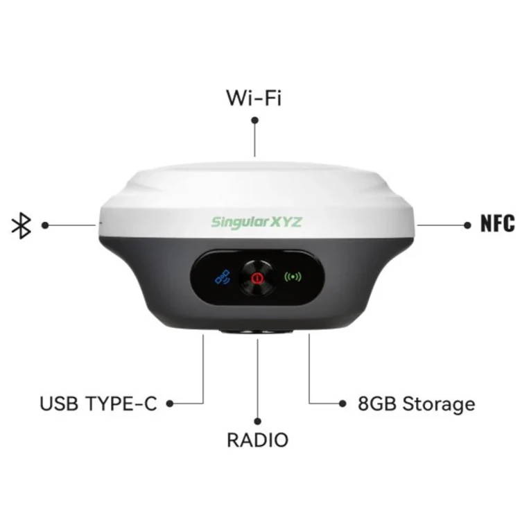
The internal 4,200 mAh battery provides up to 12 hours of operation, depending on configuration and working conditions. USB Type-C supports charging and data transfer, while Bluetooth, Wi-Fi and NFC provide several options for connecting controllers and managing the receiver.
The IP67-rated enclosure protects against dust and temporary water exposure. It is also designed to withstand a drop of up to two metres onto concrete, giving crews a receiver suited to active construction sites, infrastructure projects and everyday survey use.
Field software and survey workflows
The Orion ONE works with SingularPad, an Android-based field surveying application. Available workflows include point surveying, point stakeout, visual stakeout, laser surveying, CAD mapping, road stakeout, area calculations and static data collection.
Static observations can be stored in the receiver and converted to RINEX for post-processing. Wi-Fi access and the receiver WebUI also provide options for checking settings, managing files and downloading recorded data.
Typical applications
- Land and topographic surveying
- Construction layout and site checking
- Road, rail and civil infrastructure work
- Utility and asset mapping
- GIS data collection and as-built surveys
- Measurements near hazards or inaccessible features
Buying and support from Global GPS Systems
Global GPS Systems can help determine the correct Orion ONE configuration for the intended correction source, controller and field workflow. This is important because radio capabilities, regional frequencies, software requirements and supplied accessories may vary by version.
Professional guidance is also available for setup, coordinate systems, CORS or NTRIP connections and integration into an existing survey workflow. This helps construction teams, surveyors and GIS users start with a configuration that matches the way they work in the field.
Datasheets & Manuals
Beoordelingen (0)
Enkel ingelogde klanten die dit product gekocht hebben, kunnen een beoordeling schrijven.

Beoordelingen
Er zijn nog geen beoordelingen